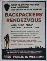
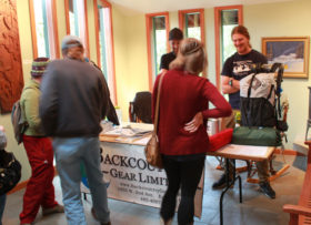
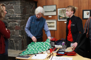
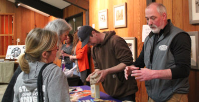
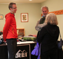
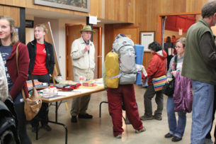
During the recent Backpackers’ Rendezvous 2017 held in Eugene, Oregon, I shared a printed spreadsheet detailing the various systems used by backpackers of all skill levels. Thinking in systems (rain system, footwear system, sleep system, etc.) is important because it can save you time, money, and reduce headaches. Enjoy the spreadsheet for yourself, may it help you better plan your own journeys. Thank you to everyone who contributed! Please note the spreadsheet is legal-sized and front and back. Download the PDF here.
Volunteer Organizer: Mark Hougardy | Location: Eugene-based Hiking Group Lodge | Date: April 2017 | Duration: 1 day | Participants: 80+ | Type: Outreach Event
The Backpackers’ Rendezvous helps hikers, backpackers, and anyone curious about the trail to network, learn, and do more with less. I’m happy to have organized the event and contributed to Eugene’s backpacking community.
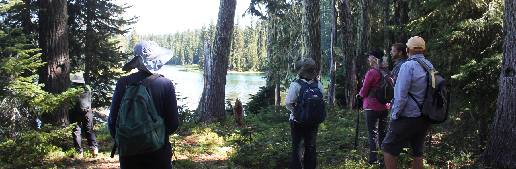
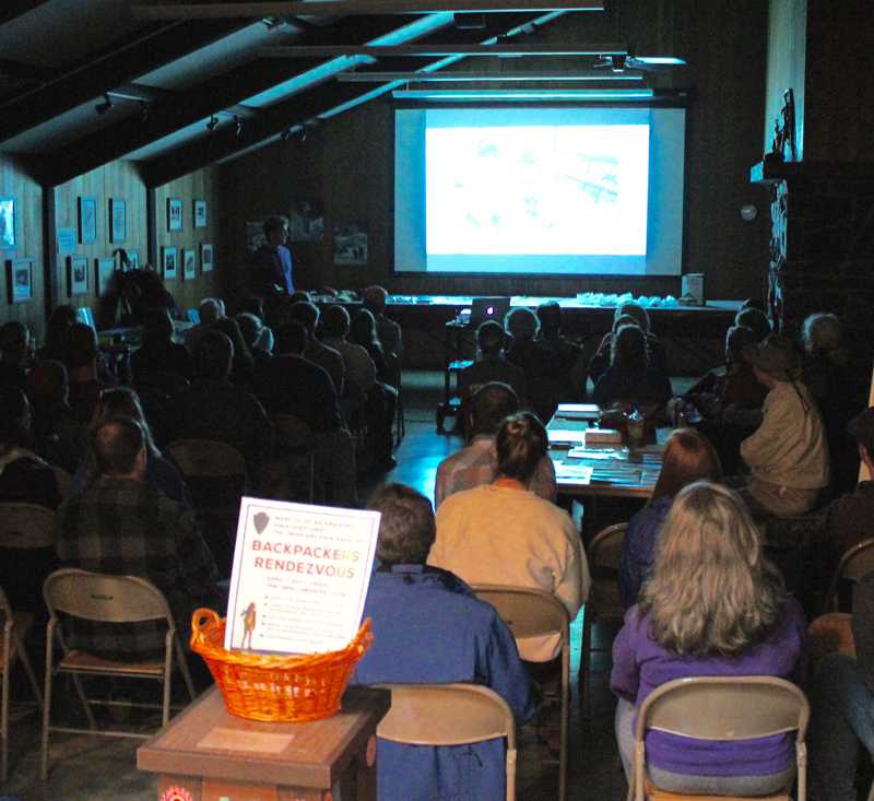
An evening of rain, wind gusts, and downed trees could not deter seventy hearty folks of all ages and skill levels from attending the second Backpackers’ Rendezvous held at a local lodge in Eugene, Oregon.
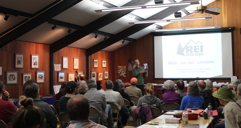
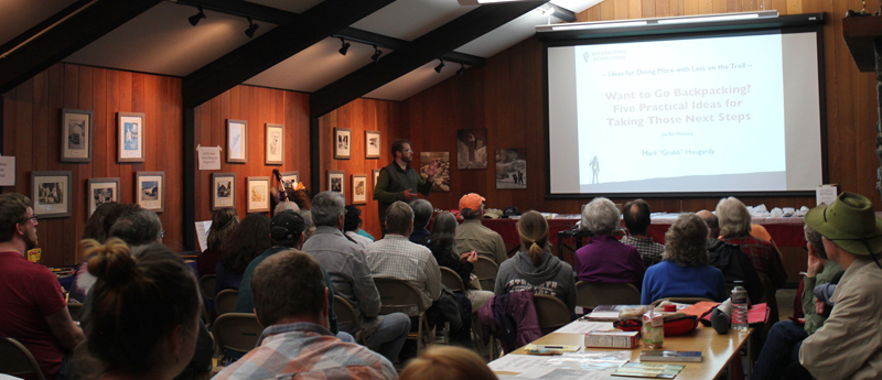
The first hour includes presentations from PCT and AT thru-hiker Chris “Scrub” Burke with tips on approaching a large hike, REI’s Mark “Jar-Jar” Lemaire on researching lightweight gear options, and Mark “Grub” Hougardy on five tips for starting a section hike on Oregon’s PCT.
Presenters from Left to Right: Mark “Grub” Hougardy rendezvous organizer, Mark “Jar-Jar” Lemaire of REI, and Chris “Scrub” Burke a PCT/AT thru-hiker.
The second hour included knowledge tables, pack shakedowns, and interactions with local outdoor retailers and thought leaders, including lightweight ideas for the big three with REI-Eugene, staying warm and dry with Backcountry Gear; resources for making your gear with the Rain Shed, staying safe outdoors with a hiking club’s safety committee, hiking Oregon’s coast with the National Coast Trail Association, and dry food options with Capella Market.
One of the best quotes during the event came from a woman in her thirties, “I want to go backpacking and don’t know where to start. I came here to find out more.” Thank you to everyone who helped enrich and strengthen the backpacking community in Eugene.
Chris “Scrub” Burke, PCT & AT thru-hiker shares his lightweight tips.Mark “Jar-Jar” Lemaire of REI on “Lightweight Ideas for the Big Three, Starter Trips, & Navigation.”Mark “Grub” Hougardy on “Want to Go Backpacking? Five Practical Ideas for Taking Those Next Steps”
Trip Report:
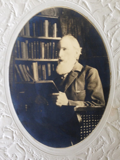
Volunteer Leader: Mark Hougardy | Group: Eugene-based Hiking Club | Dates: November 7, 2016 | Participants: 6 | Type: University of Oregon Archives Visit
On this sunny day in November, our small group spent several hours with the original writings, journals, and photographs of a true champion of nature – John B. Waldo.
Waldo was an ardent conservationist, he’s been referred to as the west’s David Thoreau and even Oregon’s John Muir. Waldo was known for venturing into the Cascades, often spending months at a time, and recording his findings of this dynamic and vibrant landscape.
Over the course of his life, Waldo worked as an explorer, legislator, and chief justice on the Oregon Supreme Court, all the time helping to preserve land in the Cascades. He envisioned a protected band of land along the crest of the Oregon Cascade Range that ran the entire length of Oregon. This goal became his personal mission.
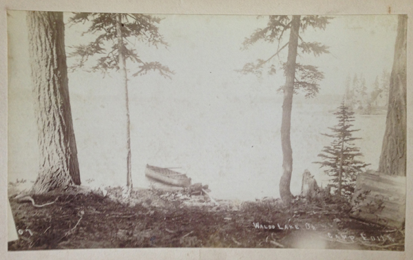
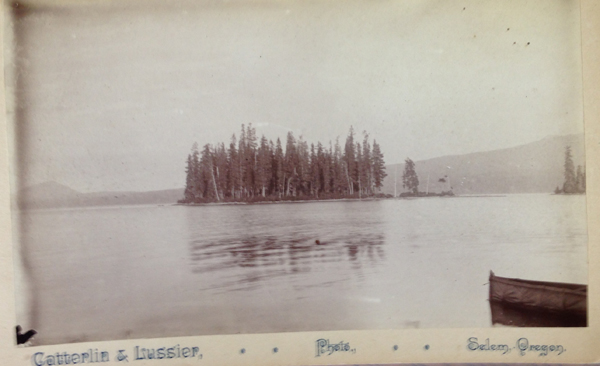
On September 28, 1893, the Cascade Range Forest Reserve became a reality and 5 million acres were protected.
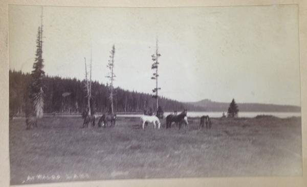
Today, we can experience his legacy in the protected lands and open spaces of the Cascades from Mount Hood south to the border with California, that include: Crater Lake National Park, Mt. Hood, Willamette, Umpqua, Rogue River national forests, and other public lands. And in the middle of this grand monument are the deep and pristine waters of Waldo Lake, named in his honor.
Curiously, little is written about Waldo. The judge was a philosophical and reflective person who did not directly seek publicity. But possibly this muted message is part of his larger voice – appreciating the beauty of Oregon is best experienced by hiking on the trails, exploring in the mountains, traveling in the wilderness, and experiencing the (as he wrote) “untrammeled nature and the free air.†Discover Waldo’s story for yourself. The University of Oregon archive is free to use – Knight Library, Paulson Reading Room.
Reference: John B. Waldo and William G. Steel: Forest Reserve Advocates for the Cascade Range of Oregon, Gerald W. Williams
Umpqua and Willamette National Forests
http://www.foresthistory.org/Publications/Books/Origins_National_Forests/sec21.htm
Here are just a few of the photos from his collection:
Trip Report:
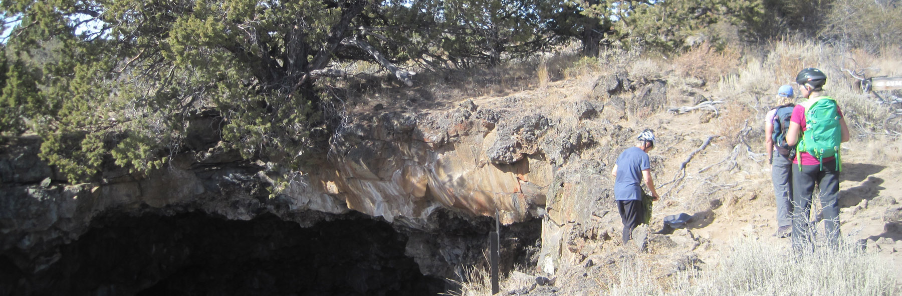
Volunteer Leader: Mark Hougardy | Group: Eugene-based Hiking Club | Dates: September 10-11, 2016 |Participants: 10 | Hiking 8 miles | Type: Day Hike & Tent Camping
Visiting Big Bear Camp is like inhaling a fresh breath of forest air: it’s invigorating.
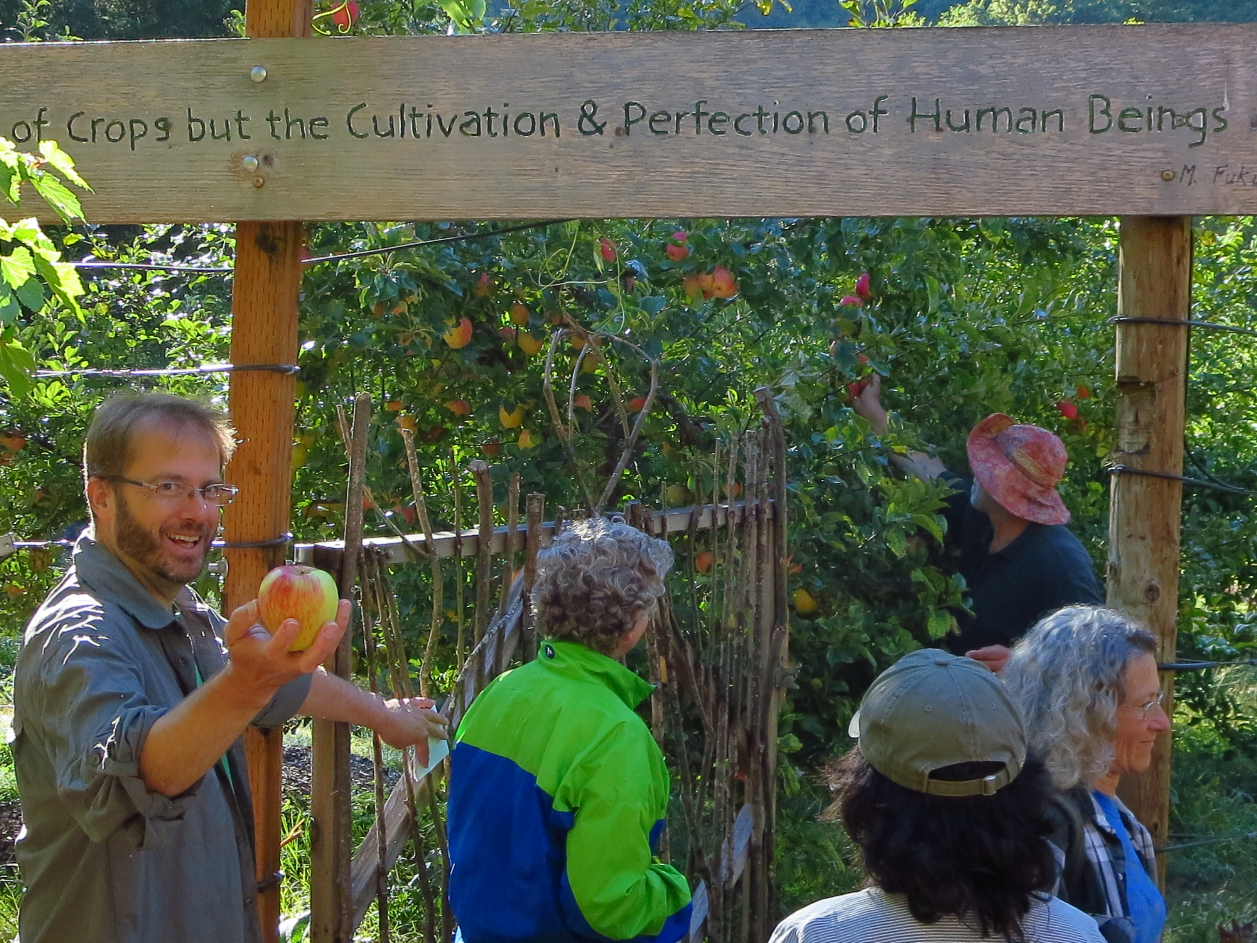
That’s me with the apple. The lodge’s owners Hal and Tonia quickly welcomed us as we arrived at their retreat/garden/camp in the woods. Hal offered us delicious Honey Crisp apples directly off the tree to enjoy on our hike. [Photo by Darko]
Our 8-mile hike started up a reclaimed forest road, past cedar trees used by mountain lions for scratching, across the deep ravine where a rope was needed (shown), and finally to a deceptively steep forest road.
After a good heart-pounding climb, we arrived at the “Secret Spot,†the highest location within the Coast Range in Lane County. We had climbed roughly 1,600 feet from where we started but the view made up for it. Looking east we could see 130+ miles in the distance: in the north, Mt Hood, followed by Mt, Jefferson, Three-Fingered Jack, North, Middle and South Sister, Mt. Bachelor, and finally 125 miles further south, Diamond Peak.
We rested, enjoyed some lunch, and then traversed back down the forest road to several turnoffs, and a forest trail that deposited us back at Big Bear. That evening we shared a potluck with neighbors; everyone’s gardens were abundant and we and enjoyed the bounty of harvest-time meals. Later that evening we enjoyed guitar folk music by the fire and enjoyed freshly picked grapes (shown below). In the morning we hung out, explored the local creek, enjoyed the garden, and planned a route for a 42-mile, 4-day backpacking trip to the coast for next spring.
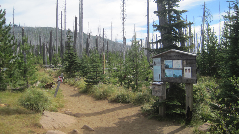
The High Cascades in Oregon is beautiful. While much of this chiseled landscape can be viewed at a distance by zipping around in a car, it is best experienced moving at the speed of human – on foot. By hiking, you can appreciate this terrain using all your senses and see it not as entertainment, but as a necessity. Below is an eight-day account of a 100-mile northbound section hike on the PCT from the dry Santiam Pass to the windswept Timberline Lodge on Mount Hood. This hike was powered by a whole-food plant-based (vegan) diet.
Day 1: Santiam Pass to Wasco Lake (10 Miles)
A view of the Santiam Pass trailhead, mile number 2006.9 on the PCT. As my wife and I gathered our gear, we met two sixty-something ladies that started at Crater Lake for a section hike several weeks earlier. These women had already hiked about 175 miles.
The weather was beautiful – if a bit warm – that morning. We were joined by two friends, Jack and Cindy, who drove us to the trailhead and then hiked with us for the first five miles of our journey.
A view of the north side of Three Fingered Jack, a jagged and rugged mountain in the High Cascades that has banded stripes. A PCT thru-hiker stands in the foreground. He was one of about 25 who passed us that day; the oldest being somewhere in her 60s, the youngest about 18, and about half of the thru-hikers were female.
Near the end of our first day, we took a steep side-trail from Minto Pass to Wasco Lake and set up camp. As dusk fell, the sky was pink from a far-away fire. That night elk, frogs, and ducks made noises around our campsite.
Day 2: Wasco Lake to Shale Lake (12 Miles)
A view of Wasco Lake the following morning at about 7 am.
We enjoyed a mid-morning break on the shores of Rockpile Lake. Several thru-hikers can be seen on the trail at the left. The two women we met a day earlier enjoyed their lunch and a quick swim on the opposite side of the lake.
Much of our day was spent walking through woods that had been burned several years earlier and were now recovering. In the distance, the peak of Mount Jefferson made frequent and teasing appearances.
That evening we camped at Shale Lake and enjoyed an amazing view of the south side of Mount Jefferson. We ate our dinner and watched the evening light blanket the slopes of this iconic High Cascades peak.
Day 3: Shale Lake to Jefferson Park (12 Miles)
Looking upon a picturesque view of Pamelia Lake from the PCT. This area is a limited entry zone requiring a permit to camp. Our hike that morning was in the forest where we encountered some sizeable old growth trees, and at one point we rounded a corner and surprised a grouse.
Milk Creek has cut a 100-foot deep gorge into the slopes of Mount Jefferson. Several backpackers are seen crossing the creek below us.
Overgrown and green, this is what the trail looked like for the rest of the afternoon. It was also humid and hot, making our progress slower than expected. Occasionally, we would see glimpses of Mount Jefferson through the trees.
Russell Creek pours off the mountainside where it meets a “flat†area for about 100 feet before dropping into a deep gorge; this more level area is where the trail crosses. Earlier in the season, the flow can be very strong and this can be a dangerous crossing. Today, though, it just brought about some wet shoes. In this image, a hiker approaches the crossing area. We spoke with her later to find out that she was 18 and was hiking 250 miles of the PCT by herself.
In 2016, the Forest Service implemented a new permit system to camp in the stunningly beautiful Jefferson Park area. We did not have a permit and spent a good two hours looking for a walk-up site. The foresters had done an efficient job of decommissioning non-reserved sites; eventually, we found a single site near Russell Lake just as the sun was setting. We were asleep at 9 pm, which is considered “hiker’s midnight.”
Day 4: Jefferson Park to Ollalie Lake (12 Miles)
We enjoyed breakfast under this stunning skyline.
The next morning we climbed 1,200 feet out of Jefferson Park. The views were magnificent: wildflowers were in bloom along the trail, and at times it was hard to hear because of the abundance of buzzing coming off nearby flowers.
We reached the trail’s summit and could see Mount Hood in the distance. Descending the slope, we passed several snowfields. For several hours our progress was slow going because of the loose rocks, though the trail soon became forested and we passed a number of beautiful mountain lakes.
Late in the afternoon, we reached Ollalie Lake. Here is a view looking south across the area we just hiked, and in the distance is Mount Jefferson. About two dozen thru-hikers were staying at Ollalie Lake to rest.
We met some new friends at Ollalie Lake:
Darren and Sandy had hiked continuously for 4 months. They were also world travelers that raised geography education awareness by sharing information with students about the places they visit. Their travels can be seen at their site: trekkingtheplanet.net.
Franziska and her family had hiked for 2+ weeks and 100 miles on the PCT, the youngest of her group being her eight-year-old brother! Franziska is the founder of hikeoregon.net.
Ollalie Lake has a small store where my wife and I eagerly purchased a bag of sea salt and vinegar potato chips and promptly devoured the entire bag. At one point there were a whopping total of eight stinky hikers in that little store – ah, the aroma of humanity!
Day 5: Ollalie Lake to the Warm Springs Area (14 Miles)
The trail on day five was mostly flat and in the shade of tall trees, making trekking much easier. The forest was drier in this region and water was less abundant than before. When the opportunity presented itself, we filled up our bottles at a small, tranquil trailside spring. The temperature that day was especially warm.
We arrived at Trooper Springs near the Lemiti Marsh area. This was our last water for about twelve miles. The spring was a welcome site although a small and precarious platform needed repair. We were attacked by horseflies; they were numerous, aggressive, and very persistent. Needless to say, we did not stay long.
Taking care of some much-needed laundry at the spring using the “Ziplock spin cycle” washing method.
Walking through a clearcut was a stark contrast to the lush forest we had seen all day. Near this area, we found the strangest price of trash on the trip: a Howard Johnson’s hotel key card lying next to the trail. We picked it up.
We located a bare spot at the edge of the trail and camped for the night. Trailside camping can look messy, but everything goes back into the pack and we always leave the site cleaner than we found it.
Day 6: Warm Springs Area to Timothy Lake (18 Miles)
We were up early that morning to hike six miles to the next water at the Warm Springs River.
Shown is an old style PCT trail marker that we found, one of the few older versions that we saw on the entire trip.
Crossing the Warm Springs River. It was more a small creek at this point, but the water the clean and cold – a welcome site.
As I took off my shoes I realized just how dusty the trail was that day.
That evening we stealth camped near the trail close to Timothy Lake. During the night we unzipped the tent for a “nature break” – only to be scolded by an owl that repeatedly whooo’d at us until we went back to bed.
Day 7: Timothy Lake to Frog Lake (11 Miles)
The next morning was slow; we woke up late, and it seemed to take forever to get moving. We found a quiet site on the shoreline of Timothy Lake to we rest, take care of some laundry, and enjoy the sun for a couple of hours before continuing.
Several miles down the trail was Crater Creek, a beautiful riparian area with some astonishingly cold water: a welcome find on a hot day. We soaked our feet, took a twenty-second dip (the water was that frigid), then soaked our shirts and put them on as a natural air-conditioner. We made a stop at Little Crater Lake, the source of the creek. Little Crater Lake is astonishingly blue like it’s larger cousin, but this was not volcanic in origin. Rather, this was a large artesian well. Continuing down the trail, we passed a gravel forest service road and found a bag hanging on PCT post. Inside were some small apples or Asian pears – some unexpected trail magic in the middle of nowhere.
This was our first view of Mount Hood after about 40 miles of hiking – what a fantastic sight.
We took a side trail to Frog Lake for some water where there was a hand pump that drew water from a well. As we entered the campground we were momentary celebrities answering questions like: “Where did you hike from?†“How many days have you been out?†“Tell me about your gear?†etc. It was an odd but welcome feeling. That night, we camped just outside the campground on a forest road.
Day 8: Frog Lake to Timberline Lodge (11 Miles)
The next morning, we stopped back in at the campground for some water and said goodbye to our new fans. A girl pulled up on her bike. “Good luck!†she exclaimed, and even a “Thanks for being so inspiring” from an adult. It felt good to hear, but the truly inspirational folks were the PCT thru-hikers who had hiked 2,663 miles and spent six months on the trail.
We made good time that day ascending Mount Hood: 5.5 miles in two hours with a significant elevation gain; we were getting our hiking legs.
Finally, the green of the trees turned to open space and vistas as we passed the timberline. It was windy with twenty to thirty mile an hour gusts that kicked up sand and dust. We wore our sunglasses to keep volcanic grit out of our eyes.
There was an abundance of mountain flowers on the trail.
Close to the Timberline Lodge, the views were fantastic! We could see much of the route that we had spent the past week traversing.
We arrived at the Timberline Lodge, mile 2107.3 on the PCT, and 100 miles from our starting point at Santiam Pass. Inside the lodge, scores of thru-hikers had taken refuge in the common areas. There was access to food and good company, with couches for sleeping and a warm fire to enjoy in the evening. We met some new friends here: Shepherd, Snow, Lonestar, and Patch, all thru-hikers who started at the Mexican border and were resting before their final push into Washington State and Canada.
Looking through the door at the Timberline Lodge onto the Roosevelt Terrace: in the distance Jefferson Peak, and behind it, Three Fingered Jack and Santiam Pass. From the lodge, we were able to take public transit back home.
Trip Report:
Volunteer Leader: Mark Hougardy | Date: June 12, 2016 | Duration: 3 Days
Participants: 10 | Group: Eugene-based Hiking Club | Hiking 5 miles (1,000-foot elevation loss/gain) | Type: Day Hike and Camping
On this trip, Mother Nature reminded our group of nine that she is always in control, and she reminded two members of our group to remember the tent!
Our original itinerary had to be re-worked because of a late July storm, but the unusually cold weather added an extra element of adventure and excitement.
Everyone arrived in great spirits on Saturday, though we knew that rain was on the horizon. Unfortunately, two members of the group had – in their enthusiasm – unexpectedly left their tent at home. Undeterred by the unfortunate error they purchased a tent at the campground store – for a good deal of course! The skies that afternoon were clear and we made good use of the sun by hiking to Garfield Peak.
On the way, we encountered several snowfields, one of which was very steep, but the stunning views from the top were well worth the extra effort in getting there. In the distance, Mount Scott was enticingly clear of snow, though we later learned it was impossible to reach because several miles of the eastern rim highway was closed for repairs. Returning down the mountainside we visited the small loop trail of Godfrey Glen where we collected trash that uncaring visitors had left. We collected enough garbage to fill a large bag! That evening we sat around the campfire and commented on the number of stars that were visible, where was the rain? All was calm until 2 am when the rain arrived and temperatures lowered to just above freezing. Our two members in their “good deal†tent had a cold and wet night.
Sunday morning I looked out my tent and was excited to see full-bodied snowflakes quietly falling but they only lasted for a minute. Several early risers made a trip to the rim where 3-4 inches of snow had fallen the night before. All of us were off to a slow start that morning. The “good deal†tent had not fared well in the rain and when the drops were shaken off the outer cover a support bar snapped making the tent almost useless. For the entire day temperatures never ventured past the mid-thirties and at times the drippy rain became unrelenting torrents.
We explored the Visitor’s Center, the Sinnott Memorial Overlook (featuring an indoor exhibit room) and the gift shop to escape the fog, wind, rain, and occasional snow flurries. The fog was so thick we could not see the lake or a few hundred feet in front of us. In the afternoon we moved below the cloud line to hike the picturesque Annie Creek trail. Although a short hike, it was very picturesque. Laurie and Brad had reservations at the Crater Lake Lodge for dinner, they generously increased their table size to include all of us so we could get out of the rain and have some warm food. About 8 pm that evening the sky cleared and at first, the temperatures seemed warm. The group campfire that evening had just half of the group, the remainder had gone to bed early. The two members in the “good deal†tent had another cold and memorable night. In the middle of the night I awoke and was stunned by the visibility of the night sky – there were thousands of stars! My tent thermometer showed that temperatures had dropped into the upper twenties.
On Monday the sun returned and the group broke camp, but before we did we waited anxiously for two members to return their “good deal†tent. The two walked stoically into the store and presented their tale of woe to a staff person when the person said “no refunds†the disheveled and muddy remains of the tent was plopped like a large wet sponge onto the counter for all to see. The act proved its point about the product’s poor quality. Their money was returned. Victorious that two of our members had saved their money (and dignity) we traveled to the rim where we hiked for several hours sightseeing and enjoying the views of Wizard Island. We tried to visit Watchman Peak but the trail was still heavy with snow and the area was closed. Although the sun was shining the temperatures remained in the mid-50s and the wind had a nippy bite, the group tabled Cleetwood Cove for another time, jumping in Crater Lake would be for another trip.
Trip Report:
Volunteer Leader: Mark Hougardy | Date: June 12, 2016| Duration: 1 Day| Participants: 10 | Group: Eugene-based Hiking Club; As this was the first visit to a very remote location, for safety, I enlisted the help of Oregon Wild to introduce us to the area. | Hiking 5 miles (1,000-foot elevation loss/gain)
Type: Day Hike
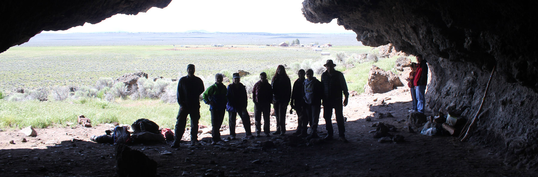
The proposed Devil’s Staircase Wilderness is one of the most remote and inaccessible regions of rainforest left in the Coast Range. This impenetrable area has limited hiking trails or roads and is visited by only a few hundred people a year. Yet it remains unprotected despite the efforts of conservation groups and Oregon’s congressional delegation. To find out more about this compelling landscape, eleven hikers joined Chandra LeGue, the Western Oregon Field Coordinator at Oregon Wild, for a day of hiking to the Dark Grove. The Dark Grove has never been logged and is home to ancient trees that are 400-500 years old.
Our caravan of cars departed Eugene and meandered on back roads through the coast range. At one point, the green surroundings were cleaved from our sight as we drove through a wasteland of cut and darkened stumps: one member in the car likened the lifeless land to the desolated area at Mount St. Helens just after its eruption. This sight was a stark contrast to the lush biomass that we would encounter later that day.
About 15 miles northeast of Reedsport, we pulled off the pavement and slowly traveled up a single laned, overgrown backroad. Salmonberries grew in abundance here and scratched the sides of the car.
We parked at a junction and walked down an old logging road that was being reclaimed by the forest. Then we disappeared into the bushes, venturing down an elk trail. Posted on a tree was a sign that told us this was not the path to the Devil’s Staircase waterfall and unless you’re prepared to stay the night, and have Search and Rescue to look for you, to turn back. Fortunately, we had a guide for our inaugural visit.
The so-called “trail†was on loose soil and maintained a direct angle downward at 45-50 degrees. For the next hour and a half, we carefully descended 1,000 feet. Roots frequently caught our feet as we clamored over fallen logs and beneath large trees that had crashed across ravines and splintered. Ferns grew in abundance and they and helped us balance ourselves with their solid fronds. We quickly learned that ferns were our friends.
The weather that day was pleasant and sunny, though had our schedule been a day or two off, our visit might have been plagued with slippery trails.
Finally, the trail leveled out and we enjoyed lunch in an amphitheater-like area of fallen logs surrounded by a carpet of greenery. We saw a shadow over the canopy as a turkey vulture circled far overhead, no doubt curious to see if the humans had lost their way.
A forest of Salmonberries obstructed our path, so we made a trail straight up a ridge, then down into a forest of sword ferns. The ferns stood at five to six feet in height, so they engulfed us all and many of the shorter members traveled with their arms raised straight overhead. These tranquil glens often hid downed logs and it was easy to twist ankles or slam shins.
A fallen giant became our catwalk above the salmonberries, foxgloves, and ferns. We crossed a creek, but could barely see the water because of the thick undergrowth. Scampering down the side of the massive tree, we squatted and crawled through a small jungle, then emerged at the root base of the fallen giant – it was 25 feet tall!
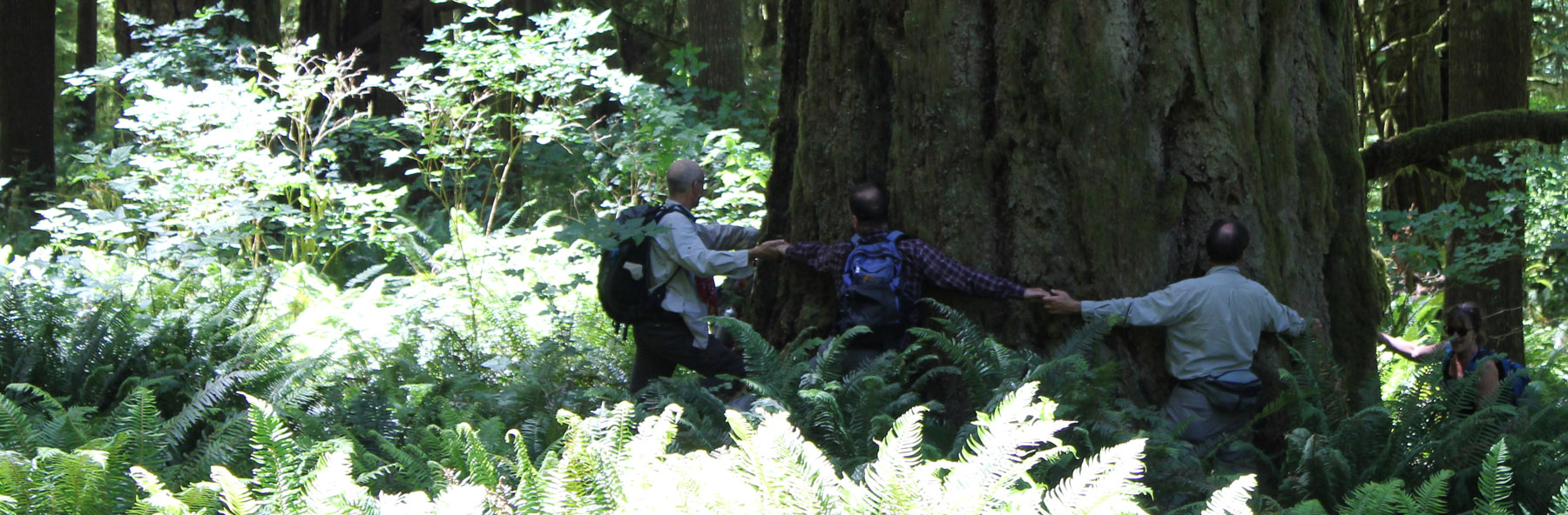
In front of us was the Dark Grove, a cathedral of 8-foot wide Douglas Fir trees. The trees were dark in appearance, the result of fire about 150 years earlier. Touching the bark a charcoal residue was imprinted on fingers. The tree model is Becky Lipton.
Crossing back across the fallen giant, we stood at the base of one of the largest trees we saw that day. Eight people stood at its base, arms outstretched and hands grasped. They counted one, two, three… their calls became muffled as they rounded the opposite side…the voices returned and the loop stopped – at seven and a half people! This immense tree was somewhere between 35 to 40 feet in circumference! Several hikers mentioned they felt like kids in a giant outdoor playground.
We continued through the ferns and back again along the ridge (which was unmarked on the Forest Service map). We lost the trail several times but finally found what we were looking for: a small rocky outcrop along Wasson Creek where the channeled water made a small waterfall for us to enjoy. We rested for half an hour in the sun.
The rest of the afternoon was spent returning via the same trail that we had descended earlier, which was a workout! At about 4 pm, we returned to our cars and started our two-hour drive back to Eugene.
This hike was a rugged and demanding off-trail experience, and all of us got scratched and dirty, some of us stung by insects, and one person had a fall (fortunately the ground was padded by an abundance of moss and there was no injury)! I understand why people get lost in this wilderness; even with directions, I could never have found this remote location. The sheer scale of the forest is very disorienting, but experiencing this place at ground level provides clarity as to why it needs to be protected.
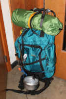
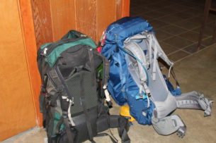
Volunteer Organizer: Mark Hougardy | Location: Eugene-based Hiking Group Lodge | Date: April 30, 2016 | Duration: 1 day | Participants: 25 | Type: Outreach Event
Backpackers of all experience levels spread out their gear to share ideas and swap stories about backpacking. Of particular interest was the lightweight and ultra-light items and how they could help people do more with less. Twenty-five people attended to learn from other backpackers about what stove, sleeping bag or tent might best help them on the trail.
Trip Report
Volunteer Leader: Mark Hougardy | Group: Eugene-based Hiking Club: joined by BRING Recycling| Date: April 9, 2016 | Participants: 8 | Type: Day Hike
Visiting the local landfill is not high on a person’s bucket list, but ask this question, “Where is away?†When you throw something in the trash where does it go? What happens to it? What will happen to it?
Roughly 5-miles from Eugene is the County landfill. Visiting such a place is very useful for gaining perspective about our personal and societal use of resources. This was short, but a very educational trip. A handful of curious folks made the trip to learn about the facility’s methane recovery operations, how the landfill cells are designed, how space is maximized via compaction, leachate management (trash juice), wetlands mitigation, and impacts on the Middle Fork’s water quality – a potential secondary source of water for 250,000 people.
The footprint for this site is 540-acres, and the hills will eventually reach a height of 600-feet. The expected “lifespan†for this site is another 100-years; which means we will be putting trash into the ground for another 100-years at this site. That is a lot of trash.
Trip Report
Volunteer Leader: Mark Hougardy | Group: Eugene-based Hiking Club: joined by BRING Recycling | Date: October 27, 2015 | Participants: 8 | Type: Day Hike
Our trip to the landfill was cut short because of gunfire in the vicinity. We left the area immediately. Apparently, a state-licensed trapper was on top of the 250-foot trash hill shooting birds considered to be a nuisance. The BRING representative, who was guiding our trip, was not happy because there was a breakdown in communications. Our trip had apparently uncovered a major hole in the landfill’s processes concerning visitors, signage, and contractors with firearms using the site. This has been resolved and I will be re-scheduling another visit to see everything that we missed.
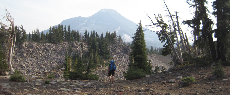
The Three Sisters Wilderness in Oregon is breathtakingly beautiful. This diverse landscape of volcanoes, snow, forests, creeks, lava fields, and lakes gives hikers the opportunity to explore a vibrant topography. The wilderness encompasses 281,190-acres and is dominated by three volcanic peaks: North, Middle, and South, that each exceeds 10,000-feet in height! Several paved roads around the perimeter of the wilderness allow visitors to see vistas with just a car ride, but to really appreciate the immensity of this setting some footwork is required. Here are some pictures of a 34-mile, 4-day trip along the north and eastern portions of the wilderness ending between Middle and South Sister at a subalpine area known as Camp Lake.
My wife and I began our first day with a late start; we hiked 3 miles south from the Lava Camp trailhead and spent the night at South Matthieu Lake. Smoke from forest fires in the region made everything, even a view of North Sister and the moon, opaque. That night, an anticipated cool breeze was replaced by a warm wind that blew in from high plains of Oregon where a large ground fire was burning. In the middle of the night, the smoke became extremely thick and breathing for several hours was difficult. By morning the winds had shifted and the air was clearer.
The next day we hiked 14 miles; 7 of which reminded us just how destructive forest fires can be, constantly around us were the stark and charcoaled remains of incinerated trees. This conflagration was called the Pole Creek Fire and occurred just 3 years ago in 2012.
Several small creeks crossed our path, most were dry, but Alder Creek’s water was cold and clear even though the flow was very low. The creek offered a respite from a temperature of 85 degrees and hot sun that was beating down. We welcomed the opportunity for rest and refill our water bottles at this little pool.
The North Sister towers in the distance. Continuing south the trail crossed several areas where the fire had not reached; these were often pumice expanses where vegetation was dispersed.
As we crossed Soap Creek we saw a number Bumble Bees buzzing from one flower to another. Soap Creek gets its name from the soapy color of the water; this is because of the sediment that gets carried down in the glacial meltwater.
The trail turned to the west and the terrain gradually increased in elevation. After about an hour and a half we crossed the North Fork of Whychus Creek, which had to be traversed via several logs that served as a makeshift bridge, below us the grey and auburn glacial melt water loudly churned. Its source was about 2 miles upstream at the Hayden and Diller Glaciers. After crossing the views opened up.
A photo of Christiane hiking through a pumice area on our way to Camp Lake; walking on this material is akin to walking on dry sand.
What a beautiful landscape!
A view of South Sister on the horizon; this dramatic peak is 10,358-feet in elevation!
Our destination for the night, Camp Lake at 6,952-feet. The wind here can be unrelenting, this is because the lake’s location is sandwiched in a pass between Middle and South Sister. The wind was strong that afternoon so we found sanctuary behind a glacial moraine and set up camp.
Our original plan was to stay the night at Camp Lake and then in the morning continue over the pass. This would have included: hiking up a climber’s trail for an hour and up several hundred feet in elevation, crossing over a snowfield and down the western side of the mountain and to several remote lakes then overland another 3 miles to the Pacific Crest Trail. But, uncertain weather changed our plans. The forecast had called for a rainstorm along with high winds within the next 24 hours and we were hoping to make it over the pass before the rain. That evening dark clouds marched across the sky. As the sun disappeared under the horizon the temperature dropped well into the 40s and that night we heard several deep and rumbling crashes of thunder. The wind howled into the morning and for several hours we heard rain outside and at times our tent was pelted by ice.
When we woke, the sky was grey in color but appeared mostly calm, though as I stepped out from behind the shelter of the moraine the wind almost knocked me over. I collected water at the lake and was surprised at how chilled I had become in just a few minutes; the wind was deceptively cold. Partially frozen raindrops fell sporadically. My wife and I made the decision to hold off crossing over the pass during this trip. We would return by the route we came.
The area’s starkness was beautiful. Several tents were dotted around the area, all of them, like the tent, is shown in the photo, was strategically placed behind natural wind brakes.
Our hike off the mountain was cold and occasionally it rained on us. At about noon the sun briefly came out, but this did not last long for the sky again turned dark and overcast. We hiked out of the burn zone and returned to the Matthieu Lakes area about dinnertime. That evening, the weather was peaceable, but about 7 pm the wind started up, by 8 pm it roared through camp with gusts reaching 40-50 miles an hour, by 9 pm the rain started. This continued into dawn. We slept comfortably in our tent.
The next morning was drippy and low clouds blew over the treetops. Later that morning we hiked out the last 3 miles. As we approached the Lava Camp trailhead the sky offered us some brief patches of blue. We ended our day with each other clinking together mugs of trail coffee in honor of a good trip.
A high point of summer is witnessing the Perseid meteor shower. Every year in mid-August these cosmic bits of dust and ice streak into the Earth’s atmosphere giving a heavenly spectacle to those on the ground. These ‘shooting stars’ can be seen once every minute and are best seen away from city lights. This year provided an extra challenge because of smoke from forest fires in southern Oregon.
My family grabbed the camping gear and we made our way to the crest of the Cascades in hopes of clear views. Our first stop was at 7,400 feet; unfortunately smoke shrouded the sky and nearby mountains, viewing that evening was very limited.
The next day the winds shifted and skies were clearer. For the second night, we selected a lakeside view at about 5,500 feet. We found a quiet peninsula on the water – the sky theater was open before us and we had front row seats!
As the sun lowered on the horizon it passed behind a thick grey-brown wall of smoke from the forest fires. The pre-show sunset was visually stunning.
For 20 minutes everything around us had a red hue (shown), then the sun completely disappeared behind the wall of smoke. The sky darkened.
Along the shore were gatherings of families, hikers, and campers. On the lake, kayakers began to raft up (shown). Everyone was eager for that evening’s performance. A voice from the water curiously asked if the smudge in the eastern sky was the Milky Way? We turned, behind us the great cross-section of our galaxy began to reveal itself. Someone shouted from the shore, “I saw one!†A wave of audible oohs and aahs was heard from the various groups of people who had seen a meteor streak across the sky.
We laid back on the smooth glacially-carved boulders that would be our theater seats for the evening, and for the next 3 hours were amazed by the variety of meteors that zipped across the heavenly stage; some meteors were micro-sized blips, others were graceful streaks, some dramatically required the length of the entire sky. At about midnight sleep was getting the better of us and we returned to our tents.
I tried to capture some of the Perseids with my camera, out of 80 photos that night this is the best I could accomplish.
Later that night I woke up and walked outside my tent where I could see the sky clearly. The Milky Way was overhead and amazingly bright. I shivered in the night’s cool temperature while looking up. A streak appeared across the star field of the Milky Way; it was bright, then not, then bright again, it rotated about 8 times before disappearing. What an amazing night!
Waldo Lake is one of Oregon’s largest bodies of water, though its lack of amenities such as convenience stores, resorts, and ban of motorized motors upon the water makes this destination easily overlooked. If you’re interested in a great overnight backpacking trip to try the Jim Weaver Loop, a 20.2-mile trail around Waldo lake, here are some photos taken in early July.
We parked the car and started from Shadow Bay near the southeastern edge of the lake. Our hike around the lake was in a clockwise direction. We were quickly out of sight from the parking lot and headed along the trail.
Near Mile 2. Our first stop was at the South Waldo shelter, it was fully equipped with wood and a stove; this is a popular destination in the winter. We continued on.
The south shore had some great views of the South and Middle Sisters. The trail now meandered up the western side of the lake.
Cascade Blueberry
Close to Mile 5. Overlooking the picturesque Klovdahl Bay. Overhead, the clouds began building into thunderheads; in the distance, we could hear the rumbling crescendo of thunder as though gigantic timpani drums were being struck.
The western trail has a number of places where the forest looks like it had a close encounter with a forest fire; note the scoring on the tree at the right.
Mile 10. Continuing north. Seen in the right on the image, about 2-miles away is a scarred hilltop within the burn zone.
We spied several campsites peppered along the western shore of the lake, but as we reached the northern shore we discovered a favorite spot was vacant. As evening approached we appreciated a gentle breeze that chased most of the mosquitoes away.
Enjoying a gorgeous sunset. The sky was clear that night when the stars came out they were so bright you could almost touch them.
A very small toad had made its home just outside our tent during the night. It was discovered in the morning hiding next to one of our shoes.
Roughly Mile 12. Heading east, the trail meanders through the burn zone along the north shore. This day was going to be hot so we tried to cross before the sun rose too high in the sky. Several weeks earlier, during a scamper through the burn zone, we crossed this section and encountered numerous trees that had fallen across the trail, these had since been removed – thank you Forest Service!
Mile 13-ish. Standing on the north shore looking across to the southern shore. The morning was calm, it was difficult to tell where the sky ended and the lake began. Determining the depth of the logs seen the water was difficult, but if the terrain continued its steep angle into the water, these logs were at least 40 feet deep in the foreground and 60+ feet deep further out.
A Couple Selfie taken on the trail within the burn zone.
We’re out of the burn zone and heading south along the eastern edge of the lake. Half of the trail around Waldo Lake is in the woods, with only brief glimpses of the water. Be prepared to see lots of trees.
Just as we neared the south shore a massive toad was seen at the edge of the trail eating mosquitoes. During the entire trip, mosquitoes were not a big issue, though the last several miles of the trail we were devoured by these little flying beasts! I was glad to see this toad!
Mile 20.2. The best part of finishing the loop trail around Waldo Lake is that you can dip your feet into the lake’s cold and clean water.
We arrived back at the car the next day. Except for people we saw in the campgrounds, we only saw 6 people on the trail.
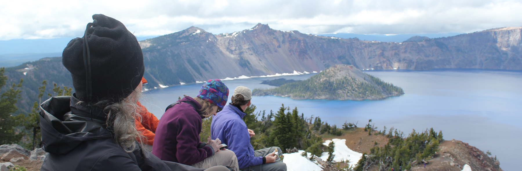
Crater Lake National Park in Oregon is spectacular to behold, but the park’s centerpiece, Wizard Island, truly enchants visitors.
Wizard Island is striking because it appears unreal, as though it was pulled from the pages of a fantasy novel, here’s how I might [poorly] describe such a mystical setting-
Seeing the island for the first time I could only describe this place as the dominion of a sorcerer, a fortress where he/she can perform incantations in solitude. The isle looks as though it was inspired by a familiar clothing item, something mundane and convenient – the magi’s hat; the island gently rises from all sides to a center point, the top appears mischievous as though the fabric has deliberately toppled to the far side. Surrounding the castle is a beguiling blue-colored lake, a gigantic moat that is miles across and terrifyingly deep! The island is fortified too; soldiers of green trees stand guard, expecting an attack from the water they are numerous near the shore, only to have their numbers fray at the ramparts. In the distance, immense cliffs stab into the sky creating an impenetrable wall of stone. The scene is inspiring, beautiful…serene. A cool wind gently blows past and whispers about the power of a hellish phantasm that was once unleashed and devoured a mountain, possibly of a battle between Gods. The island captivates the soul; its beauty too alluring, this grandeur too inspiring, the enchantment…too intoxicating. The wind’s gentle whisper beckons to visit, to explore this place – to walk in its magic.
The best part about Wizard Island is that it is not a fictional destination, this spellbinding place really can be explored, though your time on the island is limited to just a couple of hours.
Like most adventures, be flexible on your journey; while camping at the park I tried, for several days, to obtain tickets for the boat ride to Wizard Island. Unfortunately, weather concerns and mechanical problems caused delays. On the third day, the stars aligned and tickets were quickly in hand. After a quick scramble for gear, my family and some friends drove to the opposite side of the massive crater to the Cleetwood Cove parking lot.
The hike to Cleetwood Cove is a 1-mile long, 700-foot descent down the side of the crater.
At the water’s edge was our boat to Wizard Island, about 25 or so people boarded, then we were off.
What is most fascinating about the boat ride is the perspective – a view not fully appreciated from seeing Crater Lake from the rim. Being at the lake’s surface you feel like a small toy boat in a gigantic bathtub, it is an awe-inspiring method to better appreciate just how immense Crater Lake is-
The lake stretched beyond our boat in all directions, the crater’s oval shape is a massive 5-miles by 6-miles wide.
Below our boat, at the deepest point, was 1,943 feet of water – that’s equal to a 180-story building below us!
Around us the rim towered overhead, it ranged in height from 700 feet to 1,800 feet.
Most fascinating, this entire place literally went to hell about 7,700 years ago when the 12,000-foot Mount Mazama erupted – the eruption was 42 times greater than the eruption of Mount St. Helens in 1980*. Riding over the waves it is hard to imagine that the original mountain once stood 1 mile above us and a quarter mile below our tiny boat, and within the course of 2 violent days…completely disappeared in one eruption.
The eruption was recorded in Klamath Native American oral traditions; it tells of two Gods, Skell, and Llao who fought. It was their battle that caused the eruption of Mount Mazama and left many of the geographic features seen today.
Over time the volcano eventually settled down, though, in the process left behind several gigantic cones, which rise from the crater, several are underwater, the one above the water’s surface is Wizard Island.
The water of Crater Lake is from snowmelt – it is clear, pure, and cold! Its clarity allows light to penetrate to great depths, which absorbs longer rays of light (like red) while scattering and reflecting shorter rays (like blue). When we peer into the water we see these scattered/reflected blue shorter rays.
Approaching Wizard Island, even several miles away, is very impressive.
As the boat approaches Wizard Island the size and grandeur of this volcanic cone become apparent.
Hiking to the top of Wizard Island the trail climbs 760 feet, but this is nothing compared to the eastern rim of the crater which towers above me. In the photo, the Watchman scrapes the sky at 1840 feet above the lake’s surface. Seen between the trees, on the water (crossing Skell Channel) is a small white line, this is one of the boats that transport passengers to the island.
The views hiking to the top of Wizard Island are jaw-dropping.
Think of Wizard Island as a small volcano, and it has a crater; this picture shows several people hiking out. The rim of Crater Lake looms on the horizon.
This Ground Squirrel is a resident of Wizard Island. He was demanding a food tithe from me for visiting his island retreat.
A view from atop Wizard Island looking across Crater Lake to the opposite rim which is about 5 miles away. The blue color is just magnificent.
Hiking down the cinder cone we enjoy a rich tapestry of colors – a masterpiece painted by nature!
This is one of the few boats allowed on Crater Lake. It is seen here delivering visitors; this boat will take us on our return trip around the lake’s perimeter in a counterclockwise direction. Our next stop was the southern shore to see a slide area and the Phantom Ship.
The spires of the Phantom Ship, an island in the lake, which under low-light conditions resembles a ghost ship.
Looking into the water from the edge of the boat we saw this dramatic difference in color. The interpreter on the boat said the contrast was because we were passing over an underwater ledge, to the left the water depth was about 900 feet, to the right the depths plunged to 1,600 feet!


 Volunteer Organizer: Mark Hougardy | Location: Eugene-based Hiking Group Lodge | Date: April 2017 | Duration: 1 day | Participants: 80+ | Type: Outreach Event
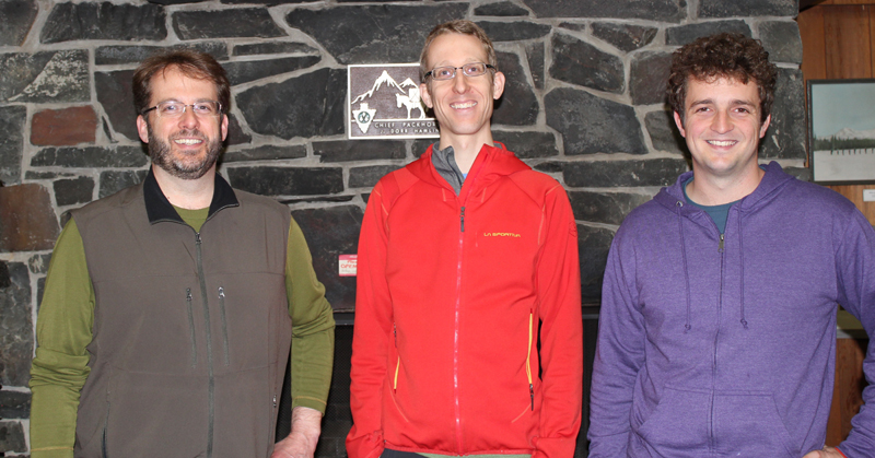


 That’s me with the apple. The lodge’s owners Hal and Tonia quickly welcomed us as we arrived at their retreat/garden/camp in the woods. Hal offered us delicious Honey Crisp apples directly off the tree to enjoy on our hike. [Photo by Darko]
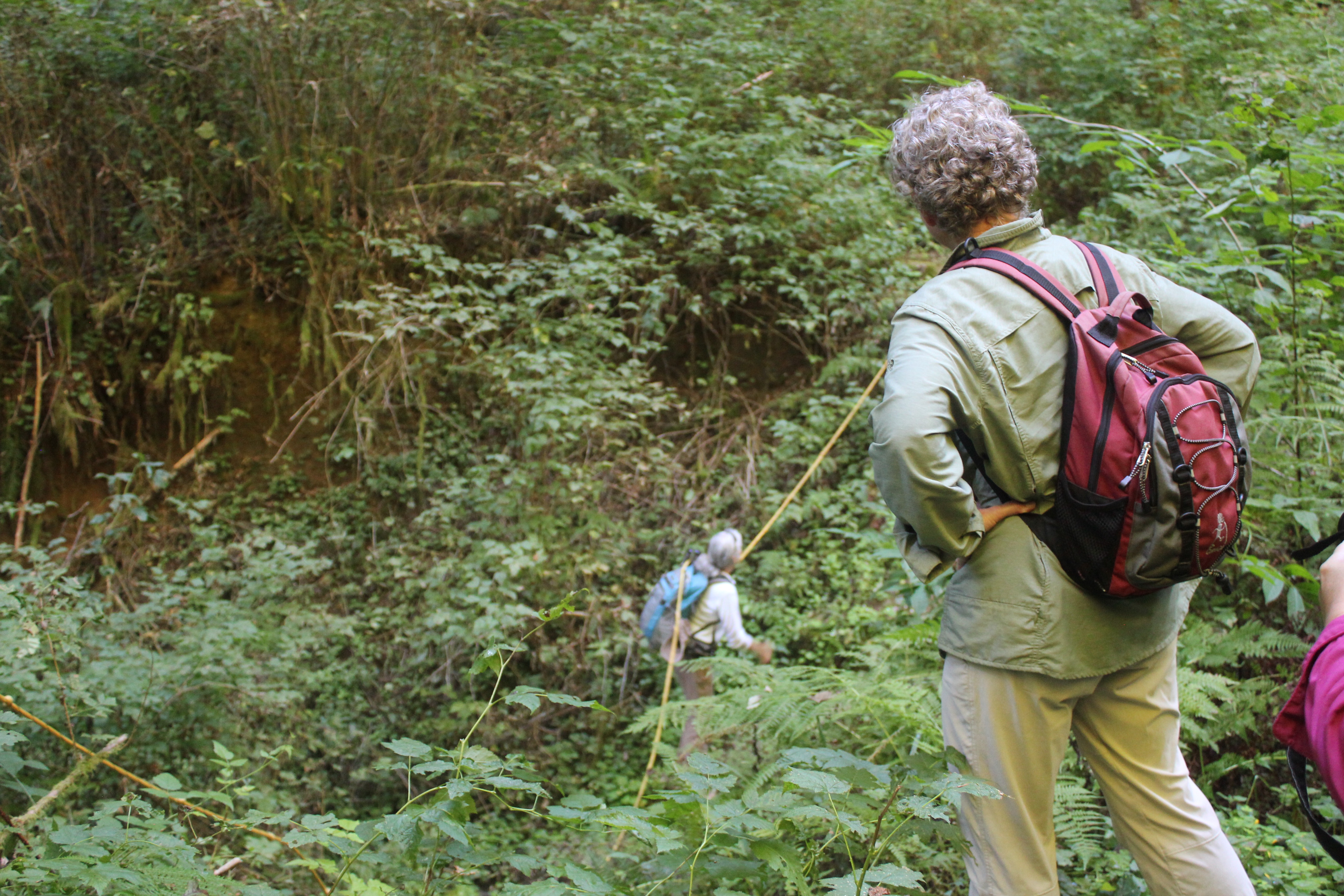 Our 8-mile hike started up a reclaimed forest road, past cedar trees used by mountain lions for scratching, across the deep ravine where a rope was needed (shown), and finally to a deceptively steep forest road.
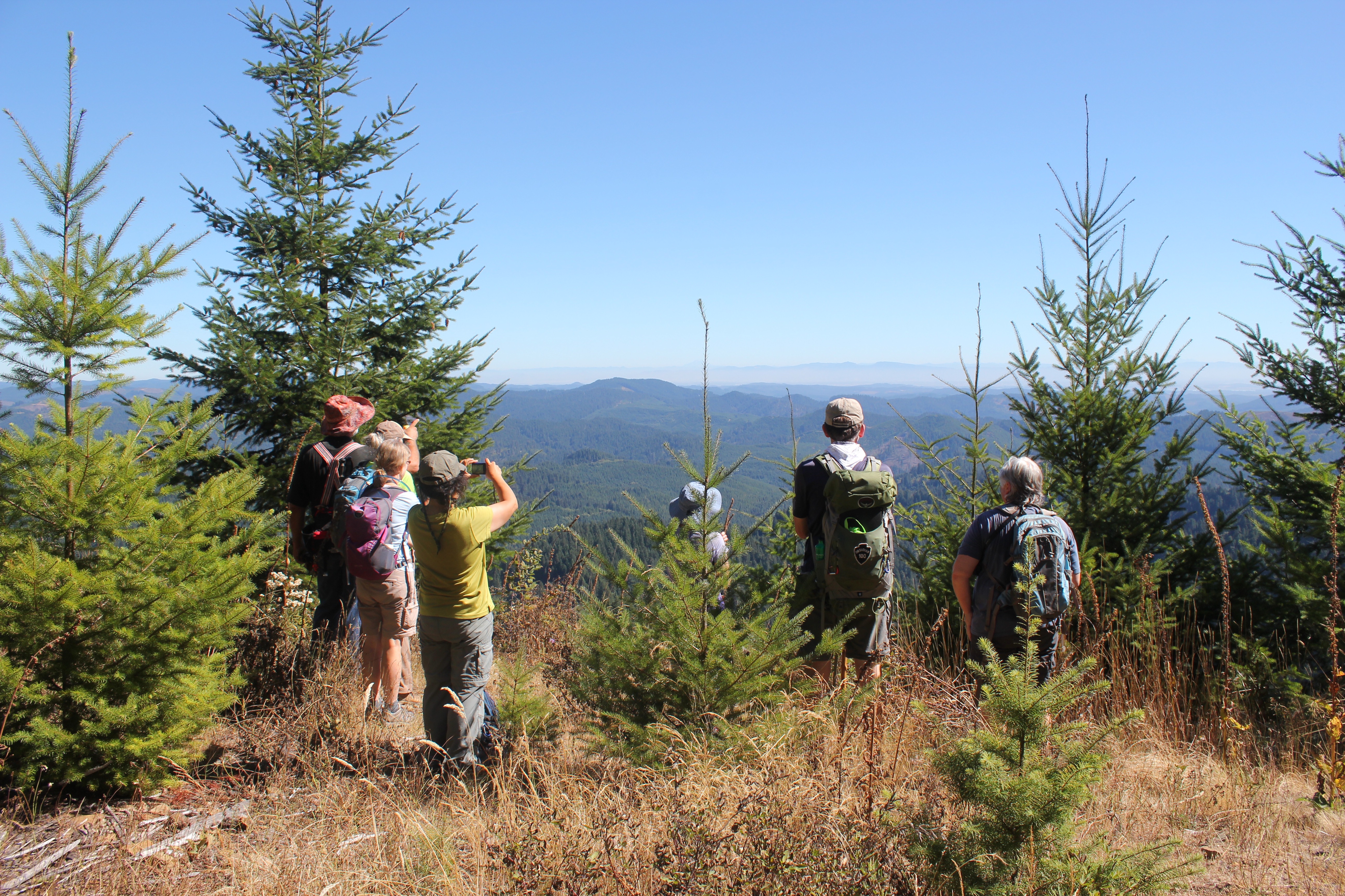 After a good heart-pounding climb, we arrived at the “Secret Spot,†the highest location within the Coast Range in Lane County. We had climbed roughly 1,600 feet from where we started but the view made up for it. Looking east we could see 130+ miles in the distance: in the north, Mt Hood, followed by Mt, Jefferson, Three-Fingered Jack, North, Middle and South Sister, Mt. Bachelor, and finally 125 miles further south, Diamond Peak.
 We rested, enjoyed some lunch, and then traversed back down the forest road to several turnoffs, and a forest trail that deposited us back at Big Bear. That evening we shared a potluck with neighbors; everyone’s gardens were abundant and we and enjoyed the bounty of harvest-time meals. Later that evening we enjoyed guitar folk music by the fire and enjoyed freshly picked grapes (shown below). In the morning we hung out, explored the local creek, enjoyed the garden, and planned a route for a 42-mile, 4-day backpacking trip to the coast for next spring.
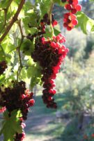
 A view of the Santiam Pass trailhead, mile number 2006.9 on the PCT. As my wife and I gathered our gear, we met two sixty-something ladies that started at Crater Lake for a section hike several weeks earlier. These women had already hiked about 175 miles.
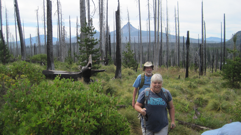 The weather was beautiful – if a bit warm – that morning. We were joined by two friends, Jack and Cindy, who drove us to the trailhead and then hiked with us for the first five miles of our journey.
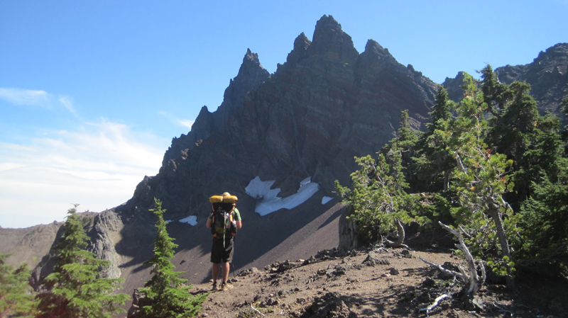 A view of the north side of Three Fingered Jack, a jagged and rugged mountain in the High Cascades that has banded stripes. A PCT thru-hiker stands in the foreground. He was one of about 25 who passed us that day; the oldest being somewhere in her 60s, the youngest about 18, and about half of the thru-hikers were female.
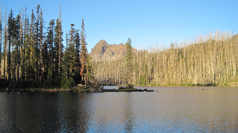 A view of Wasco Lake the following morning at about 7 am.
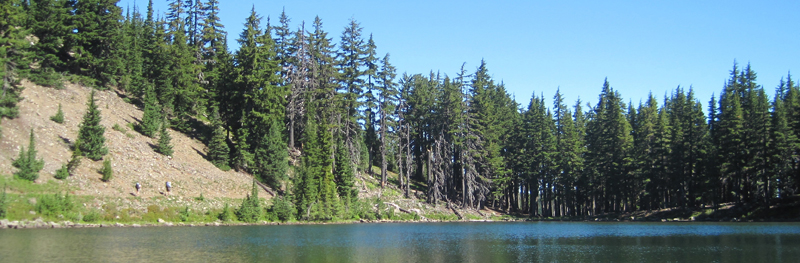 We enjoyed a mid-morning break on the shores of Rockpile Lake. Several thru-hikers can be seen on the trail at the left. The two women we met a day earlier enjoyed their lunch and a quick swim on the opposite side of the lake.
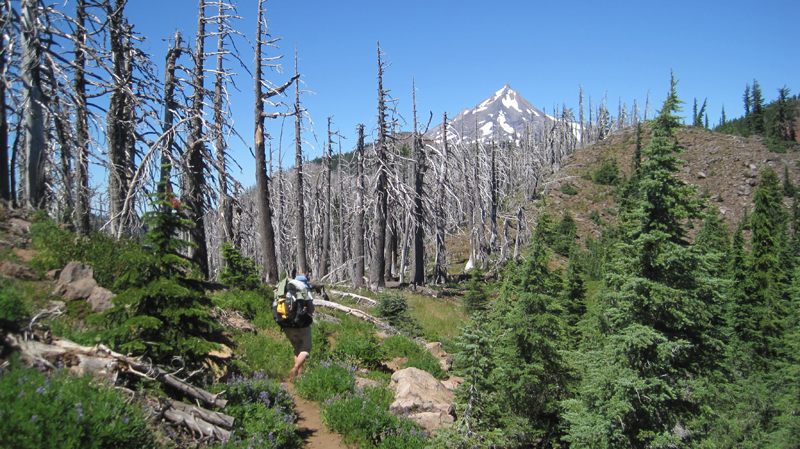 Much of our day was spent walking through woods that had been burned several years earlier and were now recovering. In the distance, the peak of Mount Jefferson made frequent and teasing appearances.
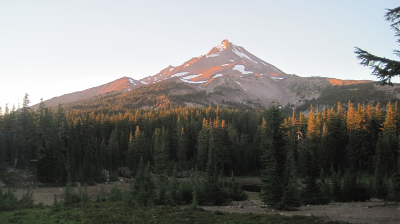 That evening we camped at Shale Lake and enjoyed an amazing view of the south side of Mount Jefferson. We ate our dinner and watched the evening light blanket the slopes of this iconic High Cascades peak.
 Looking upon a picturesque view of Pamelia Lake from the PCT. This area is a limited entry zone requiring a permit to camp. Our hike that morning was in the forest where we encountered some sizeable old growth trees, and at one point we rounded a corner and surprised a grouse.
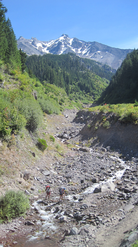 Milk Creek has cut a 100-foot deep gorge into the slopes of Mount Jefferson. Several backpackers are seen crossing the creek below us.
 Overgrown and green, this is what the trail looked like for the rest of the afternoon. It was also humid and hot, making our progress slower than expected. Occasionally, we would see glimpses of Mount Jefferson through the trees.
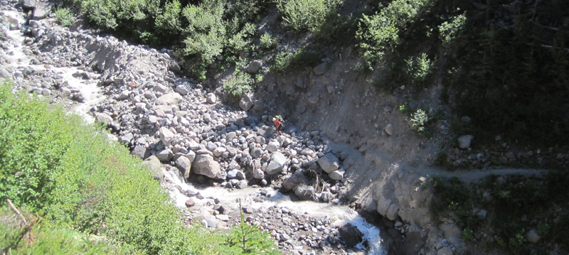 Russell Creek pours off the mountainside where it meets a “flat†area for about 100 feet before dropping into a deep gorge; this more level area is where the trail crosses. Earlier in the season, the flow can be very strong and this can be a dangerous crossing. Today, though, it just brought about some wet shoes. In this image, a hiker approaches the crossing area. We spoke with her later to find out that she was 18 and was hiking 250 miles of the PCT by herself.
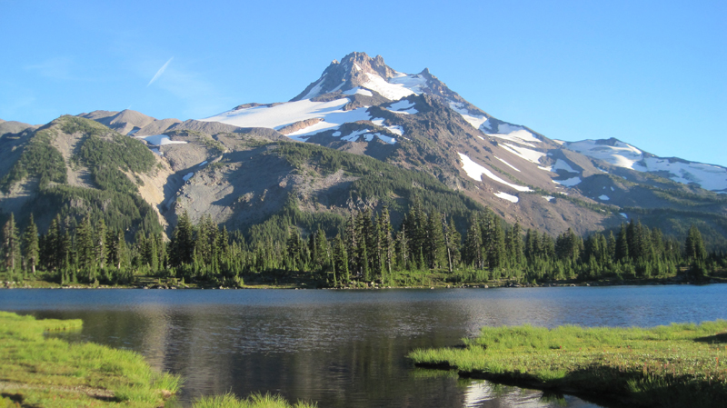 We enjoyed breakfast under this stunning skyline.
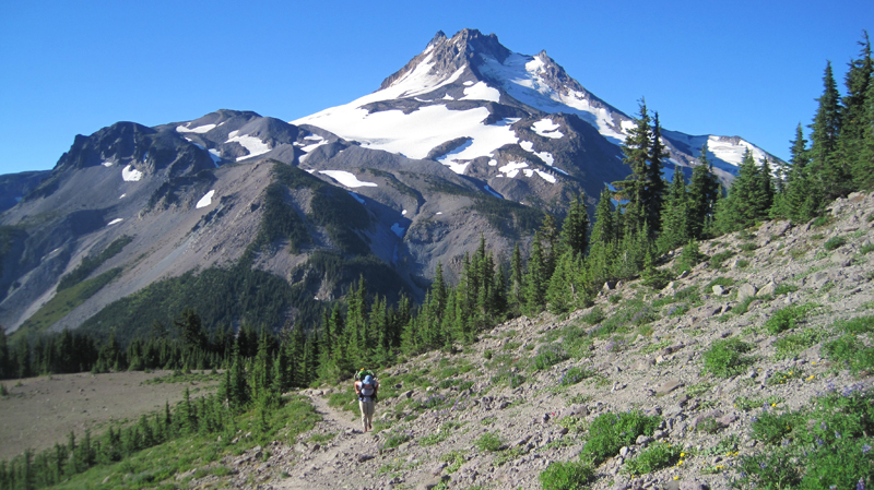 The next morning we climbed 1,200 feet out of Jefferson Park. The views were magnificent: wildflowers were in bloom along the trail, and at times it was hard to hear because of the abundance of buzzing coming off nearby flowers.
 We reached the trail’s summit and could see Mount Hood in the distance. Descending the slope, we passed several snowfields. For several hours our progress was slow going because of the loose rocks, though the trail soon became forested and we passed a number of beautiful mountain lakes.
 Late in the afternoon, we reached Ollalie Lake. Here is a view looking south across the area we just hiked, and in the distance is Mount Jefferson. About two dozen thru-hikers were staying at Ollalie Lake to rest.
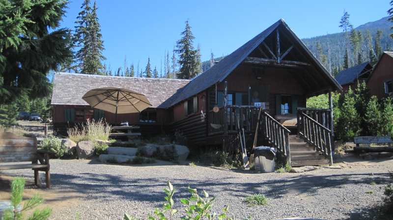 Ollalie Lake has a small store where my wife and I eagerly purchased a bag of sea salt and vinegar potato chips and promptly devoured the entire bag. At one point there were a whopping total of eight stinky hikers in that little store – ah, the aroma of humanity!
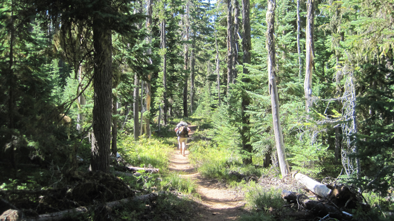 The trail on day five was mostly flat and in the shade of tall trees, making trekking much easier. The forest was drier in this region and water was less abundant than before. When the opportunity presented itself, we filled up our bottles at a small, tranquil trailside spring. The temperature that day was especially warm.
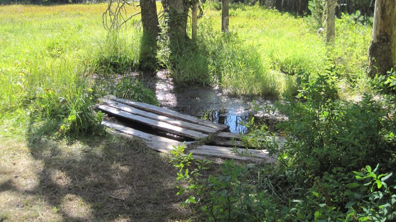 We arrived at Trooper Springs near the Lemiti Marsh area. This was our last water for about twelve miles. The spring was a welcome site although a small and precarious platform needed repair. We were attacked by horseflies; they were numerous, aggressive, and very persistent. Needless to say, we did not stay long.
 Taking care of some much-needed laundry at the spring using the “Ziplock spin cycle” washing method.
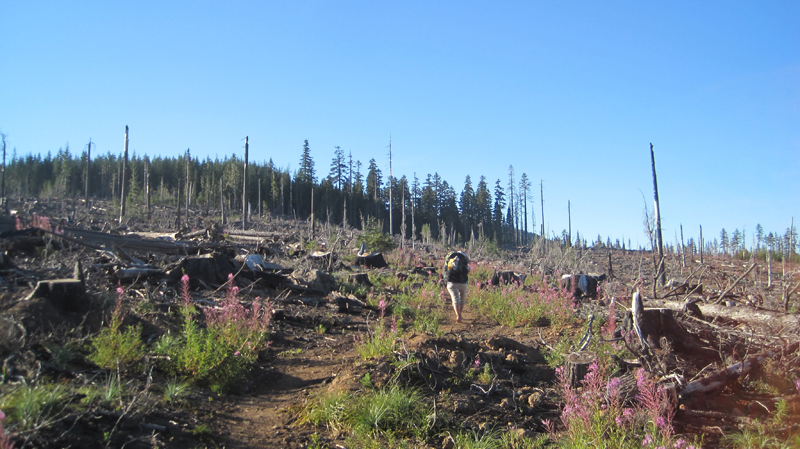 Walking through a clearcut was a stark contrast to the lush forest we had seen all day. Near this area, we found the strangest price of trash on the trip: a Howard Johnson’s hotel key card lying next to the trail. We picked it up.
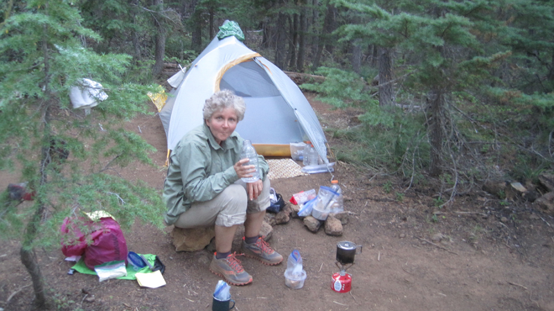 We located a bare spot at the edge of the trail and camped for the night. Trailside camping can look messy, but everything goes back into the pack and we always leave the site cleaner than we found it.
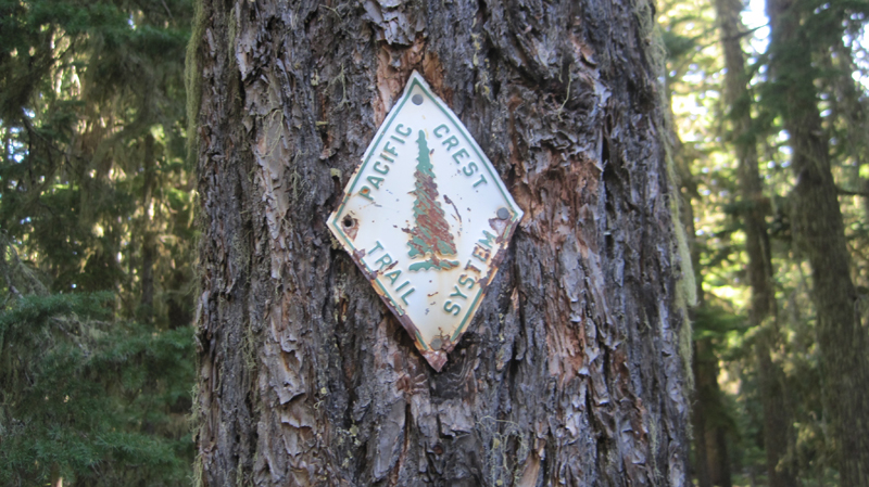 Shown is an old style PCT trail marker that we found, one of the few older versions that we saw on the entire trip.
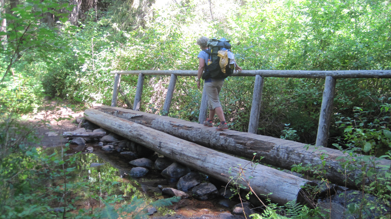 Crossing the Warm Springs River. It was more a small creek at this point, but the water the clean and cold – a welcome site.
 As I took off my shoes I realized just how dusty the trail was that day.
 That evening we stealth camped near the trail close to Timothy Lake. During the night we unzipped the tent for a “nature break” – only to be scolded by an owl that repeatedly whooo’d at us until we went back to bed.
 Several miles down the trail was Crater Creek, a beautiful riparian area with some astonishingly cold water: a welcome find on a hot day. We soaked our feet, took a twenty-second dip (the water was that frigid), then soaked our shirts and put them on as a natural air-conditioner. We made a stop at Little Crater Lake, the source of the creek. Little Crater Lake is astonishingly blue like it’s larger cousin, but this was not volcanic in origin. Rather, this was a large artesian well. Continuing down the trail, we passed a gravel forest service road and found a bag hanging on PCT post. Inside were some small apples or Asian pears – some unexpected trail magic in the middle of nowhere.
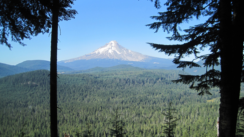 This was our first view of Mount Hood after about 40 miles of hiking – what a fantastic sight.
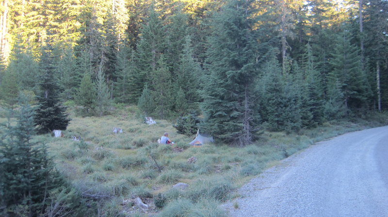 We took a side trail to Frog Lake for some water where there was a hand pump that drew water from a well. As we entered the campground we were momentary celebrities answering questions like: “Where did you hike from?†“How many days have you been out?†“Tell me about your gear?†etc. It was an odd but welcome feeling. That night, we camped just outside the campground on a forest road.
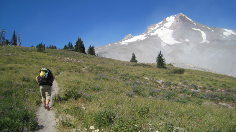 Finally, the green of the trees turned to open space and vistas as we passed the timberline. It was windy with twenty to thirty mile an hour gusts that kicked up sand and dust. We wore our sunglasses to keep volcanic grit out of our eyes.
 There was an abundance of mountain flowers on the trail.
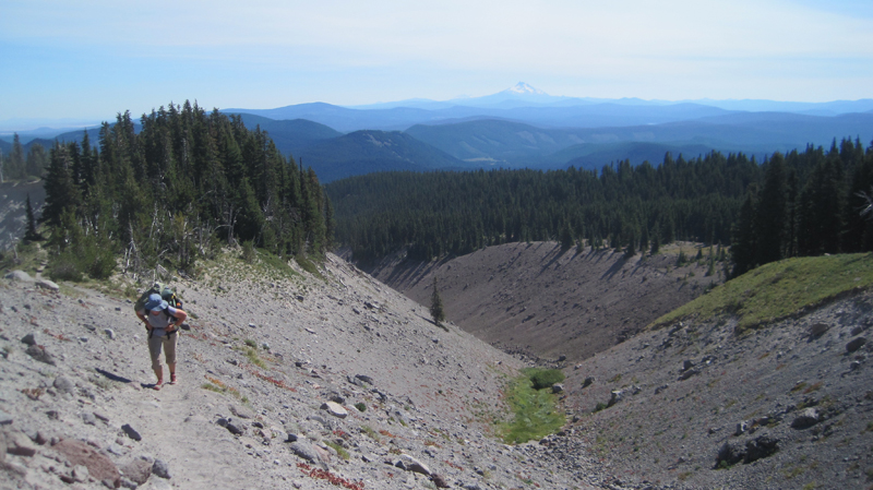 Close to the Timberline Lodge, the views were fantastic! We could see much of the route that we had spent the past week traversing.
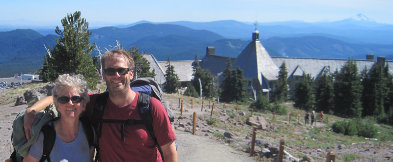 We arrived at the Timberline Lodge, mile 2107.3 on the PCT, and 100 miles from our starting point at Santiam Pass. Inside the lodge, scores of thru-hikers had taken refuge in the common areas. There was access to food and good company, with couches for sleeping and a warm fire to enjoy in the evening. We met some new friends here: Shepherd, Snow, Lonestar, and Patch, all thru-hikers who started at the Mexican border and were resting before their final push into Washington State and Canada.
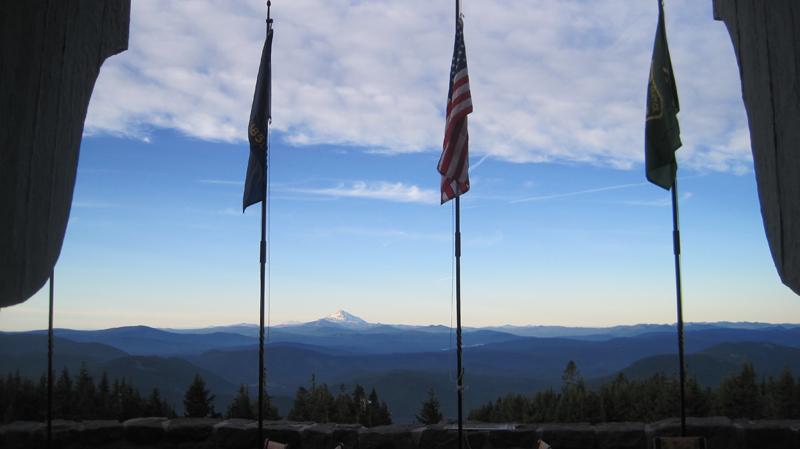 Looking through the door at the Timberline Lodge onto the Roosevelt Terrace: in the distance Jefferson Peak, and behind it, Three Fingered Jack and Santiam Pass. From the lodge, we were able to take public transit back home.
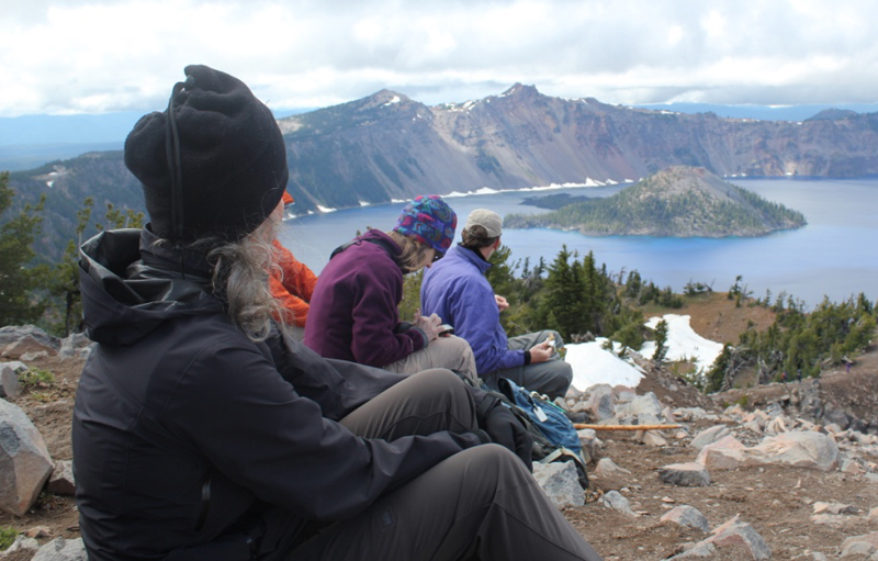
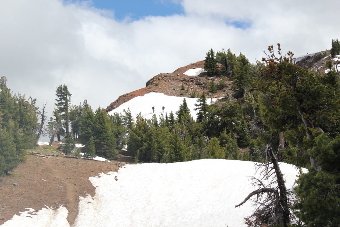 On the way, we encountered several snowfields, one of which was very steep, but the stunning views from the top were well worth the extra effort in getting there. In the distance, Mount Scott was enticingly clear of snow, though we later learned it was impossible to reach because several miles of the eastern rim highway was closed for repairs. Returning down the mountainside we visited the small loop trail of Godfrey Glen where we collected trash that uncaring visitors had left. We collected enough garbage to fill a large bag! That evening we sat around the campfire and commented on the number of stars that were visible, where was the rain? All was calm until 2 am when the rain arrived and temperatures lowered to just above freezing. Our two members in their “good deal†tent had a cold and wet night.
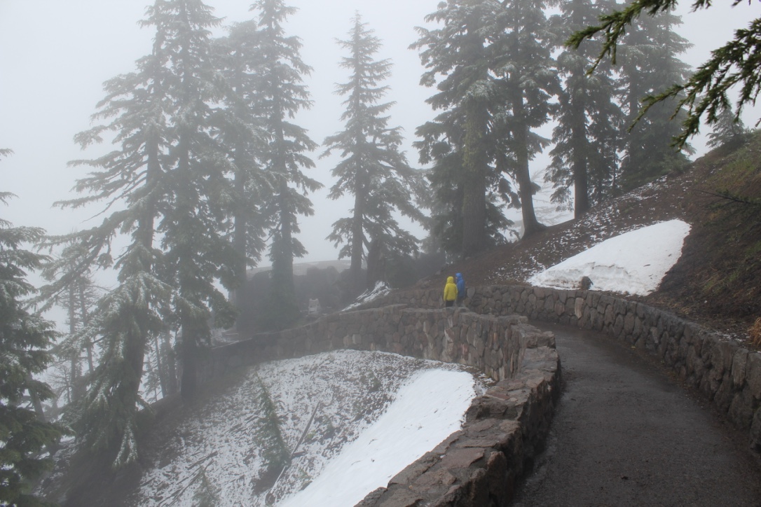 We explored the Visitor’s Center, the Sinnott Memorial Overlook (featuring an indoor exhibit room) and the gift shop to escape the fog, wind, rain, and occasional snow flurries. The fog was so thick we could not see the lake or a few hundred feet in front of us. In the afternoon we moved below the cloud line to hike the picturesque Annie Creek trail. Although a short hike, it was very picturesque. Laurie and Brad had reservations at the Crater Lake Lodge for dinner, they generously increased their table size to include all of us so we could get out of the rain and have some warm food. About 8 pm that evening the sky cleared and at first, the temperatures seemed warm. The group campfire that evening had just half of the group, the remainder had gone to bed early. The two members in the “good deal†tent had another cold and memorable night. In the middle of the night I awoke and was stunned by the visibility of the night sky – there were thousands of stars! My tent thermometer showed that temperatures had dropped into the upper twenties.
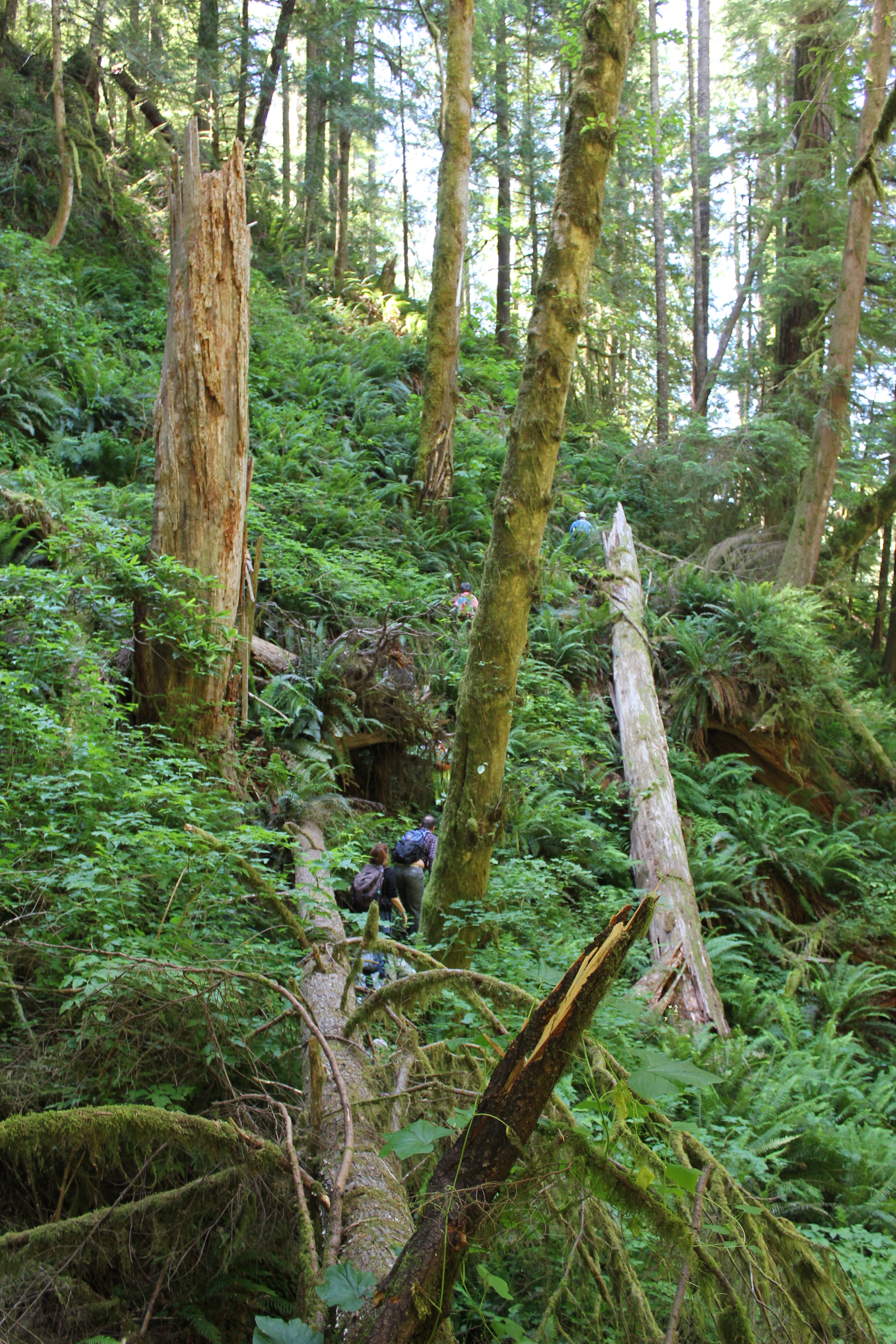 We parked at a junction and walked down an old logging road that was being reclaimed by the forest. Then we disappeared into the bushes, venturing down an elk trail. Posted on a tree was a sign that told us this was not the path to the Devil’s Staircase waterfall and unless you’re prepared to stay the night, and have Search and Rescue to look for you, to turn back. Fortunately, we had a guide for our inaugural visit.
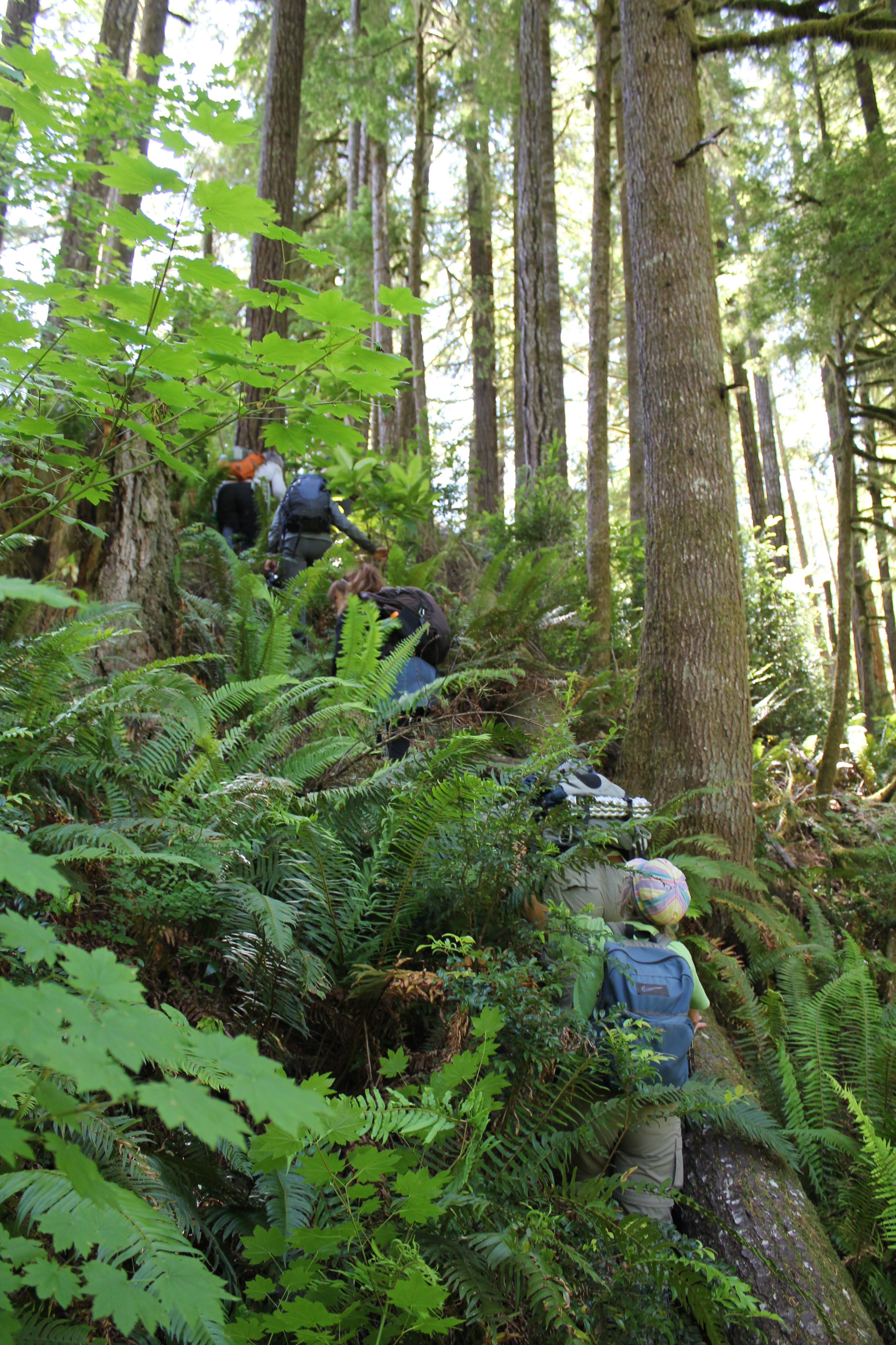 A forest of Salmonberries obstructed our path, so we made a trail straight up a ridge, then down into a forest of sword ferns. The ferns stood at five to six feet in height, so they engulfed us all and many of the shorter members traveled with their arms raised straight overhead. These tranquil glens often hid downed logs and it was easy to twist ankles or slam shins.
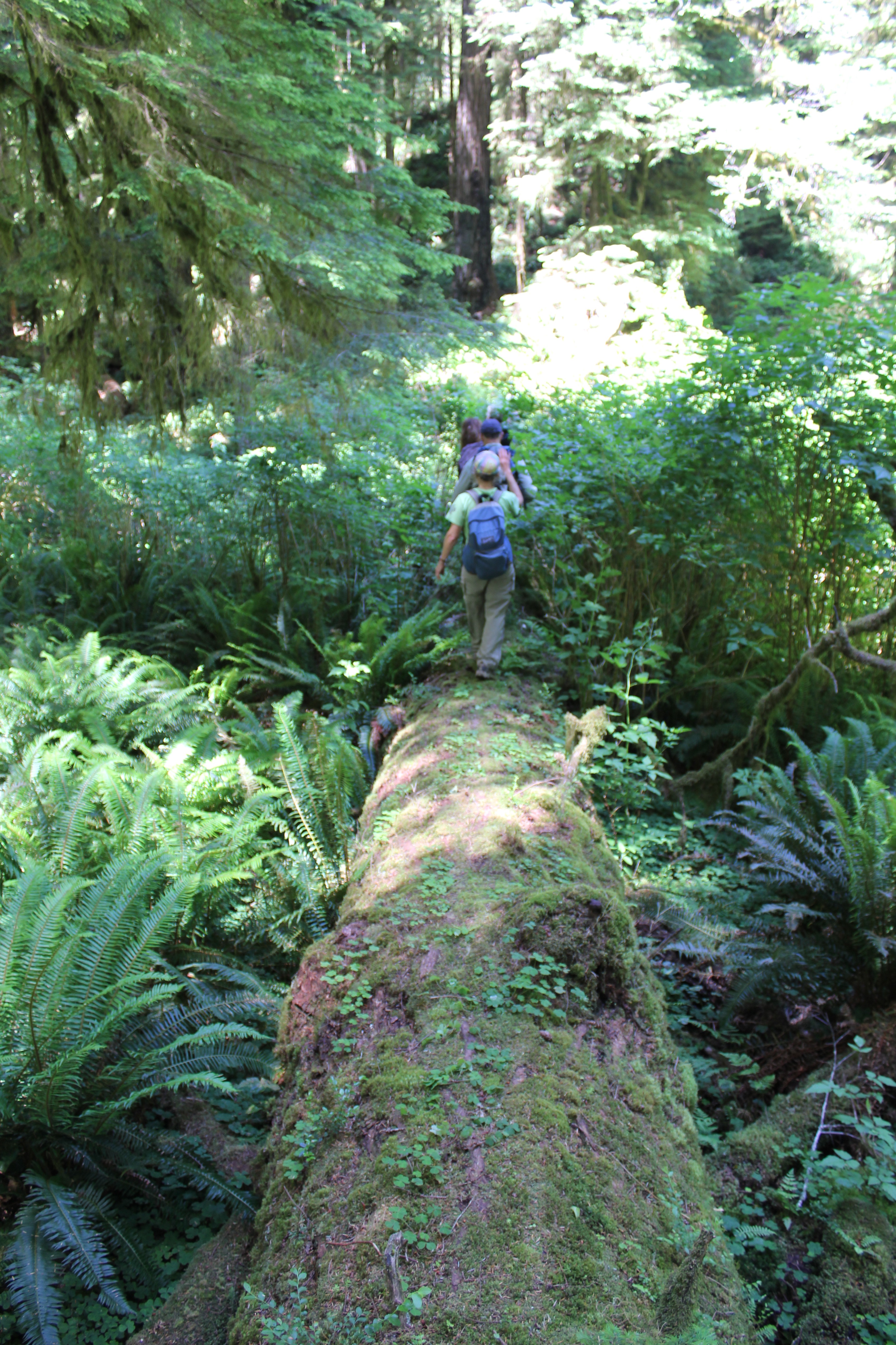 A fallen giant became our catwalk above the salmonberries, foxgloves, and ferns. We crossed a creek, but could barely see the water because of the thick undergrowth. Scampering down the side of the massive tree, we squatted and crawled through a small jungle, then emerged at the root base of the fallen giant – it was 25 feet tall!
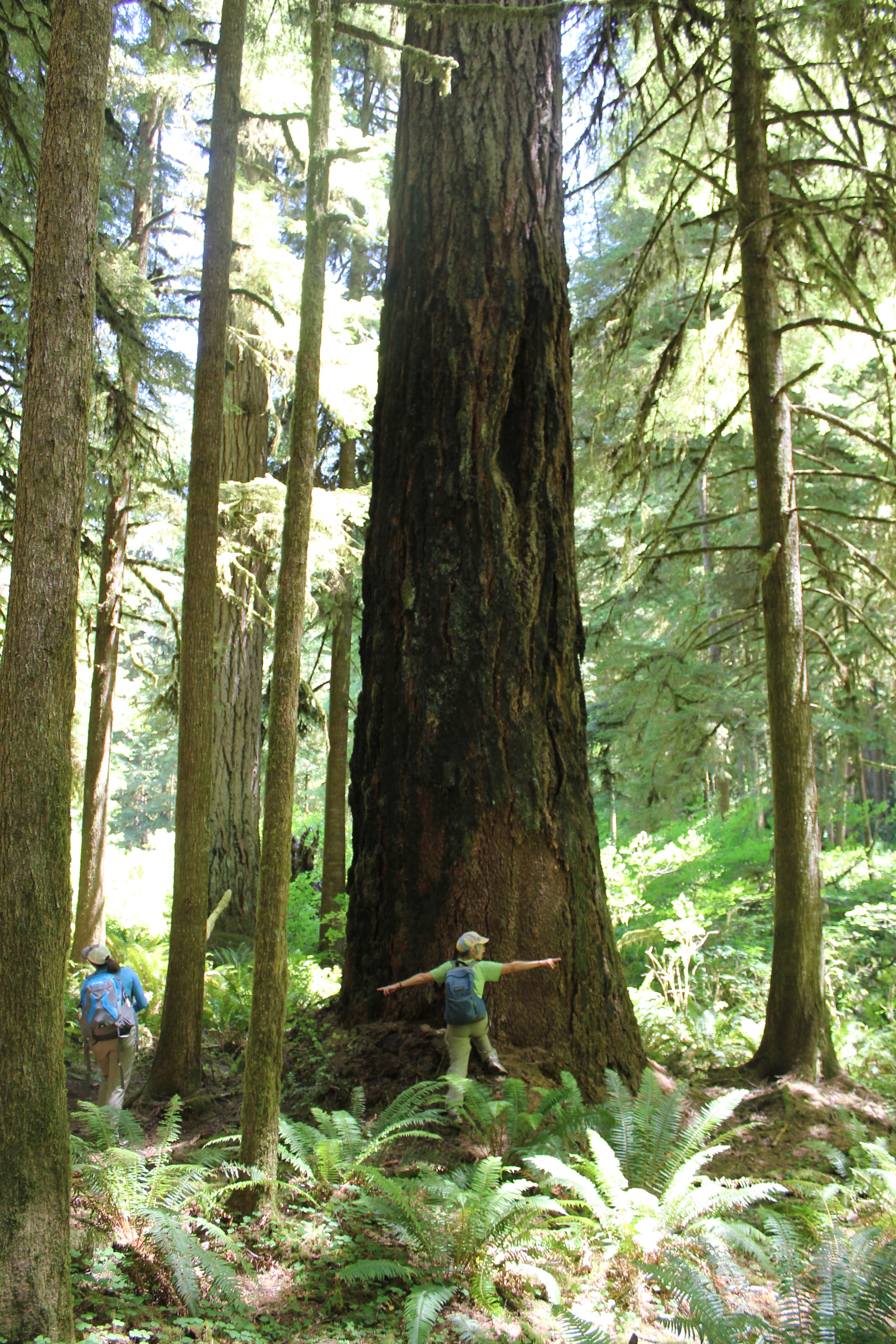 In front of us was the Dark Grove, a cathedral of 8-foot wide Douglas Fir trees. The trees were dark in appearance, the result of fire about 150 years earlier. Touching the bark a charcoal residue was imprinted on fingers. The tree model is Becky Lipton.
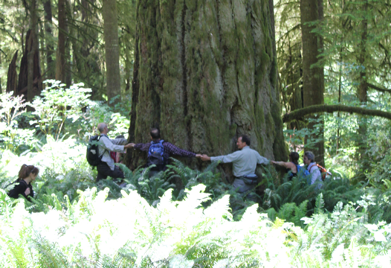 Crossing back across the fallen giant, we stood at the base of one of the largest trees we saw that day. Eight people stood at its base, arms outstretched and hands grasped. They counted one, two, three… their calls became muffled as they rounded the opposite side…the voices returned and the loop stopped – at seven and a half people! This immense tree was somewhere between 35 to 40 feet in circumference! Several hikers mentioned they felt like kids in a giant outdoor playground.
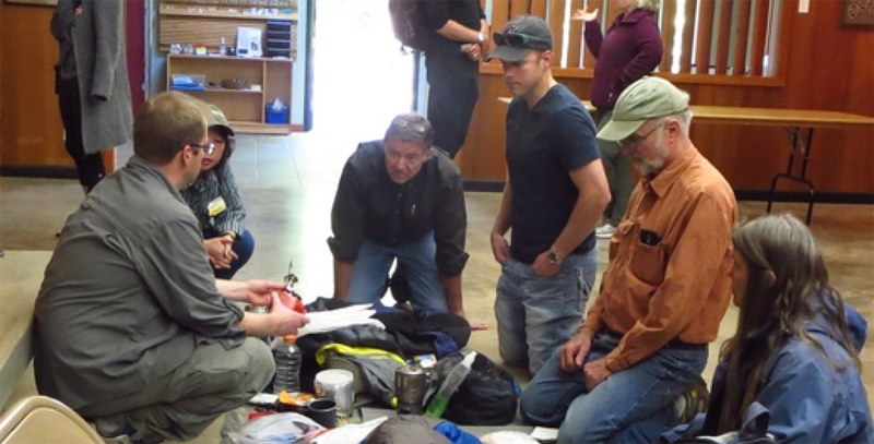
 The Three Sisters Wilderness in Oregon is breathtakingly beautiful. This diverse landscape of volcanoes, snow, forests, creeks, lava fields, and lakes gives hikers the opportunity to explore a vibrant topography. The wilderness encompasses 281,190-acres and is dominated by three volcanic peaks: North, Middle, and South, that each exceeds 10,000-feet in height! Several paved roads around the perimeter of the wilderness allow visitors to see vistas with just a car ride, but to really appreciate the immensity of this setting some footwork is required. Here are some pictures of a 34-mile, 4-day trip along the north and eastern portions of the wilderness ending between Middle and South Sister at a subalpine area known as Camp Lake.
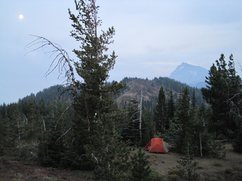 My wife and I began our first day with a late start; we hiked 3 miles south from the Lava Camp trailhead and spent the night at South Matthieu Lake. Smoke from forest fires in the region made everything, even a view of North Sister and the moon, opaque. That night, an anticipated cool breeze was replaced by a warm wind that blew in from high plains of Oregon where a large ground fire was burning. In the middle of the night, the smoke became extremely thick and breathing for several hours was difficult. By morning the winds had shifted and the air was clearer.
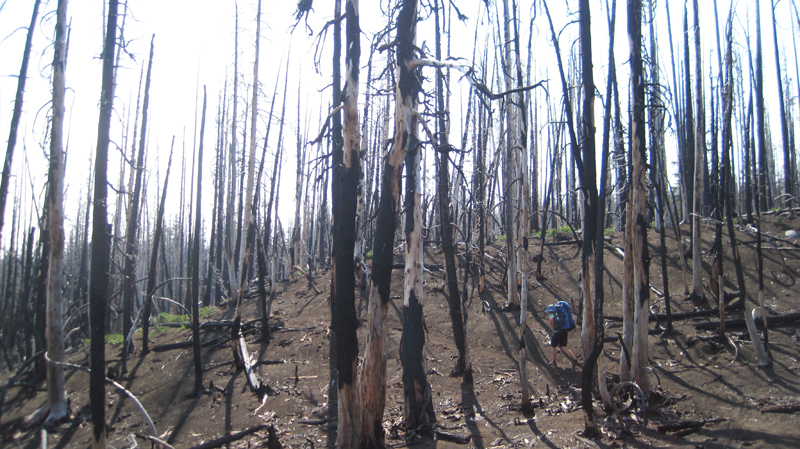 The next day we hiked 14 miles; 7 of which reminded us just how destructive forest fires can be, constantly around us were the stark and charcoaled remains of incinerated trees. This conflagration was called the Pole Creek Fire and occurred just 3 years ago in 2012.
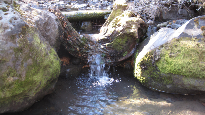 Several small creeks crossed our path, most were dry, but Alder Creek’s water was cold and clear even though the flow was very low. The creek offered a respite from a temperature of 85 degrees and hot sun that was beating down. We welcomed the opportunity for rest and refill our water bottles at this little pool.
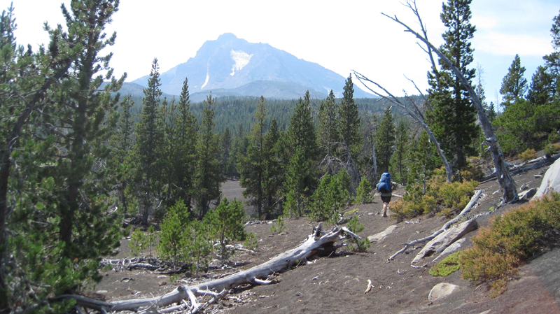 The North Sister towers in the distance. Continuing south the trail crossed several areas where the fire had not reached; these were often pumice expanses where vegetation was dispersed.
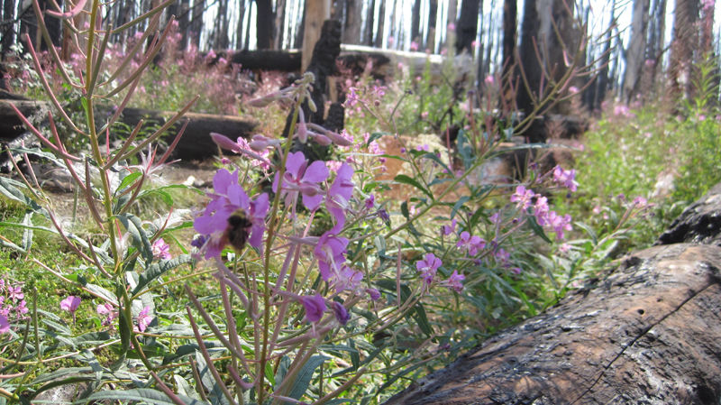 As we crossed Soap Creek we saw a number Bumble Bees buzzing from one flower to another. Soap Creek gets its name from the soapy color of the water; this is because of the sediment that gets carried down in the glacial meltwater.
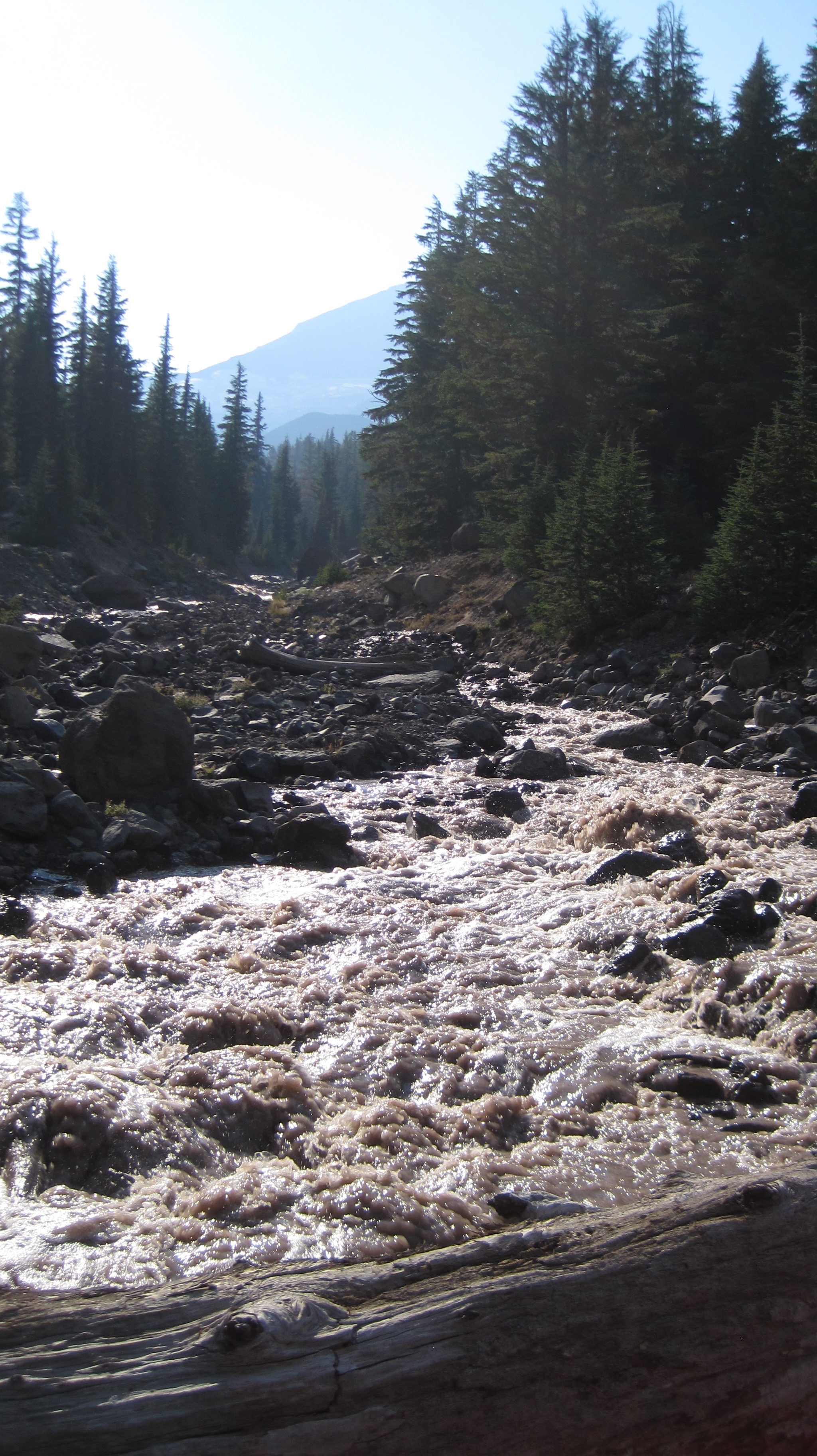 The trail turned to the west and the terrain gradually increased in elevation. After about an hour and a half we crossed the North Fork of Whychus Creek, which had to be traversed via several logs that served as a makeshift bridge, below us the grey and auburn glacial melt water loudly churned. Its source was about 2 miles upstream at the Hayden and Diller Glaciers. After crossing the views opened up.
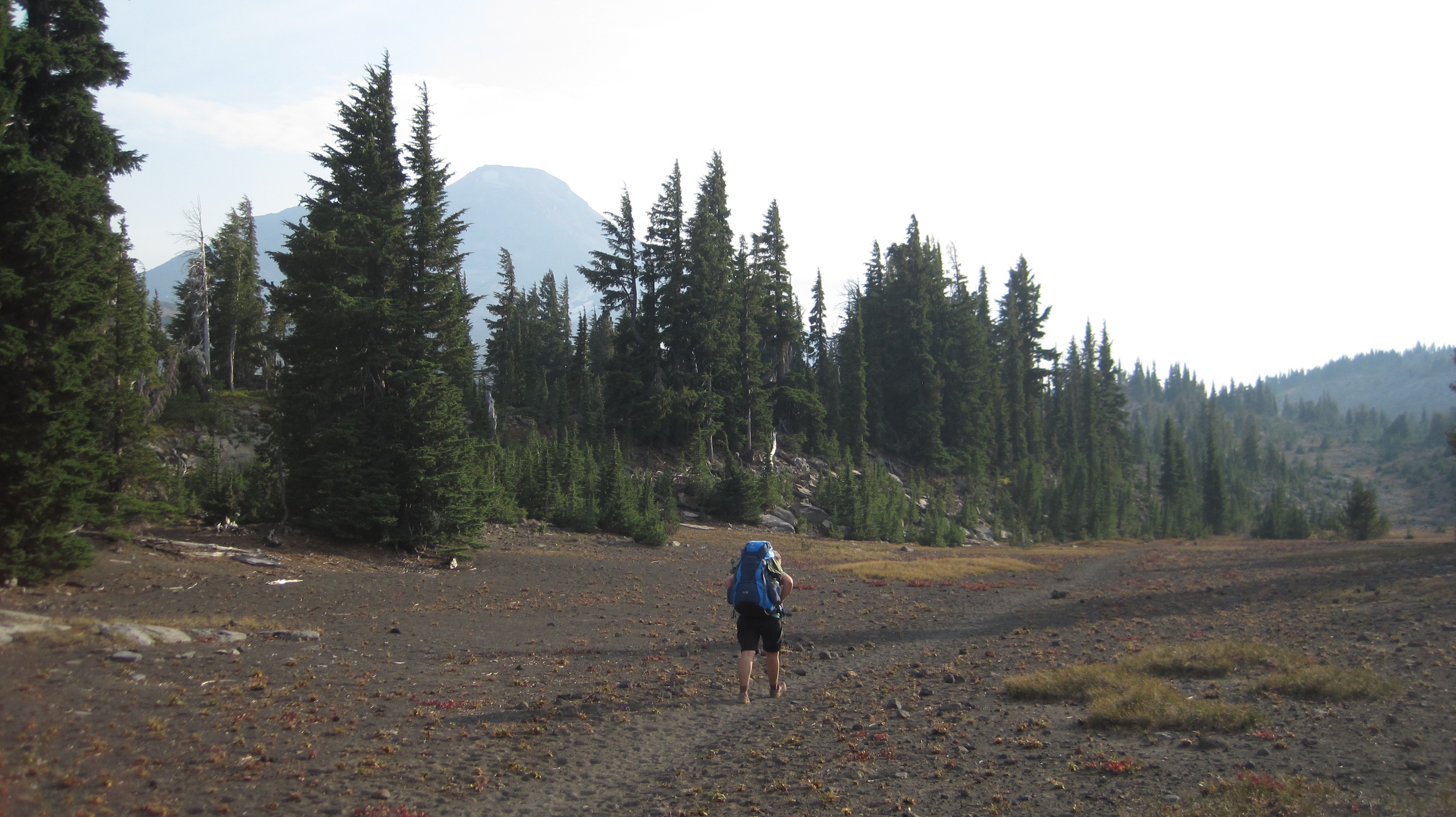 A photo of Christiane hiking through a pumice area on our way to Camp Lake; walking on this material is akin to walking on dry sand.
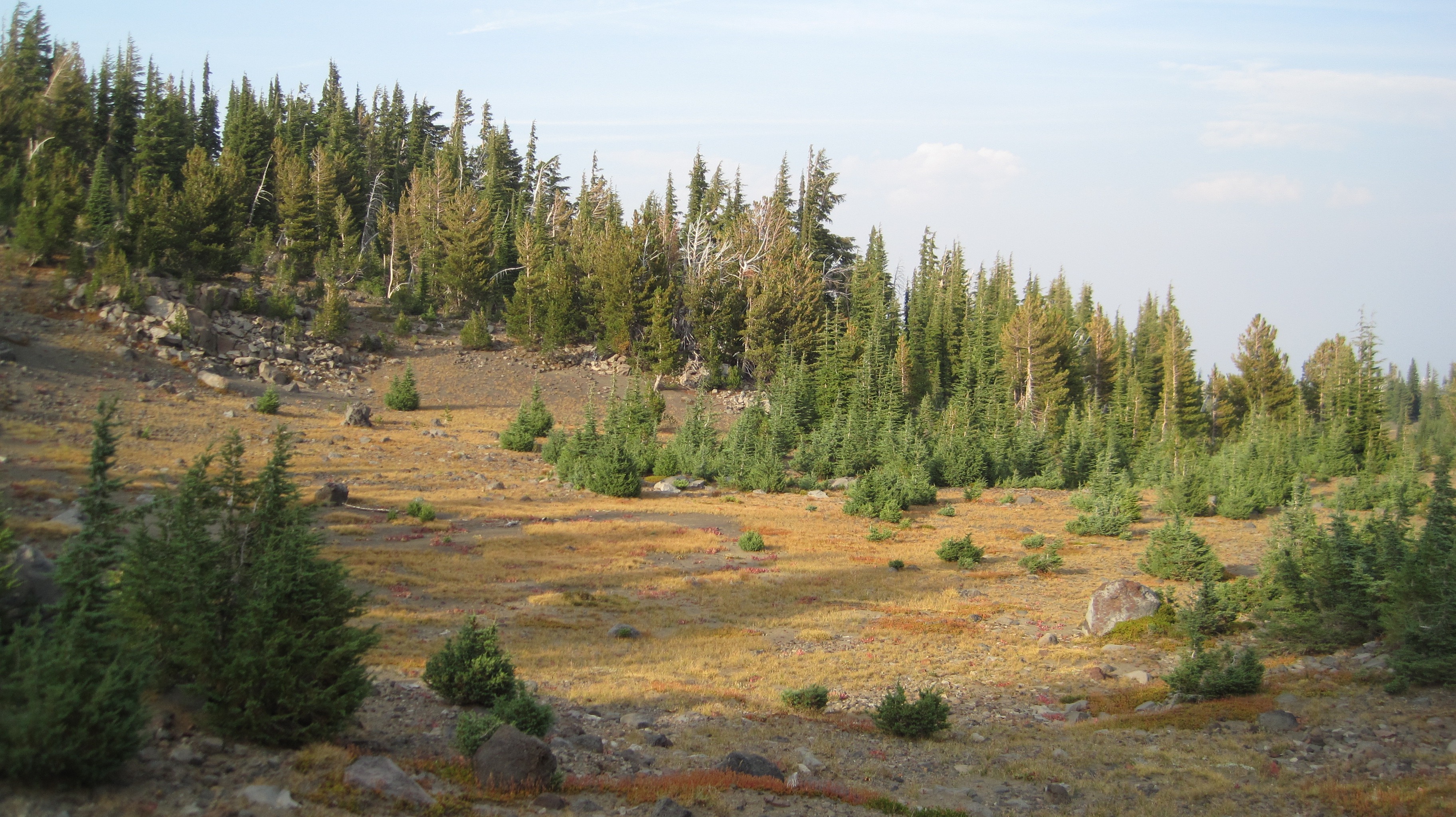 What a beautiful landscape!
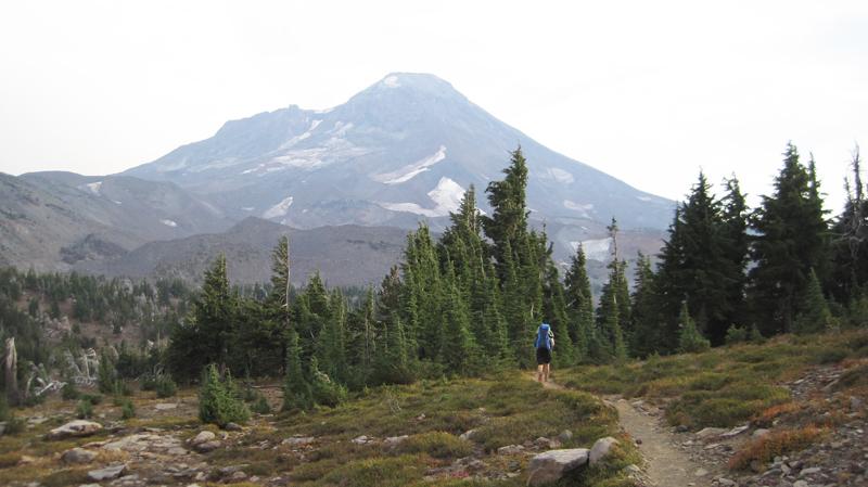 A view of South Sister on the horizon; this dramatic peak is 10,358-feet in elevation!
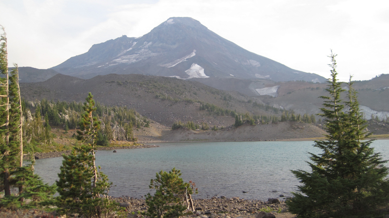 Our destination for the night, Camp Lake at 6,952-feet. The wind here can be unrelenting, this is because the lake’s location is sandwiched in a pass between Middle and South Sister. The wind was strong that afternoon so we found sanctuary behind a glacial moraine and set up camp.
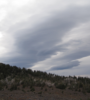 Our original plan was to stay the night at Camp Lake and then in the morning continue over the pass. This would have included: hiking up a climber’s trail for an hour and up several hundred feet in elevation, crossing over a snowfield and down the western side of the mountain and to several remote lakes then overland another 3 miles to the Pacific Crest Trail. But, uncertain weather changed our plans. The forecast had called for a rainstorm along with high winds within the next 24 hours and we were hoping to make it over the pass before the rain. That evening dark clouds marched across the sky. As the sun disappeared under the horizon the temperature dropped well into the 40s and that night we heard several deep and rumbling crashes of thunder. The wind howled into the morning and for several hours we heard rain outside and at times our tent was pelted by ice.
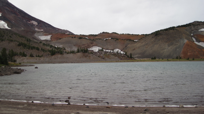 When we woke, the sky was grey in color but appeared mostly calm, though as I stepped out from behind the shelter of the moraine the wind almost knocked me over. I collected water at the lake and was surprised at how chilled I had become in just a few minutes; the wind was deceptively cold. Partially frozen raindrops fell sporadically. My wife and I made the decision to hold off crossing over the pass during this trip. We would return by the route we came.
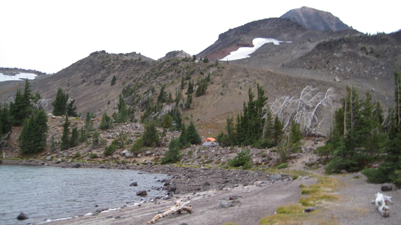 The area’s starkness was beautiful. Several tents were dotted around the area, all of them, like the tent, is shown in the photo, was strategically placed behind natural wind brakes.
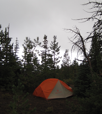 Our hike off the mountain was cold and occasionally it rained on us. At about noon the sun briefly came out, but this did not last long for the sky again turned dark and overcast. We hiked out of the burn zone and returned to the Matthieu Lakes area about dinnertime. That evening, the weather was peaceable, but about 7 pm the wind started up, by 8 pm it roared through camp with gusts reaching 40-50 miles an hour, by 9 pm the rain started. This continued into dawn. We slept comfortably in our tent.
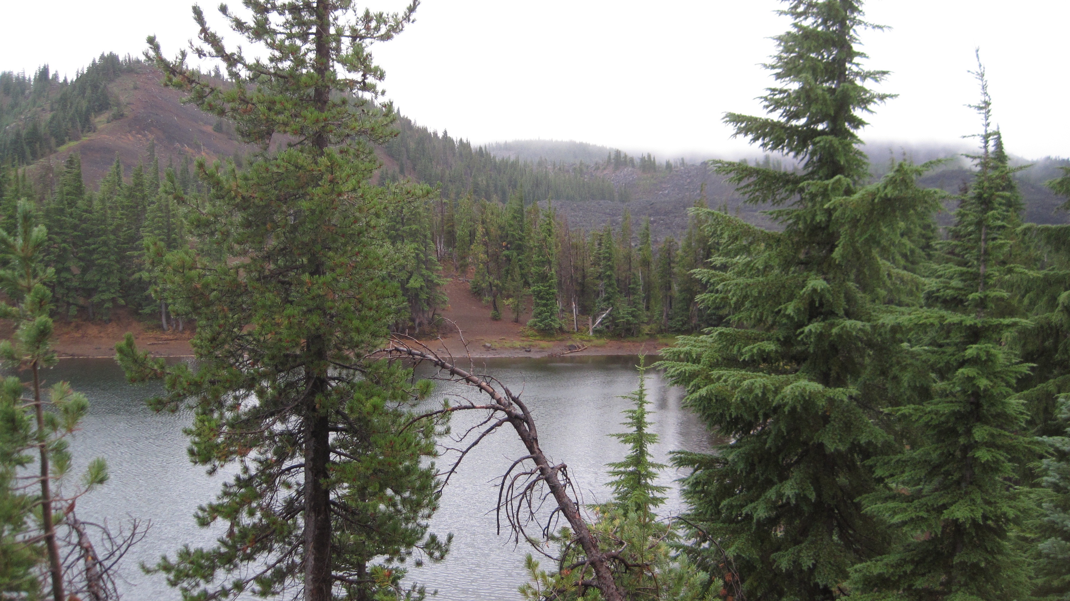 The next morning was drippy and low clouds blew over the treetops. Later that morning we hiked out the last 3 miles. As we approached the Lava Camp trailhead the sky offered us some brief patches of blue. We ended our day with each other clinking together mugs of trail coffee in honor of a good trip.
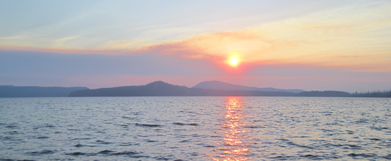
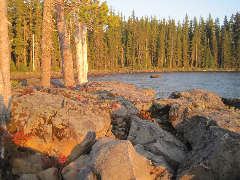
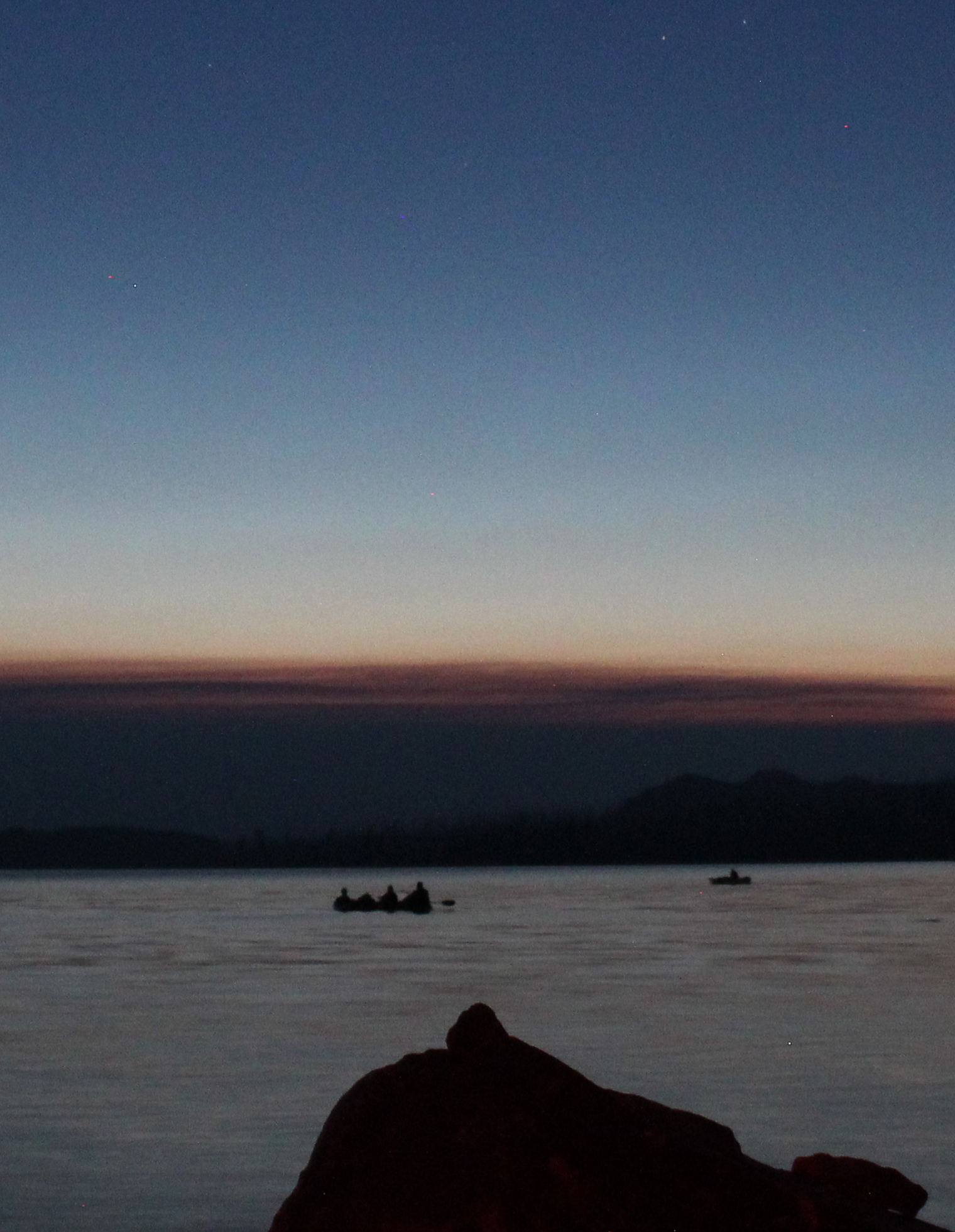
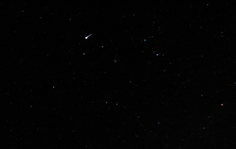
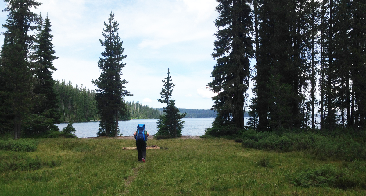 Waldo Lake is one of Oregon’s largest bodies of water, though its lack of amenities such as convenience stores, resorts, and ban of motorized motors upon the water makes this destination easily overlooked. If you’re interested in a great overnight backpacking trip to try the Jim Weaver Loop, a 20.2-mile trail around Waldo lake, here are some photos taken in early July.
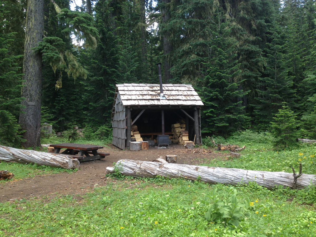 Near Mile 2. Our first stop was at the South Waldo shelter, it was fully equipped with wood and a stove; this is a popular destination in the winter. We continued on.
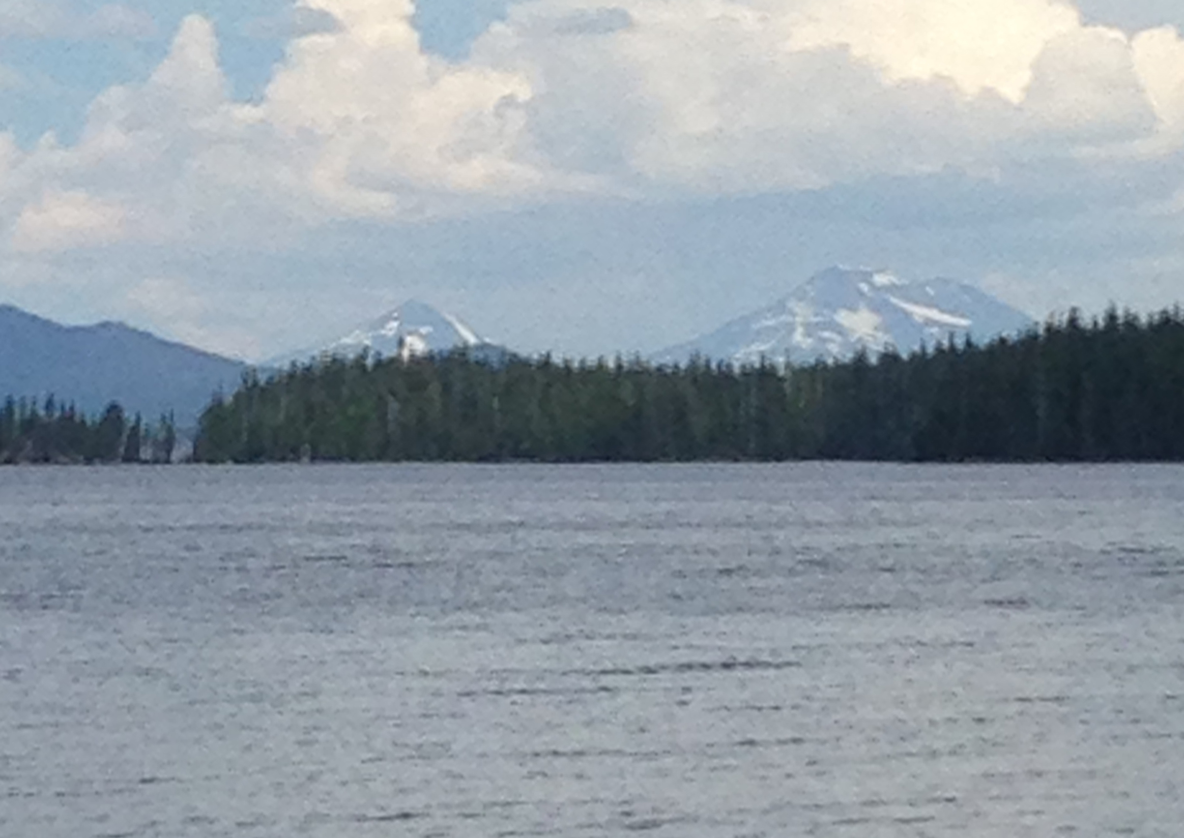 The south shore had some great views of the South and Middle Sisters. The trail now meandered up the western side of the lake.
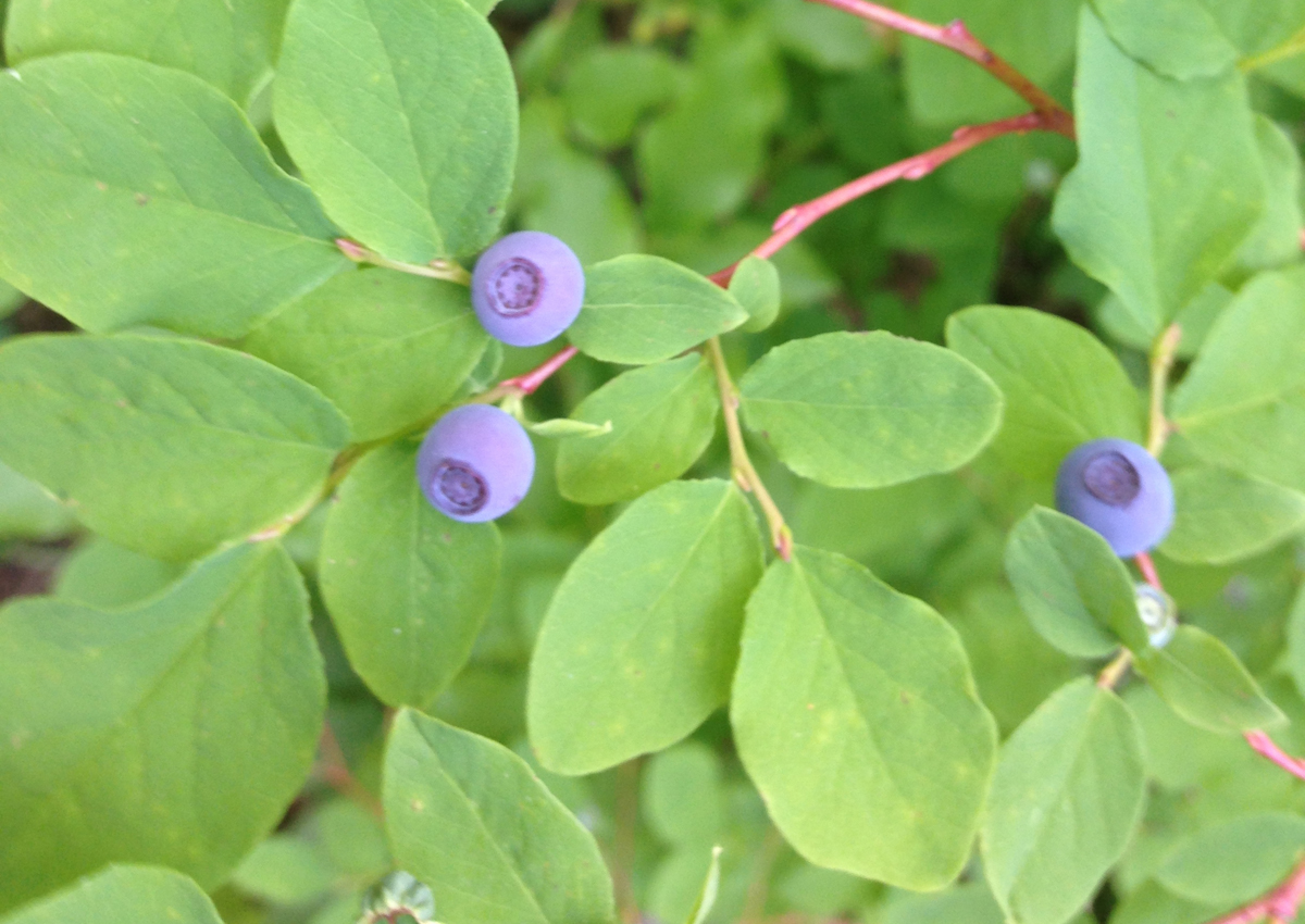 Cascade Blueberry
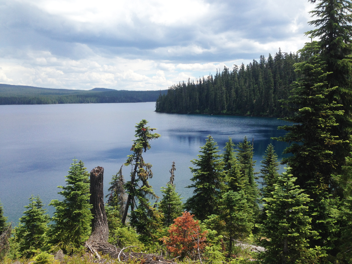 Close to Mile 5. Overlooking the picturesque Klovdahl Bay. Overhead, the clouds began building into thunderheads; in the distance, we could hear the rumbling crescendo of thunder as though gigantic timpani drums were being struck.
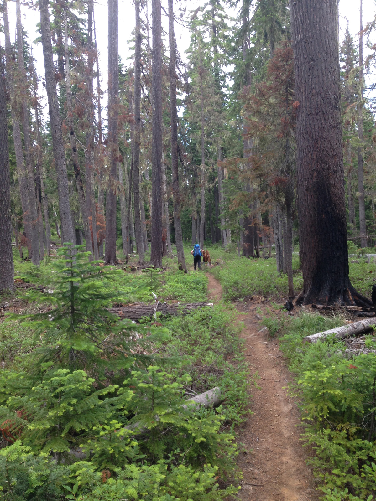 The western trail has a number of places where the forest looks like it had a close encounter with a forest fire; note the scoring on the tree at the right.
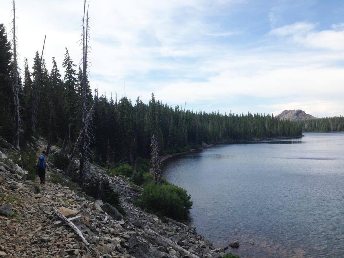 Mile 10. Continuing north. Seen in the right on the image, about 2-miles away is a scarred hilltop within the burn zone.
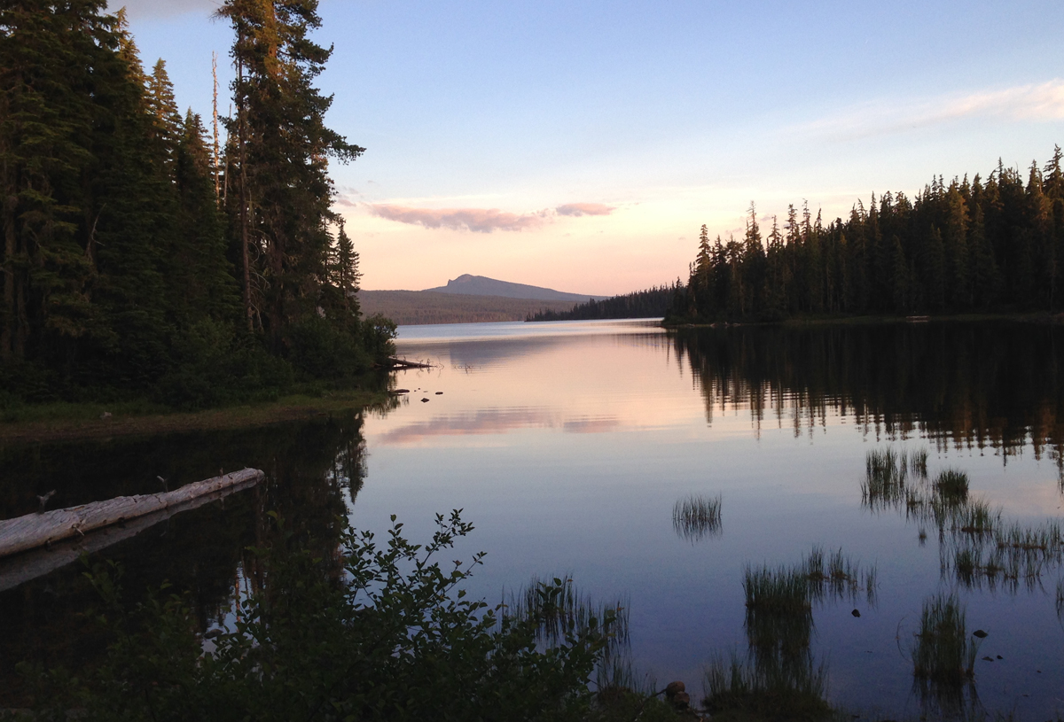 We spied several campsites peppered along the western shore of the lake, but as we reached the northern shore we discovered a favorite spot was vacant. As evening approached we appreciated a gentle breeze that chased most of the mosquitoes away.
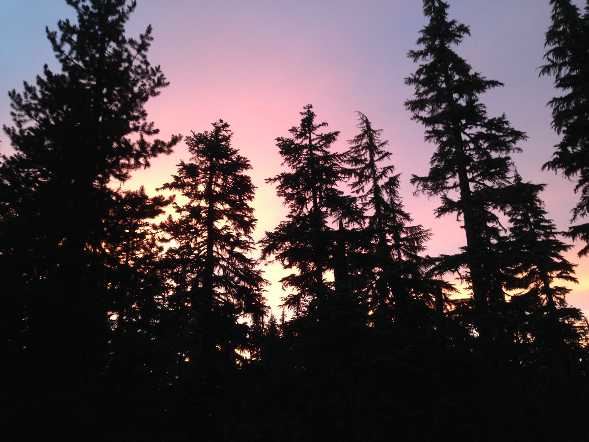 Enjoying a gorgeous sunset. The sky was clear that night when the stars came out they were so bright you could almost touch them.
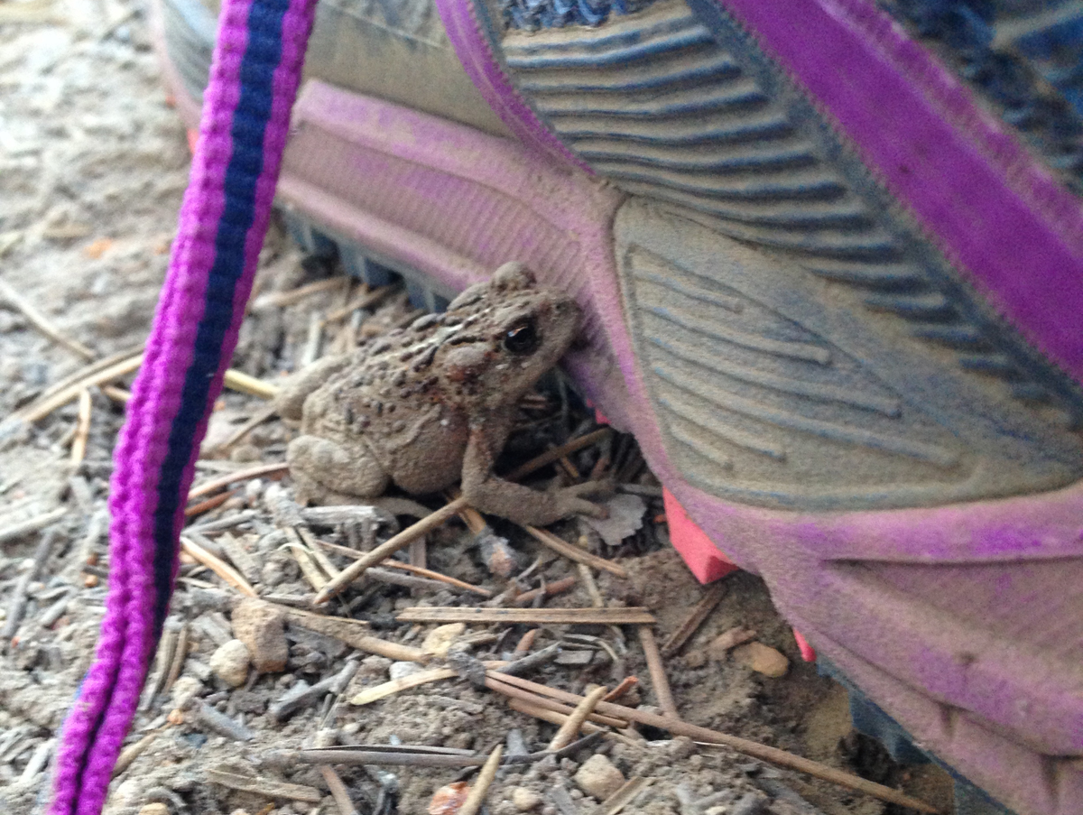 A very small toad had made its home just outside our tent during the night. It was discovered in the morning hiding next to one of our shoes.
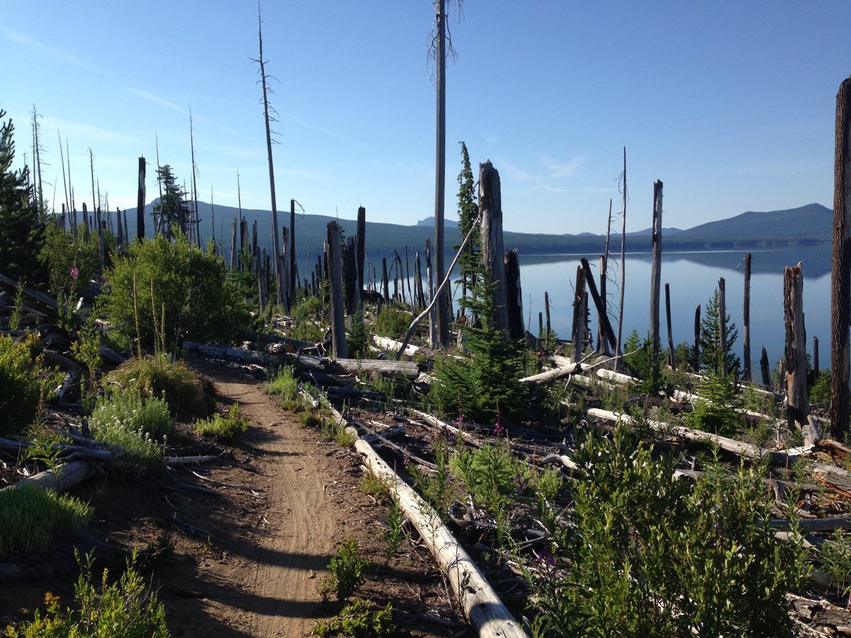 Roughly Mile 12. Heading east, the trail meanders through the burn zone along the north shore. This day was going to be hot so we tried to cross before the sun rose too high in the sky. Several weeks earlier, during
 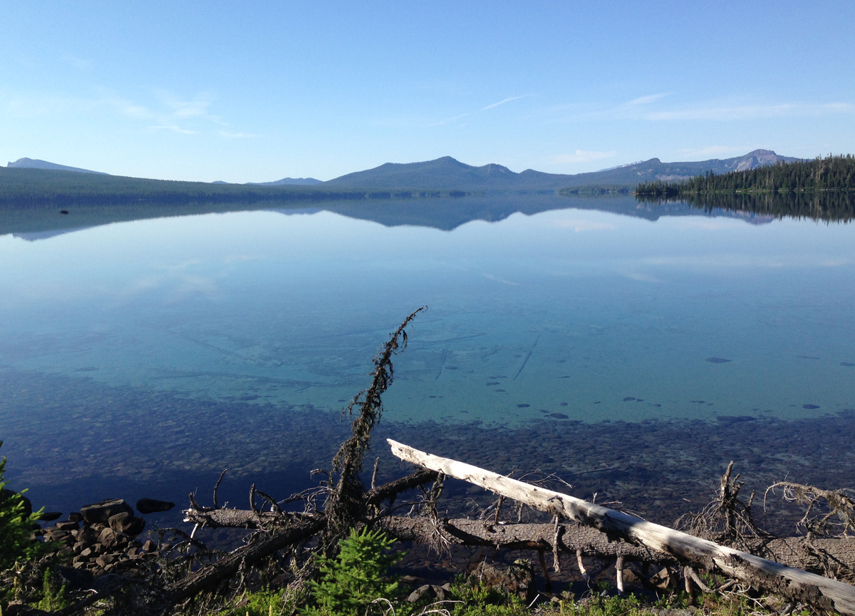 Mile 13-ish. Standing on the north shore looking across to the southern shore. The morning was calm, it was difficult to tell where the sky ended and the lake began. Determining the depth of the logs seen the water was difficult, but if the terrain continued its steep angle into the water, these logs were at least 40 feet deep in the foreground and 60+ feet deep further out.
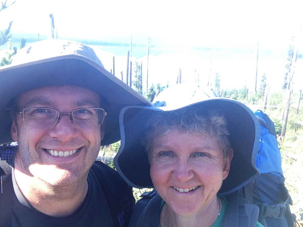 A Couple Selfie taken on the trail within the burn zone.
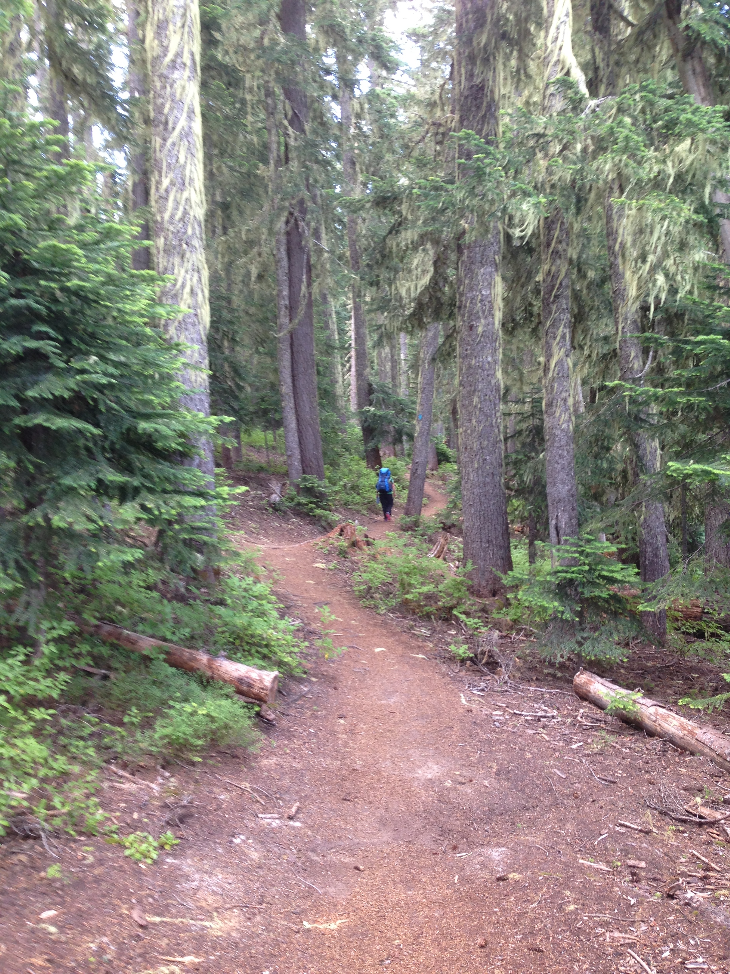 We’re out of the burn zone and heading south along the eastern edge of the lake. Half of the trail around Waldo Lake is in the woods, with only brief glimpses of the water. Be prepared to see lots of trees.
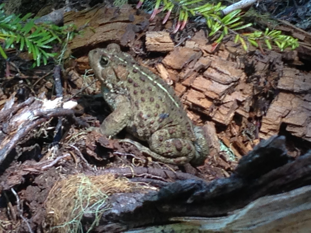 Just as we neared the south shore a massive toad was seen at the edge of the trail eating mosquitoes. During the entire trip, mosquitoes were not a big issue, though the last several miles of the trail we were devoured by these little flying beasts! I was glad to see this toad!
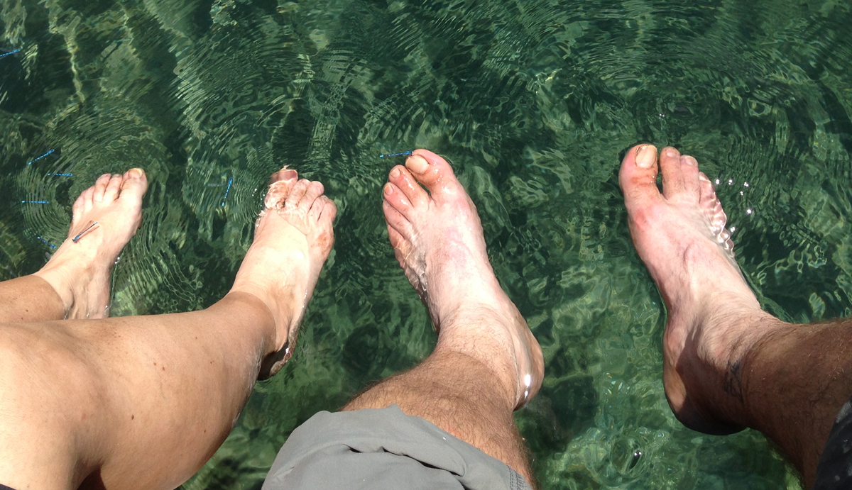 Mile 20.2. The best part of finishing the loop trail around Waldo Lake is that you can dip your feet into the lake’s cold and clean water.
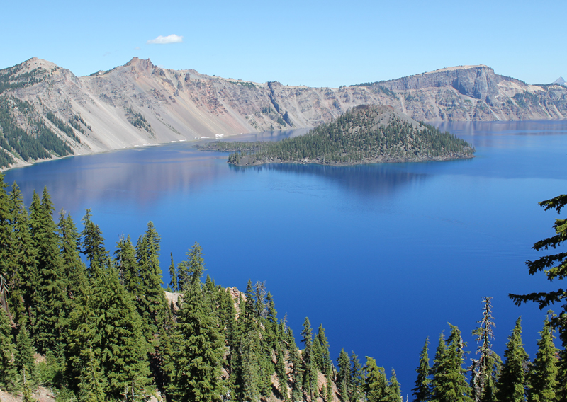
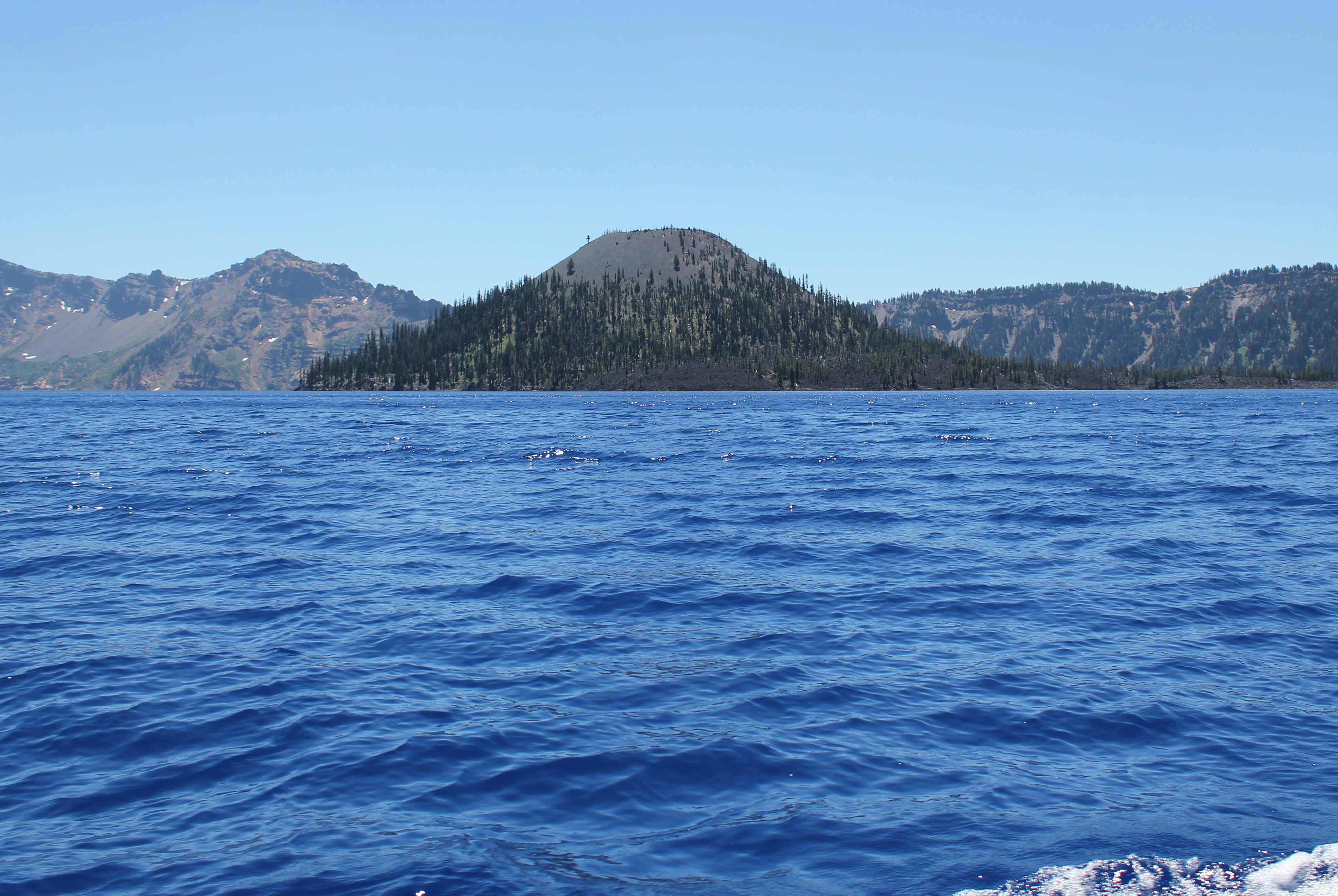 Approaching Wizard Island, even several miles away, is very impressive.
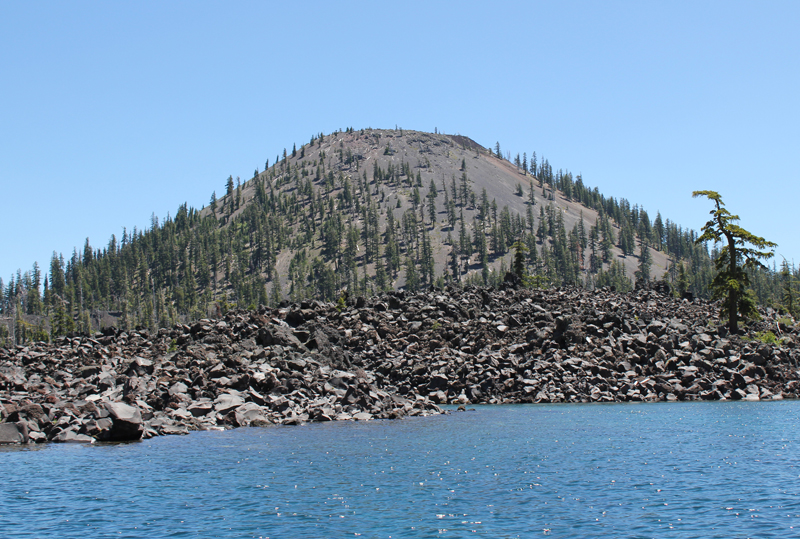 As the boat approaches Wizard Island the size and grandeur of this volcanic cone become apparent.
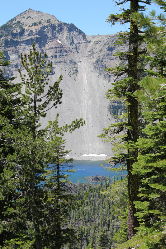 Hiking to the top of Wizard Island the trail climbs 760 feet, but this is nothing compared to the eastern rim of the crater which towers above me. In the photo, the Watchman scrapes the sky at 1840 feet above the lake’s surface. Seen between the trees, on the water (crossing Skell Channel) is a small white line, this is one of the boats that transport passengers to the island.
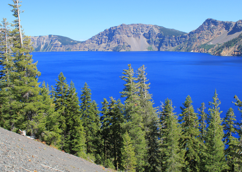 The views hiking to the top of Wizard Island are jaw-dropping.
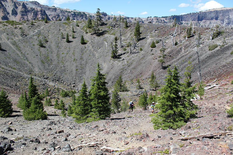 Think of Wizard Island as a small volcano, and it has a crater; this picture shows several people hiking out. The rim of Crater Lake looms on the horizon.
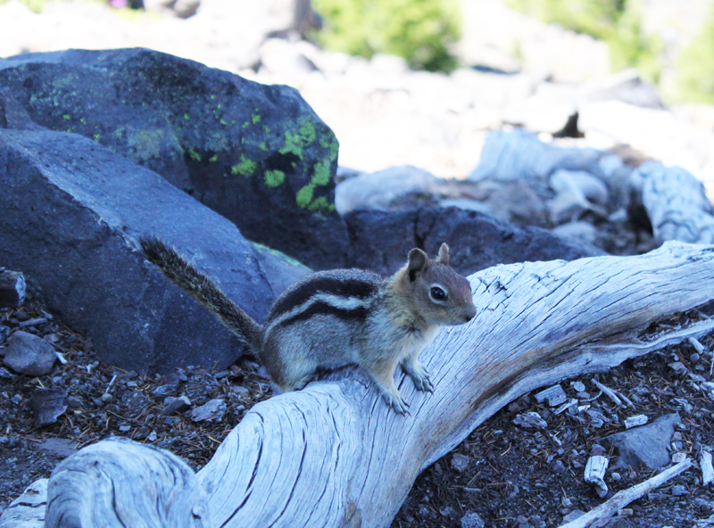 This Ground Squirrel is a resident of Wizard Island. He was demanding a food tithe from me for visiting his island retreat.
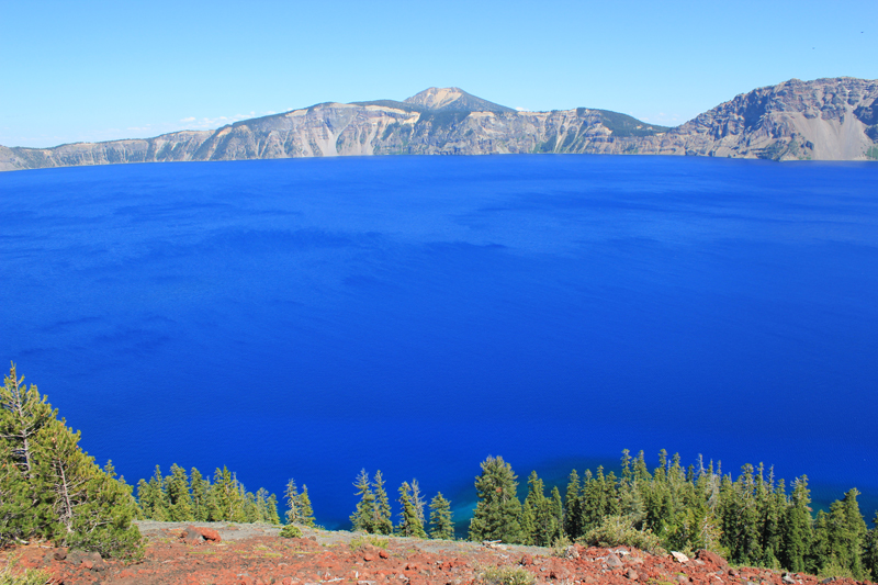 A view from atop Wizard Island looking across Crater Lake to the opposite rim which is about 5 miles away. The blue color is just magnificent.
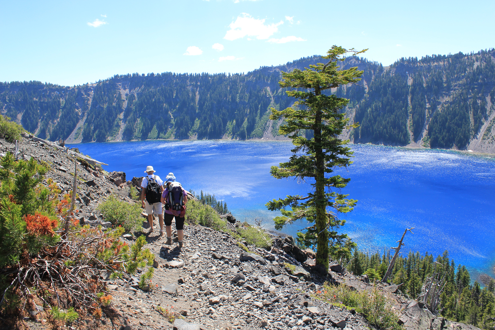 Hiking down the cinder cone we enjoy a rich tapestry of colors – a masterpiece painted by nature!
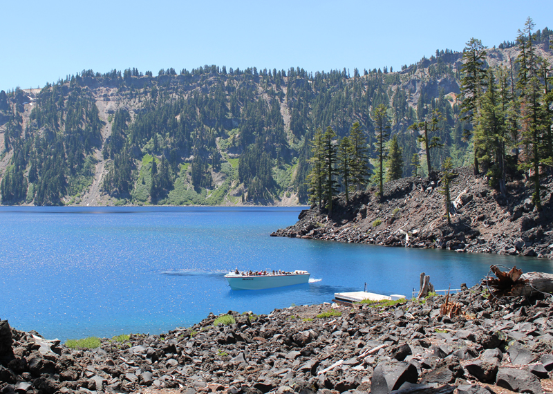 This is one of the few boats allowed on Crater Lake. It is seen here delivering visitors; this boat will take us on our return trip around the lake’s perimeter in a counterclockwise direction. Our next stop was the southern shore to see a slide area and the Phantom Ship.
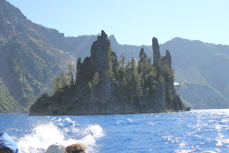 The spires of the Phantom Ship, an island in the lake, which under low-light conditions resembles a ghost ship.
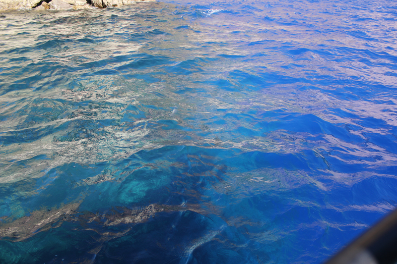 Looking into the water from the edge of the boat we saw this dramatic difference in color. The interpreter on the boat said the contrast was because we were passing over an underwater ledge, to the left the water depth was about 900 feet, to the right the depths plunged to 1,600 feet!
 Crater Lake’s legendary “blue” water.