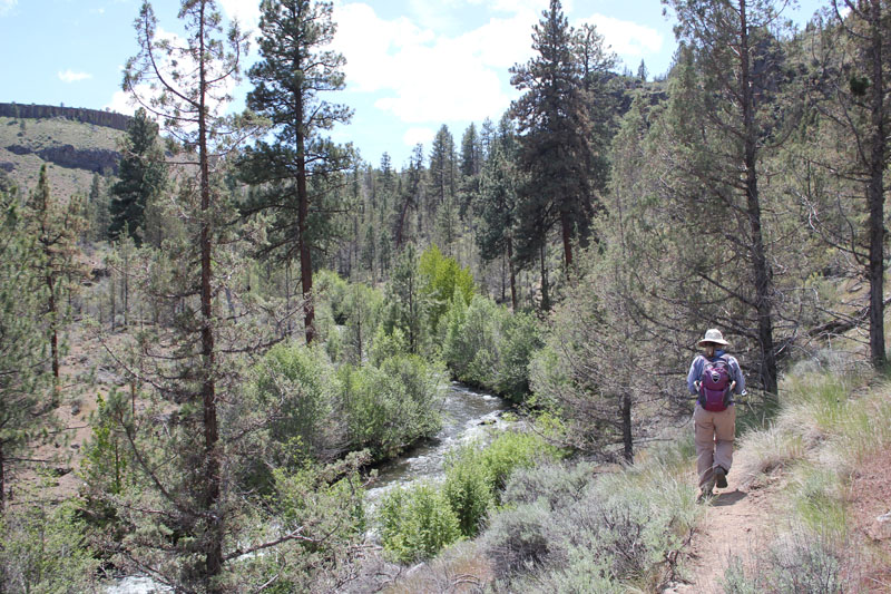
Trip Report: Group Leader: Mark Hougardy | Organization: Eugene-based hiking group | Date: in September 2023 | Duration: 1 day | Walking Distance: 4 miles | Participants: 8 | Elevation Gain/Loss: 200 feet
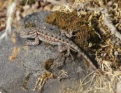
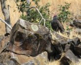
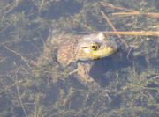
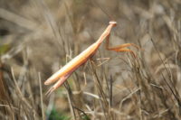
This was a meandering nature-viewing hike to the highest point of the William L. Finley National Wildlife Refuge in Oregon. Our hike began with a short side trip to the Prairie Overlook on the south side of Bruce Road to enjoy the view, then we walked north along the Pigeon Butte Trail. We looked for band-tailed pigeons and songbirds. We did see one raptor. There were signs of a previous fire on the south side of the butte as much of the grasslands had been charred. We saw a large white oaks along the trail going up the butte. At the old quarry, several roosting turkey vultures observed us. At the top of the butte, we could easily see 40 miles to the south of Skinner Butte even though there was smoke from an area forest fire. On the return walk, we had lunch under a tree then Cheadle Barn then continued on the Cheadle Marsh Trail to observe a wetland. The area was very dry. We saw signs of elk, a lizard, a frog, several white-colored praying mantis, and a Great Blue Heron eating a frog.
Trip Report: Group Leader: Mark Hougardy | Organization: Eugene-based hiking group | Date: in September 2023 | Duration: 1 day | Walking Distance: 4 miles | Participants: 4 | Elevation Gain/Loss: 50 feet
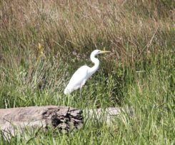
We saw egrets (shown in the photo), pelicans, grebes, swallows, a hawk, a red-winged blackbird, jays, vultures, oak woodpeckers, and other birds. A baby Gartner snake (shown) was peeking out along the trail, and we saw tracks where elk had passed over a muddy area. It was interesting to see the Cabell Marsh at a time of year when the water level is shallow and many birds have left the area. The marsh was dry and a big crisp, though the recent rain did help. We visited the quarter-mile-long Campbell Boardwalk. On our departure, we stopped by the visitor center. In the town of Monroe, we visited a family farm stand.
Trip Report:
Group Leader: Mark Hougardy | Organization: Eugene-based hiking group | Date: in September 2023 | Duration: 1 day | Walking Distance: 4.5 miles | Participants: 5 | Elevation Gain/Loss: 300 feet
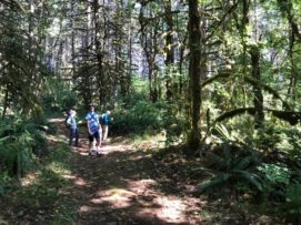
Arriving at the Finley National Wildlife Refuge we discovered the Woodpecker Loop Trail was closed for repairs. Instead of beginning our hike on that path, we parked at the Visitor Center and then proceeded to the second part of our planned hike, the Mill Hill Loop. We saw a vulture on the trail. There were numerous flying ants emerging from the ground in several areas. Upon returning to the Visitor Center area, it was learned the nearby and rarely opened Fiechter House was open and staffed with interpreters. The house was built in the 1850s and is considered to be the oldest house in Benton County. After our visit to the Fiechter House, we stopped by the Campbell Boardwalk for a side trip to the Cabell Marsh. We made good use of the opportunity to eat plums and blackberries in the parking area before heading home.
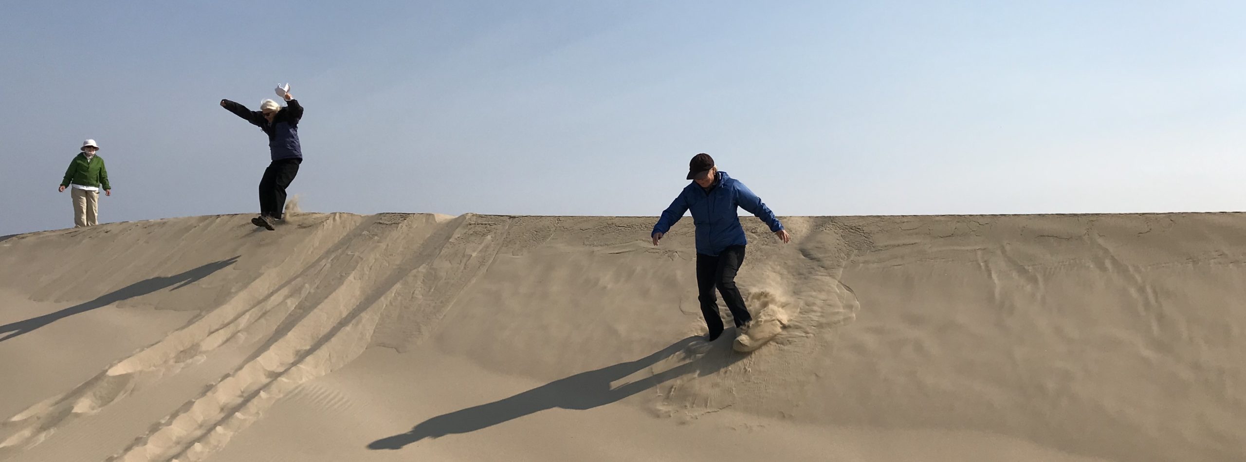
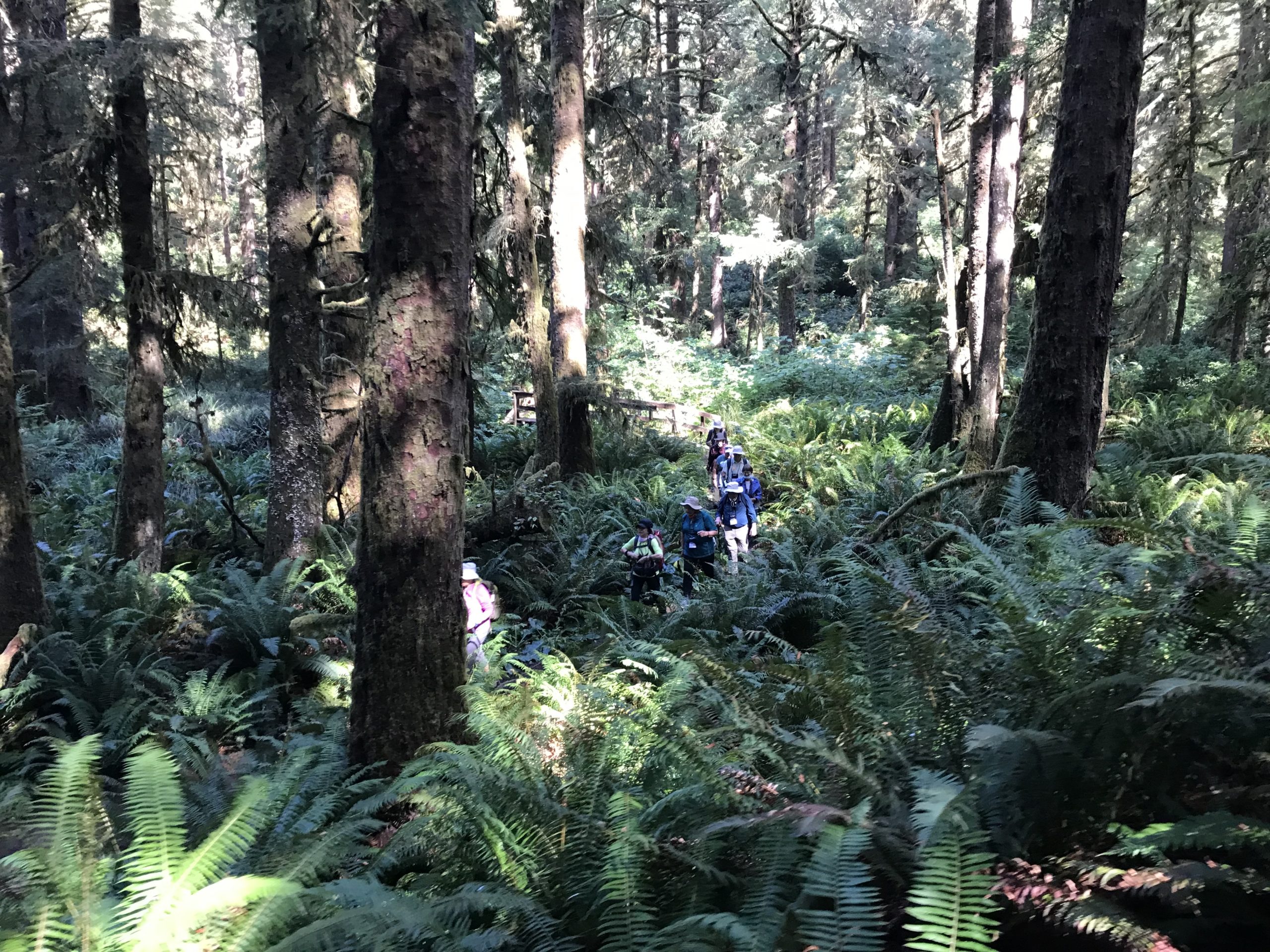
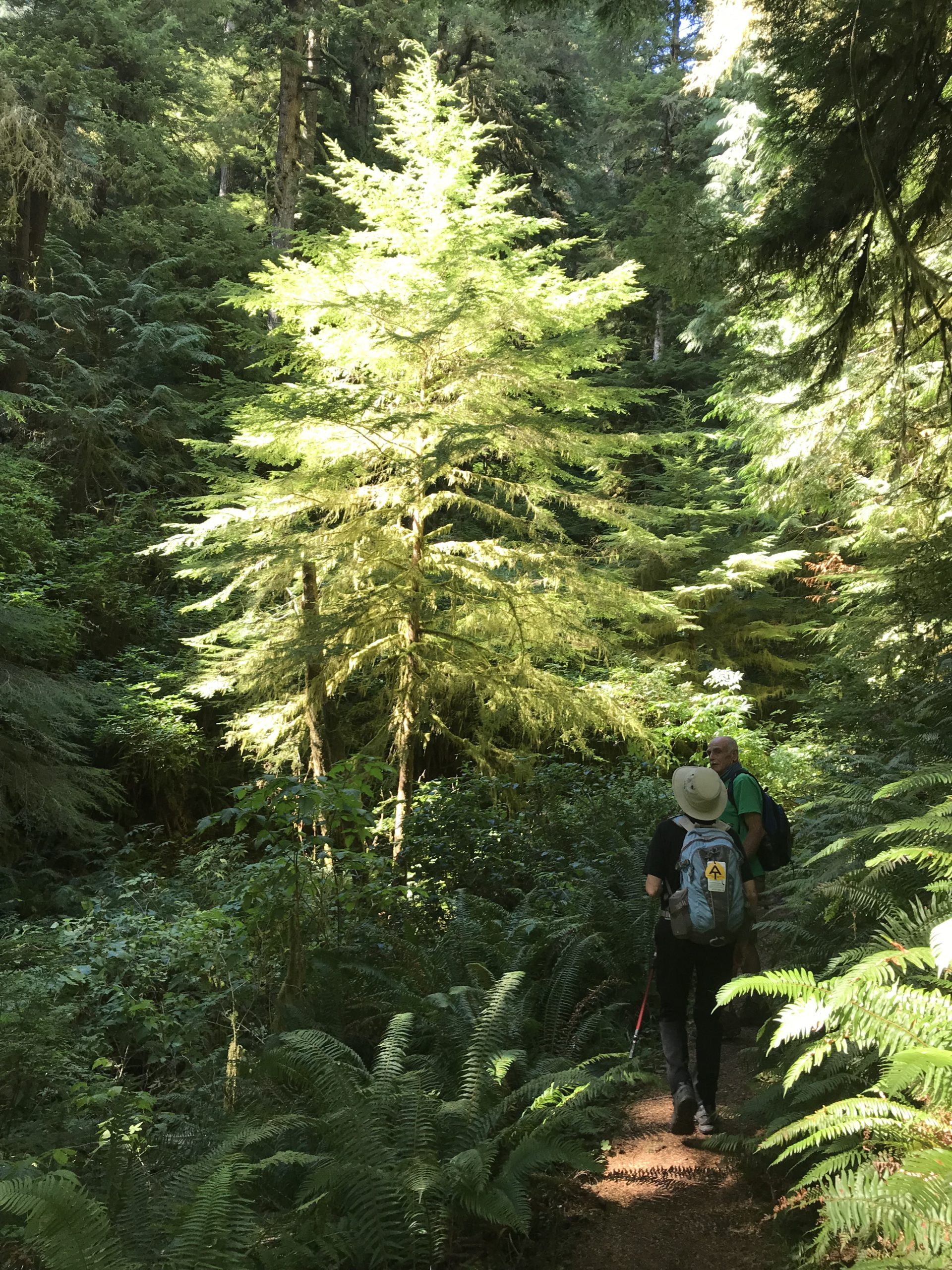
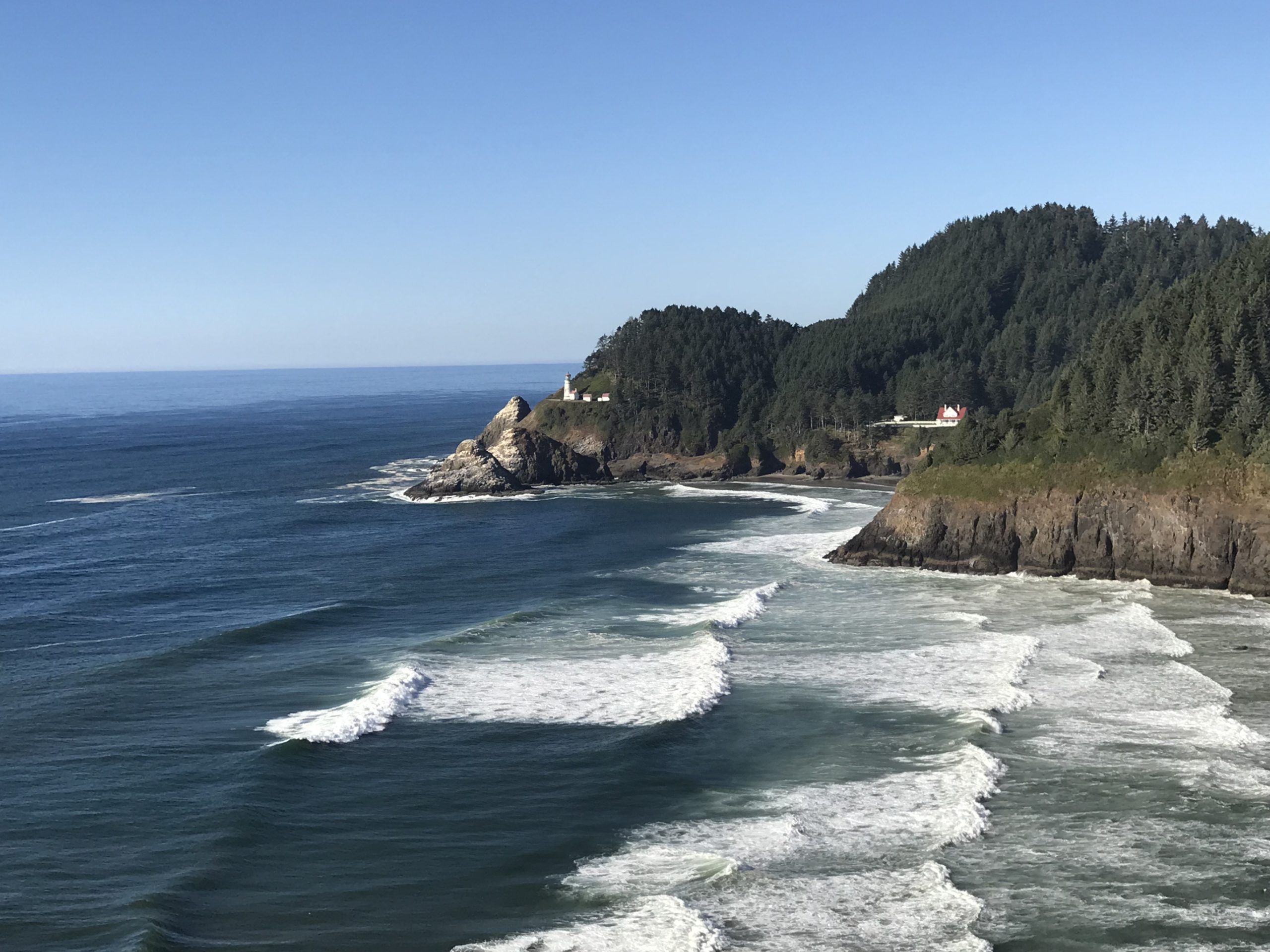
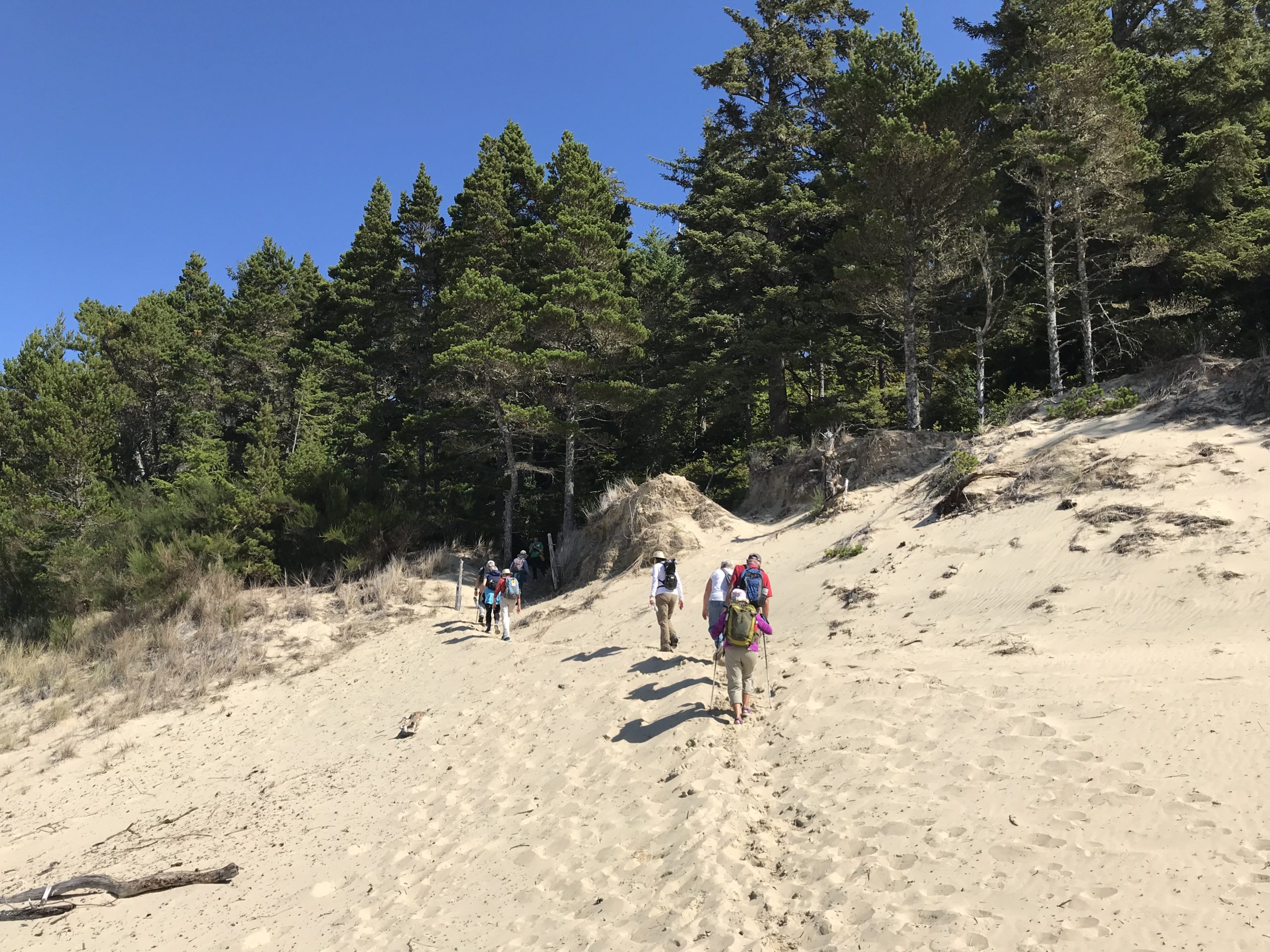
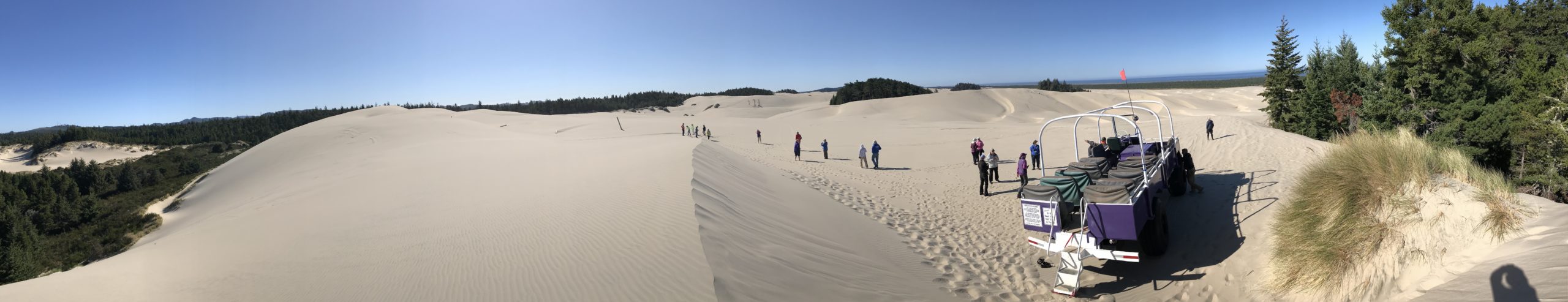
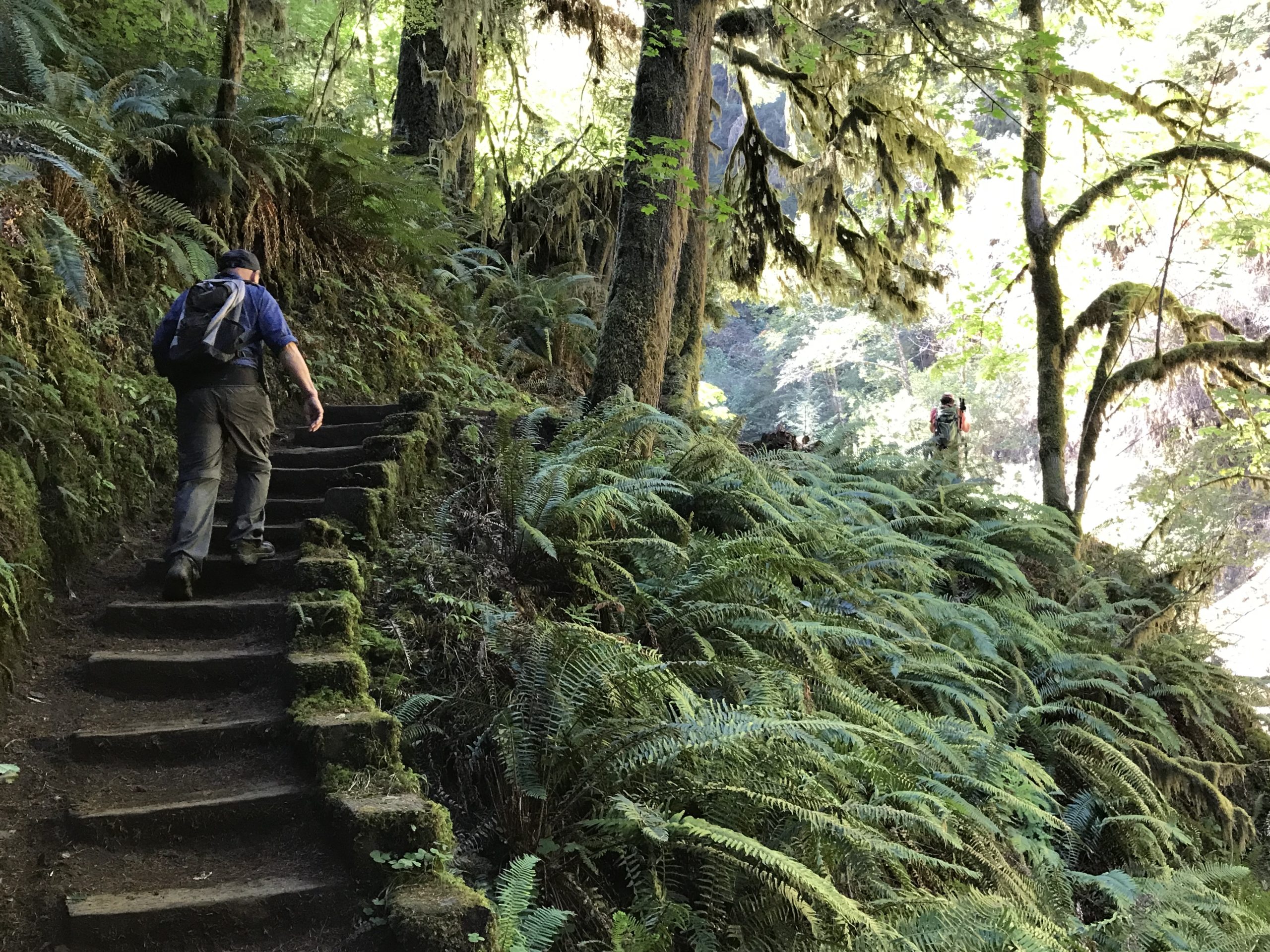
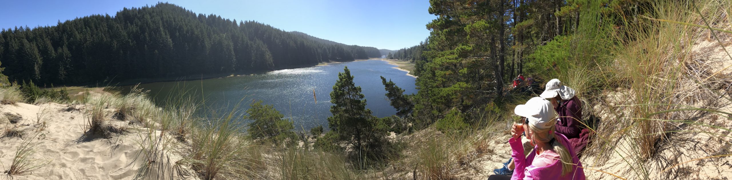
Trip Report: Group Leader: Mark Hougardy | Organization: Road Scholar | Date: August & September 2021 | Departures: 4 | Duration per Program: 6 days | Hiking Distance: 30 miles each departure | Participants: ~20 per departure | Type: Hiking | Note: The trip leader and participants were fully vaccinated against Covid-19 and Covid safety protocols were strictly observed. A big thank you to everyone for being considerate and recognizing the safety of your fellow travelers allowing all to better enjoy this program.
Sunny weather and pleasant temperatures greeted participants on 4 hiking programs exploring Oregon’s central coast. The focus of each program was learning about how the coast has changed especially over the last 100 years. Hikes included exploring the temperate rain forest, old-growth Sitka Spruce, the rugged Oregon coast, and the Oregon Dunes National Recreation Area which is one of the largest expanses of temperate coastal sand dunes in the world.
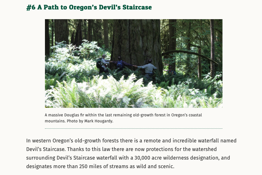
Wow! One of my photos was selected by the National Wildlife Federation to use in their March 13, 2019 article, “Ten Big Wins For Land, Water and Wildlife.” The article celebrated the passage of the WILD ACT, which helped to create 30,000 acres of new wilderness in Oregon.
My photo was used on #6: A Path to Oregon’s Devil’s Staircase. The photo is of a Dark Grove giant from a trip I organized into the remote Devil’s Staircase area to help bring awareness to this amazing place. Here is my 2016 trip report with the image that was used in the NWF article. I’m so happy to have helped bring awareness to this beautiful area (in a small way) and to have spoken with the NWF while they were researching their article.
Trip Report: Volunteer Leader: Mark Hougardy | Organization: Eugene-based Hiking Club | Dates: September 10, 2017, | Participants: 7 | Type: Day hike and wayfinding
Along the forested backbone of Oregon’s Cascade Range is a large tranquil lake that invites “Where’s Waldo?” jokes. But, laughter aside, Waldo Lake is quiet. For those exploring the hushed shoreline, they might wander upon an old mountain hemlock blazed with the 130-year-old text, “Camp Edith, Waldo Lake.” At first, the blaze appears as an act of modern vandalism, but looking closer at the aged wood a modest story slowly reveals itself. The story is about a child who grew up to become the astute and reserved white-bearded grandfather of Oregon’s public lands. It was his passion that laid the groundwork for six national forests, over a dozen wilderness areas, and even support for Crater Lake National Park. Yet, most who visit these places today, don’t know this man’s name, Judge John Breckenridge Waldo. The few who know his name compare him to Emerson or Thoreau; some even call him “Oregon’s John Muir.”
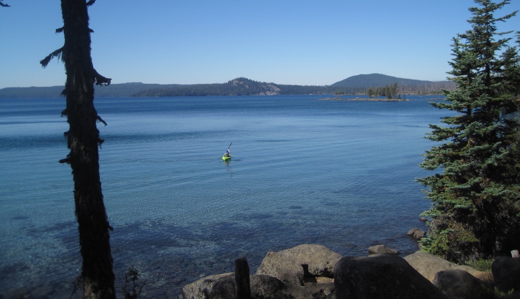
The beautiful Waldo Lake in Oregon’s Cascade Range. Waldo Lake is 10 square miles in area. The lake is rare in that it is a gas-free zone, only wind and human-powered boats are allowed.
My curiosity about John B. Waldo was piqued when I learned that his documents could be found nearby at the University of Oregon Special Collections archive. A visit to the archives was arranged through a local hiking club and several others joined me. A library staff member delivered several old boxes to our table.
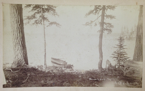
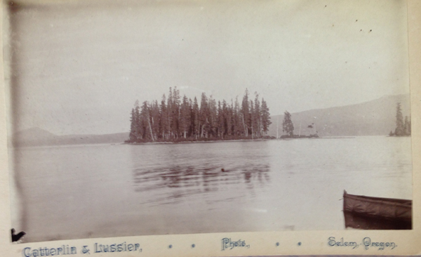
As we carefully reviewed this man’s life, a grainy black-and-white photograph caught my gaze. The photo was etched with the text, “Camp Edith, Waldo Lake.” The picture was dated 1890 and revealed a couple of trees and a canoe. At first, I was stunned by the fortitude and strength involved in hauling early camera equipment and a canoe more than 70 miles or so into the mountains.
Camp Edith, Waldo Lake, Oregon (circa 1890). I have hiked all over Waldo Lake and never encountered Camp Edith. Waldo’s campsite was not listed on modern maps. Where was it?
Then I was curious because none of my fellow hikers had ever heard of this place. I looked at modern maps, but there was no reference to Camp Edith. I looked at maps from the late 1800s and early 1900s, but still found nothing. The more I researched, the deeper the mystery became. This “lost” campsite of Waldo’s was a loose thread in a story, and I just had to pull at it.
John B. Waldo was born in 1844 to parents who had arrived just a year earlier on a wagon train and were new arrivals to the Willamette Valley. Waldo, as a child, had asthma which worsened in the summer as the valley filled with heat and smoke. Seeking refuge, Waldo and his brother made forays into the nearby Cascade Mountains for clean air. Waldo returned often.
As a young man, he studied law, became an attorney, and was eventually elected to the Oregon Supreme Court, even serving as a representative in the state legislature. He loved law and policy but always returned to the mountains, often for months at a time, to write about nature.
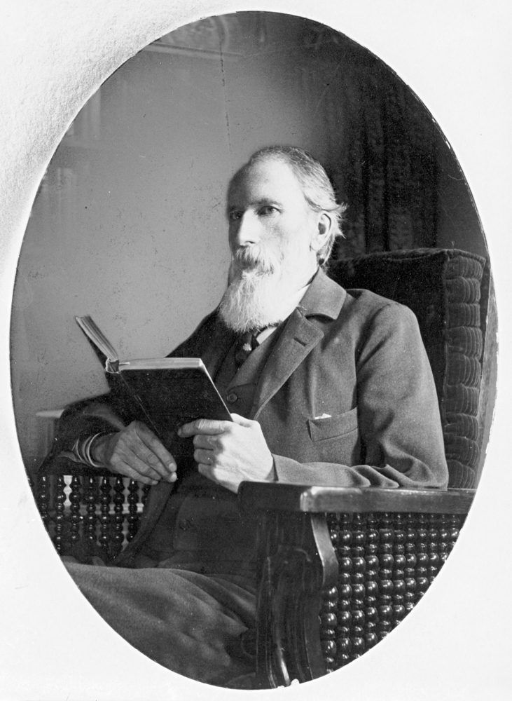
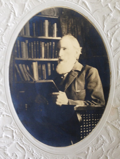
Judge John Breckenridge Waldo
From 1877 to 1907, Waldo extensively explored and chronicled —in his words— the “untrammeled nature” of Oregon’s Cascades. He believed that modern life had “narrowing tendencies” on a person and that wilderness allowed difficulties to “be perceived and corrected, and the spirit enlarged and strengthened.”
He had seen the effects of over logging back east and overgrazing in the Cascades by sheep. Waldo imagined a protected place in the mountains where people could escape the toils of life. An individual’s trip would be assisted by an interconnected trail system dotted with lodges. These lodges would be roughly a day’s walk apart, where hikers and travelers could stay, enjoy a meal, and rest. Upon returning from his expeditions, he quietly and diligently advanced such a vision: a 40-mile-wide protected band along Oregon’s mountainous crest stretching 300 miles from the Columbia Gorge to the California border. Waldo spent decades and countless hours increasing public awareness through letter writing, newspaper posts, and using his professional resources to advocate for this vision.
Waldo died in 1907 at the age of 63; he had become ill while attempting to summit Mount Jefferson. His colleagues returned Waldo to his family farm outside of Salem, where he passed. After his death, his writings became missing, but Waldo had started something in the minds of others. In the following years, national forests and wilderness areas began to form a patchwork along Oregon’s crest. Outdoor enthusiasts created clubs like the Mazamas, the Chemeketans, and the Obsidians, all dedicated to experiencing the outdoors. Three of the west’s greatest national park lodges were constructed in Oregon: the Chateau at the Oregon Caves, Crater Lake Lodge, and the crowning gem Timberline Lodge on Mount Hood. Rangers opened campgrounds, trail maintenance volunteers began creating and maintaining hundreds of recreation trails, skiing enthusiasts opened ski resorts, and rafters opened rafting companies. Friends of the Pacific Crest Trail (PCT) worked to span Oregon with this narrow ribbon of trail that crosses the U.S. from Mexico to Canada. In the past few years, via a citizens’ initiative, Oregon voters secured funding so all fifth or sixth-grade students can move from their school classrooms into the outdoors to learn and be immersed in nature.
For almost 80 years, the location of Waldo’s writings and photos was unknown and thought to be lost. In the 1980s, these items were located in an attic and delivered to a conservation organization in Eugene. Eventually, his papers made their way to the University of Oregon archives and can be viewed today by appointment. It was here where I first saw the old grainy photo inscribed, “Camp Edith, Waldo Lake.” Supposedly this was one of his favorite locations. Yet, where was this place?
During the past year, I have been reading, researching, and trying to figure out where Camp Edith might be. I poured over maps, performed internet searches, and reviewed old hiking books but found nothing. I checked with living knowledge keepers: the seasoned hikers, campers, and old-timers in central Oregon. Most only knew about Waldo because of the lake that shares his name. Of the few who knew about Waldo as a preservationist, only a handful had heard about Camp Edith.
A man said he knew of the camp. He suggested that I look at Waldo’s obituary for guidance. One portion stood out. It read, “To him, the mountains with their purpling canyons and glittering snow peaks were a book to which there was no end. The beauty of the hills was a sermon.” Inspiring words, but was I any closer to finding Camp Edith?
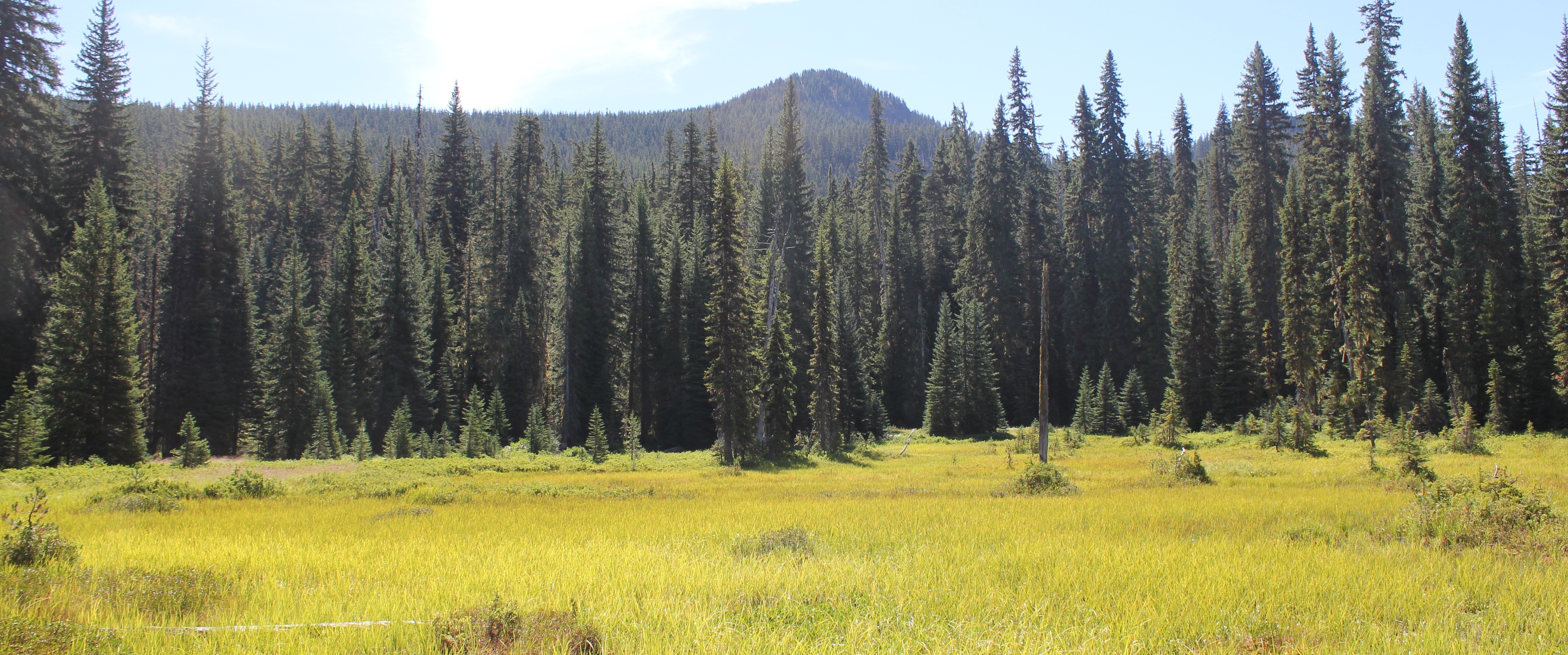
To Waldo, “the mountains with their purpling canyons and glittering snow peaks were a book to which there was no end.” A photo of a meadow and Mount Ray, Waldo Lake area.
Another person, a retired employee of the Forest Service, revealed she knew of the camp’s location. She added, “It’s easy to forget where a single tree is in the forest, but [she] could point me in the right direction if I wished.” Several weeks later, a PDF copy of Waldo’s transcribed 500-page diary arrived in my inbox from someone I never met along with the text, “A former colleague thought you might appreciate this.”
One individual, with ties to the Waldo documents, said he knew where the campsite was located, but, “It’s yours to find.”
Finally, I met an aged man who loved long-distance hiking and somehow knew that I had been looking for Camp Edith. He claimed to have walked across the U.S. a total of four times in his life and was eagerly looking forward to at least another two trips. He wore a Grateful Dead t-shirt and on his pack a bright yellow button of the Gadsden flag with a rattlesnake and the words, “Don’t Tread On Me.” The man said he had “hiked all over Oregon including Waldo Lake” and had seen the Camp Edith tree and knew the location. He had enjoyed eating a sandwich there. I leaned in, hoping for a quick answer to the location, but he uttered these enigmatic words, “When you find the tree, man, you’ll be there.” I left feeling none the wiser, or did I?
Waldo Lake, Oregon
That winter, when skies in the Pacific Northwest are overcast and darkness comes quickly in the afternoon hours, I wrapped myself in a warm quilt. I jumped into reading Waldo’s 500-page diary. It was here that I learned that during Waldo’s treks, he traveled for months to nourish his insatiable wanderlust and love of the mountains. This included trekking as far south as California’s Mount Shasta.
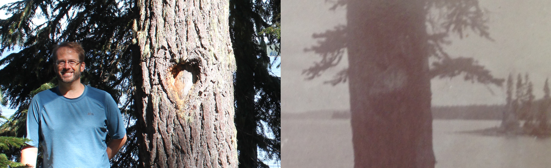
But like many of us who desire to travel, when we do so, we become homesick for loved ones, and Waldo was no exception. In 1889, or thereabouts, to lessen his loneliness he christened a favorite camping site in honor of his daughter, Edith. Shortly after, a colleague blazed a heart-shape and Edith’s name into a tree trunk.
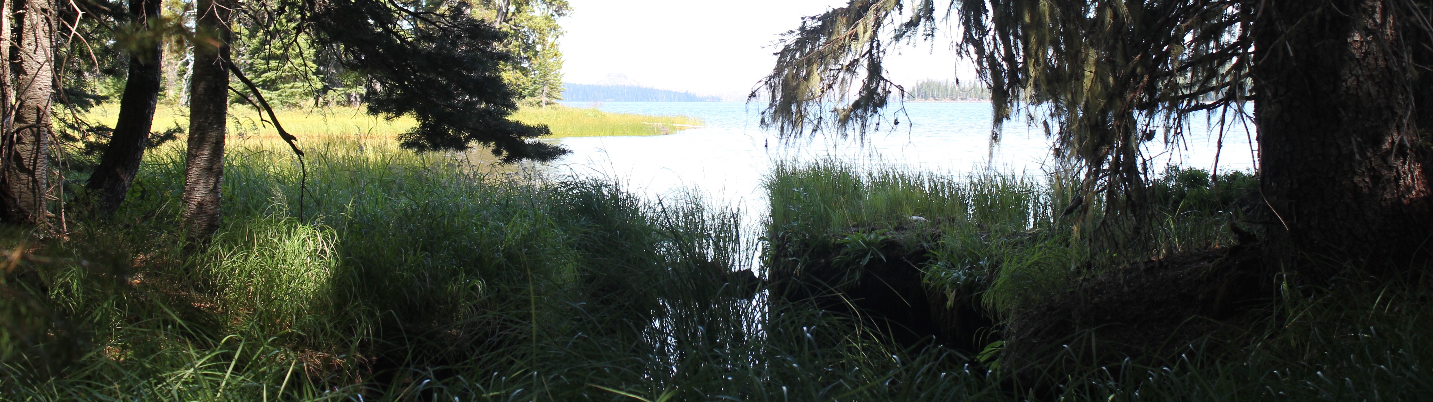
Part of the marshy shore of Waldo Lake.
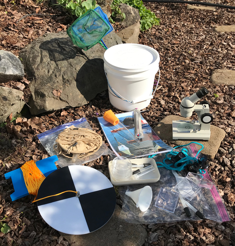
Secchi Disk: The black and white plate-looking object in the lower left of the image. On a separate visit to the lake, 60 feet was the maximum amount of line attached to my Secchi disk and I could still see the disk in the water. The disk is a simple device used to measure water transparency or turbidity. Also shown is my freshwater sampling kit.
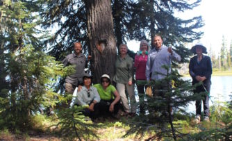
As I waited for the snow in the mountains to melt and for the highway to Waldo Lake to reopen, I casually picked up the old photo of Camp Edith that I had looked at a hundred times before and saw something small. I grabbed a magnifying glass. At that moment, I knew the basic location of the camp. I had enjoyed my journey up to this point, but now, others needed to share in the experience. Therefore, I enlisted members of the same hiking group I had met at the archives the year before.
Several months later, we arrived at the lake. I provisioned them with three items: a copy of the Camp Edith photo from 1890, a few telling diary entries from Waldo’s writings, and pointed them in a direction. Everyone was eager, if a bit perplexed, as we walked into the vast forest to find a single tree.
Waldo Lake is always an inspiring place to visit. It is one of the largest natural lakes in Oregon, roughly 5 miles in length and 2 miles in width. The waters are clear and turquoise and the deeper areas are bespeckled with shades of rich blue. Light can easily penetrate 60 feet deep and possibly further.
Progress was slow as we carefully crossed marshy fields, scrambled over downed logs, and occasionally got our feet muddy as they identified clues in the photo. The day was getting late and several questioned if the tree even existed. I was also beginning to wonder, as this was taking longer than expected, but then a joyous shout.
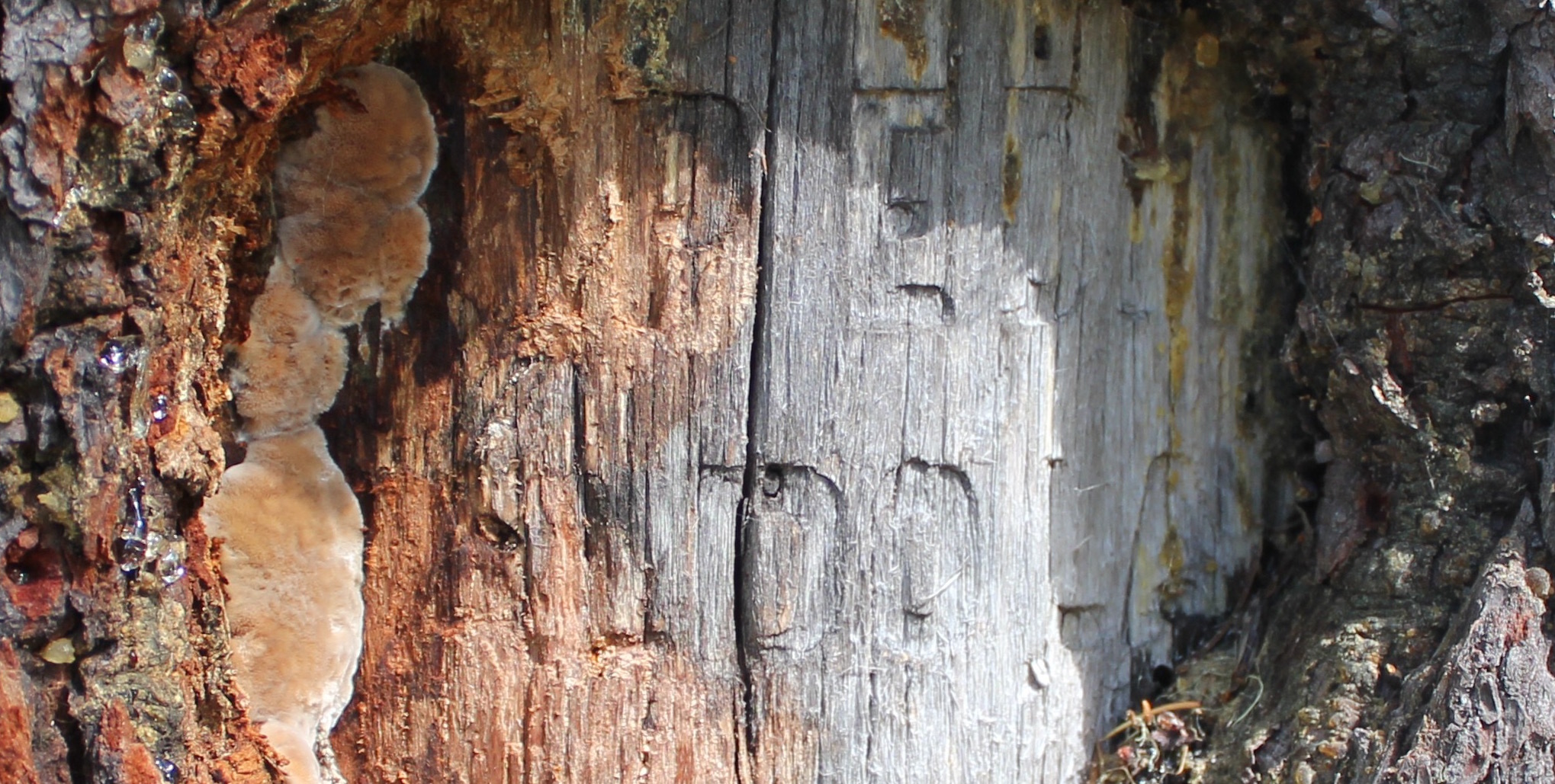
Arriving at the tree, we saw thirteen decades of bark growth had covered the blaze, but the inscription was still legible: “Camp Edith, Waldo Lake.”
After a year of reading Waldo’s papers, speaking with others, and carefully studying an old photo from 1890, my fellow explorers and I stood at Waldo’s lost campsite. Well, “lost” is a relative term. While we celebrated our discovery, we were not the first to locate the tree. People had likely visited here many centuries before Waldo’s time, and in more recent years pitched tents, or stopped for lunch along a lake’s edge, or even tried to solve the mystery of Camp Edith’s location for themselves.
A close-up of the Camp Edith tree, part of the “Camp Edith, Waldo Lake” inscription is still visible.
Standing there, I remembered blissfully walking past this location several years earlier during a day hike, yet never turning to see the blaze on the tree. I shook my head at the wondrous absurdity of my journey, a year of research only to discover a place in the outdoors where I had walked before.
Sharing that moment with others, standing on the shore of a picturesque lake in the middle of the woods, was a sense of nourishment, renewal, and connection. The tree’s inscription shares a nearly forgotten story, but to me, this is not a monument. Waldo’s monument isn’t this inscription, or a lake with his name, or even dusty photos in an archive. Waldo’s monument —his legacy— is about generations of people being outside, connecting with nature, and enjoying Oregon’s beautiful mountains.
Standing in front of the Camp Edith tree.
“The lake stretches away up to the North; crags and peaks tower above us. It is a splendid scene – this source of rivers and cities, hid away, like pure trains of thought from vulgar observation – in the deep bosom of the wilderness buried. Camp Edith sends you greeting, “greeting to Edith from ‘Papa’s Lake.’” -An excerpt from one of Waldo’s 1890 letters
“Children born and reared here might be expected to have something of the wild flavor of nature in their composition.” -Some of the last known words recorded in Waldo’s wilderness diary (between Aug 14- 17, 1907 just before his death)
A side-by-side comparison of the heart-shaped blaze seen in 2017 and 1890. You can still see the original heart outline in the bark of the newer photo.
Trip Report:
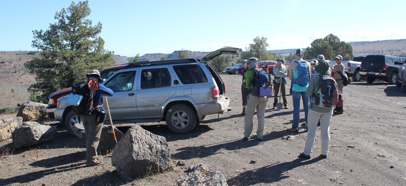
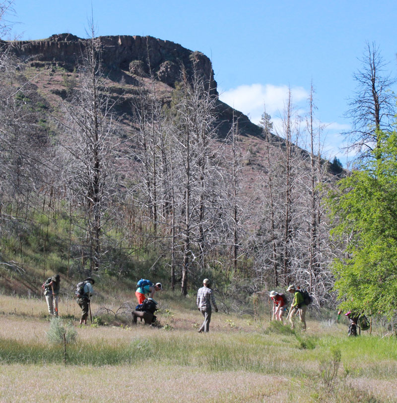
Volunteer Leader: Mark Hougardy | Group: Eugene-based Hiking Club collaborating with the Oregon Natural Desert Association (ONDA) | Dates: May 22, 2017 | Participants: 6 | Type: Weekend Camping & Restoration Work
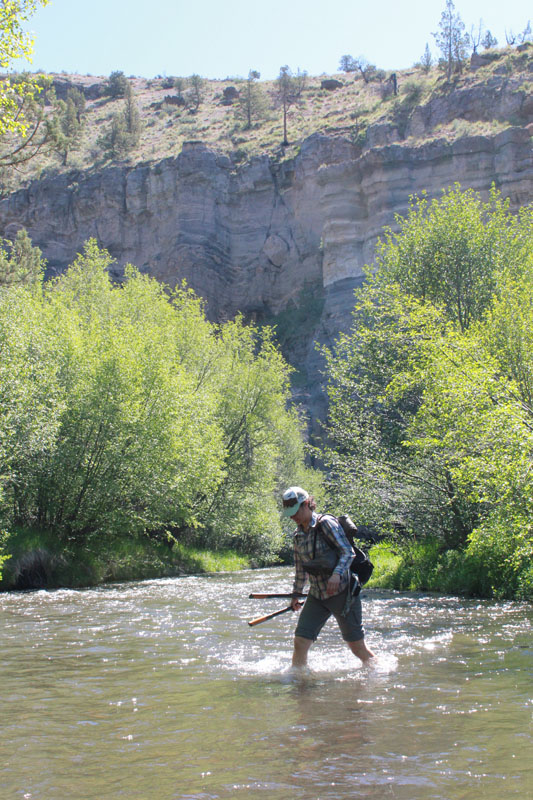
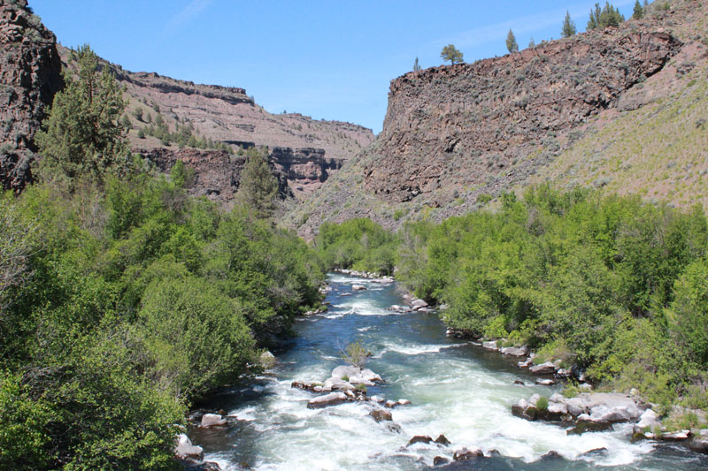
The Whychus-Deschutes proposed Wilderness is a rugged and beautiful landscape in central Oregon. Driving here requires a vehicle with high clearance and some sturdy hiking shoes for the remaining distance. It is a place of weathered cliffs, cold streams, and rocky canyons. If you have observant eyes you might even see bald eagles flying overhead. A prominent landmark is Alder Springs. The mainspring spontaneously gushs from the dry ground at an impressive 60 gallons per second. These cool waters flow a short distance into the picturesque Whychus Creek and a few miles further it joins the turbulent water of the Middle Deschutes River. These unique waterways provide spawning habitat for salmon, steelhead, and are central to all life in the area. This wilderness is prominent in fueling the region’s robust outdoor recreation opportunities, tourism industry, and a high quality of life. The Whychus-Deschutes landscape is an asset, yet it lacks permanent protection.
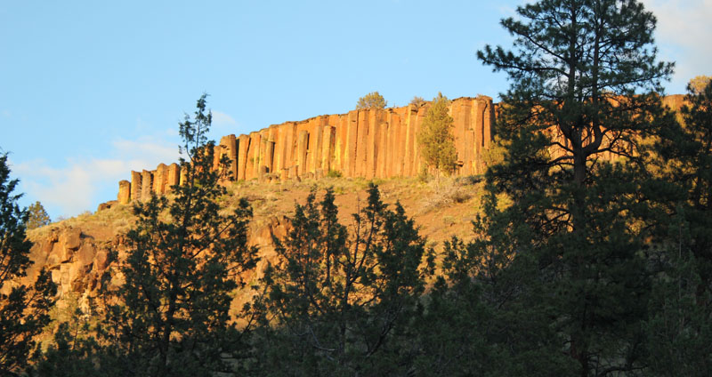
The first evening allowed for some hiking and enjoying the local sights. The ridge above the campground offered wonderful views of basalt columns. The columns were between 80 and 100 feet in height.
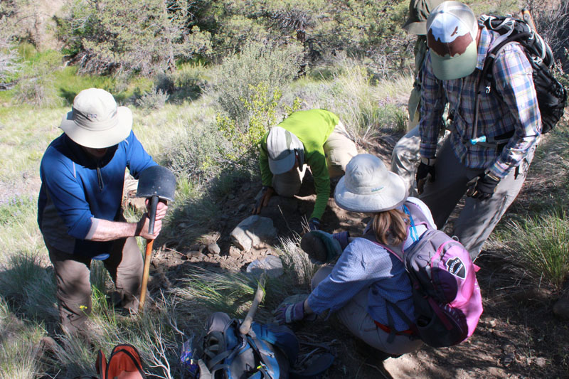
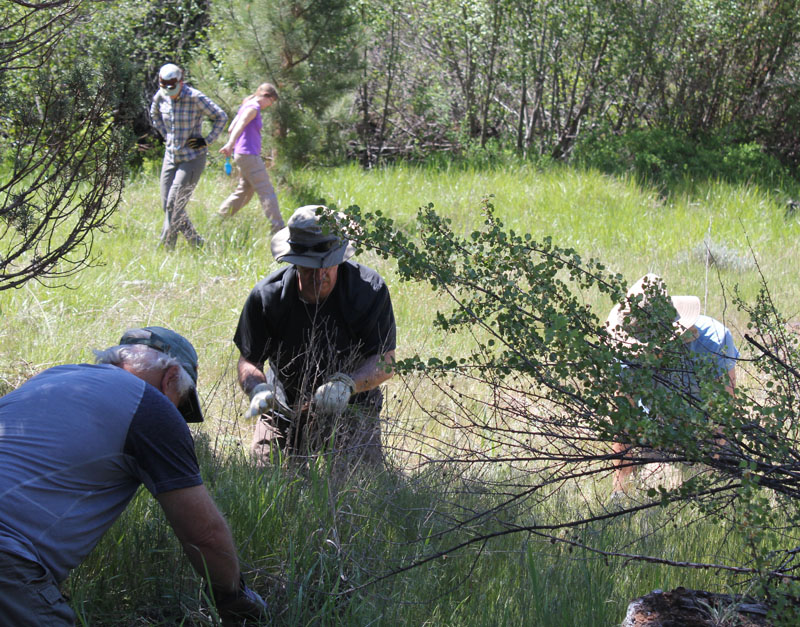
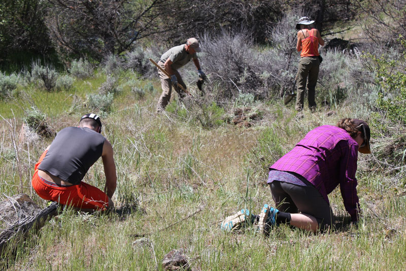
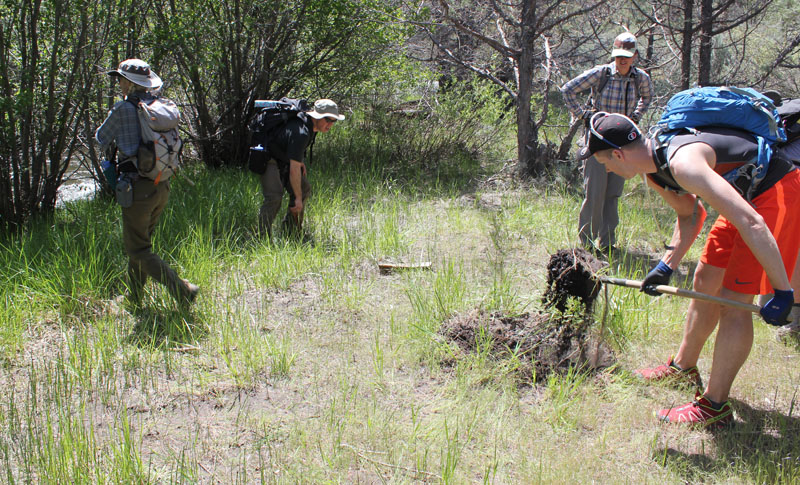
I wanted to learn more about protecting this land so I led a group of fellow eager hikers. We joined several other volunteers for an extended weekend of restoration work with the Oregon Natural Desert Association (ONDA). During the summer months, this sensitive area can be hammered by an influx of visitors who are seeking their interpretation of this place. We were there to learn about the natural history, rebuild trails, fix up campsites, and remove some invasive plants that were taking resources from native species.
First, a shout-out to ONDA. Learn more about ONDA’s great work and how you can help at onda.org
Here are some photos of our restoration weekend:
The next morning, we drove to the Alder Springs Trailhead and gathered our gear.
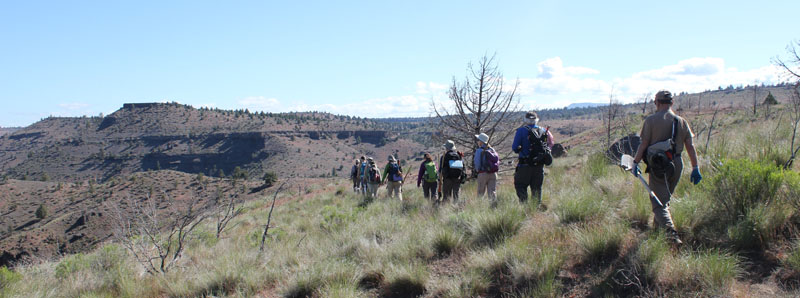
This is a stark and beautiful country. Our route was about three miles one way. We worked the entire distance down the trail.
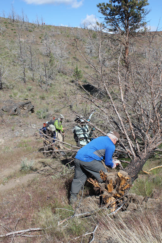
Volunteers jumped to it keeping the trail open.
This water bar (a small dike that prevents erosion on trails) had filled in and was no longer functioning. Our team rebuilt this and a good many others that day. The green in the background is courtesy of Alder Springs which flows at the base of the canyon.
Our host, Gena from ONDA, is crossing Whychus Creek.
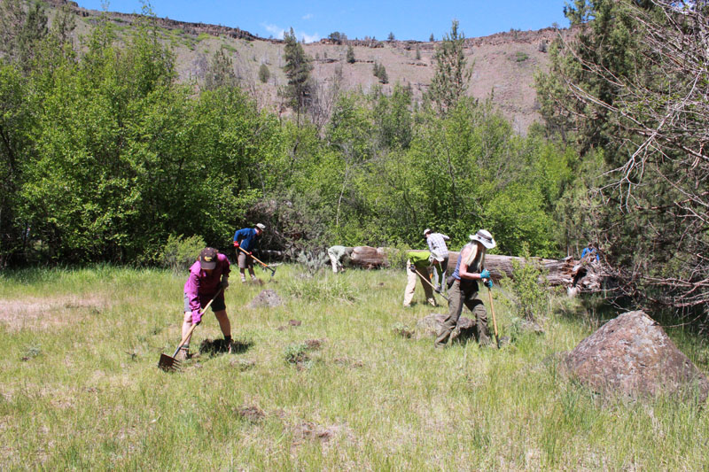
Our group is removing an abundance of Knapweed from a meadow. Knapweed can quickly take over an area and choke out native vegetation.
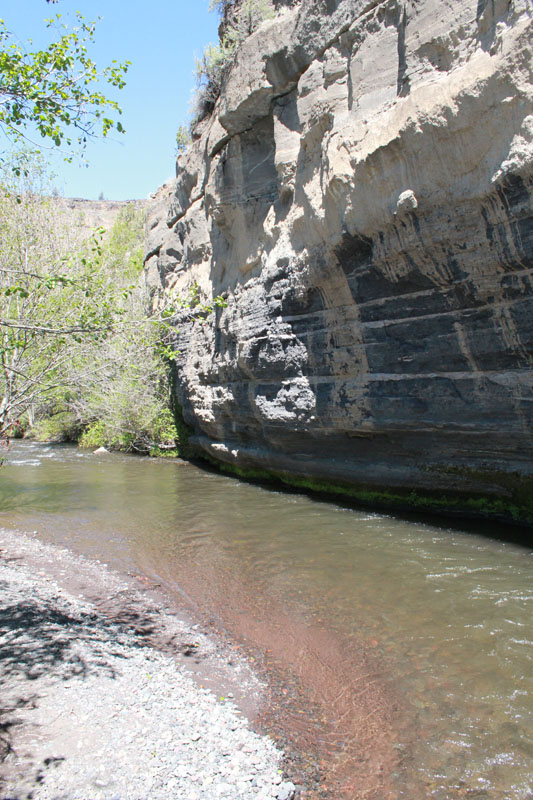
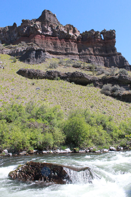
The creek skirted along the base of this amazing painted cliff. The horizontal bands displayed a multitude of geologic layers. The cliff’s face was streaked with gray which oozed out during recent rains. Several of us enjoyed lunch at this picturesque location.
Our work group is removing a large outcrop of Mullein. Mullein adapts easily to natural meadows and can outpace native plants.
An amazing view looking down Whychus Creek.
We enjoyed a well-earned break at the confluence of Whychus Creek as it pours into the Deschutes River. This view is several hundred feet downstream from the confluence. The scenery here is spectacular.
The next day we were at it again. We easily spent two hours pulling Knapweed in just this little meadow.
More Knapweed! One plant was so tough it snapped a hand trowel.
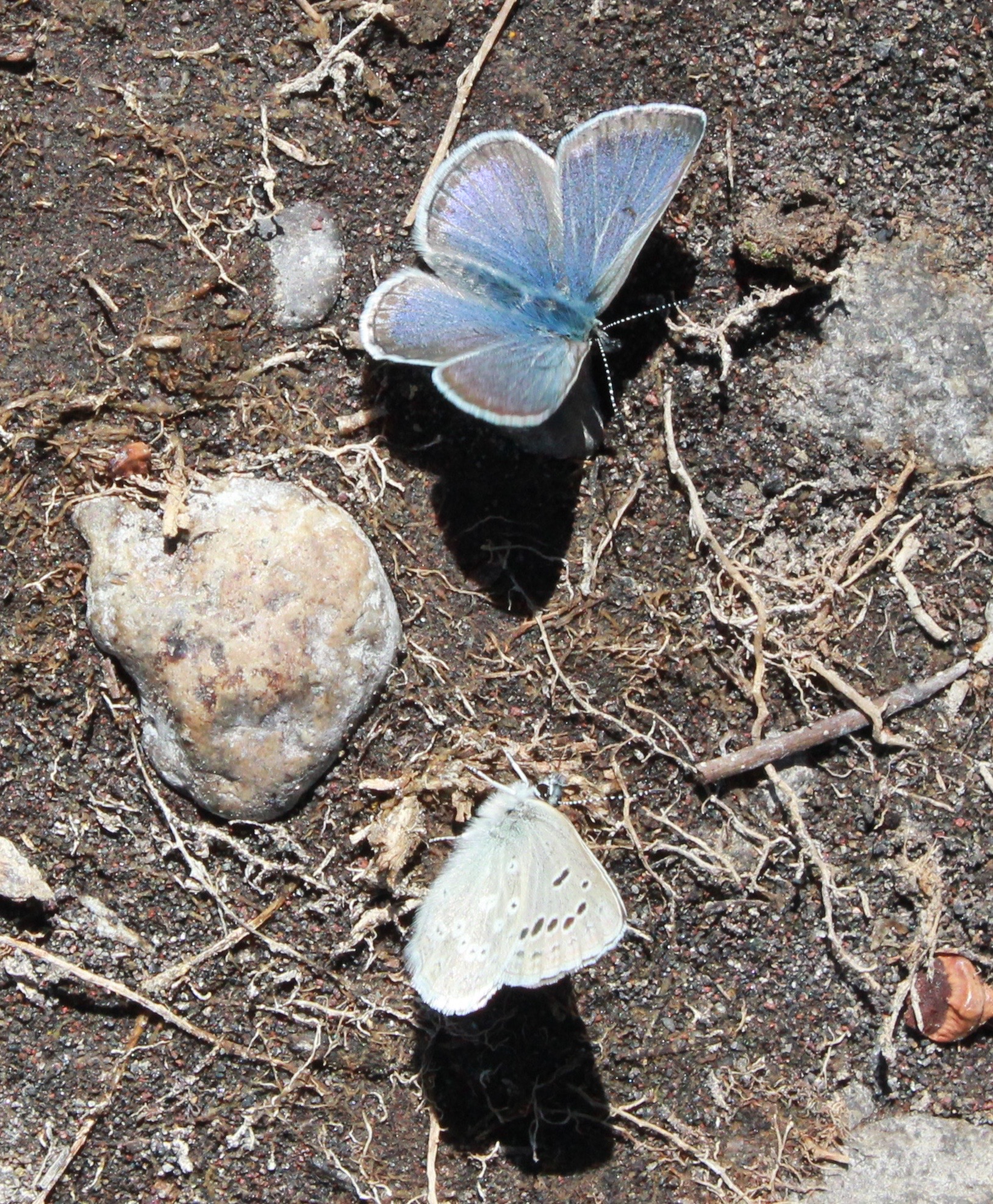
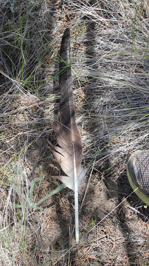
Amazing colors on these butterflies! Animals we saw on this trip included two bald eagles, turkey vultures, several meadowlarks, a robin, one gemstone-colored Lazuli Bunting, scores of butterflies, and two snakes. Sadly, we saw four deceased deer, victims of an aggressively cold winter.
Our group removed an illegal fire ring fifteen feet from the creek. We restored this sensitive habitat as best we could.
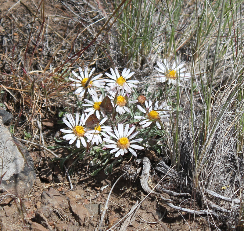
Such simple, yet complex, beauty can be observed here. Note the small butterflies.
The last of our group returns down a dusty path after a long and rewarding weekend.
A true delight was spotted next to the trail. This is believed to be a primary feather of a Bald Eagle (possibly from a sub-adult). The top edge of a trail shoe is included for scale. This feather was discovered near the final hour of our restoration work – helping to protect public land. Seeing it was a welcome gift.
Trip Report:
Volunteer Leader: Mark Hougardy | Group: Eugene-based Hiking Club | Dates: November 7, 2016 | Participants: 6 | Type: University of Oregon Archives Visit
On this sunny day in November, our small group spent several hours with the original writings, journals, and photographs of a true champion of nature – John B. Waldo.
Waldo was an ardent conservationist, he’s been referred to as the west’s David Thoreau and even Oregon’s John Muir. Waldo was known for venturing into the Cascades, often spending months at a time, and recording his findings of this dynamic and vibrant landscape.
Over the course of his life, Waldo worked as an explorer, legislator, and chief justice on the Oregon Supreme Court, all the time helping to preserve land in the Cascades. He envisioned a protected band of land along the crest of the Oregon Cascade Range that ran the entire length of Oregon. This goal became his personal mission.
On September 28, 1893, the Cascade Range Forest Reserve became a reality and 5 million acres were protected.
Today, we can experience his legacy in the protected lands and open spaces of the Cascades from Mount Hood south to the border with California, that include: Crater Lake National Park, Mt. Hood, Willamette, Umpqua, Rogue River national forests, and other public lands. And in the middle of this grand monument are the deep and pristine waters of Waldo Lake, named in his honor.
Curiously, little is written about Waldo. The judge was a philosophical and reflective person who did not directly seek publicity. But possibly this muted message is part of his larger voice – appreciating the beauty of Oregon is best experienced by hiking on the trails, exploring in the mountains, traveling in the wilderness, and experiencing the (as he wrote) “untrammeled nature and the free air.†Discover Waldo’s story for yourself. The University of Oregon archive is free to use – Knight Library, Paulson Reading Room.
Reference: John B. Waldo and William G. Steel: Forest Reserve Advocates for the Cascade Range of Oregon, Gerald W. Williams
Umpqua and Willamette National Forests
http://www.foresthistory.org/Publications/Books/Origins_National_Forests/sec21.htm
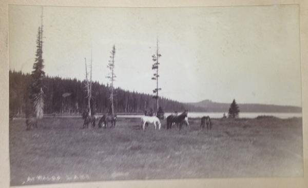
Here are just a few of the photos from his collection:
Trip Report:
Volunteer Leader: Mark Hougardy | Date: June 12, 2016| Duration: 1 Day| Participants: 10 | Group: Eugene-based Hiking Club; As this was the first visit to a very remote location, for safety, I enlisted the help of Oregon Wild to introduce us to the area. | Hiking 5 miles (1,000-foot elevation loss/gain)
Type: Day Hike
The proposed Devil’s Staircase Wilderness is one of the most remote and inaccessible regions of rainforest left in the Coast Range. This impenetrable area has limited hiking trails or roads and is visited by only a few hundred people a year. Yet it remains unprotected despite the efforts of conservation groups and Oregon’s congressional delegation. To find out more about this compelling landscape, eleven hikers joined Chandra LeGue, the Western Oregon Field Coordinator at Oregon Wild, for a day of hiking to the Dark Grove. The Dark Grove has never been logged and is home to ancient trees that are 400-500 years old.
Our caravan of cars departed Eugene and meandered on back roads through the coast range. At one point, the green surroundings were cleaved from our sight as we drove through a wasteland of cut and darkened stumps: one member in the car likened the lifeless land to the desolated area at Mount St. Helens just after its eruption. This sight was a stark contrast to the lush biomass that we would encounter later that day.
About 15 miles northeast of Reedsport, we pulled off the pavement and slowly traveled up a single laned, overgrown backroad. Salmonberries grew in abundance here and scratched the sides of the car.
We parked at a junction and walked down an old logging road that was being reclaimed by the forest. Then we disappeared into the bushes, venturing down an elk trail. Posted on a tree was a sign that told us this was not the path to the Devil’s Staircase waterfall and unless you’re prepared to stay the night, and have Search and Rescue to look for you, to turn back. Fortunately, we had a guide for our inaugural visit.
The so-called “trail†was on loose soil and maintained a direct angle downward at 45-50 degrees. For the next hour and a half, we carefully descended 1,000 feet. Roots frequently caught our feet as we clamored over fallen logs and beneath large trees that had crashed across ravines and splintered. Ferns grew in abundance and they and helped us balance ourselves with their solid fronds. We quickly learned that ferns were our friends.
The weather that day was pleasant and sunny, though had our schedule been a day or two off, our visit might have been plagued with slippery trails.
Finally, the trail leveled out and we enjoyed lunch in an amphitheater-like area of fallen logs surrounded by a carpet of greenery. We saw a shadow over the canopy as a turkey vulture circled far overhead, no doubt curious to see if the humans had lost their way.
A forest of Salmonberries obstructed our path, so we made a trail straight up a ridge, then down into a forest of sword ferns. The ferns stood at five to six feet in height, so they engulfed us all and many of the shorter members traveled with their arms raised straight overhead. These tranquil glens often hid downed logs and it was easy to twist ankles or slam shins.
A fallen giant became our catwalk above the salmonberries, foxgloves, and ferns. We crossed a creek, but could barely see the water because of the thick undergrowth. Scampering down the side of the massive tree, we squatted and crawled through a small jungle, then emerged at the root base of the fallen giant – it was 25 feet tall!
In front of us was the Dark Grove, a cathedral of 8-foot wide Douglas Fir trees. The trees were dark in appearance, the result of fire about 150 years earlier. Touching the bark a charcoal residue was imprinted on fingers. The tree model is Becky Lipton.
Crossing back across the fallen giant, we stood at the base of one of the largest trees we saw that day. Eight people stood at its base, arms outstretched and hands grasped. They counted one, two, three… their calls became muffled as they rounded the opposite side…the voices returned and the loop stopped – at seven and a half people! This immense tree was somewhere between 35 to 40 feet in circumference! Several hikers mentioned they felt like kids in a giant outdoor playground.
We continued through the ferns and back again along the ridge (which was unmarked on the Forest Service map). We lost the trail several times but finally found what we were looking for: a small rocky outcrop along Wasson Creek where the channeled water made a small waterfall for us to enjoy. We rested for half an hour in the sun.
The rest of the afternoon was spent returning via the same trail that we had descended earlier, which was a workout! At about 4 pm, we returned to our cars and started our two-hour drive back to Eugene.
This hike was a rugged and demanding off-trail experience, and all of us got scratched and dirty, some of us stung by insects, and one person had a fall (fortunately the ground was padded by an abundance of moss and there was no injury)! I understand why people get lost in this wilderness; even with directions, I could never have found this remote location. The sheer scale of the forest is very disorienting, but experiencing this place at ground level provides clarity as to why it needs to be protected.
The Three Sisters Wilderness in Oregon is breathtakingly beautiful. This diverse landscape of volcanoes, snow, forests, creeks, lava fields, and lakes gives hikers the opportunity to explore a vibrant topography. The wilderness encompasses 281,190-acres and is dominated by three volcanic peaks: North, Middle, and South, that each exceeds 10,000-feet in height! Several paved roads around the perimeter of the wilderness allow visitors to see vistas with just a car ride, but to really appreciate the immensity of this setting some footwork is required. Here are some pictures of a 34-mile, 4-day trip along the north and eastern portions of the wilderness ending between Middle and South Sister at a subalpine area known as Camp Lake.
My wife and I began our first day with a late start; we hiked 3 miles south from the Lava Camp trailhead and spent the night at South Matthieu Lake. Smoke from forest fires in the region made everything, even a view of North Sister and the moon, opaque. That night, an anticipated cool breeze was replaced by a warm wind that blew in from high plains of Oregon where a large ground fire was burning. In the middle of the night, the smoke became extremely thick and breathing for several hours was difficult. By morning the winds had shifted and the air was clearer.
The next day we hiked 14 miles; 7 of which reminded us just how destructive forest fires can be, constantly around us were the stark and charcoaled remains of incinerated trees. This conflagration was called the Pole Creek Fire and occurred just 3 years ago in 2012.
Several small creeks crossed our path, most were dry, but Alder Creek’s water was cold and clear even though the flow was very low. The creek offered a respite from a temperature of 85 degrees and hot sun that was beating down. We welcomed the opportunity for rest and refill our water bottles at this little pool.
The North Sister towers in the distance. Continuing south the trail crossed several areas where the fire had not reached; these were often pumice expanses where vegetation was dispersed.
As we crossed Soap Creek we saw a number Bumble Bees buzzing from one flower to another. Soap Creek gets its name from the soapy color of the water; this is because of the sediment that gets carried down in the glacial meltwater.
The trail turned to the west and the terrain gradually increased in elevation. After about an hour and a half we crossed the North Fork of Whychus Creek, which had to be traversed via several logs that served as a makeshift bridge, below us the grey and auburn glacial melt water loudly churned. Its source was about 2 miles upstream at the Hayden and Diller Glaciers. After crossing the views opened up.
A photo of Christiane hiking through a pumice area on our way to Camp Lake; walking on this material is akin to walking on dry sand.
What a beautiful landscape!
A view of South Sister on the horizon; this dramatic peak is 10,358-feet in elevation!
Our destination for the night, Camp Lake at 6,952-feet. The wind here can be unrelenting, this is because the lake’s location is sandwiched in a pass between Middle and South Sister. The wind was strong that afternoon so we found sanctuary behind a glacial moraine and set up camp.
Our original plan was to stay the night at Camp Lake and then in the morning continue over the pass. This would have included: hiking up a climber’s trail for an hour and up several hundred feet in elevation, crossing over a snowfield and down the western side of the mountain and to several remote lakes then overland another 3 miles to the Pacific Crest Trail. But, uncertain weather changed our plans. The forecast had called for a rainstorm along with high winds within the next 24 hours and we were hoping to make it over the pass before the rain. That evening dark clouds marched across the sky. As the sun disappeared under the horizon the temperature dropped well into the 40s and that night we heard several deep and rumbling crashes of thunder. The wind howled into the morning and for several hours we heard rain outside and at times our tent was pelted by ice.
When we woke, the sky was grey in color but appeared mostly calm, though as I stepped out from behind the shelter of the moraine the wind almost knocked me over. I collected water at the lake and was surprised at how chilled I had become in just a few minutes; the wind was deceptively cold. Partially frozen raindrops fell sporadically. My wife and I made the decision to hold off crossing over the pass during this trip. We would return by the route we came.
The area’s starkness was beautiful. Several tents were dotted around the area, all of them, like the tent, is shown in the photo, was strategically placed behind natural wind brakes.
Our hike off the mountain was cold and occasionally it rained on us. At about noon the sun briefly came out, but this did not last long for the sky again turned dark and overcast. We hiked out of the burn zone and returned to the Matthieu Lakes area about dinnertime. That evening, the weather was peaceable, but about 7 pm the wind started up, by 8 pm it roared through camp with gusts reaching 40-50 miles an hour, by 9 pm the rain started. This continued into dawn. We slept comfortably in our tent.
The next morning was drippy and low clouds blew over the treetops. Later that morning we hiked out the last 3 miles. As we approached the Lava Camp trailhead the sky offered us some brief patches of blue. We ended our day with each other clinking together mugs of trail coffee in honor of a good trip.
Oregon’s Diamond Peak Wilderness is frequently overlooked for more picturesque settings like the Three Sisters, but this wild place is no less a treasured gem; the Wilderness includes the 8,629-foot Diamond Peak, 14-miles of the PCT (Pacific Crest Trail), one of the high points on the PCT in Oregon, and over 50,000 acres to explore!
A glorious view from Diamond View Lake. The clouds at the left of the image produced some amazing lightning and thunder that afternoon.
The trail got a little hard to follow at one point and we had to bushwhack.
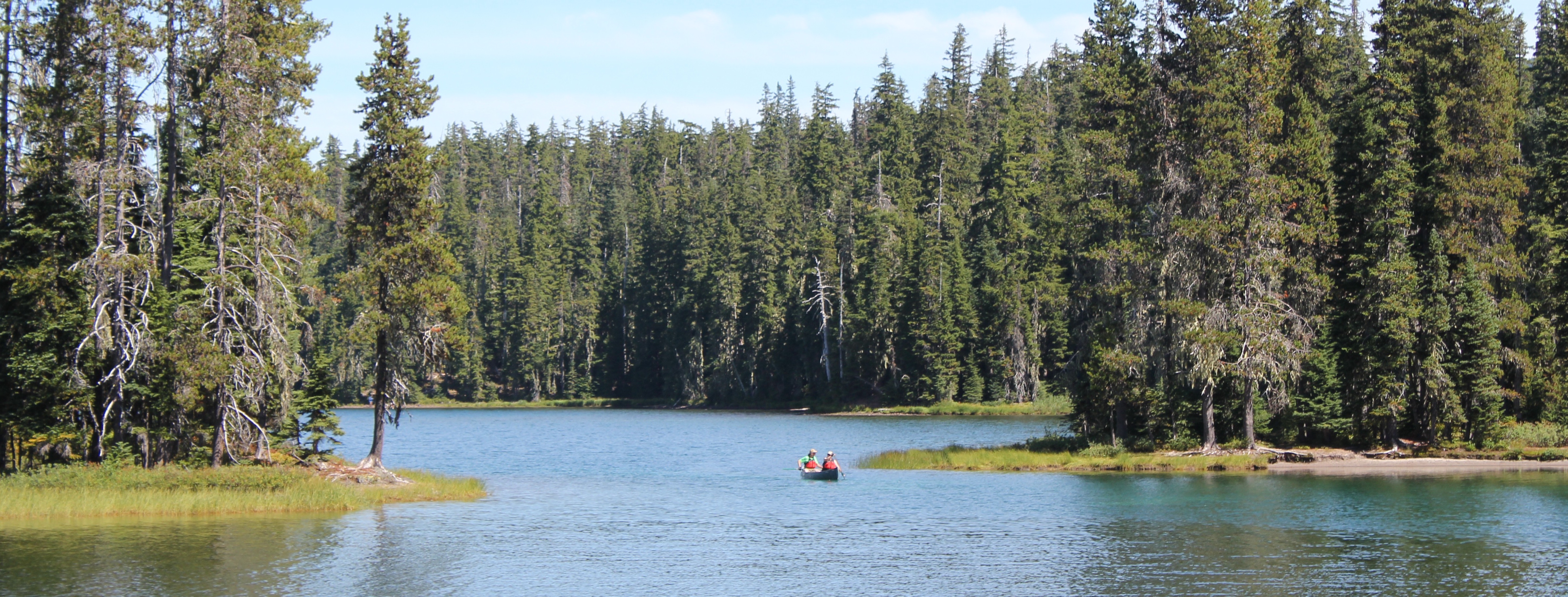
A little lake where we stopped for a rest, only to stay for the night. Water was scarce in the area and the lake provided a great location for watching wildlife and hearing even more wildlife during the nighttime.
A very dusty path. This trail was well worn because of the number of PCT hikers that we met, many had been side-tracked to a lower elevation because of the lack of water on the main PCT.
Wow! You find lots of cool things on the trail.
Standing at the outflow of Yoran Lake looking south to Diamond Peak. After a break, we bushwhacked about half a mile to the PCT to loopback.
A small island on Yoran Lake.
Enjoying some lunch while scouting out a great campsite.

 Trip Report:
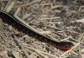
 Trip Report:
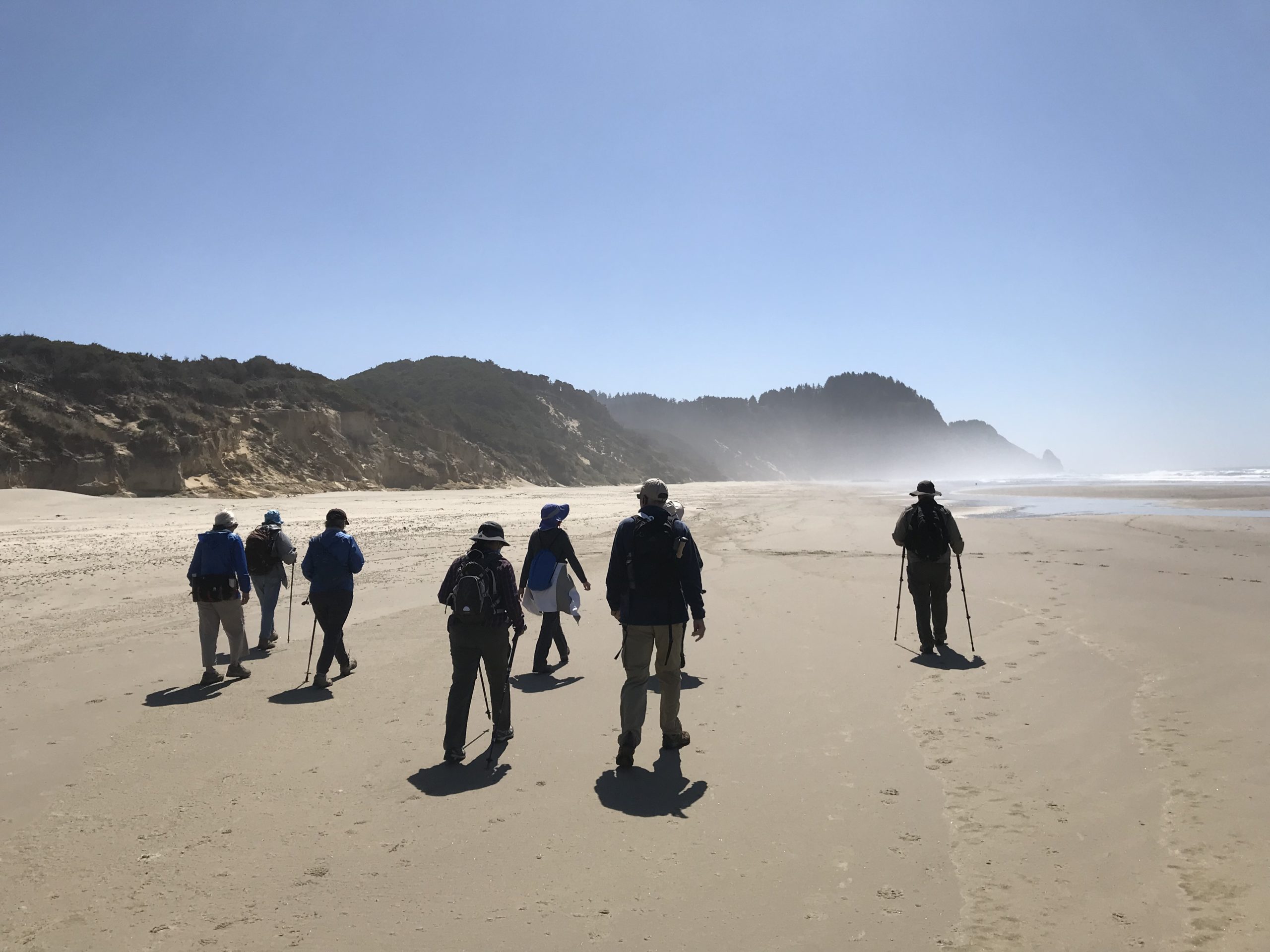

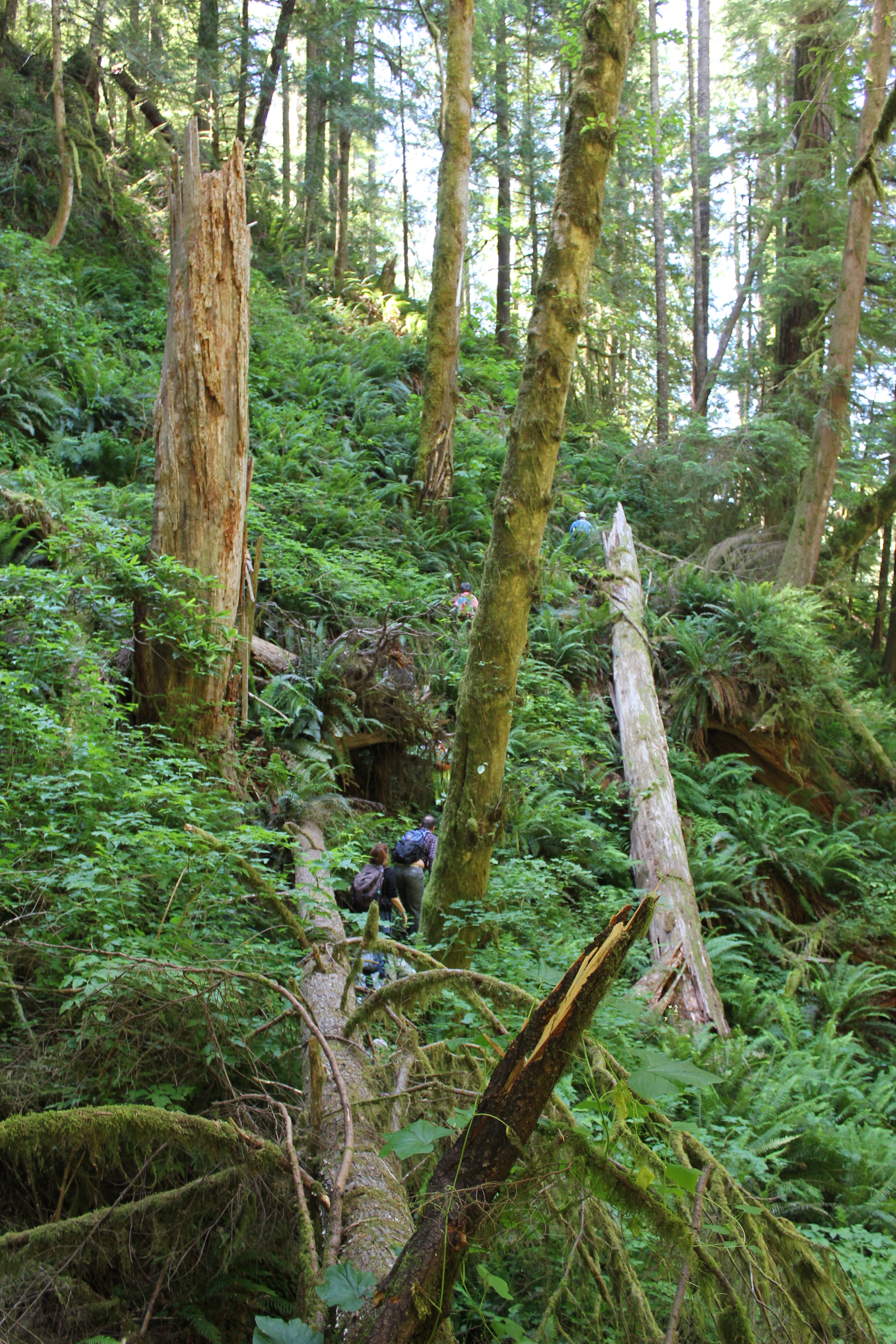 We parked at a junction and walked down an old logging road that was being reclaimed by the forest. Then we disappeared into the bushes, venturing down an elk trail. Posted on a tree was a sign that told us this was not the path to the Devil’s Staircase waterfall and unless you’re prepared to stay the night, and have Search and Rescue to look for you, to turn back. Fortunately, we had a guide for our inaugural visit.
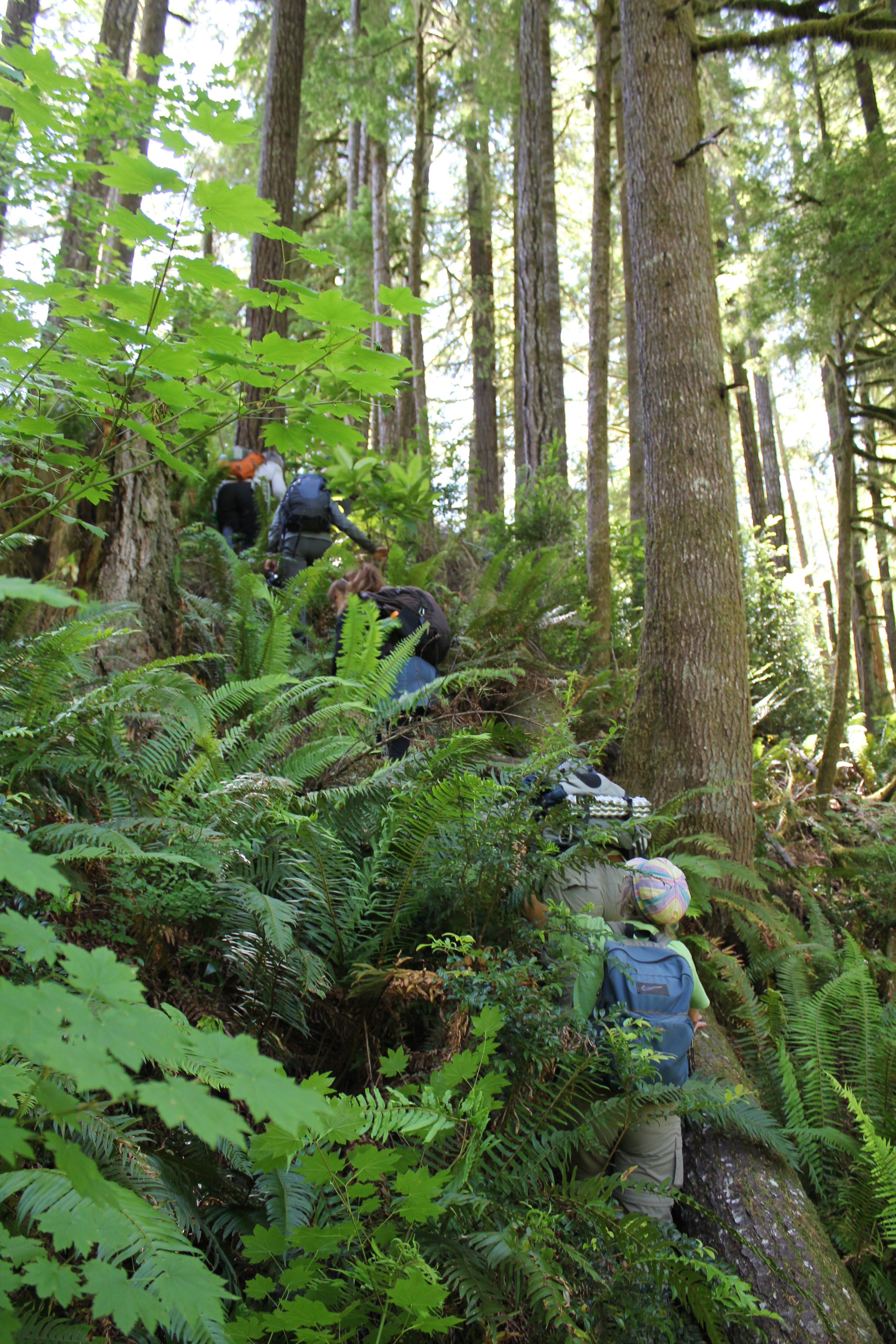 A forest of Salmonberries obstructed our path, so we made a trail straight up a ridge, then down into a forest of sword ferns. The ferns stood at five to six feet in height, so they engulfed us all and many of the shorter members traveled with their arms raised straight overhead. These tranquil glens often hid downed logs and it was easy to twist ankles or slam shins.
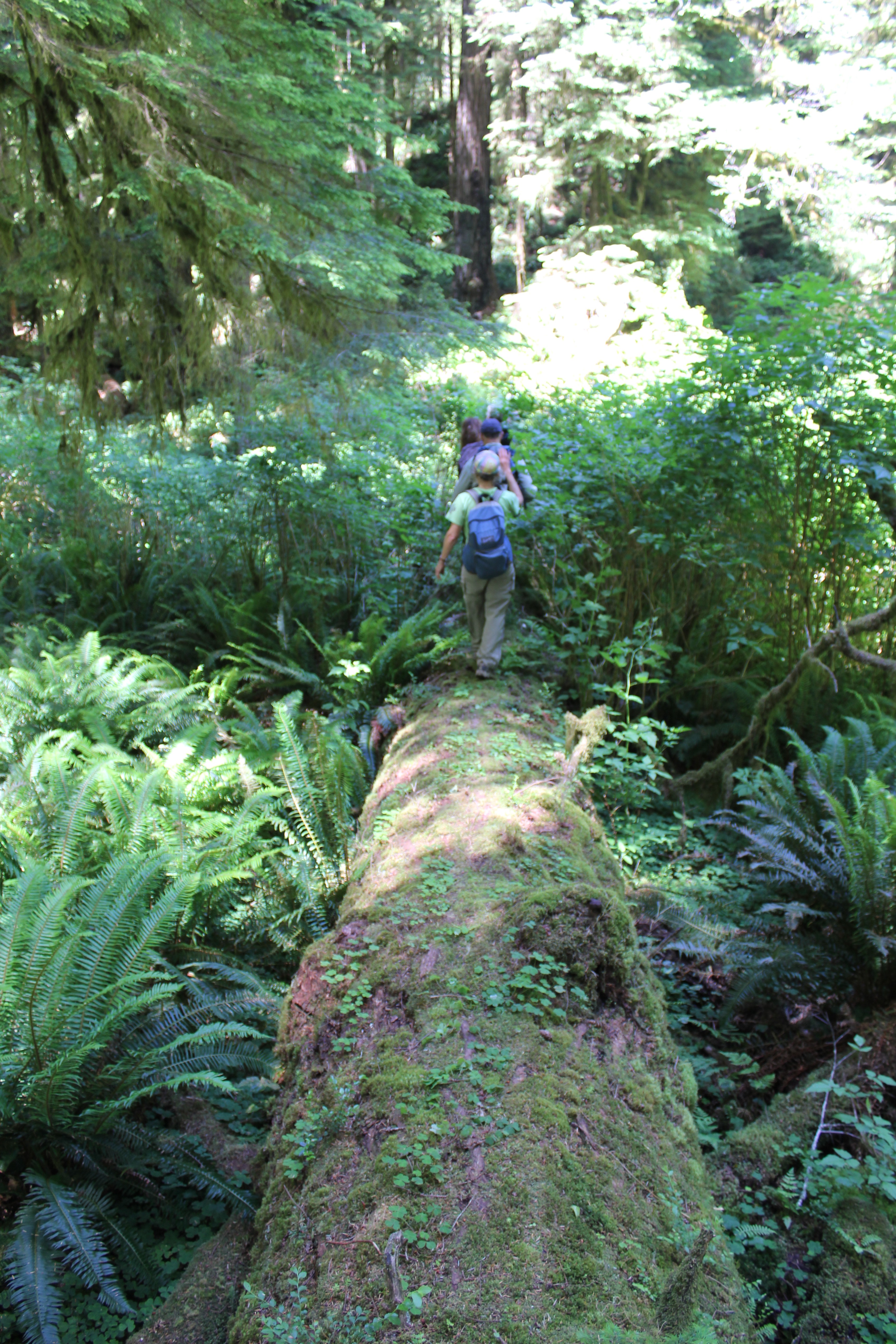 A fallen giant became our catwalk above the salmonberries, foxgloves, and ferns. We crossed a creek, but could barely see the water because of the thick undergrowth. Scampering down the side of the massive tree, we squatted and crawled through a small jungle, then emerged at the root base of the fallen giant – it was 25 feet tall!
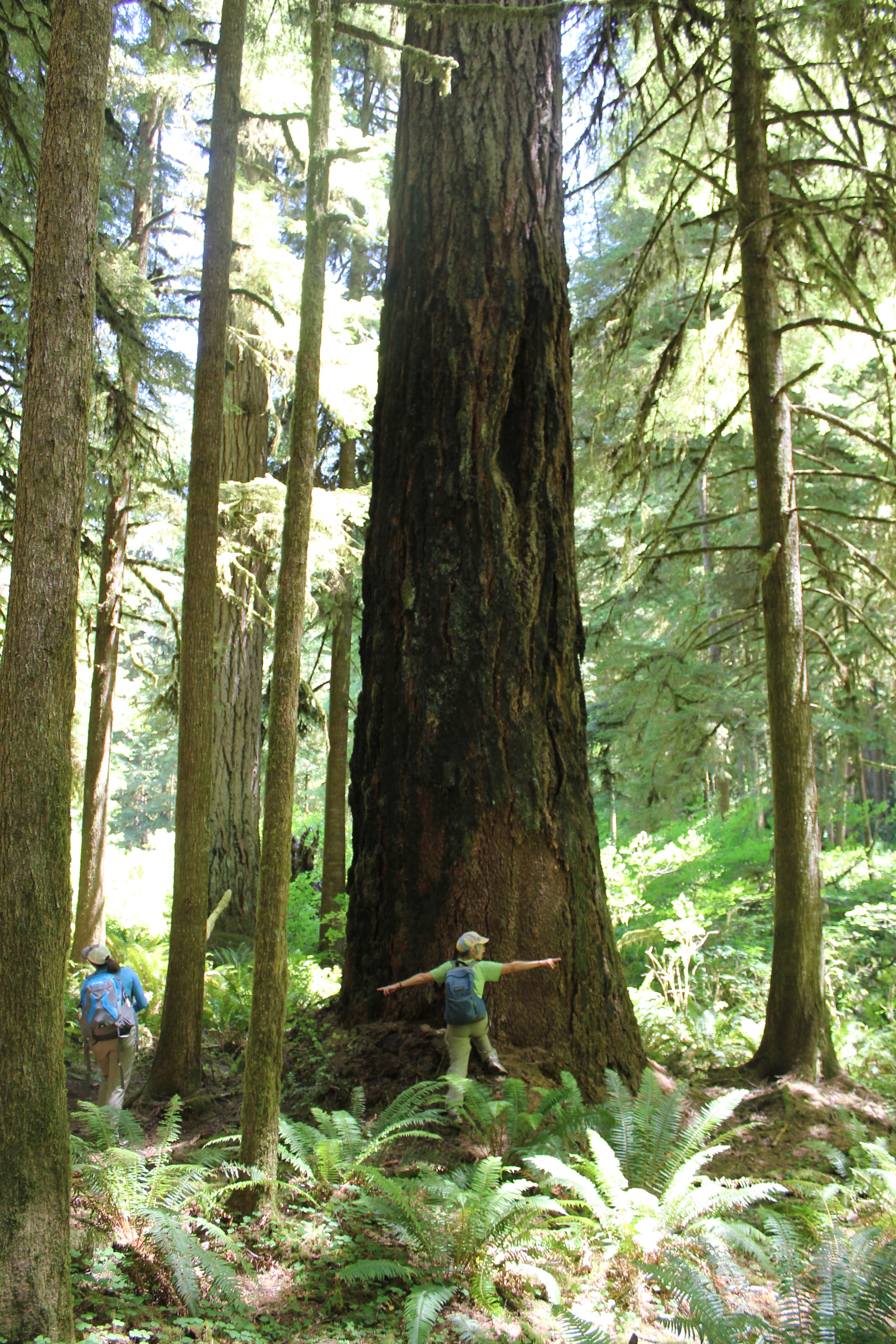 In front of us was the Dark Grove, a cathedral of 8-foot wide Douglas Fir trees. The trees were dark in appearance, the result of fire about 150 years earlier. Touching the bark a charcoal residue was imprinted on fingers. The tree model is Becky Lipton.
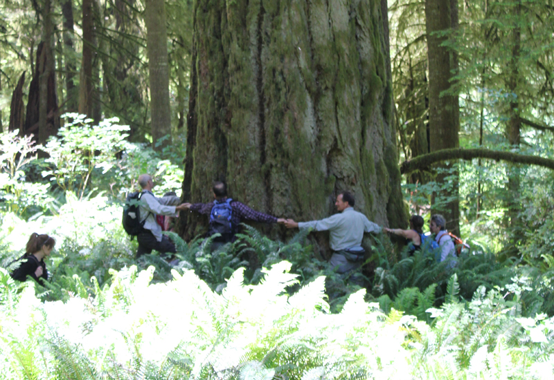 Crossing back across the fallen giant, we stood at the base of one of the largest trees we saw that day. Eight people stood at its base, arms outstretched and hands grasped. They counted one, two, three… their calls became muffled as they rounded the opposite side…the voices returned and the loop stopped – at seven and a half people! This immense tree was somewhere between 35 to 40 feet in circumference! Several hikers mentioned they felt like kids in a giant outdoor playground.
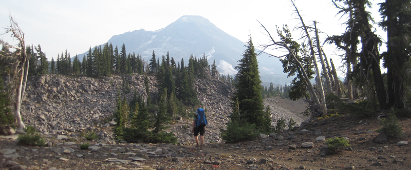 The Three Sisters Wilderness in Oregon is breathtakingly beautiful. This diverse landscape of volcanoes, snow, forests, creeks, lava fields, and lakes gives hikers the opportunity to explore a vibrant topography. The wilderness encompasses 281,190-acres and is dominated by three volcanic peaks: North, Middle, and South, that each exceeds 10,000-feet in height! Several paved roads around the perimeter of the wilderness allow visitors to see vistas with just a car ride, but to really appreciate the immensity of this setting some footwork is required. Here are some pictures of a 34-mile, 4-day trip along the north and eastern portions of the wilderness ending between Middle and South Sister at a subalpine area known as Camp Lake.
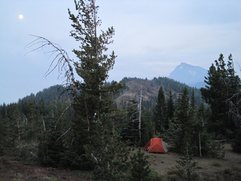 My wife and I began our first day with a late start; we hiked 3 miles south from the Lava Camp trailhead and spent the night at South Matthieu Lake. Smoke from forest fires in the region made everything, even a view of North Sister and the moon, opaque. That night, an anticipated cool breeze was replaced by a warm wind that blew in from high plains of Oregon where a large ground fire was burning. In the middle of the night, the smoke became extremely thick and breathing for several hours was difficult. By morning the winds had shifted and the air was clearer.
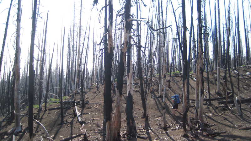 The next day we hiked 14 miles; 7 of which reminded us just how destructive forest fires can be, constantly around us were the stark and charcoaled remains of incinerated trees. This conflagration was called the Pole Creek Fire and occurred just 3 years ago in 2012.
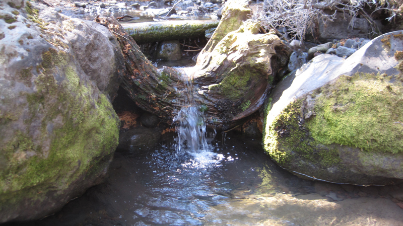 Several small creeks crossed our path, most were dry, but Alder Creek’s water was cold and clear even though the flow was very low. The creek offered a respite from a temperature of 85 degrees and hot sun that was beating down. We welcomed the opportunity for rest and refill our water bottles at this little pool.
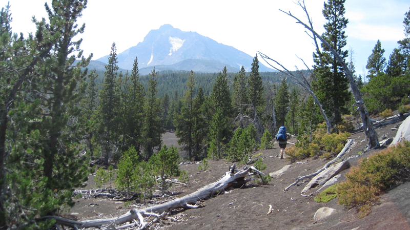 The North Sister towers in the distance. Continuing south the trail crossed several areas where the fire had not reached; these were often pumice expanses where vegetation was dispersed.
 As we crossed Soap Creek we saw a number Bumble Bees buzzing from one flower to another. Soap Creek gets its name from the soapy color of the water; this is because of the sediment that gets carried down in the glacial meltwater.
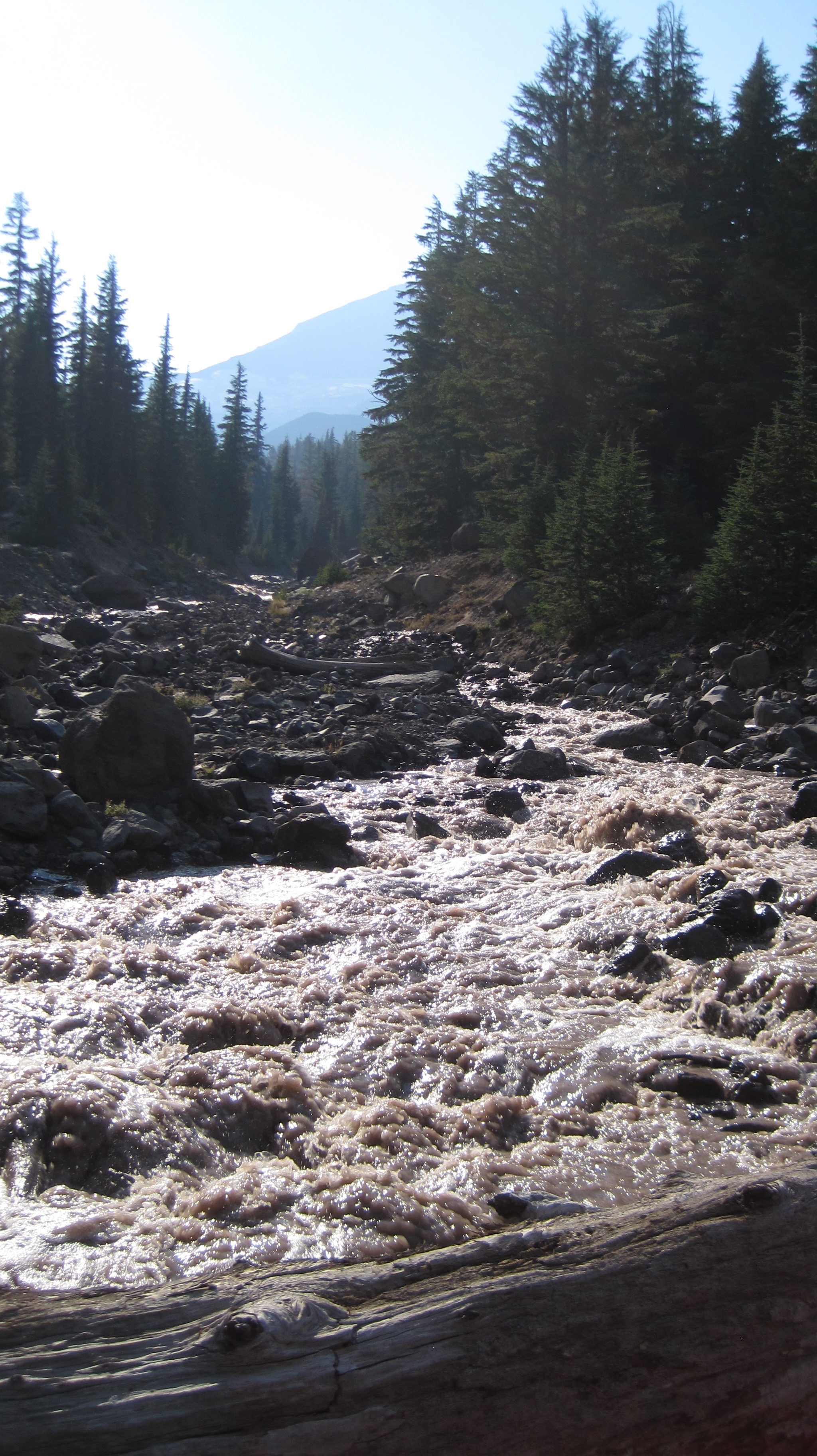 The trail turned to the west and the terrain gradually increased in elevation. After about an hour and a half we crossed the North Fork of Whychus Creek, which had to be traversed via several logs that served as a makeshift bridge, below us the grey and auburn glacial melt water loudly churned. Its source was about 2 miles upstream at the Hayden and Diller Glaciers. After crossing the views opened up.
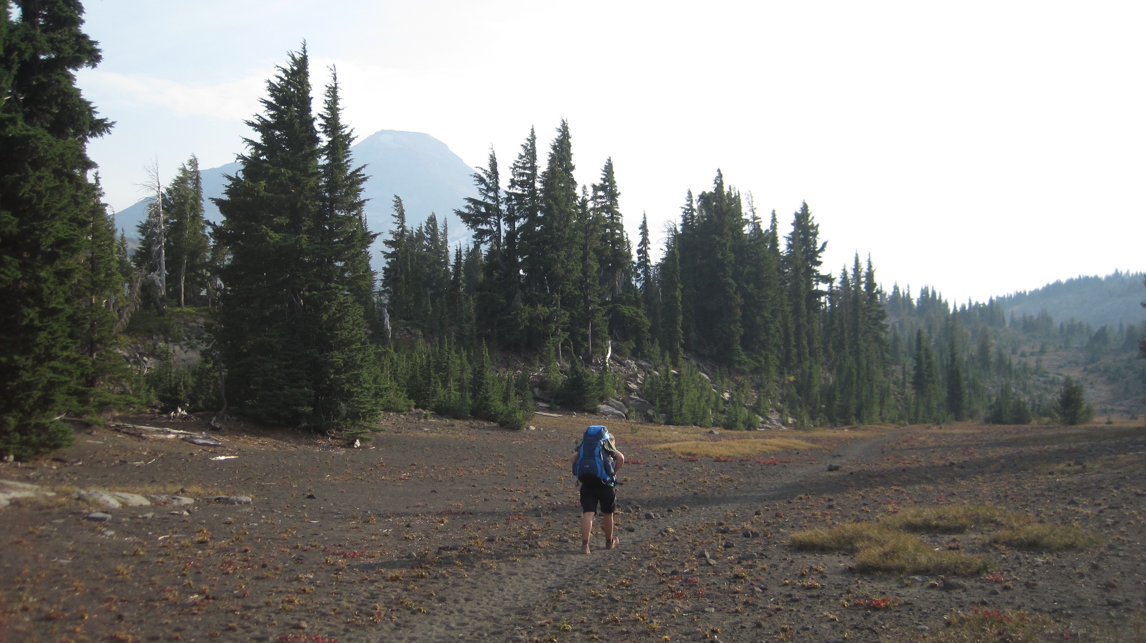 A photo of Christiane hiking through a pumice area on our way to Camp Lake; walking on this material is akin to walking on dry sand.
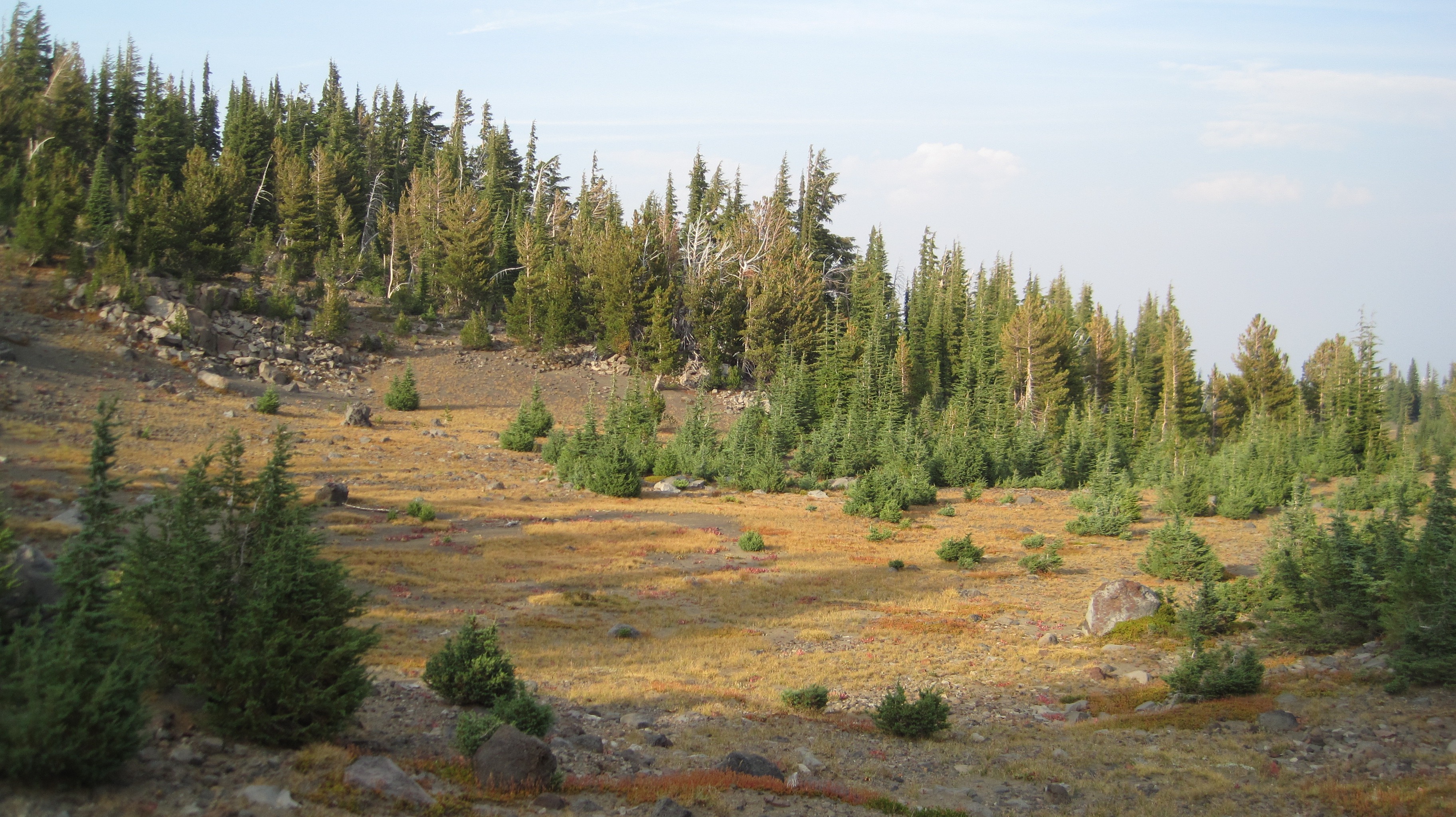 What a beautiful landscape!
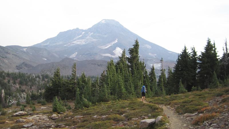 A view of South Sister on the horizon; this dramatic peak is 10,358-feet in elevation!
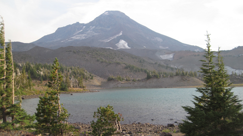 Our destination for the night, Camp Lake at 6,952-feet. The wind here can be unrelenting, this is because the lake’s location is sandwiched in a pass between Middle and South Sister. The wind was strong that afternoon so we found sanctuary behind a glacial moraine and set up camp.
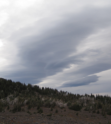 Our original plan was to stay the night at Camp Lake and then in the morning continue over the pass. This would have included: hiking up a climber’s trail for an hour and up several hundred feet in elevation, crossing over a snowfield and down the western side of the mountain and to several remote lakes then overland another 3 miles to the Pacific Crest Trail. But, uncertain weather changed our plans. The forecast had called for a rainstorm along with high winds within the next 24 hours and we were hoping to make it over the pass before the rain. That evening dark clouds marched across the sky. As the sun disappeared under the horizon the temperature dropped well into the 40s and that night we heard several deep and rumbling crashes of thunder. The wind howled into the morning and for several hours we heard rain outside and at times our tent was pelted by ice.
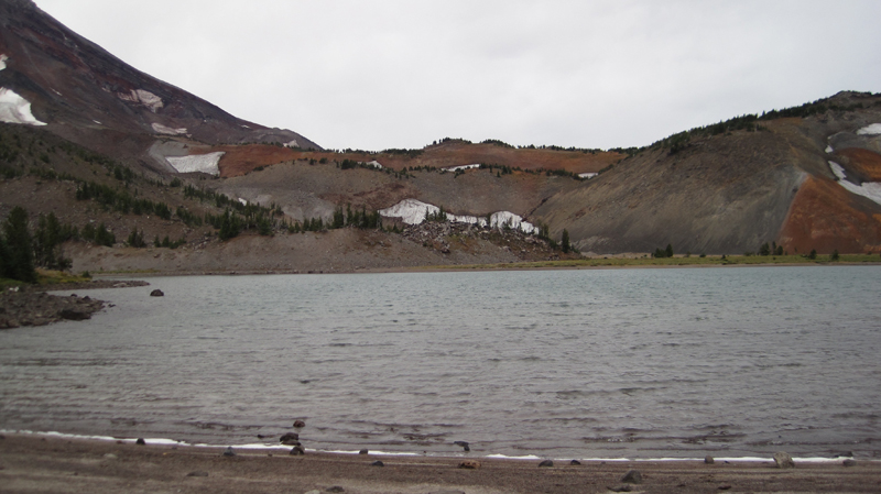 When we woke, the sky was grey in color but appeared mostly calm, though as I stepped out from behind the shelter of the moraine the wind almost knocked me over. I collected water at the lake and was surprised at how chilled I had become in just a few minutes; the wind was deceptively cold. Partially frozen raindrops fell sporadically. My wife and I made the decision to hold off crossing over the pass during this trip. We would return by the route we came.
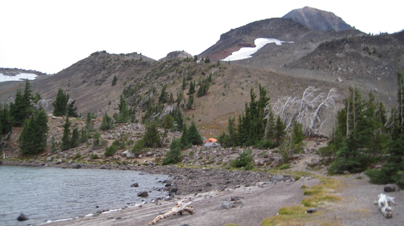 The area’s starkness was beautiful. Several tents were dotted around the area, all of them, like the tent, is shown in the photo, was strategically placed behind natural wind brakes.
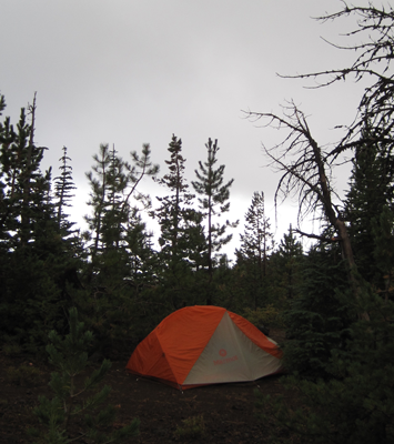 Our hike off the mountain was cold and occasionally it rained on us. At about noon the sun briefly came out, but this did not last long for the sky again turned dark and overcast. We hiked out of the burn zone and returned to the Matthieu Lakes area about dinnertime. That evening, the weather was peaceable, but about 7 pm the wind started up, by 8 pm it roared through camp with gusts reaching 40-50 miles an hour, by 9 pm the rain started. This continued into dawn. We slept comfortably in our tent.
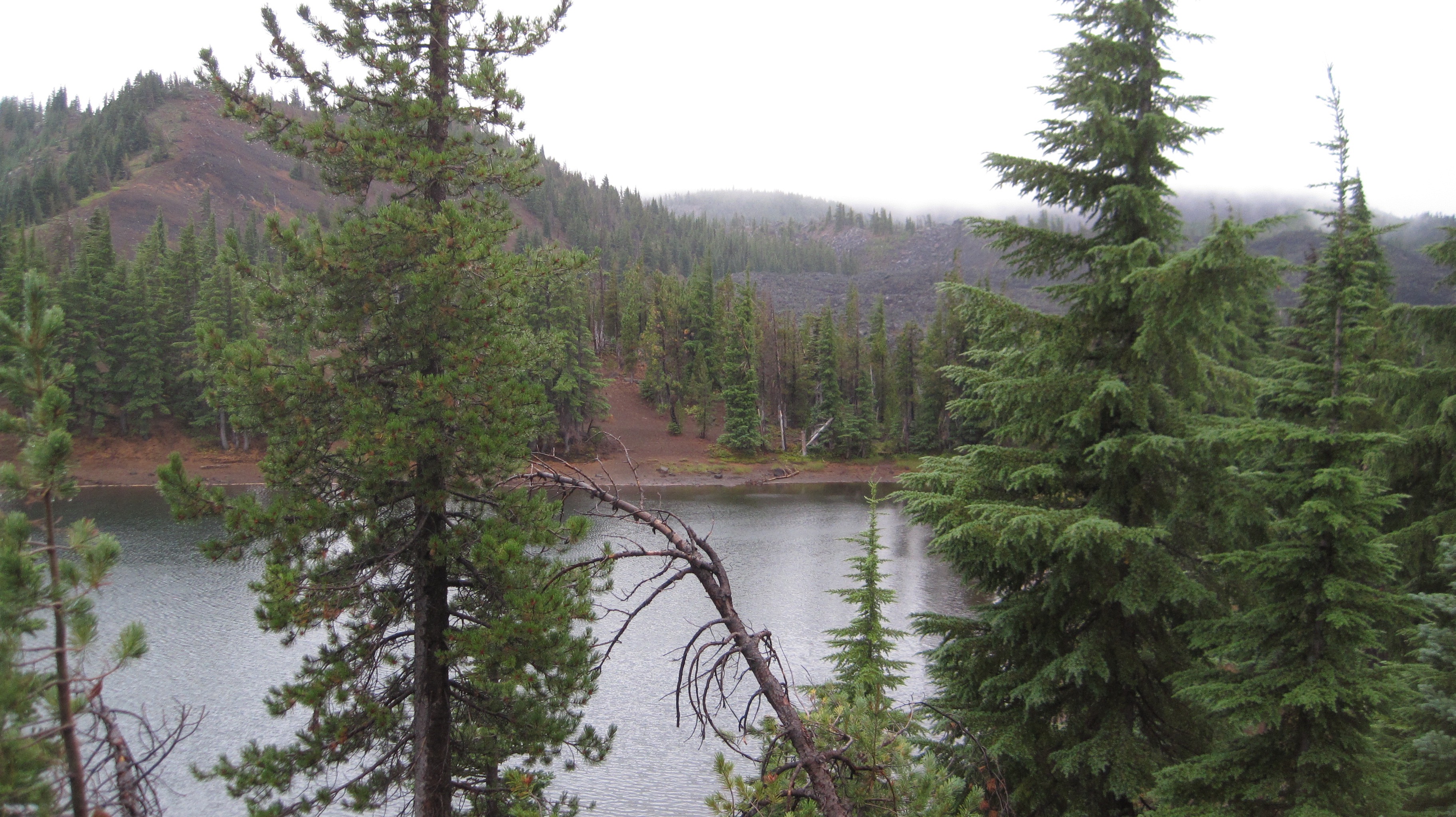 The next morning was drippy and low clouds blew over the treetops. Later that morning we hiked out the last 3 miles. As we approached the Lava Camp trailhead the sky offered us some brief patches of blue. We ended our day with each other clinking together mugs of trail coffee in honor of a good trip.
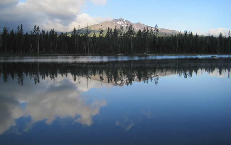 A glorious view from Diamond View Lake. The clouds at the left of the image produced some amazing lightning and thunder that afternoon.
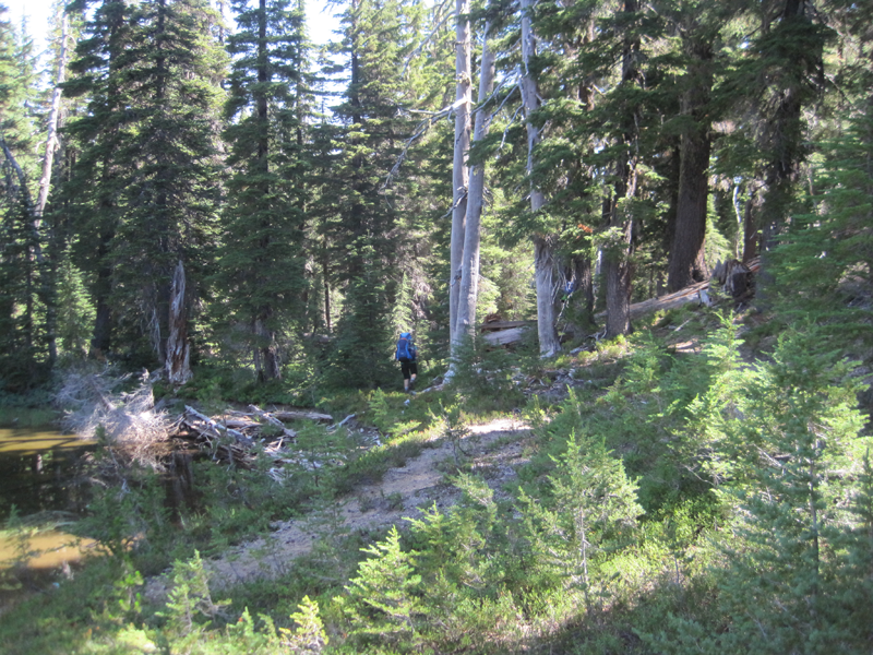 The trail got a little hard to follow at one point and we had to bushwhack.
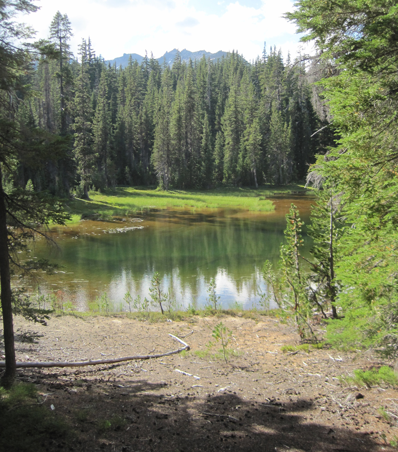 A little lake where we stopped for a rest, only to stay for the night. Water was scarce in the area and the lake provided a great location for watching wildlife and hearing even more wildlife during the nighttime.
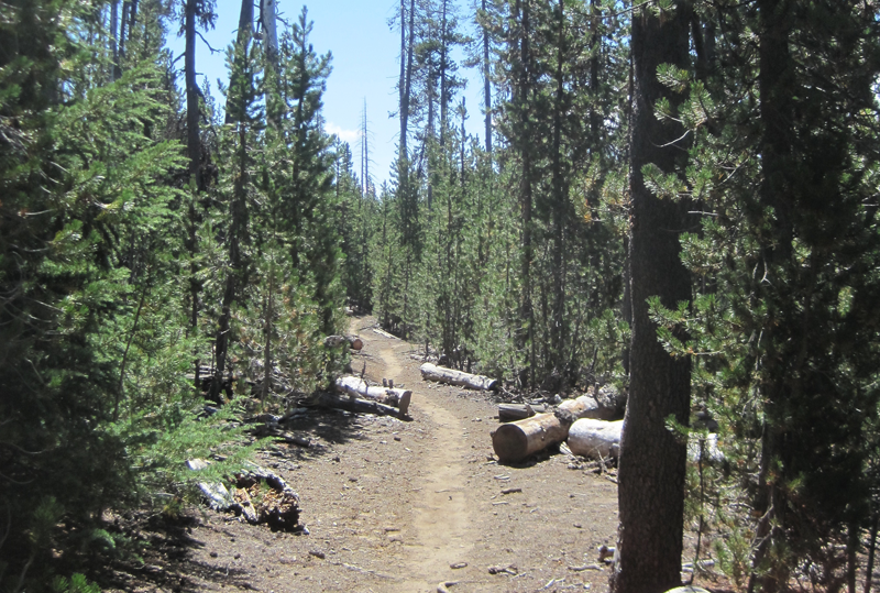 A very dusty path. This trail was well worn because of the number of PCT hikers that we met, many had been side-tracked to a lower elevation because of the lack of water on the main PCT.
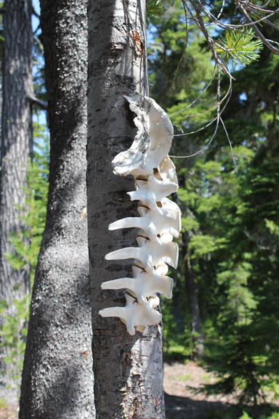 Wow! You find lots of cool things on the trail.
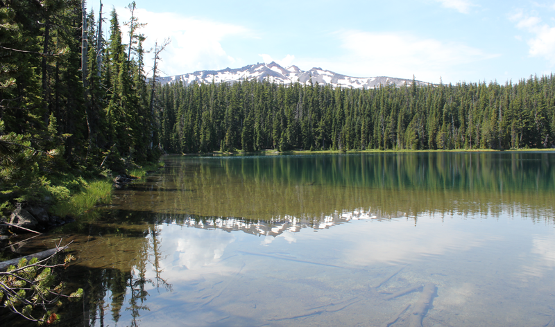 Standing at the outflow of Yoran Lake looking south to Diamond Peak. After a break, we bushwhacked about half a mile to the PCT to loopback.
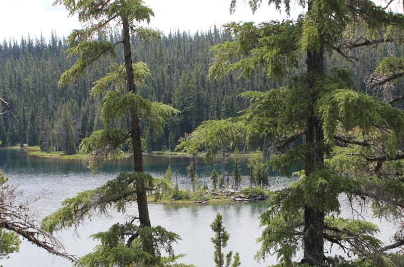 A small island on Yoran Lake.
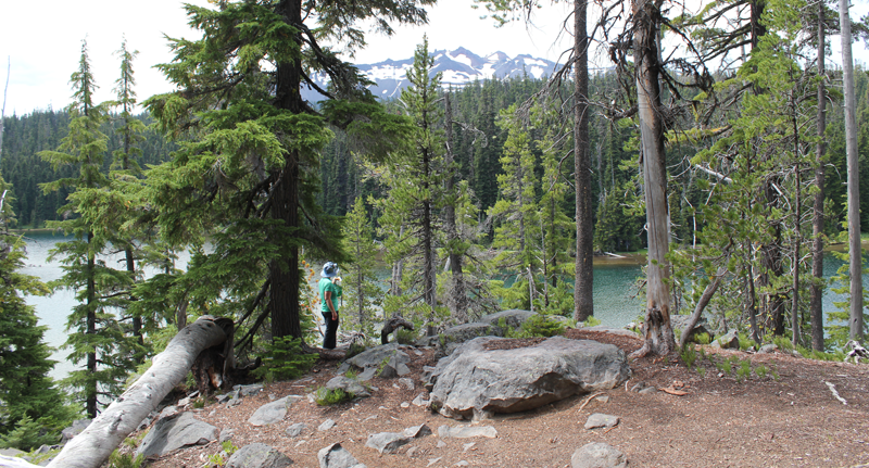 Enjoying some lunch while scouting out a great campsite.