Trip Report: Group Leader: Mark Hougardy | Organization: Eugene-based hiking group | Date: late-June 2022 | Duration: 3 days | Hiking Distance: 9 miles | Participants: 5 | Type: Hiking & Tent Camping
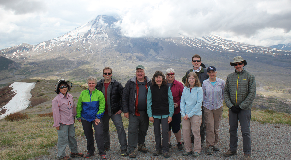
This trip was to visit the southeast side of Mount St. Helens, in Washington State.
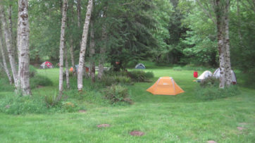
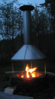
Day 1: The group arrived and we had time to explore the quiet tent-only campground and some local trails near Cougar, Washington. We had dinner, talked around the campfire, and some stayed out close to 10 pm as the mid-summer sun stayed long into the evening sky.
Having lunch at Lava Canyon.
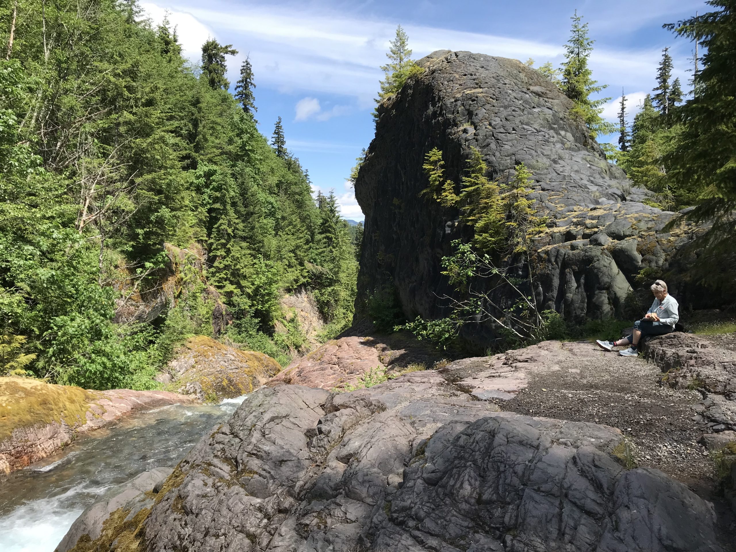
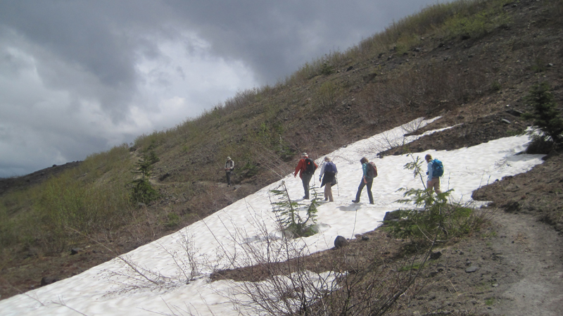
The morning of Day 2 began with birds blasting the campground with calls at about 4:30 am! The group had a relaxed morning, though several commented they had not slept well that night. Possibly this was related to being tired, or we were talking, but while driving to the hiking area we missed a turn-off and went the expected distance down a road to realize we needed to backtrack. This delay caused us to start about an hour and a half late. Driving back, we learned there was a significant absence of Forest Service signage in the area related to general features like river crossings, sights, overlooks, etc. We finally made our destination of Lava Canyon and hiked around the upper trail area. Prior to the trip, we knew the suspension bridge was out of commission, though we had hoped to hike downstream to the Ship Rock area, sadly this trail was also closed. Hiking back, we crossed over the main footbridge and ate lunch overlooking the beautiful glacial-blue Muddy River. Leaving, we made a stop at the bridge overlooking the 1980 lahar flow with Mount St. Helens looming in the background.
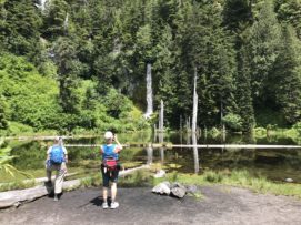
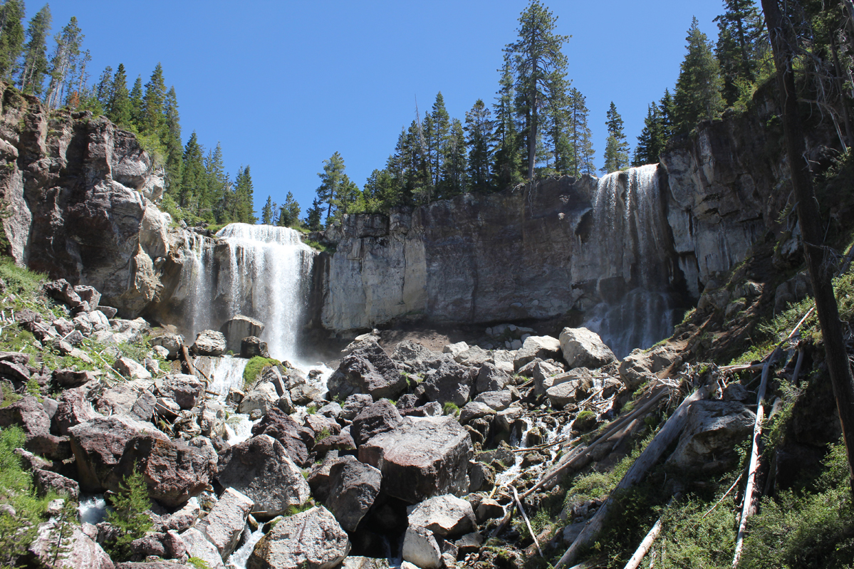
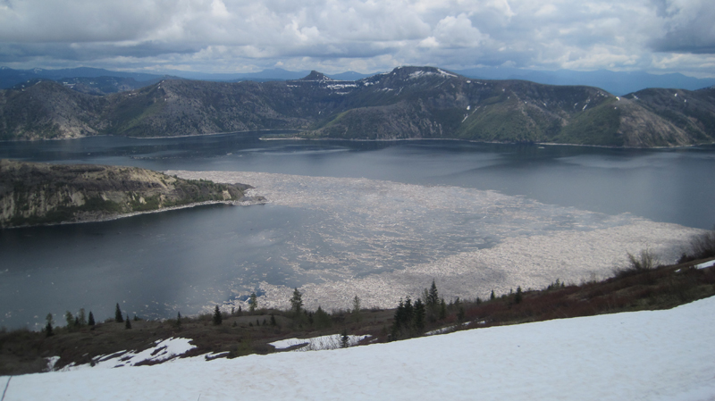
Viewing the waterfall at June Lake.
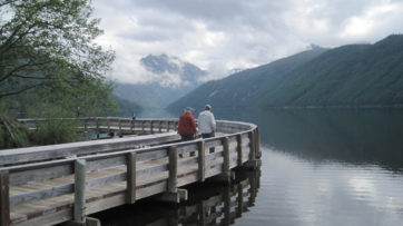
We drove to the June Lake parking area and began our hike to June Lake. The plan had been to continue to Chocolate Falls for a 5-mile loop, but about 2 miles into the trip the leader made the call to stop the hike soon after June Lake. This was an unhappy call to make but hopefully avoided an injury. Driving back to camp, we located where the earlier signage mistake had been made – a sign had been misinterpreted. We also visited the Ape Cave turnoff to better know where to go the following morning and we discovered the sign along the road identifying the turn for Ape Cave was completely missing! Finding the turn, we stopped for 20 minutes at the Trail of Two Forests Interpretive Site where a 2,000-year-old lava flow from Mount St. Helens ran through the forest, around trees, solidifying around the trunks and leaving tree wells. The group ended our day back at the campground and had an early evening.
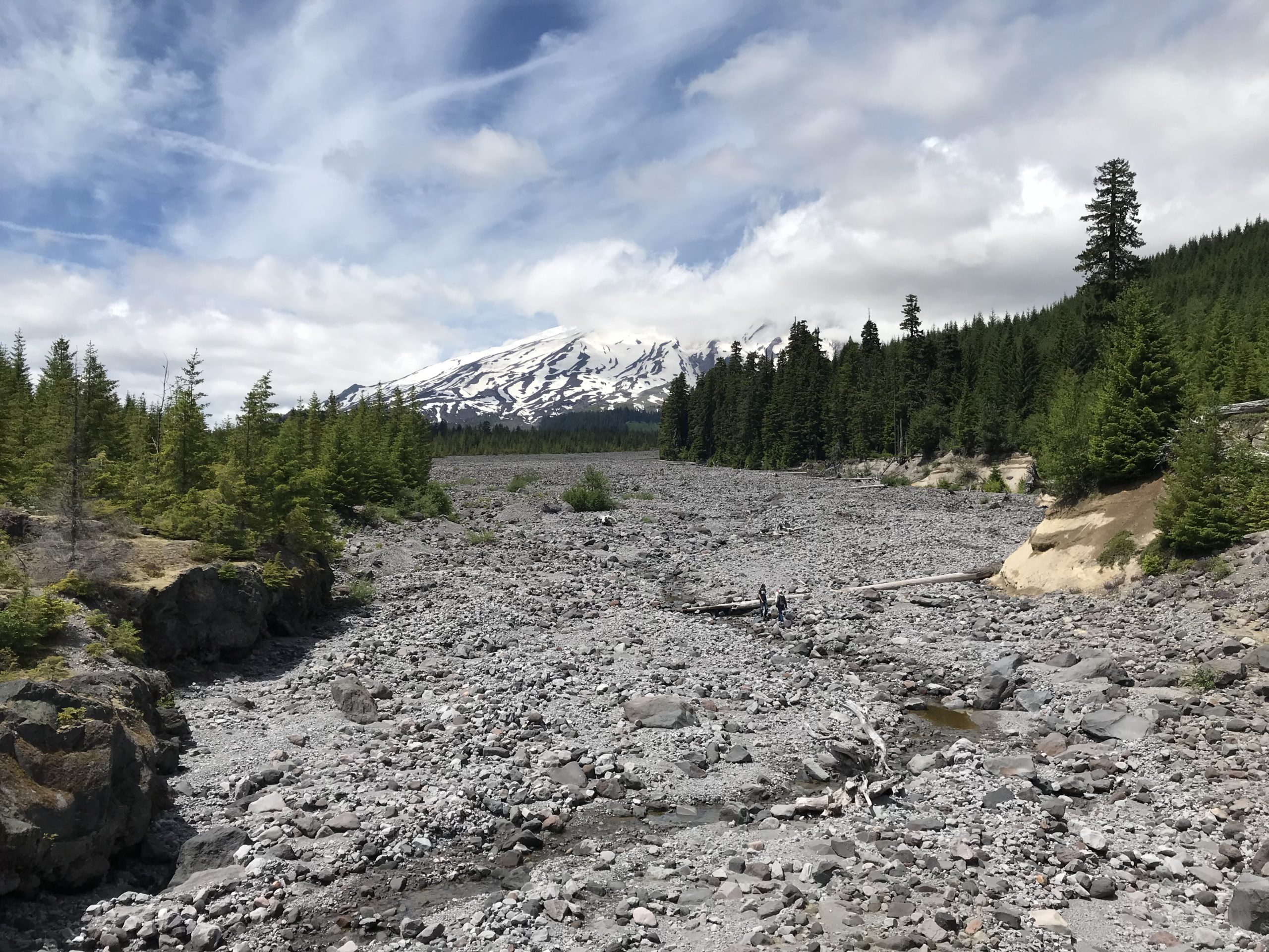
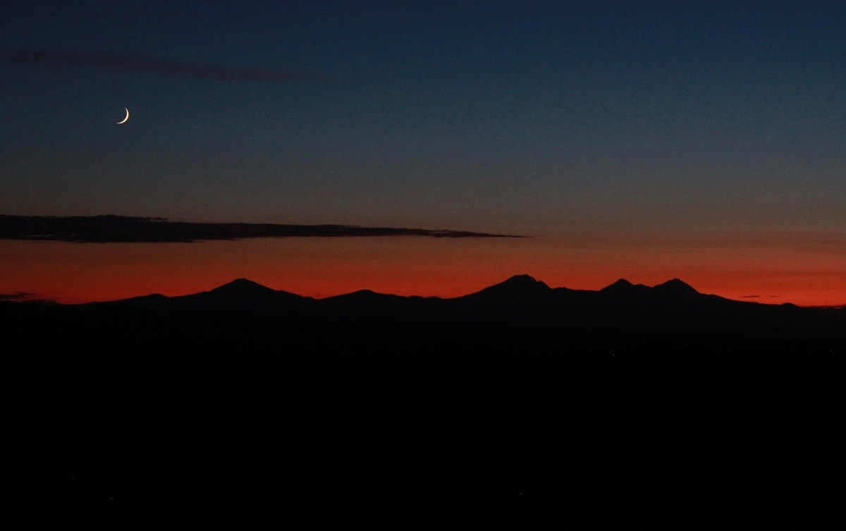
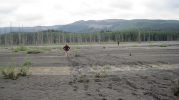
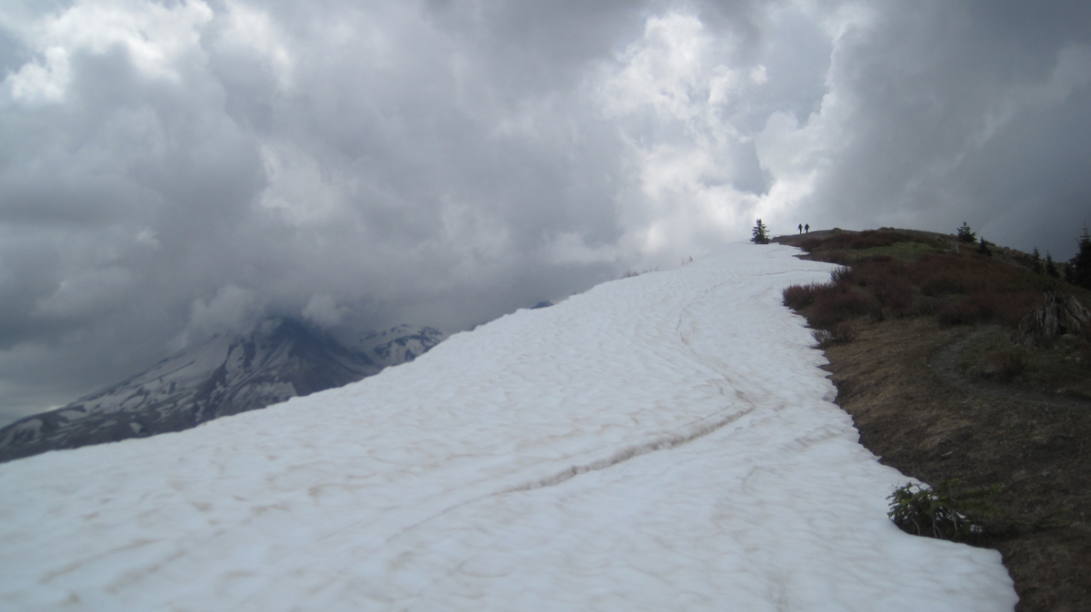
Looking up the lahar, Mount St. Helens is in distance. For scale, note the people walking in the lahar.
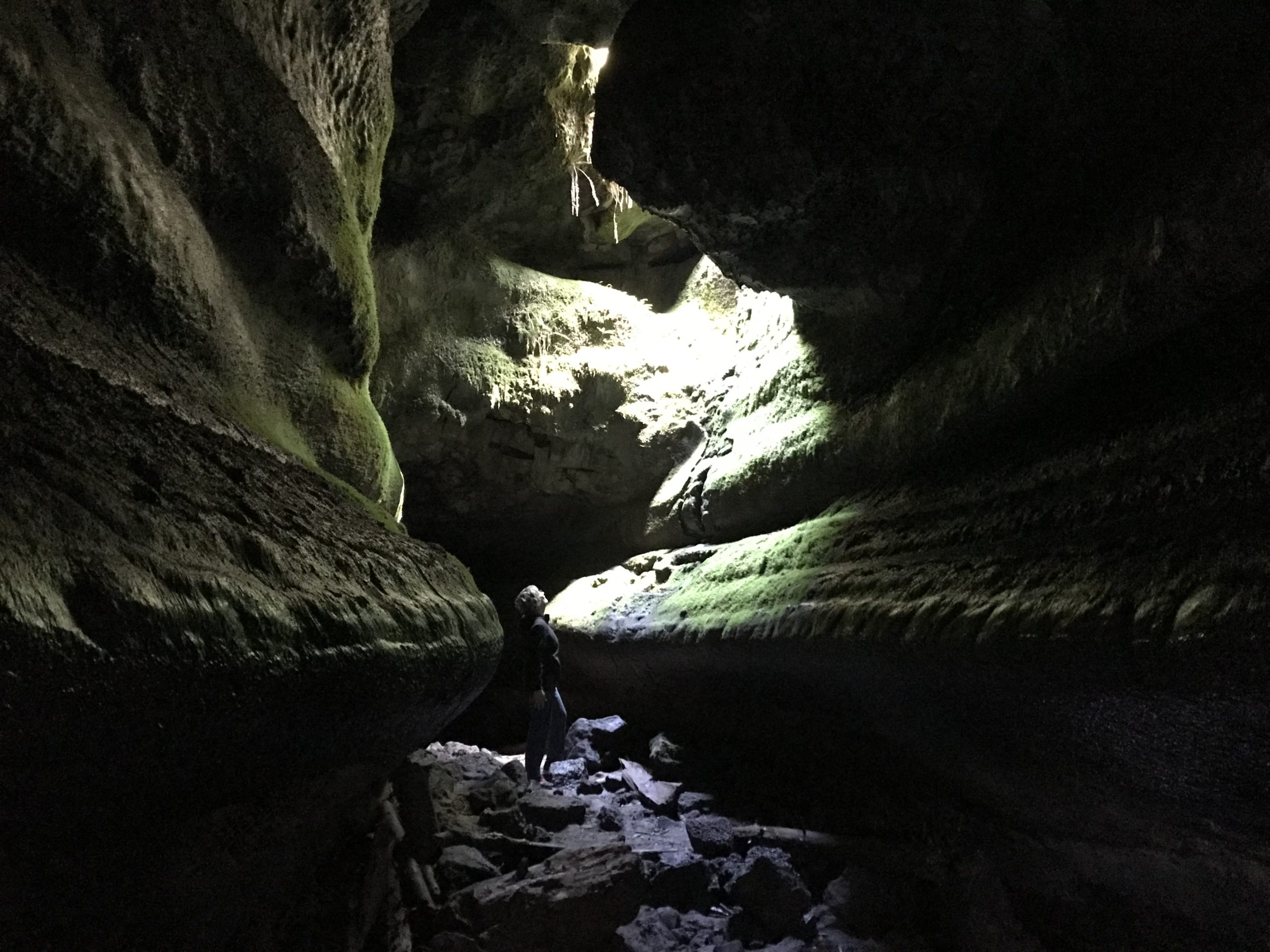
On the final day, we departed camp at 8:45 am and visited Ape Cave for our 9-9:30 am time slot to arrive. We parked in a lower lot as the official signage in the area was poor and did not direct us to the upper lot. Finally, we began our adventure up the difficult 1.5-mile upper cave route. Progress was slow as there was a significant amount of bouldering across rock falls, several tight places, and a harder-than-it-sounds narrow 8-foot wall that had to be scaled. There were a few scraped knees, but the group arrived at the end of the lava tube; our completion time was 2 hours and 15 minutes. We walked 1.5 miles back to the visitor center through the forest for farewells and then drove back to Eugene. We had hoped to get ahead of any surge related to the Fourth of July weekend holiday traffic but still managed to hit bumper-to-bumper traffic through Portland, making drive time from Ape Cave to Eugene 4 hours.
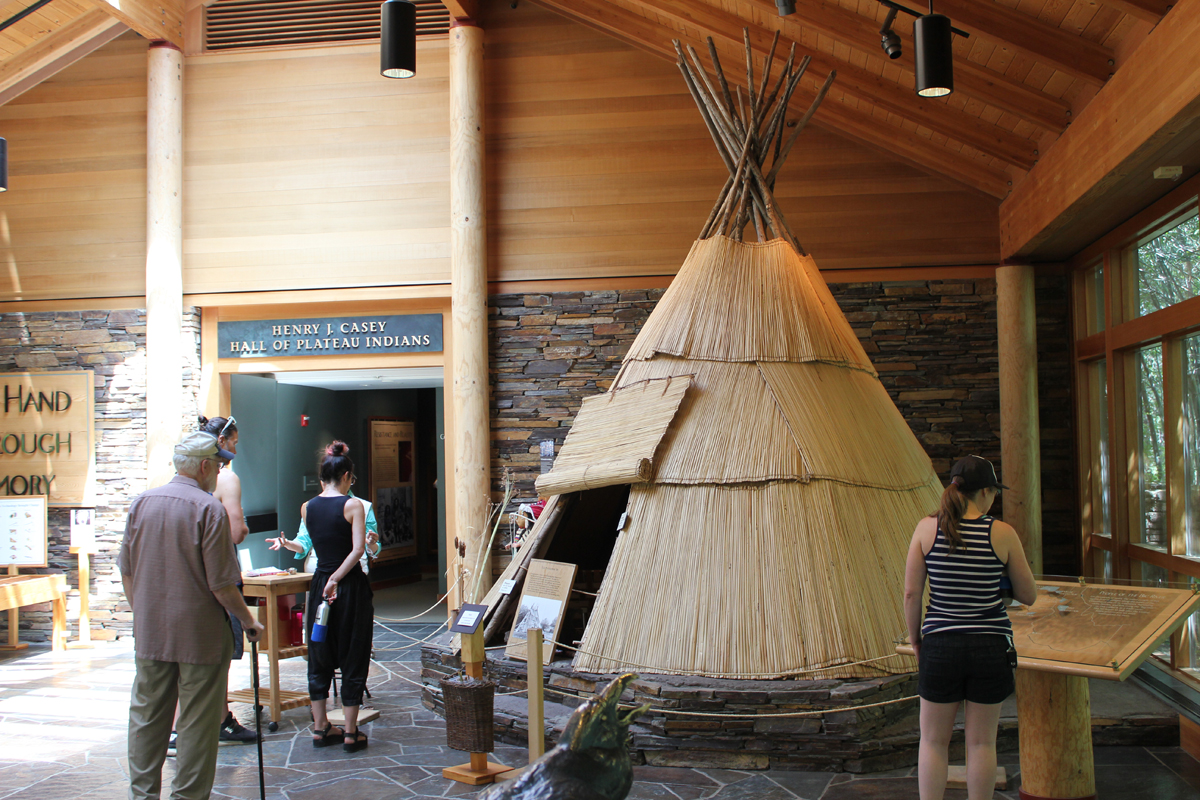
Our 4-day trip to learn more about central Oregon’s historic past started with a call from the interpretive ranger at Fort Rock. The 100-degree heatwave hitting the region was the cause for canceling our visit to the Fort Rock Cave for safety concerns and the threat of extreme fire danger. The cave is a significant archaeological site where shoes dating back 10,000 years were discovered and public entry is limited to just a handful of people each year. Sadly, but understandably, we were not able to visit the cave and I had to amend our trip to Oregon’s high desert on the fly. Fortunately, everything worked out. [Here is a link to a later visit to Fort Rock Cave.]
Trip Report:
Volunteer Leader: Mark Hougardy | Organization: Eugene-based Hiking Club | Date: July 2018 | Duration: 4 days | Participants: 7 | Type: A 4-day exploration of central Oregon’s rich cultural heritage, dynamic geology, and the majestic night sky. Car camping, hiking, and lots of open space.
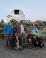
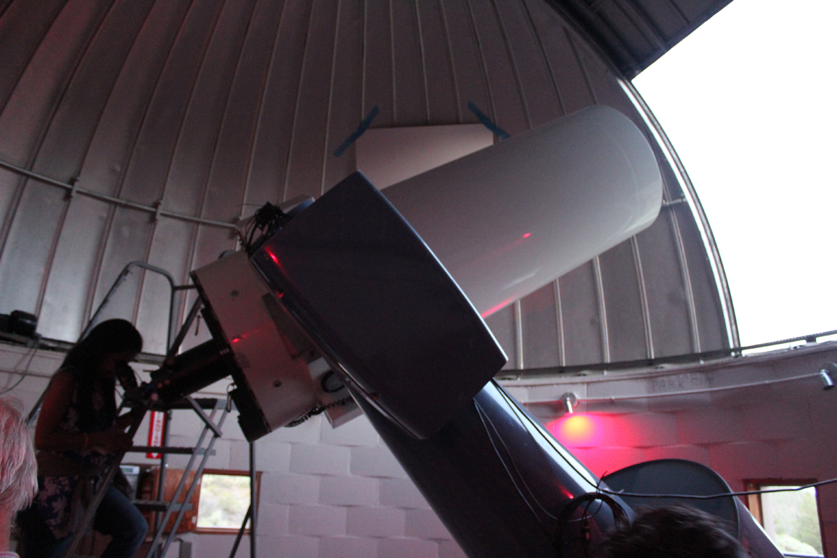
Group photo at the Pine Mountain Observatory. The red lights are easier on the eyes when working around astronomical equipment.
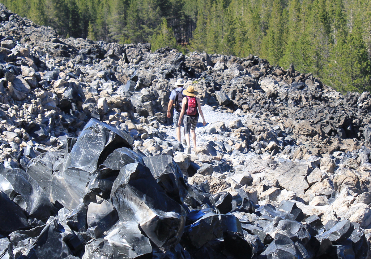
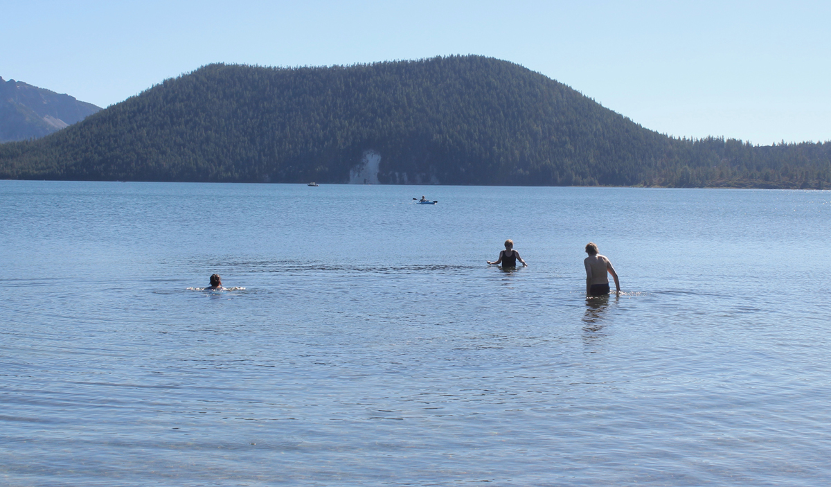
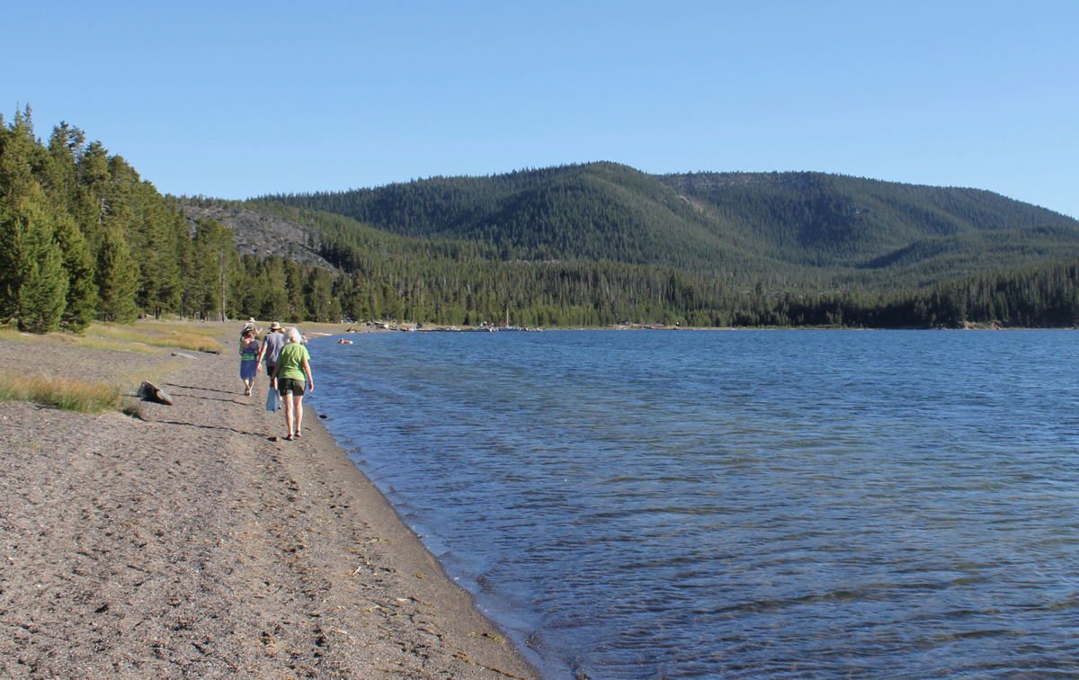
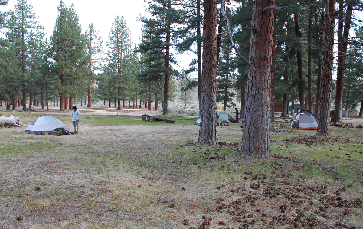
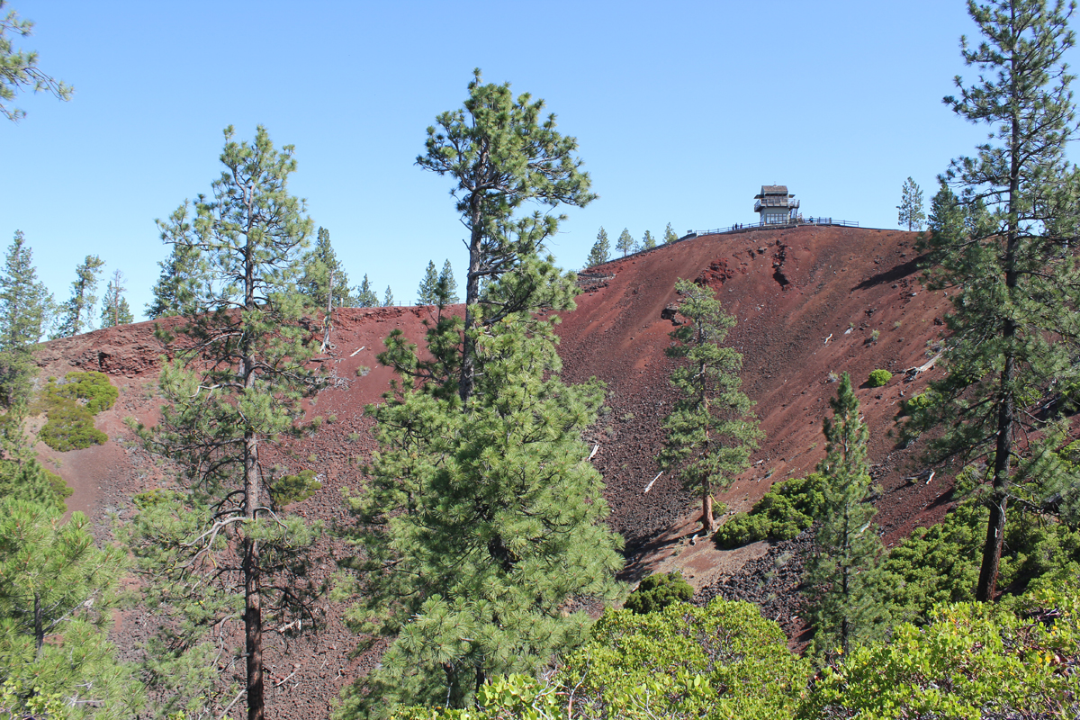
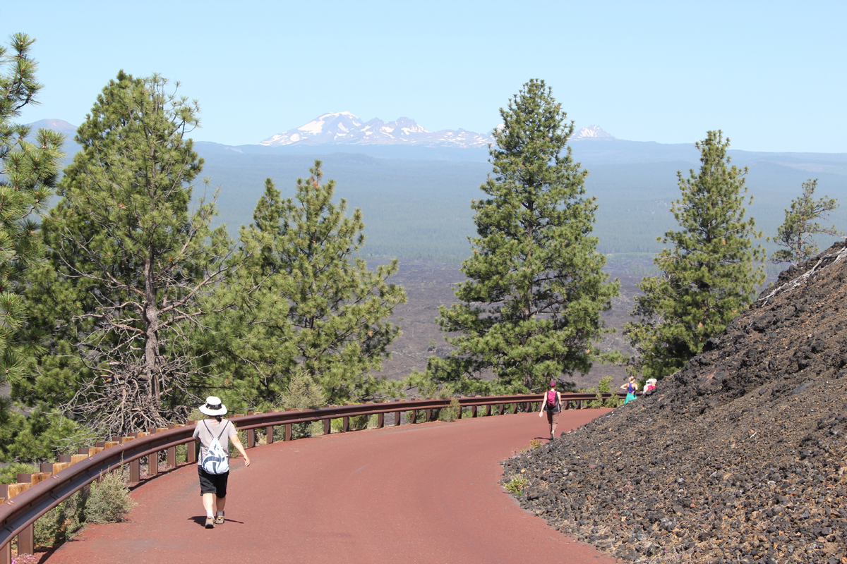
On our first day, we arrived at the massive caldera located in the heart of the Newberry National Volcanic Monument. We visited the double 80-foot Paulina Falls and ate lunch overlooking the stream. We located two adjoining campsites on the picturesque East Lake, and just in time as the park was busy. In the afternoon we hiked the impressive Obsidian Flow trail, a massive flow of volcanic glass and pumice 17 stories tall. Returning to camp we enjoyed a swim in the cool and clear waters of East Lake. Afterward, we hiked on the beach to the local resort and were reminded of the subtle, yet abrasive qualities of volcanic glass on the feet. At the lodge, we enjoyed a delicious meal and had some good laughs with the staff. The radio in the background was playing a tribute to Tom Petty. We walked about a mile back to camp. That night we listened to acapella hymnals from a Mennonite group camping nearby.
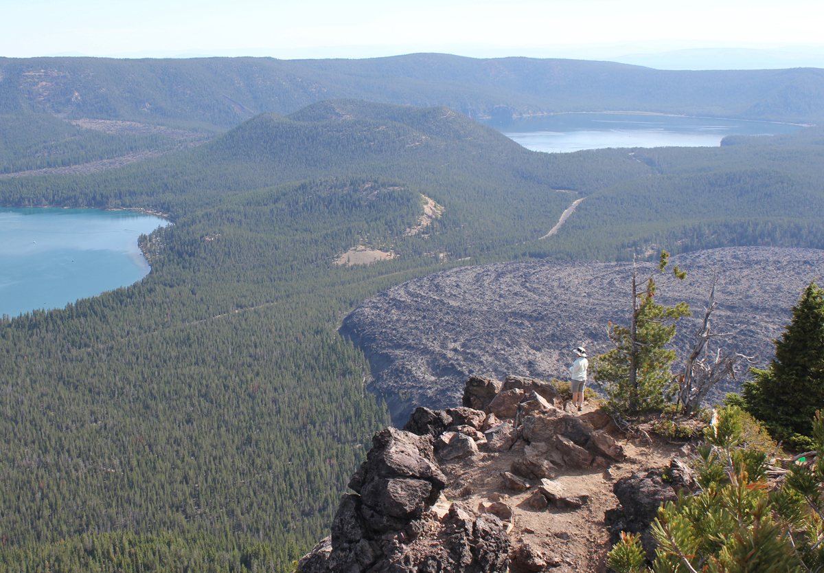
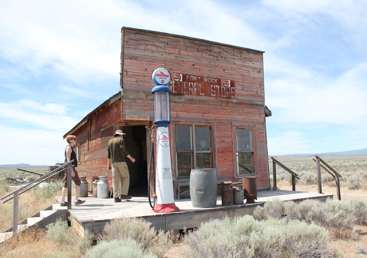
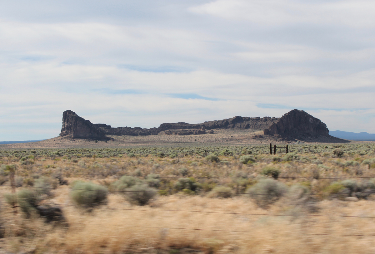
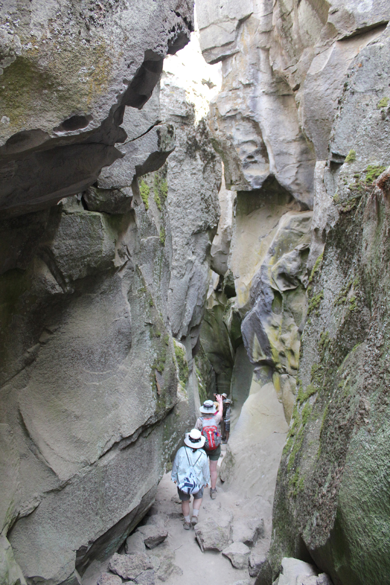
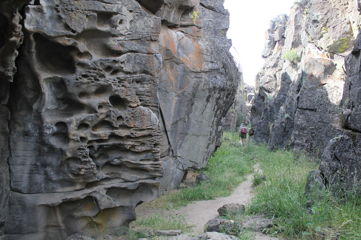
On day two we drove to the top of Paulina Peak. The peak is 7,984 feet and sits in the middle of Oregon. The views are impressive; to the north, we could see the massive stratovolcano, Mount Hood, then down the spine of the Cascades to the steep-sided Mount McLoughlin close to the California border – a distance of about 300 miles! To our south was our next stop, the iconic shaped Fort Rock, a volcanic landmark named for the tall fort-like walls. We left Paulina Peak and drove for about an hour. Our first stop was the Fort Rock Homestead Museum, an open-air collection of historic structures. This is where I learned about a shortcut of a backroad to Derrick Cave, a remote lava tube that we had hoped to visit. Apparently, the private landowner had closed the shortcut because visitors were not closing a gate and his cows were escaping. The alternate route would have involved about a 50-mile detour on forest and back roads. This was tabled until another visit. Our next stop was the massive Fort Rock a horseshoe-shaped tuff ring that rises 300 feet over the surrounding flat landscape. We hiked for about an hour in the heat then drove to the town of Christmas Valley for ice. We continue on a short distance to Crack in the Ground, a 2-mile-long tension fracture where we could hike and scramble over boulders about 30 feet underground. The temperature at the surface was 95 degrees, in the fissure it was a comfortable 70 degrees with some pockets of air in the lowest sections that were very chilling. Late that afternoon we stayed at the Rockhorse Ranch where we pitched our tents and gleefully enjoyed their shower! A celebrity at the ranch’s store was a black cat named, “Scratchy.”
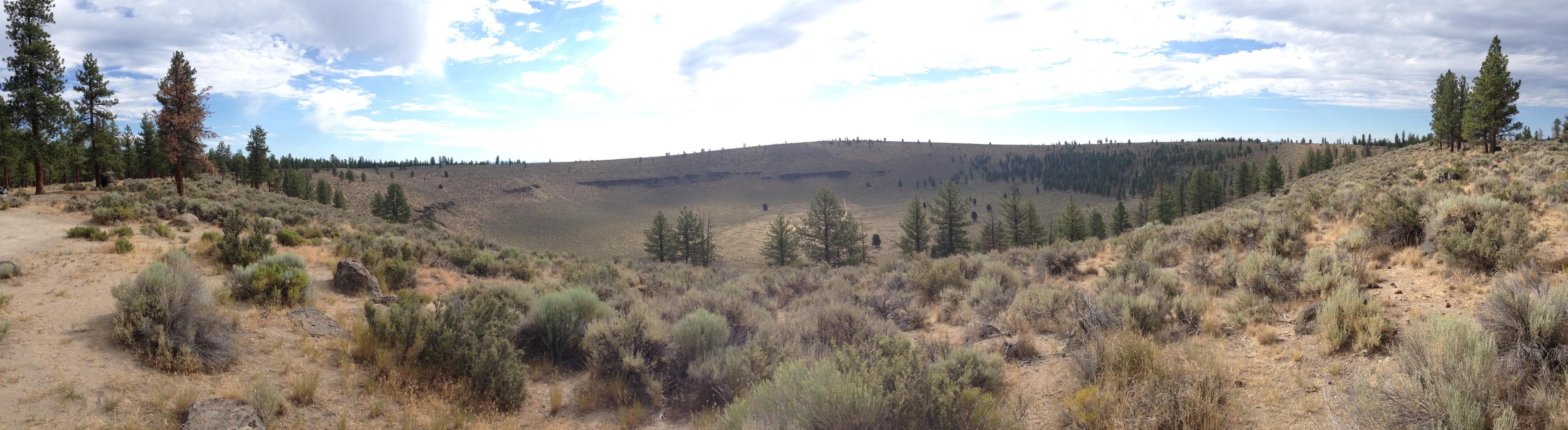
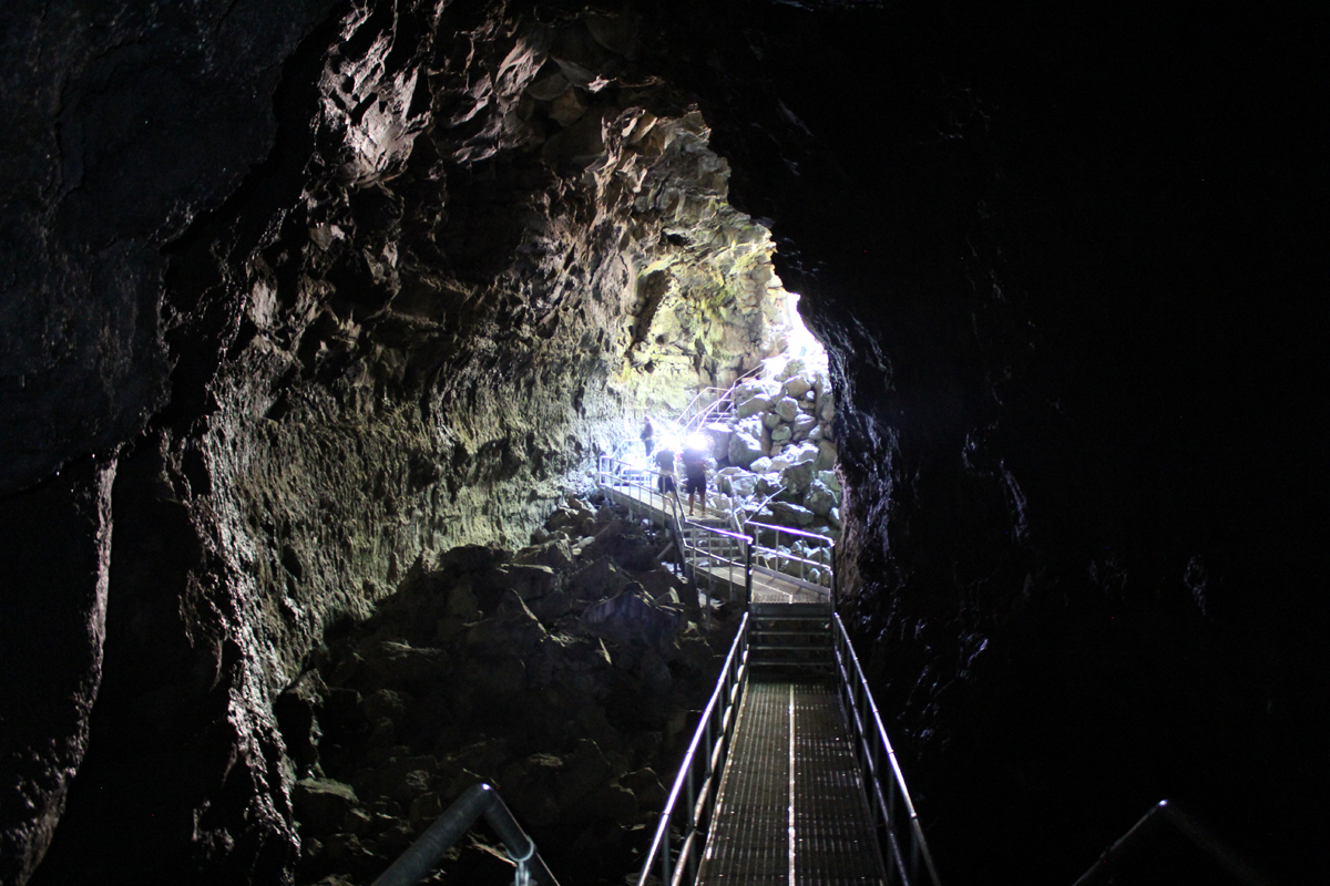
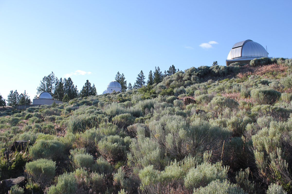
On day three we drove a short distance to Hole in the Ground, a crater that is a mile wide and 500 feet deep. Once thought to be a meteor impact the formation was actually caused by magma contacting groundwater. The resulting flash (there were many over the millennia) formed the massive hole we see today. The steep hike down the side was dusty and the walk up the forest service road was blazing hot. Near the end of our hike, three cars zipped up the road in a cloud of thick dust. The vehicles looked as though they were from the set of a Mad Max movie. The last car to pass was missing the driver-side door; the driver was wearing thick goggles. The rag-tag group waved as they passed. These were participants in the Gambler 500, a navigational adventure for cars whose value is no more than $500. Later that day we visited the High Desert Museum for a closer look at the cultural and natural history of the region, and we explored by flashlight the 1-mile-long Lava River Cave, the longest continuous lava tube in Oregon. The cave was a welcome 42 degrees! As the sun lowered in the sky we made our way about 30 miles east of Bend to the Pine Mountain Observatory, an astronomical observatory operated by the University of Oregon. The center sits near the top of Pine Mountain at an elevation of 6,509 feet. We made camp, ate dinner, watched the sunset, and enjoyed the various telescopes of the facility. There were close-up views of Jupiter, Saturn, Venus, Mars, nebulae, globular clusters, and various astronomy talks from UO instructors. Most impressive was a view of Jupiter and several moons through the 24-inch scope.
The final morning we woke up hearing a chorus of cows in the distance. We made our way off the mountain appreciating the drastic change in terrain from pines to the open high desert. We took a shortcut around Bend and stopped at the Lava Lands Visitor Center where we explored the 500-foot tall Lava Butte that has commanding views of central Oregon’s volcanic story before returning home.
The High Cascades in Oregon is beautiful. While much of this chiseled landscape can be viewed at a distance by zipping around in a car, it is best experienced moving at the speed of human – on foot. By hiking, you can appreciate this terrain using all your senses and see it not as entertainment, but as a necessity. Below is an eight-day account of a 100-mile northbound section hike on the PCT from the dry Santiam Pass to the windswept Timberline Lodge on Mount Hood. This hike was powered by a whole-food plant-based (vegan) diet.
Day 1: Santiam Pass to Wasco Lake (10 Miles)
A view of the Santiam Pass trailhead, mile number 2006.9 on the PCT. As my wife and I gathered our gear, we met two sixty-something ladies that started at Crater Lake for a section hike several weeks earlier. These women had already hiked about 175 miles.
The weather was beautiful – if a bit warm – that morning. We were joined by two friends, Jack and Cindy, who drove us to the trailhead and then hiked with us for the first five miles of our journey.
A view of the north side of Three Fingered Jack, a jagged and rugged mountain in the High Cascades that has banded stripes. A PCT thru-hiker stands in the foreground. He was one of about 25 who passed us that day; the oldest being somewhere in her 60s, the youngest about 18, and about half of the thru-hikers were female.
Near the end of our first day, we took a steep side-trail from Minto Pass to Wasco Lake and set up camp. As dusk fell, the sky was pink from a far-away fire. That night elk, frogs, and ducks made noises around our campsite.
Day 2: Wasco Lake to Shale Lake (12 Miles)
A view of Wasco Lake the following morning at about 7 am.
We enjoyed a mid-morning break on the shores of Rockpile Lake. Several thru-hikers can be seen on the trail at the left. The two women we met a day earlier enjoyed their lunch and a quick swim on the opposite side of the lake.
Much of our day was spent walking through woods that had been burned several years earlier and were now recovering. In the distance, the peak of Mount Jefferson made frequent and teasing appearances.
That evening we camped at Shale Lake and enjoyed an amazing view of the south side of Mount Jefferson. We ate our dinner and watched the evening light blanket the slopes of this iconic High Cascades peak.
Day 3: Shale Lake to Jefferson Park (12 Miles)
Looking upon a picturesque view of Pamelia Lake from the PCT. This area is a limited entry zone requiring a permit to camp. Our hike that morning was in the forest where we encountered some sizeable old growth trees, and at one point we rounded a corner and surprised a grouse.
Milk Creek has cut a 100-foot deep gorge into the slopes of Mount Jefferson. Several backpackers are seen crossing the creek below us.
Overgrown and green, this is what the trail looked like for the rest of the afternoon. It was also humid and hot, making our progress slower than expected. Occasionally, we would see glimpses of Mount Jefferson through the trees.
Russell Creek pours off the mountainside where it meets a “flat†area for about 100 feet before dropping into a deep gorge; this more level area is where the trail crosses. Earlier in the season, the flow can be very strong and this can be a dangerous crossing. Today, though, it just brought about some wet shoes. In this image, a hiker approaches the crossing area. We spoke with her later to find out that she was 18 and was hiking 250 miles of the PCT by herself.
In 2016, the Forest Service implemented a new permit system to camp in the stunningly beautiful Jefferson Park area. We did not have a permit and spent a good two hours looking for a walk-up site. The foresters had done an efficient job of decommissioning non-reserved sites; eventually, we found a single site near Russell Lake just as the sun was setting. We were asleep at 9 pm, which is considered “hiker’s midnight.”
Day 4: Jefferson Park to Ollalie Lake (12 Miles)
We enjoyed breakfast under this stunning skyline.
The next morning we climbed 1,200 feet out of Jefferson Park. The views were magnificent: wildflowers were in bloom along the trail, and at times it was hard to hear because of the abundance of buzzing coming off nearby flowers.
We reached the trail’s summit and could see Mount Hood in the distance. Descending the slope, we passed several snowfields. For several hours our progress was slow going because of the loose rocks, though the trail soon became forested and we passed a number of beautiful mountain lakes.
Late in the afternoon, we reached Ollalie Lake. Here is a view looking south across the area we just hiked, and in the distance is Mount Jefferson. About two dozen thru-hikers were staying at Ollalie Lake to rest.
We met some new friends at Ollalie Lake:
Darren and Sandy had hiked continuously for 4 months. They were also world travelers that raised geography education awareness by sharing information with students about the places they visit. Their travels can be seen at their site: trekkingtheplanet.net.
Franziska and her family had hiked for 2+ weeks and 100 miles on the PCT, the youngest of her group being her eight-year-old brother! Franziska is the founder of hikeoregon.net.
Ollalie Lake has a small store where my wife and I eagerly purchased a bag of sea salt and vinegar potato chips and promptly devoured the entire bag. At one point there were a whopping total of eight stinky hikers in that little store – ah, the aroma of humanity!
Day 5: Ollalie Lake to the Warm Springs Area (14 Miles)
The trail on day five was mostly flat and in the shade of tall trees, making trekking much easier. The forest was drier in this region and water was less abundant than before. When the opportunity presented itself, we filled up our bottles at a small, tranquil trailside spring. The temperature that day was especially warm.
We arrived at Trooper Springs near the Lemiti Marsh area. This was our last water for about twelve miles. The spring was a welcome site although a small and precarious platform needed repair. We were attacked by horseflies; they were numerous, aggressive, and very persistent. Needless to say, we did not stay long.
Taking care of some much-needed laundry at the spring using the “Ziplock spin cycle” washing method.
Walking through a clearcut was a stark contrast to the lush forest we had seen all day. Near this area, we found the strangest price of trash on the trip: a Howard Johnson’s hotel key card lying next to the trail. We picked it up.
We located a bare spot at the edge of the trail and camped for the night. Trailside camping can look messy, but everything goes back into the pack and we always leave the site cleaner than we found it.
Day 6: Warm Springs Area to Timothy Lake (18 Miles)
We were up early that morning to hike six miles to the next water at the Warm Springs River.
Shown is an old style PCT trail marker that we found, one of the few older versions that we saw on the entire trip.
Crossing the Warm Springs River. It was more a small creek at this point, but the water the clean and cold – a welcome site.
As I took off my shoes I realized just how dusty the trail was that day.
That evening we stealth camped near the trail close to Timothy Lake. During the night we unzipped the tent for a “nature break” – only to be scolded by an owl that repeatedly whooo’d at us until we went back to bed.
Day 7: Timothy Lake to Frog Lake (11 Miles)
The next morning was slow; we woke up late, and it seemed to take forever to get moving. We found a quiet site on the shoreline of Timothy Lake to we rest, take care of some laundry, and enjoy the sun for a couple of hours before continuing.
Several miles down the trail was Crater Creek, a beautiful riparian area with some astonishingly cold water: a welcome find on a hot day. We soaked our feet, took a twenty-second dip (the water was that frigid), then soaked our shirts and put them on as a natural air-conditioner. We made a stop at Little Crater Lake, the source of the creek. Little Crater Lake is astonishingly blue like it’s larger cousin, but this was not volcanic in origin. Rather, this was a large artesian well. Continuing down the trail, we passed a gravel forest service road and found a bag hanging on PCT post. Inside were some small apples or Asian pears – some unexpected trail magic in the middle of nowhere.
This was our first view of Mount Hood after about 40 miles of hiking – what a fantastic sight.
We took a side trail to Frog Lake for some water where there was a hand pump that drew water from a well. As we entered the campground we were momentary celebrities answering questions like: “Where did you hike from?†“How many days have you been out?†“Tell me about your gear?†etc. It was an odd but welcome feeling. That night, we camped just outside the campground on a forest road.
Day 8: Frog Lake to Timberline Lodge (11 Miles)
The next morning, we stopped back in at the campground for some water and said goodbye to our new fans. A girl pulled up on her bike. “Good luck!†she exclaimed, and even a “Thanks for being so inspiring” from an adult. It felt good to hear, but the truly inspirational folks were the PCT thru-hikers who had hiked 2,663 miles and spent six months on the trail.
We made good time that day ascending Mount Hood: 5.5 miles in two hours with a significant elevation gain; we were getting our hiking legs.
Finally, the green of the trees turned to open space and vistas as we passed the timberline. It was windy with twenty to thirty mile an hour gusts that kicked up sand and dust. We wore our sunglasses to keep volcanic grit out of our eyes.
There was an abundance of mountain flowers on the trail.
Close to the Timberline Lodge, the views were fantastic! We could see much of the route that we had spent the past week traversing.
We arrived at the Timberline Lodge, mile 2107.3 on the PCT, and 100 miles from our starting point at Santiam Pass. Inside the lodge, scores of thru-hikers had taken refuge in the common areas. There was access to food and good company, with couches for sleeping and a warm fire to enjoy in the evening. We met some new friends here: Shepherd, Snow, Lonestar, and Patch, all thru-hikers who started at the Mexican border and were resting before their final push into Washington State and Canada.
Looking through the door at the Timberline Lodge onto the Roosevelt Terrace: in the distance Jefferson Peak, and behind it, Three Fingered Jack and Santiam Pass. From the lodge, we were able to take public transit back home.
Trip Report:
Volunteer Leader: Mark Hougardy | Date: June 12, 2016 | Duration: 3 Days
Participants: 10 | Group: Eugene-based Hiking Club | Hiking 5 miles (1,000-foot elevation loss/gain) | Type: Day Hike and Camping
On this trip, Mother Nature reminded our group of nine that she is always in control, and she reminded two members of our group to remember the tent!
Our original itinerary had to be re-worked because of a late July storm, but the unusually cold weather added an extra element of adventure and excitement.
Everyone arrived in great spirits on Saturday, though we knew that rain was on the horizon. Unfortunately, two members of the group had – in their enthusiasm – unexpectedly left their tent at home. Undeterred by the unfortunate error they purchased a tent at the campground store – for a good deal of course! The skies that afternoon were clear and we made good use of the sun by hiking to Garfield Peak.
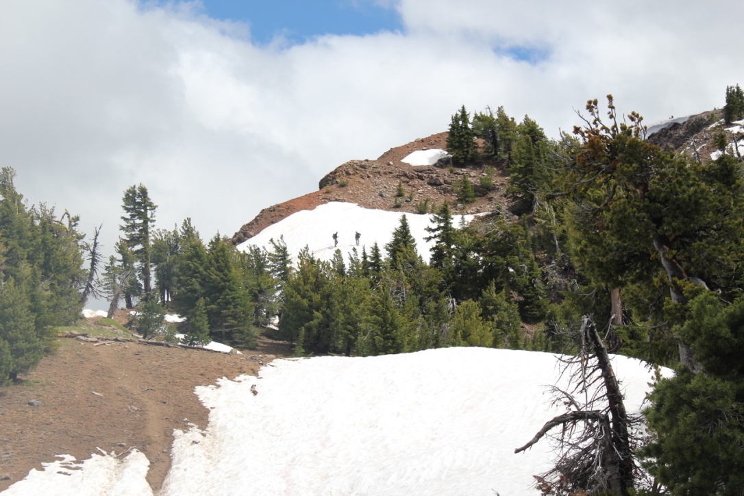
On the way, we encountered several snowfields, one of which was very steep, but the stunning views from the top were well worth the extra effort in getting there. In the distance, Mount Scott was enticingly clear of snow, though we later learned it was impossible to reach because several miles of the eastern rim highway was closed for repairs. Returning down the mountainside we visited the small loop trail of Godfrey Glen where we collected trash that uncaring visitors had left. We collected enough garbage to fill a large bag! That evening we sat around the campfire and commented on the number of stars that were visible, where was the rain? All was calm until 2 am when the rain arrived and temperatures lowered to just above freezing. Our two members in their “good deal†tent had a cold and wet night.
Sunday morning I looked out my tent and was excited to see full-bodied snowflakes quietly falling but they only lasted for a minute. Several early risers made a trip to the rim where 3-4 inches of snow had fallen the night before. All of us were off to a slow start that morning. The “good deal†tent had not fared well in the rain and when the drops were shaken off the outer cover a support bar snapped making the tent almost useless. For the entire day temperatures never ventured past the mid-thirties and at times the drippy rain became unrelenting torrents.
We explored the Visitor’s Center, the Sinnott Memorial Overlook (featuring an indoor exhibit room) and the gift shop to escape the fog, wind, rain, and occasional snow flurries. The fog was so thick we could not see the lake or a few hundred feet in front of us. In the afternoon we moved below the cloud line to hike the picturesque Annie Creek trail. Although a short hike, it was very picturesque. Laurie and Brad had reservations at the Crater Lake Lodge for dinner, they generously increased their table size to include all of us so we could get out of the rain and have some warm food. About 8 pm that evening the sky cleared and at first, the temperatures seemed warm. The group campfire that evening had just half of the group, the remainder had gone to bed early. The two members in the “good deal†tent had another cold and memorable night. In the middle of the night I awoke and was stunned by the visibility of the night sky – there were thousands of stars! My tent thermometer showed that temperatures had dropped into the upper twenties.
On Monday the sun returned and the group broke camp, but before we did we waited anxiously for two members to return their “good deal†tent. The two walked stoically into the store and presented their tale of woe to a staff person when the person said “no refunds†the disheveled and muddy remains of the tent was plopped like a large wet sponge onto the counter for all to see. The act proved its point about the product’s poor quality. Their money was returned. Victorious that two of our members had saved their money (and dignity) we traveled to the rim where we hiked for several hours sightseeing and enjoying the views of Wizard Island. We tried to visit Watchman Peak but the trail was still heavy with snow and the area was closed. Although the sun was shining the temperatures remained in the mid-50s and the wind had a nippy bite, the group tabled Cleetwood Cove for another time, jumping in Crater Lake would be for another trip.
Crater Lake National Park in Oregon is spectacular to behold, but the park’s centerpiece, Wizard Island, truly enchants visitors.
Wizard Island is striking because it appears unreal, as though it was pulled from the pages of a fantasy novel, here’s how I might [poorly] describe such a mystical setting-
Seeing the island for the first time I could only describe this place as the dominion of a sorcerer, a fortress where he/she can perform incantations in solitude. The isle looks as though it was inspired by a familiar clothing item, something mundane and convenient – the magi’s hat; the island gently rises from all sides to a center point, the top appears mischievous as though the fabric has deliberately toppled to the far side. Surrounding the castle is a beguiling blue-colored lake, a gigantic moat that is miles across and terrifyingly deep! The island is fortified too; soldiers of green trees stand guard, expecting an attack from the water they are numerous near the shore, only to have their numbers fray at the ramparts. In the distance, immense cliffs stab into the sky creating an impenetrable wall of stone. The scene is inspiring, beautiful…serene. A cool wind gently blows past and whispers about the power of a hellish phantasm that was once unleashed and devoured a mountain, possibly of a battle between Gods. The island captivates the soul; its beauty too alluring, this grandeur too inspiring, the enchantment…too intoxicating. The wind’s gentle whisper beckons to visit, to explore this place – to walk in its magic.
The best part about Wizard Island is that it is not a fictional destination, this spellbinding place really can be explored, though your time on the island is limited to just a couple of hours.
Like most adventures, be flexible on your journey; while camping at the park I tried, for several days, to obtain tickets for the boat ride to Wizard Island. Unfortunately, weather concerns and mechanical problems caused delays. On the third day, the stars aligned and tickets were quickly in hand. After a quick scramble for gear, my family and some friends drove to the opposite side of the massive crater to the Cleetwood Cove parking lot.
The hike to Cleetwood Cove is a 1-mile long, 700-foot descent down the side of the crater.
At the water’s edge was our boat to Wizard Island, about 25 or so people boarded, then we were off.
What is most fascinating about the boat ride is the perspective – a view not fully appreciated from seeing Crater Lake from the rim. Being at the lake’s surface you feel like a small toy boat in a gigantic bathtub, it is an awe-inspiring method to better appreciate just how immense Crater Lake is-
The lake stretched beyond our boat in all directions, the crater’s oval shape is a massive 5-miles by 6-miles wide.
Below our boat, at the deepest point, was 1,943 feet of water – that’s equal to a 180-story building below us!
Around us the rim towered overhead, it ranged in height from 700 feet to 1,800 feet.
Most fascinating, this entire place literally went to hell about 7,700 years ago when the 12,000-foot Mount Mazama erupted – the eruption was 42 times greater than the eruption of Mount St. Helens in 1980*. Riding over the waves it is hard to imagine that the original mountain once stood 1 mile above us and a quarter mile below our tiny boat, and within the course of 2 violent days…completely disappeared in one eruption.
The eruption was recorded in Klamath Native American oral traditions; it tells of two Gods, Skell, and Llao who fought. It was their battle that caused the eruption of Mount Mazama and left many of the geographic features seen today.
Over time the volcano eventually settled down, though, in the process left behind several gigantic cones, which rise from the crater, several are underwater, the one above the water’s surface is Wizard Island.
The water of Crater Lake is from snowmelt – it is clear, pure, and cold! Its clarity allows light to penetrate to great depths, which absorbs longer rays of light (like red) while scattering and reflecting shorter rays (like blue). When we peer into the water we see these scattered/reflected blue shorter rays.
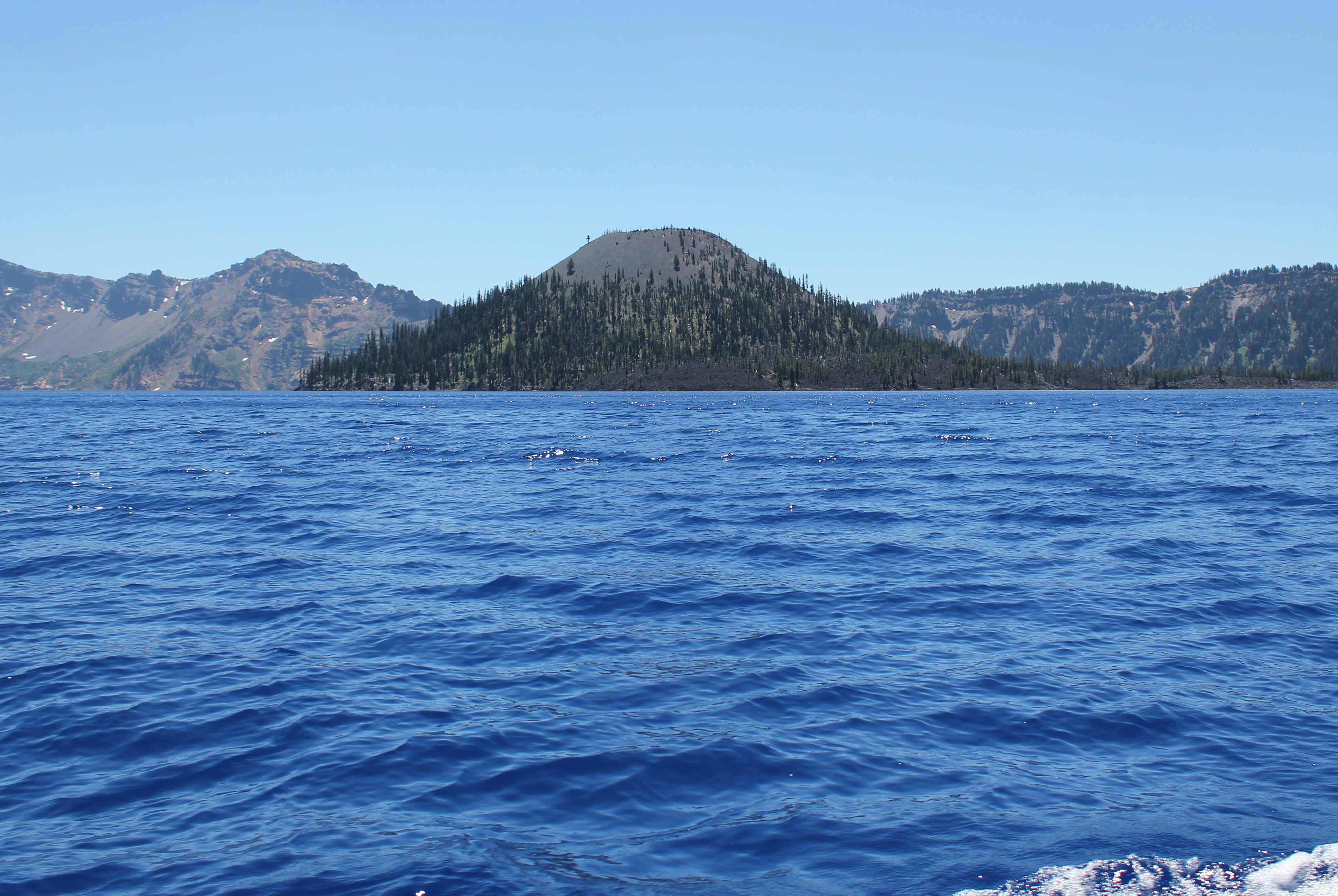
Approaching Wizard Island, even several miles away, is very impressive.
As the boat approaches Wizard Island the size and grandeur of this volcanic cone become apparent.
Hiking to the top of Wizard Island the trail climbs 760 feet, but this is nothing compared to the eastern rim of the crater which towers above me. In the photo, the Watchman scrapes the sky at 1840 feet above the lake’s surface. Seen between the trees, on the water (crossing Skell Channel) is a small white line, this is one of the boats that transport passengers to the island.
The views hiking to the top of Wizard Island are jaw-dropping.
Think of Wizard Island as a small volcano, and it has a crater; this picture shows several people hiking out. The rim of Crater Lake looms on the horizon.
This Ground Squirrel is a resident of Wizard Island. He was demanding a food tithe from me for visiting his island retreat.
A view from atop Wizard Island looking across Crater Lake to the opposite rim which is about 5 miles away. The blue color is just magnificent.
Hiking down the cinder cone we enjoy a rich tapestry of colors – a masterpiece painted by nature!
This is one of the few boats allowed on Crater Lake. It is seen here delivering visitors; this boat will take us on our return trip around the lake’s perimeter in a counterclockwise direction. Our next stop was the southern shore to see a slide area and the Phantom Ship.
The spires of the Phantom Ship, an island in the lake, which under low-light conditions resembles a ghost ship.
Looking into the water from the edge of the boat we saw this dramatic difference in color. The interpreter on the boat said the contrast was because we were passing over an underwater ledge, to the left the water depth was about 900 feet, to the right the depths plunged to 1,600 feet!
My kayak breezes over the surface of the aptly named “Clear Lake†in central Oregon. The lake bottom descends below me ten, twenty, thirty feet, yet I can still see features as though looking into an aquarium.
Each stroke of my paddle dips into the crystalline fluid and scoops out rounded orbs of glass-like liquid, I dip my hand into the water, the temperature is cold, somewhere around 40 degrees Fahrenheit. The lake is fed by mountain springs that course from deep within old lava flows; the water temperature stays a near constant throughout the year.
The sun had been hiding behind a cloud, but now bursts forth illuminating the lake. The clear water that surrounds me now becomes a turquoise pool. The green and the tan forested shoreline is reflected onto this gem-colored liquid. I cannot help but to stop paddling and just watch – immersed at the moment.
A number of Mallard ducks float next to my kayak, some are just a few feet away. One comes abreast to me and looks at me in the eye; he cocks his head as though wondering what kind of strange beast I might be. I can see his little legs moving underneath the water, churning like a miniature paddle wheel.
My kayak hugs a rocky shoreline; it is a jumbled and erratic wall that descends sharply into the water. This is the edge of an ancient lava flow that three millennia earlier was the outlet of a stream. As the water rose, a new lake was created, and the surrounding forest was submerged. The water temperature was so cold that decomposers could not survive and the original forest was preserved. Today, three-thousand years later, several dozen of the ancient trees from that forest remain upright and can be seen from the surface.
A large dark form starts to become visible in the water before my kayak. I stop paddling and the surface becomes undisturbed allowing the shape to come into focus, it is the column-like shape of one of the ancient trees. The trunk appears to be as big around as a dinner platter, and only just a couple of feet below my kayak. I try to gently tap the top of the trunk with my paddle, but I am unable to reach it. The water has played a trick on my eyes by making things appear closer than they really are. I peer down the trunk looking, fifty, sixty, possibly a hundred feet down to the bottom.
The only sounds are people laughing in the distance, and a gentle wind blowing through the trees.
There are no motorboats on Clear Lake, just human powered crafts.


 A view of the Santiam Pass trailhead, mile number 2006.9 on the PCT. As my wife and I gathered our gear, we met two sixty-something ladies that started at Crater Lake for a section hike several weeks earlier. These women had already hiked about 175 miles.
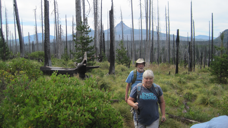 The weather was beautiful – if a bit warm – that morning. We were joined by two friends, Jack and Cindy, who drove us to the trailhead and then hiked with us for the first five miles of our journey.
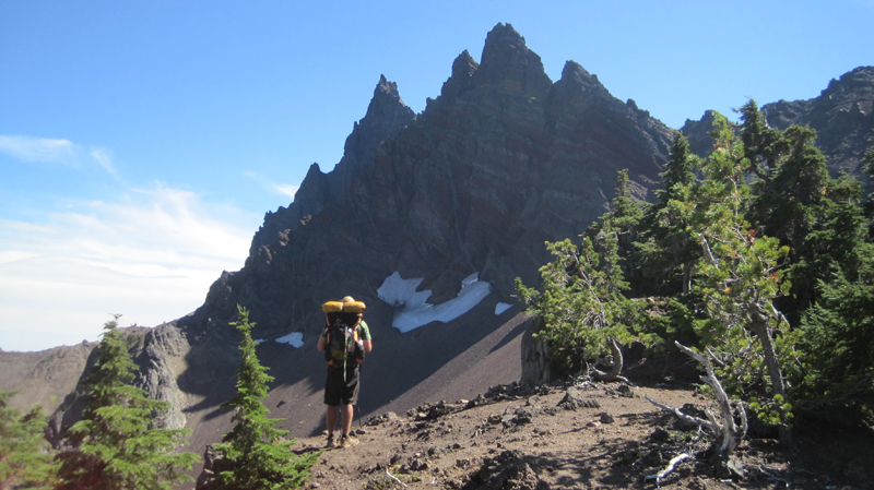 A view of the north side of Three Fingered Jack, a jagged and rugged mountain in the High Cascades that has banded stripes. A PCT thru-hiker stands in the foreground. He was one of about 25 who passed us that day; the oldest being somewhere in her 60s, the youngest about 18, and about half of the thru-hikers were female.
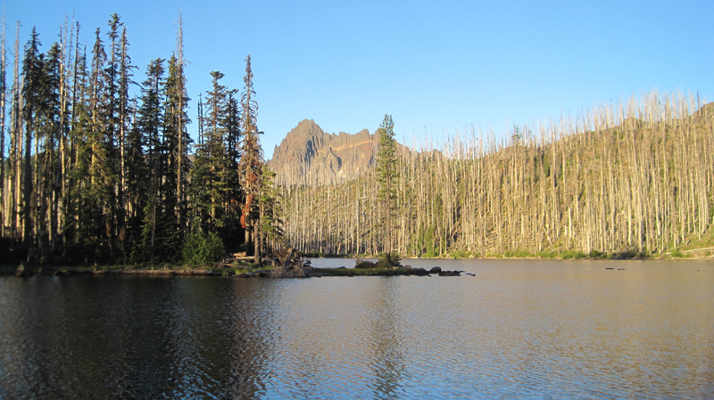 A view of Wasco Lake the following morning at about 7 am.
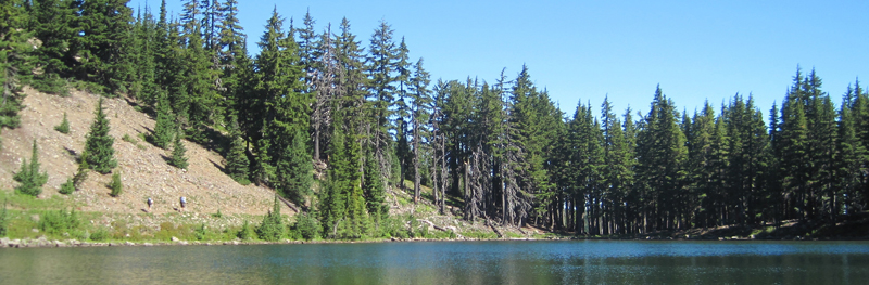 We enjoyed a mid-morning break on the shores of Rockpile Lake. Several thru-hikers can be seen on the trail at the left. The two women we met a day earlier enjoyed their lunch and a quick swim on the opposite side of the lake.
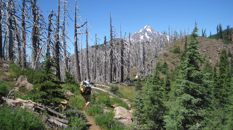 Much of our day was spent walking through woods that had been burned several years earlier and were now recovering. In the distance, the peak of Mount Jefferson made frequent and teasing appearances.
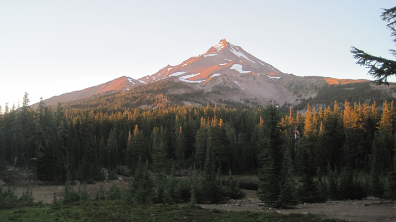 That evening we camped at Shale Lake and enjoyed an amazing view of the south side of Mount Jefferson. We ate our dinner and watched the evening light blanket the slopes of this iconic High Cascades peak.
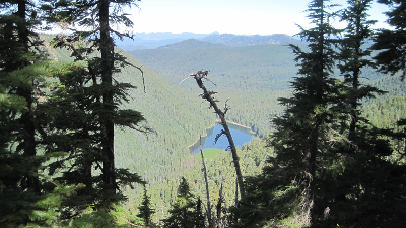 Looking upon a picturesque view of Pamelia Lake from the PCT. This area is a limited entry zone requiring a permit to camp. Our hike that morning was in the forest where we encountered some sizeable old growth trees, and at one point we rounded a corner and surprised a grouse.
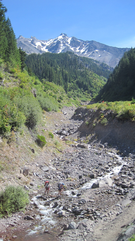 Milk Creek has cut a 100-foot deep gorge into the slopes of Mount Jefferson. Several backpackers are seen crossing the creek below us.
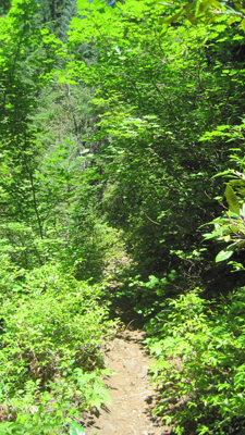 Overgrown and green, this is what the trail looked like for the rest of the afternoon. It was also humid and hot, making our progress slower than expected. Occasionally, we would see glimpses of Mount Jefferson through the trees.
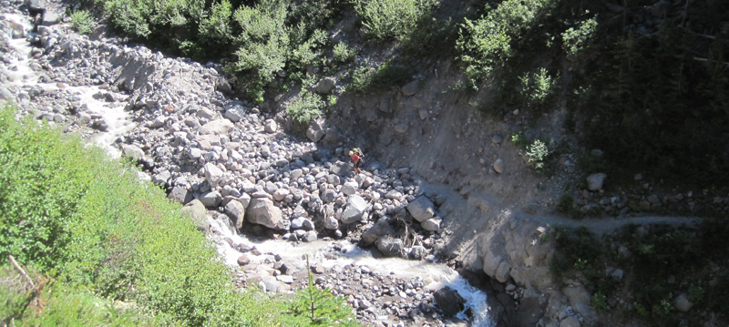 Russell Creek pours off the mountainside where it meets a “flat†area for about 100 feet before dropping into a deep gorge; this more level area is where the trail crosses. Earlier in the season, the flow can be very strong and this can be a dangerous crossing. Today, though, it just brought about some wet shoes. In this image, a hiker approaches the crossing area. We spoke with her later to find out that she was 18 and was hiking 250 miles of the PCT by herself.
 We enjoyed breakfast under this stunning skyline.
 The next morning we climbed 1,200 feet out of Jefferson Park. The views were magnificent: wildflowers were in bloom along the trail, and at times it was hard to hear because of the abundance of buzzing coming off nearby flowers.
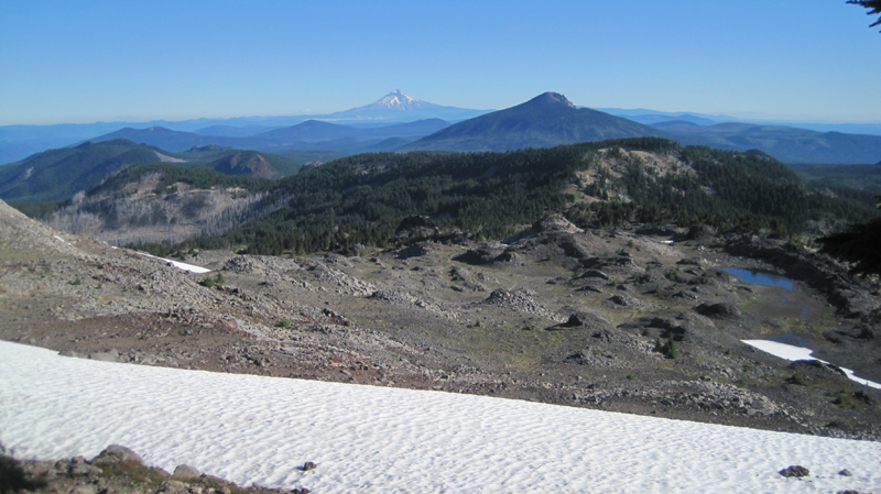 We reached the trail’s summit and could see Mount Hood in the distance. Descending the slope, we passed several snowfields. For several hours our progress was slow going because of the loose rocks, though the trail soon became forested and we passed a number of beautiful mountain lakes.
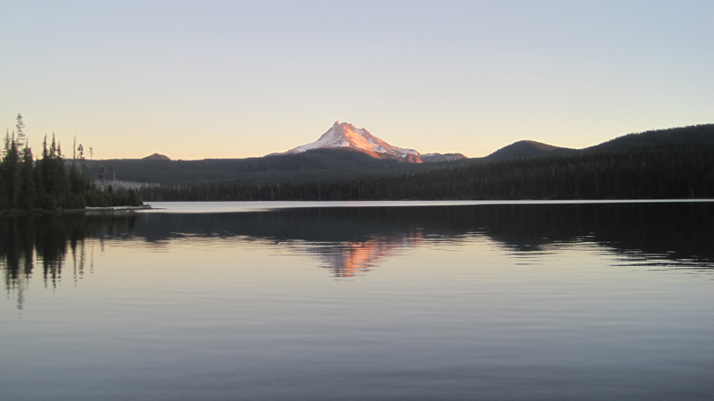 Late in the afternoon, we reached Ollalie Lake. Here is a view looking south across the area we just hiked, and in the distance is Mount Jefferson. About two dozen thru-hikers were staying at Ollalie Lake to rest.
 Ollalie Lake has a small store where my wife and I eagerly purchased a bag of sea salt and vinegar potato chips and promptly devoured the entire bag. At one point there were a whopping total of eight stinky hikers in that little store – ah, the aroma of humanity!
 The trail on day five was mostly flat and in the shade of tall trees, making trekking much easier. The forest was drier in this region and water was less abundant than before. When the opportunity presented itself, we filled up our bottles at a small, tranquil trailside spring. The temperature that day was especially warm.
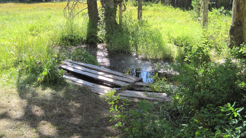 We arrived at Trooper Springs near the Lemiti Marsh area. This was our last water for about twelve miles. The spring was a welcome site although a small and precarious platform needed repair. We were attacked by horseflies; they were numerous, aggressive, and very persistent. Needless to say, we did not stay long.
 Taking care of some much-needed laundry at the spring using the “Ziplock spin cycle” washing method.
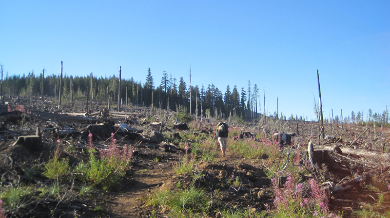 Walking through a clearcut was a stark contrast to the lush forest we had seen all day. Near this area, we found the strangest price of trash on the trip: a Howard Johnson’s hotel key card lying next to the trail. We picked it up.
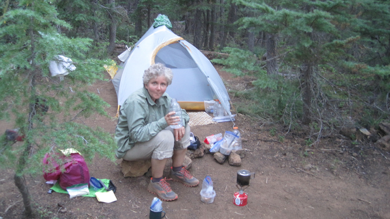 We located a bare spot at the edge of the trail and camped for the night. Trailside camping can look messy, but everything goes back into the pack and we always leave the site cleaner than we found it.
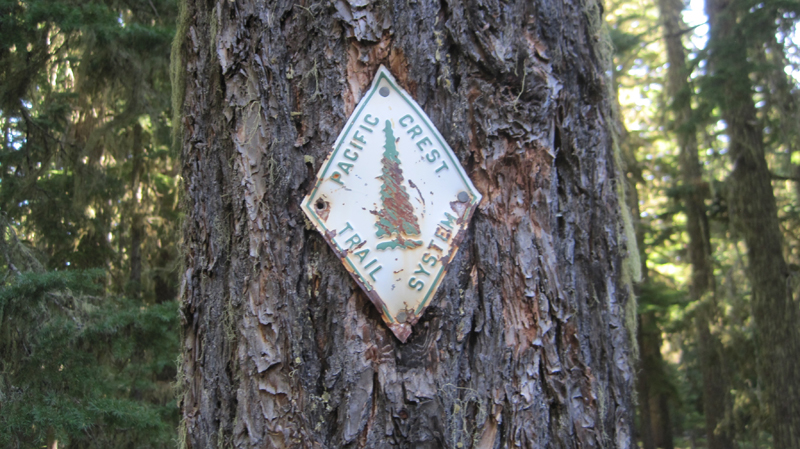 Shown is an old style PCT trail marker that we found, one of the few older versions that we saw on the entire trip.
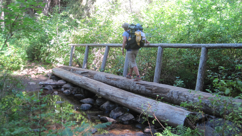 Crossing the Warm Springs River. It was more a small creek at this point, but the water the clean and cold – a welcome site.
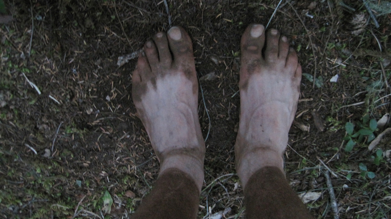 As I took off my shoes I realized just how dusty the trail was that day.
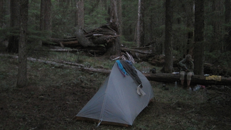 That evening we stealth camped near the trail close to Timothy Lake. During the night we unzipped the tent for a “nature break” – only to be scolded by an owl that repeatedly whooo’d at us until we went back to bed.
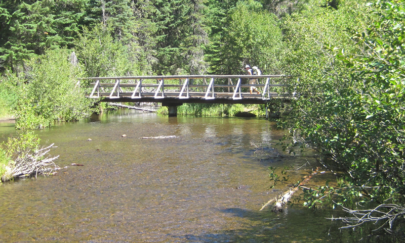 Several miles down the trail was Crater Creek, a beautiful riparian area with some astonishingly cold water: a welcome find on a hot day. We soaked our feet, took a twenty-second dip (the water was that frigid), then soaked our shirts and put them on as a natural air-conditioner. We made a stop at Little Crater Lake, the source of the creek. Little Crater Lake is astonishingly blue like it’s larger cousin, but this was not volcanic in origin. Rather, this was a large artesian well. Continuing down the trail, we passed a gravel forest service road and found a bag hanging on PCT post. Inside were some small apples or Asian pears – some unexpected trail magic in the middle of nowhere.
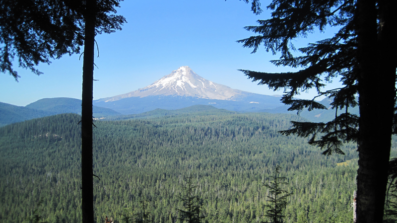 This was our first view of Mount Hood after about 40 miles of hiking – what a fantastic sight.
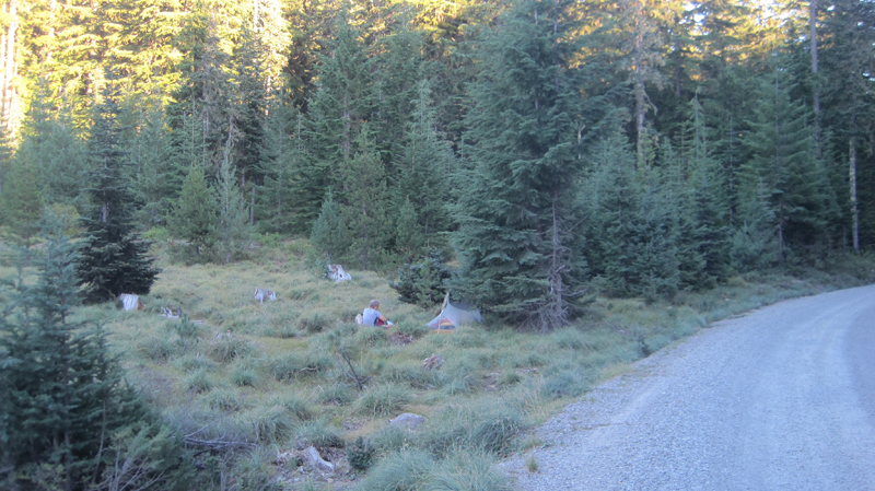 We took a side trail to Frog Lake for some water where there was a hand pump that drew water from a well. As we entered the campground we were momentary celebrities answering questions like: “Where did you hike from?†“How many days have you been out?†“Tell me about your gear?†etc. It was an odd but welcome feeling. That night, we camped just outside the campground on a forest road.
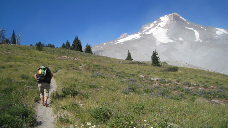 Finally, the green of the trees turned to open space and vistas as we passed the timberline. It was windy with twenty to thirty mile an hour gusts that kicked up sand and dust. We wore our sunglasses to keep volcanic grit out of our eyes.
 There was an abundance of mountain flowers on the trail.
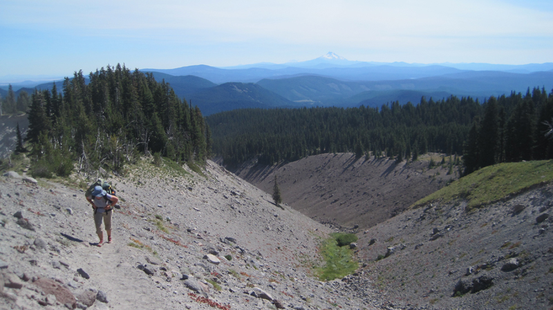 Close to the Timberline Lodge, the views were fantastic! We could see much of the route that we had spent the past week traversing.
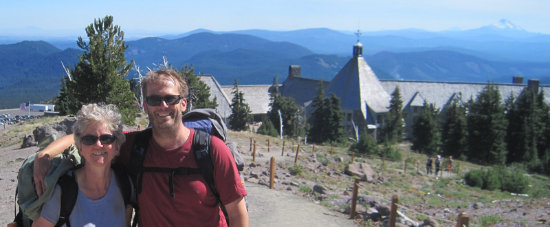 We arrived at the Timberline Lodge, mile 2107.3 on the PCT, and 100 miles from our starting point at Santiam Pass. Inside the lodge, scores of thru-hikers had taken refuge in the common areas. There was access to food and good company, with couches for sleeping and a warm fire to enjoy in the evening. We met some new friends here: Shepherd, Snow, Lonestar, and Patch, all thru-hikers who started at the Mexican border and were resting before their final push into Washington State and Canada.
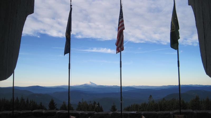 Looking through the door at the Timberline Lodge onto the Roosevelt Terrace: in the distance Jefferson Peak, and behind it, Three Fingered Jack and Santiam Pass. From the lodge, we were able to take public transit back home.
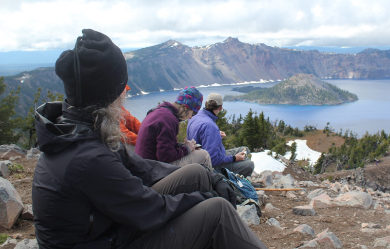
 On the way, we encountered several snowfields, one of which was very steep, but the stunning views from the top were well worth the extra effort in getting there. In the distance, Mount Scott was enticingly clear of snow, though we later learned it was impossible to reach because several miles of the eastern rim highway was closed for repairs. Returning down the mountainside we visited the small loop trail of Godfrey Glen where we collected trash that uncaring visitors had left. We collected enough garbage to fill a large bag! That evening we sat around the campfire and commented on the number of stars that were visible, where was the rain? All was calm until 2 am when the rain arrived and temperatures lowered to just above freezing. Our two members in their “good deal†tent had a cold and wet night.
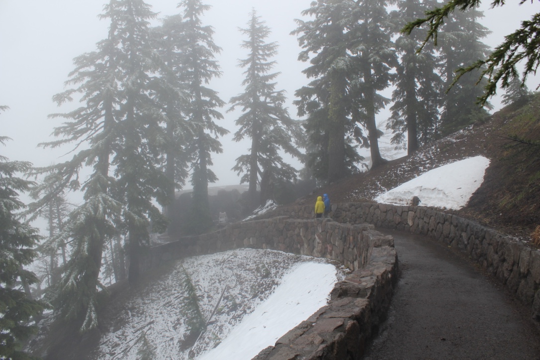 We explored the Visitor’s Center, the Sinnott Memorial Overlook (featuring an indoor exhibit room) and the gift shop to escape the fog, wind, rain, and occasional snow flurries. The fog was so thick we could not see the lake or a few hundred feet in front of us. In the afternoon we moved below the cloud line to hike the picturesque Annie Creek trail. Although a short hike, it was very picturesque. Laurie and Brad had reservations at the Crater Lake Lodge for dinner, they generously increased their table size to include all of us so we could get out of the rain and have some warm food. About 8 pm that evening the sky cleared and at first, the temperatures seemed warm. The group campfire that evening had just half of the group, the remainder had gone to bed early. The two members in the “good deal†tent had another cold and memorable night. In the middle of the night I awoke and was stunned by the visibility of the night sky – there were thousands of stars! My tent thermometer showed that temperatures had dropped into the upper twenties.
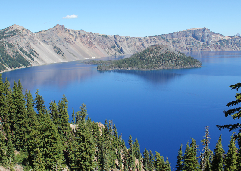
 Approaching Wizard Island, even several miles away, is very impressive.
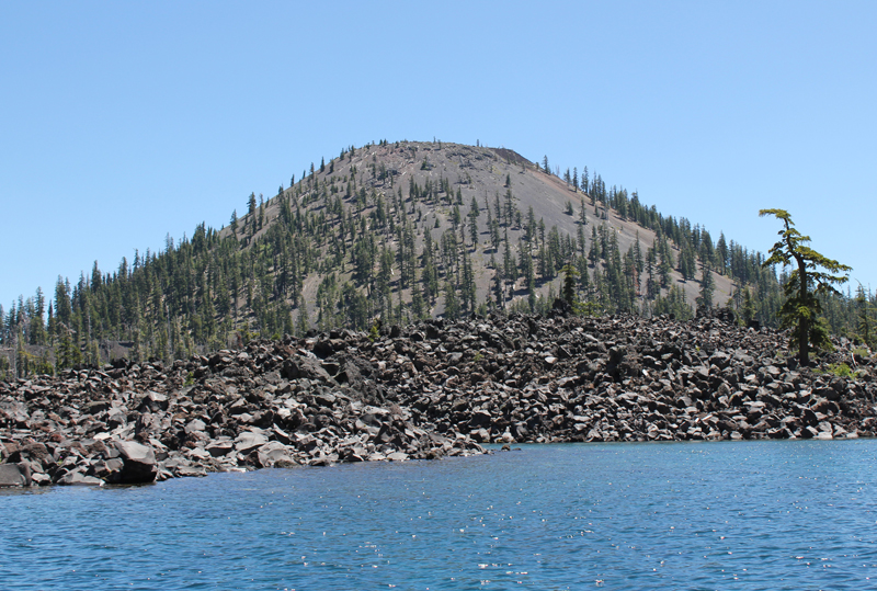 As the boat approaches Wizard Island the size and grandeur of this volcanic cone become apparent.
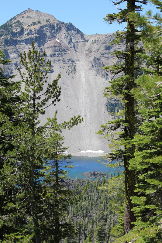 Hiking to the top of Wizard Island the trail climbs 760 feet, but this is nothing compared to the eastern rim of the crater which towers above me. In the photo, the Watchman scrapes the sky at 1840 feet above the lake’s surface. Seen between the trees, on the water (crossing Skell Channel) is a small white line, this is one of the boats that transport passengers to the island.
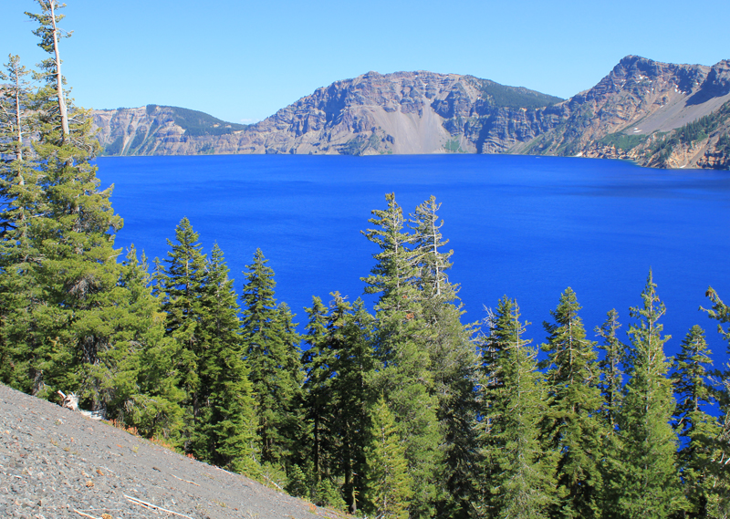 The views hiking to the top of Wizard Island are jaw-dropping.
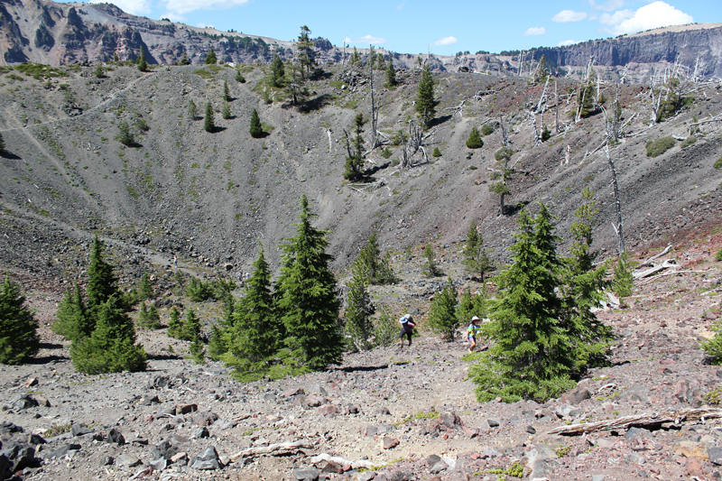 Think of Wizard Island as a small volcano, and it has a crater; this picture shows several people hiking out. The rim of Crater Lake looms on the horizon.
 This Ground Squirrel is a resident of Wizard Island. He was demanding a food tithe from me for visiting his island retreat.
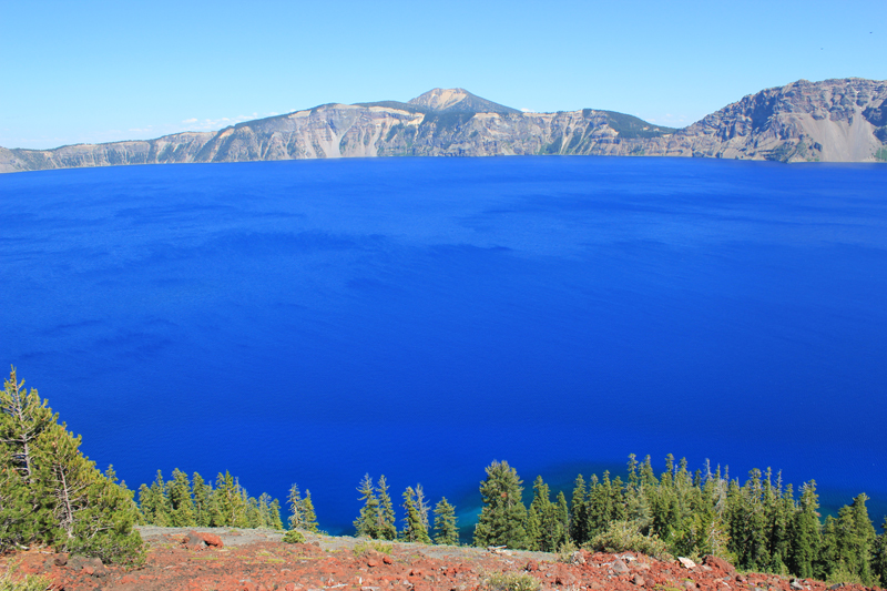 A view from atop Wizard Island looking across Crater Lake to the opposite rim which is about 5 miles away. The blue color is just magnificent.
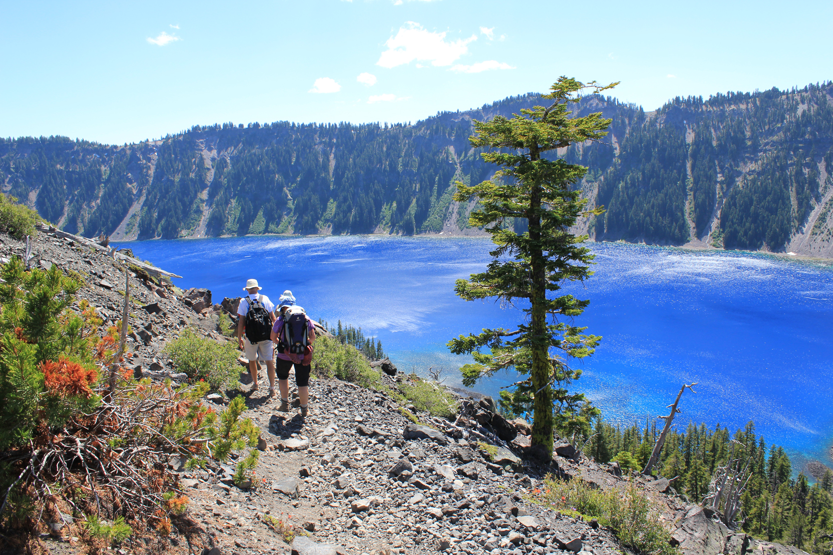 Hiking down the cinder cone we enjoy a rich tapestry of colors – a masterpiece painted by nature!
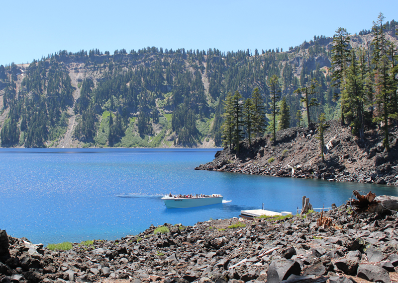 This is one of the few boats allowed on Crater Lake. It is seen here delivering visitors; this boat will take us on our return trip around the lake’s perimeter in a counterclockwise direction. Our next stop was the southern shore to see a slide area and the Phantom Ship.
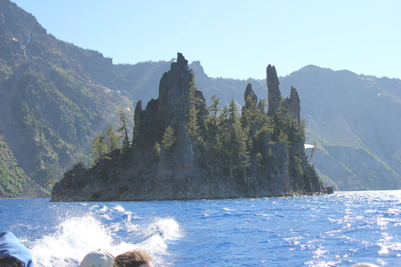 The spires of the Phantom Ship, an island in the lake, which under low-light conditions resembles a ghost ship.
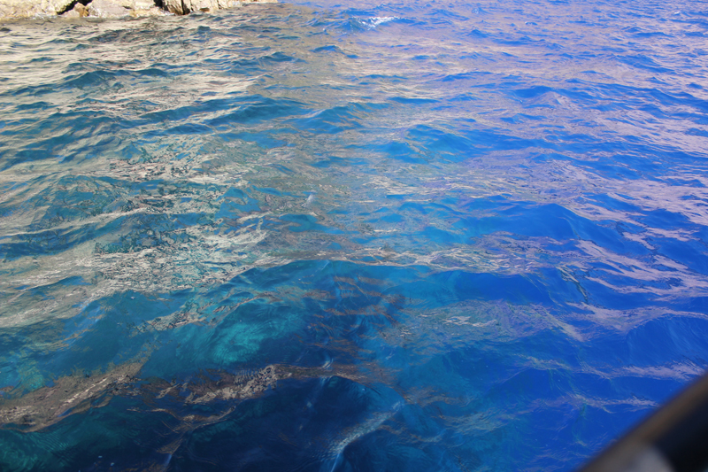 Looking into the water from the edge of the boat we saw this dramatic difference in color. The interpreter on the boat said the contrast was because we were passing over an underwater ledge, to the left the water depth was about 900 feet, to the right the depths plunged to 1,600 feet!
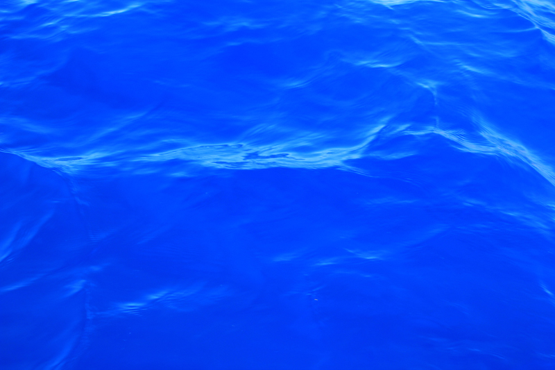 Crater Lake’s legendary “blue” water.
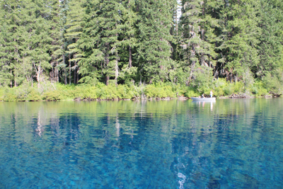 Each stroke of my paddle dips into the crystalline fluid and scoops out rounded orbs of glass-like liquid, I dip my hand into the water, the temperature is cold, somewhere around 40 degrees Fahrenheit. The lake is fed by mountain springs that course from deep within old lava flows; the water temperature stays a near constant throughout the year.
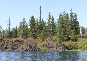 A number of Mallard ducks float next to my kayak, some are just a few feet away. One comes abreast to me and looks at me in the eye; he cocks his head as though wondering what kind of strange beast I might be. I can see his little legs moving underneath the water, churning like a miniature paddle wheel.
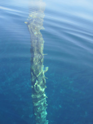 A large dark form starts to become visible in the water before my kayak. I stop paddling and the surface becomes undisturbed allowing the shape to come into focus, it is the column-like shape of one of the ancient trees. The trunk appears to be as big around as a dinner platter, and only just a couple of feet below my kayak. I try to gently tap the top of the trunk with my paddle, but I am unable to reach it. The water has played a trick on my eyes by making things appear closer than they really are. I peer down the trunk looking, fifty, sixty, possibly a hundred feet down to the bottom.