
 The Three Sisters Wilderness in Oregon is breathtakingly beautiful. This diverse landscape of volcanoes, snow, forests, creeks, lava fields, and lakes gives hikers the opportunity to explore a vibrant topography. The wilderness encompasses 281,190-acres and is dominated by three volcanic peaks: North, Middle, and South, that each exceeds 10,000-feet in height! Several paved roads around the perimeter of the wilderness allow visitors to see vistas with just a car ride, but to really appreciate the immensity of this setting some footwork is required. Here are some pictures of a 34-mile, 4-day trip along the north and eastern portions of the wilderness ending between Middle and South Sister at a subalpine area known as Camp Lake.
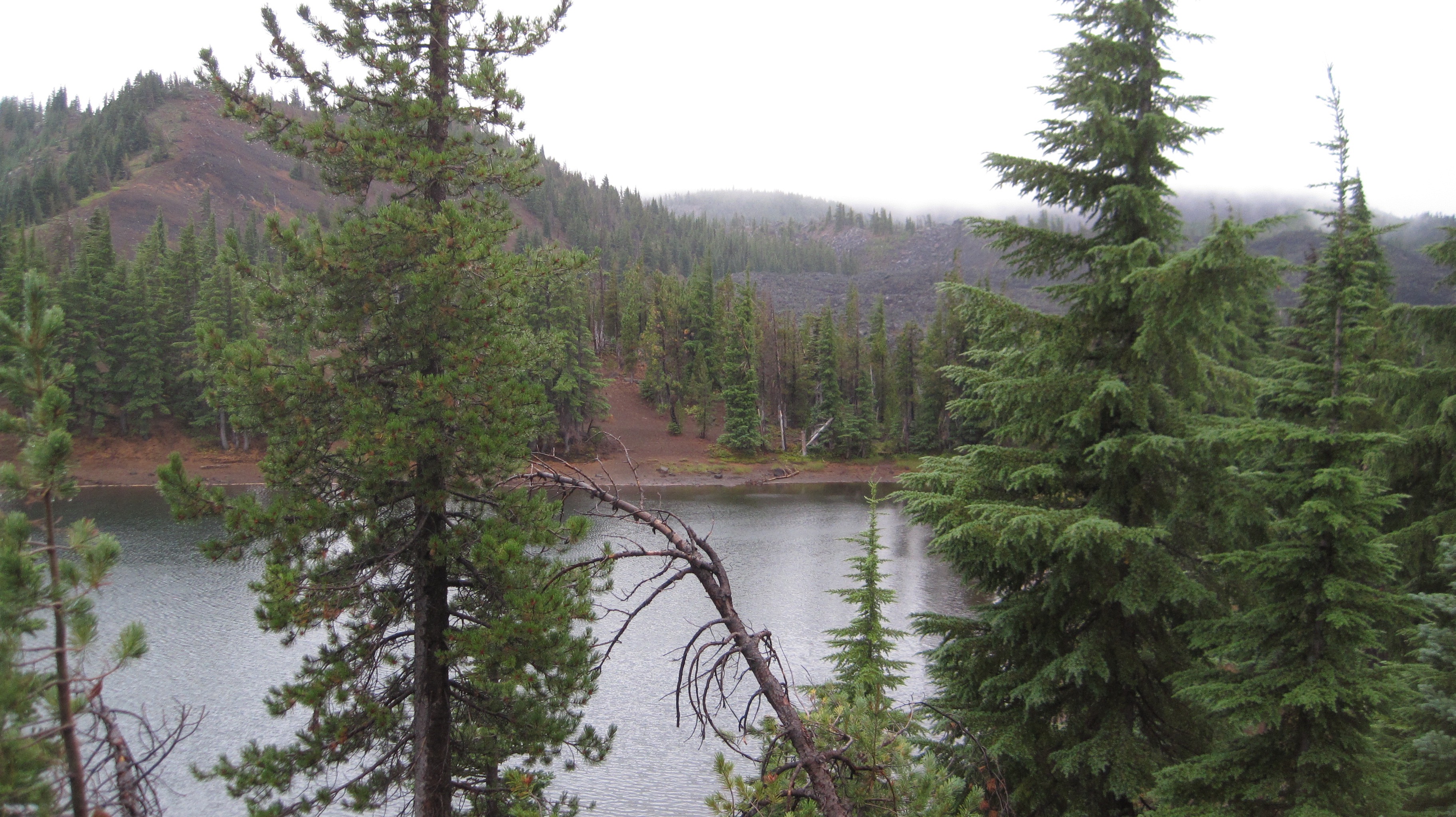
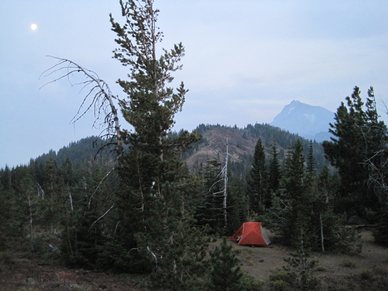 My wife and I began our first day with a late start; we hiked 3 miles south from the Lava Camp trailhead and spent the night at South Matthieu Lake. Smoke from forest fires in the region made everything, even a view of North Sister and the moon, opaque. That night, an anticipated cool breeze was replaced by a warm wind that blew in from high plains of Oregon where a large ground fire was burning. In the middle of the night, the smoke became extremely thick and breathing for several hours was difficult. By morning the winds had shifted and the air was clearer.
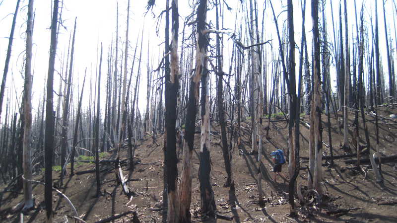 The next day we hiked 14 miles; 7 of which reminded us just how destructive forest fires can be, constantly around us were the stark and charcoaled remains of incinerated trees. This conflagration was called the Pole Creek Fire and occurred just 3 years ago in 2012.
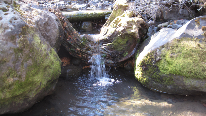 Several small creeks crossed our path, most were dry, but Alder Creek’s water was cold and clear even though the flow was very low. The creek offered a respite from a temperature of 85 degrees and hot sun that was beating down. We welcomed the opportunity for rest and refill our water bottles at this little pool.
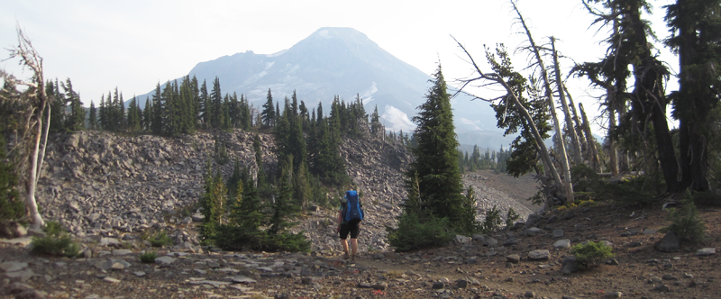
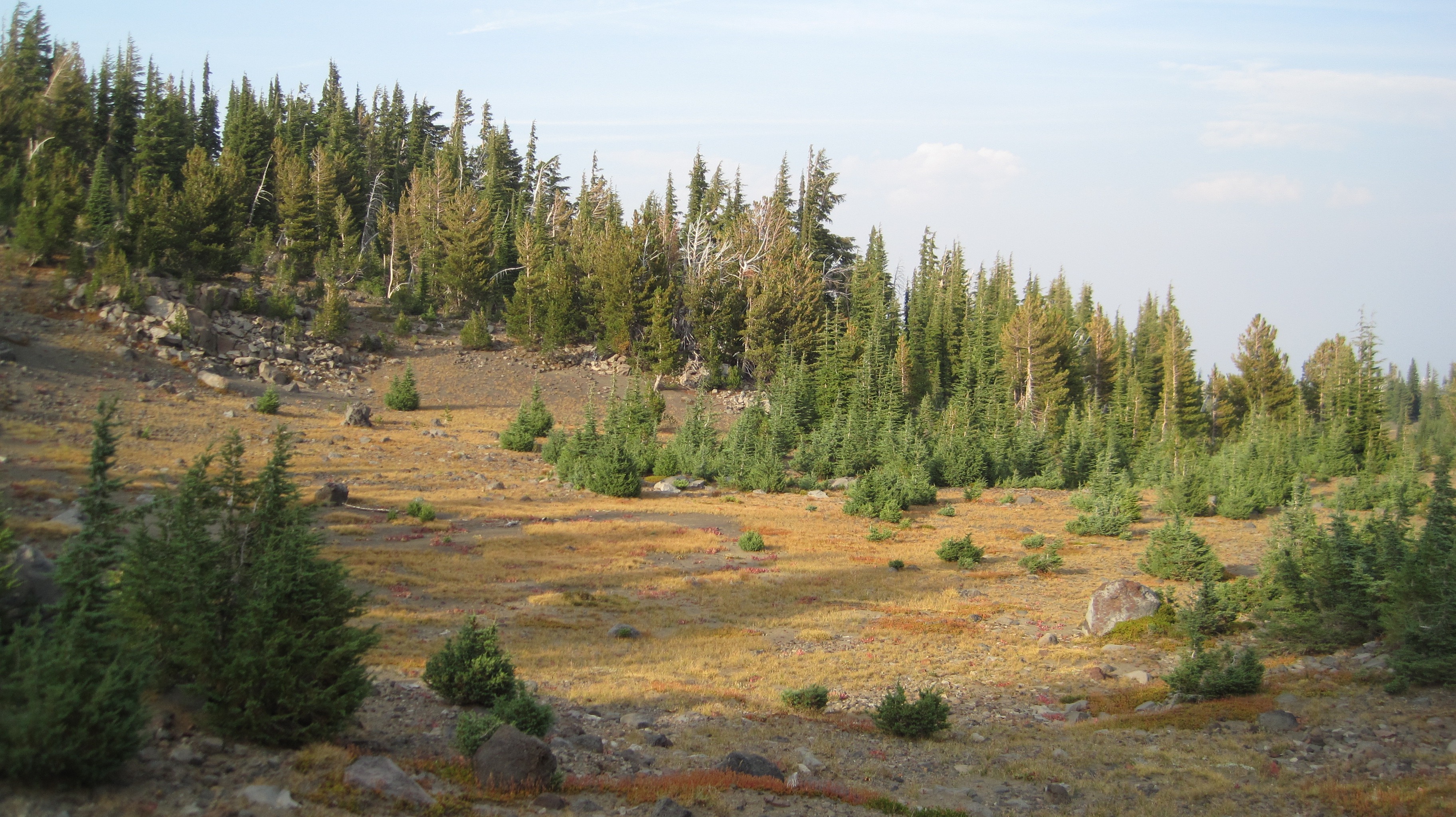
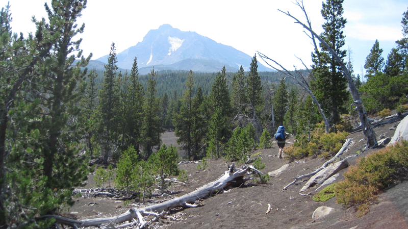 The North Sister towers in the distance. Continuing south the trail crossed several areas where the fire had not reached; these were often pumice expanses where vegetation was dispersed.
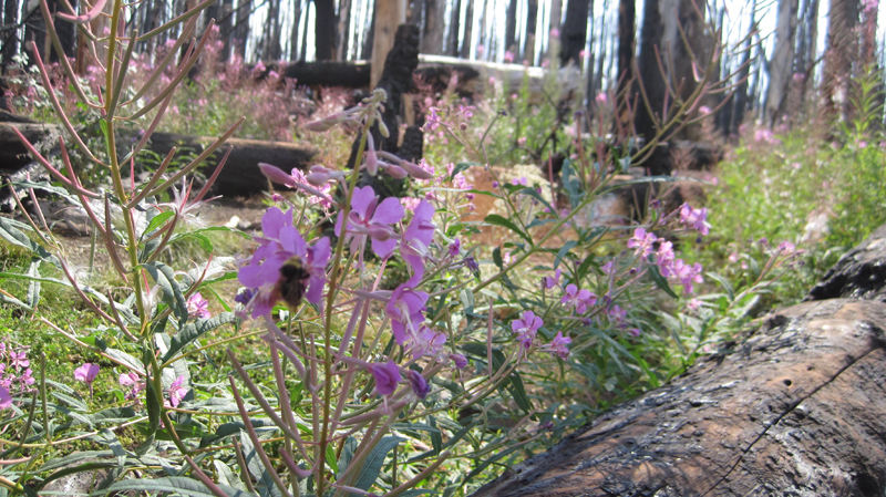 As we crossed Soap Creek we saw a number Bumble Bees buzzing from one flower to another. Soap Creek gets its name from the soapy color of the water; this is because of the sediment that gets carried down in the glacial meltwater.
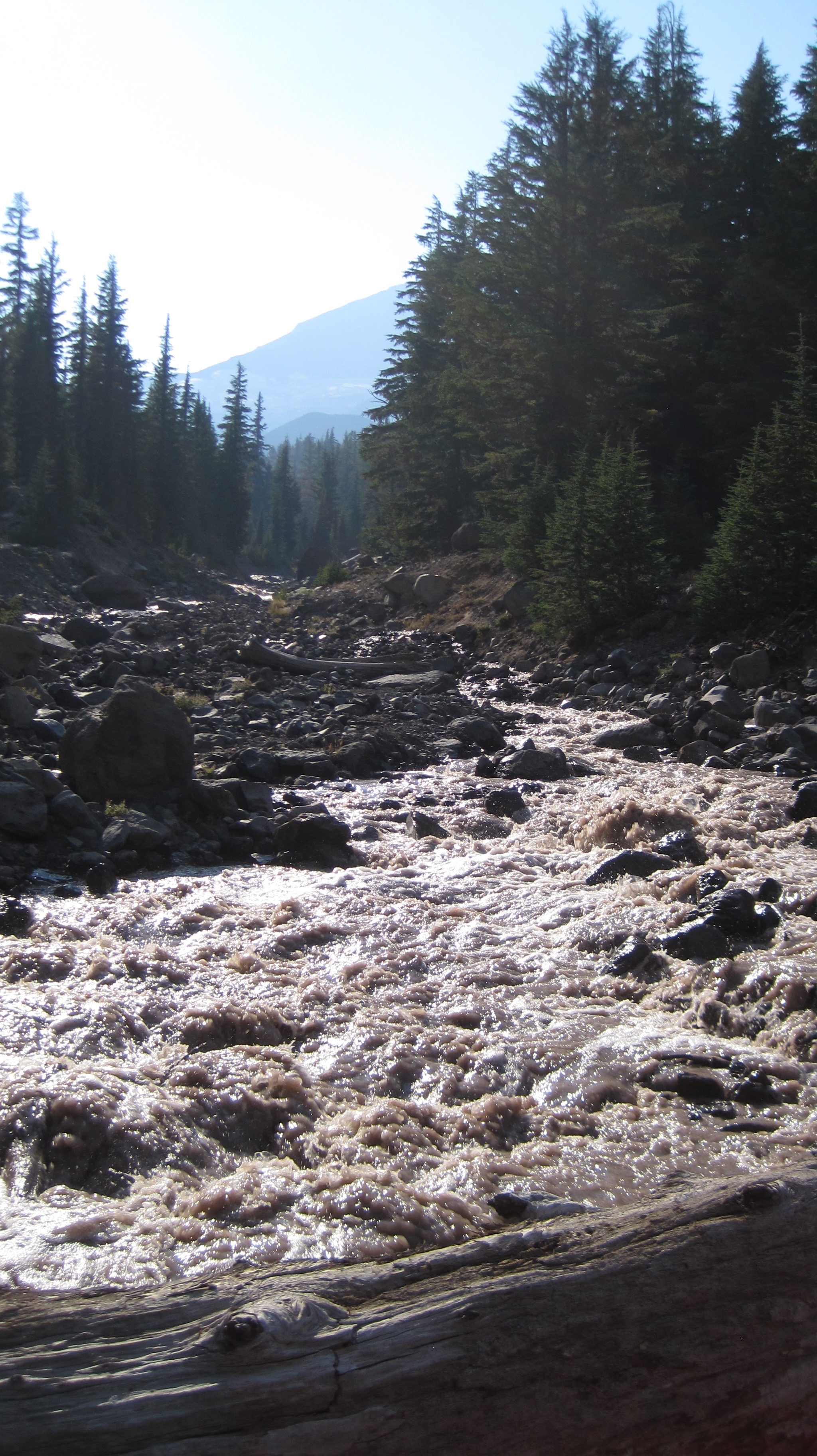 The trail turned to the west and the terrain gradually increased in elevation. After about an hour and a half we crossed the North Fork of Whychus Creek, which had to be traversed via several logs that served as a makeshift bridge, below us the grey and auburn glacial melt water loudly churned. Its source was about 2 miles upstream at the Hayden and Diller Glaciers. After crossing the views opened up.
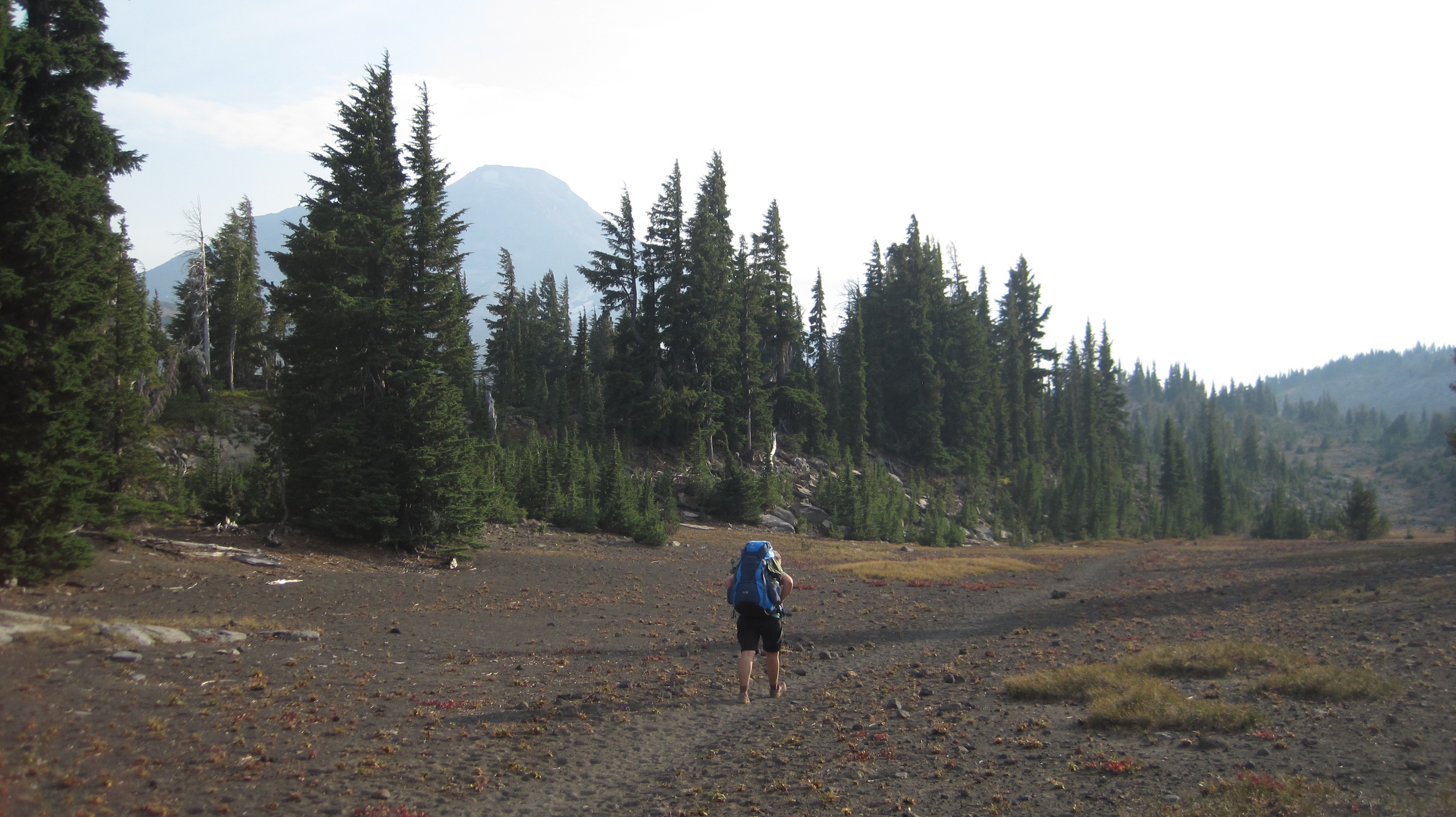 A photo of Christiane hiking through a pumice area on our way to Camp Lake; walking on this material is akin to walking on dry sand.
 What a beautiful landscape!
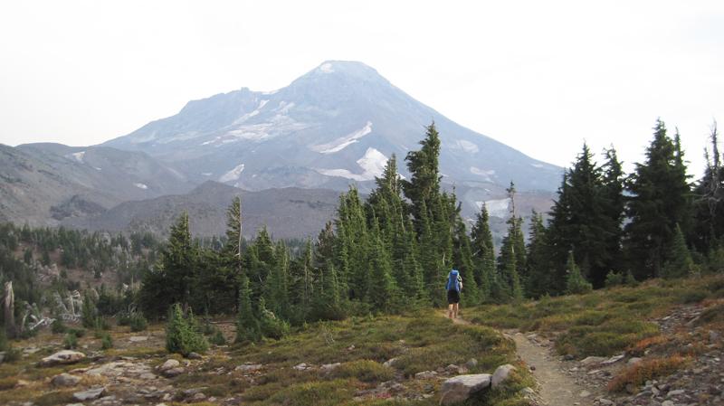 A view of South Sister on the horizon; this dramatic peak is 10,358-feet in elevation!
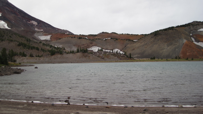
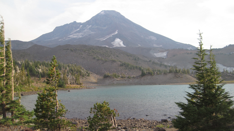 Our destination for the night, Camp Lake at 6,952-feet. The wind here can be unrelenting, this is because the lake’s location is sandwiched in a pass between Middle and South Sister. The wind was strong that afternoon so we found sanctuary behind a glacial moraine and set up camp.
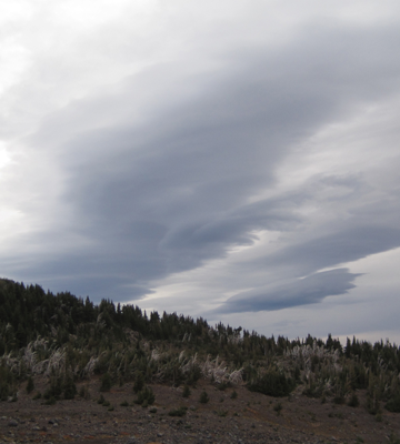 Our original plan was to stay the night at Camp Lake and then in the morning continue over the pass. This would have included: hiking up a climber’s trail for an hour and up several hundred feet in elevation, crossing over a snowfield and down the western side of the mountain and to several remote lakes then overland another 3 miles to the Pacific Crest Trail. But, uncertain weather changed our plans. The forecast had called for a rainstorm along with high winds within the next 24 hours and we were hoping to make it over the pass before the rain. That evening dark clouds marched across the sky. As the sun disappeared under the horizon the temperature dropped well into the 40s and that night we heard several deep and rumbling crashes of thunder. The wind howled into the morning and for several hours we heard rain outside and at times our tent was pelted by ice.
 When we woke, the sky was grey in color but appeared mostly calm, though as I stepped out from behind the shelter of the moraine the wind almost knocked me over. I collected water at the lake and was surprised at how chilled I had become in just a few minutes; the wind was deceptively cold. Partially frozen raindrops fell sporadically. My wife and I made the decision to hold off crossing over the pass during this trip. We would return by the route we came.
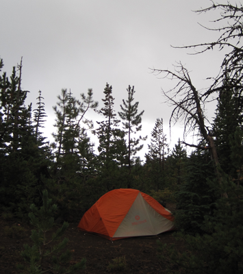
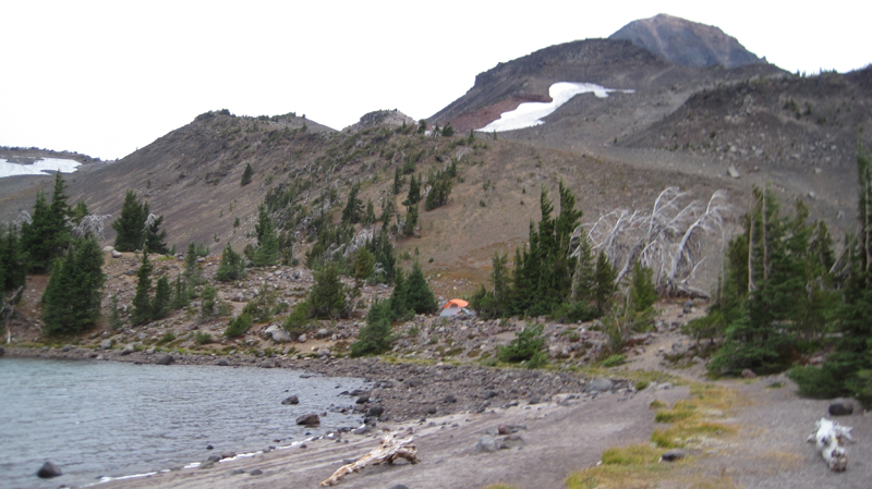 The area’s starkness was beautiful. Several tents were dotted around the area, all of them, like the tent, is shown in the photo, was strategically placed behind natural wind brakes.
 Our hike off the mountain was cold and occasionally it rained on us. At about noon the sun briefly came out, but this did not last long for the sky again turned dark and overcast. We hiked out of the burn zone and returned to the Matthieu Lakes area about dinnertime. That evening, the weather was peaceable, but about 7 pm the wind started up, by 8 pm it roared through camp with gusts reaching 40-50 miles an hour, by 9 pm the rain started. This continued into dawn. We slept comfortably in our tent.
 The next morning was drippy and low clouds blew over the treetops. Later that morning we hiked out the last 3 miles. As we approached the Lava Camp trailhead the sky offered us some brief patches of blue. We ended our day with each other clinking together mugs of trail coffee in honor of a good trip.