Trip Report:
Group Leader: Mark Hougardy | Organization: Eugene-based hiking group | Date: in April 2023 | Duration: 1 day | Walking Distance: 4.5 miles | Participants: 8 | Elevation Gain/Loss: <100 feet | Type: Urban Walking
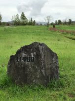
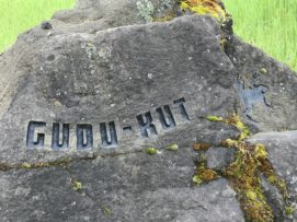
Walkers, runners, bikers, birders, and anyone who enjoys exploring the many trails and paths of the Whilamut Natural Area in Eugene, Oregon (and nearby Springfield) can learn from these quiet stones of place. The stones help to connect people with traditional names on the land and remind people that the Kalapuya people are still here. Our 2.5-hour walk was sunny and the temperatures were perfect for a springtime walk. Shown is the Gudu-kut stone; Gudu-kut is the Kalapuyan name for frog.
Group Leader: Mark Hougardy | Organization: Eugene-based hiking club | Date: February 2022 | Walking Distance: 5 miles | Participants: 11
Scattered throughout the Whilamut Natural Area in Eugene, Oregon (and nearby Springfield) are 15 boulders etched with words from the Kalapuya language. These are the Kalapuya Talking Stones, and they help educate and remind visitors that the Kalapuya people, the original inhabitants of the area, are still here. The writing on the stones reflects natural items in the traditional landscape. We enjoyed visiting all 15 stones on our walk.
On Saturday, February 26th, attend the Kalapuya Storytelling & Drumming event (Downtown & Online) at the Eugene Public Library.
https://www.eugene-or.gov/Calendar.aspx?EID=25128&month=2&year=2022&day=5&calType=0
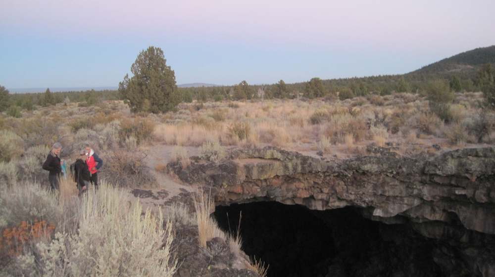
This was a 3-day experience into Central Oregon’s Outback to learn more about early human habitation and the area’s geology. Our route included the archaeological site of Fort Rock Cave, the 2-mile long volcanic fissure known as Crack in the Ground, and plans to visit the Fossil Lake area.
Trip Report: Volunteer Leader: Mark Hougardy | Organization: Eugene-based Hiking Club | Date: May 2019 | Duration: 3 days | Participants: 8 | Type: hiking & camping
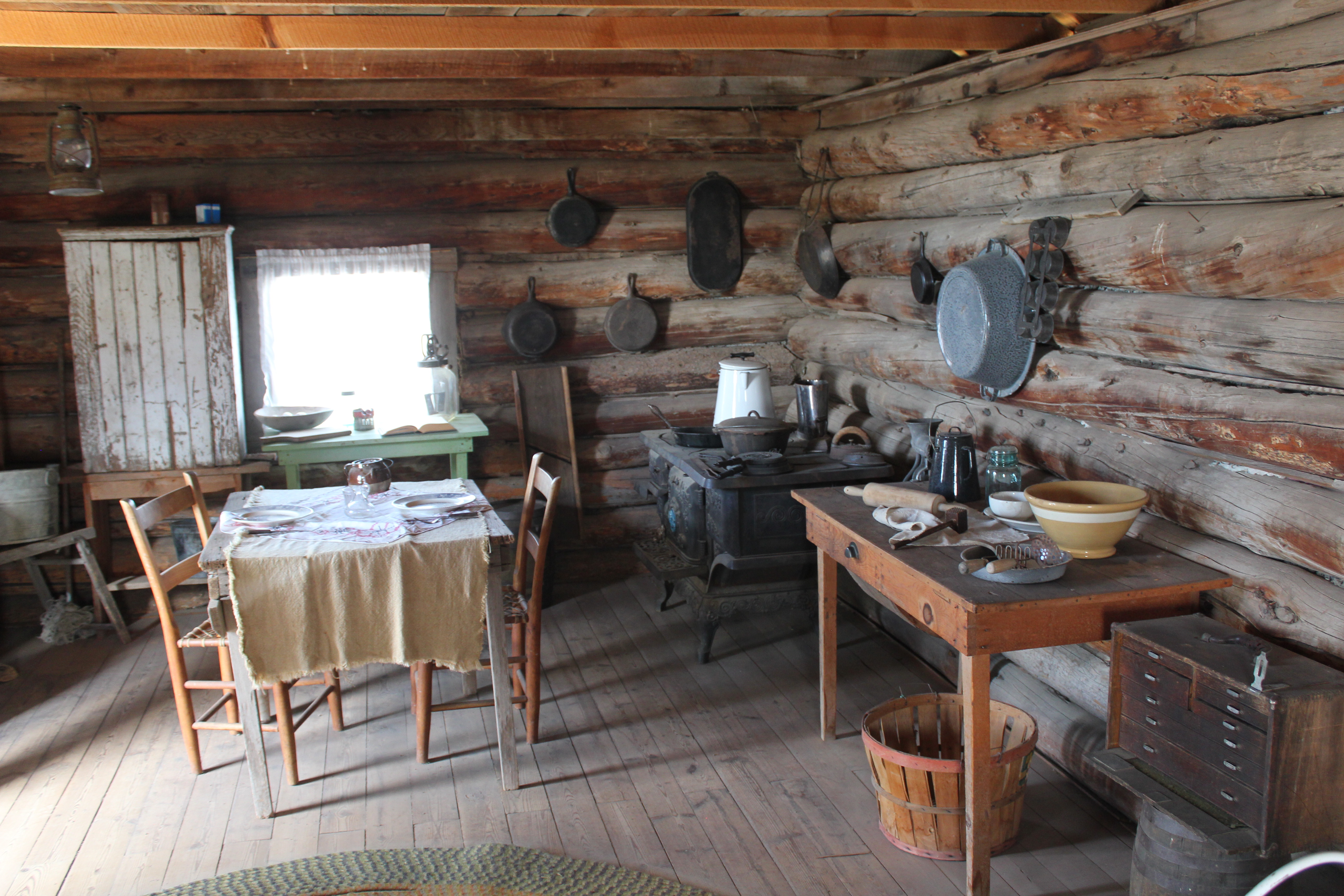
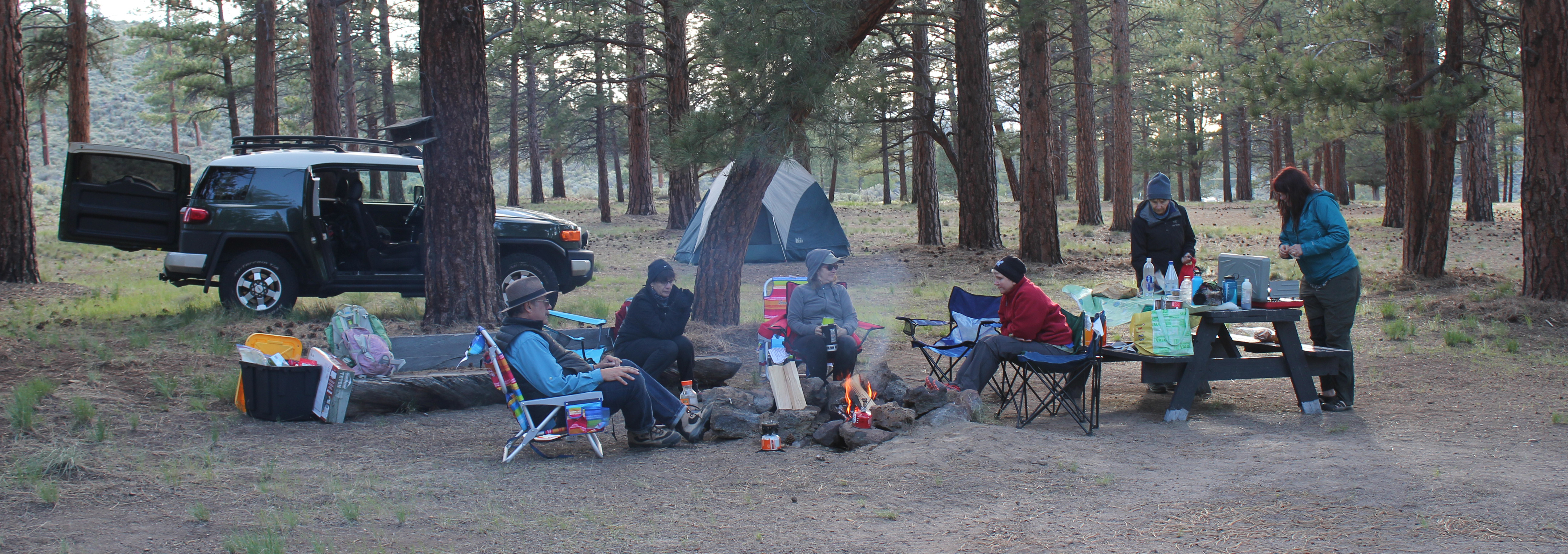
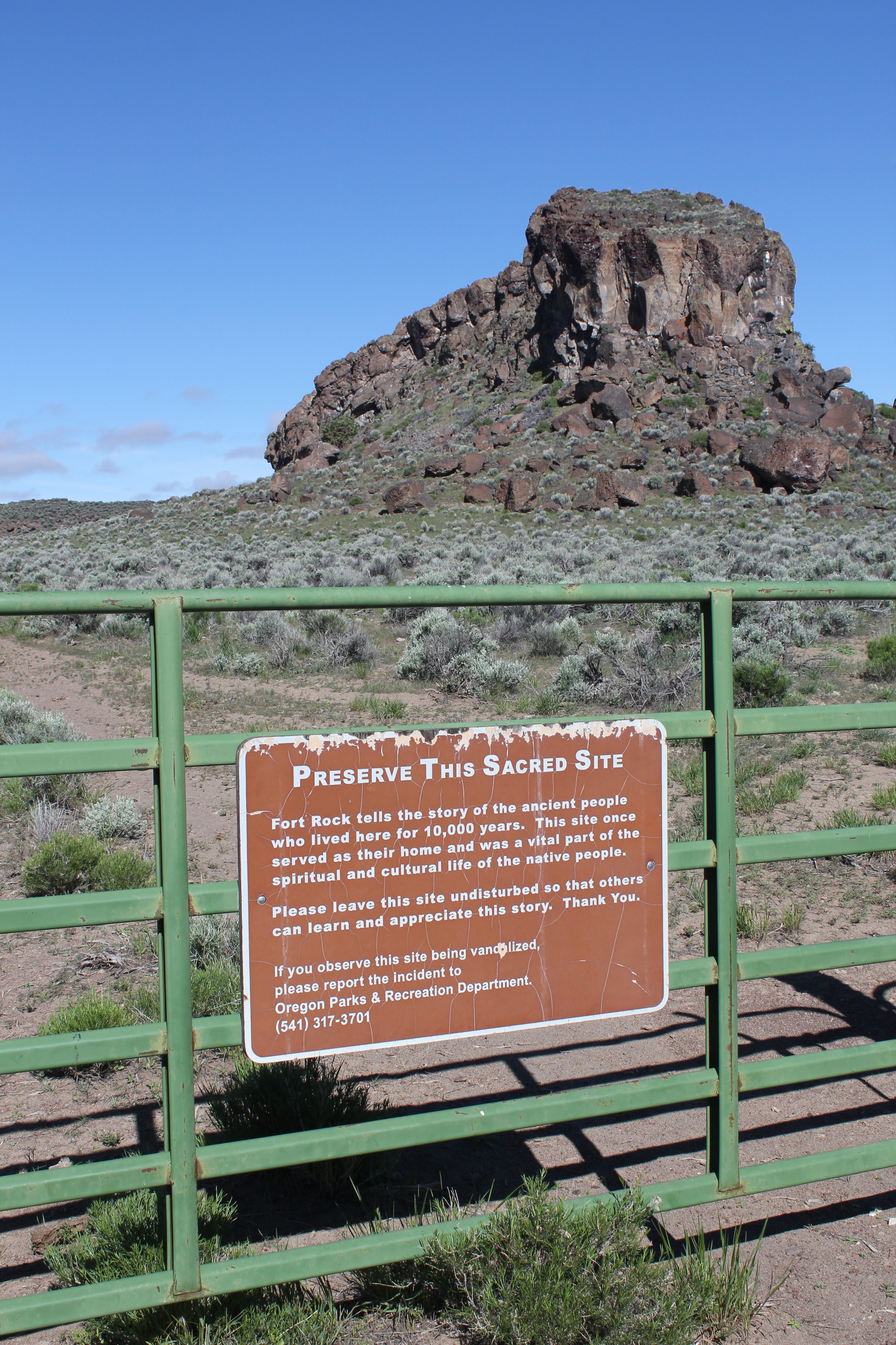
On our first day, one member discovered she didn’t have the right key to the car carrier which held her sleeping bag. Our caravan stopped at a hardware store in Oakridge where the employee emerged with the largest pair of bolt cutters ever seen. He quickly removed the troublesome lock. For lunch, we stopped at Salt Creek Fall for a break and later at an info kiosk on Hwy 31 before continuing to Fort Rock. At Fort Rock, we hiked to “the notch” along the western tuff ring where the wind was really strong. We made our own trail back down the rough side to more level ground. Afterward, we visited the Homestead Museum to learn more about homesteading was like in earlier years. At a nearby private campground, we set up our tents and enjoyed a fire for an hour or so when we noticed a mist in the distance. Within a minute or two it started to rain. We called it an early evening.
On the second day, in the early morning, the sunrise was beautiful and a coyote was heard yelping in the distance. One participant had green shower shoes and after a miscommunication about where they were to be delivered, gave everyone a good laugh. At 9 am we drove to Fort Rock for our interpretive tour of the Fork Rock Cave where 10,000-year-old shoes had previously been found. The Oregon State Park Ranger had driven from La Pine and was delayed a few minutes because of traffic. Our group and two others joined him in a state park van and we drove ten minutes close to the site. Then we walked about half a mile to the cave. He shared 3 prevailing theories about how humans arrived in the Americas and included a traditional story about how Fort Rock had been formed. We were asked that the story remains in the cave. As we walked back to the van one participant was keenly interested in the bleached bones of a dead cow. Back at Fort Rock we ate lunch and watch some of the birds on the cliff face.
A reproduction of a 10,000 year-old sagebrush sandal
We then drove half an hour to Christmas Valley then to Crack in the Ground. We hiked several sections that we could scamper through and also hiked along the top of the fissure. Several participants disturbed a prairie falcon who was not happy to see them. The falcon made a lot of noise, and as they moved away it acted as though it wanted to nose dive them. Storm clouds were approaching; we left about 3 pm and drove to an isolated ranch. The directions were a bit off and we took several wrong turns before arriving. We were greeted by two rambunctious dogs, a golden colored and bear-sized dog and a smaller ten-month-old border collie. As we were unloading our cars the collie jumped in the back of the trip leader’s car when a door was open and pee’d on the back seat. Just as we completed setting up our tents a 20-30 mile-an-hour wind blew past and dark clouds rolled in. The rain started at about 6:30 pm and everyone quickly disappeared into their tents to eat. We didn’t see anyone again until the next morning. The rain poured throughout the night.
The morning of the last day we were happy to hear that everyone pretty much stayed dry during the rain. We decided that traveling on muddy back roads might be problematic so we canceled the last portion of our trip to Fossil Lake. Just as we packed the last of our gear the two dogs reappeared but now they covered in mud – quickly we departed. We stopped in Fort Rock at a convenience store for gasoline and a break, then another break at Fort Rock, then again Salt Creek Falls before returning home.
Trip Report -Volunteer Leader: Mark Hougardy; Group: Eugene-based Hiking Club; Dates: April 2019; Participants: 16; Type: Urban & Trail Walking
Imagine attending a grand celebration… Every year, 100 people gather to laugh, tell stories, eat good food, and celebrate. Near the conclusion of the festival, everyone erupts into a joyous song, this music is extra special because for it to be harmonious each person is responsible for contributing just one note at the right time. The song rises and flows with many voices as old and young share. The following year there is another celebration but now a people few are missing. The next year, there are others who don’t attend and the melody starts to fray. For decades this unraveling of the song continues as fewer people are around to sing. Afer one hundred years only two people remain. They sing with passion, but how do they celebrate the larger song with so many notes missing? …How would you?
In the early 1800s, the Kalapuya people numbered around 15,000 and were the largest Native American group in what is now known as the Willamette Valley of western Oregon. Diseases introduced to the area decimated the population and by 1850 about 1,000 people remained. In 1900, the Kalapuya numbered about 300 (2% of the original population) and by the 1950s the last generation of speakers had passed. A 1977 University of Oregon anthropological paper declared, “the Kalapuya population is now presumed extinct.”
This was the setting for Esther Stutzman, a woman of Kalapuya heritage who wanted to revive the language. Over the years she made incremental steps to build awareness about the Kalapuya and awaken the language, but even into the early 1990’s, she was told by academics to not even bother as the language was dead. One reason for this difficulty was the geographic connection to Kalapuya place names no longer existed; pioneers had given all the landmarks names. Esther eventually partnered with the Citizen Planning Committee of East Alton Baker Park. Together, they convinced Willamalane Parks and Recreation and the City of Eugene to re-associate place names with Kalapuya words and phrases. The 237-acre park was re-named the Whilamut Natural Area of Alton Baker Park, and a year later, they placed cultural art installations known as the Kalapuya Talking Stones.
The Talking Stones are etched boulders that carry a Kalapuya word from one of the several dialects that describe the location where the stones reside. Today, fifteen stones quietly speak with those who will listen from along riverside trails in the Whilamut Natural Area in Eugene and the Eastgate Woodlands of Springfield, Oregon.
Talking Stone GUDU-KUT (frog)
The stones are etched with a simple font that approximates being written by a human finger as though an elder has just shared an idea by drawing a concept in the earth.
Placing the stones required years of work, public education, and patience from Esther and often-unsung heroes on the Citizen Planning Committee (CPC), including Charlotte Behm, Vicky Mello, David Sonnichsen, and others. The group has spent more than twenty years (as volunteers) diligently working to place and maintain the sacred Talking Stones and to educate the public about their important role in our community. The Talking Stones is a watershed project on blending native place names within metropolitan areas for the education about the people who once lived -and continue to live- in the area.
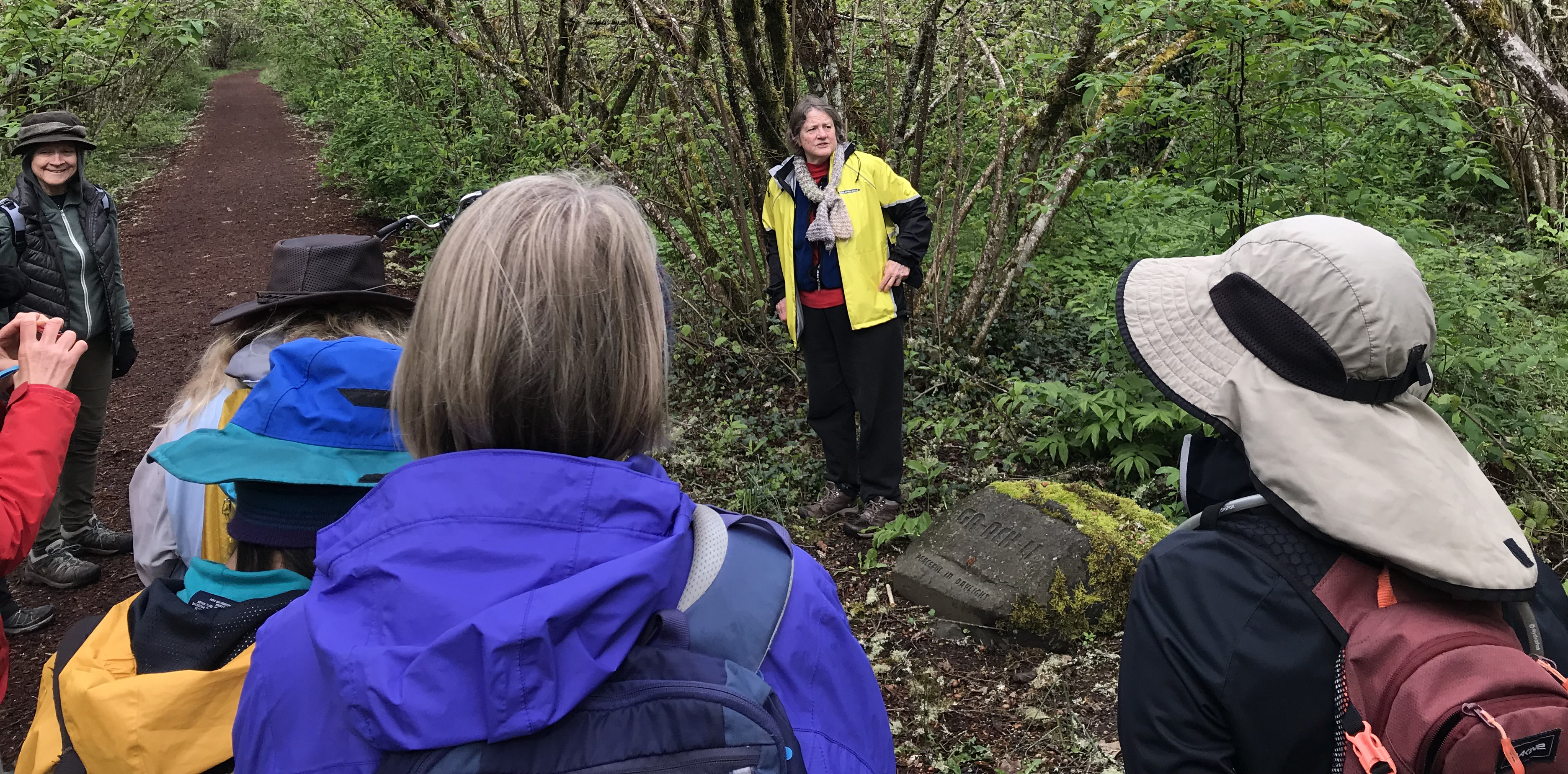
Charlotte Behm shares stories about the creation, installation, and public interactions with the Talking Stones.
To better understand the Talking Stones’ stories Charlotte Behm joined us on our 2.5-hour walk. She shared her experiences and history about the stones and some of the challenges that remain. We were happy to listen and better understand the geographic connection to Kalapuya place names. Thank you, Esther and Charlotte, and the many others for helping to share a larger story with your voices.
An additional thank you to Charlotte Behm for her help with this article.
This was an exploration of two dramatic volcanic landscapes timed with the Autumnal Equinox.
Trip Report:
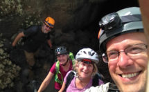
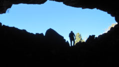
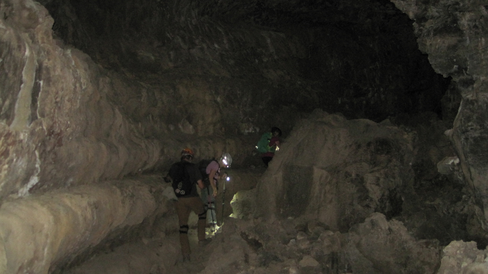
Volunteer Leader: Mark Hougardy | Organization: Eugene-based Hiking Club | Date: September 2018 | Duration: 4 days | Participants: 5 | Type: car camping, hiking, and caving
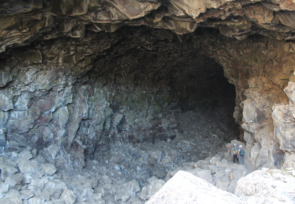
Upon arriving at the forbidding Lava Lands National Monument we made camp and then explored several accessible lava tube caves around the visitor center. We also climbed the conical shaped 5,302-foot tall Schonchin Butte where we enjoyed views 100 miles east to the Warner Mountains, near Nevada, and 50 miles west to Mount Shasta. In the evening, we walked along a dusty trail into the Schonchin Wilderness Area and encountered an entrance to a lava tube that was at least 4 stories tall.
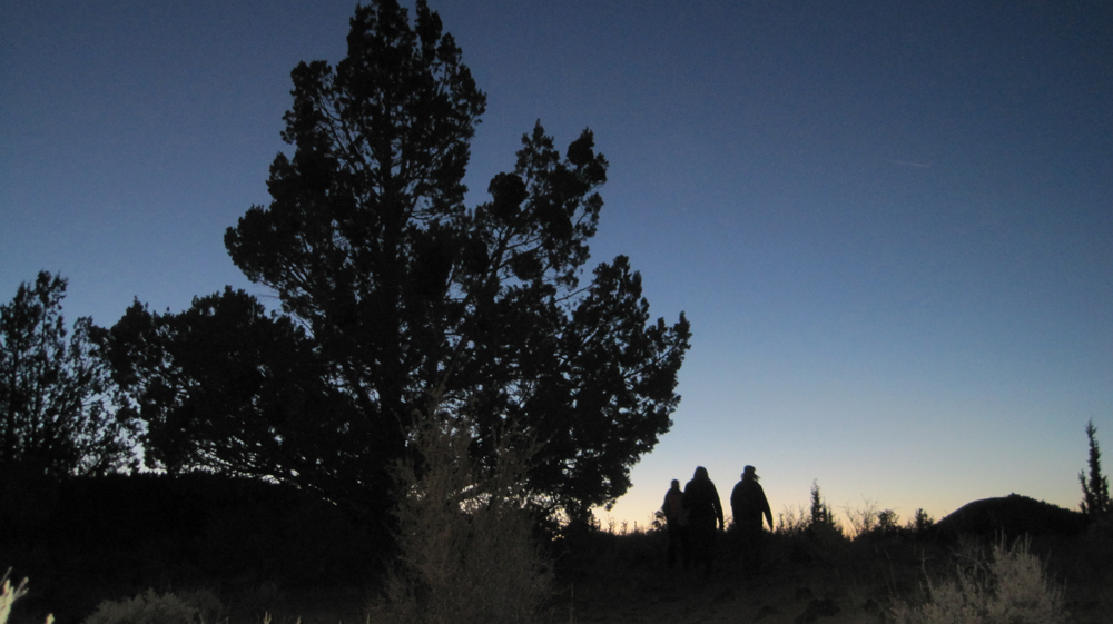
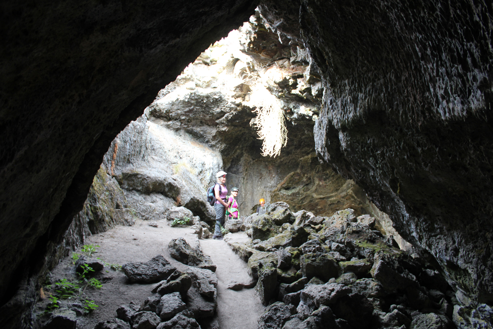
The next morning we hiked from the campground to Skull Cave where a small ice pond can be viewed year round. We also hiked to several pictograph caves and enjoyed our lunch on the trail. As the afternoon warmed we spent our time underground where we explored three caves and partially a fourth. Back at camp, we were surprised to discover that several hundred bugs had descended upon the hood of one of the cars, possibly attracted by the metallic-blue color. They had apparently been engaged in a frenzied mating and exhausting themselves to death. Bugs that fell onto the ground were snapped up by an eager lizard. As the sun set, we hiked into the nearby wilderness and enjoyed a pastel sky.
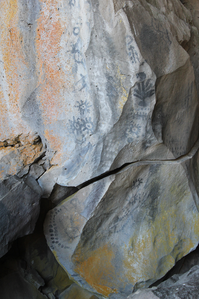
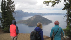
On the third day, we packed up and drove through the northern section of the monument. Our last stop was to Petroglyph Point where a monolithic wall includes petroglyphs, raptor nests, and evidence of former wave action. Tule Lake was a gigantic, yet shallow inland lake that existed for millennia. The lake was drained in the early 1900s and the exposed land turned into farmland. The existing lake is far to the west and is one-sixth its original size. Future explorations to Lava Beds will include additional sites of the Modoc War and seeing the remnants of an imprisonment camp where Americans of Japanese ancestry were forced to live during WWII. In the afternoon we drove to Crater Lake and made camp. The Mazama Campground was closing for the season and this was its last weekend. Upon our arrival, the sky darkened and it rained for several minutes. After making camp we hiked to the Great Spring and down the picturesque Annie Creek trail loop. In the late afternoon, we made good use of the camp showers then drove the rim to enjoy the views from Discovery Point. At dinnertime, we made our way to the historic Crater Lake Lodge where we raised a glass to celebrate the Autumnal Equinox then enjoyed a meal. Back at the campground, a nearly full moon encouraged multiple parties at neighboring campsites and sleeping was difficult.
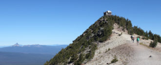
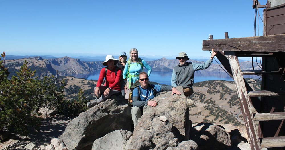
On day four we woke to a frosty 28 degrees Fahrenheit. We warmed up though at the local Annie Creek Restaurant with some hot coffee and breakfast. As we drove along the east rim to the Mount Scott trailhead the sky was blue and clear. We hiked for about an hour to this highest point in the park, which stands just less than 9,000 feet. The view of the once massive volcano Mount Mazama, now known as Crater Lake, was superb! We could see about 100 miles in each direction; to the north the Three Sisters, and to the south Mount Shasta. As noon approached we hiked back down the mountain and ended our trip with a late lunch. There was a definite chill in the air, fall had arrived.
Some of the most interesting places are located just a short drive off the main road. Sequoyah’s one-room log cabin in the beautiful forests and hills of eastern Oklahoma is just such a place.
Sequoyah is known as the inventor of the Cherokee’s nation’s written language. He built this cabin in 1829 shortly after his move to what is present-day Oklahoma.
Sequoyah was born about 1770 in Tennessee to a Cherokee mother and non-Indian father. Sequoyah was intrigued by “the fact that white men could convey messages by the use of writing or ‘talking leaves’…. Sequoyah came to realize that the Cherokee language is composed of a set number of reoccurring sounds. With this insight it was possible for him to identify and create a symbol for each sound, thus producing a syllabary rather than an alphabet.†After 12 years of work, in 1821 he completed the Cherokee syllabary.
The drive to the cabin takes visitors along some beautiful country roads. The first thing you notice when you enter the grounds is the air – it is clean, moist and just makes you feel good. The next things you notice are the well-maintained grounds followed by how solid the buildings are constructed. It is obvious this is a well loved and appreciated landmark.
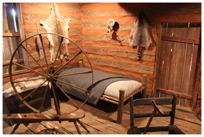
The cabin is actually preserved inside a modern building. After opening the door of the outside building you enter a single open room; at the center is a hand-hewn log cabin, along with the walls, are displays about Sequoyah’s life and his work. What is nice about this exhibit is that visitors can actually step inside his cabin for a close-up view of the period furniture and items that would have been in his life. Unlike many places that hide stories from the past behind cold glass, this landmark is open, inviting and warm.
The people working at the landmark were all friendly.
Sequoyah’s cabin is located about 6 miles northeast of Sallisaw, Oklahoma, on State 101. The cabin and grounds are open Tuesday – Sunday. Check the website for hours. Admission is free.
The cabin is preserved as a National Historic Landmark.
A special ‘thank you’ to Arethia Stann for her introduction to this great place and a tour of the surrounding countryside. Wado, Arethia!
For additional information visit:
http://www.okhistory.org/outreach/homes/sequoyahcabin.html
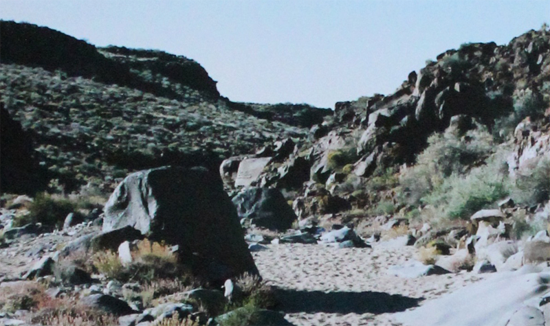
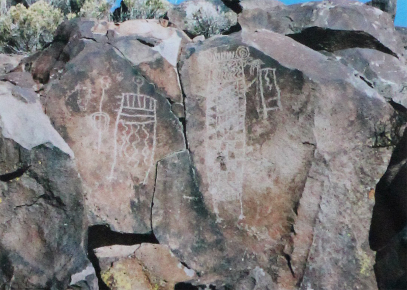
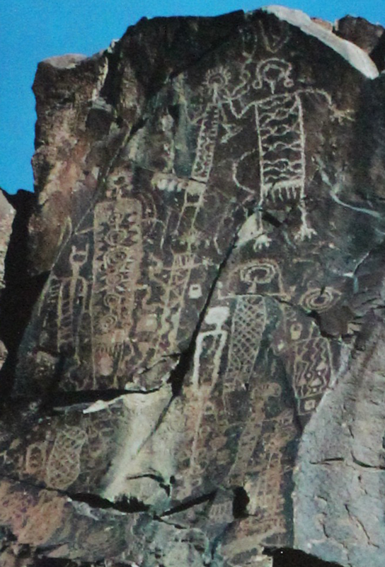
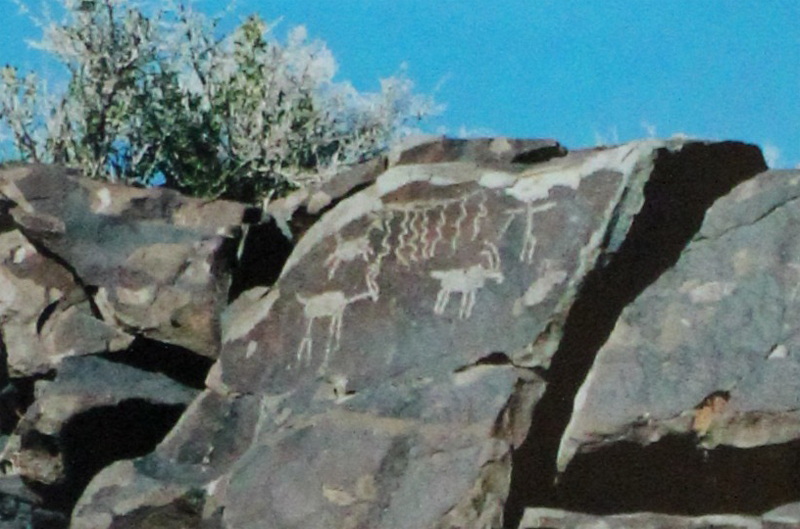
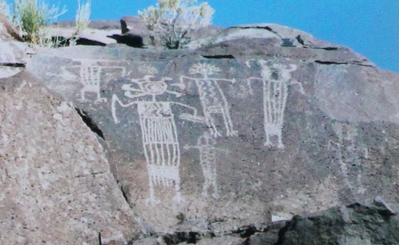
Hidden in the northern Mojave Desert and within the Naval Air Weapons Station China Lake, near Ridgecrest California, is a half-mile wash with over 20,000 images. It is considered the largest known concentration of petroglyphs in the western hemisphere. More information about visiting this remote area can be found at maturango.org.
The canyon starts as an unassuming wash. It quickly impresses. This is a mysterious place and is to be respected. The natural history guide will ask you not to touch the glyphs as the oils from our hands can destroy the rock art over time.
Some of the images are sixty feet above the floor of the canyon.
Impressive. The temperatures at the top of the canyon were well into the 90s’ on the day we visited, however, in the canyon they were in the 70s.
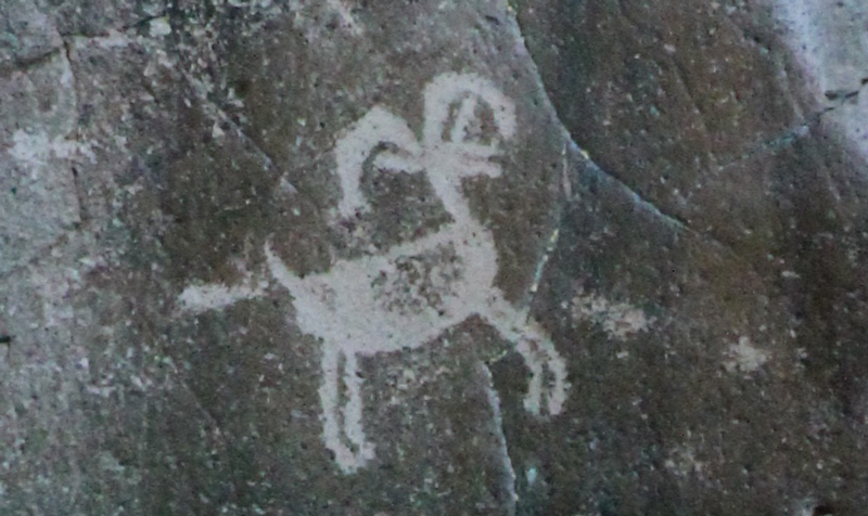
The largest glyph is possibly the most recognizable of all the images in the canyon.
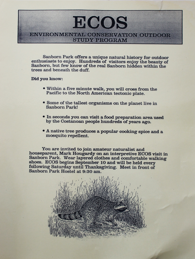
From 1990 to 1992 I developed and led the Environmental Conservation Outdoor Study (ECOS) program at the Sanborn Park Hostel. The hostel was located in a 2,000-acre redwood forested park. I loved sharing the story of this place. It is a land where the Ohlone people once visited (and still do). They prepared food in an area that is underneath the modern floorboard of the hostel’s kitchen. It is a place where salmon once swam in the streams and condors flew overhead. In 1907 the Great San Francisco earthquake ripped a 40-foot scarp through a nearby orchard that most would never recognize today. It is a place where a uranium miner sold his fortune and created Walden West, a place where the early minds Silicon Valley gathered to grow an industry. Hidden among the trees and beneath the duff is a compelling story. Below is an early flier for the weekly programs.

 Trip Report:
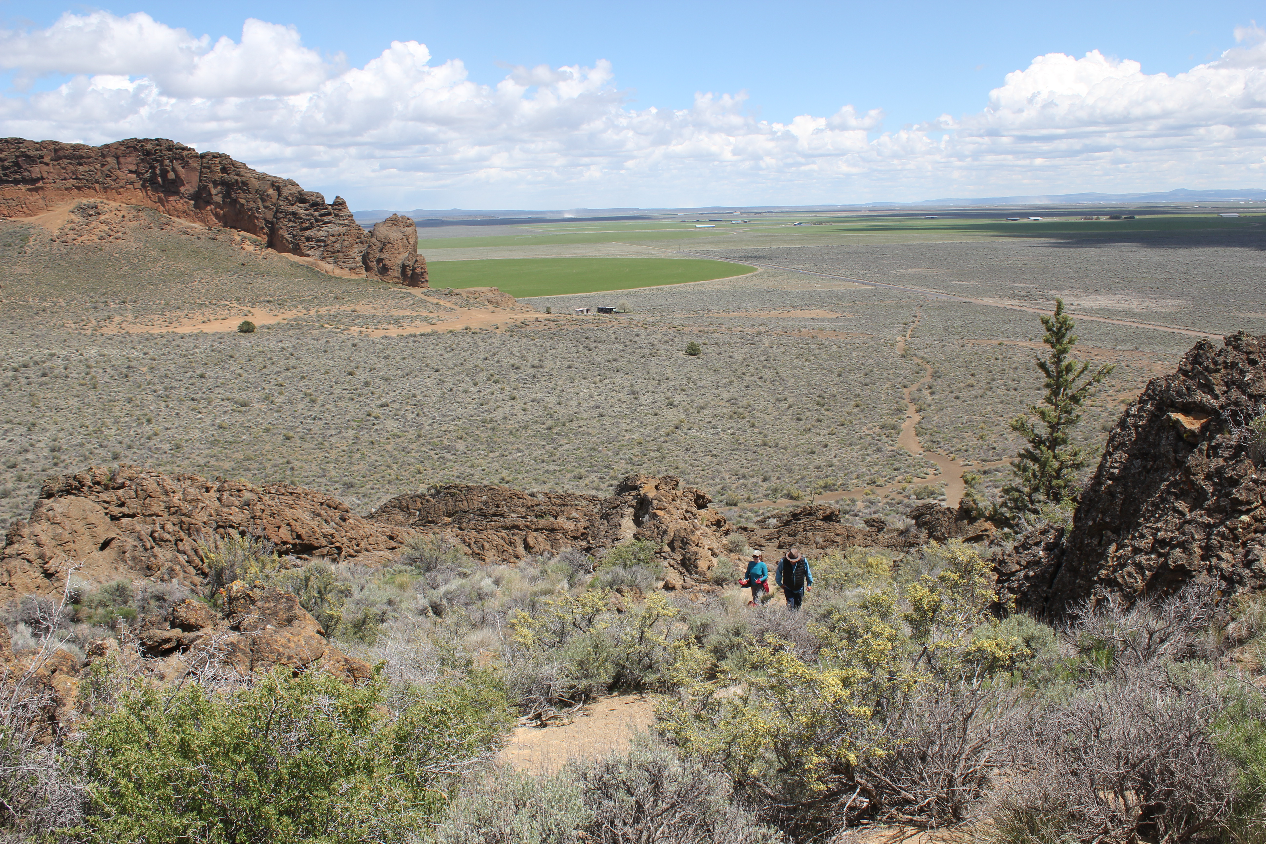

 Some of the most interesting places are located just a short drive off the main road. Sequoyah’s one-room log cabin in the beautiful forests and hills of eastern Oklahoma is just such a place.
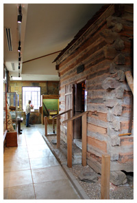 The cabin is actually preserved inside a modern building. After opening the door of the outside building you enter a single open room; at the center is a hand-hewn log cabin, along with the walls, are displays about Sequoyah’s life and his work. What is nice about this exhibit is that visitors can actually step inside his cabin for a close-up view of the period furniture and items that would have been in his life. Unlike many places that hide stories from the past behind cold glass, this landmark is open, inviting and warm.