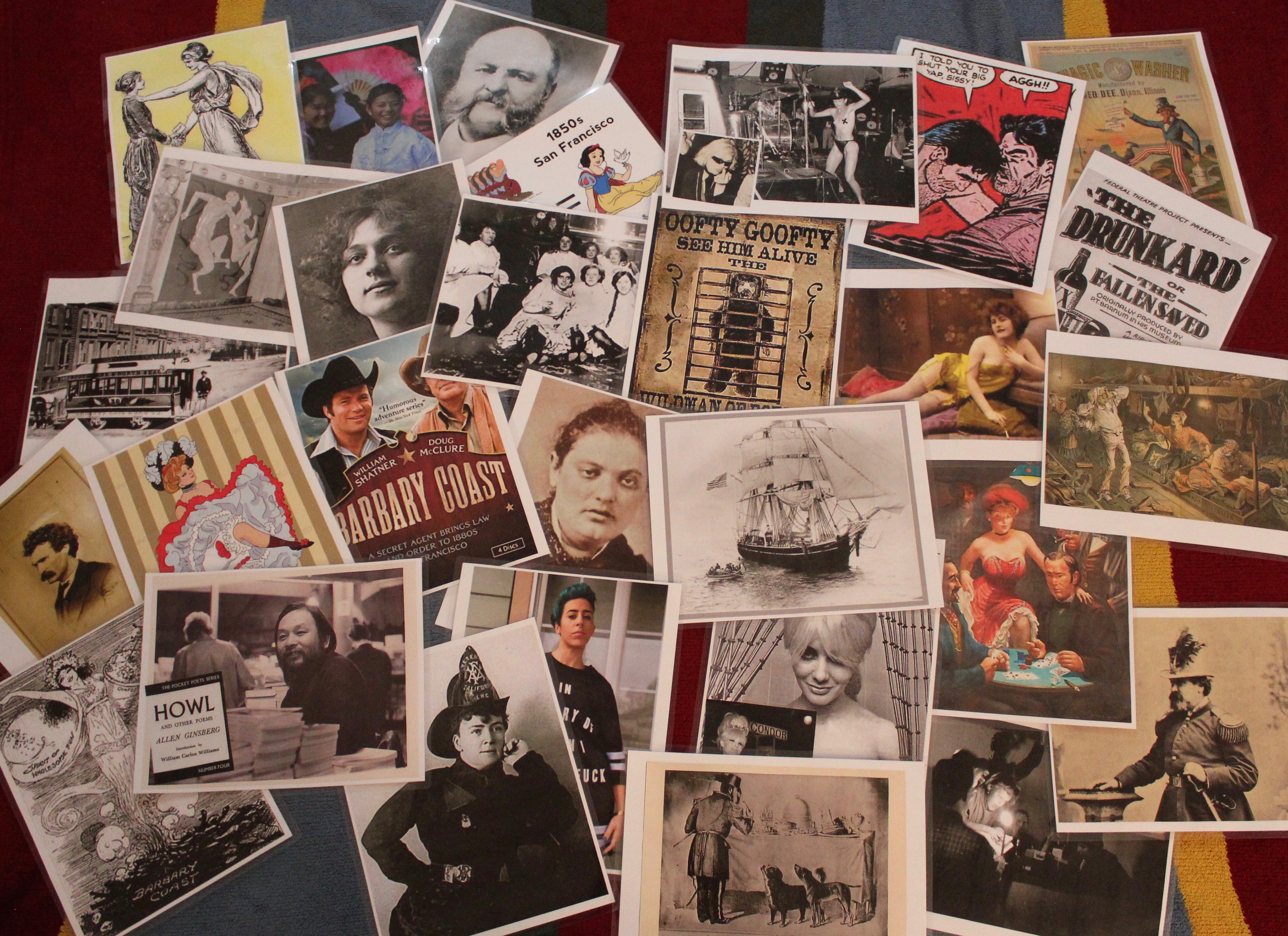
San Francisco is a city born within a moment – the discovery of gold in 1848. The city’s parents were not elites or idealist, but gritty prospectors, sailors, railroad workers, gamblers, ladies of the night, grifters, poets, and carney hustlers. Like then, today’s San Francisco is often idealized as being a place where a person can discover one’s fortune, where an individual can craft their future, and where it’s OK to be weird. But, beneath the sidewalks, unimpressive alleys and among lonely buildings of the original city —the old Barbary Coast— is a hidden San Francisco, a city that was forged in fear, sex, and gold.
Trip Report:
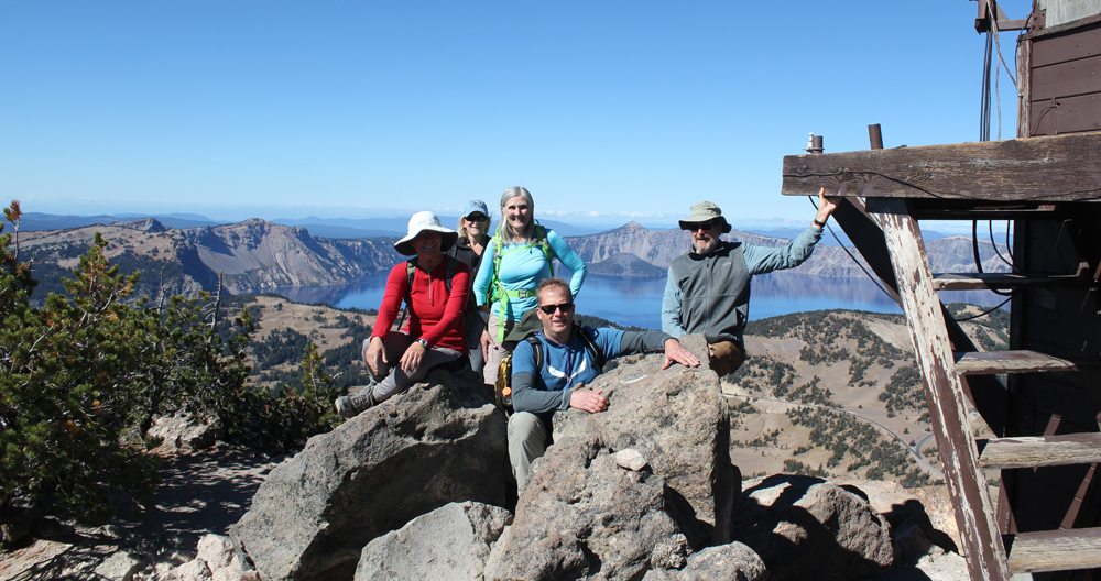
Volunteer Leader: Mark Hougardy | Organization: Eugene-based Hiking Club | Date: November 2018 | Duration: 4 days | Participants: 8 | Type: walking and urban exploration
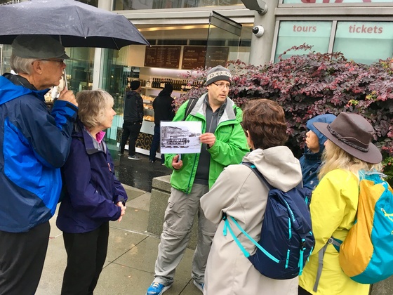
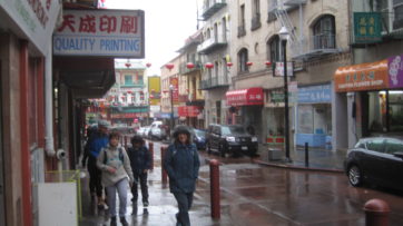
Our interpretive walking trip explored how fear, sex, and gold changed the city in three important ways. We saw how fear directed at those considered “unfit” by society (poor, minorities, and women) reveals they are the true backbone of the city, then how censorship of sex led to modern freedoms, and finally how gold fever changed forms never really disappeared.
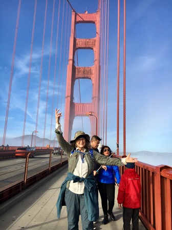
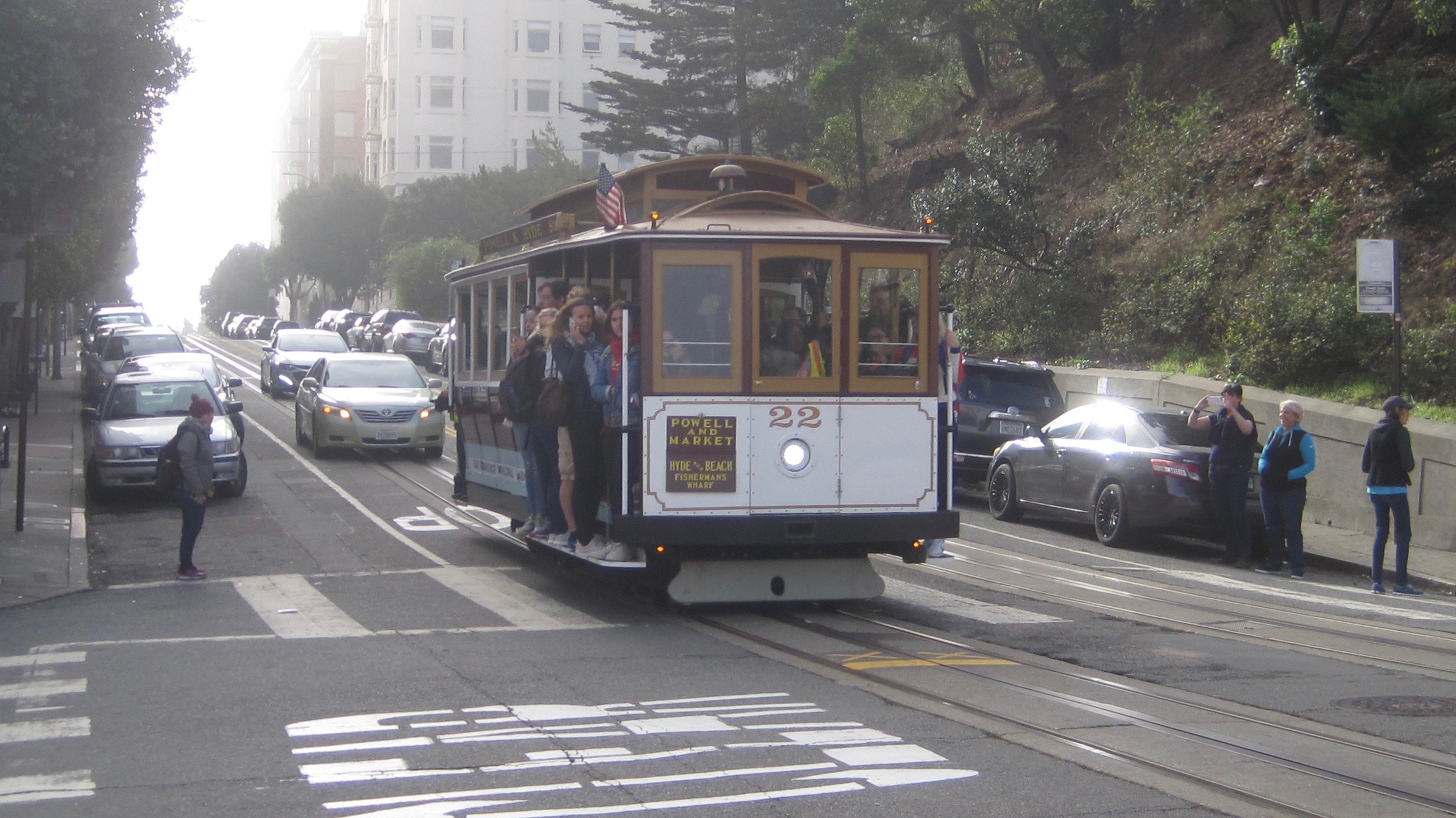
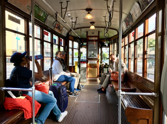
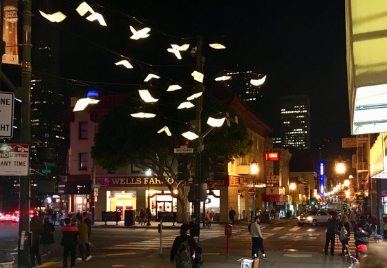
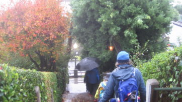
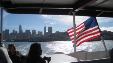
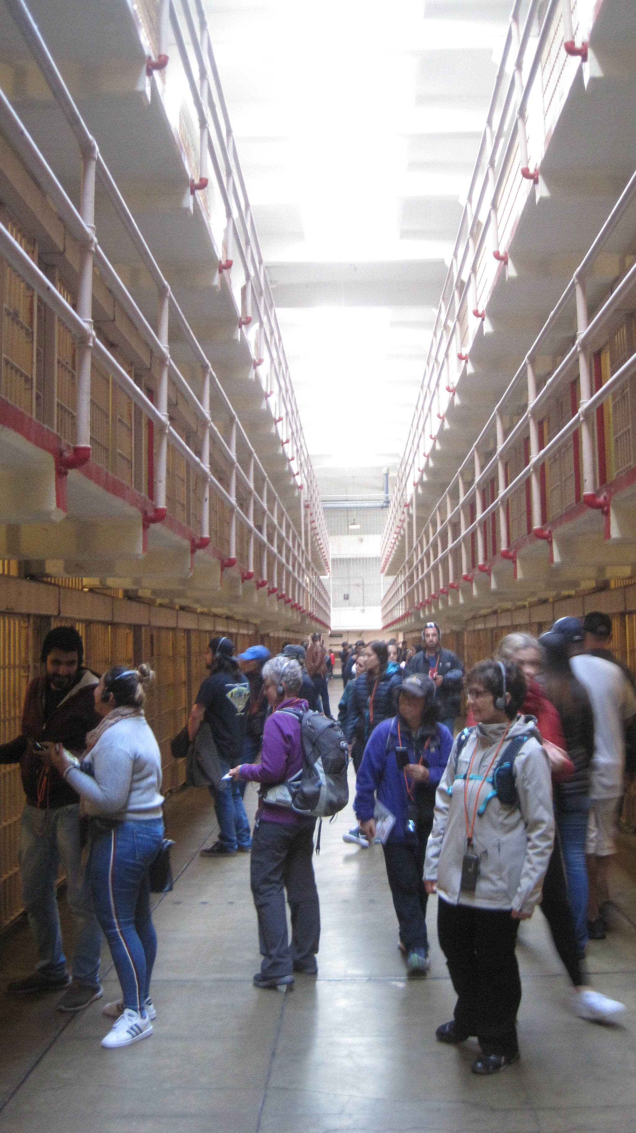
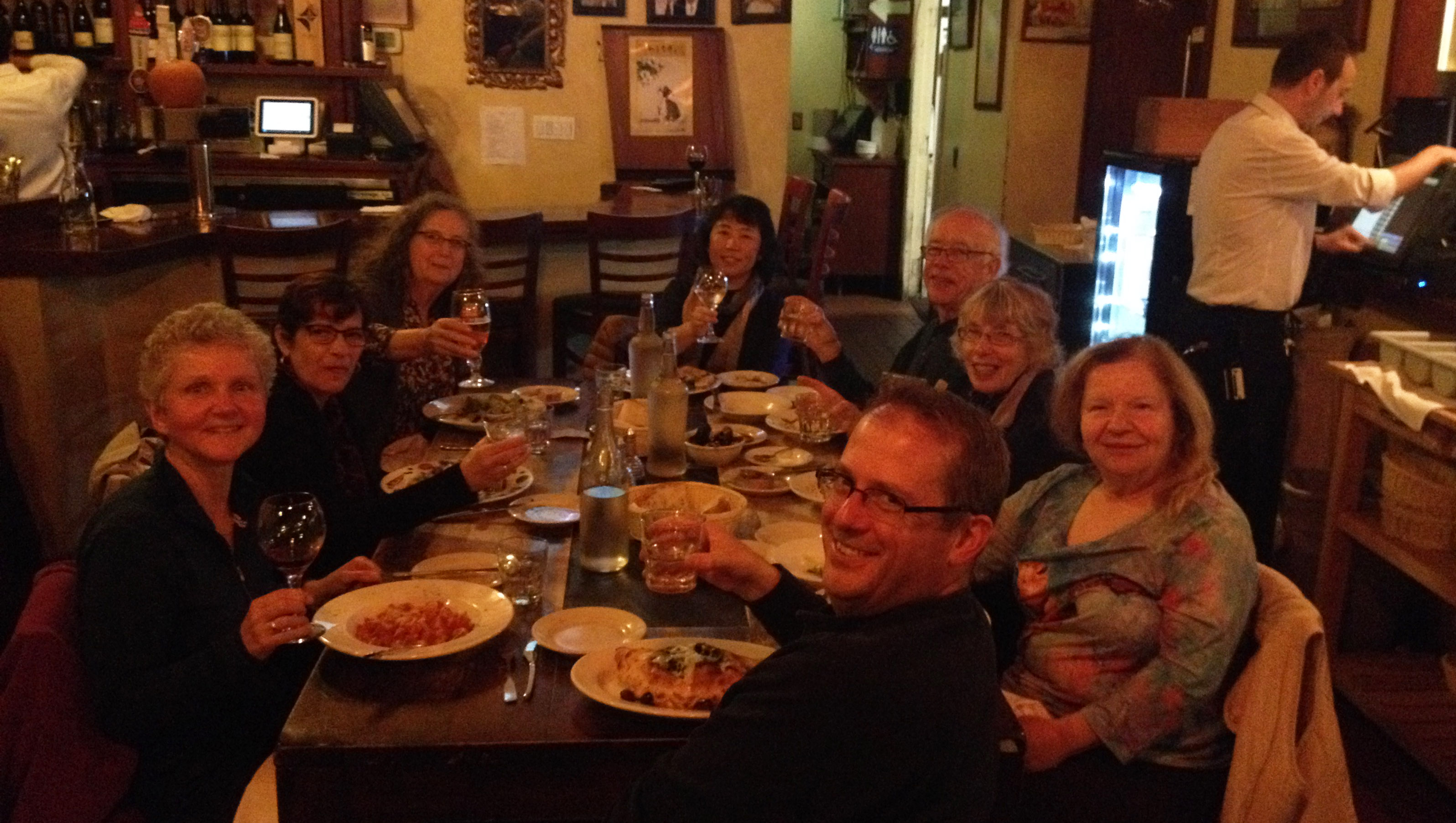
Our group traveled by air from Oregon on Thanksgiving Day to San Francisco. Many of us overnighted at the Fort Mason Hostel and dined at a waterfront restaurant. The next day we traveled by trolley to Union Square and enjoyed the Christmas decorations before starting our 5-mile walk. We explored the sordid history of Maiden Lane, the colorful streets of Chinatown, and the historically depraved area known as the Barbary Coast. Our route followed much of the original shoreline, which is now half a mile inland. We visited City Lights Books and places where the counter-culture Beats hung out. We climbed the steep steps of Telegraph Hill to see the murals of the historic Coit Tower. Our walk took us along garden-lined staircases and alleys. The next day we traveled to the lonely island of Alcatraz to learn more about its prison then enjoyed an afternoon exploring the city. That evening the group enjoyed a salty performance of Beach Blanket Babylon. On the final full day, several members walked ten-miles from the Marina District over the Golden Gate Bridge to Sausalito and returned by ferry. The group walked ~20 miles in total. The group returned by plane to Oregon. Photos by Mark Hougardy & Meg Stewart Smith.
Some of the faces and places who showed participants a good time… er, helped them learn more about San Francisco’s story on this wicked trip.
Group Leader Mark Hougardy sharing a story about a gutsy woman who challenged societal norms in the 1860s. Today, everyone can ride a trolley in San Francisco because of her struggle.
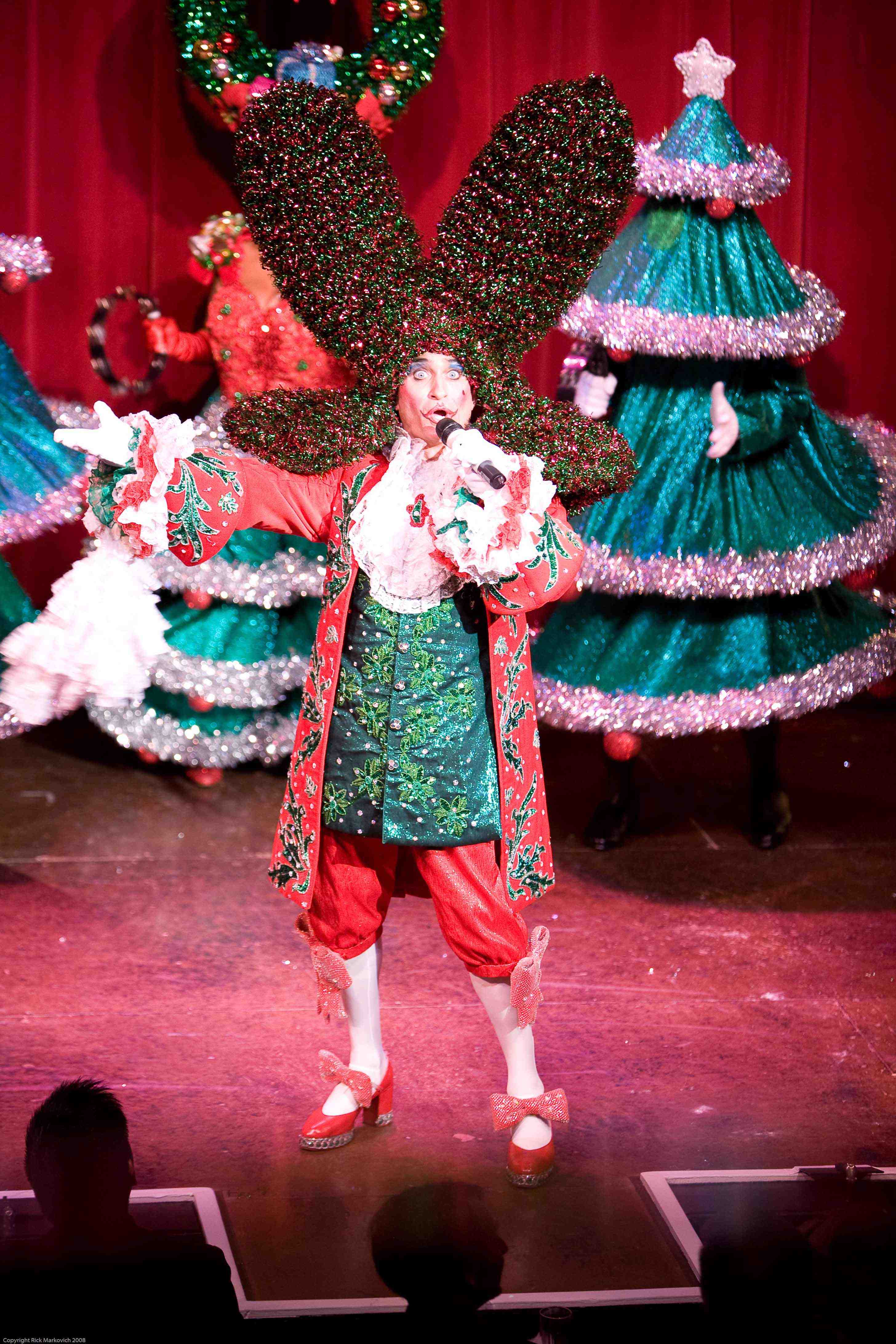
We caught a Holiday performance of Beach Blanket Babylon. King Louie sings his heart out. Photo: Beach Blanket Babylon
Explorations can sometimes be found at 38,000 feet while sitting in the cramped quarters of an airplane. The route between San Francisco, California and the Pacific Northwest is a favorite to visually explore because of the varied topography. Here are some photos, the images were taken over several trips.
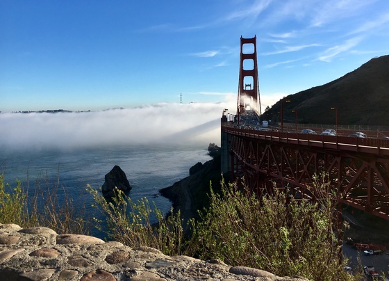
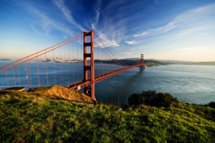
A magnificent view of San Francisco and the Golden Gate. San Francisco covers an area roughly 49 square miles! The Golden Gate Bridge shown on the left is 1.7 miles in length and 746′ tall.
Mount Shasta (14,179′). Shasta sits uniquely at the southern end of the Cascade Range and the northern end of the Sacramento Valley. The mountain is so massive that it can be seen from 280 miles away from atop Diablo Mountain (3,848′), the tallest mountain in the eastern San Francisco Bay Area.
Crater Lake is in the distance. Once known as Mount Mazama, this peak rivaled Mount Shasta for prominence upon the skyline. Mazama erupted about 7,000 years ago, and in the process list its peak and collapsed upon itself. Over time the remaining crater filled with water. The lake is 2,000′ deep and about 5 miles across.
From north to south – left to right: Black Butte (6,436′) Mount Washington, Belknap Crater (6,876′), and the Three Sisters (north, middle and the south sisters); they were once known as Faith, Hope, and Charity.
From north to south – left to right: Ollalie Butte (7,219′), the snow-capped Mount Jefferson (10,497′), Three Fingered Jack (7,844′), Black Butte, Mount Washington, and Belknap Crater.
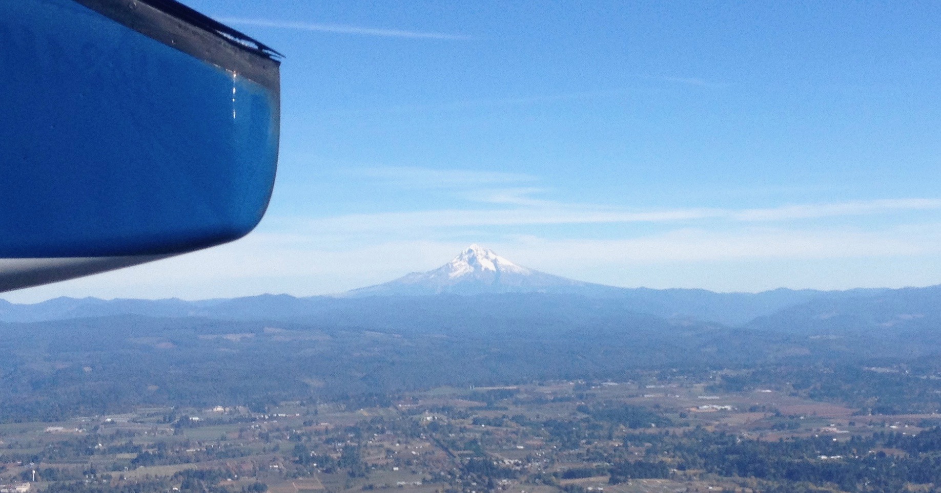
Mount Hood (11,250′) dominates the skyline east of Portland, Oregon.
Looking north into Washington State to Mount St. Helens (8,366′), Mount Rainier (14,411′), and Mount Adams (12,280′). The mighty Columbia River is in the foreground.
This was an exploration of two dramatic volcanic landscapes timed with the Autumnal Equinox.
Trip Report:
Volunteer Leader: Mark Hougardy | Organization: Eugene-based Hiking Club | Date: September 2018 | Duration: 4 days | Participants: 5 | Type: car camping, hiking, and caving
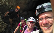
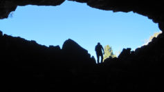
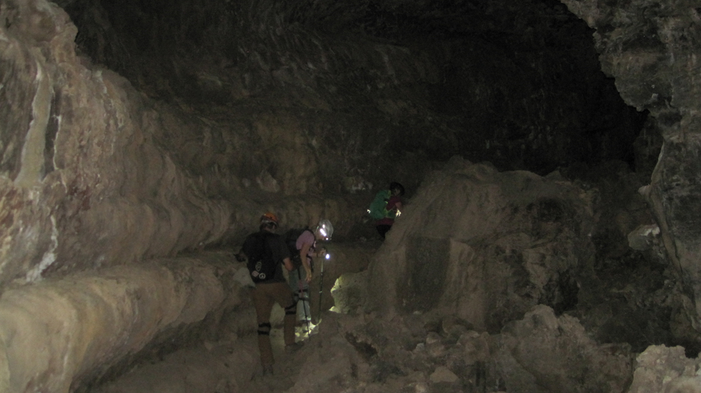
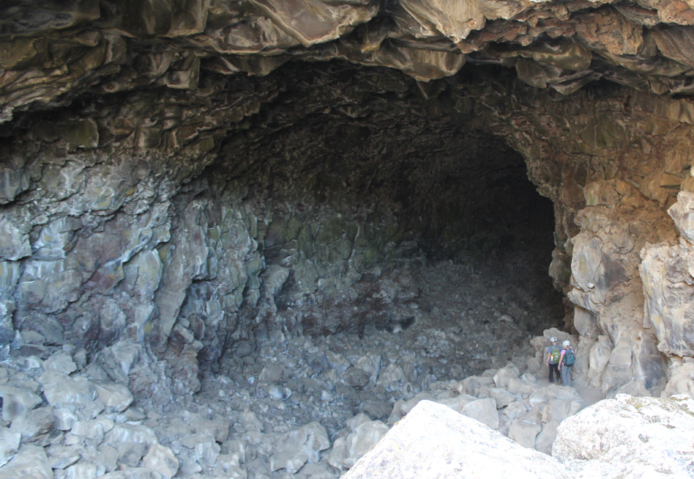
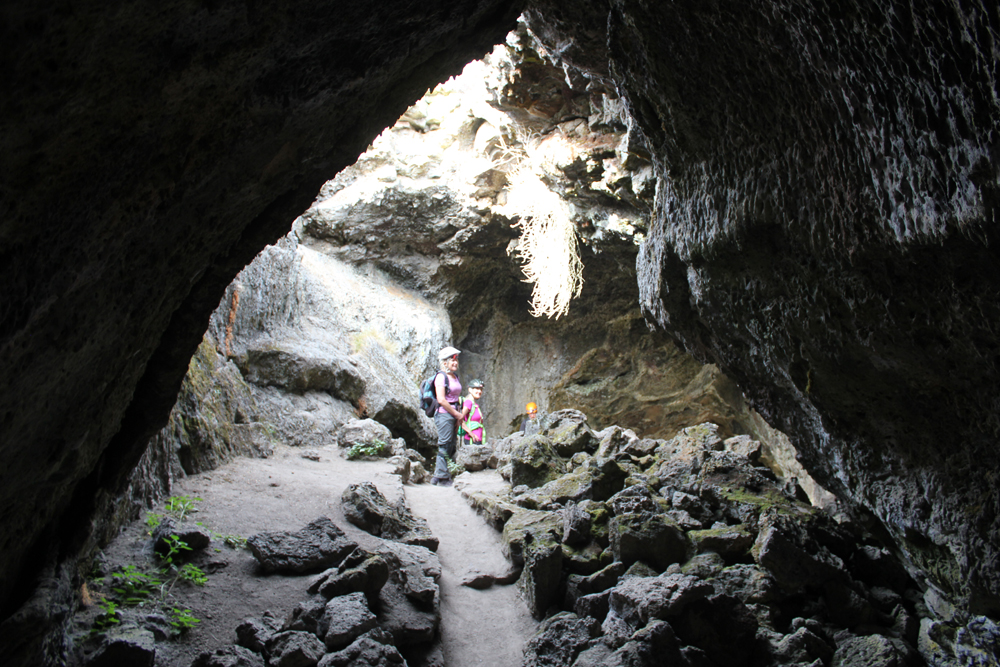
Upon arriving at the forbidding Lava Lands National Monument we made camp and then explored several accessible lava tube caves around the visitor center. We also climbed the conical shaped 5,302-foot tall Schonchin Butte where we enjoyed views 100 miles east to the Warner Mountains, near Nevada, and 50 miles west to Mount Shasta. In the evening, we walked along a dusty trail into the Schonchin Wilderness Area and encountered an entrance to a lava tube that was at least 4 stories tall.
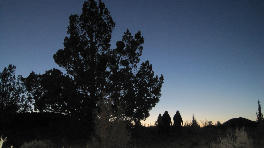
The next morning we hiked from the campground to Skull Cave where a small ice pond can be viewed year round. We also hiked to several pictograph caves and enjoyed our lunch on the trail. As the afternoon warmed we spent our time underground where we explored three caves and partially a fourth. Back at camp, we were surprised to discover that several hundred bugs had descended upon the hood of one of the cars, possibly attracted by the metallic-blue color. They had apparently been engaged in a frenzied mating and exhausting themselves to death. Bugs that fell onto the ground were snapped up by an eager lizard. As the sun set, we hiked into the nearby wilderness and enjoyed a pastel sky.
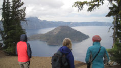
On the third day, we packed up and drove through the northern section of the monument. Our last stop was to Petroglyph Point where a monolithic wall includes petroglyphs, raptor nests, and evidence of former wave action. Tule Lake was a gigantic, yet shallow inland lake that existed for millennia. The lake was drained in the early 1900s and the exposed land turned into farmland. The existing lake is far to the west and is one-sixth its original size. Future explorations to Lava Beds will include additional sites of the Modoc War and seeing the remnants of an imprisonment camp where Americans of Japanese ancestry were forced to live during WWII. In the afternoon we drove to Crater Lake and made camp. The Mazama Campground was closing for the season and this was its last weekend. Upon our arrival, the sky darkened and it rained for several minutes. After making camp we hiked to the Great Spring and down the picturesque Annie Creek trail loop. In the late afternoon, we made good use of the camp showers then drove the rim to enjoy the views from Discovery Point. At dinnertime, we made our way to the historic Crater Lake Lodge where we raised a glass to celebrate the Autumnal Equinox then enjoyed a meal. Back at the campground, a nearly full moon encouraged multiple parties at neighboring campsites and sleeping was difficult.
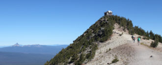
On day four we woke to a frosty 28 degrees Fahrenheit. We warmed up though at the local Annie Creek Restaurant with some hot coffee and breakfast. As we drove along the east rim to the Mount Scott trailhead the sky was blue and clear. We hiked for about an hour to this highest point in the park, which stands just less than 9,000 feet. The view of the once massive volcano Mount Mazama, now known as Crater Lake, was superb! We could see about 100 miles in each direction; to the north the Three Sisters, and to the south Mount Shasta. As noon approached we hiked back down the mountain and ended our trip with a late lunch. There was a definite chill in the air, fall had arrived.
Where can a frugal traveler stay in ultra-expensive San Francisco? These are friendly, clean, and safe hostels to help you explore this world-class city while not wrecking your budget.
The Adelaide Hostel
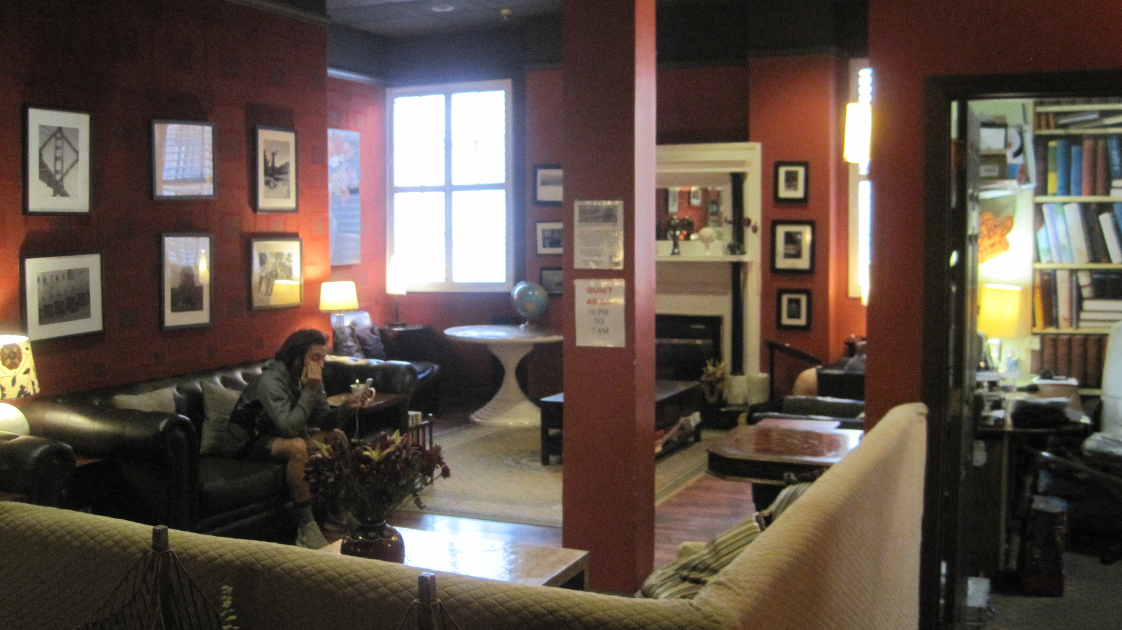
The Adelaide is a few blocks west of the centrally located Union Square. The hostel’s name originates from a former owner’s love of his Australian hometown. This is an older building, but the architecture’s warm color palette and modern facilities only compliment the charm. The kitchen and dining areas are clean and there are nights where the hostel prepares meals for guests. In the morning make sure to grab a bowl of complimentary oatmeal and orange juice. A quiet area on the main floor is a great place to read and work on a laptop. The staff is very knowledgeable about local places to eat and go sightseeing. Expect some street noise if the windows are open, but earplugs will take care of most extraneous sounds.
Website: www.adelaidehostel.com
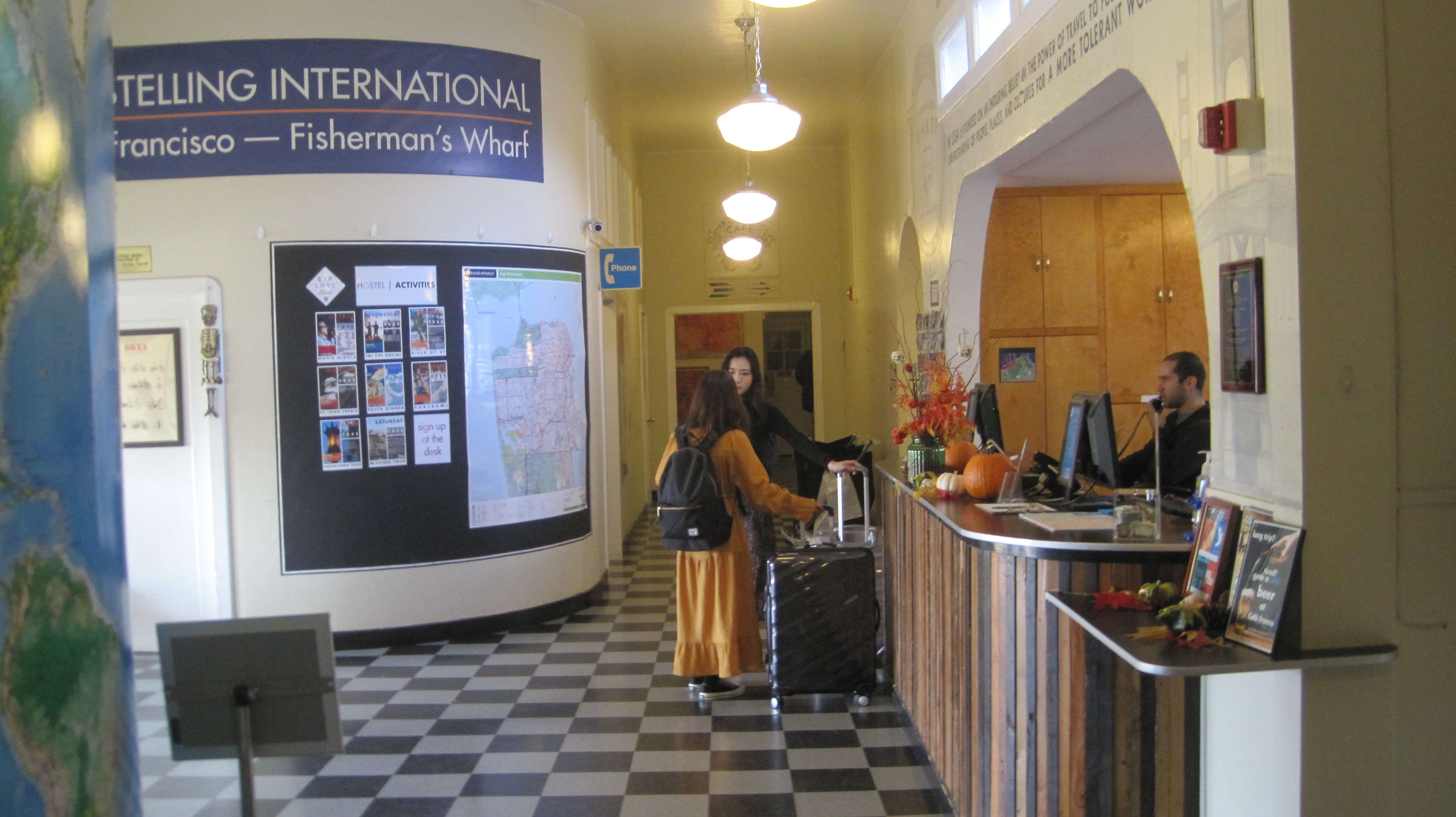
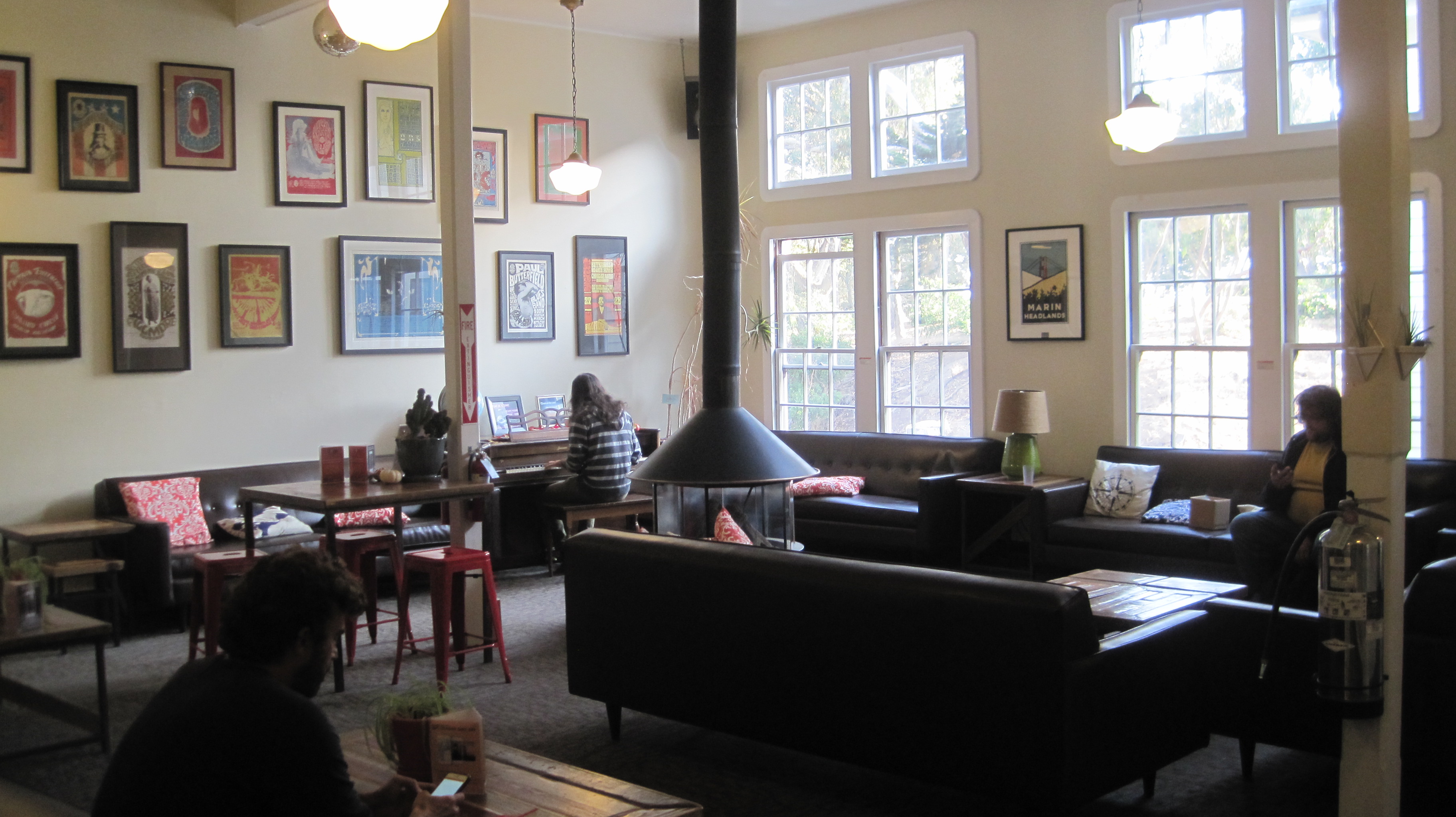
Fort Mason Hostel (Hosteling International Fisherman’s Wharf)
All of the HI hostels in the bay area great places to stay, but Fort Mason takes the cake just because of its proximity to the Marina District, Fisherman’s Wharf, and Ghirardelli Square. The hostel retains the crispness and presentation of the building’s military history. The kitchen is sizeable and the common area includes a pool table. Nearby is a small coffee shop that offers pastries and cookies. A palatial quiet room on the main floor offers a respite for computer work, reading, or just hanging out. A grocery store (the Marina Safeway) is about half a mile away if you need to resupply. If you want to explore the city, a Cable Car turnaround is a short walk away. The staff is very friendly and helpful and went the extra distance to answer some of my questions. I really appreciate the hostel’s extra activities, which included area hikes led by knowledgeable locals.
Website: www.sfhostels.org/fishermans-wharf
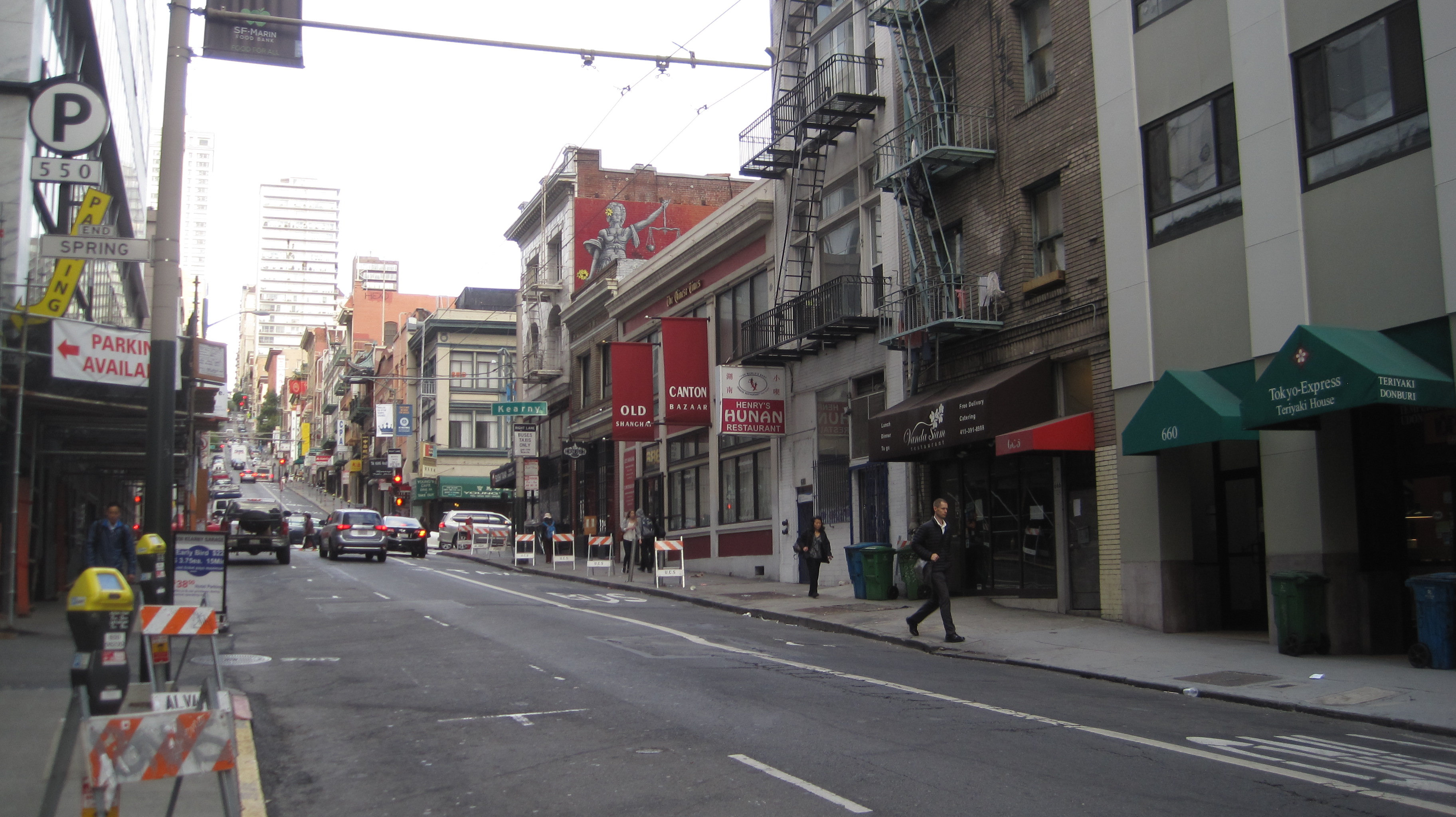
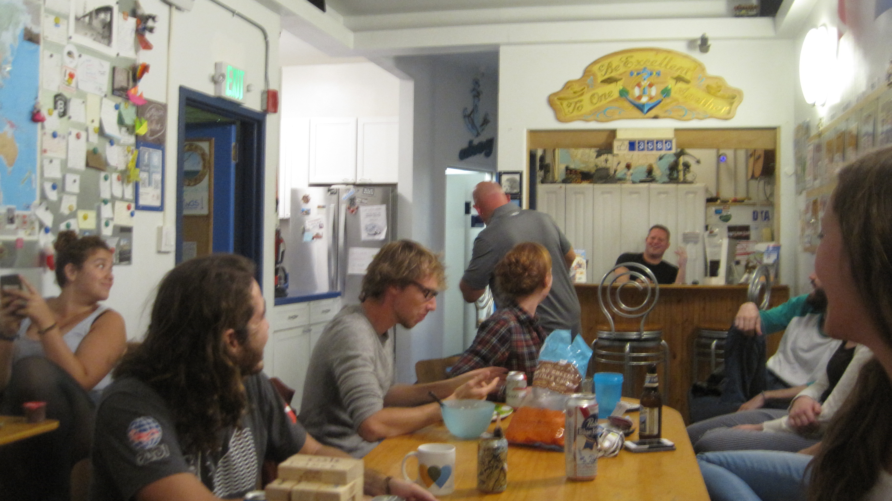
Pacific Tradewinds Hostel
Don’t let the unassuming street entrance adjacent to a Hunan restaurant fool you, the Pacific Tradewinds Hostel is clean, modern, and has a friendly staff. Located near Chinatown, this hostel is centrally located to downtown and North Beach clubs. Be aware, this is a social hostel (aka a party hostel!) and is usually frequented by a younger crowd. The hostel’s main room can quickly become busy and an innocent game of Jenga can turn into a (friendly) beer drinking competition. Bring earplugs as street noise at the night can keep you up. The hostel has a small kitchen with all the amenities. The hostel staff leads tours and clubbing excursions throughout the week.
Website: san-francisco-hostel.com
All of the above-mentioned hostels run about $50 a night. Make sure to bring a small travel lock to secure any items in a locker, as well as shower shoes and extra soap. To avoid the crowds in San Francisco, the best time for visiting is mid-October through March.
If you and your family have the opportunity to visit the General Grant Tree of Kings Canyon National Park you are in for a treat.
Parents can walk among and appreciate the majesty of these ancient and immense Giant Sequoia Redwood trees. Kids will enjoy being outside, playing in an old cabin, and walking through the Fallen Monarch, a cave-like giant redwood that is so big that it once stabled 32 U.S. Cavalry horses.
The General Grant Tree is important because it is the world’s third-largest living thing (by volume). The General Grant is 268 feet (81.6 meters) in height and has a circumference of 107.5 feet (32.7 meters)! It is not just big, but ancient; although the exact age of The General Grant is not known the National Park Service’s website estimates the tree to be between 1,800 and 2,700 years old.
When visiting this tree spend a few minutes contemplating about the civilizations and people who lived about 2,000 years ago, then consider that the General Grant was likely an old tree when those people walked the earth. Wow!
Some “fun facts” displayed on a placard near the General Grant Tree help visitors better understand more about this immense redwood, they include:
If the trunk of the General Grant Tree was a gas tank on a car that got 25 miles per gallon, you could drive around the earth 350 times without refueling.
The General Grant Tree is so wide it would take about twenty people holding hands to make a complete circle around the base.
If the General Grant Tree’s trunk could be filled with sports equipment, it could hold 159,000 basketballs or more than 37 million ping-pong balls.
President Calvin Coolidge proclaimed the General Grant Tree to be the nation’s Christmas Tree in 1926. In 1956, President Dwight D. Eisenhower designated it as a National Shrine, a living memorial to those who have given their lives for their country.
Many of the Giant Redwood trees in the Sierra Nevada Mountains were named just after the American Civil War. It was at this time that General Grant Tree was named after Ulysses S. Grant the final leader of the Union forces. A short distance away from the Grant Tree is the Robert E. Lee Tree, named for the leader of the Confederate forces. The Lee tree is the 12th largest tree on the planet.
The General Grant Tree and other Giant Sequoias are located in Kings Canyon National Park and the adjacent Sequoia National Park. Visitors to the Grant Tree can enjoy a self-guided trail that is half a mile (.8 kilometers) in length. The trail from the parking area is paved so wheelchairs and strollers are welcome. The location of the Grant Tree is roughly a 1.5-hour drive east of Fresno, California.
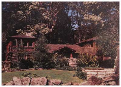
The Sanborn Park Hostel is a beautiful historic log house hidden among the coastal redwoods of Sanborn Park County Park near Saratoga, California. Sadly, after a 30-year run, the hostel recently closed its doors. Shown above is how it appeared at the time of the closing in 2010. Below is how it appeared in its heyday – in the late 1980s and early 90s.
Sanborn Park Hostel – a view from its heyday in the late 1980s and early ’90s.
This hostel was a friendly place to stay for backpackers, international travelers, bicyclists, Scout troops, church groups, students on field trips and families who needed a weekend away from the frantic pace of Silicon Valley.
Visitors could explore miles of trails in the 3,688-acre park, discover a nearby section of the San Andreas Fault, enjoy a short hike to a Nature Center, take a picnic to a nearby winery or enjoy a cookout under a grove of redwood trees.
The Hostel always provided programs and trips to help ‘tell the story’ of the local area for those who were curious. Like the park and the redwoods around the building, the hostel also has a story.
For hundreds of years, the local area was visited by native Ohlone people. Signs of their acorn grinding mortors can be found on monolithic rocks that now form an entry to Hostel grounds. The Grizzly Bear once lived in this park. Forests of old growth redwood trees blanketed the hillsides; several large redwood stumps eight feet in diameter are still in the woods if you know where to look.
In 1908 the Honorable Judge Welch built a large log style summer cottage. He named it, “Welch-Hurst.†The name was derived from his name and the word Hurst, meaning woods or a grove. The Judge planted several orchards in the area. He also had a vineyard. He turned a nearby sag pond (sag ponds are natural pools found along the path of the San Andreas Fault) into a picturesque pond with a small island, footbridge, waterfalls, and large lily pads. The pond was home to fish, frogs and an assortment of ducks and geese.
In the 1950s a man named Pick lived in the log style house. Mr. Pick had discovered Uranium in the west (Wyoming or Colorado) and sold his claim to the U.S. military earning several million dollars at the time. With part of his fortune, he bought “Welch-Hurst†and he renamed it “Walden West.†The name was derived from the book, “Walden,†by author, philosopher, and naturalist, Henry David Thoreau.
Pick added a number of buildings in the area including a small complex of buildings that housed early IBM employees and possibly helped to incubate some thinking that led to modern Silicon Valley. Today, the buildings of Walden West provide outdoor education programs for students.
In the 1960s and 70s, the house rapidly passed between several owners and the structure was in serious decline. In 1970s Sanborn Park was being expanded and the old house was purchased by Santa Clara County. Estimates at the time to renovate the deteriorating Welch-Hurst house was estimated at half-a-million dollars, too much for county coffers, and the house was scheduled for demolition.
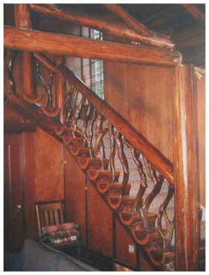
Sanborn Park Hostel’s Madrone and Redwood Staircase.
In 1979, as destruction seemed imminent, the volunteers of the Santa Clara Valley hostelling club stepped forward with a box of hand tools and $460 in the bank to finance their reconstruction project. They were given the go-ahead. Year-after-year volunteers completely rebuilt and refurbished the Judge’s old home. In the main house, they preserved the original rock fireplace and the beautiful madrone and redwood staircase (shown). They also reconstructed the old carriage house turning it into a modern building with beautiful pine ceilings and wooden floors – all the time using as much wood from the original structure as possible. Tax dollars were never used to restore Hostel. This effort was entirely self-funded.
The hostel’s ‘Golden Age’ was in the late 1980s and the early 1990’s when the Hostel’s 39 beds were completely booked.
After the horrible events of 9/11 in 2001 international travel plummeted. Seeing a backpacker from Europe was a rare sight. American travel also declined during this time as a strained U.S. economy, lessening vacation time for families, increasing insurance costs and a host of other reasons impacted travel and the Hostel. These forces slowly took their toll and Sanborn Park Hostel closed in 2010.
When the hostel closed the price to stay for one person was $14, the lowest overnight fee at any hostel in the United States.
The County has no plans for the historic Welch-Hurst building which the Hostel rented from the Parks Department. The refurbished one-hundred-year-old house will likely be boarded up and forgotten. The building is on the Registry of National Historic Places.
I have many fond memories of the hostel. While in college I worked as a ‘Houseparent’ at Sanborn Park Hostel. At the time I wanted to travel, but could not; working at the Hostel provided an opportunity for the travelers to come to me. The Hostel provided me with rich opportunities to learn about different cultures and to meet a wide variety of people. During this time I met thousands of people and some special travelers from Australia, New Zealand, and Austria became life-long friends. One wonderful woman traveling from overseas eventually became my wife.
At times the hostel had a ‘magic.’ One such time involved an evening sitting in front of the large stone fireplace in the living room. A small but bright fire burned. About fifteen people, of all ages, some from overseas, sat on the sofas. We talked about the world. At one point someone brought out some sweet crackers, then someone else made tea for the group. We all talked late into the evening about ideas, places to travel and shared stories. It was an evening that fed the soul. This might sound odd, but if you find yourself in such a setting ask how people sing ‘Happy Birthday’ in their native language. It is a great way to make friends and end an evening with a smile.
In the 30 years as a Hostel, 157,460 people stayed as overnight guests. This number included visitors from 99 foreign countries and all 50 states. Foreign travelers accounted for 20 percent of the total visitorship; that is roughly 31,500 visitors who chose to explore and experience America.
Four points are especially noteworthy about Sanborn Park Hostel’s 30+ year run.
The work to refurbish this historic 100-year-old building was done entirely by volunteers.
Not one penny of public money was ever used to refurbish or operate the building – it was entirely self-funded.
During the hostel’s entire history, it had the lowest overnight fee of all US hostels, only $3 in 1979 to $14 when it closed.
In the 30 years of being a Hostel that 157,460 overnight visitors stayed here; with visitors from 99 foreign countries and all 50 states.
The organization who started Sanborn Park Hostel will continue their famous monthly pot-luck and slide show dinners on the last Thursday of the month at the Saratoga Community Center. Plus, some of the resources from Sanborn Park Hostel have been used to further Hostelling along California’s Central Coast. So in a sense, although the Hostel is gone it will continue in spirit.
It is sad to see the Hostel go, but the Hostel’s newsletter said it with dignity, “Closing the Sanborn Park Hostel is bitter-sweet, but birth and death are both nature’s ways.â€
To learn more about hostelling visit these sites:
http://www.hihostels.com
http://www.hiusa.org
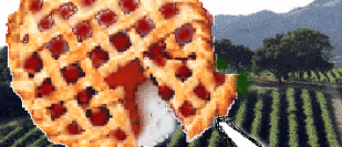
Today, Silicon Valley is home to cutting-edge technology, but just a few short decades ago this land was covered by a stretch of orchards twenty miles wide. Join us as we help celebrate this heritage at the 100-year anniversary of Olson’s Cherry Farm in Sunnyvale, California. Olson’s’ is unique is that it is one of the last remaining farms in the south bay.
The day includes a tour of the farms before traveling (with cherries in tow) to the historic 1908 Sanborn Park Hostel to bake fresh, homemade cherry pies. Then we’ll step outside and enjoy a scoop of hand-cranked vanilla ice cream, with our pie, under the redwoods. A picnic lunch encouraged for the hostel.
Time: Meet in front of the Cherry Stand at 10:45am. Tour starts at 11:00 am Location: Olson’s Cherry Farm. Near the corner of Mathilda Ave on El Camino Real, Sunnyvale. Cost: $10.00 per person, includes a tour, pie makin’s and ice cream. Checks should be made to Sanborn Park Hostel.
Organization: Sanborn Park Hostel
Date: June 6, 1999
Trip leader: Mark Hougardy
Participants: 12
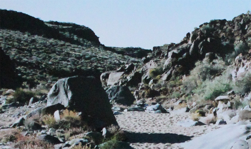
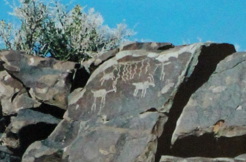
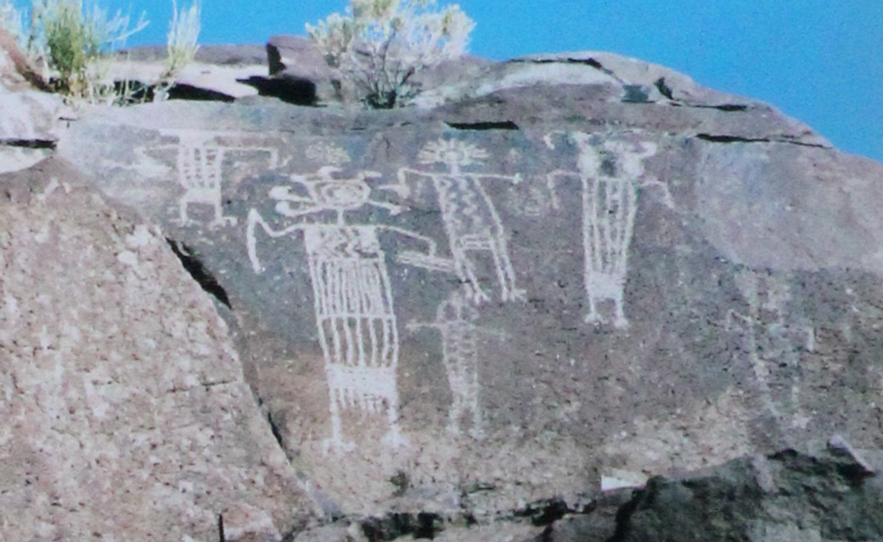
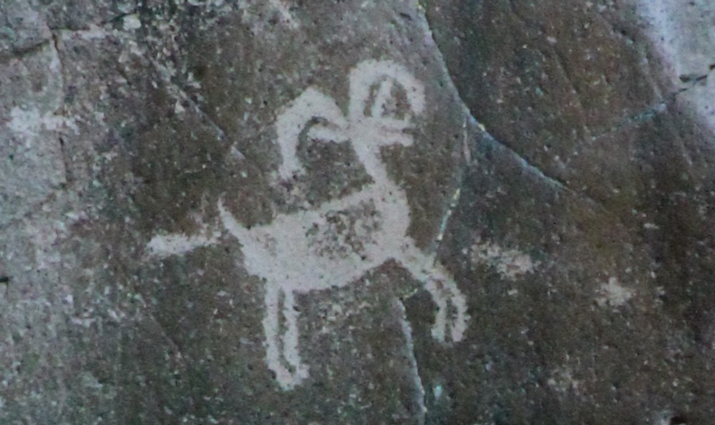
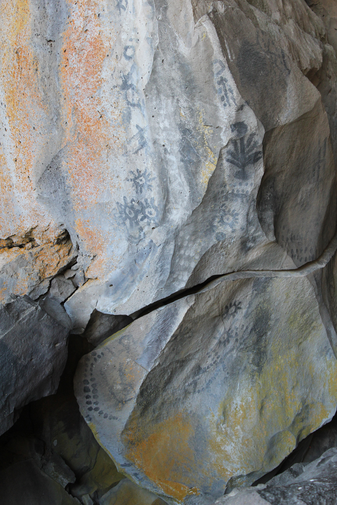
Hidden in the northern Mojave Desert and within the Naval Air Weapons Station China Lake, near Ridgecrest California, is a half-mile wash with over 20,000 images. It is considered the largest known concentration of petroglyphs in the western hemisphere. More information about visiting this remote area can be found at maturango.org.
The canyon starts as an unassuming wash. It quickly impresses. This is a mysterious place and is to be respected. The natural history guide will ask you not to touch the glyphs as the oils from our hands can destroy the rock art over time.
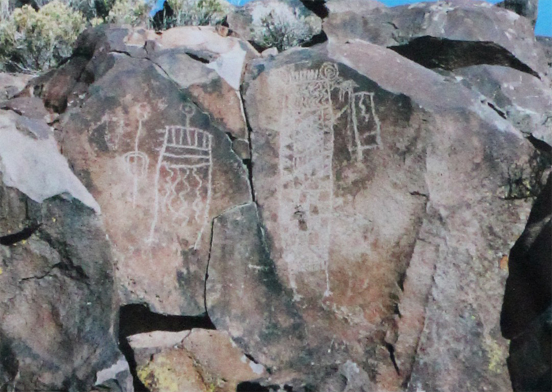
Some of the images are sixty feet above the floor of the canyon.Impressive. The temperatures at the top of the canyon were well into the 90s’ on the day we visited, however, in the canyon they were in the 70s.
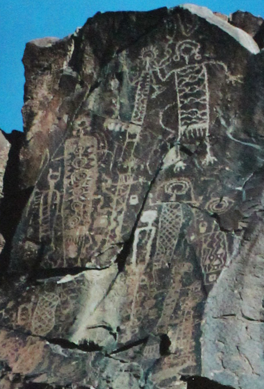
The largest glyph is possibly the most recognizable of all the images in the canyon.
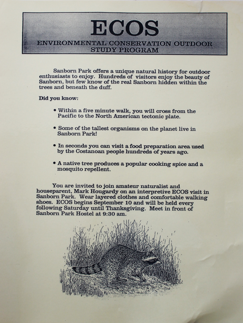
From 1990 to 1992 I developed and led the Environmental Conservation Outdoor Study (ECOS) program at the Sanborn Park Hostel. The hostel was located in a 2,000-acre redwood forested park. I loved sharing the story of this place. It is a land where the Ohlone people once visited (and still do). They prepared food in an area that is underneath the modern floorboard of the hostel’s kitchen. It is a place where salmon once swam in the streams and condors flew overhead. In 1907 the Great San Francisco earthquake ripped a 40-foot scarp through a nearby orchard that most would never recognize today. It is a place where a uranium miner sold his fortune and created Walden West, a place where the early minds Silicon Valley gathered to grow an industry. Hidden among the trees and beneath the duff is a compelling story. Below is an early flier for the weekly programs.

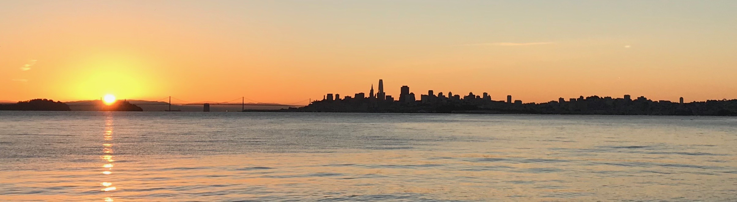
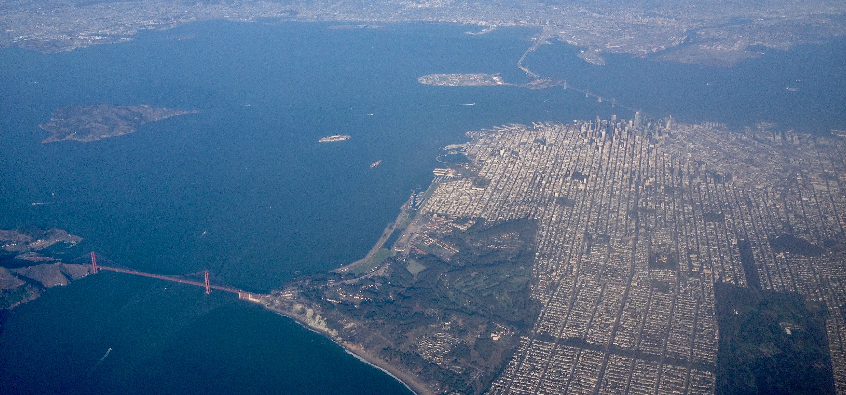 A magnificent view of San Francisco and the Golden Gate. San Francisco covers an area roughly 49 square miles! The Golden Gate Bridge shown on the left is 1.7 miles in length and 746′ tall.
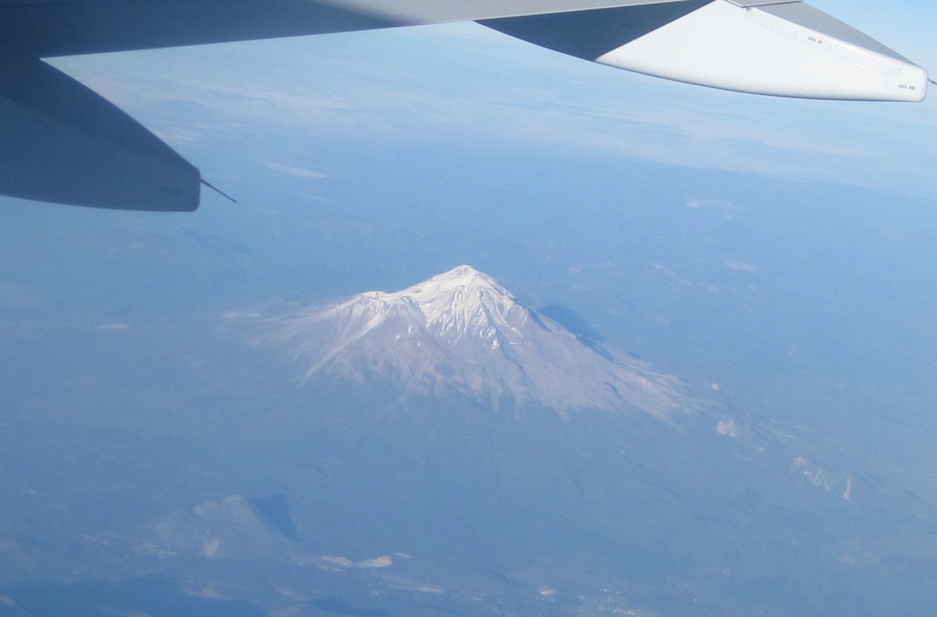 Mount Shasta (14,179′). Shasta sits uniquely at the southern end of the Cascade Range and the northern end of the Sacramento Valley. The mountain is so massive that it can be seen from 280 miles away from atop Diablo Mountain (3,848′), the tallest mountain in the eastern San Francisco Bay Area.
 Crater Lake is in the distance. Once known as Mount Mazama, this peak rivaled Mount Shasta for prominence upon the skyline. Mazama erupted about 7,000 years ago, and in the process list its peak and collapsed upon itself. Over time the remaining crater filled with water. The lake is 2,000′ deep and about 5 miles across.
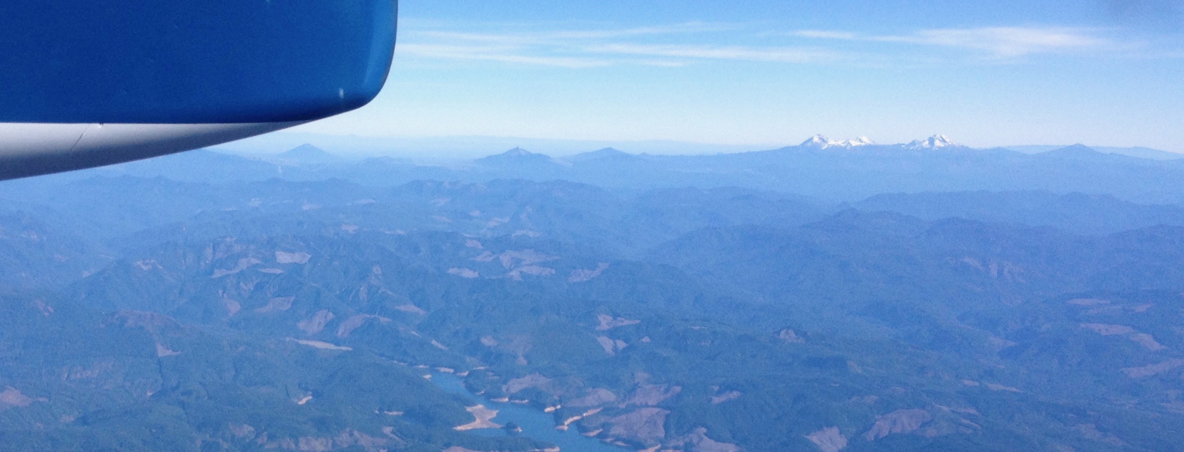 From north to south – left to right: Black Butte (6,436′) Mount Washington, Belknap Crater (6,876′), and the Three Sisters (north, middle and the south sisters); they were once known as Faith, Hope, and Charity.
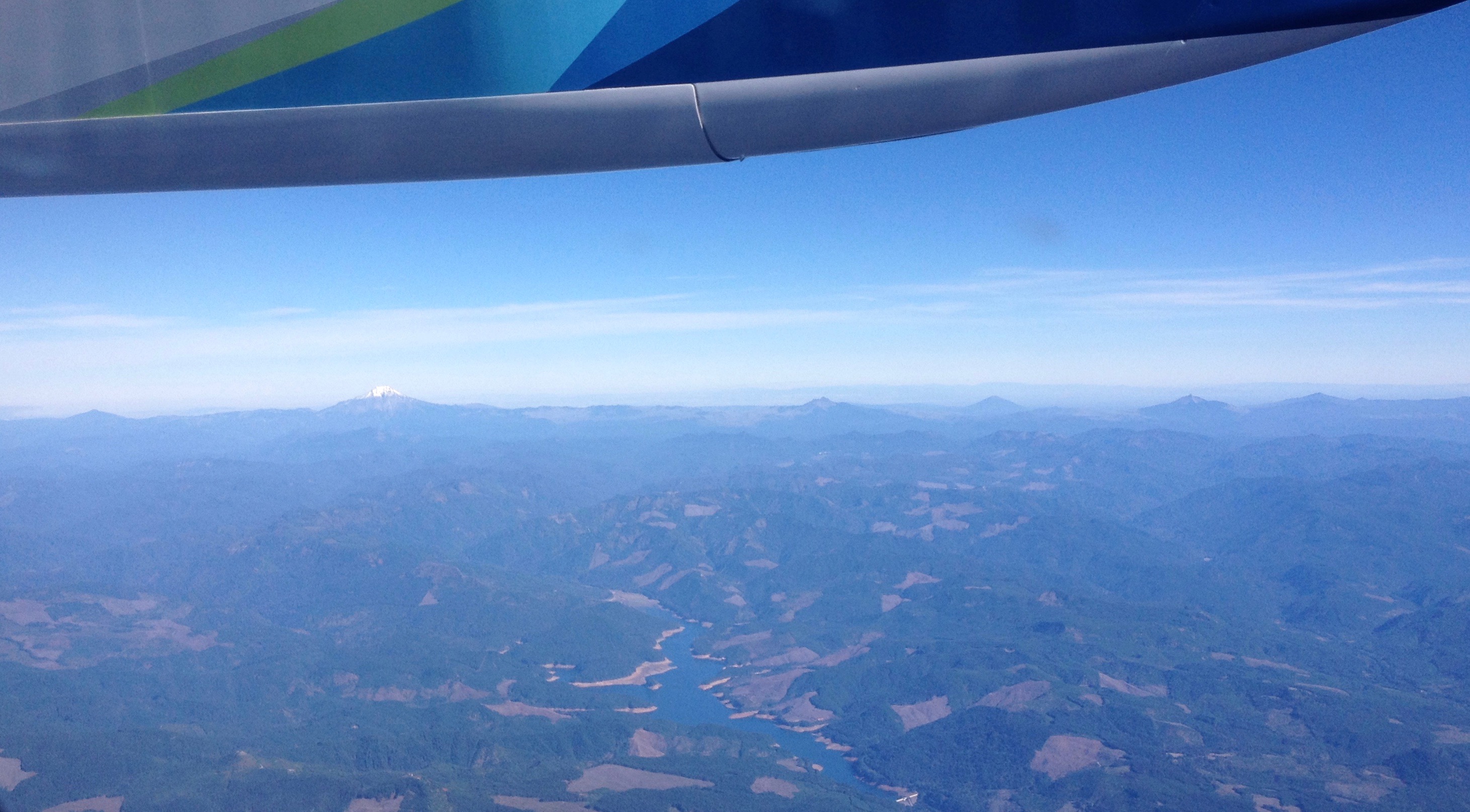
 Mount Hood (11,250′) dominates the skyline east of Portland, Oregon.
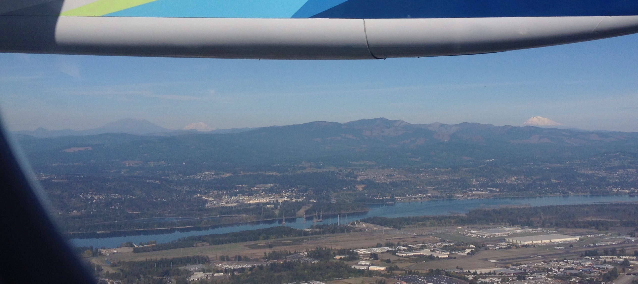 Looking north into Washington State to Mount St. Helens (8,366′), Mount Rainier (14,411′), and Mount Adams (12,280′). The mighty Columbia River is in the foreground.

 Where can a frugal traveler stay in ultra-expensive San Francisco? These are friendly, clean, and safe hostels to help you explore this world-class city while not wrecking your budget.

 Today, Silicon Valley is home to cutting-edge technology, but just a few short decades ago this land was covered by a stretch of orchards twenty miles wide. Join us as we help celebrate this heritage at the 100-year anniversary of Olson’s Cherry Farm in Sunnyvale, California. Olson’s’ is unique is that it is one of the last remaining farms in the south bay.