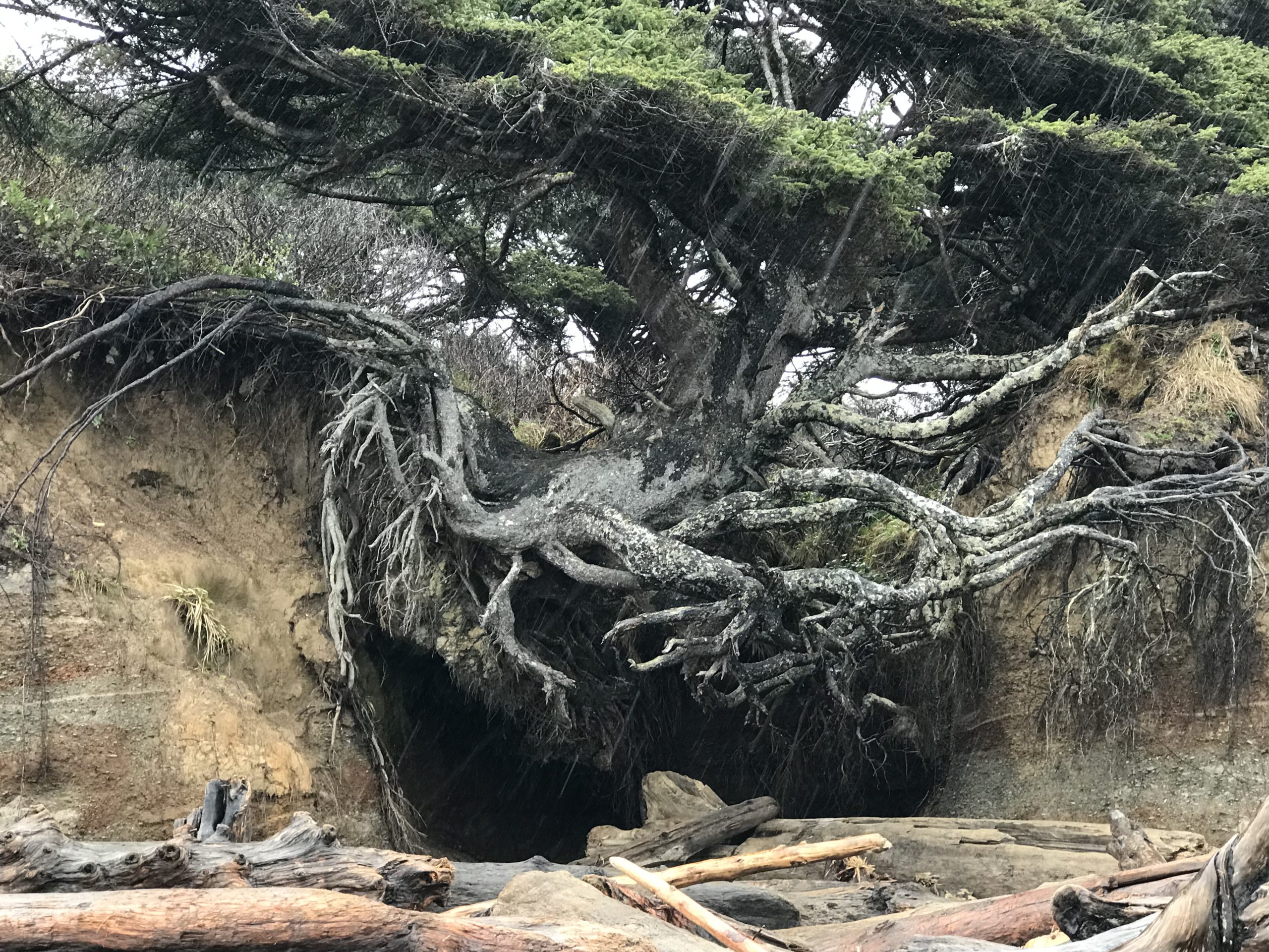
Clinging to the rugged shoreline of Washington’s coast is an especially tenacious Sitka Spruce. The tree is a favorite among visitors to the area because it appears to grow suspended in the air with just a few roots clinging on for support.
A little creek flows underneath, forming a little cave, and on a rainy day I was there a little waterfall could be seen.
Sitka Spruce is known for being especially sturdy. During World War I, straight-growing Sitka Spruce was sought out because the wood was the preferred wood for bi-planes that needed a high-strength to lower-weight ratio on construction materials. This Sitka Spruce displays its heartiness as it hangs on to the western shoreline of North America.
On this day, just feet away was a high tide, a violent ocean, and little room on a small beach littered with tree-sized logs. Turing one’s back to the water was not advised. I didn’t stay long, but it was good to see this unusual and inspiring tree.
The Tree of Life is located near Kalaloch and within the Olympic National Park.
For more information visit the Coastal Interpretive Center’s page on the tree.
During a trip to the Olympic Peninsula in March, I was excited to experience the Hoh Rainforest, but upon arriving at the Ranger’s kiosk was told that a tree had fallen over the road. The tree was large enough that outside help had been called in to help with the removal. My vehicle, along with others, was told to return another day. 🙁
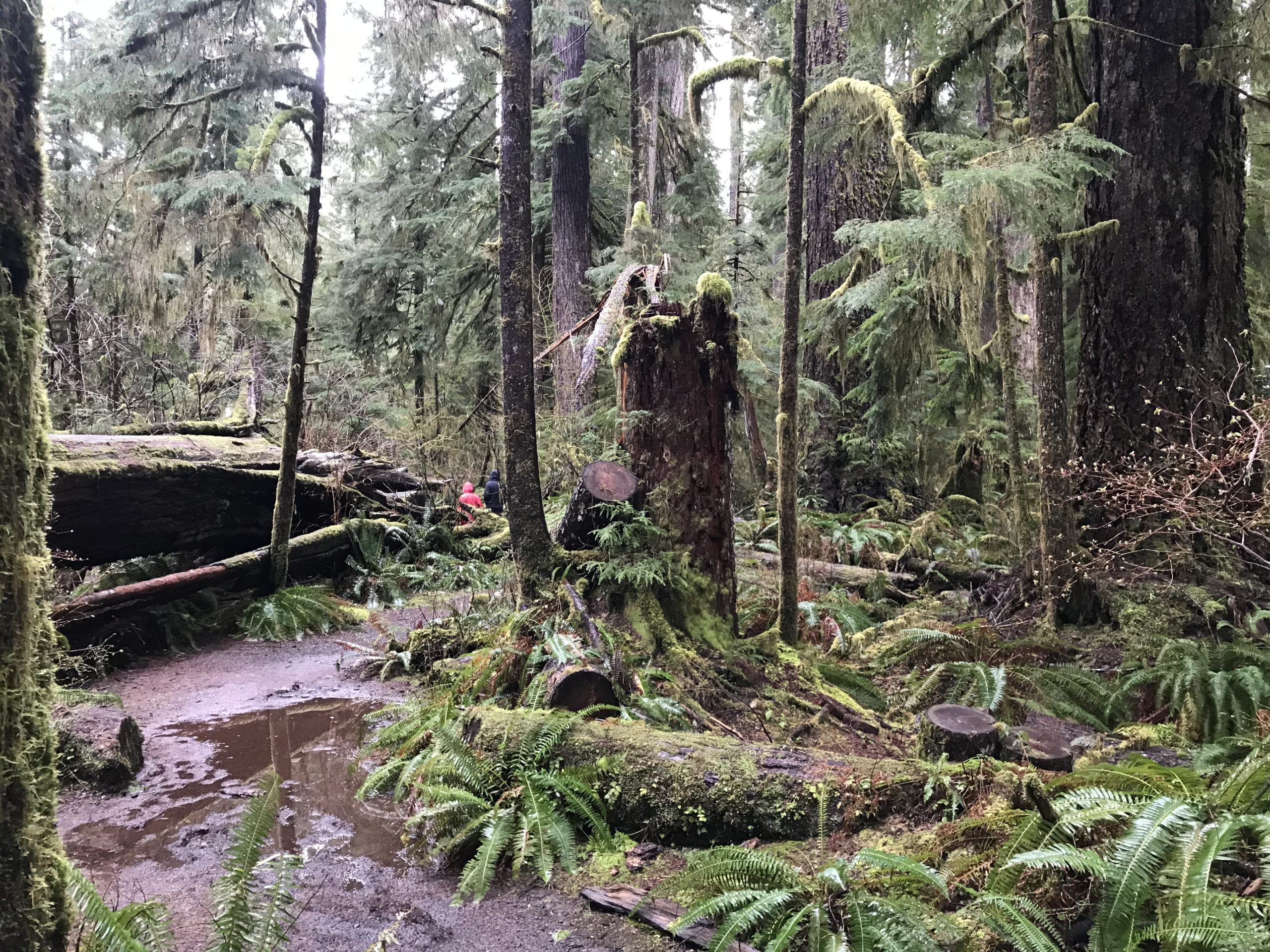
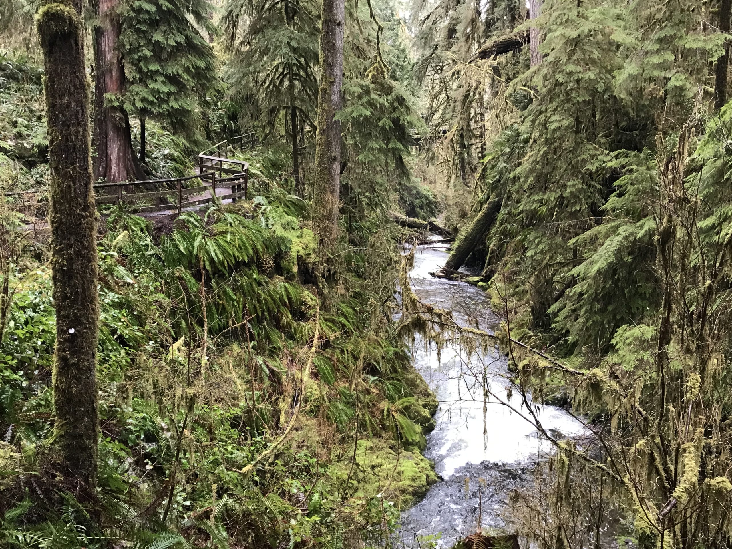
But the ranger, upon hearing that I was traveling to the south shore of Lake Quinalt suggested visiting the Quinault Rain Forest Nature Trail -a personal favorite of his.
Upon seeing the striking beauty of the trail I was hooked. This trail was about half a mile in distance but required an hour just to meander through this old-growth forest and fern-covered canyon. There were hanging carpets of lush green moss, signs of various animals, fungi, and the wonderful smell of clean air. This place, in a word, is breathtaking. I love interpretive trails but had not expected this half-mile walk to be so encompassing. For a longer walk, the nature trail connects to the Quinalt National Recreation Trail System with several additional miles of trails. The trail has some fantastic interpretive signage – kudos to those who arranged the material! This visit was in the springtime with temperatures in the low 50s and lots and lots of rain.
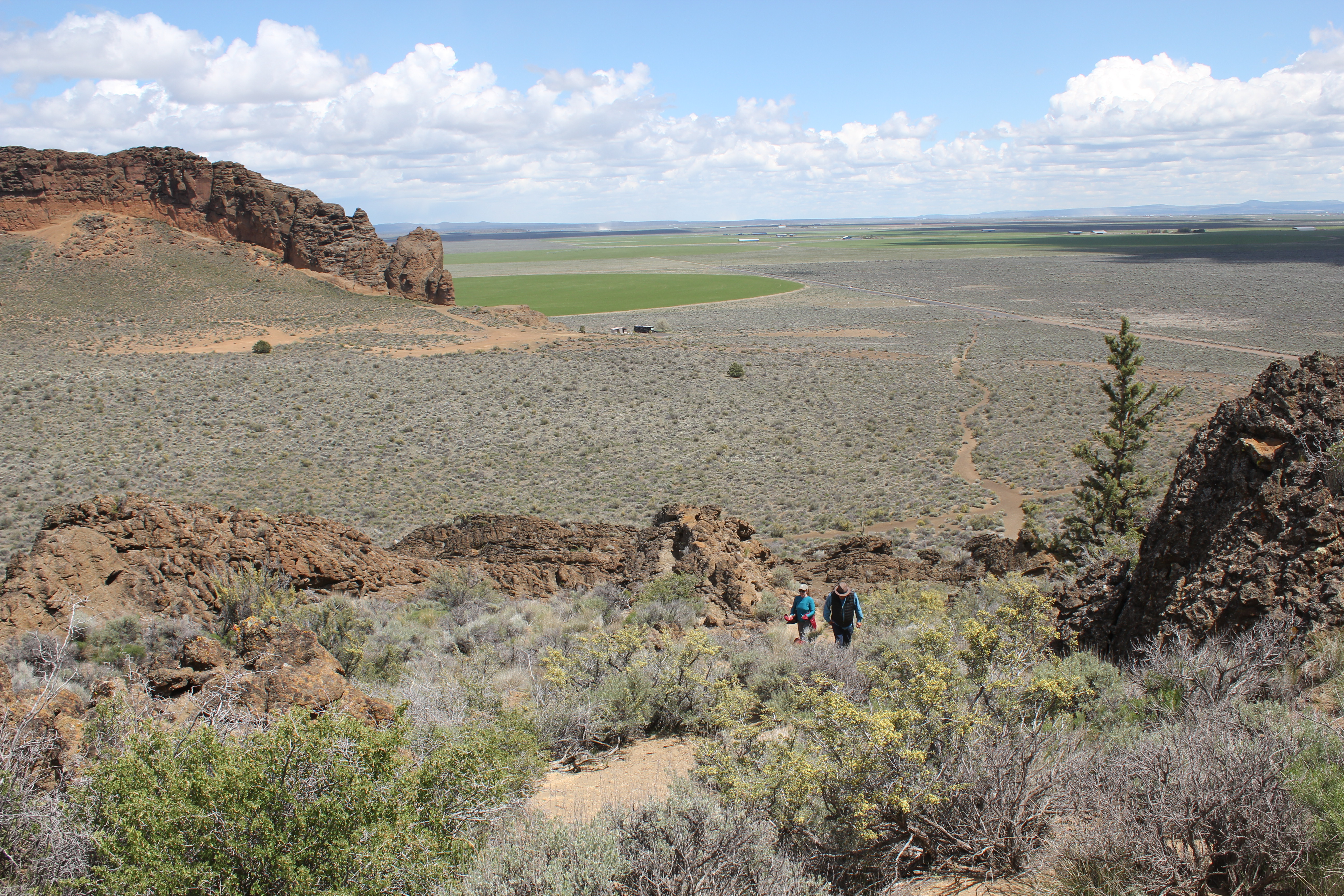
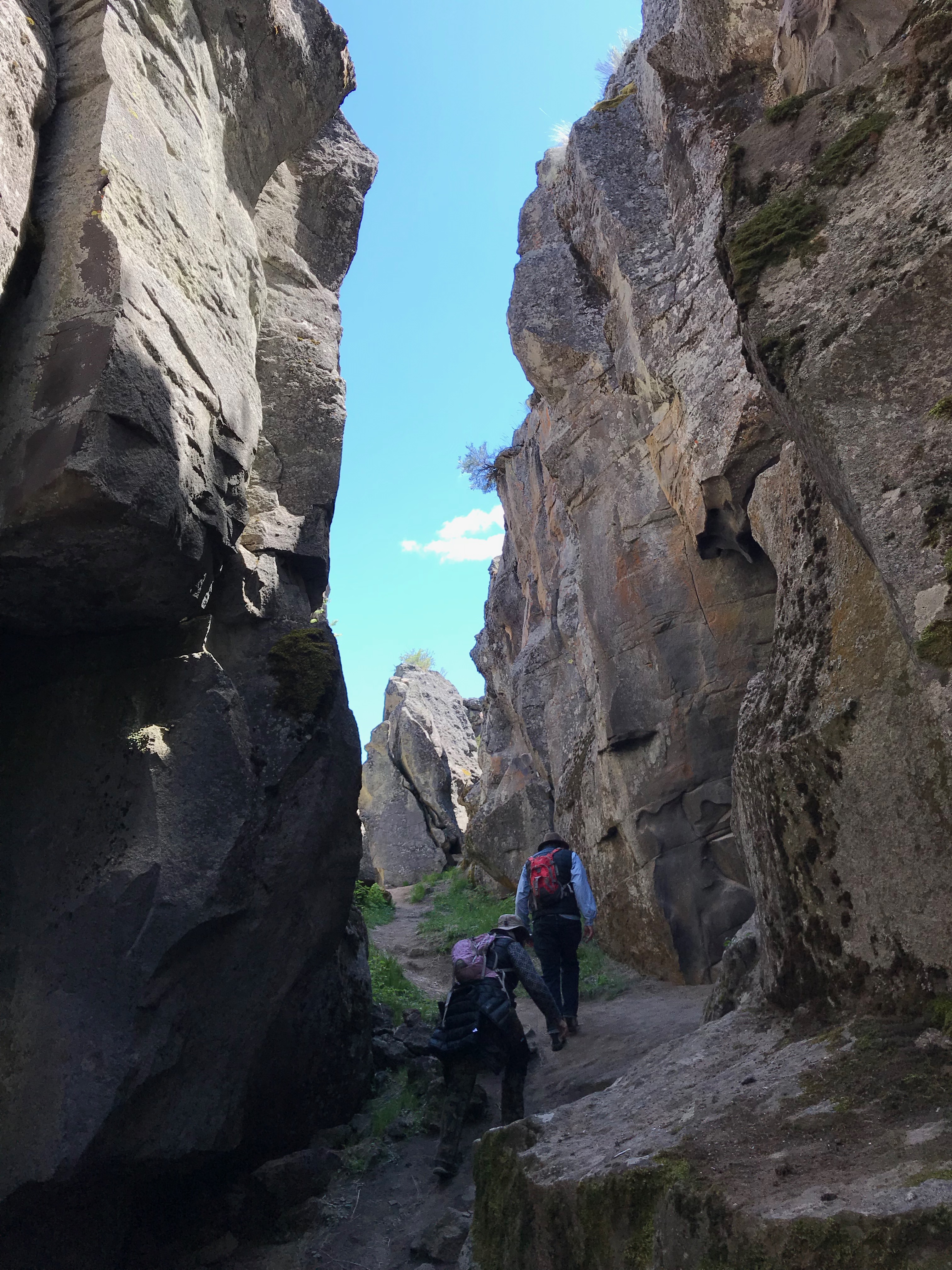
This was a 3-day experience into Central Oregon’s Outback to learn more about early human habitation and the area’s geology. Our route included the archaeological site of Fort Rock Cave, the 2-mile long volcanic fissure known as Crack in the Ground, and plans to visit the Fossil Lake area.
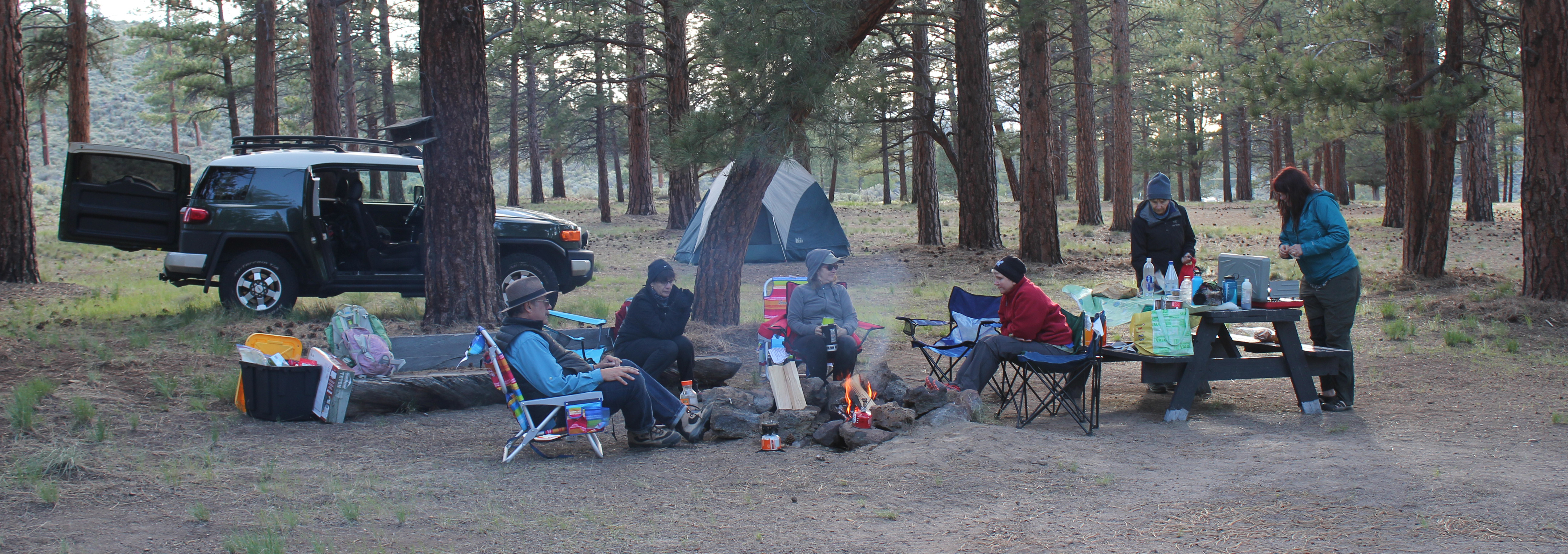
Trip Report: Volunteer Leader: Mark Hougardy | Organization: Eugene-based Hiking Club | Date: May 2019 | Duration: 3 days | Participants: 8 | Type: hiking & camping
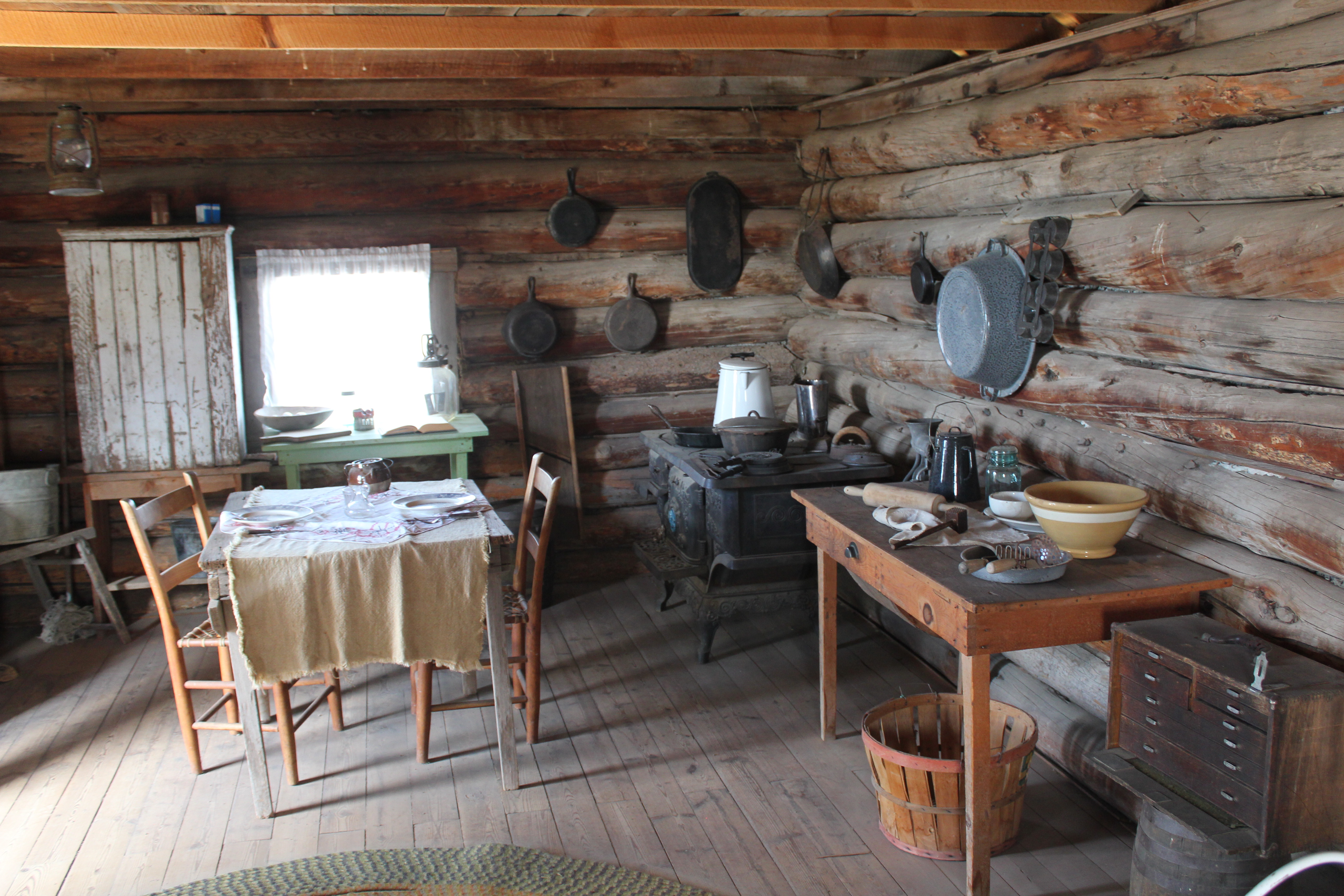
On our first day, one member discovered she didn’t have the right key to the car carrier which held her sleeping bag. Our caravan stopped at a hardware store in Oakridge where the employee emerged with the largest pair of bolt cutters ever seen. He quickly removed the troublesome lock. For lunch, we stopped at Salt Creek Fall for a break and later at an info kiosk on Hwy 31 before continuing to Fort Rock. At Fort Rock, we hiked to “the notch” along the western tuff ring where the wind was really strong. We made our own trail back down the rough side to more level ground. Afterward, we visited the Homestead Museum to learn more about homesteading was like in earlier years. At a nearby private campground, we set up our tents and enjoyed a fire for an hour or so when we noticed a mist in the distance. Within a minute or two it started to rain. We called it an early evening.
On the second day, in the early morning, the sunrise was beautiful and a coyote was heard yelping in the distance. One participant had green shower shoes and after a miscommunication about where they were to be delivered, gave everyone a good laugh. At 9 am we drove to Fort Rock for our interpretive tour of the Fork Rock Cave where 10,000-year-old shoes had previously been found. The Oregon State Park Ranger had driven from La Pine and was delayed a few minutes because of traffic. Our group and two others joined him in a state park van and we drove ten minutes close to the site. Then we walked about half a mile to the cave. He shared 3 prevailing theories about how humans arrived in the Americas and included a traditional story about how Fort Rock had been formed. We were asked that the story remains in the cave. As we walked back to the van one participant was keenly interested in the bleached bones of a dead cow. Back at Fort Rock we ate lunch and watch some of the birds on the cliff face.
A reproduction of a 10,000 year-old sagebrush sandal
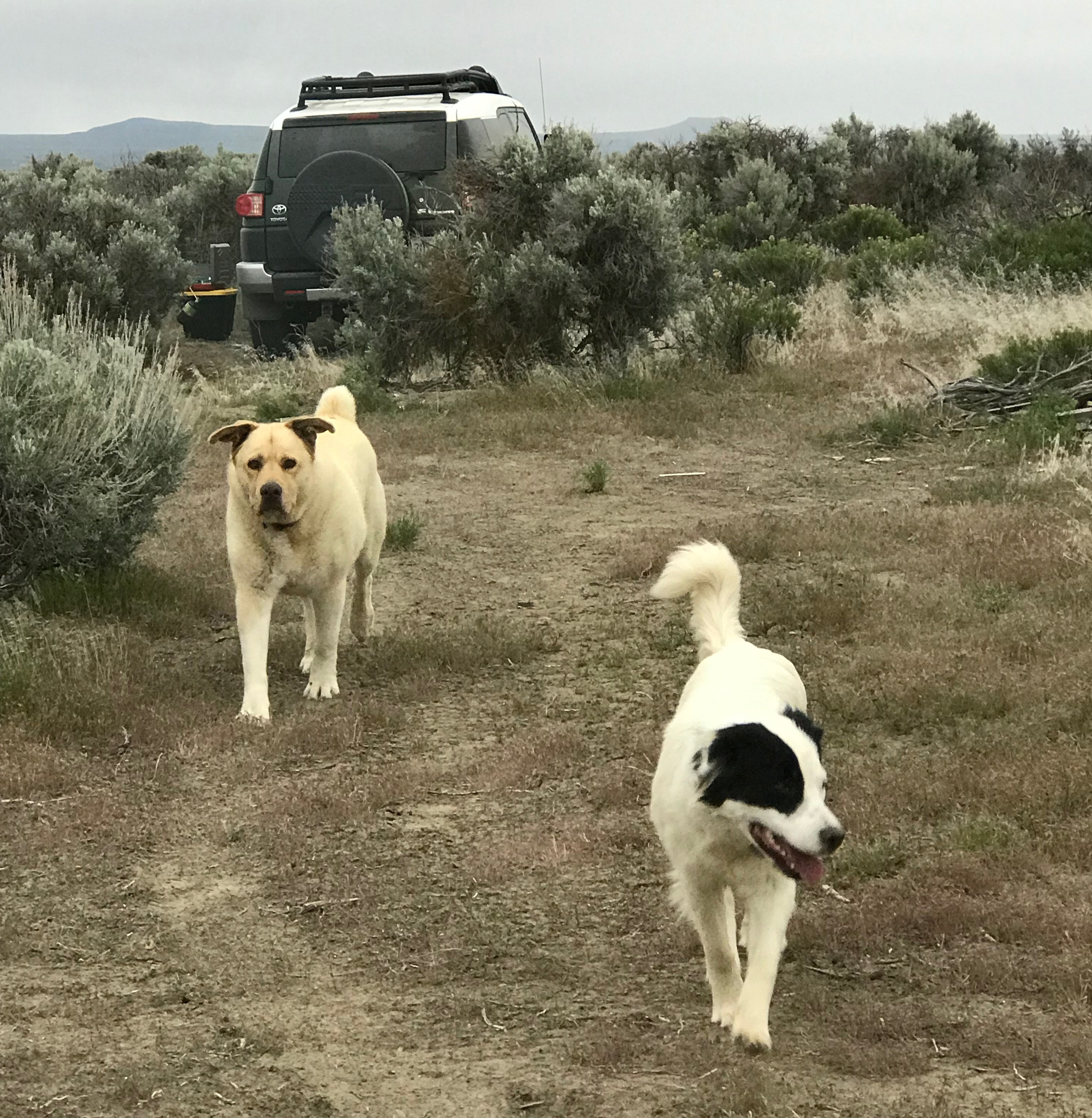
We then drove half an hour to Christmas Valley then to Crack in the Ground. We hiked several sections that we could scamper through and also hiked along the top of the fissure. Several participants disturbed a prairie falcon who was not happy to see them. The falcon made a lot of noise, and as they moved away it acted as though it wanted to nose dive them. Storm clouds were approaching; we left about 3 pm and drove to an isolated ranch. The directions were a bit off and we took several wrong turns before arriving. We were greeted by two rambunctious dogs, a golden colored and bear-sized dog and a smaller ten-month-old border collie. As we were unloading our cars the collie jumped in the back of the trip leader’s car when a door was open and pee’d on the back seat. Just as we completed setting up our tents a 20-30 mile-an-hour wind blew past and dark clouds rolled in. The rain started at about 6:30 pm and everyone quickly disappeared into their tents to eat. We didn’t see anyone again until the next morning. The rain poured throughout the night.
The morning of the last day we were happy to hear that everyone pretty much stayed dry during the rain. We decided that traveling on muddy back roads might be problematic so we canceled the last portion of our trip to Fossil Lake. Just as we packed the last of our gear the two dogs reappeared but now they covered in mud – quickly we departed. We stopped in Fort Rock at a convenience store for gasoline and a break, then another break at Fort Rock, then again Salt Creek Falls before returning home.
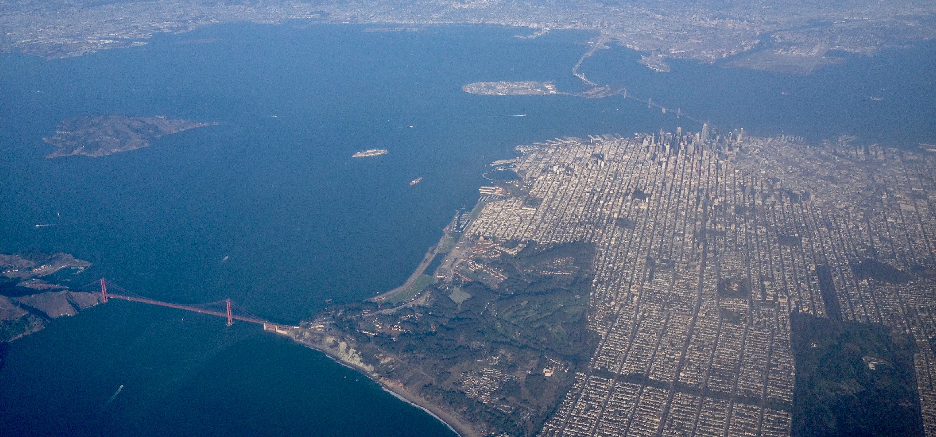
Explorations can sometimes be found at 38,000 feet while sitting in the cramped quarters of an airplane. The route between San Francisco, California and the Pacific Northwest is a favorite to visually explore because of the varied topography. Here are some photos, the images were taken over several trips.
A magnificent view of San Francisco and the Golden Gate. San Francisco covers an area roughly 49 square miles! The Golden Gate Bridge shown on the left is 1.7 miles in length and 746′ tall.
Mount Shasta (14,179′). Shasta sits uniquely at the southern end of the Cascade Range and the northern end of the Sacramento Valley. The mountain is so massive that it can be seen from 280 miles away from atop Diablo Mountain (3,848′), the tallest mountain in the eastern San Francisco Bay Area.
Crater Lake is in the distance. Once known as Mount Mazama, this peak rivaled Mount Shasta for prominence upon the skyline. Mazama erupted about 7,000 years ago, and in the process list its peak and collapsed upon itself. Over time the remaining crater filled with water. The lake is 2,000′ deep and about 5 miles across.
From north to south – left to right: Black Butte (6,436′) Mount Washington, Belknap Crater (6,876′), and the Three Sisters (north, middle and the south sisters); they were once known as Faith, Hope, and Charity.
From north to south – left to right: Ollalie Butte (7,219′), the snow-capped Mount Jefferson (10,497′), Three Fingered Jack (7,844′), Black Butte, Mount Washington, and Belknap Crater.
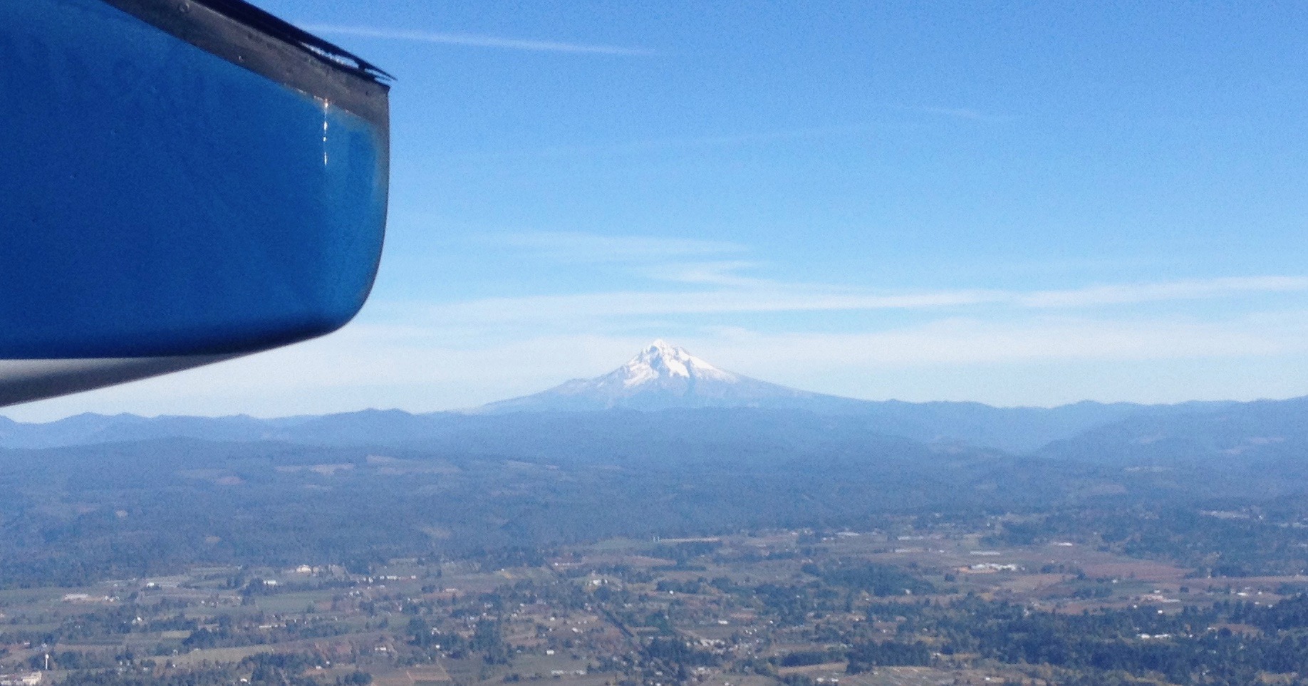
Mount Hood (11,250′) dominates the skyline east of Portland, Oregon.
Looking north into Washington State to Mount St. Helens (8,366′), Mount Rainier (14,411′), and Mount Adams (12,280′). The mighty Columbia River is in the foreground.
The High Cascades in Oregon is beautiful. While much of this chiseled landscape can be viewed at a distance by zipping around in a car, it is best experienced moving at the speed of human – on foot. By hiking, you can appreciate this terrain using all your senses and see it not as entertainment, but as a necessity. Below is an eight-day account of a 100-mile northbound section hike on the PCT from the dry Santiam Pass to the windswept Timberline Lodge on Mount Hood. This hike was powered by a whole-food plant-based (vegan) diet.
Day 1: Santiam Pass to Wasco Lake (10 Miles)
A view of the Santiam Pass trailhead, mile number 2006.9 on the PCT. As my wife and I gathered our gear, we met two sixty-something ladies that started at Crater Lake for a section hike several weeks earlier. These women had already hiked about 175 miles.
The weather was beautiful – if a bit warm – that morning. We were joined by two friends, Jack and Cindy, who drove us to the trailhead and then hiked with us for the first five miles of our journey.
A view of the north side of Three Fingered Jack, a jagged and rugged mountain in the High Cascades that has banded stripes. A PCT thru-hiker stands in the foreground. He was one of about 25 who passed us that day; the oldest being somewhere in her 60s, the youngest about 18, and about half of the thru-hikers were female.
Near the end of our first day, we took a steep side-trail from Minto Pass to Wasco Lake and set up camp. As dusk fell, the sky was pink from a far-away fire. That night elk, frogs, and ducks made noises around our campsite.
Day 2: Wasco Lake to Shale Lake (12 Miles)
A view of Wasco Lake the following morning at about 7 am.
We enjoyed a mid-morning break on the shores of Rockpile Lake. Several thru-hikers can be seen on the trail at the left. The two women we met a day earlier enjoyed their lunch and a quick swim on the opposite side of the lake.
Much of our day was spent walking through woods that had been burned several years earlier and were now recovering. In the distance, the peak of Mount Jefferson made frequent and teasing appearances.
That evening we camped at Shale Lake and enjoyed an amazing view of the south side of Mount Jefferson. We ate our dinner and watched the evening light blanket the slopes of this iconic High Cascades peak.
Day 3: Shale Lake to Jefferson Park (12 Miles)
Looking upon a picturesque view of Pamelia Lake from the PCT. This area is a limited entry zone requiring a permit to camp. Our hike that morning was in the forest where we encountered some sizeable old growth trees, and at one point we rounded a corner and surprised a grouse.
Milk Creek has cut a 100-foot deep gorge into the slopes of Mount Jefferson. Several backpackers are seen crossing the creek below us.
Overgrown and green, this is what the trail looked like for the rest of the afternoon. It was also humid and hot, making our progress slower than expected. Occasionally, we would see glimpses of Mount Jefferson through the trees.
Russell Creek pours off the mountainside where it meets a “flat†area for about 100 feet before dropping into a deep gorge; this more level area is where the trail crosses. Earlier in the season, the flow can be very strong and this can be a dangerous crossing. Today, though, it just brought about some wet shoes. In this image, a hiker approaches the crossing area. We spoke with her later to find out that she was 18 and was hiking 250 miles of the PCT by herself.
In 2016, the Forest Service implemented a new permit system to camp in the stunningly beautiful Jefferson Park area. We did not have a permit and spent a good two hours looking for a walk-up site. The foresters had done an efficient job of decommissioning non-reserved sites; eventually, we found a single site near Russell Lake just as the sun was setting. We were asleep at 9 pm, which is considered “hiker’s midnight.”
Day 4: Jefferson Park to Ollalie Lake (12 Miles)
We enjoyed breakfast under this stunning skyline.
The next morning we climbed 1,200 feet out of Jefferson Park. The views were magnificent: wildflowers were in bloom along the trail, and at times it was hard to hear because of the abundance of buzzing coming off nearby flowers.
We reached the trail’s summit and could see Mount Hood in the distance. Descending the slope, we passed several snowfields. For several hours our progress was slow going because of the loose rocks, though the trail soon became forested and we passed a number of beautiful mountain lakes.
Late in the afternoon, we reached Ollalie Lake. Here is a view looking south across the area we just hiked, and in the distance is Mount Jefferson. About two dozen thru-hikers were staying at Ollalie Lake to rest.
We met some new friends at Ollalie Lake:
Darren and Sandy had hiked continuously for 4 months. They were also world travelers that raised geography education awareness by sharing information with students about the places they visit. Their travels can be seen at their site: trekkingtheplanet.net.
Franziska and her family had hiked for 2+ weeks and 100 miles on the PCT, the youngest of her group being her eight-year-old brother! Franziska is the founder of hikeoregon.net.
Ollalie Lake has a small store where my wife and I eagerly purchased a bag of sea salt and vinegar potato chips and promptly devoured the entire bag. At one point there were a whopping total of eight stinky hikers in that little store – ah, the aroma of humanity!
Day 5: Ollalie Lake to the Warm Springs Area (14 Miles)
The trail on day five was mostly flat and in the shade of tall trees, making trekking much easier. The forest was drier in this region and water was less abundant than before. When the opportunity presented itself, we filled up our bottles at a small, tranquil trailside spring. The temperature that day was especially warm.
We arrived at Trooper Springs near the Lemiti Marsh area. This was our last water for about twelve miles. The spring was a welcome site although a small and precarious platform needed repair. We were attacked by horseflies; they were numerous, aggressive, and very persistent. Needless to say, we did not stay long.
Taking care of some much-needed laundry at the spring using the “Ziplock spin cycle” washing method.
Walking through a clearcut was a stark contrast to the lush forest we had seen all day. Near this area, we found the strangest price of trash on the trip: a Howard Johnson’s hotel key card lying next to the trail. We picked it up.
We located a bare spot at the edge of the trail and camped for the night. Trailside camping can look messy, but everything goes back into the pack and we always leave the site cleaner than we found it.
Day 6: Warm Springs Area to Timothy Lake (18 Miles)
We were up early that morning to hike six miles to the next water at the Warm Springs River.
Shown is an old style PCT trail marker that we found, one of the few older versions that we saw on the entire trip.
Crossing the Warm Springs River. It was more a small creek at this point, but the water the clean and cold – a welcome site.
As I took off my shoes I realized just how dusty the trail was that day.
That evening we stealth camped near the trail close to Timothy Lake. During the night we unzipped the tent for a “nature break” – only to be scolded by an owl that repeatedly whooo’d at us until we went back to bed.
Day 7: Timothy Lake to Frog Lake (11 Miles)
The next morning was slow; we woke up late, and it seemed to take forever to get moving. We found a quiet site on the shoreline of Timothy Lake to we rest, take care of some laundry, and enjoy the sun for a couple of hours before continuing.
Several miles down the trail was Crater Creek, a beautiful riparian area with some astonishingly cold water: a welcome find on a hot day. We soaked our feet, took a twenty-second dip (the water was that frigid), then soaked our shirts and put them on as a natural air-conditioner. We made a stop at Little Crater Lake, the source of the creek. Little Crater Lake is astonishingly blue like it’s larger cousin, but this was not volcanic in origin. Rather, this was a large artesian well. Continuing down the trail, we passed a gravel forest service road and found a bag hanging on PCT post. Inside were some small apples or Asian pears – some unexpected trail magic in the middle of nowhere.
This was our first view of Mount Hood after about 40 miles of hiking – what a fantastic sight.
We took a side trail to Frog Lake for some water where there was a hand pump that drew water from a well. As we entered the campground we were momentary celebrities answering questions like: “Where did you hike from?†“How many days have you been out?†“Tell me about your gear?†etc. It was an odd but welcome feeling. That night, we camped just outside the campground on a forest road.
Day 8: Frog Lake to Timberline Lodge (11 Miles)
The next morning, we stopped back in at the campground for some water and said goodbye to our new fans. A girl pulled up on her bike. “Good luck!†she exclaimed, and even a “Thanks for being so inspiring” from an adult. It felt good to hear, but the truly inspirational folks were the PCT thru-hikers who had hiked 2,663 miles and spent six months on the trail.
We made good time that day ascending Mount Hood: 5.5 miles in two hours with a significant elevation gain; we were getting our hiking legs.
Finally, the green of the trees turned to open space and vistas as we passed the timberline. It was windy with twenty to thirty mile an hour gusts that kicked up sand and dust. We wore our sunglasses to keep volcanic grit out of our eyes.
There was an abundance of mountain flowers on the trail.
Close to the Timberline Lodge, the views were fantastic! We could see much of the route that we had spent the past week traversing.
We arrived at the Timberline Lodge, mile 2107.3 on the PCT, and 100 miles from our starting point at Santiam Pass. Inside the lodge, scores of thru-hikers had taken refuge in the common areas. There was access to food and good company, with couches for sleeping and a warm fire to enjoy in the evening. We met some new friends here: Shepherd, Snow, Lonestar, and Patch, all thru-hikers who started at the Mexican border and were resting before their final push into Washington State and Canada.
Looking through the door at the Timberline Lodge onto the Roosevelt Terrace: in the distance Jefferson Peak, and behind it, Three Fingered Jack and Santiam Pass. From the lodge, we were able to take public transit back home.
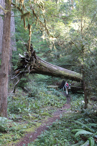
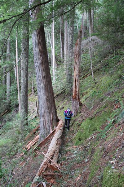
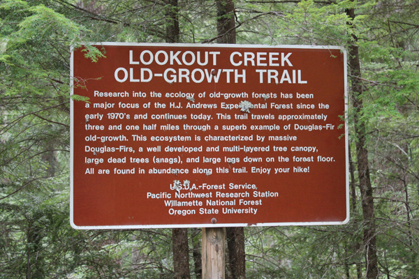
Walking in a forest with 500-year-old trees is always a delight. Finding such places – a rare treasure. Fortunately, the Lookout Creek Old-Growth Trail is such a gem, and for the price of a moderate drive from Eugene, Oregon, hikers can enjoy this richness.
The trail is located within the Willamette National Forest, more specifically the research area is known as the H.J. Andrews Experimental Forest. The experimental forest exists so scientists can conduct long-term studies of the Pacific Northwest’s complex forest and stream ecosystems.
A trail brochure states the Lookout Creek Old-Growth Trail is 2.6 miles long, though a sign at the upper trailhead states the trail is approximately 3.5 miles in length – both of these are incorrect. I believe Bill Sullivan’s book, “100 Hikes in Central Oregon Cascades” that states the trail was 6.3 miles with a 1400 elevation gain. Expect the hike (one-way uphill) to take 3 hours with breaks; the return hike down the service road to the lower trailhead adds 1 more hour, so plan for a minimum 4 hours to complete the round trip.
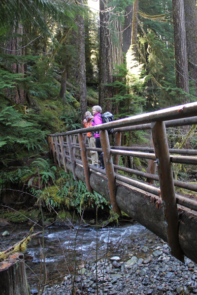
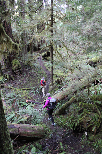
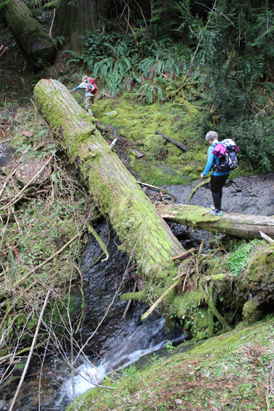
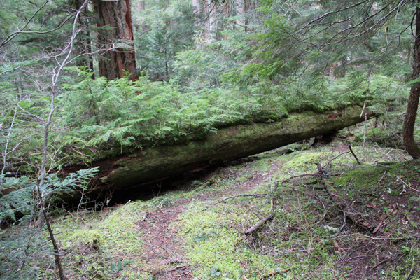
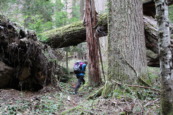
The route is rugged with steep inclines, downed trees, log scampers and a couple of creek jumps that are not shown on the map. The beginning and end of the trail provide footbridges for crossing Lookout Creek, the remaining trail is in the deep forest with lots of big and really old trees.
Help the forest; always bring a trash bag. My family did not find any trash on the trail, but on the service road, we found spent shotgun shells, beer cans, soda cans, and other trash.
The nearest populated area is the town of Blue River. Driving to the trail takes about an hour-and-a-half from Eugene. The last seven miles of driving will be on packed dirt roads.
These pictures were taken in late January. This entire area should be covered in snow, but an unusually warm winter with temperatures in the mid-forties offered the chance to see the majesty of old-growth forest at an usual time of year.
This photo gives an idea of how large these trees can become.
The bridge crossing at Lookout Creek, near the lower trailhead.
A lush landscape.
The trail meanders beneath a fallen giant.
One of several fallen trees across the trail.
What stories could this tree tell?
Scrambling across a creek.
One of many “nurse logs” seen on the trail.
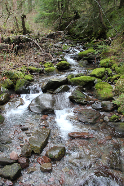
A view of Lookout Creek, near the upper trailhead.
An area where one ancient tree fell and caused a cascade of destruction. While terrible, this ending allows new life to thrive.
By my rough calculations, the trail is actually about 4.5 – 5 miles in length (one-way).
Oregon’s Diamond Peak Wilderness is frequently overlooked for more picturesque settings like the Three Sisters, but this wild place is no less a treasured gem; the Wilderness includes the 8,629-foot Diamond Peak, 14-miles of the PCT (Pacific Crest Trail), one of the high points on the PCT in Oregon, and over 50,000 acres to explore!
A glorious view from Diamond View Lake. The clouds at the left of the image produced some amazing lightning and thunder that afternoon.
The trail got a little hard to follow at one point and we had to bushwhack.
A little lake where we stopped for a rest, only to stay for the night. Water was scarce in the area and the lake provided a great location for watching wildlife and hearing even more wildlife during the nighttime.
A very dusty path. This trail was well worn because of the number of PCT hikers that we met, many had been side-tracked to a lower elevation because of the lack of water on the main PCT.
Wow! You find lots of cool things on the trail.
Standing at the outflow of Yoran Lake looking south to Diamond Peak. After a break, we bushwhacked about half a mile to the PCT to loopback.
A small island on Yoran Lake.
Enjoying some lunch while scouting out a great campsite.
My kayak breezes over the surface of the aptly named “Clear Lake†in central Oregon. The lake bottom descends below me ten, twenty, thirty feet, yet I can still see features as though looking into an aquarium.
Each stroke of my paddle dips into the crystalline fluid and scoops out rounded orbs of glass-like liquid, I dip my hand into the water, the temperature is cold, somewhere around 40 degrees Fahrenheit. The lake is fed by mountain springs that course from deep within old lava flows; the water temperature stays a near constant throughout the year.
The sun had been hiding behind a cloud, but now bursts forth illuminating the lake. The clear water that surrounds me now becomes a turquoise pool. The green and the tan forested shoreline is reflected onto this gem-colored liquid. I cannot help but to stop paddling and just watch – immersed at the moment.
A number of Mallard ducks float next to my kayak, some are just a few feet away. One comes abreast to me and looks at me in the eye; he cocks his head as though wondering what kind of strange beast I might be. I can see his little legs moving underneath the water, churning like a miniature paddle wheel.
My kayak hugs a rocky shoreline; it is a jumbled and erratic wall that descends sharply into the water. This is the edge of an ancient lava flow that three millennia earlier was the outlet of a stream. As the water rose, a new lake was created, and the surrounding forest was submerged. The water temperature was so cold that decomposers could not survive and the original forest was preserved. Today, three-thousand years later, several dozen of the ancient trees from that forest remain upright and can be seen from the surface.
A large dark form starts to become visible in the water before my kayak. I stop paddling and the surface becomes undisturbed allowing the shape to come into focus, it is the column-like shape of one of the ancient trees. The trunk appears to be as big around as a dinner platter, and only just a couple of feet below my kayak. I try to gently tap the top of the trunk with my paddle, but I am unable to reach it. The water has played a trick on my eyes by making things appear closer than they really are. I peer down the trunk looking, fifty, sixty, possibly a hundred feet down to the bottom.
The only sounds are people laughing in the distance, and a gentle wind blowing through the trees.
There are no motorboats on Clear Lake, just human powered crafts.
Few symbols represent the spirit of the American West like wild Bison grazing on the expansive and open prairie.
There is something about this setting that makes the heart pump a little faster and one’s breathing to quicken. Such a setting whispers about the time when our ancestors lived here, or even migrated across this expansive landscape. It quietly reminds us, in today’s busy world, not to forget their stories about independence, rugged individualism and family. This uniquely American setting is often seen two-dimensionally in movies and TV shows, but a three-dimensional landscape can be explored and experienced at The Nature Conservancy’s Tallgrass Prairie Preserve in Osage County of northeastern Oklahoma.
The Tallgrass Prairie Preserve is big. On a map, it covers an area that is roughly 12 miles wide and 9 miles long! The total acreage is about 40,000 acres, with 25,000 acres reserved for the bison.
This is a wonderful place to visit for many reasons, but one of the most important is seeing this landscape that was almost lost. As the settlers came westward the Bison (also known as American Buffalo) were hunted and the land plowed to create rich and bountiful farmlands. But, there was a high cost. The original population of hundreds of thousands of Bison had been hunted to less than five-hundred individuals and the pristine open prairie that spanned from Texas to Minnesota had been reduced to less than ten percent of the original size. Fortunately, there were visionary folks who saw value in preserving untamed land. Since 1989 the Nature Conservancy, a private, non-profit organization, has restored the largest “fully-functioning portion of the tallgrass prairie ecosystem with the use of about 2500 free-roaming bison.â€
My visit to the tallgrass with my Father started in the town of Pawhuska, Oklahoma, close to the preserve’s southern entrance. The drive down a paved county road was surrounded by woodlands but this soon turned to prairie and the road turned to gravel and then a packed caliche clay.
Simple signage marked the entrance to the preserve.
The sun this autumn day was shining and the blue sky was punctuated with small white clouds. The wind was blowing about ten miles an hour and the temperature outside was around 40 degrees.
A plaque near the entrance of the preserve includes the text, “The Tallgrass Prairie Preserve. You stand at the south edge of the largest unplowed, protected tract which remains of the 142 million acres of tallgrass prairie grasslands that once stretched from Canada to the Gulf of Mexico. Today, less than ten percent still exists, found mostly in the Flint Hills and Osage Hill regions of Kansas and Oklahoma. In an increasingly crowded and noisy world, what you see is an oasis of space and silence. Here you can experience the same beautiful vistas that greeted the earliest human hunters and gathers many thousands of years ago. This area is indeed a national treasure. Please treat it with respect.â€
Sadly, the area surrounding this marker had been marred by a number of empty beer cans left apparently from the evening before. I later learned the roads leading to the preserve are county roads open to the public at all hours. Although there is a cleanup service provided in the preserve by volunteers they cannot be everywhere and at all times. We spent a few minutes picking up the unsightly and very uncool trash.
Twenty minutes or so down the road we stopped at an interpretive marker along the edge of the road. Dark stacked piles of bison poo dotted the area all around us. These were not messy cow patties, rather the dung was tightly packed together into circular disks. These nutrient-rich ‘buffalo chips’ were used by natives and settlers as charcoal because the material burns hot and slow.
Further beyond a few dark bison sentinels stood at the side of hills, these were apparently lone males who had been pushed out from the herds. The mature males, after mating, are no longer needed by the female-dominated herds and are excluded.
Hawks and kestrels soared over the dry prairie grasses. Most of the birds I saw were sitting on fence posts observing their domain, but sometimes one would fly up, soar overhead and then later swoop down and appeared to have caught a rodent in its sharp talons.
A herd of bison was just ahead. It was easy to see their dark forms against the dry and brown landscape of late autumn. The bison allowed us to slowly drive past. They did not appear to mind us and continued with their business. If they wanted to the bison could cause us some harm as these are great creatures measuring 5-6 feet at the shoulders and 7-10 feet in length. Plus bison can weight up to 2,000 pounds or more! Some of the individuals peered at us through thick, wooly looking coats that would soon protect them from the coming winter cold. We watched them for some time.
In the sections of the preserve where we saw fences, the barbed wire included 6 strands and was at least 6 feet tall. We later learned that bison can jump 6 feet laterally and 6 feet in height! The fences are tall so the strands appear at eye-level to intimidate the great beasts from jumping over.
We passed another two groups of bison close to the road. The ‘Bison Loop’ road offered additional miles of great sightseeing.
The open prairie now presented low canyons of cottonwood trees and ash. In one of these more protected canyons was the Preserve Headquarters. As we pulled into the gravel parking lot an elegant looking eight-point buck darted in front of us and disappeared behind a building.
At the headquarters was an enthusiastic and knowledgeable docent who was a treasure trove of information. One item she mentioned was that the hunting of bison in the 1800s had been so intense that the last wild bison seen in Osage County was in 1869.
The Preserve Headquarters offers a great visitors center. One memorable exhibit showed just how tall the grasses at the tallgrass prairie can grow – as tall as a grown man. The grasses on the tallgrass are very nutritious and part of an amazingly fertile ecosystem. Another item was a table filled with bison bones and fur. I had expected the fur to be harsh feeling but, it was surprisingly soft and extremely warm. A scapula (shoulder blade) was at least 21 inches in length and 14 inches wide – a big bone for a large animal.
Near the headquarters are several short walking trails that looked welcoming, but the temperature that day was lowering and the wind was picking up.
We left the preserve when the sun was very low on the horizon. As the sun lowered past the rolling hills the dark forms of the bison were silhouetted against the rich shades of an ever increasingly dark sky. My heart pumped a little faster and my breathing quickened – it was a scene of the American West.
If you are interested in visiting, make the most of your day, stay overnight in the town on Pawhuska so you can get an early start. There are no gas stations or places to eat on the preserve, so fill up your gas tank in town and take some lunch or munchies with you. Tulsa, Oklahoma, has an airport, but be prepared for a good hour-and-a-half drive just to get to the preserve. Entering the preserve is free, though recommended donations of several dollars per person are welcome at the headquarters. I was informed by a docent who has been at the preserve for years the best time to visit is in the spring (May) when the wildflowers carpet the landscape and the colors are superb. I plan to return at that time.
Quoted source and learn more:
http://www.nature.org/ourinitiatives/regions/northamerica/unitedstates/oklahoma/placesweprotect/tallgrass-prairie-preserve.xml
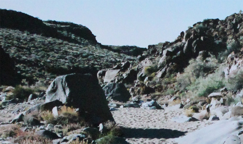
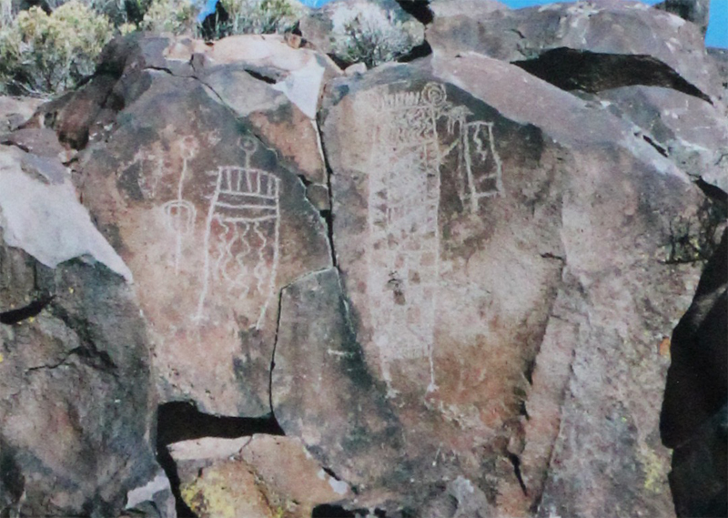
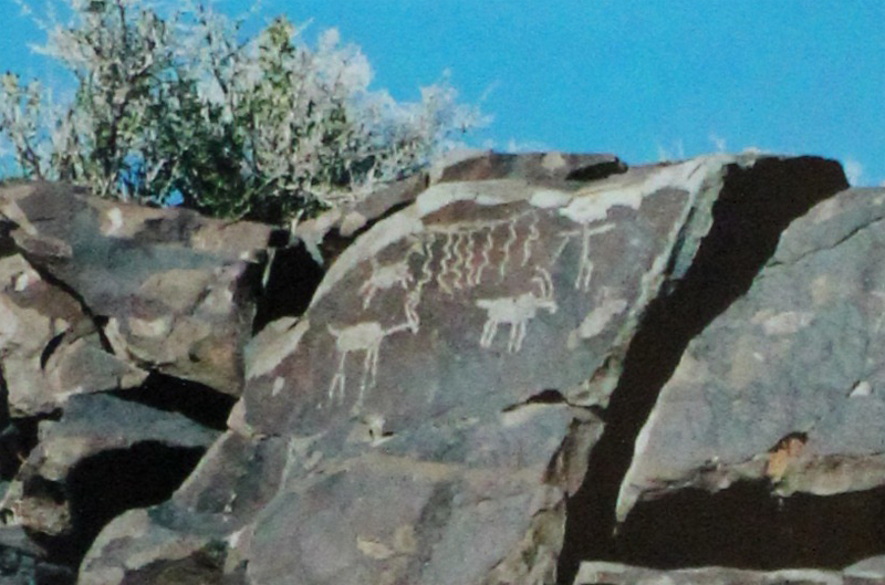
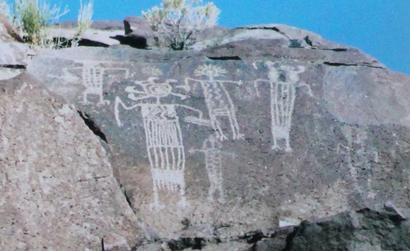
Hidden in the northern Mojave Desert and within the Naval Air Weapons Station China Lake, near Ridgecrest California, is a half-mile wash with over 20,000 images. It is considered the largest known concentration of petroglyphs in the western hemisphere. More information about visiting this remote area can be found at maturango.org.
The canyon starts as an unassuming wash. It quickly impresses. This is a mysterious place and is to be respected. The natural history guide will ask you not to touch the glyphs as the oils from our hands can destroy the rock art over time.
Some of the images are sixty feet above the floor of the canyon.
Impressive. The temperatures at the top of the canyon were well into the 90s’ on the day we visited, however, in the canyon they were in the 70s.
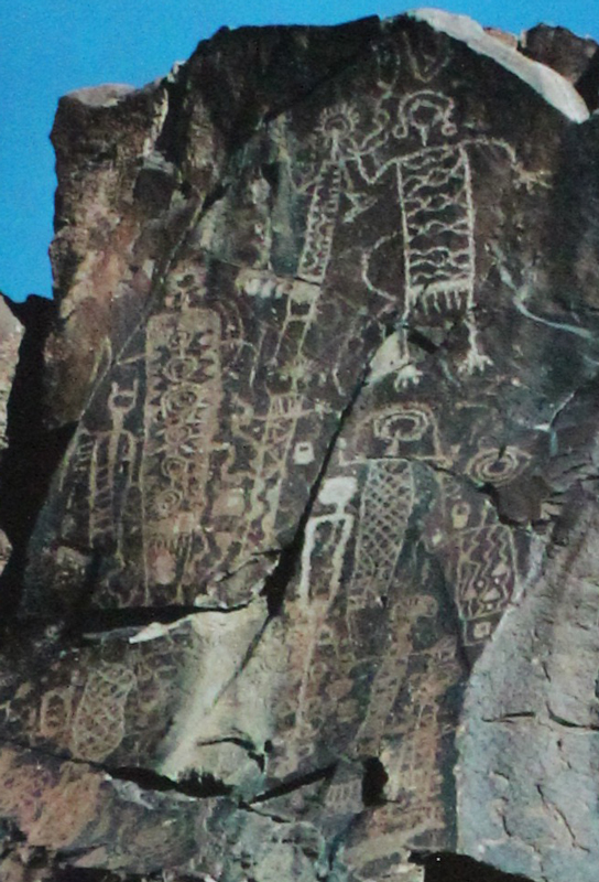
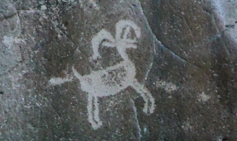
The largest glyph is possibly the most recognizable of all the images in the canyon.

 A magnificent view of San Francisco and the Golden Gate. San Francisco covers an area roughly 49 square miles! The Golden Gate Bridge shown on the left is 1.7 miles in length and 746′ tall.
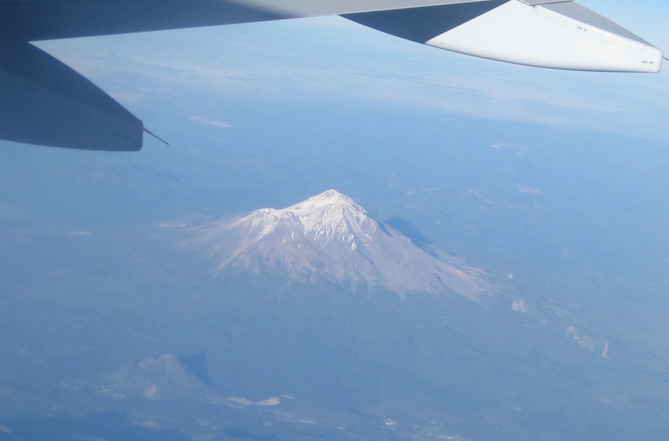 Mount Shasta (14,179′). Shasta sits uniquely at the southern end of the Cascade Range and the northern end of the Sacramento Valley. The mountain is so massive that it can be seen from 280 miles away from atop Diablo Mountain (3,848′), the tallest mountain in the eastern San Francisco Bay Area.
 Crater Lake is in the distance. Once known as Mount Mazama, this peak rivaled Mount Shasta for prominence upon the skyline. Mazama erupted about 7,000 years ago, and in the process list its peak and collapsed upon itself. Over time the remaining crater filled with water. The lake is 2,000′ deep and about 5 miles across.
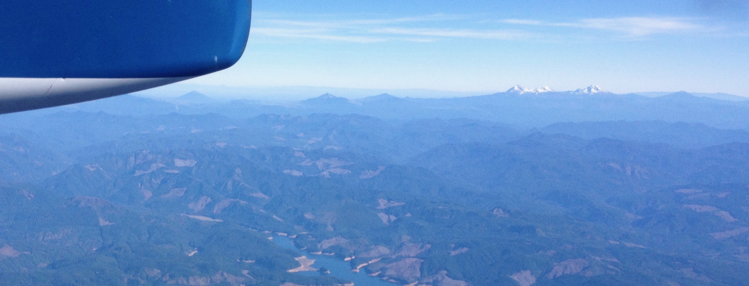 From north to south – left to right: Black Butte (6,436′) Mount Washington, Belknap Crater (6,876′), and the Three Sisters (north, middle and the south sisters); they were once known as Faith, Hope, and Charity.
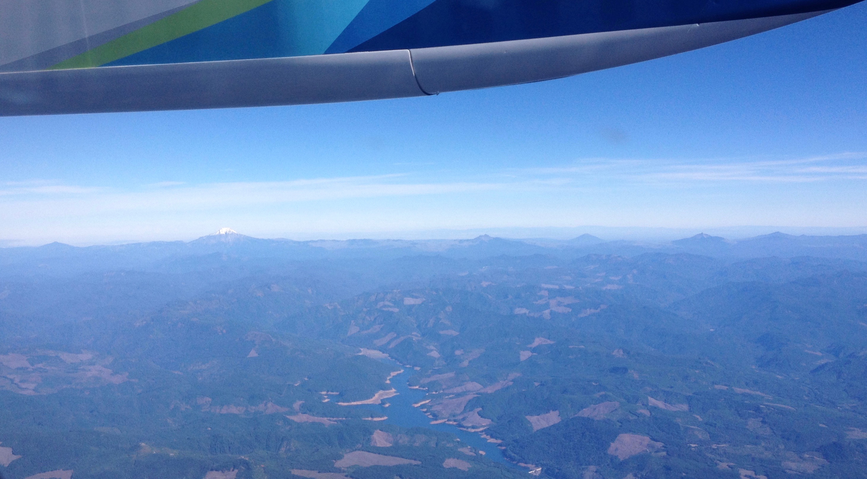
 Mount Hood (11,250′) dominates the skyline east of Portland, Oregon.
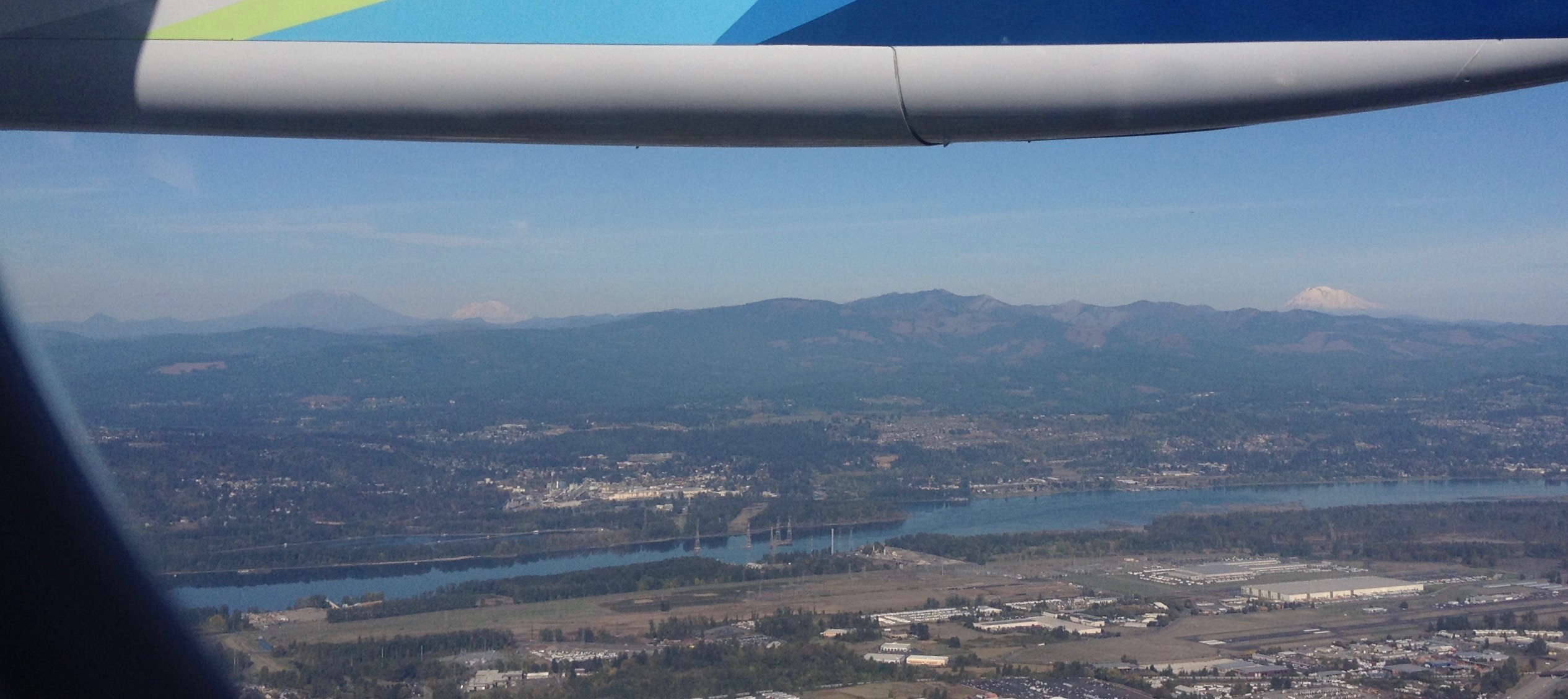 Looking north into Washington State to Mount St. Helens (8,366′), Mount Rainier (14,411′), and Mount Adams (12,280′). The mighty Columbia River is in the foreground.
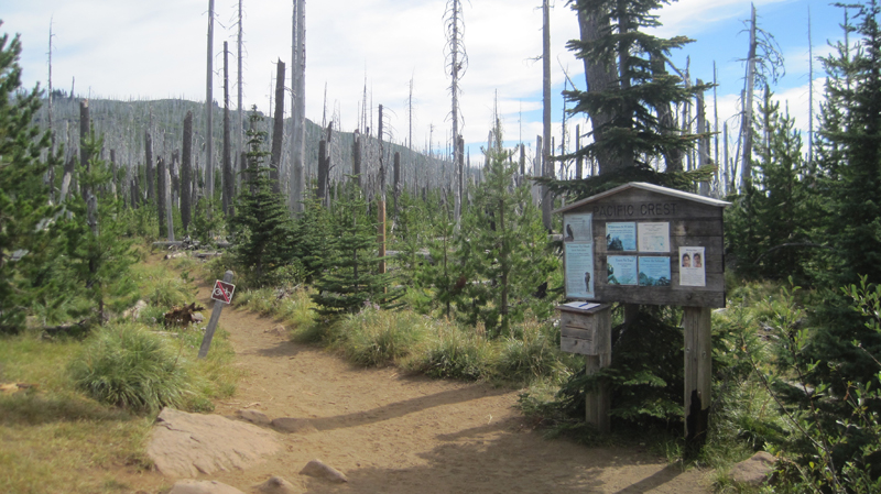 A view of the Santiam Pass trailhead, mile number 2006.9 on the PCT. As my wife and I gathered our gear, we met two sixty-something ladies that started at Crater Lake for a section hike several weeks earlier. These women had already hiked about 175 miles.
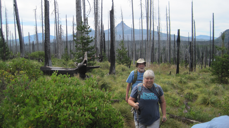 The weather was beautiful – if a bit warm – that morning. We were joined by two friends, Jack and Cindy, who drove us to the trailhead and then hiked with us for the first five miles of our journey.
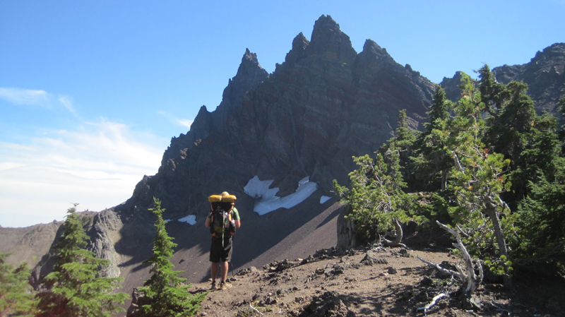 A view of the north side of Three Fingered Jack, a jagged and rugged mountain in the High Cascades that has banded stripes. A PCT thru-hiker stands in the foreground. He was one of about 25 who passed us that day; the oldest being somewhere in her 60s, the youngest about 18, and about half of the thru-hikers were female.
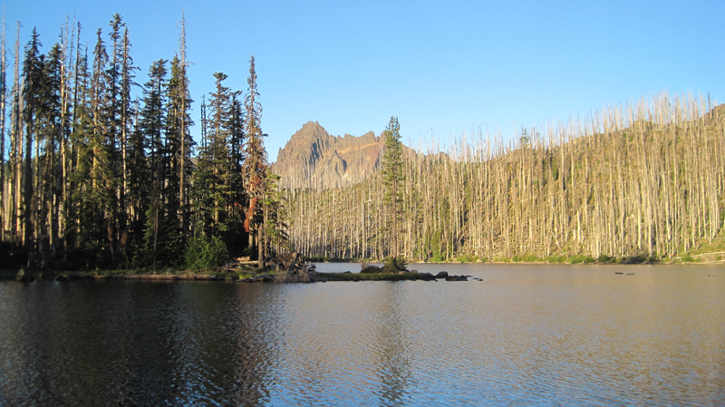 A view of Wasco Lake the following morning at about 7 am.
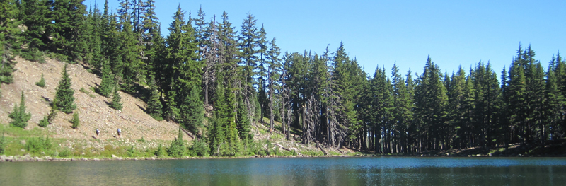 We enjoyed a mid-morning break on the shores of Rockpile Lake. Several thru-hikers can be seen on the trail at the left. The two women we met a day earlier enjoyed their lunch and a quick swim on the opposite side of the lake.
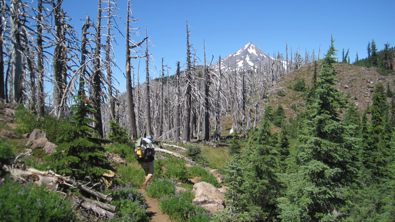 Much of our day was spent walking through woods that had been burned several years earlier and were now recovering. In the distance, the peak of Mount Jefferson made frequent and teasing appearances.
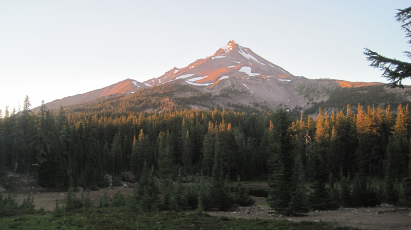 That evening we camped at Shale Lake and enjoyed an amazing view of the south side of Mount Jefferson. We ate our dinner and watched the evening light blanket the slopes of this iconic High Cascades peak.
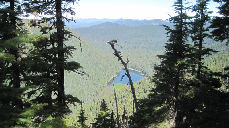 Looking upon a picturesque view of Pamelia Lake from the PCT. This area is a limited entry zone requiring a permit to camp. Our hike that morning was in the forest where we encountered some sizeable old growth trees, and at one point we rounded a corner and surprised a grouse.
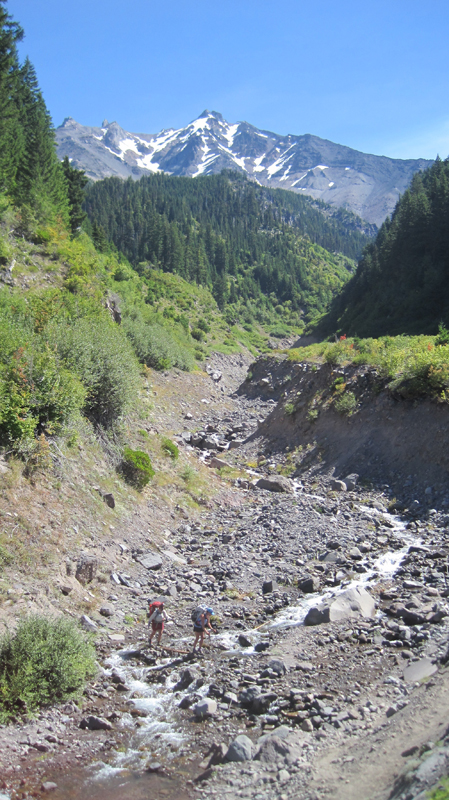 Milk Creek has cut a 100-foot deep gorge into the slopes of Mount Jefferson. Several backpackers are seen crossing the creek below us.
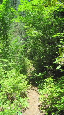 Overgrown and green, this is what the trail looked like for the rest of the afternoon. It was also humid and hot, making our progress slower than expected. Occasionally, we would see glimpses of Mount Jefferson through the trees.
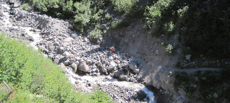 Russell Creek pours off the mountainside where it meets a “flat†area for about 100 feet before dropping into a deep gorge; this more level area is where the trail crosses. Earlier in the season, the flow can be very strong and this can be a dangerous crossing. Today, though, it just brought about some wet shoes. In this image, a hiker approaches the crossing area. We spoke with her later to find out that she was 18 and was hiking 250 miles of the PCT by herself.
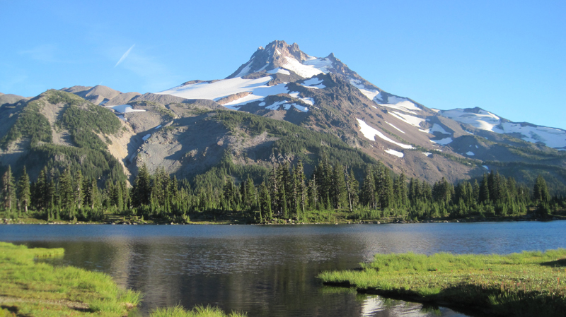 We enjoyed breakfast under this stunning skyline.
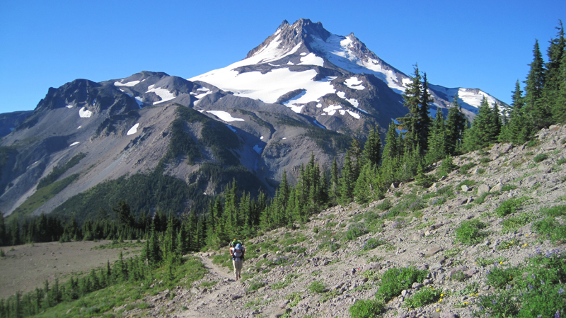 The next morning we climbed 1,200 feet out of Jefferson Park. The views were magnificent: wildflowers were in bloom along the trail, and at times it was hard to hear because of the abundance of buzzing coming off nearby flowers.
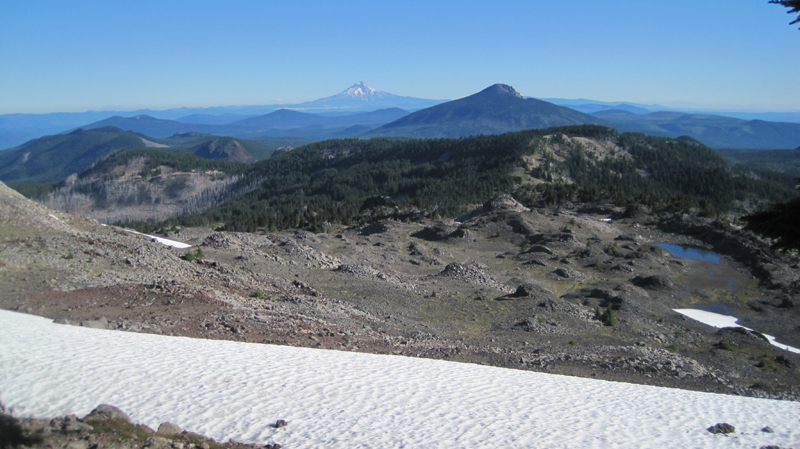 We reached the trail’s summit and could see Mount Hood in the distance. Descending the slope, we passed several snowfields. For several hours our progress was slow going because of the loose rocks, though the trail soon became forested and we passed a number of beautiful mountain lakes.
 Late in the afternoon, we reached Ollalie Lake. Here is a view looking south across the area we just hiked, and in the distance is Mount Jefferson. About two dozen thru-hikers were staying at Ollalie Lake to rest.
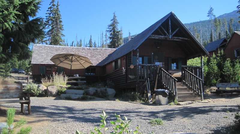 Ollalie Lake has a small store where my wife and I eagerly purchased a bag of sea salt and vinegar potato chips and promptly devoured the entire bag. At one point there were a whopping total of eight stinky hikers in that little store – ah, the aroma of humanity!
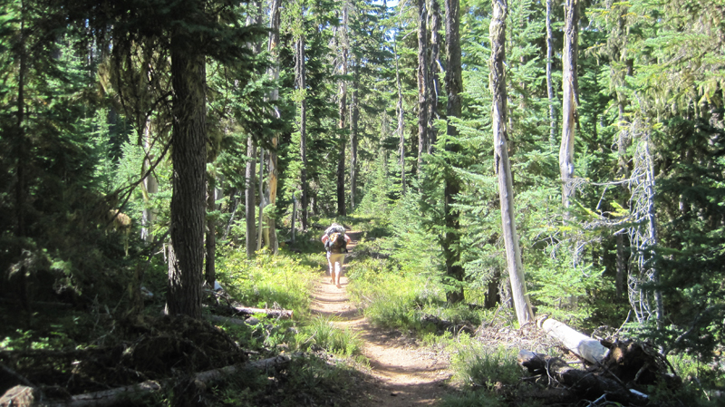 The trail on day five was mostly flat and in the shade of tall trees, making trekking much easier. The forest was drier in this region and water was less abundant than before. When the opportunity presented itself, we filled up our bottles at a small, tranquil trailside spring. The temperature that day was especially warm.
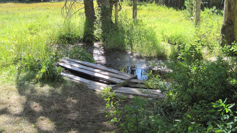 We arrived at Trooper Springs near the Lemiti Marsh area. This was our last water for about twelve miles. The spring was a welcome site although a small and precarious platform needed repair. We were attacked by horseflies; they were numerous, aggressive, and very persistent. Needless to say, we did not stay long.
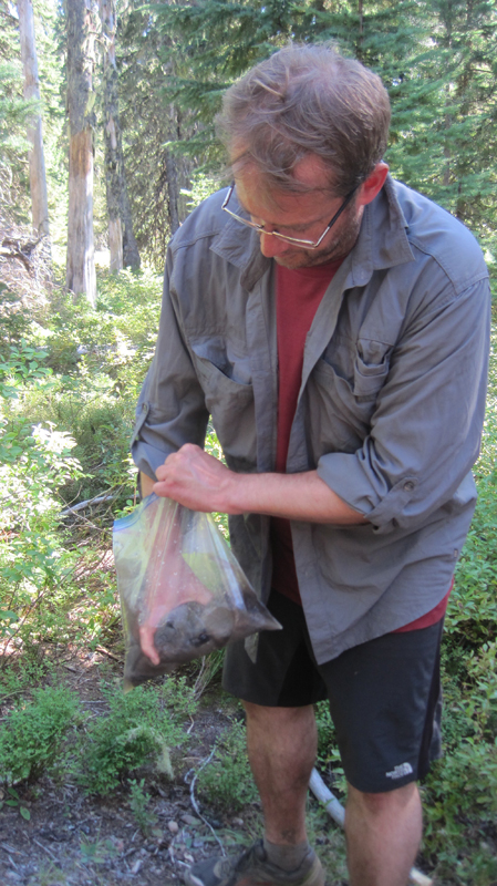 Taking care of some much-needed laundry at the spring using the “Ziplock spin cycle” washing method.
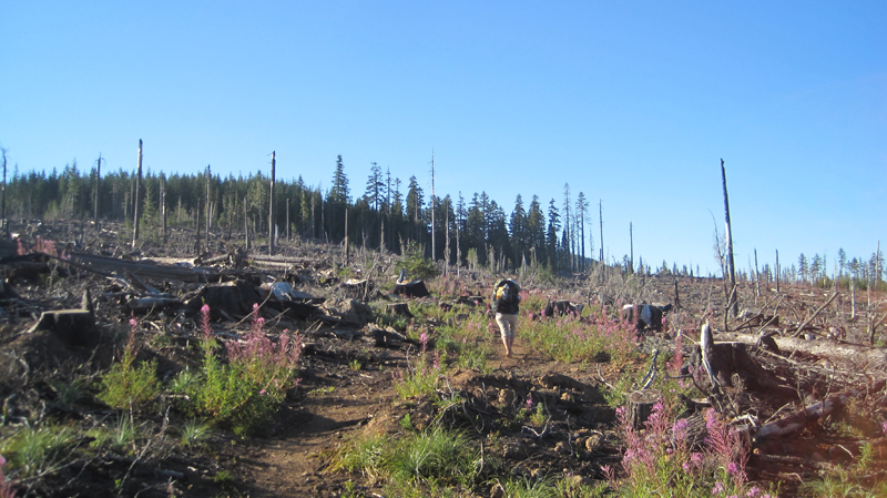 Walking through a clearcut was a stark contrast to the lush forest we had seen all day. Near this area, we found the strangest price of trash on the trip: a Howard Johnson’s hotel key card lying next to the trail. We picked it up.
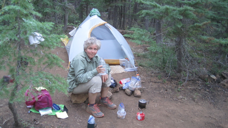 We located a bare spot at the edge of the trail and camped for the night. Trailside camping can look messy, but everything goes back into the pack and we always leave the site cleaner than we found it.
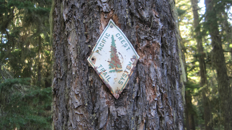 Shown is an old style PCT trail marker that we found, one of the few older versions that we saw on the entire trip.
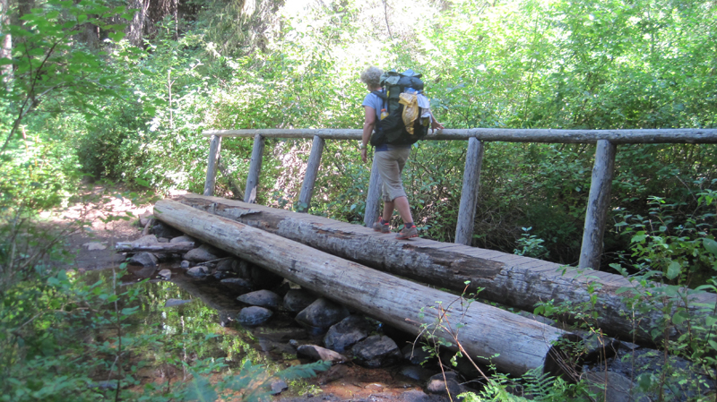 Crossing the Warm Springs River. It was more a small creek at this point, but the water the clean and cold – a welcome site.
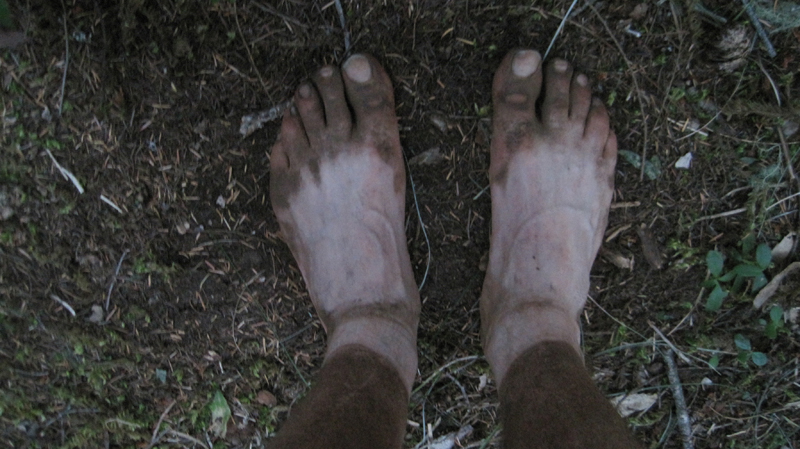 As I took off my shoes I realized just how dusty the trail was that day.
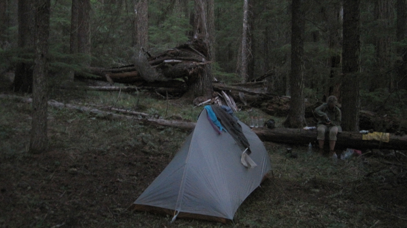 That evening we stealth camped near the trail close to Timothy Lake. During the night we unzipped the tent for a “nature break” – only to be scolded by an owl that repeatedly whooo’d at us until we went back to bed.
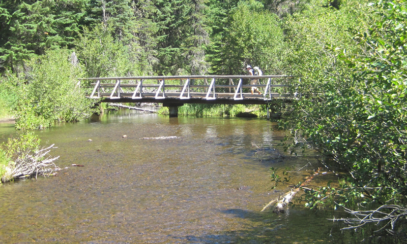 Several miles down the trail was Crater Creek, a beautiful riparian area with some astonishingly cold water: a welcome find on a hot day. We soaked our feet, took a twenty-second dip (the water was that frigid), then soaked our shirts and put them on as a natural air-conditioner. We made a stop at Little Crater Lake, the source of the creek. Little Crater Lake is astonishingly blue like it’s larger cousin, but this was not volcanic in origin. Rather, this was a large artesian well. Continuing down the trail, we passed a gravel forest service road and found a bag hanging on PCT post. Inside were some small apples or Asian pears – some unexpected trail magic in the middle of nowhere.
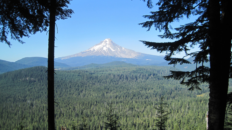 This was our first view of Mount Hood after about 40 miles of hiking – what a fantastic sight.
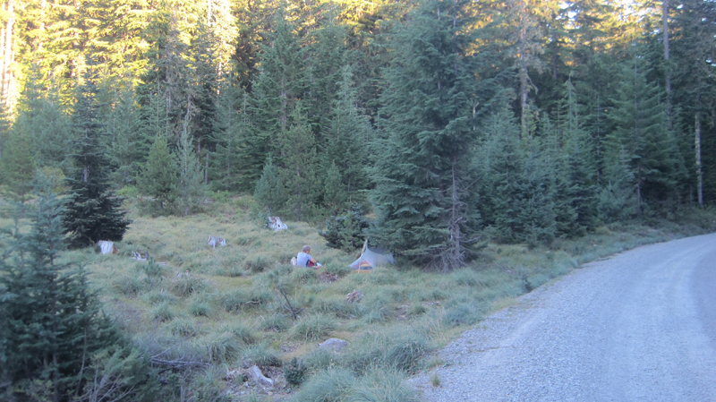 We took a side trail to Frog Lake for some water where there was a hand pump that drew water from a well. As we entered the campground we were momentary celebrities answering questions like: “Where did you hike from?†“How many days have you been out?†“Tell me about your gear?†etc. It was an odd but welcome feeling. That night, we camped just outside the campground on a forest road.
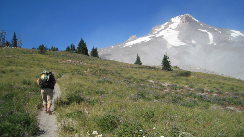 Finally, the green of the trees turned to open space and vistas as we passed the timberline. It was windy with twenty to thirty mile an hour gusts that kicked up sand and dust. We wore our sunglasses to keep volcanic grit out of our eyes.
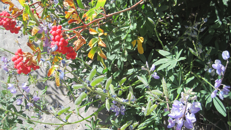 There was an abundance of mountain flowers on the trail.
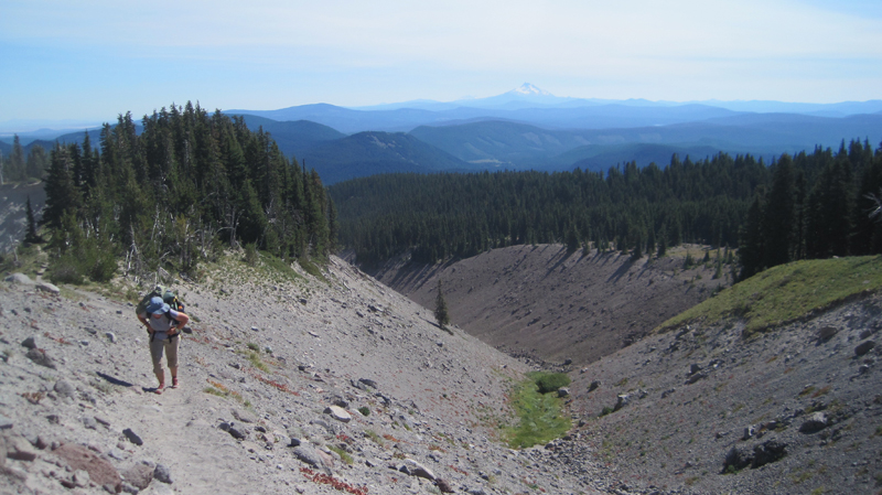 Close to the Timberline Lodge, the views were fantastic! We could see much of the route that we had spent the past week traversing.
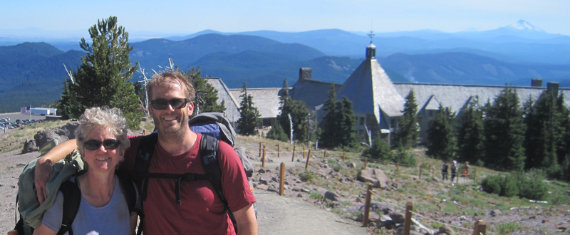 We arrived at the Timberline Lodge, mile 2107.3 on the PCT, and 100 miles from our starting point at Santiam Pass. Inside the lodge, scores of thru-hikers had taken refuge in the common areas. There was access to food and good company, with couches for sleeping and a warm fire to enjoy in the evening. We met some new friends here: Shepherd, Snow, Lonestar, and Patch, all thru-hikers who started at the Mexican border and were resting before their final push into Washington State and Canada.
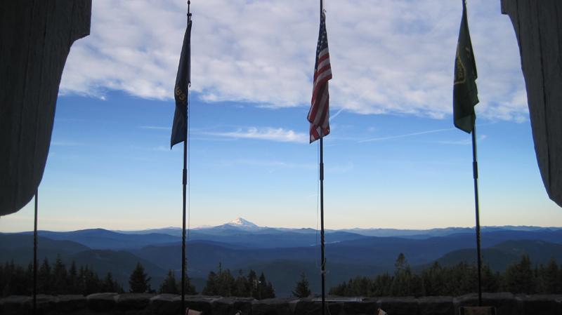 Looking through the door at the Timberline Lodge onto the Roosevelt Terrace: in the distance Jefferson Peak, and behind it, Three Fingered Jack and Santiam Pass. From the lodge, we were able to take public transit back home.
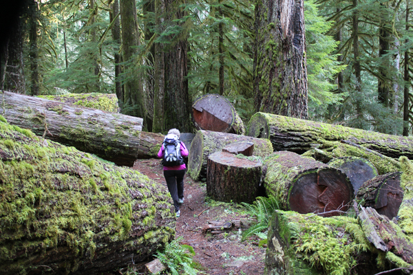

 A glorious view from Diamond View Lake. The clouds at the left of the image produced some amazing lightning and thunder that afternoon.
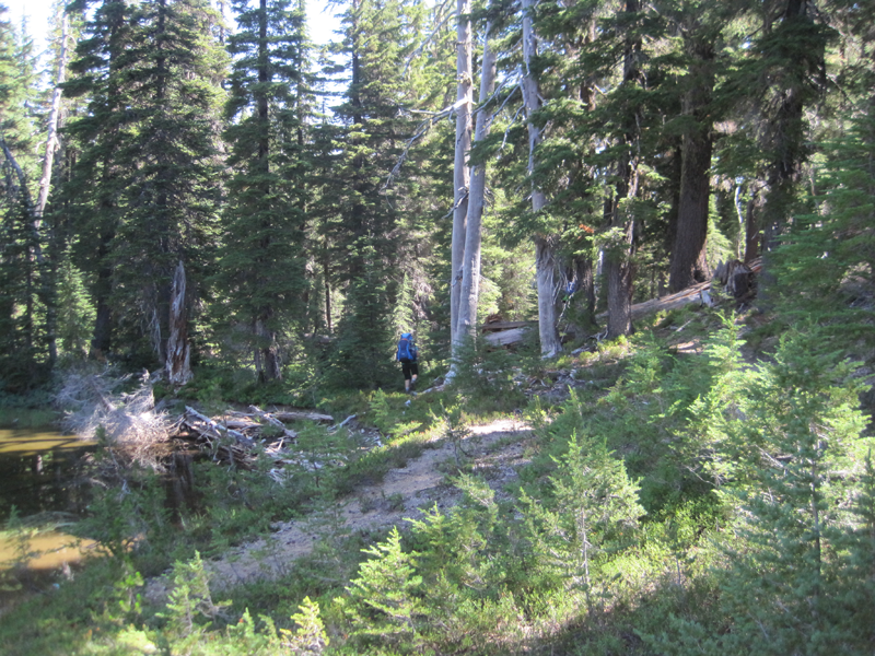 The trail got a little hard to follow at one point and we had to bushwhack.
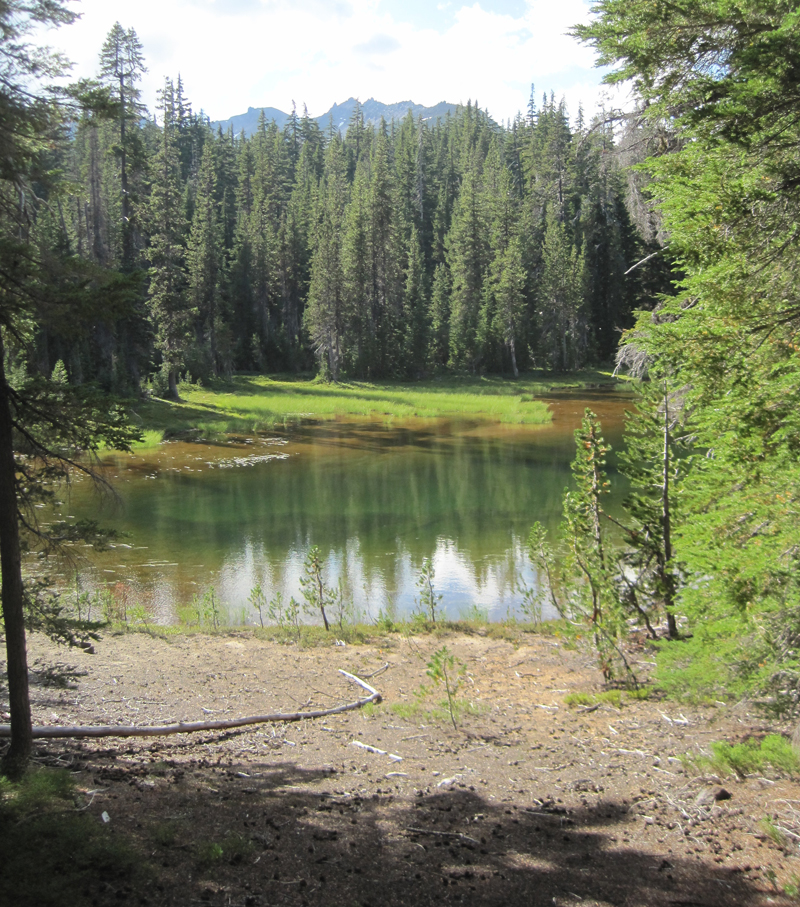 A little lake where we stopped for a rest, only to stay for the night. Water was scarce in the area and the lake provided a great location for watching wildlife and hearing even more wildlife during the nighttime.
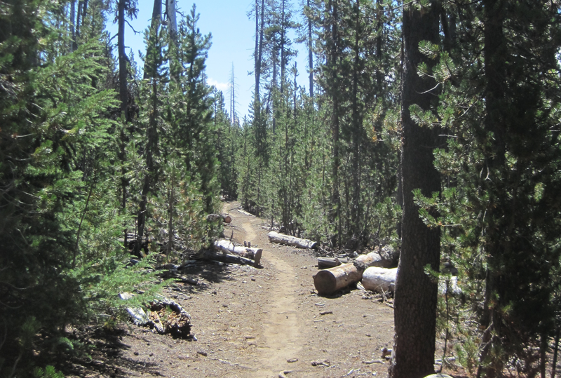 A very dusty path. This trail was well worn because of the number of PCT hikers that we met, many had been side-tracked to a lower elevation because of the lack of water on the main PCT.
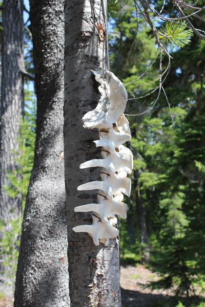 Wow! You find lots of cool things on the trail.
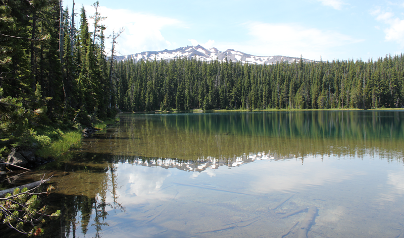 Standing at the outflow of Yoran Lake looking south to Diamond Peak. After a break, we bushwhacked about half a mile to the PCT to loopback.
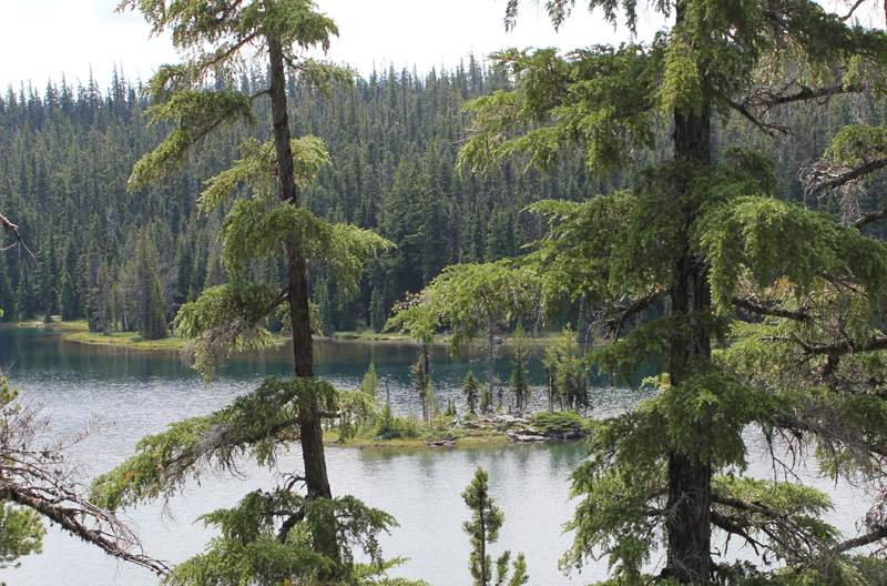 A small island on Yoran Lake.
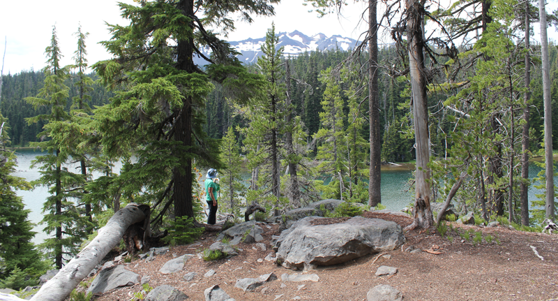 Enjoying some lunch while scouting out a great campsite.
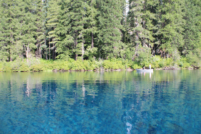 Each stroke of my paddle dips into the crystalline fluid and scoops out rounded orbs of glass-like liquid, I dip my hand into the water, the temperature is cold, somewhere around 40 degrees Fahrenheit. The lake is fed by mountain springs that course from deep within old lava flows; the water temperature stays a near constant throughout the year.
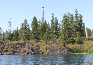 A number of Mallard ducks float next to my kayak, some are just a few feet away. One comes abreast to me and looks at me in the eye; he cocks his head as though wondering what kind of strange beast I might be. I can see his little legs moving underneath the water, churning like a miniature paddle wheel.
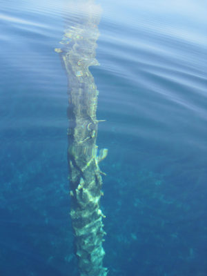 A large dark form starts to become visible in the water before my kayak. I stop paddling and the surface becomes undisturbed allowing the shape to come into focus, it is the column-like shape of one of the ancient trees. The trunk appears to be as big around as a dinner platter, and only just a couple of feet below my kayak. I try to gently tap the top of the trunk with my paddle, but I am unable to reach it. The water has played a trick on my eyes by making things appear closer than they really are. I peer down the trunk looking, fifty, sixty, possibly a hundred feet down to the bottom.
 My visit to the tallgrass with my Father started in the town of Pawhuska, Oklahoma, close to the preserve’s southern entrance. The drive down a paved county road was surrounded by woodlands but this soon turned to prairie and the road turned to gravel and then a packed caliche clay.
 A plaque near the entrance of the preserve includes the text, “The Tallgrass Prairie Preserve. You stand at the south edge of the largest unplowed, protected tract which remains of the 142 million acres of tallgrass prairie grasslands that once stretched from Canada to the Gulf of Mexico. Today, less than ten percent still exists, found mostly in the Flint Hills and Osage Hill regions of Kansas and Oklahoma. In an increasingly crowded and noisy world, what you see is an oasis of space and silence. Here you can experience the same beautiful vistas that greeted the earliest human hunters and gathers many thousands of years ago. This area is indeed a national treasure. Please treat it with respect.â€
 Further beyond a few dark bison sentinels stood at the side of hills, these were apparently lone males who had been pushed out from the herds. The mature males, after mating, are no longer needed by the female-dominated herds and are excluded.
 A herd of bison was just ahead. It was easy to see their dark forms against the dry and brown landscape of late autumn. The bison allowed us to slowly drive past. They did not appear to mind us and continued with their business. If they wanted to the bison could cause us some harm as these are great creatures measuring 5-6 feet at the shoulders and 7-10 feet in length. Plus bison can weight up to 2,000 pounds or more! Some of the individuals peered at us through thick, wooly looking coats that would soon protect them from the coming winter cold. We watched them for some time.
 We passed another two groups of bison close to the road. The ‘Bison Loop’ road offered additional miles of great sightseeing.
 The Preserve Headquarters offers a great visitors center. One memorable exhibit showed just how tall the grasses at the tallgrass prairie can grow – as tall as a grown man. The grasses on the tallgrass are very nutritious and part of an amazingly fertile ecosystem. Another item was a table filled with bison bones and fur. I had expected the fur to be harsh feeling but, it was surprisingly soft and extremely warm. A scapula (shoulder blade) was at least 21 inches in length and 14 inches wide – a big bone for a large animal.
 headquarters. I was informed by a docent who has been at the preserve for years the best time to visit is in the spring (May) when the wildflowers carpet the landscape and the colors are superb. I plan to return at that time.