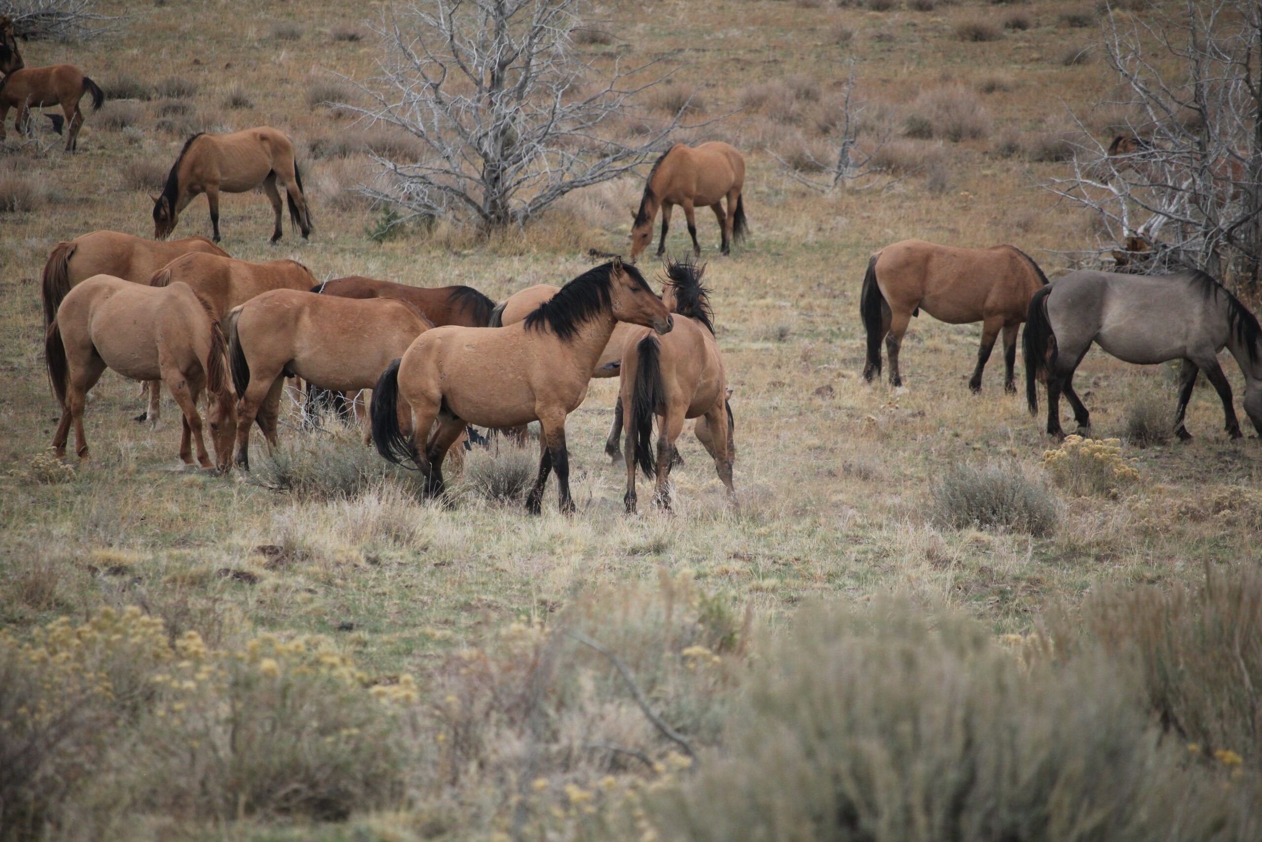
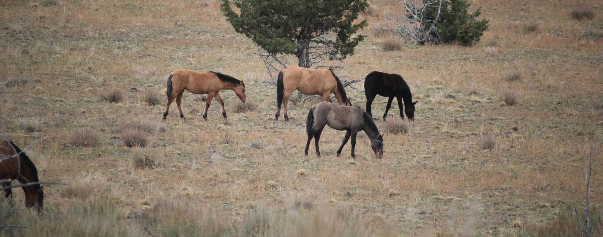
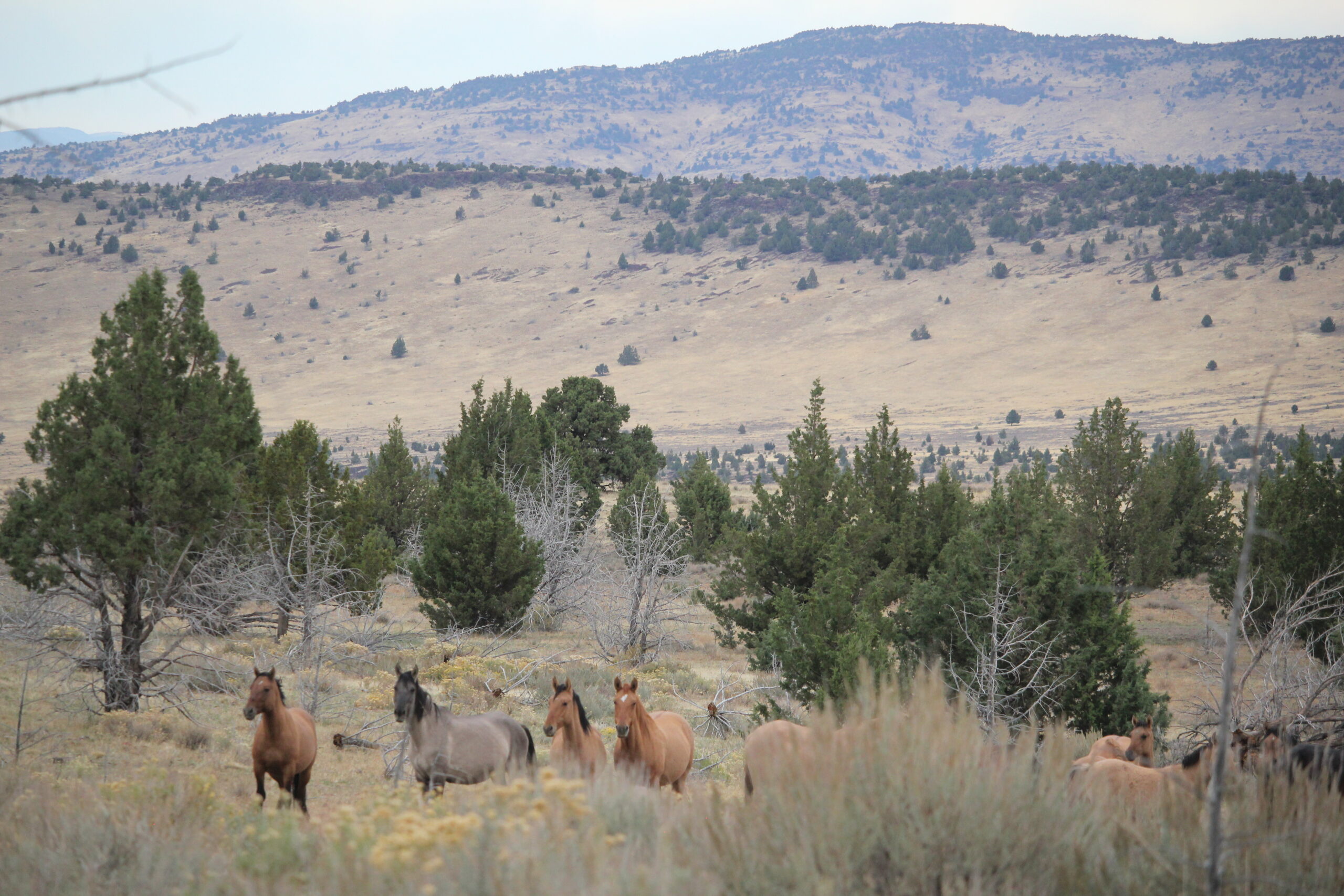
The Surprising World of Washington’s Quinault Rain Forest Nature Trail

During a trip to the Olympic Peninsula in March, I was excited to experience the Hoh Rainforest, but upon arriving at the Ranger’s kiosk was told that a tree had fallen over the road. The tree was large enough that outside help had been called in to help with the removal. My vehicle, along with others, was told to return another day. 🙁

But the ranger, upon hearing that I was traveling to the south shore of Lake Quinalt suggested visiting the Quinault Rain Forest Nature Trail -a personal favorite of his.

Upon seeing the striking beauty of the trail I was hooked. This trail was about half a mile in distance but required an hour just to meander through this old-growth forest and fern-covered canyon. There were hanging carpets of lush green moss, signs of various animals, fungi, and the wonderful smell of clean air. This place, in a word, is breathtaking. I love interpretive trails but had not expected this half-mile walk to be so encompassing. For a longer walk, the nature trail connects to the Quinalt National Recreation Trail System with several additional miles of trails. The trail has some fantastic interpretive signage – kudos to those who arranged the material! This visit was in the springtime with temperatures in the low 50s and lots and lots of rain.

Urban Walks & Explores in Track Town (Eugene, Oregon)

Winter is a wonderful time to explore Eugene, Oregon. Here’s a sampling of several group tours I led in late 2019 to see local murals, holiday lights, the university, and historic districts.

Leading an evening walk to see some of the holiday lights.

Learning about a local author (Opal Whiteley) and the statue commemorating her life. This was part of a local art walk.

After a tour, I always ask if participants would like to continue their day (or evening) enjoying some local flavors.

A walk through the grounds of the University of Oregon to see local art and craftsmanship.


Enjoying a brief side-trip to learn about some of the participant’s explorations in Oregon with this wall-sized map.

There are always curious things to see on my trips, this Holiday skeleton was spotted in a car while I was leading a recent group walk.


Eugene was once home to 18-miles of electric streetcars (trolleys). On this neighborhood walk, our group was able to see some of the original tracks that are resurfacing.

This location is actually near an old stop on the historic trolley line (from the previous photo), but today the stop is home to little free tea kiosk where a person can get a hot cup of tea and enjoy a book.


Walk participants are finding some micro-art pieces for themselves in this photo. This is a trompe-l’Å“il art piece, it uses realistic imagery to create the optical illusion that looks three dimensional.

Some of the curious street art in Eugene.

The Case of the Mysterious Crater Lake Rings

Crater Lake National Park never ceases to amaze the viewer, but this time it astounded with some mysterious rings seen upon the lake’s surface.

These unusual rings were viewed near Wizard Island from Watchman Peak, and were observed on August 29, 2019, between 9:20 am & 9:40 am (approximately).

That morning, my educational tour group had hiked to the summit of Watchmen Peak. We were treated to an expansive vista over an exceptionally peaceful Crater Lake. The gigantic body of water mirrored the sky as there was no wind, nor any waves caused by the island excursion boats. What we did see upon this flat liquid pallet were multiple “rings.” At first, the rings appeared to be raindrops to the west and southwest of Wizard Island (in the Skell Channel area), yet our perspective was 800-feet higher and three-quarters of a mile distant. These rings were sizable!

I had never observed such rings during multiple visits to the lake. Were these new? Had I not observed them before because of wind, light, or other surface conditions? -The mystery is afoot!

As my group arrived at the summit several of the participant’s phones reconnected with cell service. The group had been a couple of days without any service and a few people were eager to check email, news, etc. One person exclaimed that about an hour earlier (approx. 8 am Pacific) a 6.3 earthquake had struck off the Oregon coast. The question was raised, could a massive and distant energy release encountering a different density (energy waves traveling from rock then to liquid, especially upon a very still body of water) have allowed stored gases in a shallow area of the lake to escape, causing these rings?

Overlooking Crater Lake & Wizard Island from the Watchman

It was intriguing, yet an earthquake some 200+ miles distant seemed remote. What there a more likely cause? The area in the Skell Channel area is relatively shallow (from 60 to 200 feet deep) compared to the rest of the lake, and has an abundance of underwater moss. The water at Crater Lake is known for its clarity and this massive biomass might have been bathing in a bounty of sunlight. The weather for several days prior had been mostly sunshine with only some rain that night…could these conditions have accelerated photosynthesis? What about springs in the area? Based on the ring images (especially the close-up image) this seems likely, but Crater Lake is essentially a closed system, its small watershed (the rim of the lake) means the lake receives all its incoming water from snow-melt and rain. There is supposedly some hydrothermal spring activity on the bottom of the lake, but this appears to be limited and at greater depths.

Was there a more likely explanation? I reached out to the Crater Lake Institute and the Oregon Master Naturalist program for help. I also included some photos of the curious phenomena, including one close-up, and several photos that were overlaid with Google Earth to help with identifying the location and determining the scale.

The ring images were highlighted (first in Adobe Illustrator) then overlaid into Google Earth. The shoreline features of Wizard Island were mapped to the photos.
A close-up of the two images showing ring diameters. The various ring diameters were measured using Google Earth.

The diameter of some of the rings was massive:

2.1 meters
3.6 meters
5.4 meters
6.1 meters
6.7 meters
8.8 meters
11 meters
42.5 meters

The inside ring measures 8.8 meters!

After a few emails were exchanged one cause of the rings’ formation was the most supported: “unusually strong photosynthetic activity by prominent beds of submerged plants, which occur in shallow waters around Wizard Island creating supersaturated oxygen levels, resulting in oxygen bubbles rising to the surface.” – Crater Lake Institute.

This sounds very plausible and I’m grateful for the feedback. I am curious if there is any research or photos showing this phenomenon in previous years. If anyone has any knowledge, please contact me. Seeing the rings were amazing and I hope to return on future clear summer days to gather some additional data.

Thank you to the Crater Lake Institute and the Oregon Master Naturalist program!

Dan Witz’s Street Art – Hiding in Plain Sight in Eugene, Oregon

Dan Witz is a master of trompe l’oeil (‘trick of the eye’), the visual style of painting that looks three dimensional.

In the summer of 2017, he visited Eugene, Oregon, and placed 11 (according to the city) of his works around town. While Eugene celebrates many building-sized murals, Dan’s artwork is on a smaller scale. Locating them requires some leg-work as they are not published on a map. Also, you might have to revisit places that you at first would overlook. Most of his works are downtown between 7th & 11th Avenues and Olive & Willamette Streets – I listed some hints below – their charm is in discovering them. Several pieces are outside the downtown grid and for these, I’ve provided more specific information on where to find them. Several were removed (stolen), these are mentioned as well.

While researching Dan’s work I learned that he called such works “WTF” images. The idea is that a casual bystander on the street or someone passing in their car might briefly spy one his works, and ask the question, “What the f$@k was that?”

His artwork is creative, surprising, and sometimes disturbing. You will be asking questions about his work long after you spy them.

#1. One of the most photographed images of Dan Witz’s work in Eugene. It is located downtown on Broadway near a restaurant. Look close to the ground.

#2. Dan’s images are sometimes in places that you might not visit. Here, in a downtown alley, next to the trash dumpster and the recycling bin is a WTF image. …most people would overlook such an area, I did…at first. I wonder how much of the grime on the wall and the neglected-looking doors is real vs painted by the artist.

#2 (continued) A close-up of the image.

#3. These hands appear to be wearing yellow rubber gloves like a person might wear who uses caustic chemicals in cleaning. Such gloves hide hints of race, age, gender or other traits that might bias the viewer. It also suggests anonymity. You’ll find this in an alley close to Broadway.

#4 (two panels). Many of Dan’s images are in close proximity to Blek le Rat’s stenciled works here in Eugene. Like all good things, it takes some work to divine the location of his images. Both pieces in the photo shared wall space which appears unfinished, even a bit garish, yet it is in this unkempt space where you find the artists’ creativity. Dan’s work on this wall is possibly one of this most disturbing for me; one because of its unnerving presentation of a reclining human figure that appears to be inside a wall, and secondly that I walked past this wall for many months before I really saw it.

#4 (continued) A close-up of the reclining man; is he resting, or deceased? The two panels together are about 5 feet. Sometimes it’s easier to see this image from the side. To find this piece, look at the back wall where a cabaret for actors might work.

#5. Definitely a WTF image – seeing a blue hand pushing the grate apart. Why is the hand blue? Does the hand belong to a tagger whose hand is covered in blue paint? Or is it something more sinister? The location for this is easily overlooked by people visiting the local farmer’s market on weekends. Instead of walking up the stairs to your car take a look around the garage’s ground level.

#6. OK, this is not one of his paintings, but his work does trick the eye. While in the proximity of Tacovore in the Whiteaker (Eugene) look at rooflines for his yellow gloves. Note the Blek le Rat work in the background.

#7. This image is downtown. It’s hiding in plain sight above the back door of a music venue that opened in 1925.

#8. This is a window-sized design.  I have both driven past and seen its location from across the street many times, yet never observed it. It is worth finding. Start at the Whole Foods in Eugene and make your way across the street to the All Prophets Tattoo shop, keep your eyes open. REMOVED: Sadly, this work was removed in early February 2019 when the building repainted. It is unknown if the artwork survived.

#9 REMOVED: This was located near 6th & Pearl along the stairwell of the Lane County Parking structure.

#10 REMOVED: This very small piece was located on the corner of Oak & Broadway. Look for the crossing light box in front of D.A. Davidson & Company. You will see an outline of where the piece had been affixed to the box. It is just below his tag: a gray smudge (a tell-tale sign, but it is incongruous with the clean surroundings and one’s eye will at first overlook it).

#11 REMOVED. This photo is from the 20x21EUG Mural Project. This 2017 image shows Dan Witz working on his street art located on 11th Ave by the Chase Bank. It was removed/stolen.

Tracking Down Blek le Rat’s Street Art in Eugene, Oregon

Blek le Rat is a street artist whose work appears in many cities, including Eugene, Oregon. Finding his work can be part of a great day outing.

In 2017 Blek le Rat visited Eugene, Oregon, as part of the 20×21 Mural project. He placed 10 works around town. Most are located in a grid in the downtown area between 7th & 11th Avenues and Oak and Olive Streets. Several images are outside this grid area and those locations are mentioned in the captions. One piece was painted over in the summer of 2018, an image of it is included below.

Blek le Rat got his start as a graffiti artist in the 1970s in Paris. Eventually, he used stencils to differentiate his street writing from others. Today, he is considered the godfather of stencil street art and is credited with influencing many others, including Banksy. Accompanying his work is often the image of a black rat. Blek once mentioned (paraphrasing) that rats are the only wild creatures in an urban setting, their numbers are vast compared to the human population, and they also carry subversive plague like how graffiti affects a city.

Tug of War. This image is located next to the stage door of the Hult Center (in an alley).

Another one of Blek’s stenciled works outside the downtown grid. This eye-catching design is located next to Tacovore in Eugene. Enjoy a cup of coffee at the local shop as well.

This is another work that is outside the general grid. It is located near 13th and Oak, and in the proximity of some other wonderful murals (from other artists). The man is the image is apparently of Blek’s son and his likeness appears on many of the Blek’s works around Eugene. The Koi Fish are from a previous artist’s work and can be seen at several location swimming around town.

A downtown image on the backdoor of a restaurant. Note the tagger is dropping the can of spray paint. Is he dropping it because it is empty or because the cops have shown up?

Ballet – dancing couple. When you find this piece (if you take public transit downtown look around) keep your eyes open for works of other artists like Dan Witz.

Another one of his works in downtown Eugene. The musician is not playing. I really like the reflection in the plexiglass, this is almost two images. Curiously, in juxtaposition, a nearby work of his features two dancers.

The Pied Piper. This wall-sized work is at the edge of the IDX building in town. It is not hard to see the piper from the road below, but I’m surprised how many people overlook the work entirely. To see it properly you need to climb up several flights of stairs in the parking garage. At the piper’s feet is a rat with a microphone.

A graffiti tagger looks around a corner. If you park your car to attend the local Farmer’s Market you’ll see the tagger – or, the tagger will see you.

An image of the tagger and bird in Eugene, Oregon. This sadly was painted over in the summer of 2018, it was located just off Broadway between Willamette and Olive Streets. Photo from Blek’s website.

The mouse with a microphone. Possibly my favorite of his Eugene works. This is different from his other pieces in Eugene in that it is located inside a building. It is easy to overlook, though it can be viewed from the sidewalk through the door. The name of the establishment is in the photo. …Nice ink on the person’s arm.

SFO to PDX: View from the Window Seat

Explorations can sometimes be found at 38,000 feet while sitting in the cramped quarters of an airplane. The route between San Francisco, California and the Pacific Northwest is a favorite to visually explore because of the varied topography. Here are some photos, the images were taken over several trips.

A magnificent view of San Francisco and the Golden Gate. San Francisco covers an area roughly 49 square miles! The Golden Gate Bridge shown on the left is 1.7 miles in length and 746′ tall.

Mount Shasta (14,179′). Shasta sits uniquely at the southern end of the Cascade Range and the northern end of the Sacramento Valley. The mountain is so massive that it can be seen from 280 miles away from atop Diablo Mountain (3,848′), the tallest mountain in the eastern San Francisco Bay Area.

Crater Lake is in the distance. Once known as Mount Mazama, this peak rivaled Mount Shasta for prominence upon the skyline. Mazama erupted about 7,000 years ago, and in the process list its peak and collapsed upon itself. Over time the remaining crater filled with water. The lake is 2,000′ deep and about 5 miles across.

From north to south – left to right: Black Butte (6,436′) Mount Washington, Belknap Crater (6,876′), and the Three Sisters (north, middle and the south sisters); they were once known as Faith, Hope, and Charity.

From north to south – left to right: Ollalie Butte (7,219′), the snow-capped Mount Jefferson (10,497′), Three Fingered Jack (7,844′), Black Butte, Mount Washington, and Belknap Crater.

Mount Hood (11,250′) dominates the skyline east of Portland, Oregon.

Looking north into Washington State to Mount St. Helens (8,366′), Mount Rainier (14,411′), and Mount Adams (12,280′). The mighty Columbia River is in the foreground.

Celebrating the Autumnal Equinox at Lava Beds & Crater Lake

This was an exploration of two dramatic volcanic landscapes timed with the Autumnal Equinox.

Trip Report:
Volunteer Leader: Mark Hougardy | Organization: Eugene-based Hiking Club | Date: September 2018 | Duration: 4 days | Participants: 5 | Type: car camping, hiking, and caving

Upon arriving at the forbidding Lava Lands National Monument we made camp and then explored several accessible lava tube caves around the visitor center. We also climbed the conical shaped 5,302-foot tall Schonchin Butte where we enjoyed views 100 miles east to the Warner Mountains, near Nevada, and 50 miles west to Mount Shasta. In the evening, we walked along a dusty trail into the Schonchin Wilderness Area and encountered an entrance to a lava tube that was at least 4 stories tall.

The next morning we hiked from the campground to Skull Cave where a small ice pond can be viewed year round. We also hiked to several pictograph caves and enjoyed our lunch on the trail. As the afternoon warmed we spent our time underground where we explored three caves and partially a fourth. Back at camp, we were surprised to discover that several hundred bugs had descended upon the hood of one of the cars, possibly attracted by the metallic-blue color. They had apparently been engaged in a frenzied mating and exhausting themselves to death. Bugs that fell onto the ground were snapped up by an eager lizard. As the sun set, we hiked into the nearby wilderness and enjoyed a pastel sky.

On the third day, we packed up and drove through the northern section of the monument. Our last stop was to Petroglyph Point where a monolithic wall includes petroglyphs, raptor nests, and evidence of former wave action. Tule Lake was a gigantic, yet shallow inland lake that existed for millennia. The lake was drained in the early 1900s and the exposed land turned into farmland. The existing lake is far to the west and is one-sixth its original size. Future explorations to Lava Beds will include additional sites of the Modoc War and seeing the remnants of an imprisonment camp where Americans of Japanese ancestry were forced to live during WWII. In the afternoon we drove to Crater Lake and made camp. The Mazama Campground was closing for the season and this was its last weekend. Upon our arrival, the sky darkened and it rained for several minutes. After making camp we hiked to the Great Spring and down the picturesque Annie Creek trail loop. In the late afternoon, we made good use of the camp showers then drove the rim to enjoy the views from Discovery Point. At dinnertime, we made our way to the historic Crater Lake Lodge where we raised a glass to celebrate the Autumnal Equinox then enjoyed a meal. Back at the campground, a nearly full moon encouraged multiple parties at neighboring campsites and sleeping was difficult.

On day four we woke to a frosty 28 degrees Fahrenheit. We warmed up though at the local Annie Creek Restaurant with some hot coffee and breakfast. As we drove along the east rim to the Mount Scott trailhead the sky was blue and clear. We hiked for about an hour to this highest point in the park, which stands just less than 9,000 feet. The view of the once massive volcano Mount Mazama, now known as Crater Lake, was superb! We could see about 100 miles in each direction; to the north the Three Sisters, and to the south Mount Shasta. As noon approached we hiked back down the mountain and ended our trip with a late lunch. There was a definite chill in the air, fall had arrived.

Where to Stay in San Francisco on a Budget

Where can a frugal traveler stay in ultra-expensive San Francisco? These are friendly, clean, and safe hostels to help you explore this world-class city while not wrecking your budget.

The Adelaide Hostel
The Adelaide is a few blocks west of the centrally located Union Square. The hostel’s name originates from a former owner’s love of his Australian hometown. This is an older building, but the architecture’s warm color palette and modern facilities only compliment the charm. The kitchen and dining areas are clean and there are nights where the hostel prepares meals for guests. In the morning make sure to grab a bowl of complimentary oatmeal and orange juice. A quiet area on the main floor is a great place to read and work on a laptop. The staff is very knowledgeable about local places to eat and go sightseeing. Expect some street noise if the windows are open, but earplugs will take care of most extraneous sounds.
Website: www.adelaidehostel.com

Fort Mason Hostel (Hosteling International Fisherman’s Wharf)
All of the HI hostels in the bay area great places to stay, but Fort Mason takes the cake just because of its proximity to the Marina District, Fisherman’s Wharf, and Ghirardelli Square. The hostel retains the crispness and presentation of the building’s military history.  The kitchen is sizeable and the common area includes a pool table. Nearby is a small coffee shop that offers pastries and cookies. A palatial quiet room on the main floor offers a respite for computer work, reading, or just hanging out.  A grocery store (the Marina Safeway) is about half a mile away if you need to resupply. If you want to explore the city, a Cable Car turnaround is a short walk away. The staff is very friendly and helpful and went the extra distance to answer some of my questions. I really appreciate the hostel’s extra activities, which included area hikes led by knowledgeable locals.
Website: www.sfhostels.org/fishermans-wharf

Pacific Tradewinds Hostel
Don’t let the unassuming street entrance adjacent to a Hunan restaurant fool you, the Pacific Tradewinds Hostel is clean, modern, and has a friendly staff. Located near Chinatown, this hostel is centrally located to downtown and North Beach clubs. Be aware, this is a social hostel (aka a party hostel!) and is usually frequented by a younger crowd. The hostel’s main room can quickly become busy and an innocent game of Jenga can turn into a (friendly) beer drinking competition. Bring earplugs as street noise at the night can keep you up. The hostel has a small kitchen with all the amenities. The hostel staff leads tours and clubbing excursions throughout the week.
Website: san-francisco-hostel.com

All of the above-mentioned hostels run about $50 a night. Make sure to bring a small travel lock to secure any items in a locker, as well as shower shoes and extra soap. To avoid the crowds in San Francisco, the best time for visiting is mid-October through March.

The Power of Nature Adventures (Why I Guide)

I’m an outdoor guide because traveling and nature experiences can be powerful teachers. Here is one such story about how an encounter with a whale helped others (and myself) to grow.

Gray whale calf. Photo: Nature Picture Library / Copyright Todd Pusser.

“Whale!” a woman squealed. Two-dozen people slammed themselves onto the starboard railing of a small whale watching the ship. The vessel listed uncomfortably sideways. Just feet away a baby gray whale, the length of a long kayak, floated in the rough surf. Its large black eye seemed to study each of us. Everyone was absorbed in the experience. They had forgotten their discomfort in the previous hour and a half. Up until then, it had been a bad day to be on the water: we had not seen a whale – not one. Our ship sickeningly rolled side to side in the deep troughs, the smell of diesel permeated our nostrils, cold January weather nipped our skin, the sky was oppressively overcast and the wind-chapped our lips.  Worst of all was seasickness, not just a queasy feeling, but real illness. I heard my name being simultaneously cursed as participants barfed over the boat’s edge. Some made multiple trips. As they staggered back with a sick yet relieved look on their faces I received several vexing glances. The words were blazed in their eyes, “Why did you make me come out here?”

It was a hard day. My camera had broken too, then again maybe it was for the best. This was the first whale-watching tour that I had organized for a group and it was going horribly. I secretly wanted this trip to be over, to slink home and erase it from my memory. I wanted the trip participants to forget about it, too.

When the young whale appeared the trip was born anew. A marine biologist shared her commentary: the mother was likely on the seabed feeding and would be returning shortly. The juvenile was not lost, just hanging out at the surface.

Amazingly the whale stayed parallel with our ship for about twenty minutes. Then several hundred feet away from a large mass the size of a city bus rose to the surface. She dramatically announced herself by ejecting a plume of air in a geyser-like spray. This was the mother! The smaller whale joined her and they swam off together.

The people were giddy, but also happy to return to port. Upon disembarking from the ship, the trip participants said little, just drove away. I had organized the outing as a way for overscheduled tech workers to connect with their families in the outdoors, but had I inadvertently turned more people off that helped? This was first of several trips where unexpected situations and hardships caused me to question my outings and slowly I became disillusioned. After several summers, I stopped leading nature adventures.

Fast forward to five years. I was at an outdoor market selling child-sized backpacks I made at the time. A man approached and we talked for a minute, then he said, “Hey, you’re that guy who led the whale watching trip.” He briskly shook my hand said, “Thanks.” I wondered if we were talking about the same excursion. He told me about that day, I listened with interest then in dismay as my well-intentioned nature trip was turned into a tale of deceit. At the time, he and his mother-in-law despised one another and for spite, they created ever-increasing hardships for their rival, often to the detriment of family members. One day he saw my whale watching trip and suggested a pleasant outing for the entire family. But his coyness was masked with a desire that his mother-in-law has a miserable experience. In fact, she hated that trip and wanted nothing to do with him again. To his glee, she stopped visiting altogether! Eventually, her lengthy absence spoke to his better nature and he felt guilty for his childish behavior.

Almost a year later she returned for a holiday visit. The conversation at the dinner table was still; everyone in the room knew the two were enemies. As the serving plates started to move about she looked at him and said, “Remember that whale watching trip?” He suspected a trap but replied, “…yes.”

She looked directly at him and with a heartfelt voice said, “Thank You.” His mind was blown. No one in the family knew what to say, him especially.

She shared her story: At the time she suspected the man wanted her to get sick while whale watching, but she went anyway. It was a most unpleasant time. But when she viewed the whale up close and looked into its eye, she saw there was something there – more to the point, something in her. She returned home to southern California and was anxious to the point where sleep was difficult. She spent more time outside and took long walks. She started to walk to the store. Her walks became hikes and she asked her friends to join her, but they were “too busy”, so she went by herself. Later she joined a local hiking club. On these outings, she saw hills and valleys near her house that she had never seen despite having lived in the area for decades. On one hike in the Mojave Desert, she saw a magnificent vista and it inspired her to make a big decision. She decided to visit a place she had always dreamed of seeing since she was a child: South Korea. Then she announced to the family around the table, “I’m leaving for Seoul in three weeks.”

The iconic Gyeongbokgung Palace, Seoul, South Korea. Image copyright Korea Tourism Organization.

The man was shocked, something in her words had spoken to him. He felt ashamed. After dinner, the two of them had a heart-to-heart talk. The trickery and malice evaporated and they started to heal their relationship. Several weeks later the mother-in-law traveled to Korea and had a wonderful trip. In the months that followed, she visited the family more often and the two of them started to go on short walks. They both enjoyed being outside, even having deep conversations. A year later they had become friends and even hiking buddies. The entire family was happier and everyone was even talking about an overseas trip.

The man finished telling me his tale. Before disappearing into the crowd he said, “Thanks again for the great trip!”

His story was an elixir for me, it helped to renew and strengthen my own passion – connecting people with the outdoors. I started to organize and lead trips once again. Fifteen years later I’m still going strong.

I guide because travel and being in the outdoors teaches things that we can only learn by experiencing life. Guiding is at that nexus, the point between being in the now, learning, and living; and it is best shared with others who seek it.

The Great Eclipse of 2017, Eugene, Oregon

The first total solar eclipse to cross the U.S. from coast to coast in almost a century occurred today (August 21, 2017). It was a must-see event. In my home town of Eugene, Oregon, the obscuration (amount of the sun’s disk that’s obscured by the moon) was 99.3%. We were geographically about 40 miles south of the shadow’s extent for complete darkness, but our location did not disappoint. Below are four photos, taken with my camera, showing the progression of the moon crossing in front of the sun’s disk.

A total eclipse is a phenomenal natural spectacle. To us humans both objects appear to be the same size in the sky, this is because our star (the Sun) is 400 times wider than the moon and it is 400 times farther away from Earth than the moon. Even in the cosmos, such a splendid matchup of size and distance for intelligent life to observe is likely a rare occurrence.

This composite photo shows the trees and valley thirty minutes prior to (left) and at the height the eclipse (right). During this time the sky became very dark and there were no bird sounds. The temperature also dropped 15 to 20 degrees Fahrenheit!

From my vantage, I could see about 20 miles south and about 40 miles north. The northern view was dark, the southern direction was sunny; in between this gulf of sixty miles was a gradient between the darkness and light. My wow moment was realizing that such an immense shadow, and on such a grand scale was made by the moon which is indeed very, very big.

Rafting the Upper Willamette River with the McKenzie River Trust

Living near the Willamette River in Eugene, Oregon, offers some fun opportunities to be outside, yet after living in the area for two years I am surprised that I don’t know my local section of the river better. When the opportunity arose to experience 12+ miles of the upper Willamette (from Eugene downstream to Marshall Island) by raft and learn about important conservation work taking place, I could not refuse.

The morning of our departure, my family and I, along with about fifteen others were greeted by staff members of the McKenzie River Trust who had organized the event, and the Eugene Recreation Center who supplied the rafts, equipment and river guides. An interpretive river ranger from Oregon State Parks also joined our trio of rafts.

We were treated to hearing stories about river-lore, discovering the natural history, and learning about the McKenzie River Trust’s restoration work of 1,100-acres on Green Island. A highlight of the afternoon was a visit to the island where everyone enjoyed a fabulous lunch provided by the guides.

On the river that day we saw beaver signs of gnawed tree limbs, cranes stealthily stalking along the shore, and ospreys calling from overhead, though we ourselves were often under the watchful eyes of eagles.

There were many “take-aways” from the trip, lessons that stay with you after the trip is over. The big takeaway for me was that once we left Eugene how quickly the river became more of what I needed it to be: open and wild. I want to experience more.

Here are some pictures of the river-

image001

image003

image009

image010

image005

image006

image008

Learn more about Green Island and the work of the McKenzie River Trust visit:

Home

Kayaking Over Clear Lake’s Submerged Forest

My kayak breezes over the surface of the aptly named “Clear Lake” in central Oregon. The lake bottom descends below me ten, twenty, thirty feet, yet I can still see features as though looking into an aquarium.

blog-20121025-img2Each stroke of my paddle dips into the crystalline fluid and scoops out rounded orbs of glass-like liquid, I dip my hand into the water, the temperature is cold, somewhere around 40 degrees Fahrenheit. The lake is fed by mountain springs that course from deep within old lava flows; the water temperature stays a near constant throughout the year.

The sun had been hiding behind a cloud, but now bursts forth illuminating the lake. The clear water that surrounds me now becomes a turquoise pool. The green and the tan forested shoreline is reflected onto this gem-colored liquid. I cannot help but to stop paddling and just watch – immersed at the moment.

blog-20121025-img3A number of Mallard ducks float next to my kayak, some are just a few feet away. One comes abreast to me and looks at me in the eye; he cocks his head as though wondering what kind of strange beast I might be. I can see his little legs moving underneath the water, churning like a miniature paddle wheel.

My kayak hugs a rocky shoreline; it is a jumbled and erratic wall that descends sharply into the water. This is the edge of an ancient lava flow that three millennia earlier was the outlet of a stream. As the water rose, a new lake was created, and the surrounding forest was submerged. The water temperature was so cold that decomposers could not survive and the original forest was preserved. Today, three-thousand years later, several dozen of the ancient trees from that forest remain upright and can be seen from the surface.

blog-20121025-img4A large dark form starts to become visible in the water before my kayak. I stop paddling and the surface becomes undisturbed allowing the shape to come into focus, it is the column-like shape of one of the ancient trees. The trunk appears to be as big around as a dinner platter, and only just a couple of feet below my kayak. I try to gently tap the top of the trunk with my paddle, but I am unable to reach it. The water has played a trick on my eyes by making things appear closer than they really are. I peer down the trunk looking, fifty, sixty, possibly a hundred feet down to the bottom.

The only sounds are people laughing in the distance, and a gentle wind blowing through the trees.
There are no motorboats on Clear Lake, just human powered crafts.

Learn more:
http://www.linnparks.com/pages/parks/clearlake.html