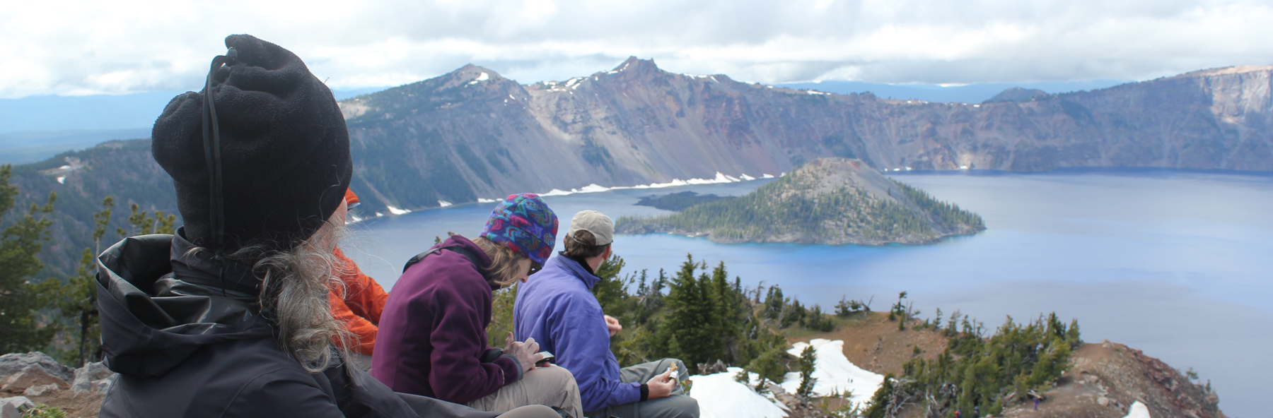
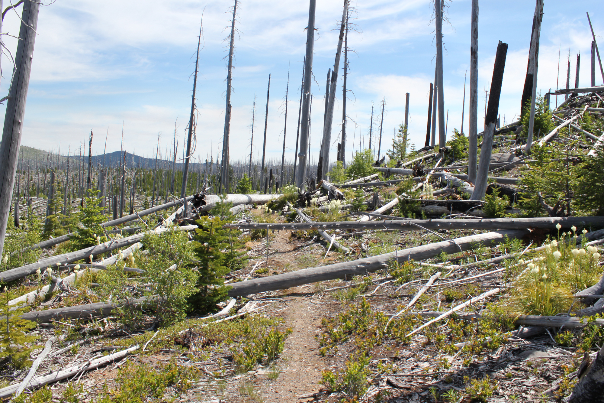
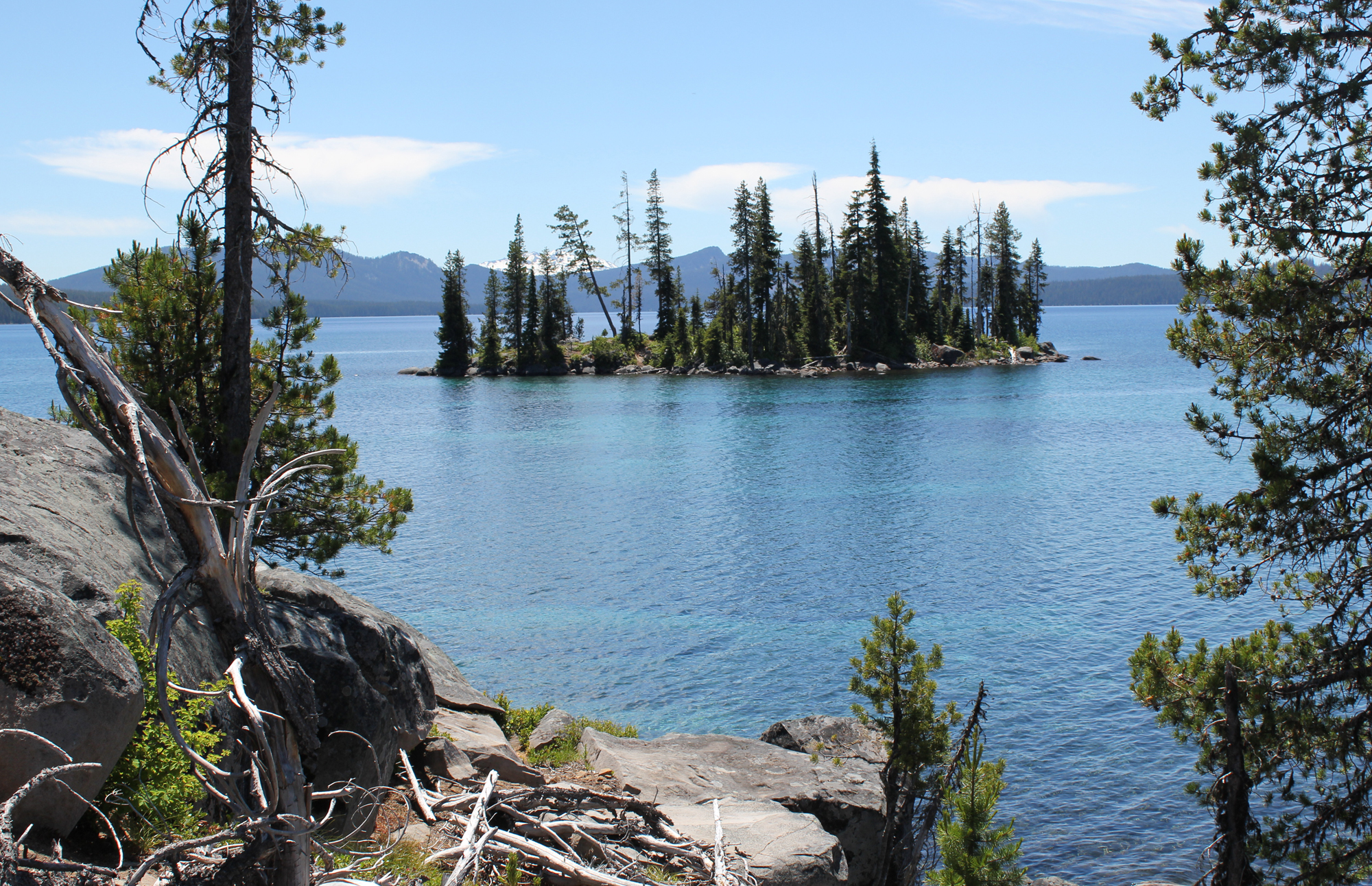
In 1996 a forest fire decimated an area in central Oregon that was roughly 5 miles wide by 3 miles long. Much of the fire’s southern advance was stopped by the immense shoreline of Waldo Lake – a glacially carved body of water that is 10-square miles in size!
The titanic forces of fire and ice have affected this magnificent landscape in dramatic and beautiful ways; all of which are best experienced from the trail.
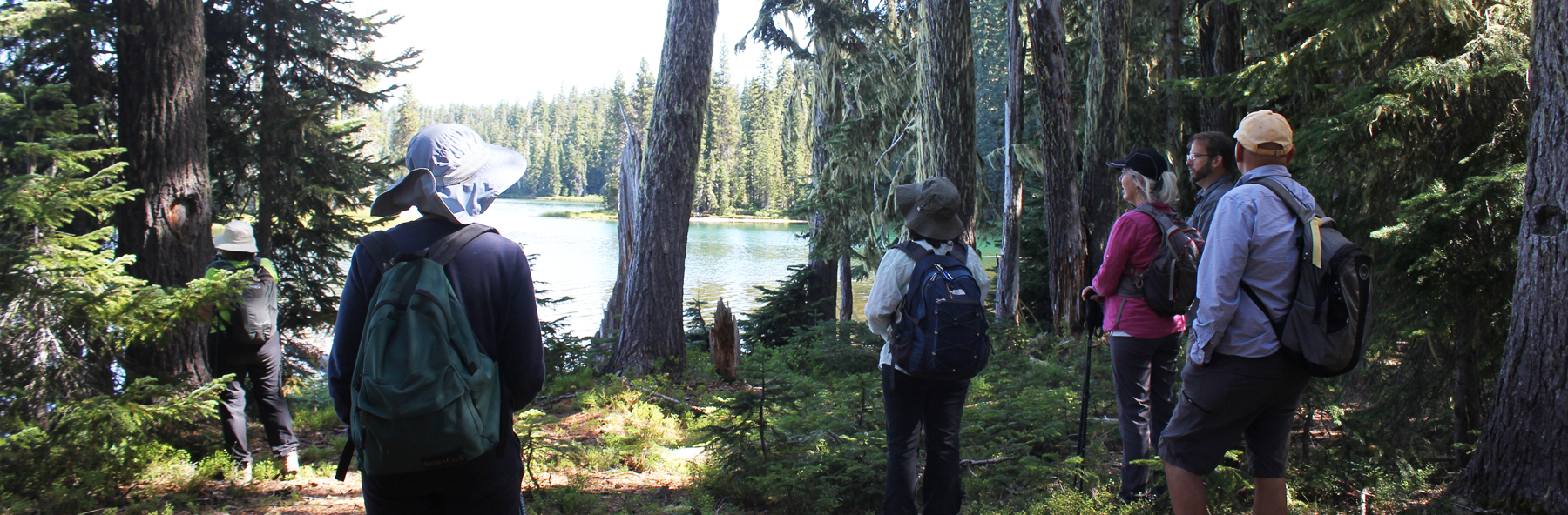
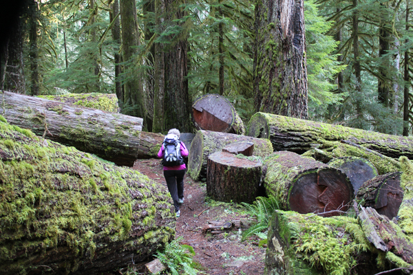
Here are some photos from a two-day, 8-mile backpacking trip along Waldo Lake’s north shore and deep into the burn zone of the Ringdon Lakes area.
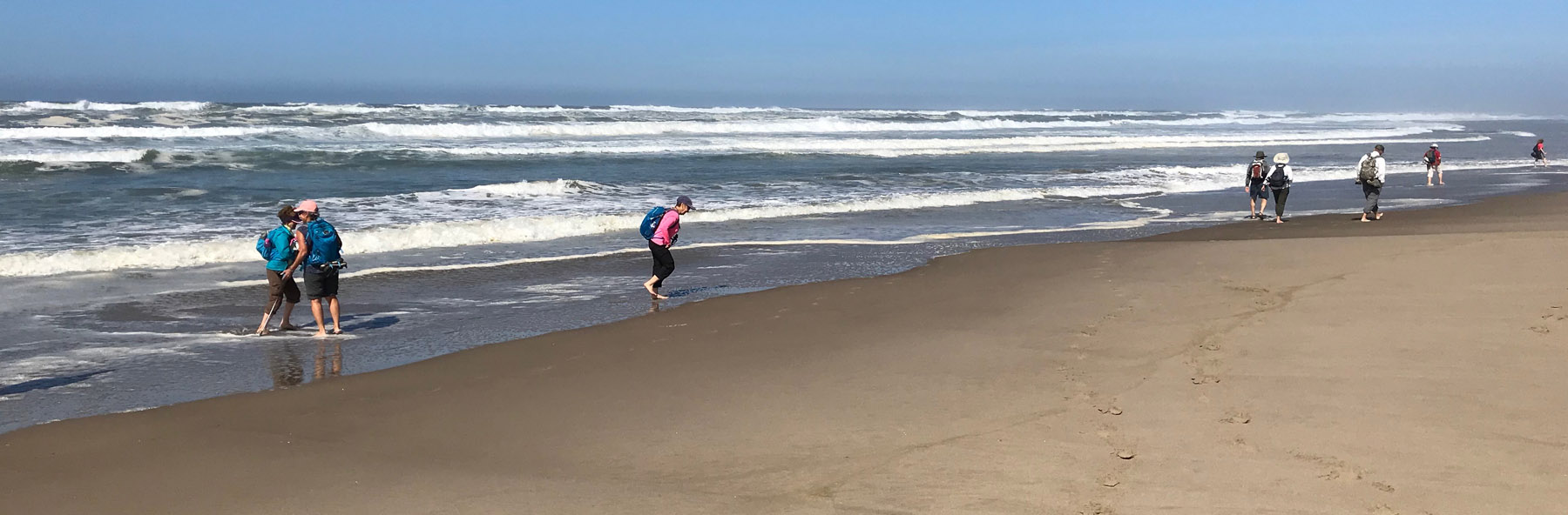
Hiking along Waldo Lake’s north shore. Waldo Lake is considered to have some of the purest water in the world. The lake was named after Judge John Breckenridge Waldo, who is considered to be the “John Muir of Oregon†for his work helping to conserve large tracks of forests in the Cascades.
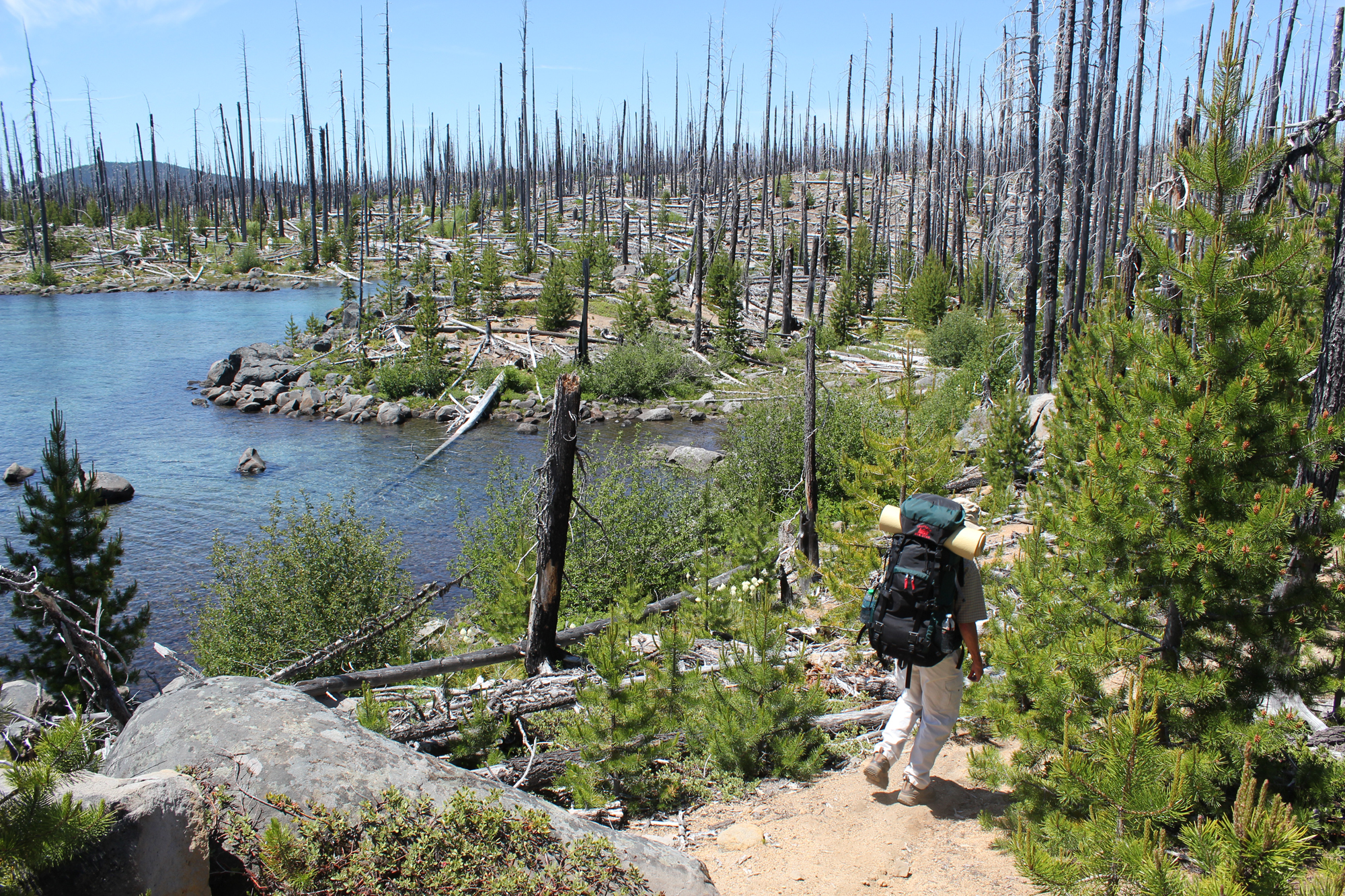
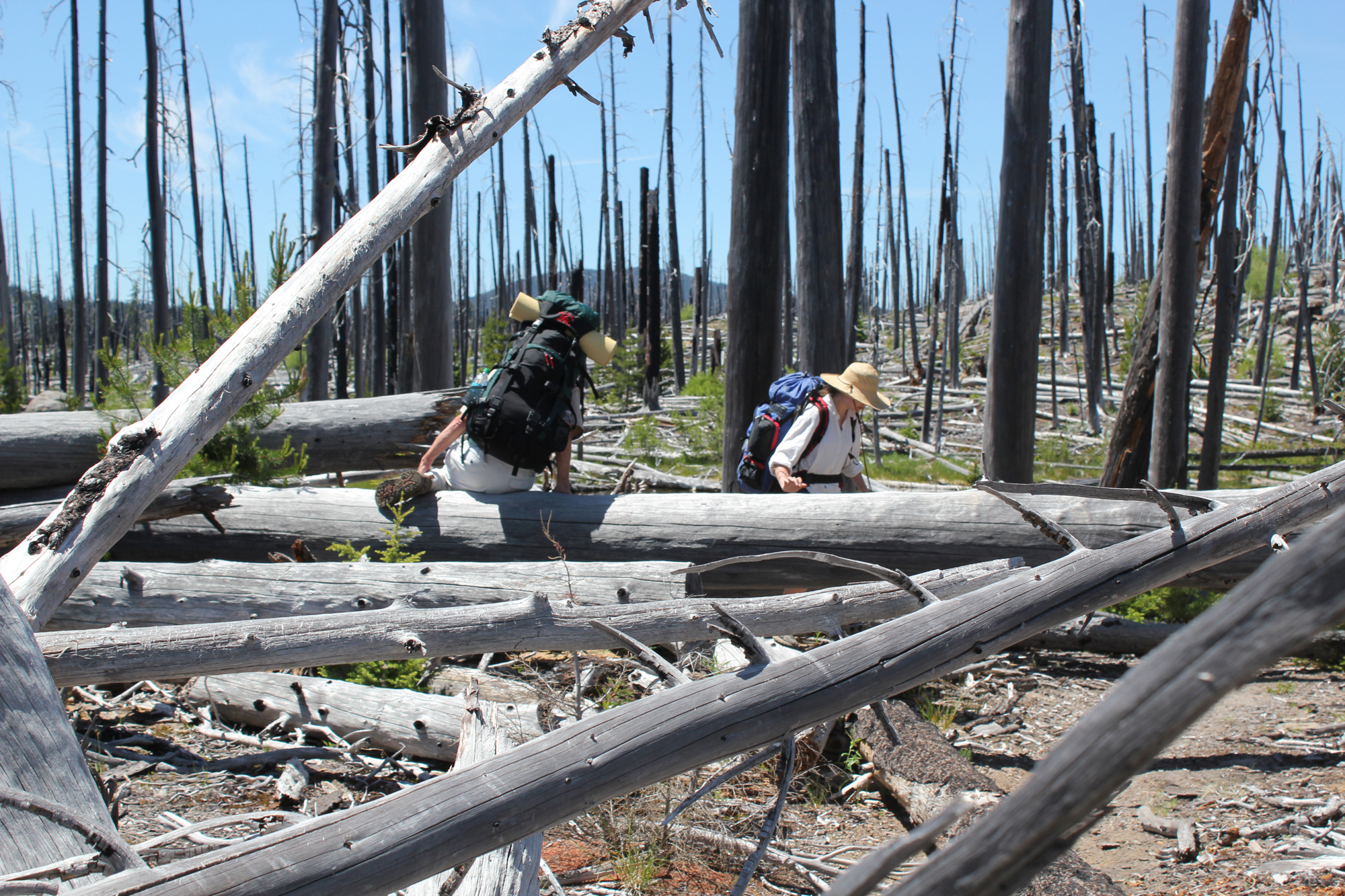
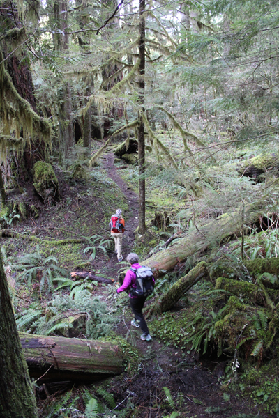
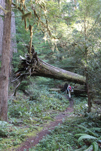
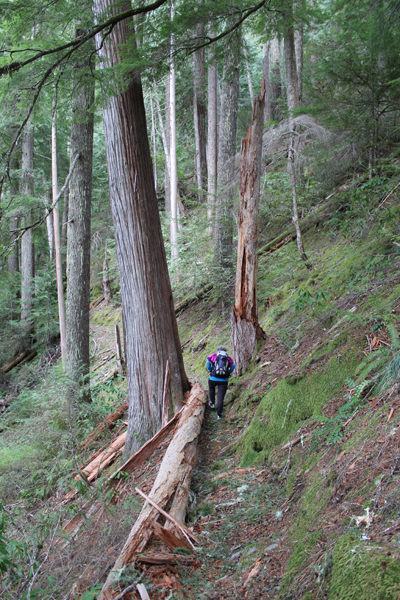
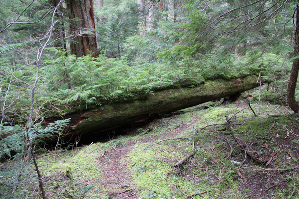
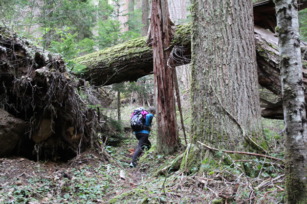
Scampering over and under the “blowdown;†these are trees that have been blown down by the wind. In this case, the blowdown are the trees that burned in the 1996 fire.
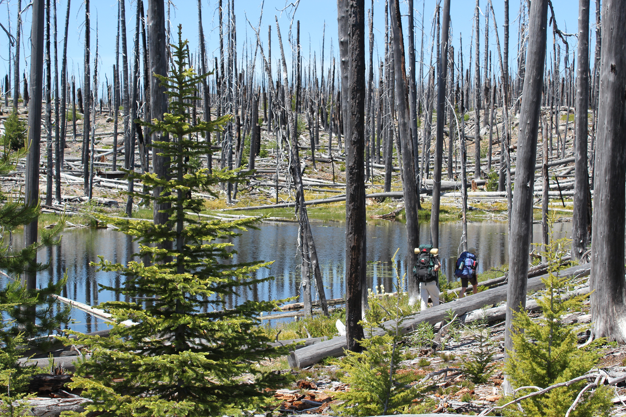
Passing one of the many ponds that dot the northern shore of Waldo Lake.
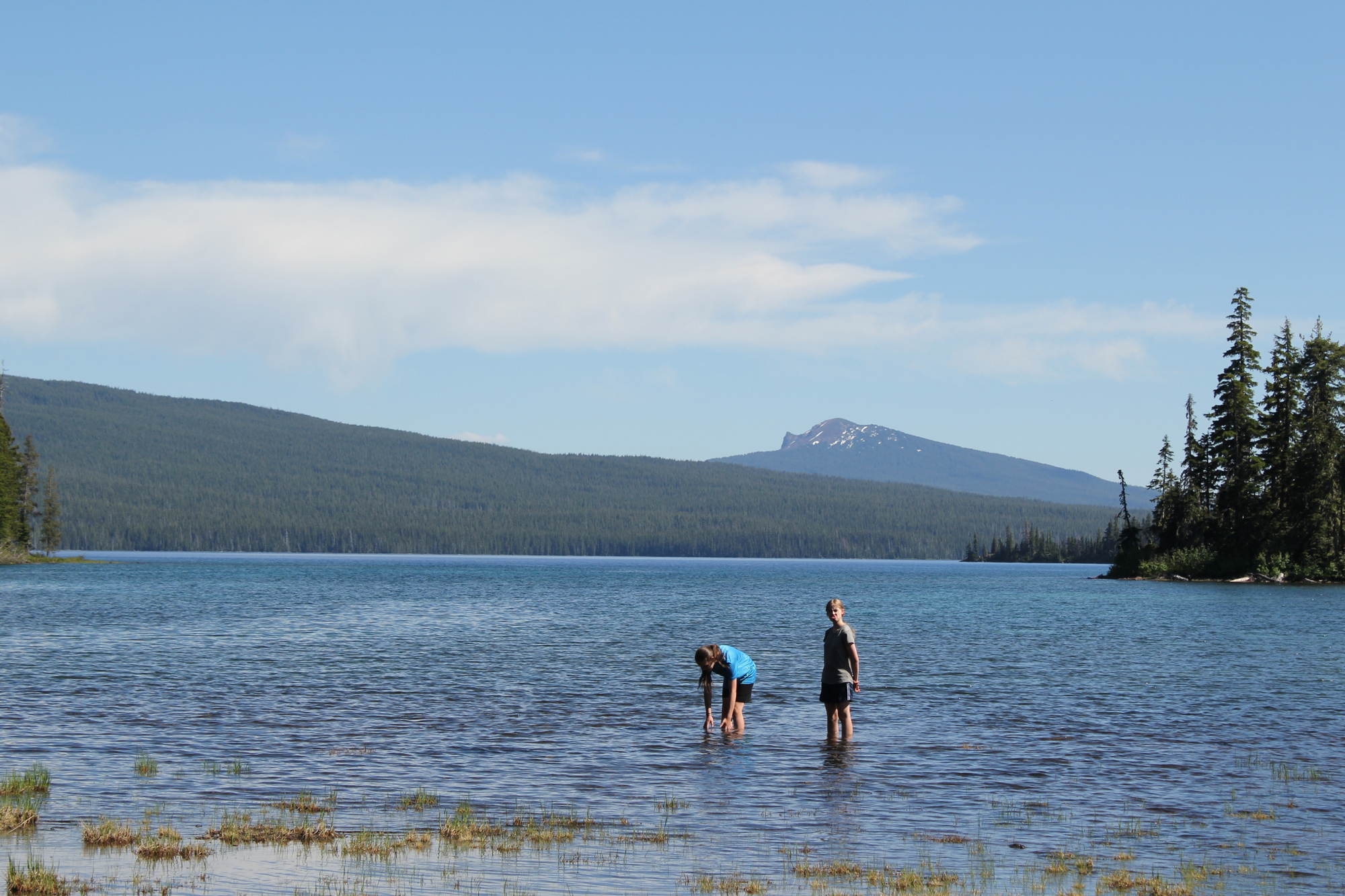
We exited the burn zone and made camp. Shown are several youthful members of the group seen enjoying the shallow and cool waters nearby.
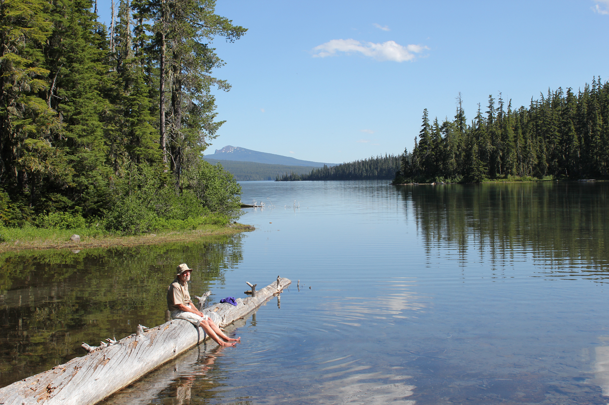
If you think you’re too old for backpacking? Just look at Jack, at 70 years old he celebrates life by getting outside.
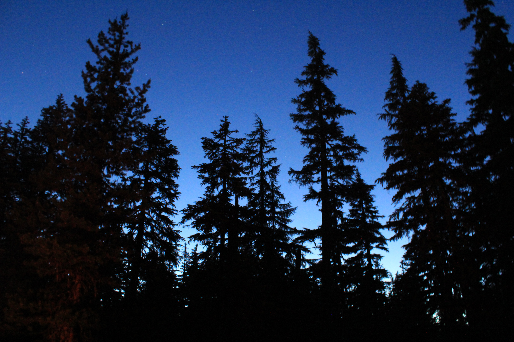
A view of the evening sky as seen from our campsite. That night we heard only nature’s sounds…which included the buzz of mosquitoes.
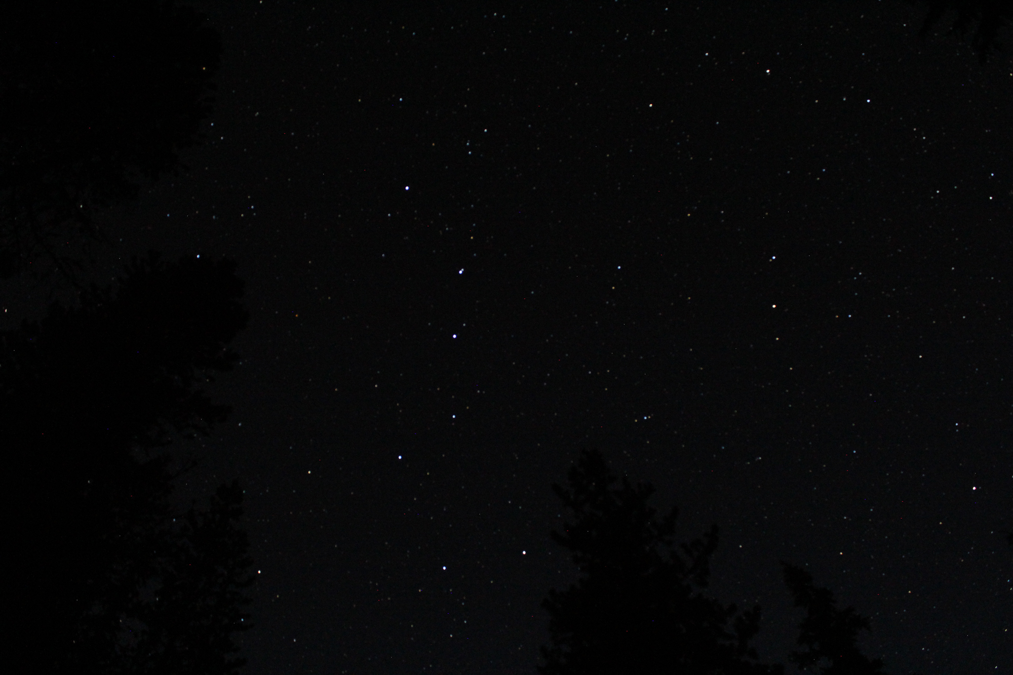
The night sky was dark on this moonless night. Note the prominent stars of the Big Dipper, in the right of the image, is Polaris (the North Star) and the Little Dipper. To locate Polaris, all you have to do is to find the Big Dipper pointer stars, which are located at the outer part of the Big Dipper’s bowl (seen at the bottom of the image). Draw a line from these and go about 5 times the distance to Polaris.
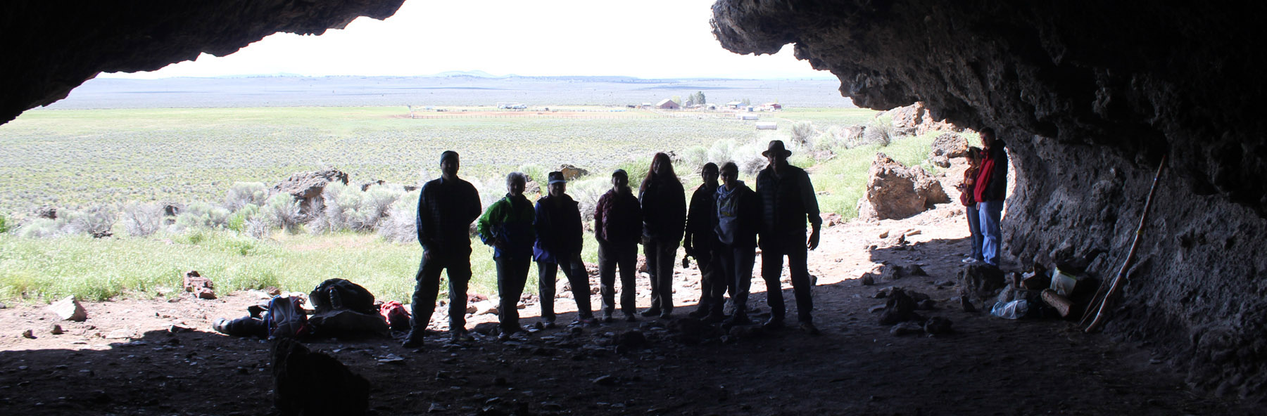
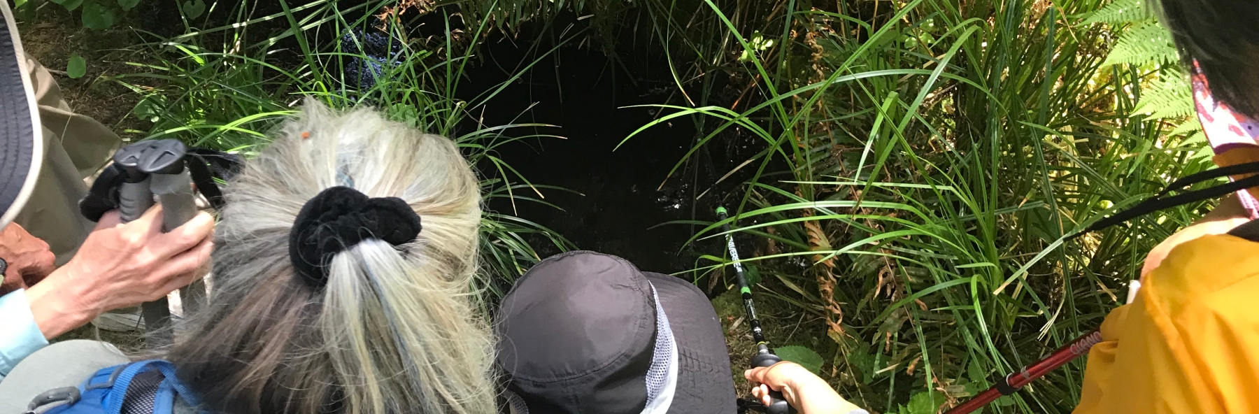
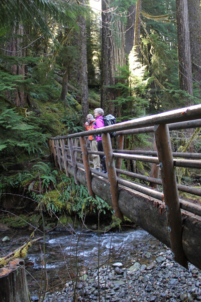
In the morning, the trail led us north, deep into the burn zone of the Waldo Lake Wilderness. The devastation from the fire continued for miles, but new growth was all around us as we hiked. Also observed were several types of bees, a wasp, woodpeckers, and a small toad.
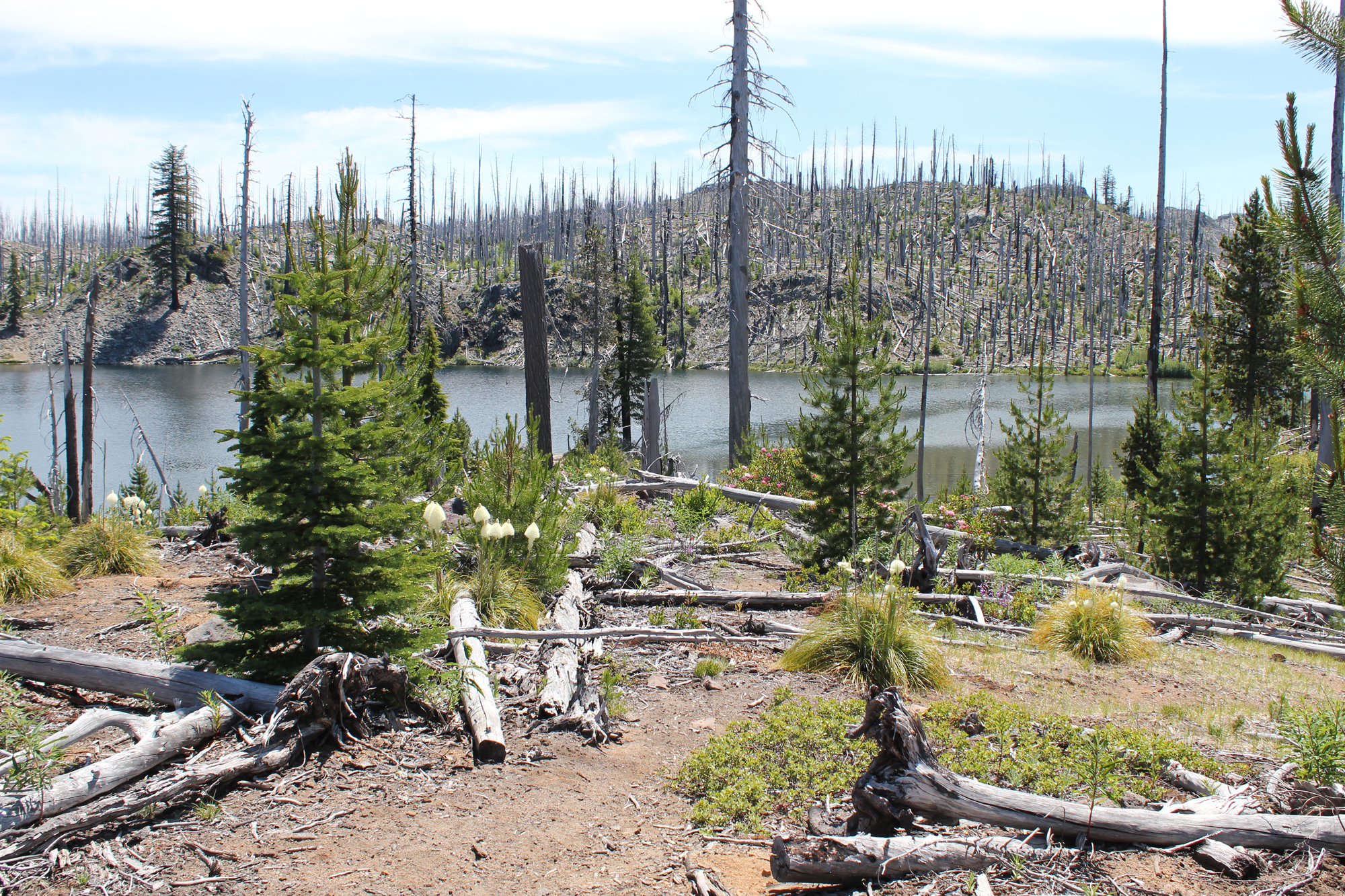
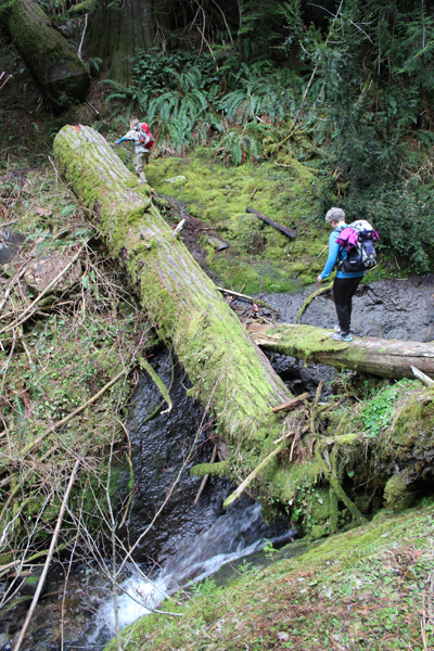
Lake Kiwa is shown in the background. The trail junction (not shown) was partially hidden by a fallen tree that also served as the post for the trail sign. The path returning us to Waldo Lake was heavy with blowdown; this two-mile trail required twice the time because of the number of downed trees we had to climb over – more scampering!
Lower Rigdon Lake offered us the visual treat of a deep blue and some much-needed shade for a short break. Near the top of the hill is Upper Ringdon Lake.
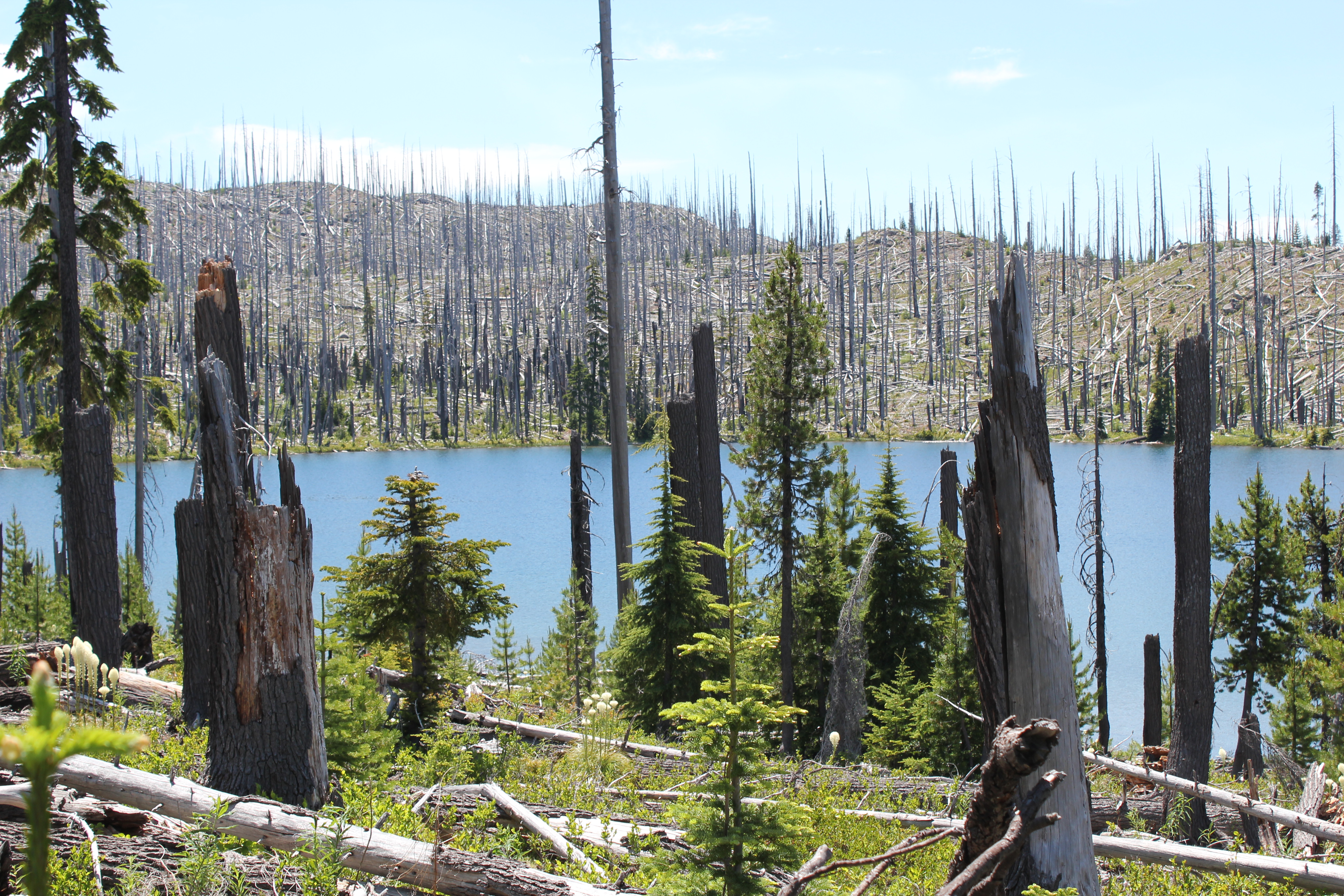
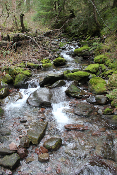
Coming down from the Ringdon Lakes; in the distance is Waldo Lake. Note shown, but interesting; there were areas on this section of trail that frequently crossed flat rocky areas where glacial scouring makes could be seen.
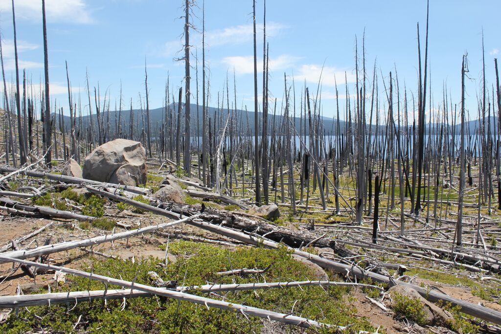
Returning to the shoreline trail we enjoy the sights of Waldo Lake’s varied and picturesque scenery.
Trip Report
Volunteer Leader: Mark Hougardy | Group: Eugene-based Hiking Club | Date: March 13, 2015 | Participants: 15 | Hiking: 2 Miles | Type: Day Hike
We have all turned on the kitchen tap and filled up a bottle in preparation for a hike, but have you ever wondered what was in your bottle? Think about it – we all live downstream from somebody.
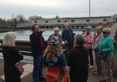
How does river water become the tap water we drink and how is wastewater made safe for wildlife and others downstream? To learn more, I organized a trip with a local hiking club to visit the local water intake and the wastewater facilities.
Our first visit was to the Hayden Bridge Water Filtration Plant, located adjacent to the McKenzie River, in Springfield. The facility is no small operation; it serves the needs of 200,000 people on a daily basis by removing water directly from the river, treating it, and finally delivering it to our taps.
Here are some observations from the visit:
The facility is very high-tech and water quality is measured at all stages of the process both by computer and by a human with hourly lab checks.
Security is paramount; the plant is gated with a security fence/gate, cameras are everywhere.
Our local water system has about two days of water reserves if there is a calamity.
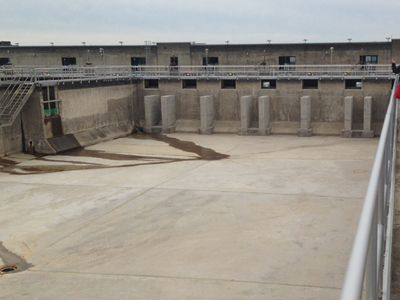
On the day we visited the facility had processed and was sending out 16 million gallons (24 Olympic sized swimming pools) of water to the surrounding community.
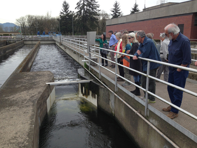
Next, we traveled to the Eugene/Springfield Water Pollution Control Facility in Eugene. This is where all of the waste materials that go down the drain/flushed from our households and businesses in the greater Eugene metropolitan area (a quarter of a million people) are processed. The plant is located adjacent to the Willamette River. Our hour and a half visit was very informative:
More than 99% of what arrives at the facility is water; less than 1% are solid materials that need to be either removed or turned into bio-solids.
Most of the odoriferous gases are collected and used to power a generator that supplies 50-60% of the energy needs of the facility.
Waste materials can take up to 10 hours, once they leave your home until it reaches the wastewater facility; then wastewater can take another 10 hours to be processed. In short, waste materials take less than 24 hours until that water is returned to the river.
The amount of water being cleaned and being returned to the Willamette River that day was about 15 million gallons (roughly 23 Olympic swimming pools).
During the summer, the plant can process up to 70 million gallons per day (106 Olympic swimming pools) of wastewater!
I was fascinated to learn that on the Willamette River in Oregon there are about 25 wastewater treatment stations, and that does not include communities on the tributaries that flow into the Willamette! Just think about that…for every wastewater plant, there is likely a water intake facility that supplies drinking water for the next community downstream. If you live downstream you really want to know that the people upstream are taking care of your water – the water you drink, use for bathing, and for recreation.
If you’re curious about the water that goes into your water bottle start asking questions. Most water intake and wastewater plants are happy to host tours for small groups. Let them know you are interested in visiting.
Water Filtration Plant: Behind us is a 2-million gallon settling basin. This is used to settle any particulate matter in the water. This water was recently pulled from the McKenzie River.Water Filtration Plant: A view an empty 2-million gallon setting basin.Water Pollution Control Facility: It looks like a really bad root-beer float, it is actually air being passed through the wastewater, this allows bacteria to better digest the waste.Water Pollution Control Facility: Treated water that is almost ready to be returned to the Willamette River.
What about when the water is returned to the Willamette River? Find out more, read my post, Rafting the Upper Willamette River with the McKenzie River Trust; the majority of the photos were taken only a few miles downstream from Eugene’s wastewater treatment facility.
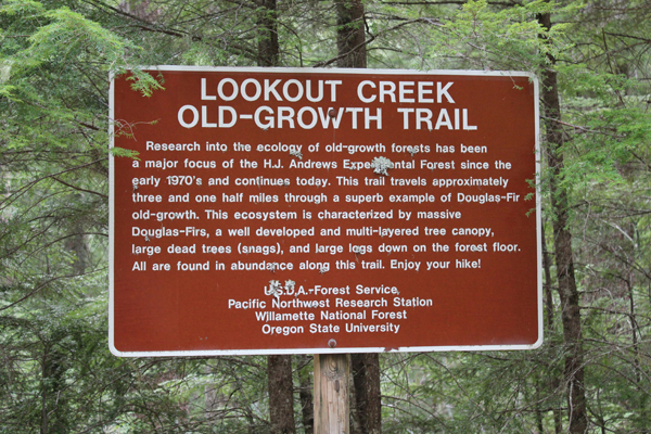
Walking in a forest with 500-year-old trees is always a delight. Finding such places – a rare treasure. Fortunately, the Lookout Creek Old-Growth Trail is such a gem, and for the price of a moderate drive from Eugene, Oregon, hikers can enjoy this richness.
The trail is located within the Willamette National Forest, more specifically the research area is known as the H.J. Andrews Experimental Forest. The experimental forest exists so scientists can conduct long-term studies of the Pacific Northwest’s complex forest and stream ecosystems.
A trail brochure states the Lookout Creek Old-Growth Trail is 2.6 miles long, though a sign at the upper trailhead states the trail is approximately 3.5 miles in length – both of these are incorrect. I believe Bill Sullivan’s book, “100 Hikes in Central Oregon Cascades” that states the trail was 6.3 miles with a 1400 elevation gain. Expect the hike (one-way uphill) to take 3 hours with breaks; the return hike down the service road to the lower trailhead adds 1 more hour, so plan for a minimum 4 hours to complete the round trip.
The route is rugged with steep inclines, downed trees, log scampers and a couple of creek jumps that are not shown on the map. The beginning and end of the trail provide footbridges for crossing Lookout Creek, the remaining trail is in the deep forest with lots of big and really old trees.
Help the forest; always bring a trash bag. My family did not find any trash on the trail, but on the service road, we found spent shotgun shells, beer cans, soda cans, and other trash.
The nearest populated area is the town of Blue River. Driving to the trail takes about an hour-and-a-half from Eugene. The last seven miles of driving will be on packed dirt roads.
These pictures were taken in late January. This entire area should be covered in snow, but an unusually warm winter with temperatures in the mid-forties offered the chance to see the majesty of old-growth forest at an usual time of year.
This photo gives an idea of how large these trees can become.The bridge crossing at Lookout Creek, near the lower trailhead.A lush landscape.The trail meanders beneath a fallen giant.One of several fallen trees across the trail.What stories could this tree tell?Scrambling across a creek.One of many “nurse logs” seen on the trail.A view of Lookout Creek, near the upper trailhead.An area where one ancient tree fell and caused a cascade of destruction. While terrible, this ending allows new life to thrive.By my rough calculations, the trail is actually about 4.5 – 5 miles in length (one-way).
In the spring and summer of 2014, I enjoyed volunteering with the Nature Conservancy of Oregon (Southwest office). My role was to help grow participation in the local volunteering community. My services included upgrading their email management tool (to Constant Contact) and designing several newsletters.
Oregon’s Diamond Peak Wilderness is frequently overlooked for more picturesque settings like the Three Sisters, but this wild place is no less a treasured gem; the Wilderness includes the 8,629-foot Diamond Peak, 14-miles of the PCT (Pacific Crest Trail), one of the high points on the PCT in Oregon, and over 50,000 acres to explore!
A glorious view from Diamond View Lake. The clouds at the left of the image produced some amazing lightning and thunder that afternoon.
The trail got a little hard to follow at one point and we had to bushwhack.
A little lake where we stopped for a rest, only to stay for the night. Water was scarce in the area and the lake provided a great location for watching wildlife and hearing even more wildlife during the nighttime.
A very dusty path. This trail was well worn because of the number of PCT hikers that we met, many had been side-tracked to a lower elevation because of the lack of water on the main PCT.
Wow! You find lots of cool things on the trail.
Standing at the outflow of Yoran Lake looking south to Diamond Peak. After a break, we bushwhacked about half a mile to the PCT to loopback.
A small island on Yoran Lake.
Enjoying some lunch while scouting out a great campsite.
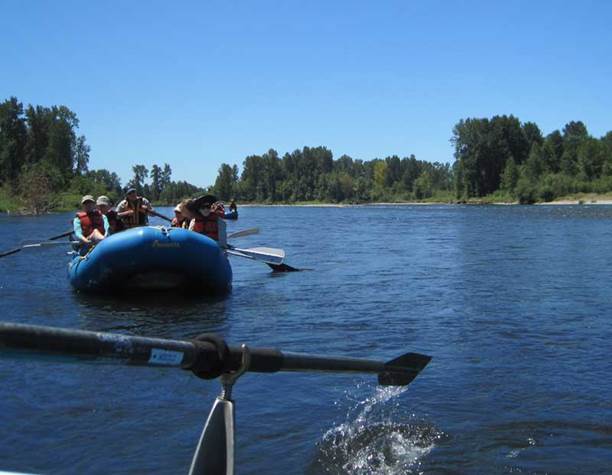
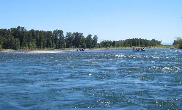
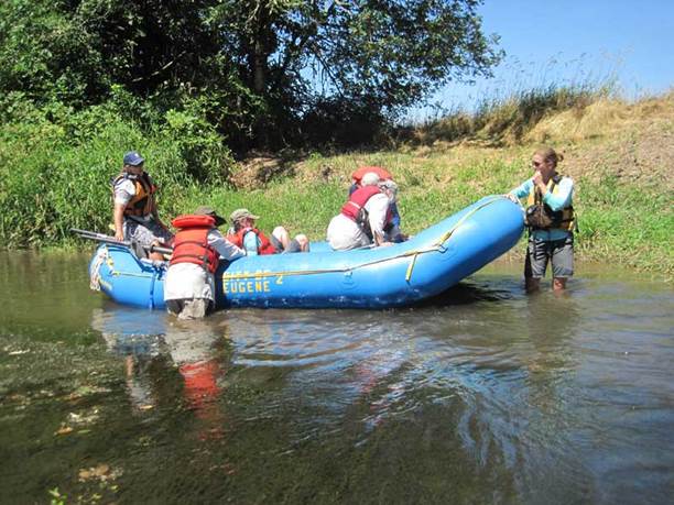
Living near the Willamette River in Eugene, Oregon, offers some fun opportunities to be outside, yet after living in the area for two years I am surprised that I don’t know my local section of the river better. When the opportunity arose to experience 12+ miles of the upper Willamette (from Eugene downstream to Marshall Island) by raft and learn about important conservation work taking place, I could not refuse.
The morning of our departure, my family and I, along with about fifteen others were greeted by staff members of the McKenzie River Trust who had organized the event, and the Eugene Recreation Center who supplied the rafts, equipment and river guides. An interpretive river ranger from Oregon State Parks also joined our trio of rafts.
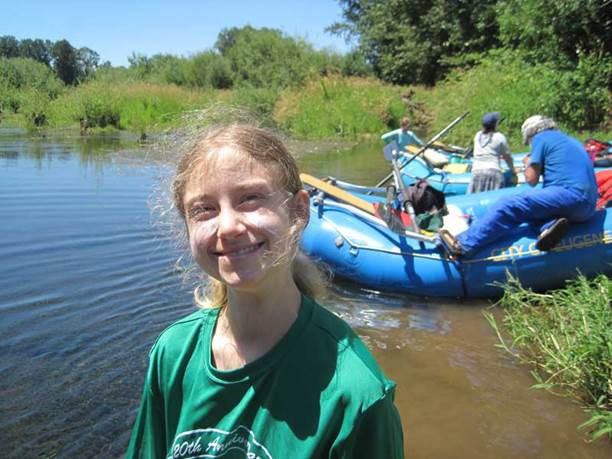
We were treated to hearing stories about river-lore, discovering the natural history, and learning about the McKenzie River Trust’s restoration work of 1,100-acres on Green Island. A highlight of the afternoon was a visit to the island where everyone enjoyed a fabulous lunch provided by the guides.
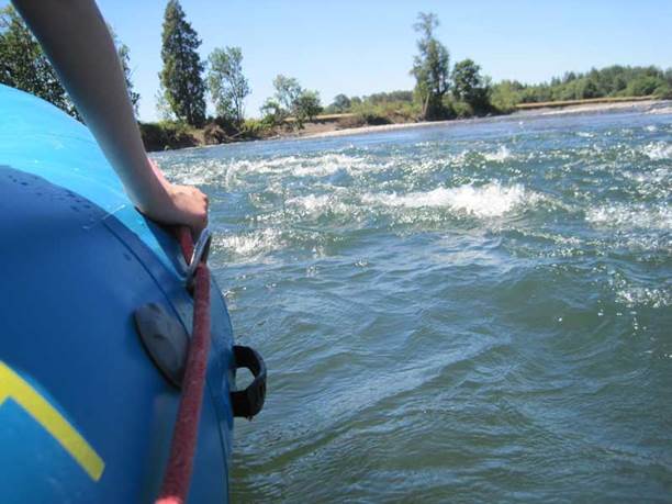
On the river that day we saw beaver signs of gnawed tree limbs, cranes stealthily stalking along the shore, and ospreys calling from overhead, though we ourselves were often under the watchful eyes of eagles.
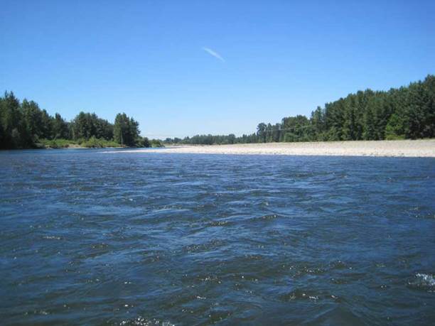
There were many “take-aways†from the trip, lessons that stay with you after the trip is over. The big takeaway for me was that once we left Eugene how quickly the river became more of what I needed it to be: open and wild. I want to experience more.
Here are some pictures of the river-
Learn more about Green Island and the work of the McKenzie River Trust visit:
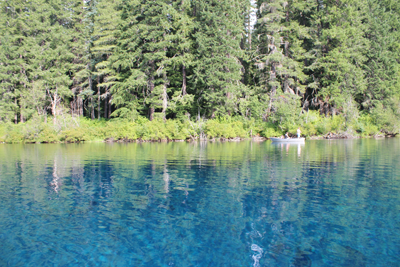
My kayak breezes over the surface of the aptly named “Clear Lake†in central Oregon. The lake bottom descends below me ten, twenty, thirty feet, yet I can still see features as though looking into an aquarium.
Each stroke of my paddle dips into the crystalline fluid and scoops out rounded orbs of glass-like liquid, I dip my hand into the water, the temperature is cold, somewhere around 40 degrees Fahrenheit. The lake is fed by mountain springs that course from deep within old lava flows; the water temperature stays a near constant throughout the year.
The sun had been hiding behind a cloud, but now bursts forth illuminating the lake. The clear water that surrounds me now becomes a turquoise pool. The green and the tan forested shoreline is reflected onto this gem-colored liquid. I cannot help but to stop paddling and just watch – immersed at the moment.
A number of Mallard ducks float next to my kayak, some are just a few feet away. One comes abreast to me and looks at me in the eye; he cocks his head as though wondering what kind of strange beast I might be. I can see his little legs moving underneath the water, churning like a miniature paddle wheel.
My kayak hugs a rocky shoreline; it is a jumbled and erratic wall that descends sharply into the water. This is the edge of an ancient lava flow that three millennia earlier was the outlet of a stream. As the water rose, a new lake was created, and the surrounding forest was submerged. The water temperature was so cold that decomposers could not survive and the original forest was preserved. Today, three-thousand years later, several dozen of the ancient trees from that forest remain upright and can be seen from the surface.
A large dark form starts to become visible in the water before my kayak. I stop paddling and the surface becomes undisturbed allowing the shape to come into focus, it is the column-like shape of one of the ancient trees. The trunk appears to be as big around as a dinner platter, and only just a couple of feet below my kayak. I try to gently tap the top of the trunk with my paddle, but I am unable to reach it. The water has played a trick on my eyes by making things appear closer than they really are. I peer down the trunk looking, fifty, sixty, possibly a hundred feet down to the bottom.
The only sounds are people laughing in the distance, and a gentle wind blowing through the trees.
There are no motorboats on Clear Lake, just human powered crafts.
Organization: Grand Opening Camping Festival at Little Basin
Date: April 20, 2012
Trip Facilitator: Mark Hougardy
In the heart of the Santa Cruz Mountains is a beautiful area of redwoods that most people have never seen. Until recently the area was a retreat for employees of Hewlett-Packard. The area called, Little Basin is a new acquisition of the California state park system that has been annexed by Big Basin Redwoods State Park, yet run as a separate entity. In April of 2012 Little Basin, held a Grand Opening Camping Festival. I organized and facilitated a “Camping 101” event. Here are some photos:
– Leap a height of 3 humans tall
– Heavier than 16 housecats
– Eat the equivalent of 1 deer each week
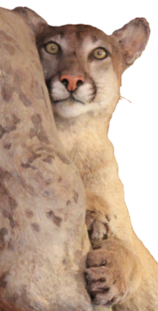
This large cat shares many names: mountain lion, puma, panther, and cougar.
Built for stealth and power these majestic creatures have large padded paws, tawny-colored fur, muscular limbs, and sharp claws. They are generally elusive and can be found in remote wooded or rocky areas where the deer populations are prevalent.
The photo was taken in Sunol, California, at the Sunol Regional Wilderness Interpretive Barn.
Few symbols represent the spirit of the American West like wild Bison grazing on the expansive and open prairie.
There is something about this setting that makes the heart pump a little faster and one’s breathing to quicken. Such a setting whispers about the time when our ancestors lived here, or even migrated across this expansive landscape. It quietly reminds us, in today’s busy world, not to forget their stories about independence, rugged individualism and family. This uniquely American setting is often seen two-dimensionally in movies and TV shows, but a three-dimensional landscape can be explored and experienced at The Nature Conservancy’s Tallgrass Prairie Preserve in Osage County of northeastern Oklahoma.
The Tallgrass Prairie Preserve is big. On a map, it covers an area that is roughly 12 miles wide and 9 miles long! The total acreage is about 40,000 acres, with 25,000 acres reserved for the bison.
This is a wonderful place to visit for many reasons, but one of the most important is seeing this landscape that was almost lost. As the settlers came westward the Bison (also known as American Buffalo) were hunted and the land plowed to create rich and bountiful farmlands. But, there was a high cost. The original population of hundreds of thousands of Bison had been hunted to less than five-hundred individuals and the pristine open prairie that spanned from Texas to Minnesota had been reduced to less than ten percent of the original size. Fortunately, there were visionary folks who saw value in preserving untamed land. Since 1989 the Nature Conservancy, a private, non-profit organization, has restored the largest “fully-functioning portion of the tallgrass prairie ecosystem with the use of about 2500 free-roaming bison.â€
My visit to the tallgrass with my Father started in the town of Pawhuska, Oklahoma, close to the preserve’s southern entrance. The drive down a paved county road was surrounded by woodlands but this soon turned to prairie and the road turned to gravel and then a packed caliche clay.
Simple signage marked the entrance to the preserve.
The sun this autumn day was shining and the blue sky was punctuated with small white clouds. The wind was blowing about ten miles an hour and the temperature outside was around 40 degrees.
A plaque near the entrance of the preserve includes the text, “The Tallgrass Prairie Preserve. You stand at the south edge of the largest unplowed, protected tract which remains of the 142 million acres of tallgrass prairie grasslands that once stretched from Canada to the Gulf of Mexico. Today, less than ten percent still exists, found mostly in the Flint Hills and Osage Hill regions of Kansas and Oklahoma. In an increasingly crowded and noisy world, what you see is an oasis of space and silence. Here you can experience the same beautiful vistas that greeted the earliest human hunters and gathers many thousands of years ago. This area is indeed a national treasure. Please treat it with respect.â€
Sadly, the area surrounding this marker had been marred by a number of empty beer cans left apparently from the evening before. I later learned the roads leading to the preserve are county roads open to the public at all hours. Although there is a cleanup service provided in the preserve by volunteers they cannot be everywhere and at all times. We spent a few minutes picking up the unsightly and very uncool trash.
Twenty minutes or so down the road we stopped at an interpretive marker along the edge of the road. Dark stacked piles of bison poo dotted the area all around us. These were not messy cow patties, rather the dung was tightly packed together into circular disks. These nutrient-rich ‘buffalo chips’ were used by natives and settlers as charcoal because the material burns hot and slow.
Further beyond a few dark bison sentinels stood at the side of hills, these were apparently lone males who had been pushed out from the herds. The mature males, after mating, are no longer needed by the female-dominated herds and are excluded.
Hawks and kestrels soared over the dry prairie grasses. Most of the birds I saw were sitting on fence posts observing their domain, but sometimes one would fly up, soar overhead and then later swoop down and appeared to have caught a rodent in its sharp talons.
A herd of bison was just ahead. It was easy to see their dark forms against the dry and brown landscape of late autumn. The bison allowed us to slowly drive past. They did not appear to mind us and continued with their business. If they wanted to the bison could cause us some harm as these are great creatures measuring 5-6 feet at the shoulders and 7-10 feet in length. Plus bison can weight up to 2,000 pounds or more! Some of the individuals peered at us through thick, wooly looking coats that would soon protect them from the coming winter cold. We watched them for some time.
In the sections of the preserve where we saw fences, the barbed wire included 6 strands and was at least 6 feet tall. We later learned that bison can jump 6 feet laterally and 6 feet in height! The fences are tall so the strands appear at eye-level to intimidate the great beasts from jumping over.
We passed another two groups of bison close to the road. The ‘Bison Loop’ road offered additional miles of great sightseeing.
The open prairie now presented low canyons of cottonwood trees and ash. In one of these more protected canyons was the Preserve Headquarters. As we pulled into the gravel parking lot an elegant looking eight-point buck darted in front of us and disappeared behind a building.
At the headquarters was an enthusiastic and knowledgeable docent who was a treasure trove of information. One item she mentioned was that the hunting of bison in the 1800s had been so intense that the last wild bison seen in Osage County was in 1869.
The Preserve Headquarters offers a great visitors center. One memorable exhibit showed just how tall the grasses at the tallgrass prairie can grow – as tall as a grown man. The grasses on the tallgrass are very nutritious and part of an amazingly fertile ecosystem. Another item was a table filled with bison bones and fur. I had expected the fur to be harsh feeling but, it was surprisingly soft and extremely warm. A scapula (shoulder blade) was at least 21 inches in length and 14 inches wide – a big bone for a large animal.
Near the headquarters are several short walking trails that looked welcoming, but the temperature that day was lowering and the wind was picking up.
We left the preserve when the sun was very low on the horizon. As the sun lowered past the rolling hills the dark forms of the bison were silhouetted against the rich shades of an ever increasingly dark sky. My heart pumped a little faster and my breathing quickened – it was a scene of the American West.
If you are interested in visiting, make the most of your day, stay overnight in the town on Pawhuska so you can get an early start. There are no gas stations or places to eat on the preserve, so fill up your gas tank in town and take some lunch or munchies with you. Tulsa, Oklahoma, has an airport, but be prepared for a good hour-and-a-half drive just to get to the preserve. Entering the preserve is free, though recommended donations of several dollars per person are welcome at the headquarters. I was informed by a docent who has been at the preserve for years the best time to visit is in the spring (May) when the wildflowers carpet the landscape and the colors are superb. I plan to return at that time.
Quoted source and learn more:
http://www.nature.org/ourinitiatives/regions/northamerica/unitedstates/oklahoma/placesweprotect/tallgrass-prairie-preserve.xml
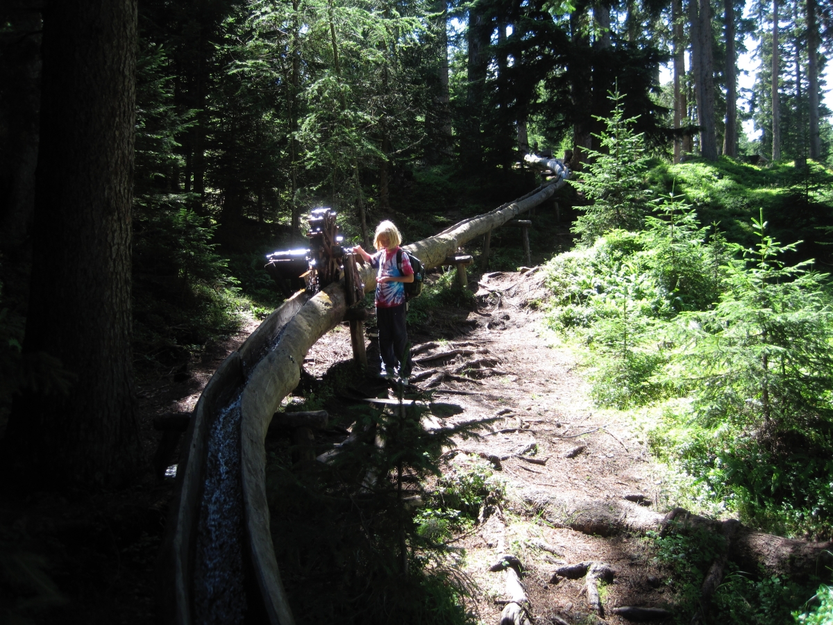
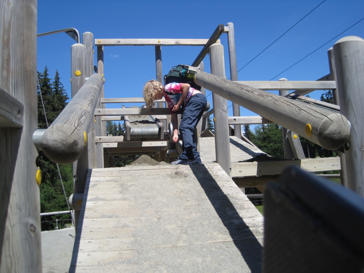
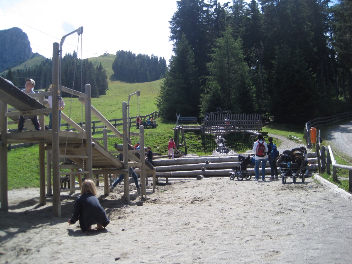
The playgrounds in Tirol, Austria, speak volumes about lifelong learning. Hint, they aren’t just for kids.
The playgrounds are nothing like the low-risk, cushioned, gently-sloped, plastic, shredded rubber turf play structures that dot the city parks and schools in the US. Many Tirolean play structures are two to three stories tall, made of solid wood, and have pulleys, rope bridges, ramps, water flumes, sand pits, lengthy slides, zip-cords, and get this… teeter-totters! I cannot remember the last time I saw a teeter-totter in an American playground. One play area even had a small rock climbing wall.
Most curious, when playing on private land, a parent does not need to sign multiple liability waivers, the kids can just play.
I have seen a variety of playgrounds in Tirol, and all have safety elements designed into the structures, but they are also architected in such a way as to foster independence, spark creativity, and provide a setting for kids to make decisions – and some decisions on these play structures have an element of risk.
Below are some photos of what lifelong learners can expect when playing in Tirol.
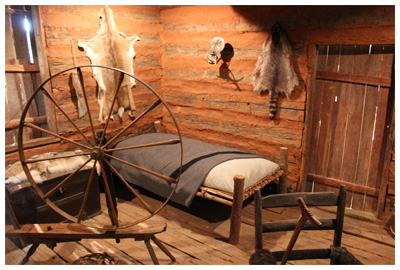
Some of the most interesting places are located just a short drive off the main road. Sequoyah’s one-room log cabin in the beautiful forests and hills of eastern Oklahoma is just such a place.
Sequoyah is known as the inventor of the Cherokee’s nation’s written language. He built this cabin in 1829 shortly after his move to what is present-day Oklahoma.
Sequoyah was born about 1770 in Tennessee to a Cherokee mother and non-Indian father. Sequoyah was intrigued by “the fact that white men could convey messages by the use of writing or ‘talking leaves’…. Sequoyah came to realize that the Cherokee language is composed of a set number of reoccurring sounds. With this insight it was possible for him to identify and create a symbol for each sound, thus producing a syllabary rather than an alphabet.†After 12 years of work, in 1821 he completed the Cherokee syllabary.
The drive to the cabin takes visitors along some beautiful country roads. The first thing you notice when you enter the grounds is the air – it is clean, moist and just makes you feel good. The next things you notice are the well-maintained grounds followed by how solid the buildings are constructed. It is obvious this is a well loved and appreciated landmark.
The cabin is actually preserved inside a modern building. After opening the door of the outside building you enter a single open room; at the center is a hand-hewn log cabin, along with the walls, are displays about Sequoyah’s life and his work. What is nice about this exhibit is that visitors can actually step inside his cabin for a close-up view of the period furniture and items that would have been in his life. Unlike many places that hide stories from the past behind cold glass, this landmark is open, inviting and warm.
The people working at the landmark were all friendly.
Sequoyah’s cabin is located about 6 miles northeast of Sallisaw, Oklahoma, on State 101. The cabin and grounds are open Tuesday – Sunday. Check the website for hours. Admission is free.
The cabin is preserved as a National Historic Landmark.
A special ‘thank you’ to Arethia Stann for her introduction to this great place and a tour of the surrounding countryside. Wado, Arethia!
For additional information visit:
http://www.okhistory.org/outreach/homes/sequoyahcabin.html
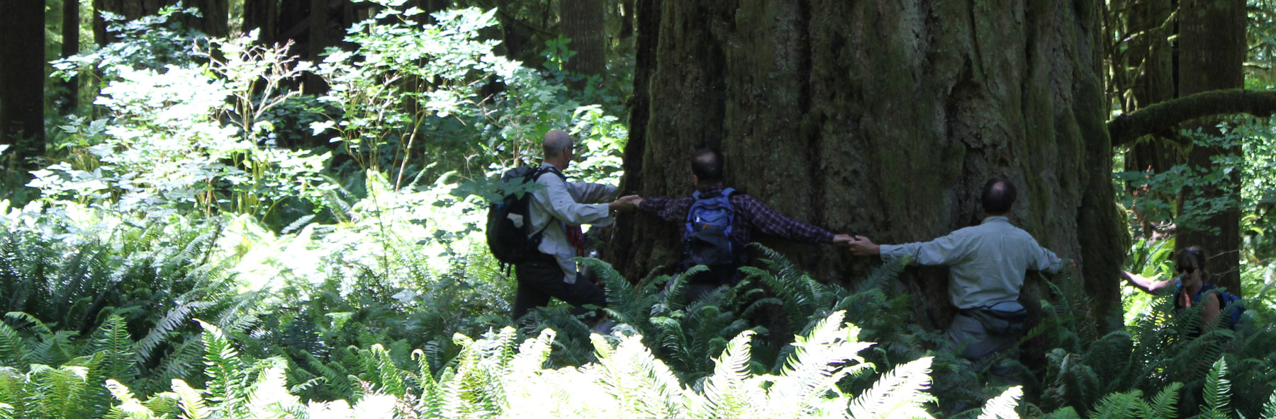
If you and your family have the opportunity to visit the General Grant Tree of Kings Canyon National Park you are in for a treat.
Parents can walk among and appreciate the majesty of these ancient and immense Giant Sequoia Redwood trees. Kids will enjoy being outside, playing in an old cabin, and walking through the Fallen Monarch, a cave-like giant redwood that is so big that it once stabled 32 U.S. Cavalry horses.
The General Grant Tree is important because it is the world’s third-largest living thing (by volume). The General Grant is 268 feet (81.6 meters) in height and has a circumference of 107.5 feet (32.7 meters)! It is not just big, but ancient; although the exact age of The General Grant is not known the National Park Service’s website estimates the tree to be between 1,800 and 2,700 years old.
When visiting this tree spend a few minutes contemplating about the civilizations and people who lived about 2,000 years ago, then consider that the General Grant was likely an old tree when those people walked the earth. Wow!
Some “fun facts” displayed on a placard near the General Grant Tree help visitors better understand more about this immense redwood, they include:
If the trunk of the General Grant Tree was a gas tank on a car that got 25 miles per gallon, you could drive around the earth 350 times without refueling.
The General Grant Tree is so wide it would take about twenty people holding hands to make a complete circle around the base.
If the General Grant Tree’s trunk could be filled with sports equipment, it could hold 159,000 basketballs or more than 37 million ping-pong balls.
President Calvin Coolidge proclaimed the General Grant Tree to be the nation’s Christmas Tree in 1926. In 1956, President Dwight D. Eisenhower designated it as a National Shrine, a living memorial to those who have given their lives for their country.
Many of the Giant Redwood trees in the Sierra Nevada Mountains were named just after the American Civil War. It was at this time that General Grant Tree was named after Ulysses S. Grant the final leader of the Union forces. A short distance away from the Grant Tree is the Robert E. Lee Tree, named for the leader of the Confederate forces. The Lee tree is the 12th largest tree on the planet.
The General Grant Tree and other Giant Sequoias are located in Kings Canyon National Park and the adjacent Sequoia National Park. Visitors to the Grant Tree can enjoy a self-guided trail that is half a mile (.8 kilometers) in length. The trail from the parking area is paved so wheelchairs and strollers are welcome. The location of the Grant Tree is roughly a 1.5-hour drive east of Fresno, California.
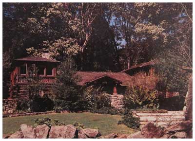
The Sanborn Park Hostel is a beautiful historic log house hidden among the coastal redwoods of Sanborn Park County Park near Saratoga, California. Sadly, after a 30-year run, the hostel recently closed its doors. Shown above is how it appeared at the time of the closing in 2010. Below is how it appeared in its heyday – in the late 1980s and early 90s.
Sanborn Park Hostel – a view from its heyday in the late 1980s and early ’90s.
This hostel was a friendly place to stay for backpackers, international travelers, bicyclists, Scout troops, church groups, students on field trips and families who needed a weekend away from the frantic pace of Silicon Valley.
Visitors could explore miles of trails in the 3,688-acre park, discover a nearby section of the San Andreas Fault, enjoy a short hike to a Nature Center, take a picnic to a nearby winery or enjoy a cookout under a grove of redwood trees.
The Hostel always provided programs and trips to help ‘tell the story’ of the local area for those who were curious. Like the park and the redwoods around the building, the hostel also has a story.
For hundreds of years, the local area was visited by native Ohlone people. Signs of their acorn grinding mortors can be found on monolithic rocks that now form an entry to Hostel grounds. The Grizzly Bear once lived in this park. Forests of old growth redwood trees blanketed the hillsides; several large redwood stumps eight feet in diameter are still in the woods if you know where to look.
In 1908 the Honorable Judge Welch built a large log style summer cottage. He named it, “Welch-Hurst.†The name was derived from his name and the word Hurst, meaning woods or a grove. The Judge planted several orchards in the area. He also had a vineyard. He turned a nearby sag pond (sag ponds are natural pools found along the path of the San Andreas Fault) into a picturesque pond with a small island, footbridge, waterfalls, and large lily pads. The pond was home to fish, frogs and an assortment of ducks and geese.
In the 1950s a man named Pick lived in the log style house. Mr. Pick had discovered Uranium in the west (Wyoming or Colorado) and sold his claim to the U.S. military earning several million dollars at the time. With part of his fortune, he bought “Welch-Hurst†and he renamed it “Walden West.†The name was derived from the book, “Walden,†by author, philosopher, and naturalist, Henry David Thoreau.
Pick added a number of buildings in the area including a small complex of buildings that housed early IBM employees and possibly helped to incubate some thinking that led to modern Silicon Valley. Today, the buildings of Walden West provide outdoor education programs for students.
In the 1960s and 70s, the house rapidly passed between several owners and the structure was in serious decline. In 1970s Sanborn Park was being expanded and the old house was purchased by Santa Clara County. Estimates at the time to renovate the deteriorating Welch-Hurst house was estimated at half-a-million dollars, too much for county coffers, and the house was scheduled for demolition.
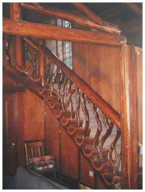
Sanborn Park Hostel’s Madrone and Redwood Staircase.
In 1979, as destruction seemed imminent, the volunteers of the Santa Clara Valley hostelling club stepped forward with a box of hand tools and $460 in the bank to finance their reconstruction project. They were given the go-ahead. Year-after-year volunteers completely rebuilt and refurbished the Judge’s old home. In the main house, they preserved the original rock fireplace and the beautiful madrone and redwood staircase (shown). They also reconstructed the old carriage house turning it into a modern building with beautiful pine ceilings and wooden floors – all the time using as much wood from the original structure as possible. Tax dollars were never used to restore Hostel. This effort was entirely self-funded.
The hostel’s ‘Golden Age’ was in the late 1980s and the early 1990’s when the Hostel’s 39 beds were completely booked.
After the horrible events of 9/11 in 2001 international travel plummeted. Seeing a backpacker from Europe was a rare sight. American travel also declined during this time as a strained U.S. economy, lessening vacation time for families, increasing insurance costs and a host of other reasons impacted travel and the Hostel. These forces slowly took their toll and Sanborn Park Hostel closed in 2010.
When the hostel closed the price to stay for one person was $14, the lowest overnight fee at any hostel in the United States.
The County has no plans for the historic Welch-Hurst building which the Hostel rented from the Parks Department. The refurbished one-hundred-year-old house will likely be boarded up and forgotten. The building is on the Registry of National Historic Places.
I have many fond memories of the hostel. While in college I worked as a ‘Houseparent’ at Sanborn Park Hostel. At the time I wanted to travel, but could not; working at the Hostel provided an opportunity for the travelers to come to me. The Hostel provided me with rich opportunities to learn about different cultures and to meet a wide variety of people. During this time I met thousands of people and some special travelers from Australia, New Zealand, and Austria became life-long friends. One wonderful woman traveling from overseas eventually became my wife.
At times the hostel had a ‘magic.’ One such time involved an evening sitting in front of the large stone fireplace in the living room. A small but bright fire burned. About fifteen people, of all ages, some from overseas, sat on the sofas. We talked about the world. At one point someone brought out some sweet crackers, then someone else made tea for the group. We all talked late into the evening about ideas, places to travel and shared stories. It was an evening that fed the soul. This might sound odd, but if you find yourself in such a setting ask how people sing ‘Happy Birthday’ in their native language. It is a great way to make friends and end an evening with a smile.
In the 30 years as a Hostel, 157,460 people stayed as overnight guests. This number included visitors from 99 foreign countries and all 50 states. Foreign travelers accounted for 20 percent of the total visitorship; that is roughly 31,500 visitors who chose to explore and experience America.
Four points are especially noteworthy about Sanborn Park Hostel’s 30+ year run.
The work to refurbish this historic 100-year-old building was done entirely by volunteers.
Not one penny of public money was ever used to refurbish or operate the building – it was entirely self-funded.
During the hostel’s entire history, it had the lowest overnight fee of all US hostels, only $3 in 1979 to $14 when it closed.
In the 30 years of being a Hostel that 157,460 overnight visitors stayed here; with visitors from 99 foreign countries and all 50 states.
The organization who started Sanborn Park Hostel will continue their famous monthly pot-luck and slide show dinners on the last Thursday of the month at the Saratoga Community Center. Plus, some of the resources from Sanborn Park Hostel have been used to further Hostelling along California’s Central Coast. So in a sense, although the Hostel is gone it will continue in spirit.
It is sad to see the Hostel go, but the Hostel’s newsletter said it with dignity, “Closing the Sanborn Park Hostel is bitter-sweet, but birth and death are both nature’s ways.â€
To learn more about hostelling visit these sites:
http://www.hihostels.com
http://www.hiusa.org


 In the spring and summer of 2014, I enjoyed volunteering with the Nature Conservancy of Oregon (Southwest office). My role was to help grow participation in the local volunteering community. My services included upgrading their email management tool (to Constant Contact) and designing several newsletters.
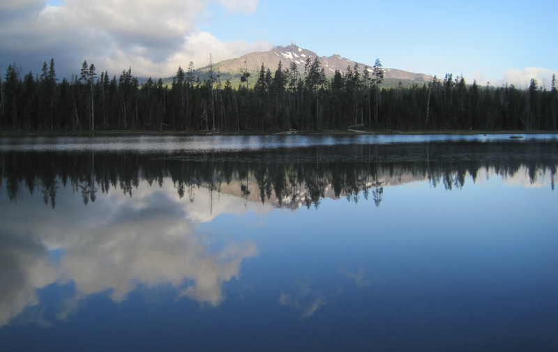 A glorious view from Diamond View Lake. The clouds at the left of the image produced some amazing lightning and thunder that afternoon.
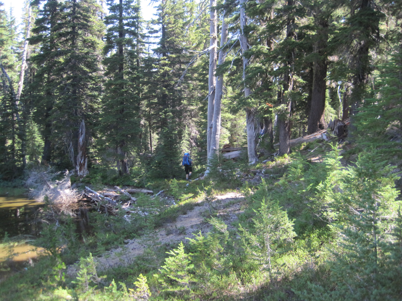 The trail got a little hard to follow at one point and we had to bushwhack.
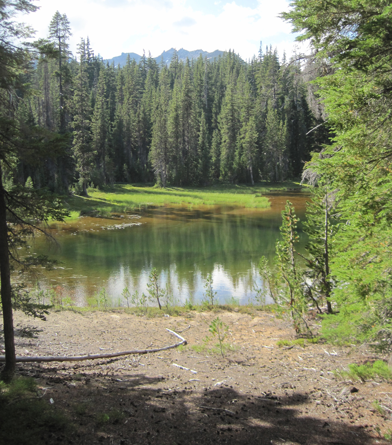 A little lake where we stopped for a rest, only to stay for the night. Water was scarce in the area and the lake provided a great location for watching wildlife and hearing even more wildlife during the nighttime.
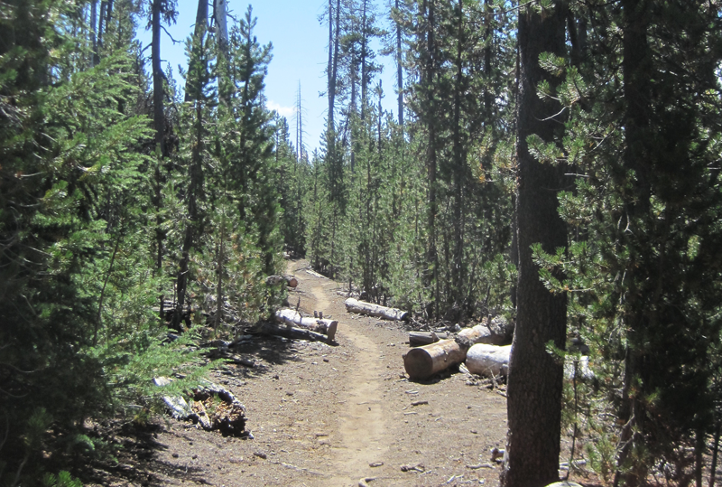 A very dusty path. This trail was well worn because of the number of PCT hikers that we met, many had been side-tracked to a lower elevation because of the lack of water on the main PCT.
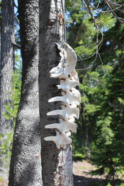 Wow! You find lots of cool things on the trail.
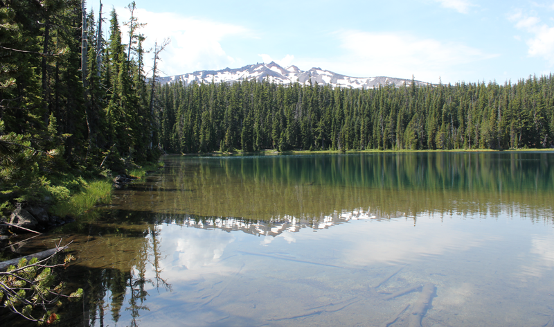 Standing at the outflow of Yoran Lake looking south to Diamond Peak. After a break, we bushwhacked about half a mile to the PCT to loopback.
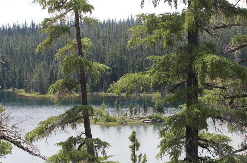 A small island on Yoran Lake.
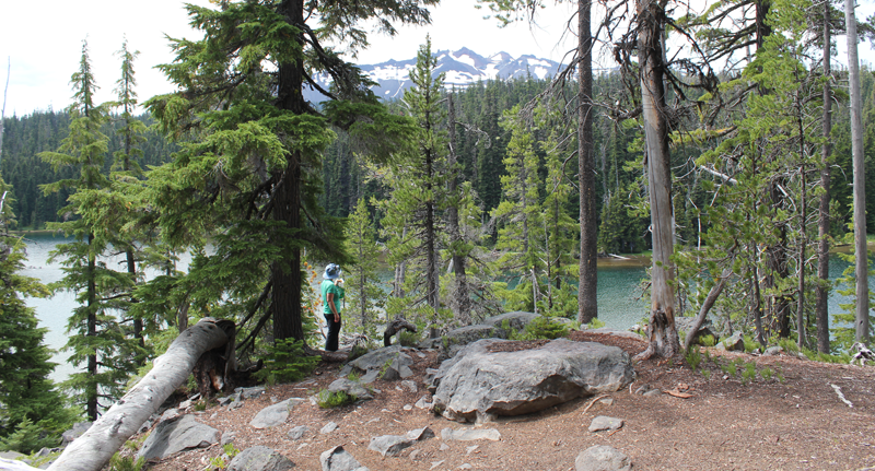 Enjoying some lunch while scouting out a great campsite.
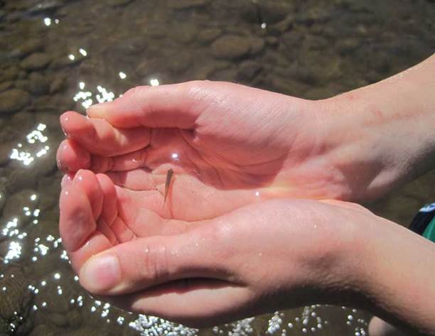
 Each stroke of my paddle dips into the crystalline fluid and scoops out rounded orbs of glass-like liquid, I dip my hand into the water, the temperature is cold, somewhere around 40 degrees Fahrenheit. The lake is fed by mountain springs that course from deep within old lava flows; the water temperature stays a near constant throughout the year.
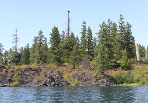 A number of Mallard ducks float next to my kayak, some are just a few feet away. One comes abreast to me and looks at me in the eye; he cocks his head as though wondering what kind of strange beast I might be. I can see his little legs moving underneath the water, churning like a miniature paddle wheel.
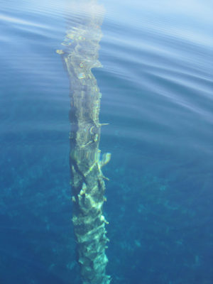 A large dark form starts to become visible in the water before my kayak. I stop paddling and the surface becomes undisturbed allowing the shape to come into focus, it is the column-like shape of one of the ancient trees. The trunk appears to be as big around as a dinner platter, and only just a couple of feet below my kayak. I try to gently tap the top of the trunk with my paddle, but I am unable to reach it. The water has played a trick on my eyes by making things appear closer than they really are. I peer down the trunk looking, fifty, sixty, possibly a hundred feet down to the bottom.

 Â
  Â
 

 Â
  Â


 My visit to the tallgrass with my Father started in the town of Pawhuska, Oklahoma, close to the preserve’s southern entrance. The drive down a paved county road was surrounded by woodlands but this soon turned to prairie and the road turned to gravel and then a packed caliche clay.
 A plaque near the entrance of the preserve includes the text, “The Tallgrass Prairie Preserve. You stand at the south edge of the largest unplowed, protected tract which remains of the 142 million acres of tallgrass prairie grasslands that once stretched from Canada to the Gulf of Mexico. Today, less than ten percent still exists, found mostly in the Flint Hills and Osage Hill regions of Kansas and Oklahoma. In an increasingly crowded and noisy world, what you see is an oasis of space and silence. Here you can experience the same beautiful vistas that greeted the earliest human hunters and gathers many thousands of years ago. This area is indeed a national treasure. Please treat it with respect.â€
 Further beyond a few dark bison sentinels stood at the side of hills, these were apparently lone males who had been pushed out from the herds. The mature males, after mating, are no longer needed by the female-dominated herds and are excluded.
 A herd of bison was just ahead. It was easy to see their dark forms against the dry and brown landscape of late autumn. The bison allowed us to slowly drive past. They did not appear to mind us and continued with their business. If they wanted to the bison could cause us some harm as these are great creatures measuring 5-6 feet at the shoulders and 7-10 feet in length. Plus bison can weight up to 2,000 pounds or more! Some of the individuals peered at us through thick, wooly looking coats that would soon protect them from the coming winter cold. We watched them for some time.
 We passed another two groups of bison close to the road. The ‘Bison Loop’ road offered additional miles of great sightseeing.
 The Preserve Headquarters offers a great visitors center. One memorable exhibit showed just how tall the grasses at the tallgrass prairie can grow – as tall as a grown man. The grasses on the tallgrass are very nutritious and part of an amazingly fertile ecosystem. Another item was a table filled with bison bones and fur. I had expected the fur to be harsh feeling but, it was surprisingly soft and extremely warm. A scapula (shoulder blade) was at least 21 inches in length and 14 inches wide – a big bone for a large animal.
 headquarters. I was informed by a docent who has been at the preserve for years the best time to visit is in the spring (May) when the wildflowers carpet the landscape and the colors are superb. I plan to return at that time.
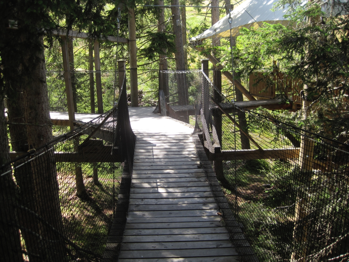
 Some of the most interesting places are located just a short drive off the main road. Sequoyah’s one-room log cabin in the beautiful forests and hills of eastern Oklahoma is just such a place.
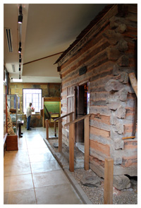 The cabin is actually preserved inside a modern building. After opening the door of the outside building you enter a single open room; at the center is a hand-hewn log cabin, along with the walls, are displays about Sequoyah’s life and his work. What is nice about this exhibit is that visitors can actually step inside his cabin for a close-up view of the period furniture and items that would have been in his life. Unlike many places that hide stories from the past behind cold glass, this landmark is open, inviting and warm.