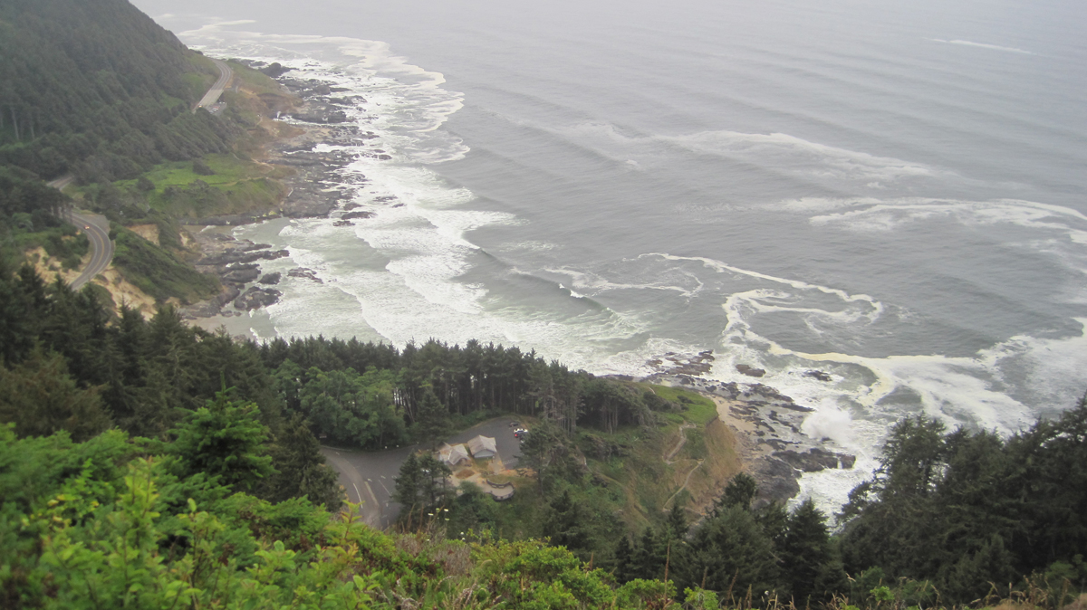
The Cape Perpetua Scenic Area on Oregon’s coast is stunning.
Trip Report:
Volunteer Leader: Mark Hougardy | Organization: Eugene-based Hiking Club | Date: August 2018 | Duration: 2 days | Participants: 8 | Type: car camping, hiking, and kayaking
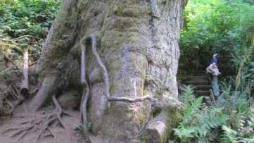
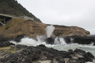
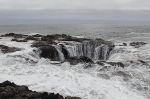
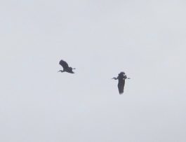
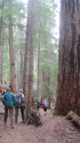
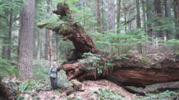
Our group was fortunate as the weather was surprisingly mild and there was little wind. We spent much of the morning exploring tide pools and beachcombing during low tide. The Cape’s forest offered us the chance to stand at the base of the 200-foot tall and 500-year old Sitka Spruce. These amazing trees grow in a four-mile-wide zone along the coast from northern California to Kodiak Island in Alaska. Around lunchtime, we pitched our tents at a nearby campground and had a quick bite to eat. Our two tiny campsites proved challenging with our collection of tents. In the late afternoon, during high tide, we appreciated the coast’s craggy beauty. A favorite is Spouting Horn, where wave action forces water into a small sea cave and through a hole at the top creating a sizeable plume. Thor’s Well, a large sinkhole on the shoreline, water cascades into what appears to be an unearthly entrance to the underworld. In the evening, some of us climbed the 700-foot cape and enjoyed awe-inspiring views of the rocky shoreline below. Standing inside the historic Civilian Conservation Corps shelter, we witnessed a brief sunset. That day we saw a whale, gulls, cormorants, sea lions, a myriad of tide pool creatures, turkey vultures, and ravens.
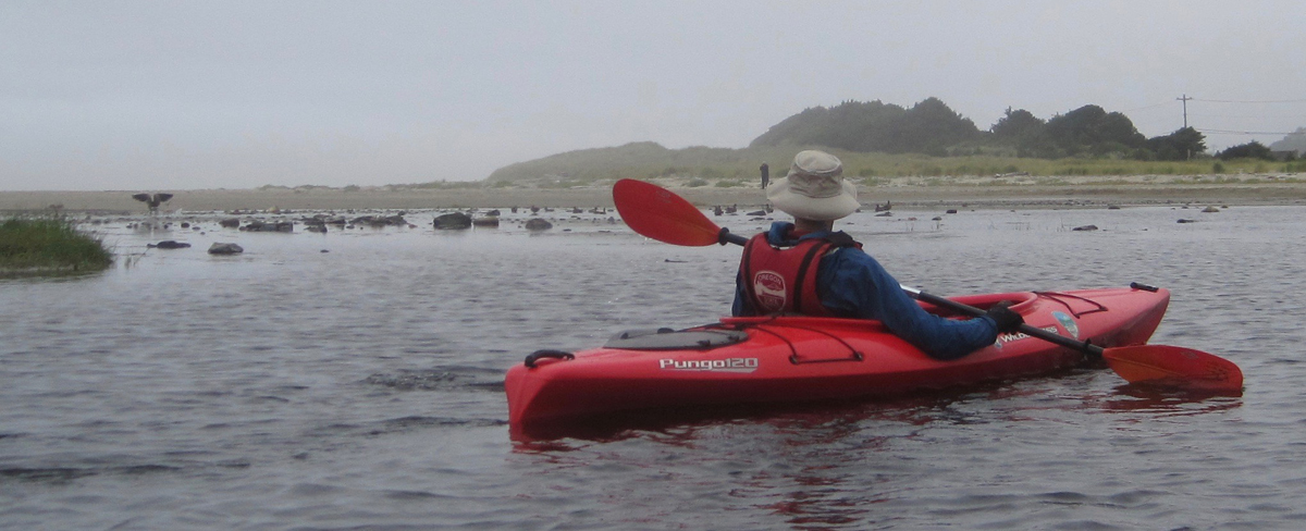
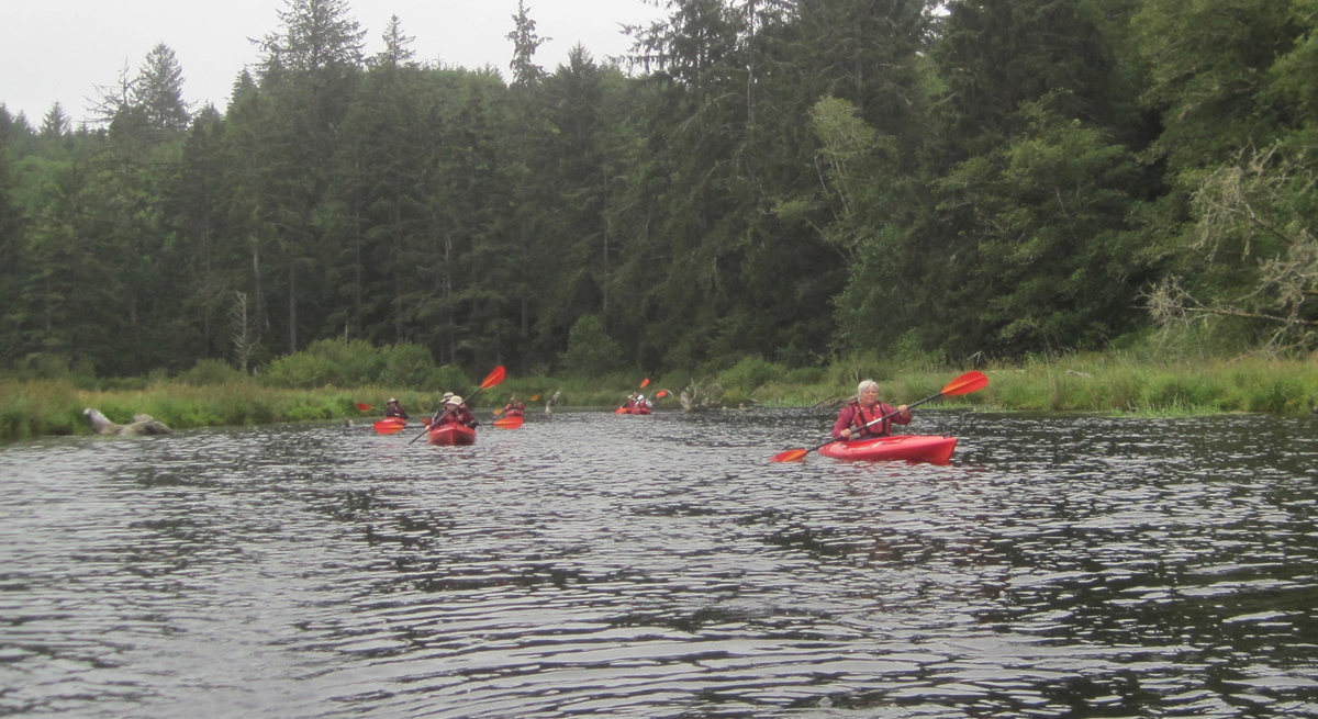
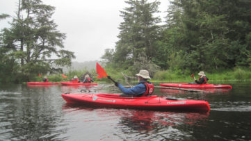
We woke with the sun and drove to Brian Booth State Park where we participated in a kayaking trip along Beaver Creek. This interpretive tour is offered as a service by Oregon State Parks. Beaver Creek is a freshwater estuary and is prime habitat for Coho salmon, cutthroat trout, winter steelhead, and waterfowl. We finished our three-mile paddle about noon and had a great time. We had seen ducks, nutria (invasive), a family of river otters, kingfishers, a young bald eagle, swallow, cranes, blue herons, a green heron, Canada geese, merganser, and a red-tailed hawk. As we pulled our kayaks from the water there was a nearby splash, a river otter had been playfully observing at us. Across the creek, a bald eagle surveyed our group. That afternoon we drove south to Yachats and enjoyed a tasty lunch before heading home.
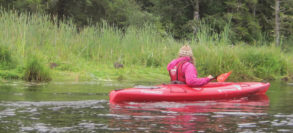
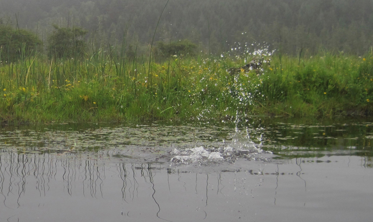
I snapped this picture half a second too late! A chain of bubbles was rapidly passing my kayak on Beaver Creek. They were followed by a furry head popping out of the water. The river otter, upon seeing me, immediately dove. Here is the splash it made as it disappeared.
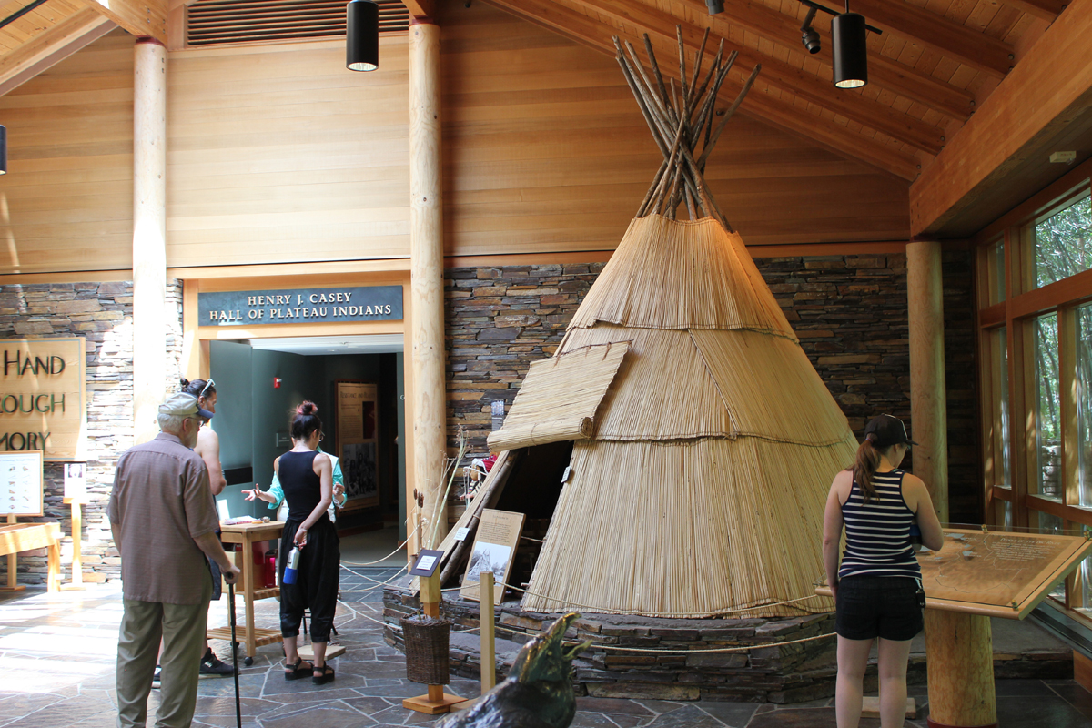
Our 4-day trip to learn more about central Oregon’s historic past started with a call from the interpretive ranger at Fort Rock. The 100-degree heatwave hitting the region was the cause for canceling our visit to the Fort Rock Cave for safety concerns and the threat of extreme fire danger. The cave is a significant archaeological site where shoes dating back 10,000 years were discovered and public entry is limited to just a handful of people each year. Sadly, but understandably, we were not able to visit the cave and I had to amend our trip to Oregon’s high desert on the fly. Fortunately, everything worked out. [Here is a link to a later visit to Fort Rock Cave.]
Trip Report:
Volunteer Leader: Mark Hougardy | Organization: Eugene-based Hiking Club | Date: July 2018 | Duration: 4 days | Participants: 7 | Type: A 4-day exploration of central Oregon’s rich cultural heritage, dynamic geology, and the majestic night sky. Car camping, hiking, and lots of open space.
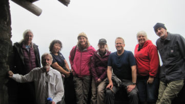
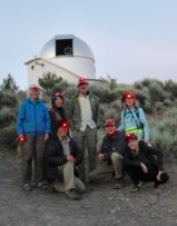
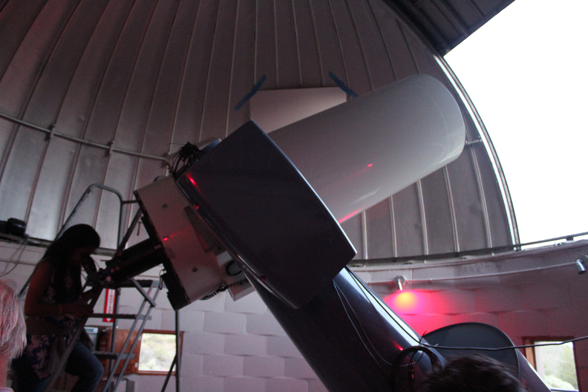
Group photo at the Pine Mountain Observatory. The red lights are easier on the eyes when working around astronomical equipment.
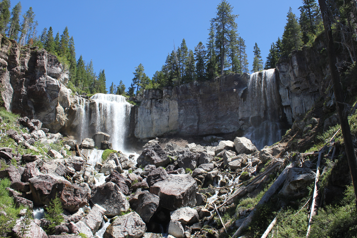
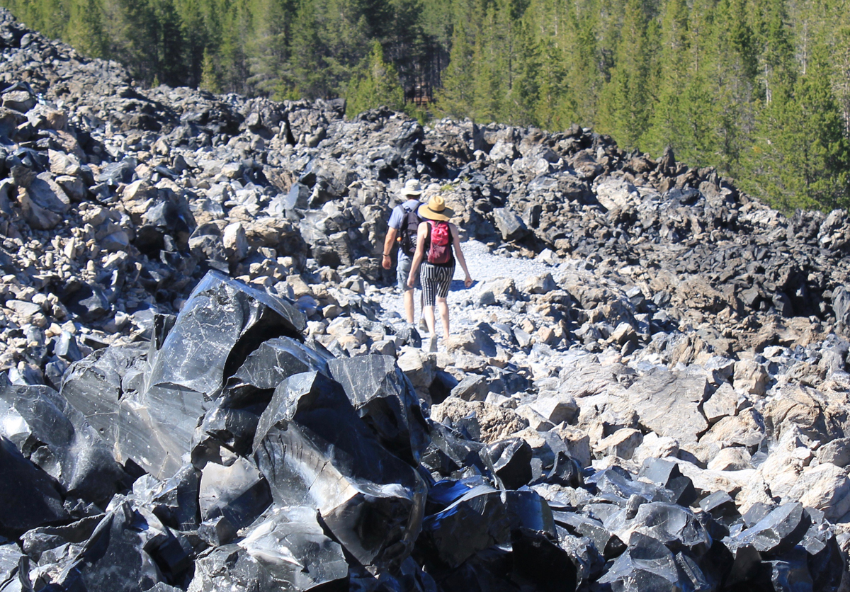
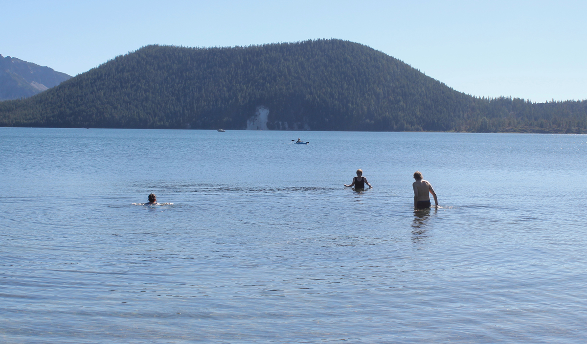
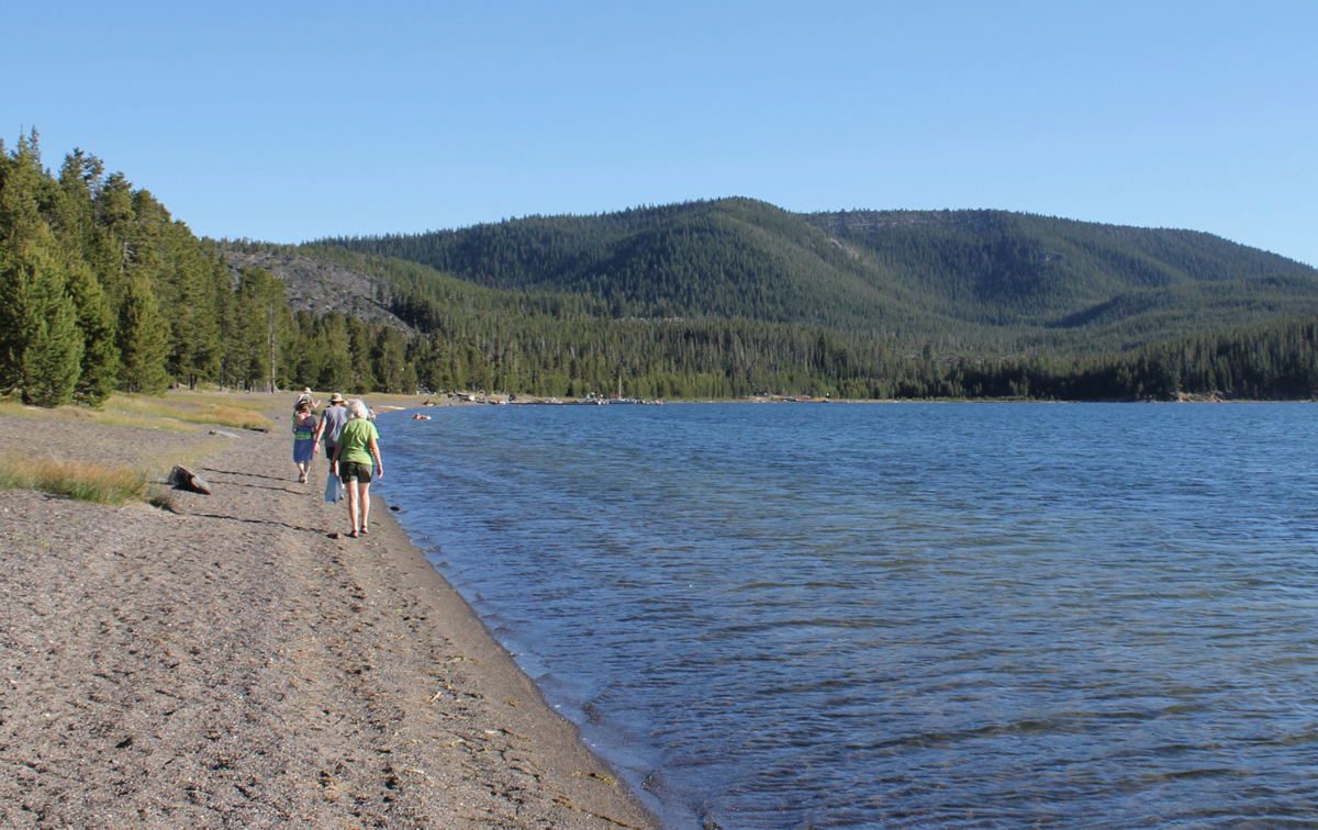
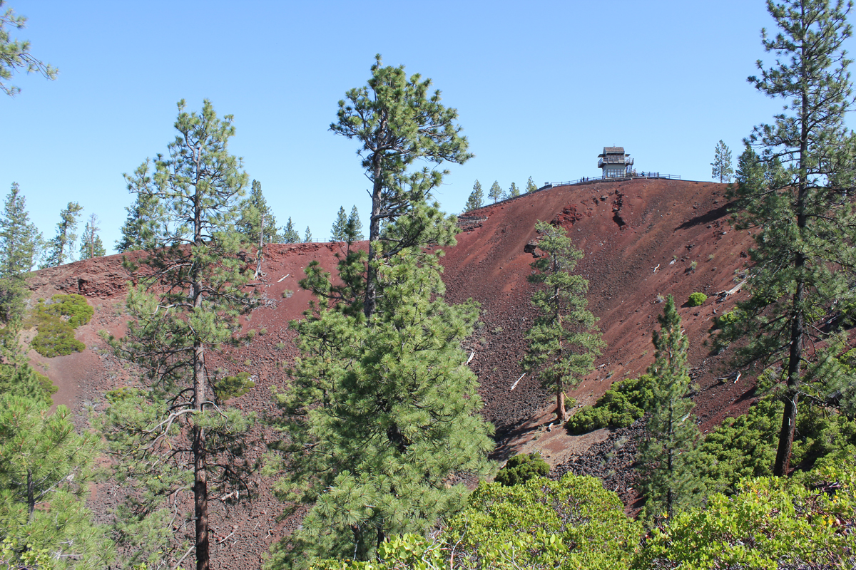
On our first day, we arrived at the massive caldera located in the heart of the Newberry National Volcanic Monument. We visited the double 80-foot Paulina Falls and ate lunch overlooking the stream. We located two adjoining campsites on the picturesque East Lake, and just in time as the park was busy. In the afternoon we hiked the impressive Obsidian Flow trail, a massive flow of volcanic glass and pumice 17 stories tall. Returning to camp we enjoyed a swim in the cool and clear waters of East Lake. Afterward, we hiked on the beach to the local resort and were reminded of the subtle, yet abrasive qualities of volcanic glass on the feet. At the lodge, we enjoyed a delicious meal and had some good laughs with the staff. The radio in the background was playing a tribute to Tom Petty. We walked about a mile back to camp. That night we listened to acapella hymnals from a Mennonite group camping nearby.
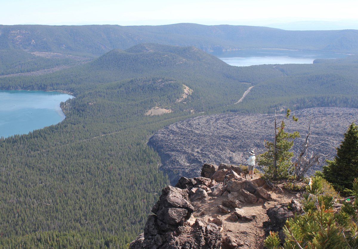
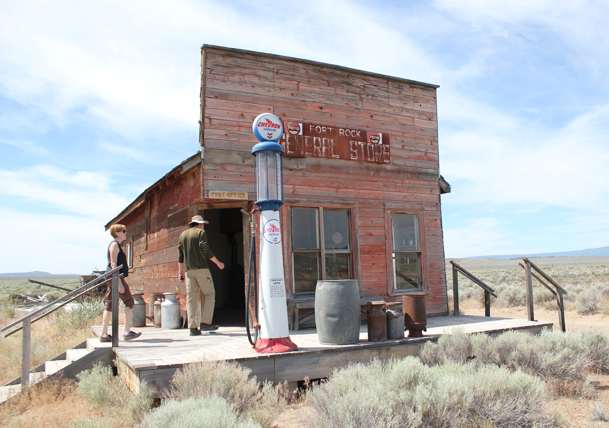
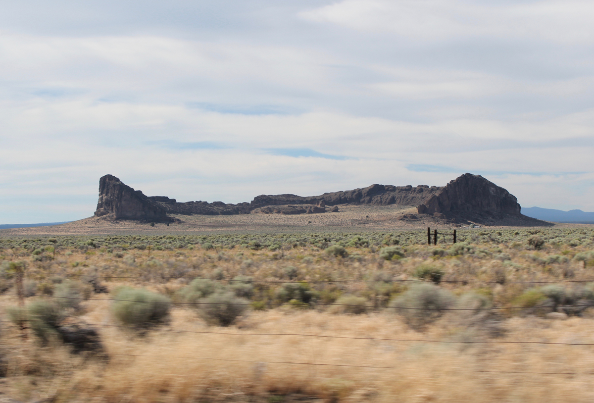
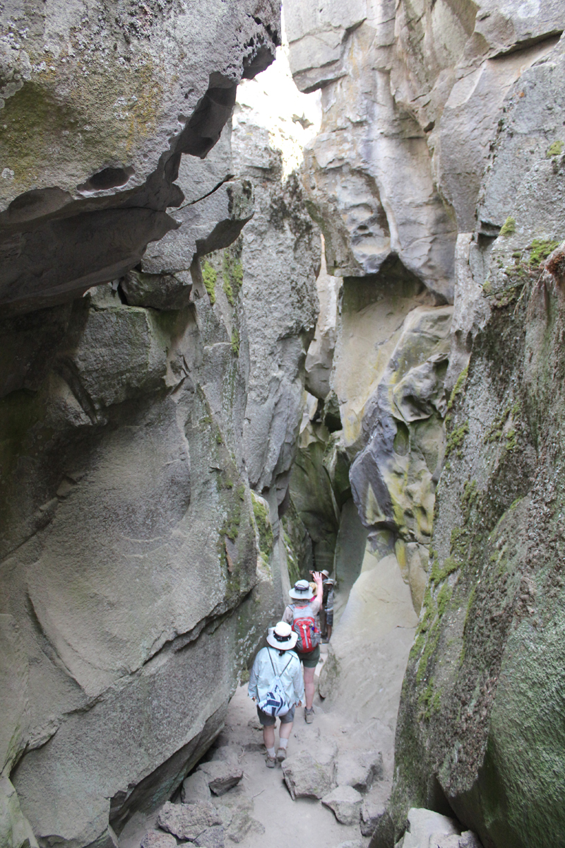
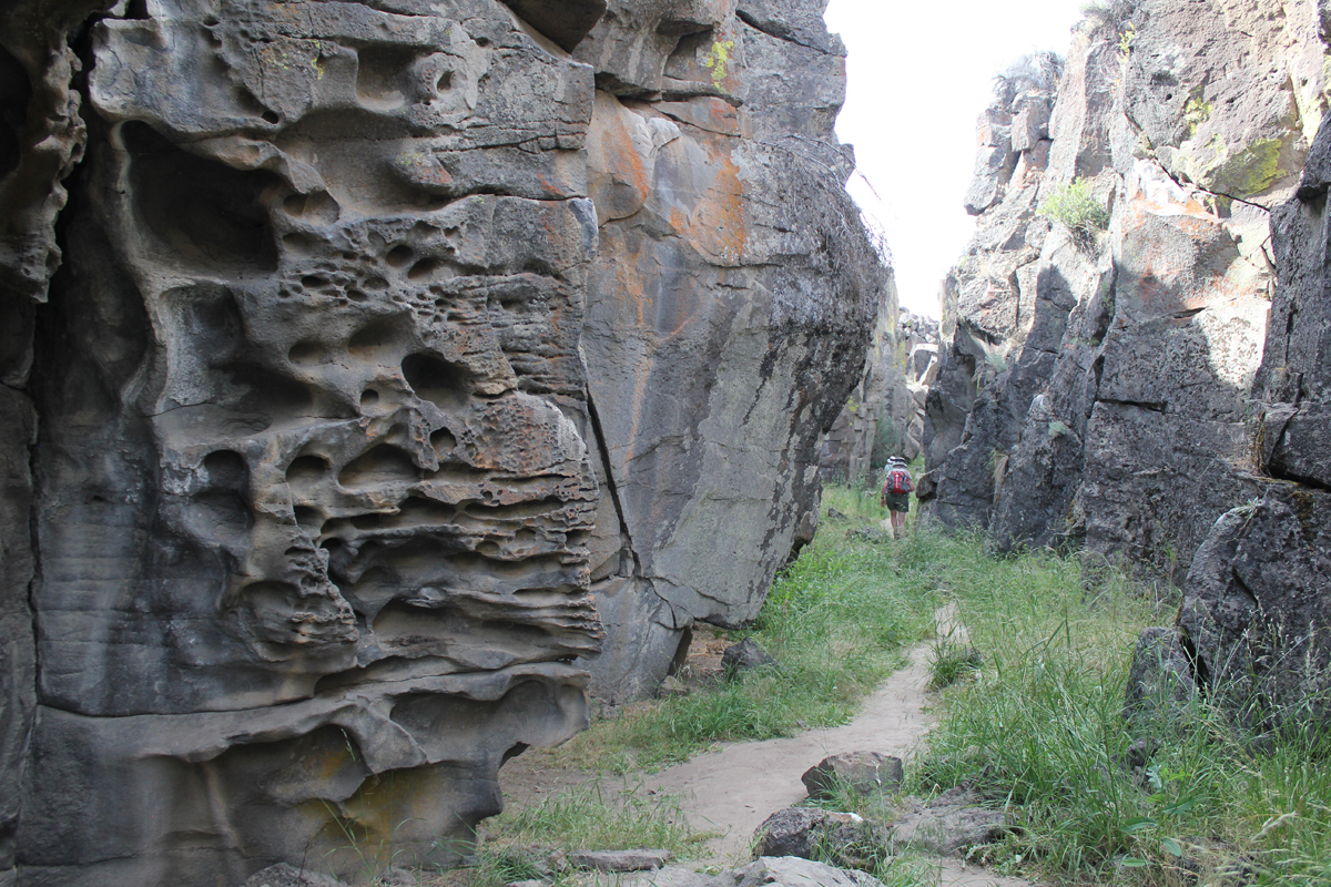
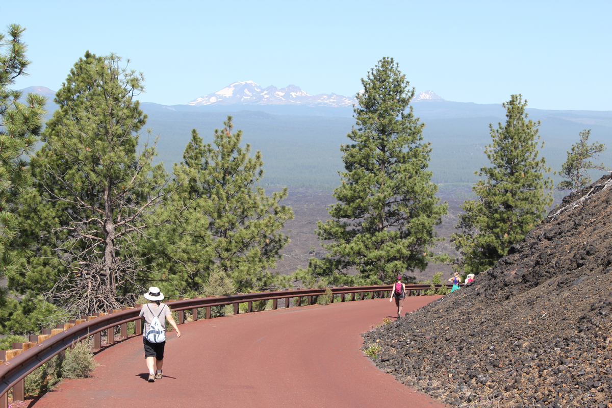
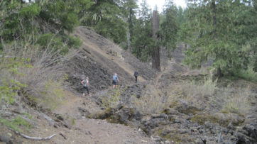
On day two we drove to the top of Paulina Peak. The peak is 7,984 feet and sits in the middle of Oregon. The views are impressive; to the north, we could see the massive stratovolcano, Mount Hood, then down the spine of the Cascades to the steep-sided Mount McLoughlin close to the California border – a distance of about 300 miles! To our south was our next stop, the iconic shaped Fort Rock, a volcanic landmark named for the tall fort-like walls. We left Paulina Peak and drove for about an hour. Our first stop was the Fort Rock Homestead Museum, an open-air collection of historic structures. This is where I learned about a shortcut of a backroad to Derrick Cave, a remote lava tube that we had hoped to visit. Apparently, the private landowner had closed the shortcut because visitors were not closing a gate and his cows were escaping. The alternate route would have involved about a 50-mile detour on forest and back roads. This was tabled until another visit. Our next stop was the massive Fort Rock a horseshoe-shaped tuff ring that rises 300 feet over the surrounding flat landscape. We hiked for about an hour in the heat then drove to the town of Christmas Valley for ice. We continue on a short distance to Crack in the Ground, a 2-mile-long tension fracture where we could hike and scramble over boulders about 30 feet underground. The temperature at the surface was 95 degrees, in the fissure it was a comfortable 70 degrees with some pockets of air in the lowest sections that were very chilling. Late that afternoon we stayed at the Rockhorse Ranch where we pitched our tents and gleefully enjoyed their shower! A celebrity at the ranch’s store was a black cat named, “Scratchy.”
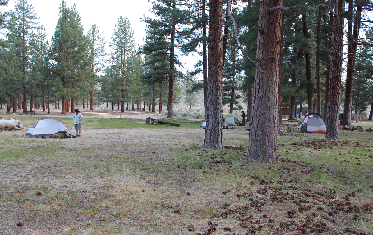
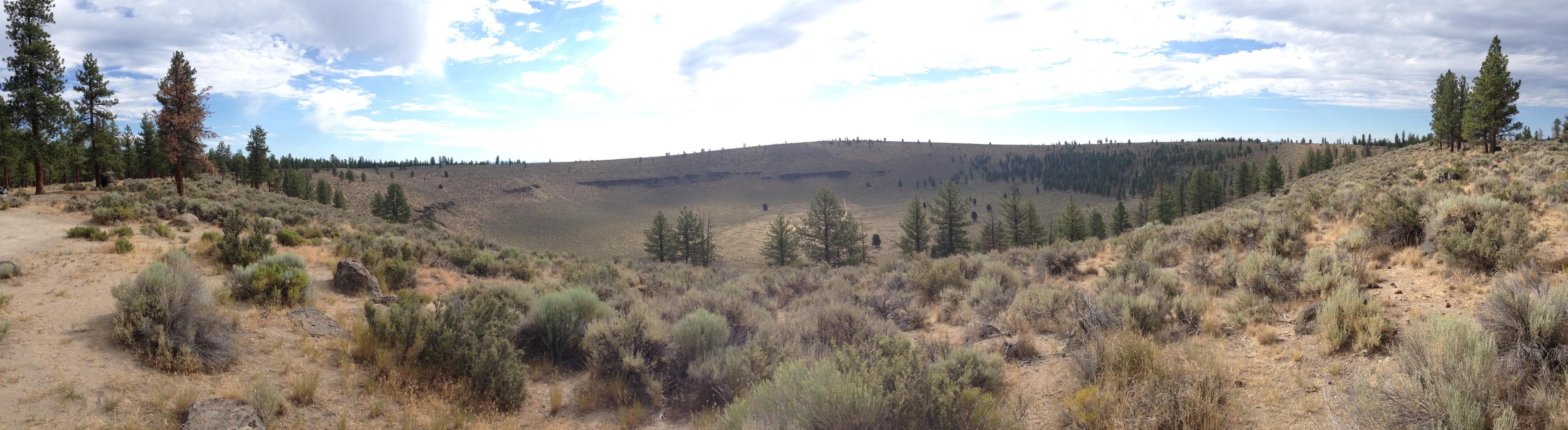
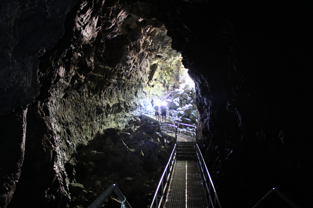
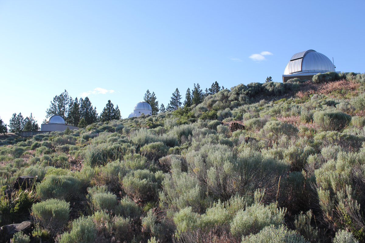
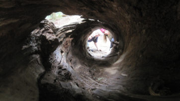
On day three we drove a short distance to Hole in the Ground, a crater that is a mile wide and 500 feet deep. Once thought to be a meteor impact the formation was actually caused by magma contacting groundwater. The resulting flash (there were many over the millennia) formed the massive hole we see today. The steep hike down the side was dusty and the walk up the forest service road was blazing hot. Near the end of our hike, three cars zipped up the road in a cloud of thick dust. The vehicles looked as though they were from the set of a Mad Max movie. The last car to pass was missing the driver-side door; the driver was wearing thick goggles. The rag-tag group waved as they passed. These were participants in the Gambler 500, a navigational adventure for cars whose value is no more than $500. Later that day we visited the High Desert Museum for a closer look at the cultural and natural history of the region, and we explored by flashlight the 1-mile-long Lava River Cave, the longest continuous lava tube in Oregon. The cave was a welcome 42 degrees! As the sun lowered in the sky we made our way about 30 miles east of Bend to the Pine Mountain Observatory, an astronomical observatory operated by the University of Oregon. The center sits near the top of Pine Mountain at an elevation of 6,509 feet. We made camp, ate dinner, watched the sunset, and enjoyed the various telescopes of the facility. There were close-up views of Jupiter, Saturn, Venus, Mars, nebulae, globular clusters, and various astronomy talks from UO instructors. Most impressive was a view of Jupiter and several moons through the 24-inch scope.
The final morning we woke up hearing a chorus of cows in the distance. We made our way off the mountain appreciating the drastic change in terrain from pines to the open high desert. We took a shortcut around Bend and stopped at the Lava Lands Visitor Center where we explored the 500-foot tall Lava Butte that has commanding views of central Oregon’s volcanic story before returning home.
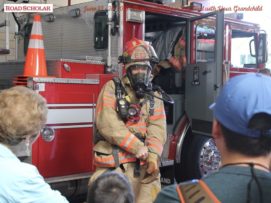
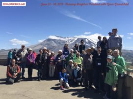
I’m happy to have been the leader on another great Road Scholar trip. This program introduced grandparents and grandkids to how fire helps forge every aspect of our life (homes/communities, food preparation, entertainment, arts, places we play, and our survival).
Trip Report:
Leader: Mark Hougardy | Organization: Road Scholar | Date: June 2018 | Duration: 6 days | Participants: 28 | Type: Field Trips & Motorcoach
“Erupting volcanoes. Blacksmithing. Outdoor cooking. Glassblowing. A fire has countless uses, and incarnations, and has been paramount to our way of life since the beginning of our time. You and your grandchild will spark your desire to safely learn more about fire through interactive experiences with professional firefighters, survivalists, welders, and fire dancers. Discover how fire can create a delicate piece of artwork, as well as destroy entire forests and cities. Learn how to survive in the remote wilderness, and discover the inner workings of a city’s fire engine. Together with your grandchild, finally have the chance to play with fire as you discover why nothing can hold a candle to this learning adventure.”
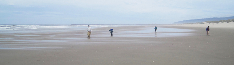
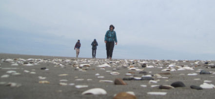
This hiking trip was to the site of the “exploding whale,” one of Oregon’s most prominent stories of local lore.
Trip Report:
Volunteer Leader: Mark Hougardy | Organization: Eugene-based Hiking Club | Date: June 2018 | Duration: 1 day | Participants: 6 | Type: Day Hike
In 1970, near Florence, a 16,000-pound whale carcass the length of a bus washed ashore. After 3-days in the sun, it became so foul smelling that locals wanted it gone. An idea was hatched to dynamite the odorous mass into tiny bits. A local TV report of the incident is classic web viewing. In the clip, a massive boom launches putrid blubber into the sky. As the blast ends, behind the camera, a series of cheers and laughs ring out. One woman’s voice is heard, “All right, Fred, you can take your hand’s our of out of your ears now … here come pieces of … my G-” No one was injured, but viewers were covered in goo and a car was nearly totaled. Our group located the approximate location of the detonation. The day included a pleasant 5-mile beach walk where we viewed a number of shells. We also observed a memorial to 41 sperm whales who mysteriously stranded themselves in the area in 1979. One whale spout was observed just offshore.
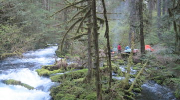
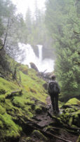
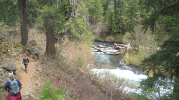
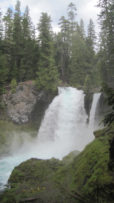
The season’s first warm weather brought significant snowmelt into the McKenzie River watershed and over the majestic Sahalie Falls and Koosah Falls.
Trip Report:
Volunteer Leader: Mark Hougardy | Organization: Eugene-based Hiking Club | Dates: May 2018 | Participants: 5 | Type: Hiking and Car Camping
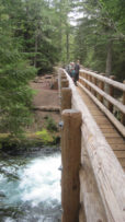
Our plan to hike to Tamolitch Falls (Blue Pool) was cut short when a sign stated a mile of trail was closed because water had flooded the path in places to a depth of 3 feet. Even with the closure, there was plenty to appreciate further upstream at Clear Lake with its crystalline waters and turquoise colored Great Spring. Animals that were seen along the trail also appeared to appreciate the warmer weather as fish jumped in the lake, several species of birds flew overhead, and a garter snake warmed itself on the rocks. In shaded areas winter still managed to hold its grip as large patches of snow remained. Springs spontaneously appeared on the trail sometimes forming small ponds, and at one point, all of us were mesmerized by a plate-sized vortex that had formed in such a pool. After a solid day of hiking, we visited Belknap Hot Springs for a relaxing soak. Because we timed our visit before the Memorial Day crowds the U.S. Forest Service campground was basically empty. Our campsite was green with moss and located next to a white rushing stream that looked like it was born from a Tolkien novel. The next day we enjoyed the comfort of a morning campfire, broke camp, and explored several more miles of trail before heading home.
Trip Report:
Volunteer Leader: Mark Hougardy | Organization: Eugene-based Hiking Club | Dates: March 2018 | Participants: 14 | Type: Urban Walking Tour
It’s difficult to imagine today, but between 1907 and 1927 streetcars (commonly referred to as trolleys) ran along 18-miles of electrified tracks in Eugene, Oregon. Their comforting clickety-clack as the wheels passed over connections in the tracks were heard on four routes in this city of 11,500 people. Only the finest cars were used and each was superbly-crafted with heaters and rattan seats. At 45-feet in length, they could carry up to 100 passengers. The cost per trip was 5 cents for a child and 10 cents for an adult. Our walk will help re-discover this curious icon of the early 1900s using old photos and traversing the Fairmount trolley’s 5.5-mile route. We walked the Fairmount’s route in its direction of travel from the train station, through downtown, across the University of Oregon’s picturesque campus, passing historic residential neighborhoods, crossing over some of the last remaining visible tracks, and back. Although many of the trolley’s tracks are not visible today, look carefully, many miles of track from this time are hidden just under the pavement.
Trip Report:
Volunteer Leader: Mark Hougardy | Organization: Eugene-based Hiking Club | Dates: January 2018 | Participants: 7 | Type: Urban Walking Tour
In 1978 a low-budget movie about a misfit fraternity who challenged authority was released. The movie “Animal House” prominently featured locations around the University of Oregon. Much to the chagrin of university officials, the movie brought unwelcome attention to the UO; to others, it is one of the greatest comedy films of all time. Forty years later, this small group of Animal House fans visited fifteen sites around campus featured in the movie. We enjoyed a pleasant walk in the light rain. Some areas on campus were similar while other locations, like a refurbished room 110 Fenton Hall where the courtroom scene was filmed, are unrecognizable. We ended our walk at the former site of the Delta Tau Chi fraternity house, the Animal House. The dilapidated structure has since been demolished and replaced with an office building. Only a small plaque remains. Thank you to everyone in the group for sharing their stories about the movie’s production.
Trip Report:
Volunteer Leader: Mark Hougardy | Organization: Eugene-based Hiking Club | Dates: December 2017 | Participants: 19 | Type: Urban Walking Tour
Over the past months in Eugene, Oregon, a number of building-sized murals have started appearing – some almost overnight. I needed to check out this gigantic expression of creativity, so I offered an invitation for an informal walk. Surprisingly, nineteen people joined me! The murals are part of the 20×21 project, an initiative to create 20 or more world-class outdoor murals in Eugene between now and the premier track and field 2021 IAAF World Championships. As a runner myself, I am really excited about this event. After the walk, some of us enjoyed a tasty lunch of pizza and salad (the vegan pizza there rocks; an image is included below). Here are a few photos:
Trip Report: Volunteer Leader: Mark Hougardy | Organization: Eugene-based Hiking Club | Dates: September 10, 2017, | Participants: 7 | Type: Day hike and wayfinding
Along the forested backbone of Oregon’s Cascade Range is a large tranquil lake that invites “Where’s Waldo?” jokes. But, laughter aside, Waldo Lake is quiet. For those exploring the hushed shoreline, they might wander upon an old mountain hemlock blazed with the 130-year-old text, “Camp Edith, Waldo Lake.” At first, the blaze appears as an act of modern vandalism, but looking closer at the aged wood a modest story slowly reveals itself. The story is about a child who grew up to become the astute and reserved white-bearded grandfather of Oregon’s public lands. It was his passion that laid the groundwork for six national forests, over a dozen wilderness areas, and even support for Crater Lake National Park. Yet, most who visit these places today, don’t know this man’s name, Judge John Breckenridge Waldo. The few who know his name compare him to Emerson or Thoreau; some even call him “Oregon’s John Muir.”
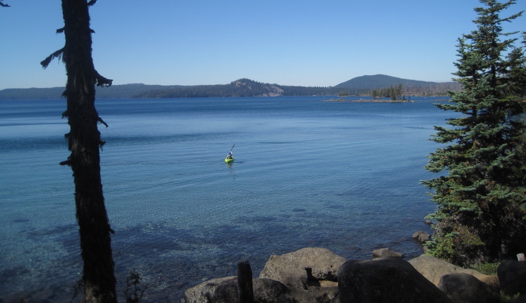
The beautiful Waldo Lake in Oregon’s Cascade Range. Waldo Lake is 10 square miles in area. The lake is rare in that it is a gas-free zone, only wind and human-powered boats are allowed.
My curiosity about John B. Waldo was piqued when I learned that his documents could be found nearby at the University of Oregon Special Collections archive. A visit to the archives was arranged through a local hiking club and several others joined me. A library staff member delivered several old boxes to our table.
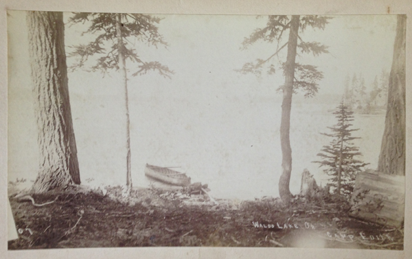
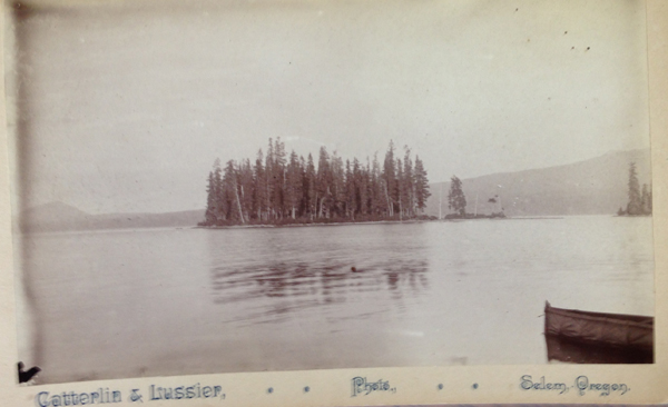
As we carefully reviewed this man’s life, a grainy black-and-white photograph caught my gaze. The photo was etched with the text, “Camp Edith, Waldo Lake.” The picture was dated 1890 and revealed a couple of trees and a canoe. At first, I was stunned by the fortitude and strength involved in hauling early camera equipment and a canoe more than 70 miles or so into the mountains.
Camp Edith, Waldo Lake, Oregon (circa 1890). I have hiked all over Waldo Lake and never encountered Camp Edith. Waldo’s campsite was not listed on modern maps. Where was it?
Then I was curious because none of my fellow hikers had ever heard of this place. I looked at modern maps, but there was no reference to Camp Edith. I looked at maps from the late 1800s and early 1900s, but still found nothing. The more I researched, the deeper the mystery became. This “lost” campsite of Waldo’s was a loose thread in a story, and I just had to pull at it.
John B. Waldo was born in 1844 to parents who had arrived just a year earlier on a wagon train and were new arrivals to the Willamette Valley. Waldo, as a child, had asthma which worsened in the summer as the valley filled with heat and smoke. Seeking refuge, Waldo and his brother made forays into the nearby Cascade Mountains for clean air. Waldo returned often.
As a young man, he studied law, became an attorney, and was eventually elected to the Oregon Supreme Court, even serving as a representative in the state legislature. He loved law and policy but always returned to the mountains, often for months at a time, to write about nature.
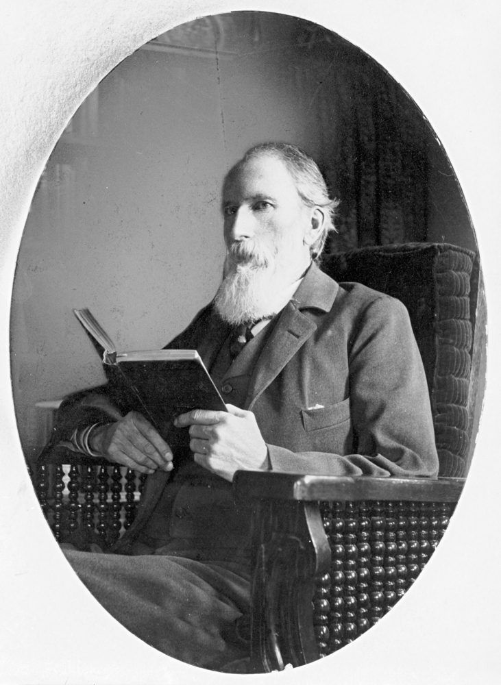
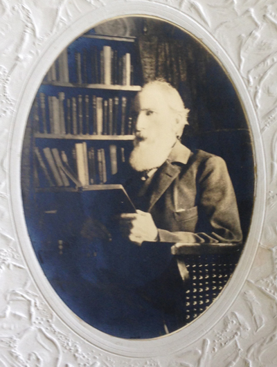
Judge John Breckenridge Waldo
From 1877 to 1907, Waldo extensively explored and chronicled —in his words— the “untrammeled nature” of Oregon’s Cascades. He believed that modern life had “narrowing tendencies” on a person and that wilderness allowed difficulties to “be perceived and corrected, and the spirit enlarged and strengthened.”
He had seen the effects of over logging back east and overgrazing in the Cascades by sheep. Waldo imagined a protected place in the mountains where people could escape the toils of life. An individual’s trip would be assisted by an interconnected trail system dotted with lodges. These lodges would be roughly a day’s walk apart, where hikers and travelers could stay, enjoy a meal, and rest. Upon returning from his expeditions, he quietly and diligently advanced such a vision: a 40-mile-wide protected band along Oregon’s mountainous crest stretching 300 miles from the Columbia Gorge to the California border. Waldo spent decades and countless hours increasing public awareness through letter writing, newspaper posts, and using his professional resources to advocate for this vision.
Waldo died in 1907 at the age of 63; he had become ill while attempting to summit Mount Jefferson. His colleagues returned Waldo to his family farm outside of Salem, where he passed. After his death, his writings became missing, but Waldo had started something in the minds of others. In the following years, national forests and wilderness areas began to form a patchwork along Oregon’s crest. Outdoor enthusiasts created clubs like the Mazamas, the Chemeketans, and the Obsidians, all dedicated to experiencing the outdoors. Three of the west’s greatest national park lodges were constructed in Oregon: the Chateau at the Oregon Caves, Crater Lake Lodge, and the crowning gem Timberline Lodge on Mount Hood. Rangers opened campgrounds, trail maintenance volunteers began creating and maintaining hundreds of recreation trails, skiing enthusiasts opened ski resorts, and rafters opened rafting companies. Friends of the Pacific Crest Trail (PCT) worked to span Oregon with this narrow ribbon of trail that crosses the U.S. from Mexico to Canada. In the past few years, via a citizens’ initiative, Oregon voters secured funding so all fifth or sixth-grade students can move from their school classrooms into the outdoors to learn and be immersed in nature.
For almost 80 years, the location of Waldo’s writings and photos was unknown and thought to be lost. In the 1980s, these items were located in an attic and delivered to a conservation organization in Eugene. Eventually, his papers made their way to the University of Oregon archives and can be viewed today by appointment. It was here where I first saw the old grainy photo inscribed, “Camp Edith, Waldo Lake.” Supposedly this was one of his favorite locations. Yet, where was this place?
During the past year, I have been reading, researching, and trying to figure out where Camp Edith might be. I poured over maps, performed internet searches, and reviewed old hiking books but found nothing. I checked with living knowledge keepers: the seasoned hikers, campers, and old-timers in central Oregon. Most only knew about Waldo because of the lake that shares his name. Of the few who knew about Waldo as a preservationist, only a handful had heard about Camp Edith.
A man said he knew of the camp. He suggested that I look at Waldo’s obituary for guidance. One portion stood out. It read, “To him, the mountains with their purpling canyons and glittering snow peaks were a book to which there was no end. The beauty of the hills was a sermon.” Inspiring words, but was I any closer to finding Camp Edith?
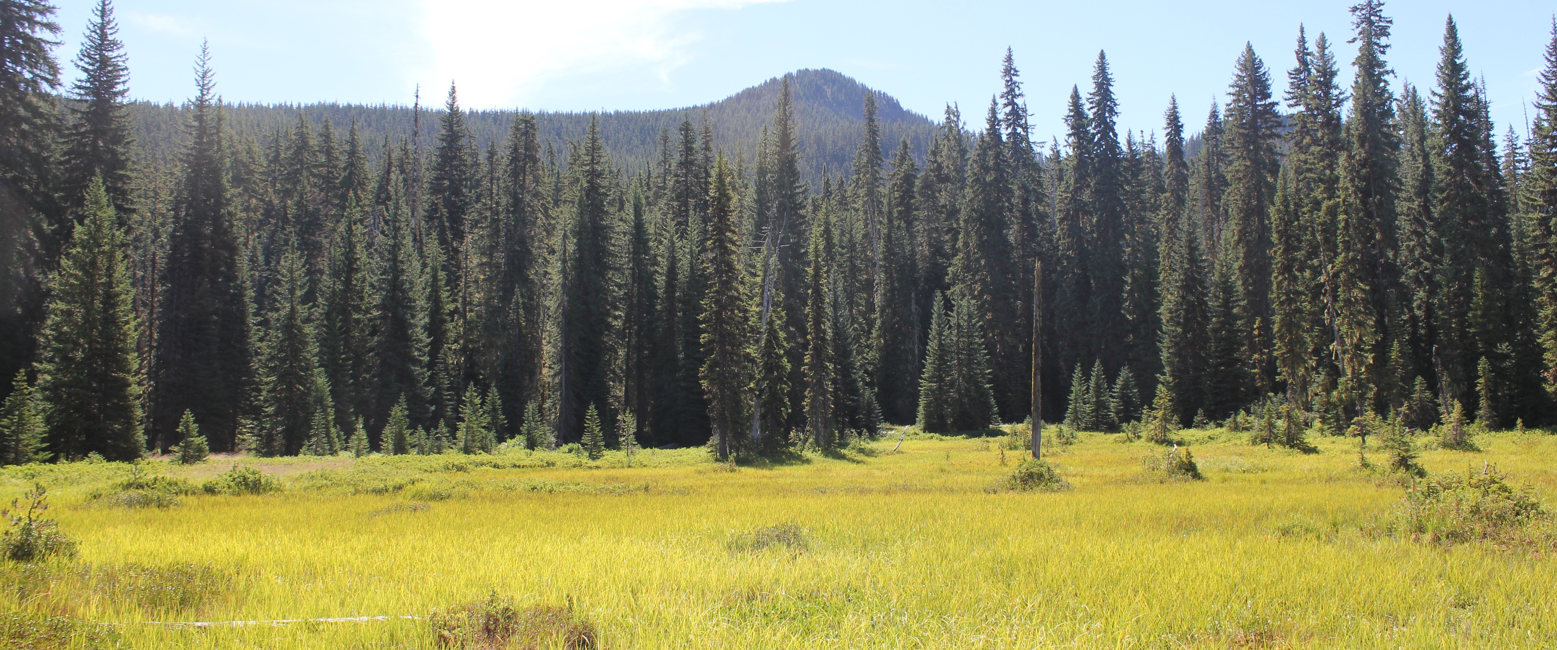
To Waldo, “the mountains with their purpling canyons and glittering snow peaks were a book to which there was no end.” A photo of a meadow and Mount Ray, Waldo Lake area.
Another person, a retired employee of the Forest Service, revealed she knew of the camp’s location. She added, “It’s easy to forget where a single tree is in the forest, but [she] could point me in the right direction if I wished.” Several weeks later, a PDF copy of Waldo’s transcribed 500-page diary arrived in my inbox from someone I never met along with the text, “A former colleague thought you might appreciate this.”
One individual, with ties to the Waldo documents, said he knew where the campsite was located, but, “It’s yours to find.”
Finally, I met an aged man who loved long-distance hiking and somehow knew that I had been looking for Camp Edith. He claimed to have walked across the U.S. a total of four times in his life and was eagerly looking forward to at least another two trips. He wore a Grateful Dead t-shirt and on his pack a bright yellow button of the Gadsden flag with a rattlesnake and the words, “Don’t Tread On Me.” The man said he had “hiked all over Oregon including Waldo Lake” and had seen the Camp Edith tree and knew the location. He had enjoyed eating a sandwich there. I leaned in, hoping for a quick answer to the location, but he uttered these enigmatic words, “When you find the tree, man, you’ll be there.” I left feeling none the wiser, or did I?
Waldo Lake, Oregon
That winter, when skies in the Pacific Northwest are overcast and darkness comes quickly in the afternoon hours, I wrapped myself in a warm quilt. I jumped into reading Waldo’s 500-page diary. It was here that I learned that during Waldo’s treks, he traveled for months to nourish his insatiable wanderlust and love of the mountains. This included trekking as far south as California’s Mount Shasta.
But like many of us who desire to travel, when we do so, we become homesick for loved ones, and Waldo was no exception. In 1889, or thereabouts, to lessen his loneliness he christened a favorite camping site in honor of his daughter, Edith. Shortly after, a colleague blazed a heart-shape and Edith’s name into a tree trunk.
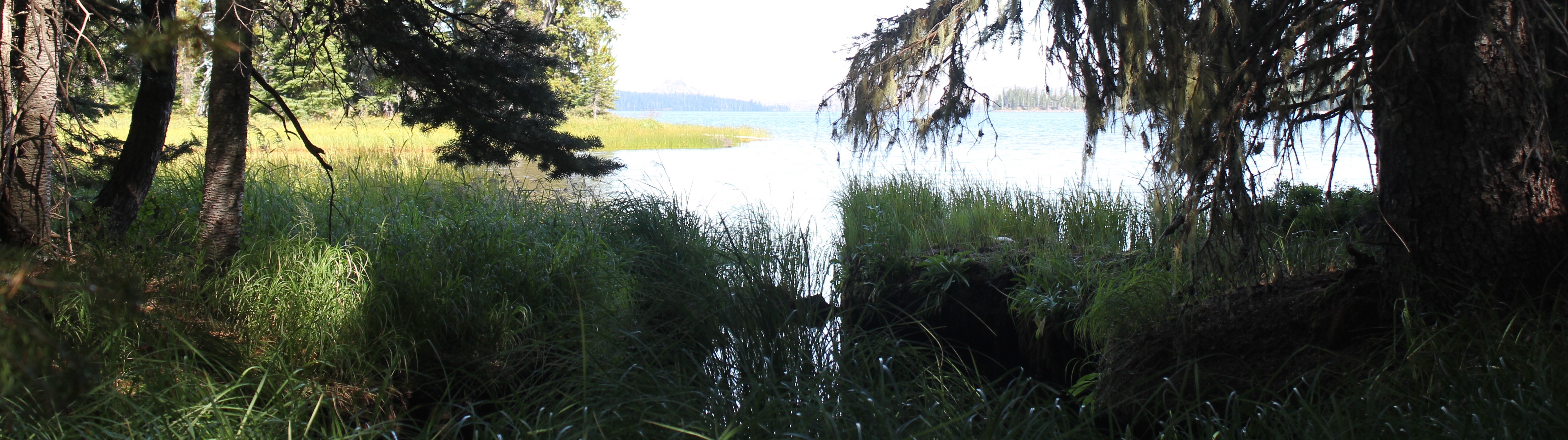
Part of the marshy shore of Waldo Lake.
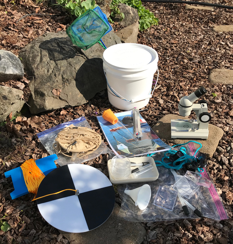
Secchi Disk: The black and white plate-looking object in the lower left of the image. On a separate visit to the lake, 60 feet was the maximum amount of line attached to my Secchi disk and I could still see the disk in the water. The disk is a simple device used to measure water transparency or turbidity. Also shown is my freshwater sampling kit.
As I waited for the snow in the mountains to melt and for the highway to Waldo Lake to reopen, I casually picked up the old photo of Camp Edith that I had looked at a hundred times before and saw something small. I grabbed a magnifying glass. At that moment, I knew the basic location of the camp. I had enjoyed my journey up to this point, but now, others needed to share in the experience. Therefore, I enlisted members of the same hiking group I had met at the archives the year before.
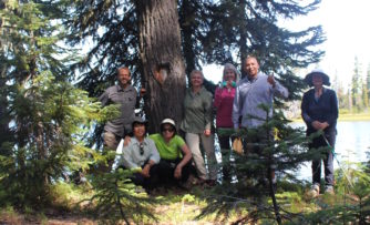
Several months later, we arrived at the lake. I provisioned them with three items: a copy of the Camp Edith photo from 1890, a few telling diary entries from Waldo’s writings, and pointed them in a direction. Everyone was eager, if a bit perplexed, as we walked into the vast forest to find a single tree.
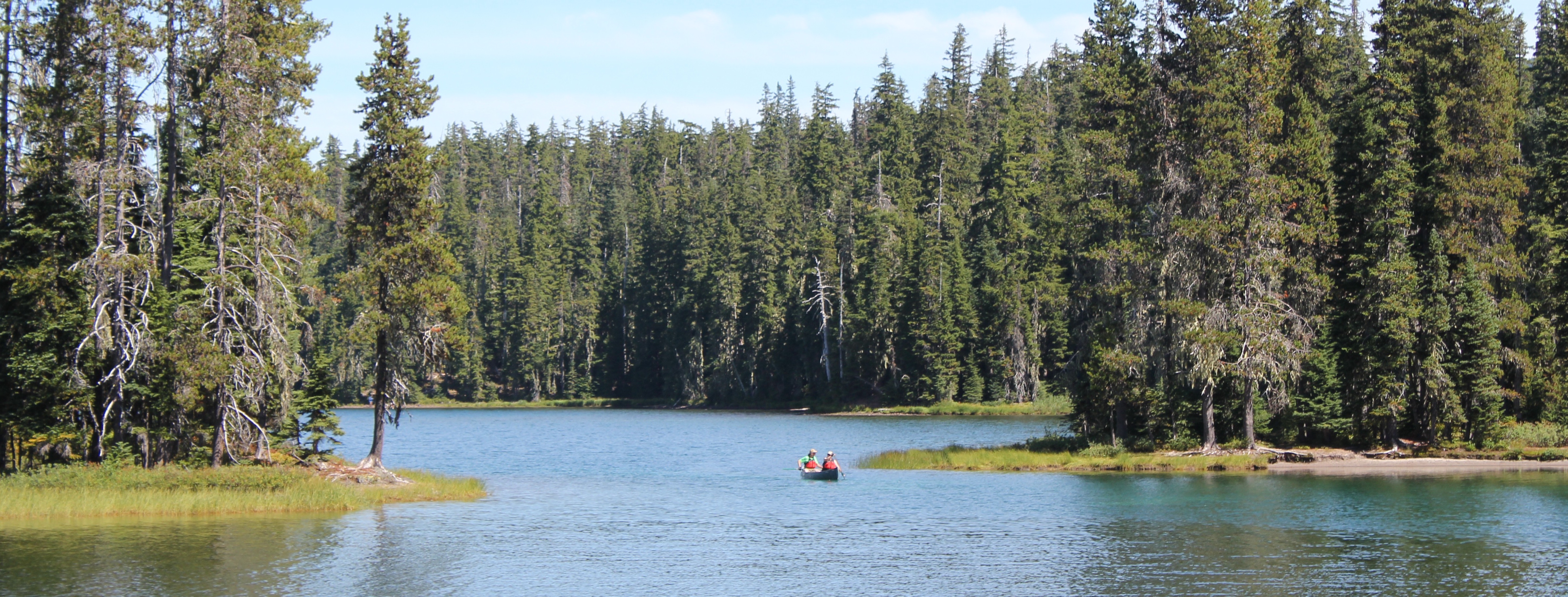
Waldo Lake is always an inspiring place to visit. It is one of the largest natural lakes in Oregon, roughly 5 miles in length and 2 miles in width. The waters are clear and turquoise and the deeper areas are bespeckled with shades of rich blue. Light can easily penetrate 60 feet deep and possibly further.
Progress was slow as we carefully crossed marshy fields, scrambled over downed logs, and occasionally got our feet muddy as they identified clues in the photo. The day was getting late and several questioned if the tree even existed. I was also beginning to wonder, as this was taking longer than expected, but then a joyous shout.
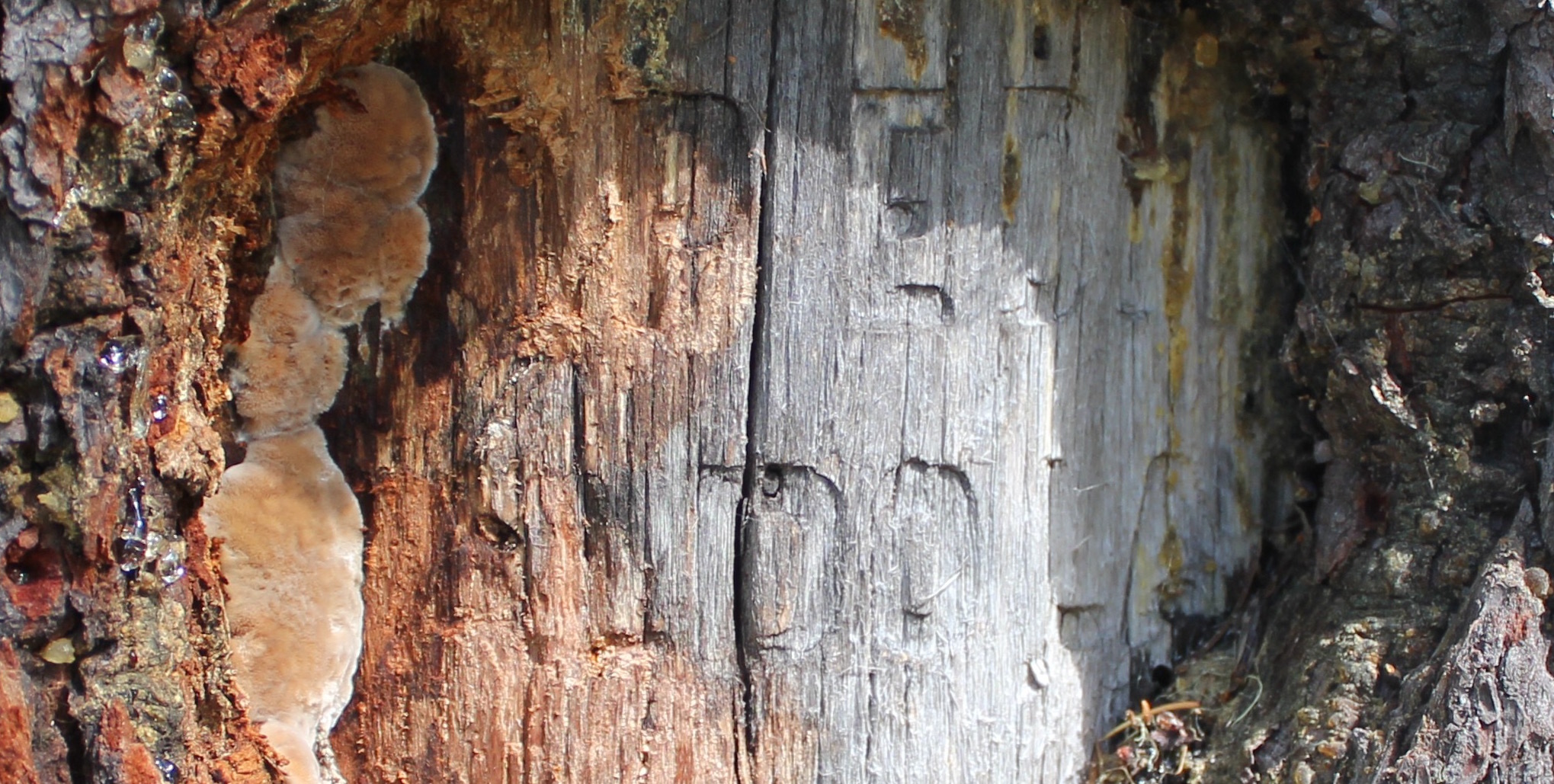
Arriving at the tree, we saw thirteen decades of bark growth had covered the blaze, but the inscription was still legible: “Camp Edith, Waldo Lake.”
After a year of reading Waldo’s papers, speaking with others, and carefully studying an old photo from 1890, my fellow explorers and I stood at Waldo’s lost campsite. Well, “lost” is a relative term. While we celebrated our discovery, we were not the first to locate the tree. People had likely visited here many centuries before Waldo’s time, and in more recent years pitched tents, or stopped for lunch along a lake’s edge, or even tried to solve the mystery of Camp Edith’s location for themselves.
A close-up of the Camp Edith tree, part of the “Camp Edith, Waldo Lake” inscription is still visible.
Standing there, I remembered blissfully walking past this location several years earlier during a day hike, yet never turning to see the blaze on the tree. I shook my head at the wondrous absurdity of my journey, a year of research only to discover a place in the outdoors where I had walked before.
Sharing that moment with others, standing on the shore of a picturesque lake in the middle of the woods, was a sense of nourishment, renewal, and connection. The tree’s inscription shares a nearly forgotten story, but to me, this is not a monument. Waldo’s monument isn’t this inscription, or a lake with his name, or even dusty photos in an archive. Waldo’s monument —his legacy— is about generations of people being outside, connecting with nature, and enjoying Oregon’s beautiful mountains.
Standing in front of the Camp Edith tree.
“The lake stretches away up to the North; crags and peaks tower above us. It is a splendid scene – this source of rivers and cities, hid away, like pure trains of thought from vulgar observation – in the deep bosom of the wilderness buried. Camp Edith sends you greeting, “greeting to Edith from ‘Papa’s Lake.’” -An excerpt from one of Waldo’s 1890 letters
“Children born and reared here might be expected to have something of the wild flavor of nature in their composition.” -Some of the last known words recorded in Waldo’s wilderness diary (between Aug 14- 17, 1907 just before his death)
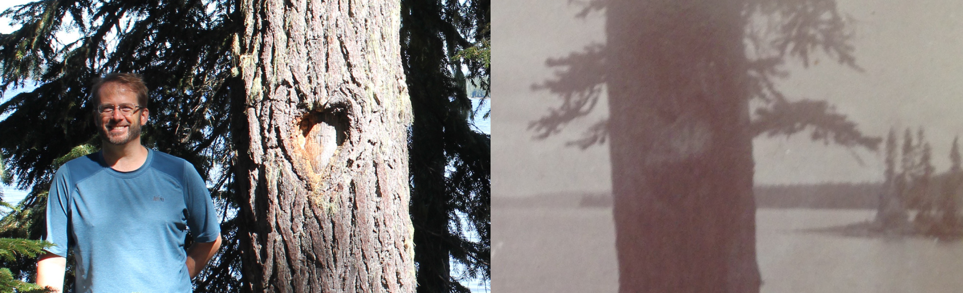
A side-by-side comparison of the heart-shaped blaze seen in 2017 and 1890. You can still see the original heart outline in the bark of the newer photo.
Trip Report:
Leader: Mark Hougardy | Company: Road Scholar | Dates: Three trips, July-August, 2017 | Participants: 15-25 per group | Type: 6-days of field outings and motorcoach travel in western Oregon
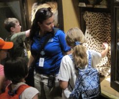
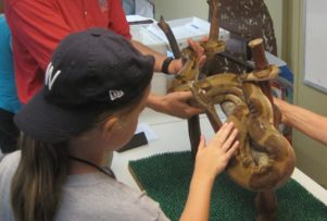
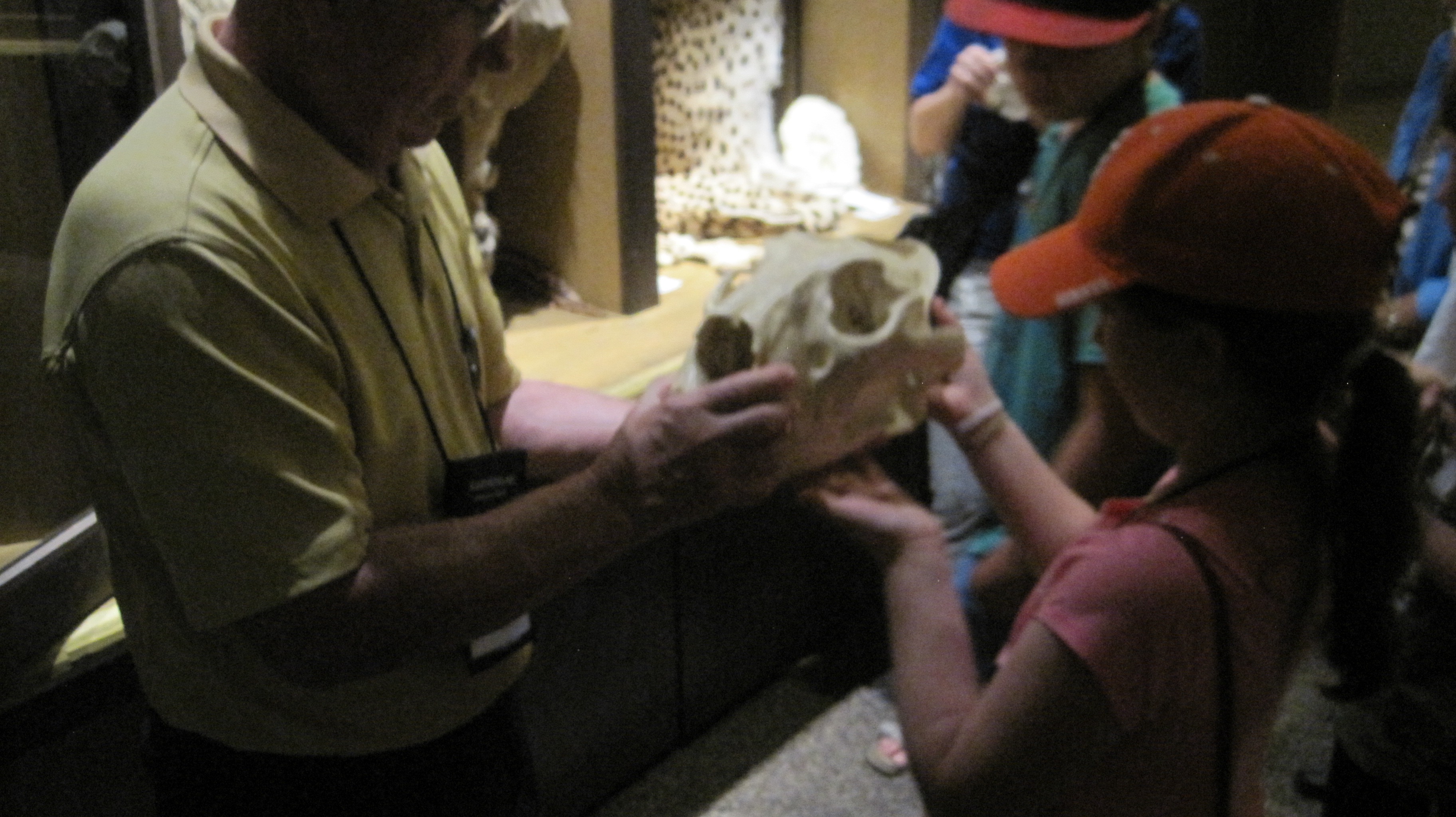
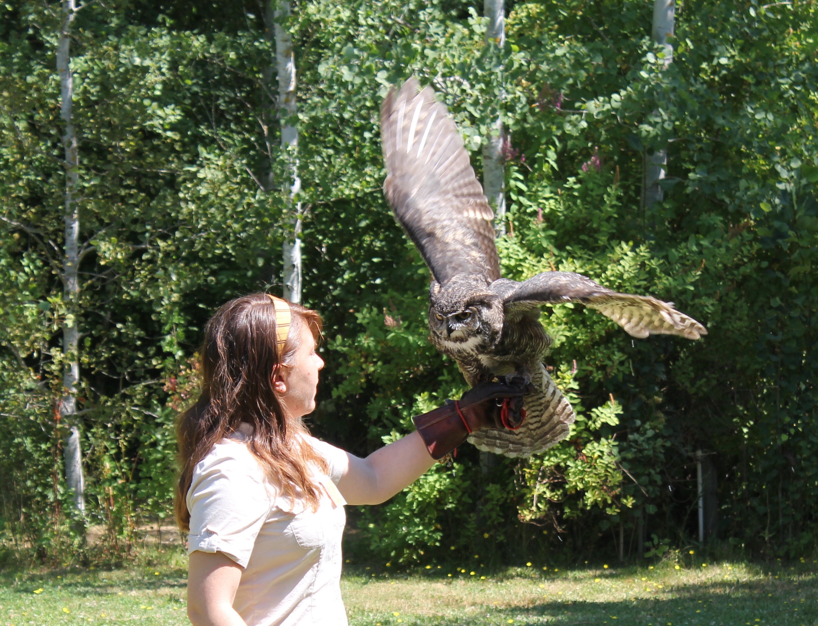
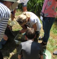
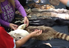
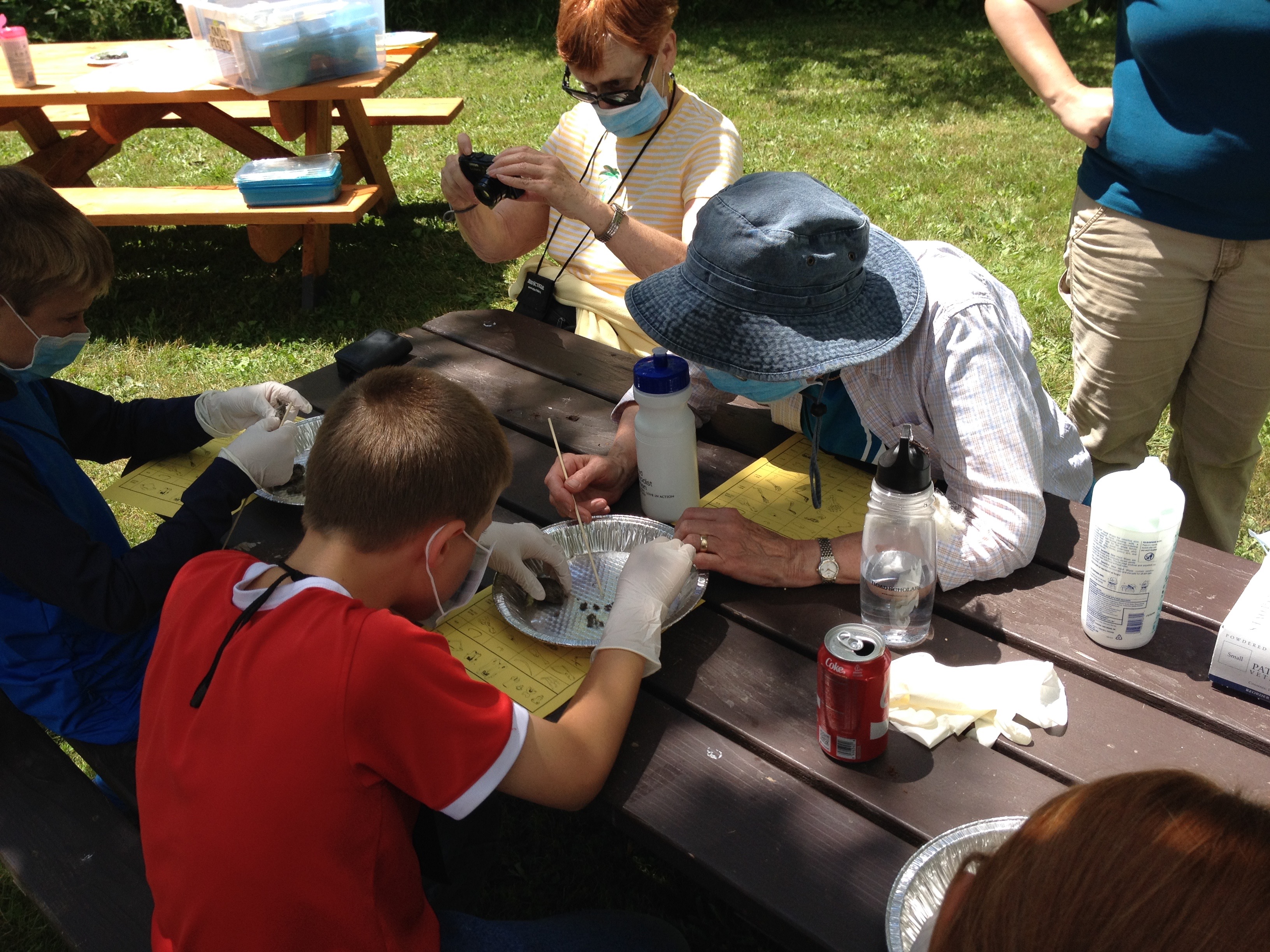
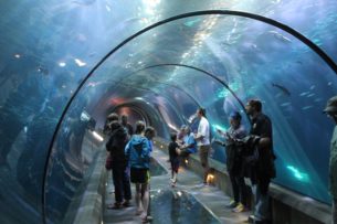
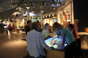
I enjoyed leading this Road Scholar trip for grandparents and grandchildren. It was a fun and educational opportunity for different generations to share time together exploring the world of animals. For my programs, I wanted to create a mentoring environment where, at the end of the program, everyone who is young at heart would think of themselves as beginning zoologists. A zoologist is a curious person (a scientist) who loves to learn about animals and everything they can teach us.
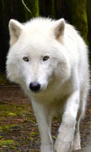
An enrichment activity I created for when the group had to be indoors. A key skill in tracking is understanding how animals move. We did this by measuring the stride and placement of tracks by various animals. This activity reinforced the story of OR-7 “Journey” Oregon’s most famous wolf who has traversed 4,000 miles during his lifetime (so far).
Trip Report:
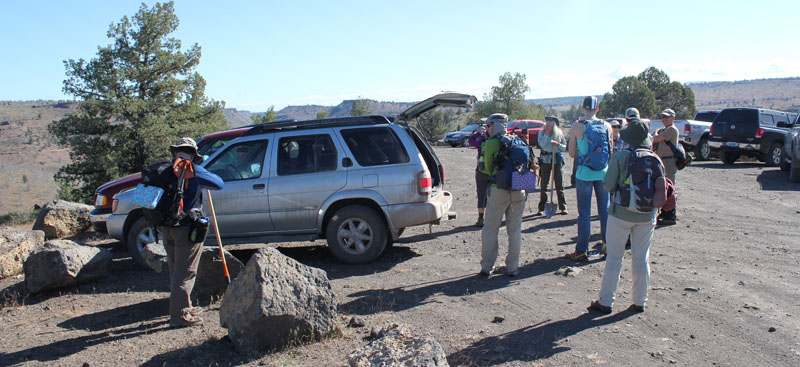
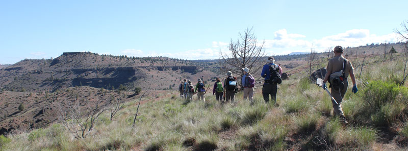
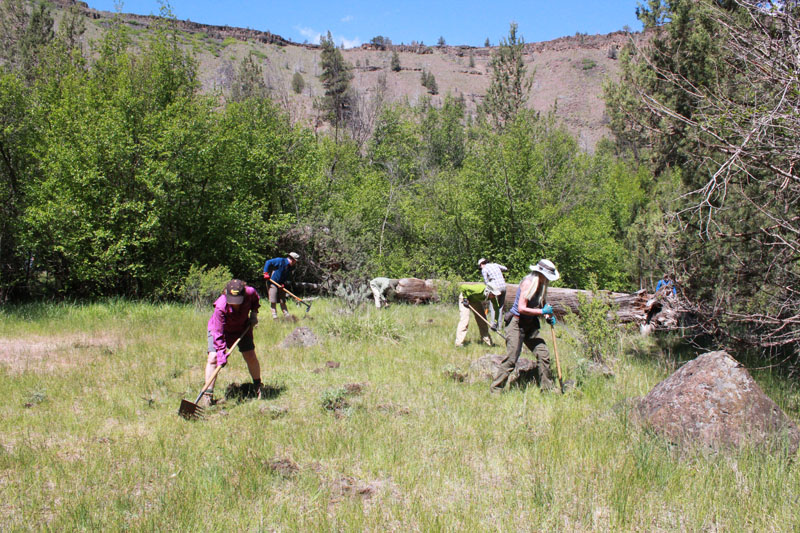
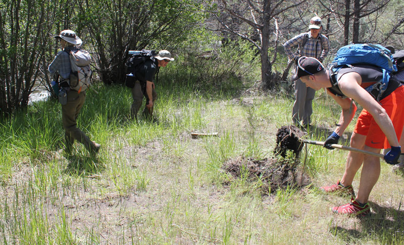
Volunteer Leader: Mark Hougardy | Group: Eugene-based Hiking Club collaborating with the Oregon Natural Desert Association (ONDA) | Dates: May 22, 2017 | Participants: 6 | Type: Weekend Camping & Restoration Work
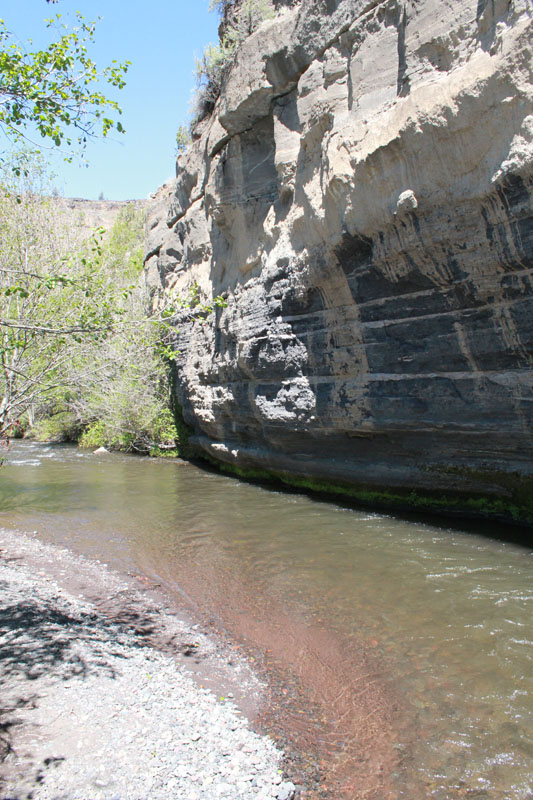
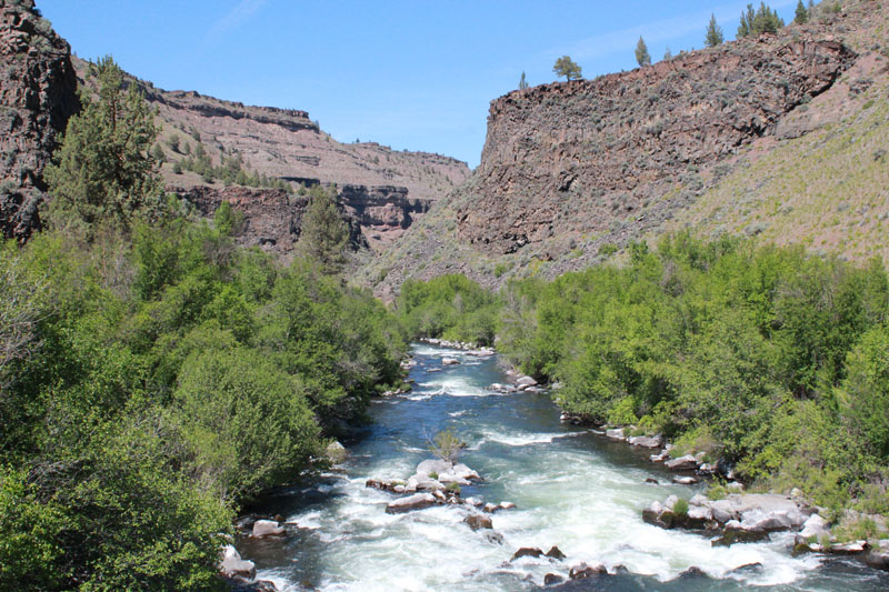
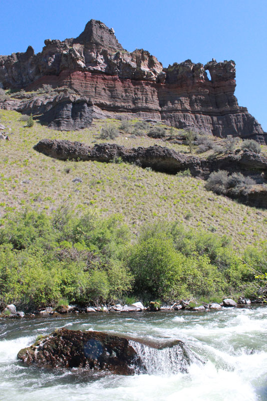
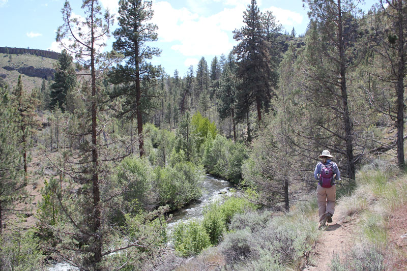
The Whychus-Deschutes proposed Wilderness is a rugged and beautiful landscape in central Oregon. Driving here requires a vehicle with high clearance and some sturdy hiking shoes for the remaining distance. It is a place of weathered cliffs, cold streams, and rocky canyons. If you have observant eyes you might even see bald eagles flying overhead. A prominent landmark is Alder Springs. The mainspring spontaneously gushs from the dry ground at an impressive 60 gallons per second. These cool waters flow a short distance into the picturesque Whychus Creek and a few miles further it joins the turbulent water of the Middle Deschutes River. These unique waterways provide spawning habitat for salmon, steelhead, and are central to all life in the area. This wilderness is prominent in fueling the region’s robust outdoor recreation opportunities, tourism industry, and a high quality of life. The Whychus-Deschutes landscape is an asset, yet it lacks permanent protection.
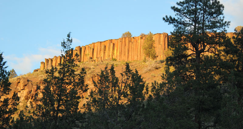
The first evening allowed for some hiking and enjoying the local sights. The ridge above the campground offered wonderful views of basalt columns. The columns were between 80 and 100 feet in height.
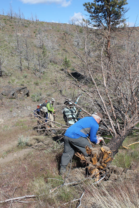
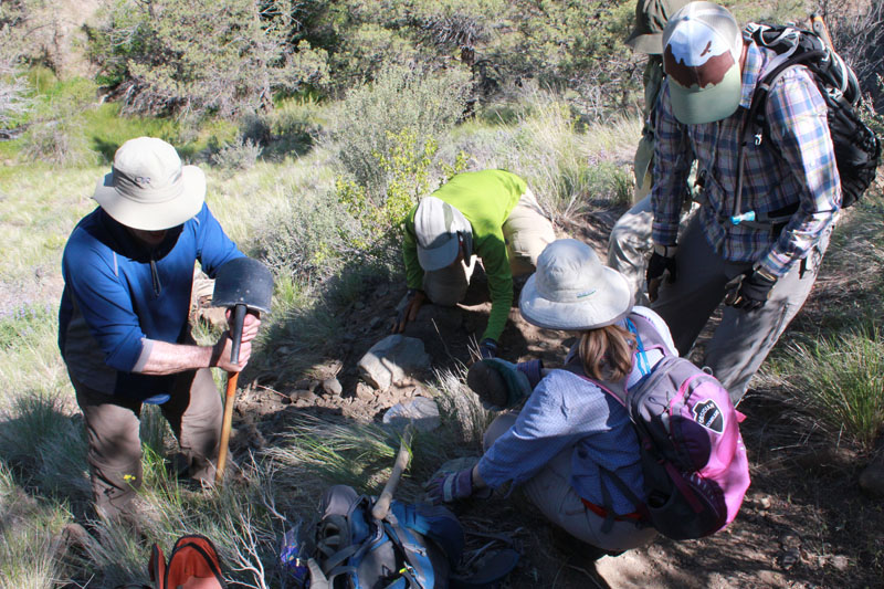
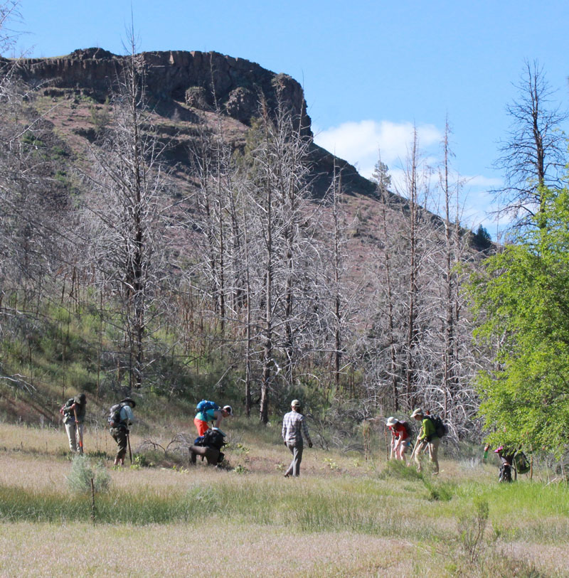
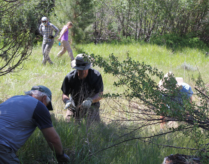
I wanted to learn more about protecting this land so I led a group of fellow eager hikers. We joined several other volunteers for an extended weekend of restoration work with the Oregon Natural Desert Association (ONDA). During the summer months, this sensitive area can be hammered by an influx of visitors who are seeking their interpretation of this place. We were there to learn about the natural history, rebuild trails, fix up campsites, and remove some invasive plants that were taking resources from native species.
First, a shout-out to ONDA. Learn more about ONDA’s great work and how you can help at onda.org
Here are some photos of our restoration weekend:
The next morning, we drove to the Alder Springs Trailhead and gathered our gear.
This is a stark and beautiful country. Our route was about three miles one way. We worked the entire distance down the trail.
Volunteers jumped to it keeping the trail open.
This water bar (a small dike that prevents erosion on trails) had filled in and was no longer functioning. Our team rebuilt this and a good many others that day. The green in the background is courtesy of Alder Springs which flows at the base of the canyon.
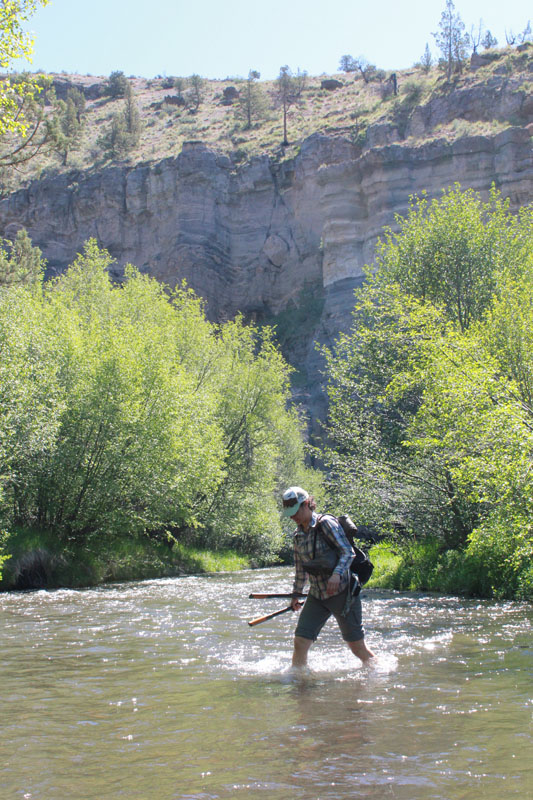
Our host, Gena from ONDA, is crossing Whychus Creek.
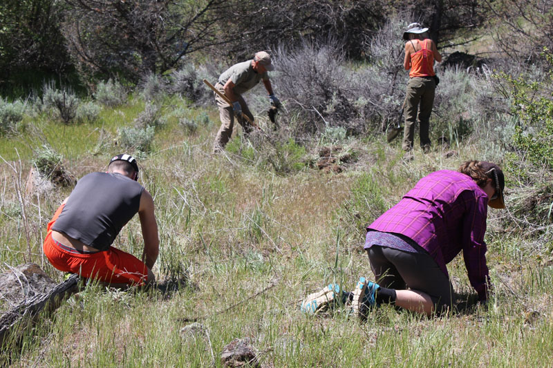
Our group is removing an abundance of Knapweed from a meadow. Knapweed can quickly take over an area and choke out native vegetation.
The creek skirted along the base of this amazing painted cliff. The horizontal bands displayed a multitude of geologic layers. The cliff’s face was streaked with gray which oozed out during recent rains. Several of us enjoyed lunch at this picturesque location.
Our work group is removing a large outcrop of Mullein. Mullein adapts easily to natural meadows and can outpace native plants.
An amazing view looking down Whychus Creek.
We enjoyed a well-earned break at the confluence of Whychus Creek as it pours into the Deschutes River. This view is several hundred feet downstream from the confluence. The scenery here is spectacular.
The next day we were at it again. We easily spent two hours pulling Knapweed in just this little meadow.
More Knapweed! One plant was so tough it snapped a hand trowel.
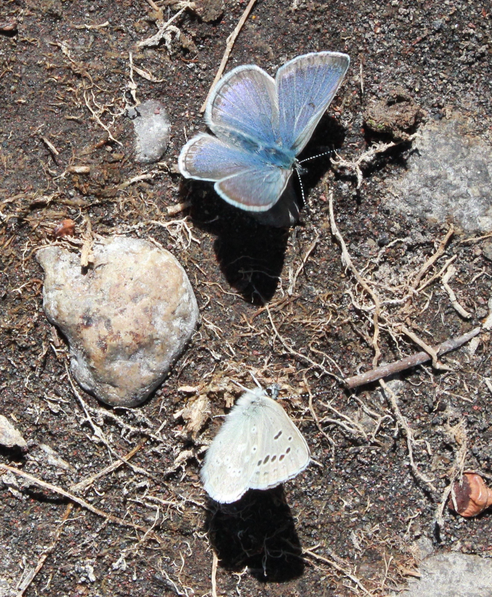
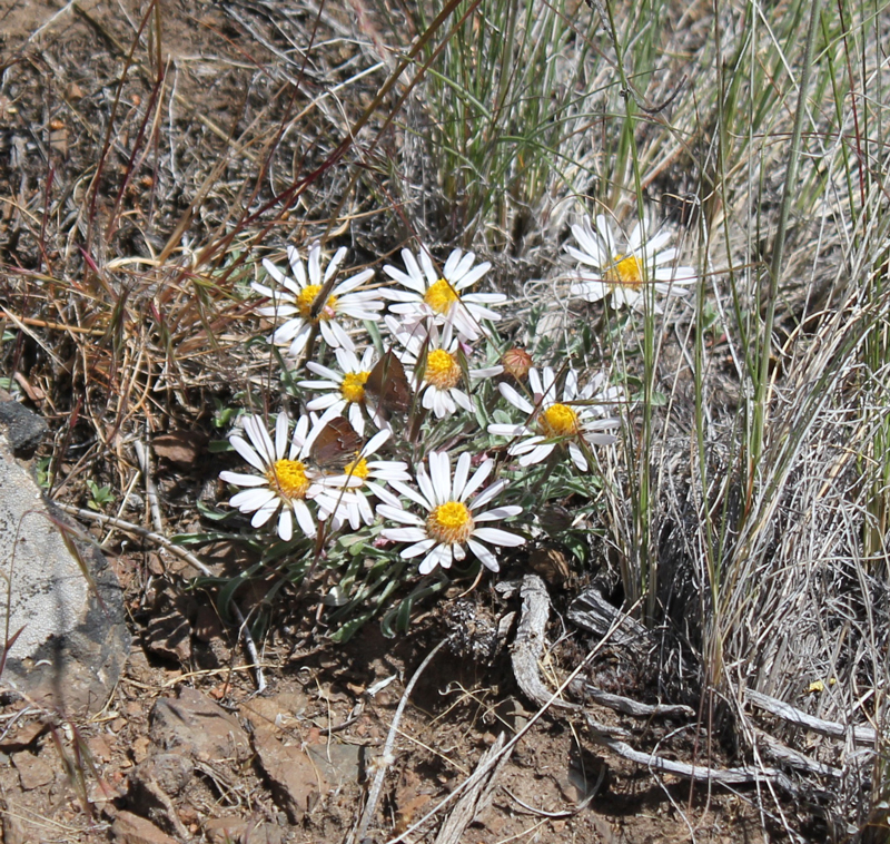
Amazing colors on these butterflies! Animals we saw on this trip included two bald eagles, turkey vultures, several meadowlarks, a robin, one gemstone-colored Lazuli Bunting, scores of butterflies, and two snakes. Sadly, we saw four deceased deer, victims of an aggressively cold winter.
Our group removed an illegal fire ring fifteen feet from the creek. We restored this sensitive habitat as best we could.
Such simple, yet complex, beauty can be observed here. Note the small butterflies.
The last of our group returns down a dusty path after a long and rewarding weekend.
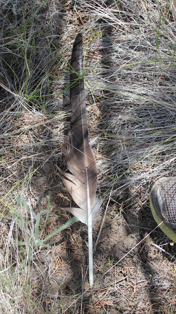
A true delight was spotted next to the trail. This is believed to be a primary feather of a Bald Eagle (possibly from a sub-adult). The top edge of a trail shoe is included for scale. This feather was discovered near the final hour of our restoration work – helping to protect public land. Seeing it was a welcome gift.
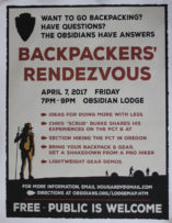
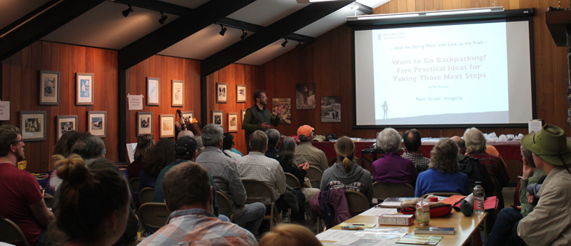
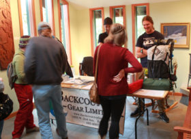
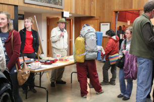
Volunteer Organizer: Mark Hougardy | Location: Eugene-based Hiking Group Lodge | Date: April 2017 | Duration: 1 day | Participants: 80+ | Type: Outreach Event
The Backpackers’ Rendezvous helps hikers, backpackers, and anyone curious about the trail to network, learn, and do more with less. I’m happy to have organized the event and contributed to Eugene’s backpacking community.
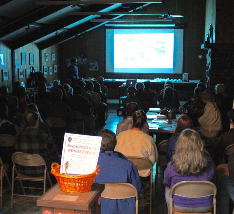
An evening of rain, wind gusts, and downed trees could not deter seventy hearty folks of all ages and skill levels from attending the second Backpackers’ Rendezvous held at a local lodge in Eugene, Oregon.
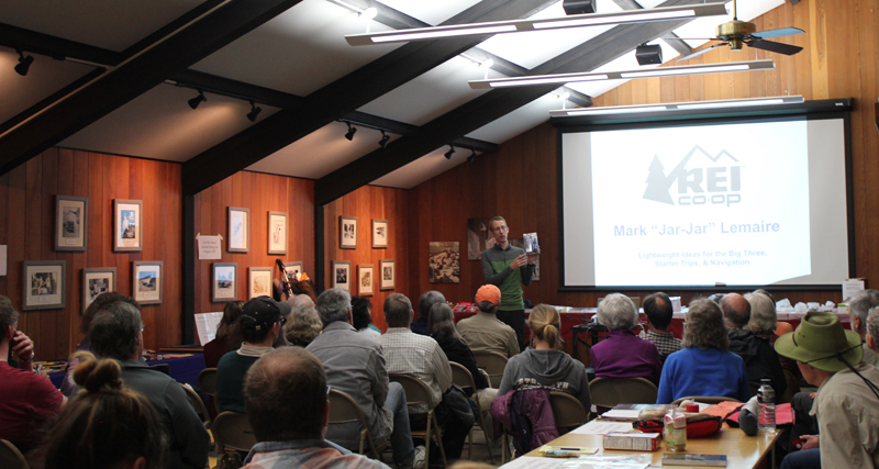
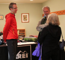
The first hour includes presentations from PCT and AT thru-hiker Chris “Scrub” Burke with tips on approaching a large hike, REI’s Mark “Jar-Jar” Lemaire on researching lightweight gear options, and Mark “Grub” Hougardy on five tips for starting a section hike on Oregon’s PCT.
Presenters from Left to Right: Mark “Grub” Hougardy rendezvous organizer, Mark “Jar-Jar” Lemaire of REI, and Chris “Scrub” Burke a PCT/AT thru-hiker.
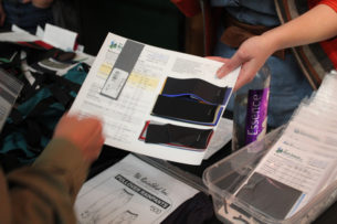
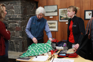
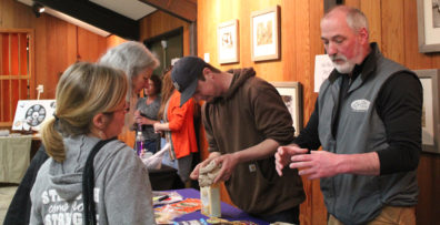
The second hour included knowledge tables, pack shakedowns, and interactions with local outdoor retailers and thought leaders, including lightweight ideas for the big three with REI-Eugene, staying warm and dry with Backcountry Gear; resources for making your gear with the Rain Shed, staying safe outdoors with a hiking club’s safety committee, hiking Oregon’s coast with the National Coast Trail Association, and dry food options with Capella Market.
One of the best quotes during the event came from a woman in her thirties, “I want to go backpacking and don’t know where to start. I came here to find out more.” Thank you to everyone who helped enrich and strengthen the backpacking community in Eugene.
Chris “Scrub” Burke, PCT & AT thru-hiker shares his lightweight tips.
Mark “Jar-Jar” Lemaire of REI on “Lightweight Ideas for the Big Three, Starter Trips, & Navigation.”
Mark “Grub” Hougardy on “Want to Go Backpacking? Five Practical Ideas for Taking Those Next Steps”
Trip Report:
Volunteer Leader: Mark Hougardy | Group: Eugene-based Hiking Club | Dates: November 7, 2016 | Participants: 6 | Type: University of Oregon Archives Visit
On this sunny day in November, our small group spent several hours with the original writings, journals, and photographs of a true champion of nature – John B. Waldo.
Waldo was an ardent conservationist, he’s been referred to as the west’s David Thoreau and even Oregon’s John Muir. Waldo was known for venturing into the Cascades, often spending months at a time, and recording his findings of this dynamic and vibrant landscape.
Over the course of his life, Waldo worked as an explorer, legislator, and chief justice on the Oregon Supreme Court, all the time helping to preserve land in the Cascades. He envisioned a protected band of land along the crest of the Oregon Cascade Range that ran the entire length of Oregon. This goal became his personal mission.
On September 28, 1893, the Cascade Range Forest Reserve became a reality and 5 million acres were protected.
Today, we can experience his legacy in the protected lands and open spaces of the Cascades from Mount Hood south to the border with California, that include: Crater Lake National Park, Mt. Hood, Willamette, Umpqua, Rogue River national forests, and other public lands. And in the middle of this grand monument are the deep and pristine waters of Waldo Lake, named in his honor.
Curiously, little is written about Waldo. The judge was a philosophical and reflective person who did not directly seek publicity. But possibly this muted message is part of his larger voice – appreciating the beauty of Oregon is best experienced by hiking on the trails, exploring in the mountains, traveling in the wilderness, and experiencing the (as he wrote) “untrammeled nature and the free air.†Discover Waldo’s story for yourself. The University of Oregon archive is free to use – Knight Library, Paulson Reading Room.
Reference: John B. Waldo and William G. Steel: Forest Reserve Advocates for the Cascade Range of Oregon, Gerald W. Williams
Umpqua and Willamette National Forests
http://www.foresthistory.org/Publications/Books/Origins_National_Forests/sec21.htm
Here are just a few of the photos from his collection:
Trip Report:
Volunteer Leader: Mark Hougardy | Group: Eugene-based Hiking Club | Dates: September 10-11, 2016 |Participants: 10 | Hiking 8 miles | Type: Day Hike & Tent Camping
Visiting Big Bear Camp is like inhaling a fresh breath of forest air: it’s invigorating.
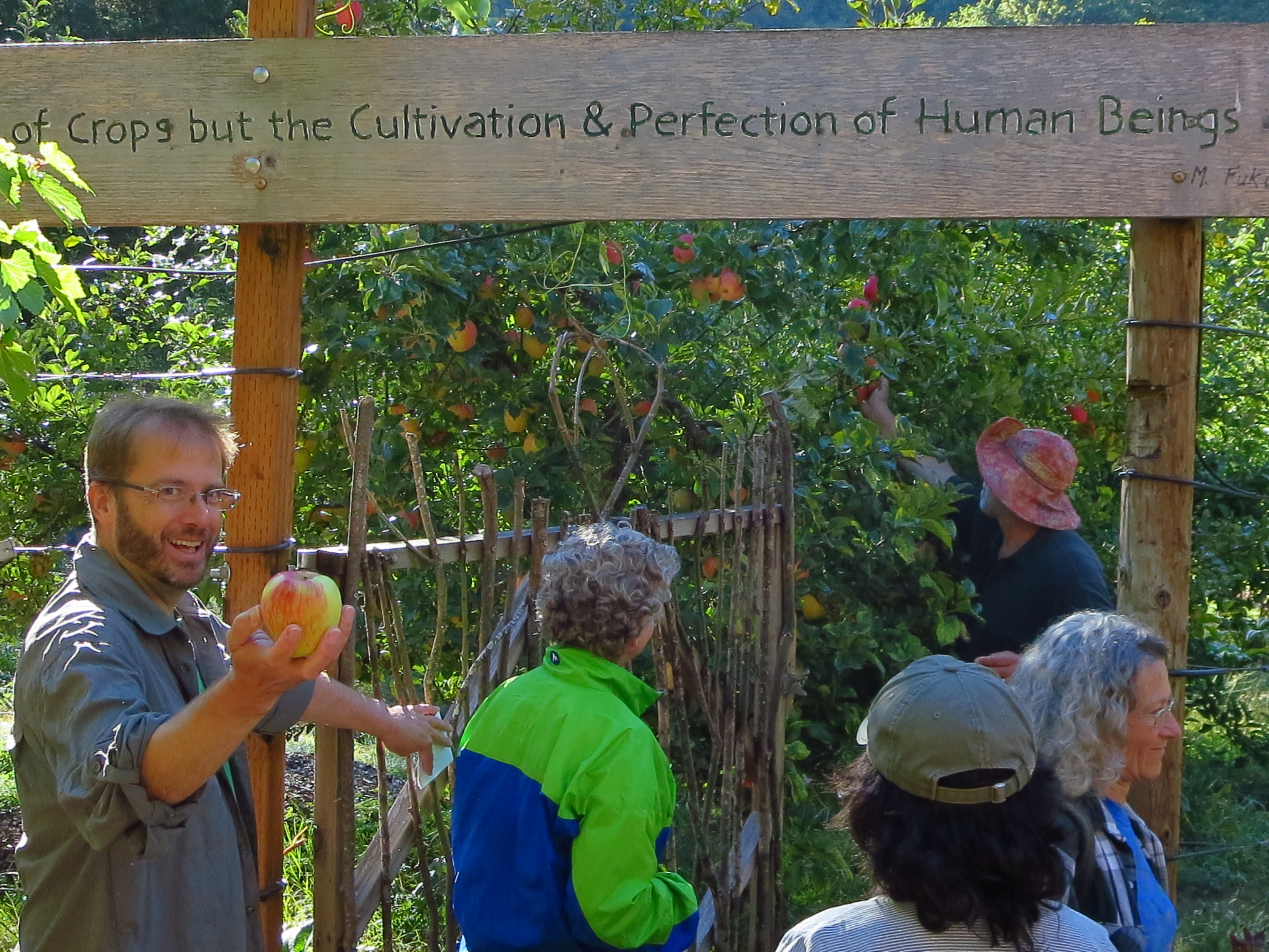
That’s me with the apple. The lodge’s owners Hal and Tonia quickly welcomed us as we arrived at their retreat/garden/camp in the woods. Hal offered us delicious Honey Crisp apples directly off the tree to enjoy on our hike. [Photo by Darko]
Our 8-mile hike started up a reclaimed forest road, past cedar trees used by mountain lions for scratching, across the deep ravine where a rope was needed (shown), and finally to a deceptively steep forest road.
After a good heart-pounding climb, we arrived at the “Secret Spot,†the highest location within the Coast Range in Lane County. We had climbed roughly 1,600 feet from where we started but the view made up for it. Looking east we could see 130+ miles in the distance: in the north, Mt Hood, followed by Mt, Jefferson, Three-Fingered Jack, North, Middle and South Sister, Mt. Bachelor, and finally 125 miles further south, Diamond Peak.
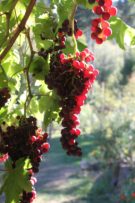
We rested, enjoyed some lunch, and then traversed back down the forest road to several turnoffs, and a forest trail that deposited us back at Big Bear. That evening we shared a potluck with neighbors; everyone’s gardens were abundant and we and enjoyed the bounty of harvest-time meals. Later that evening we enjoyed guitar folk music by the fire and enjoyed freshly picked grapes (shown below). In the morning we hung out, explored the local creek, enjoyed the garden, and planned a route for a 42-mile, 4-day backpacking trip to the coast for next spring.


 Our plan to hike to Tamolitch Falls (Blue Pool) was cut short when a sign stated a mile of trail was closed because water had flooded the path in places to a depth of 3 feet. Even with the closure, there was plenty to appreciate further upstream at Clear Lake with its crystalline waters and turquoise colored Great Spring. Animals that were seen along the trail also appeared to appreciate the warmer weather as fish jumped in the lake, several species of birds flew overhead, and a garter snake warmed itself on the rocks. In shaded areas winter still managed to hold its grip as large patches of snow remained. Springs spontaneously appeared on the trail sometimes forming small ponds, and at one point, all of us were mesmerized by a plate-sized vortex that had formed in such a pool. After a solid day of hiking, we visited Belknap Hot Springs for a relaxing soak. Because we timed our visit before the Memorial Day crowds the U.S. Forest Service campground was basically empty. Our campsite was green with moss and located next to a white rushing stream that looked like it was born from a Tolkien novel. The next day we enjoyed the comfort of a morning campfire, broke camp, and explored several more miles of trail before heading home.
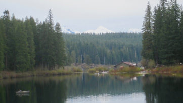
 Â Â

 It’s difficult to imagine today, but between 1907 and 1927 streetcars (commonly referred to as trolleys) ran along 18-miles of electrified tracks in Eugene, Oregon. Their comforting clickety-clack as the wheels passed over connections in the tracks were heard on four routes in this city of 11,500 people. Only the finest cars were used and each was superbly-crafted with heaters and rattan seats. At 45-feet in length, they could carry up to 100 passengers. The cost per trip was 5 cents for a child and 10 cents for an adult. Our walk will help re-discover this curious icon of the early 1900s using old photos and traversing the Fairmount trolley’s 5.5-mile route. We walked the Fairmount’s route in its direction of travel from the train station, through downtown, across the University of Oregon’s picturesque campus, passing historic residential neighborhoods, crossing over some of the last remaining visible tracks, and back. Although many of the trolley’s tracks are not visible today, look carefully, many miles of track from this time are hidden just under the pavement.
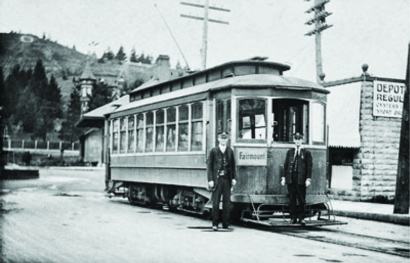


 Volunteer Organizer: Mark Hougardy | Location: Eugene-based Hiking Group Lodge | Date: April 2017 | Duration: 1 day | Participants: 80+ | Type: Outreach Event
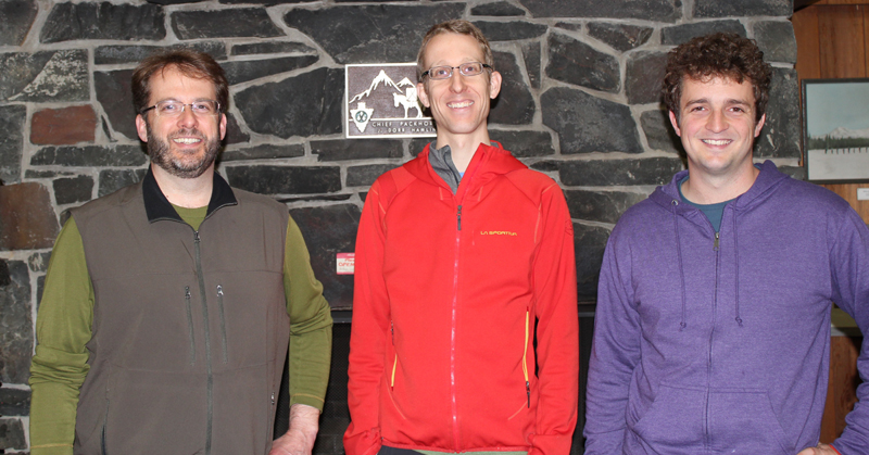


 That’s me with the apple. The lodge’s owners Hal and Tonia quickly welcomed us as we arrived at their retreat/garden/camp in the woods. Hal offered us delicious Honey Crisp apples directly off the tree to enjoy on our hike. [Photo by Darko]
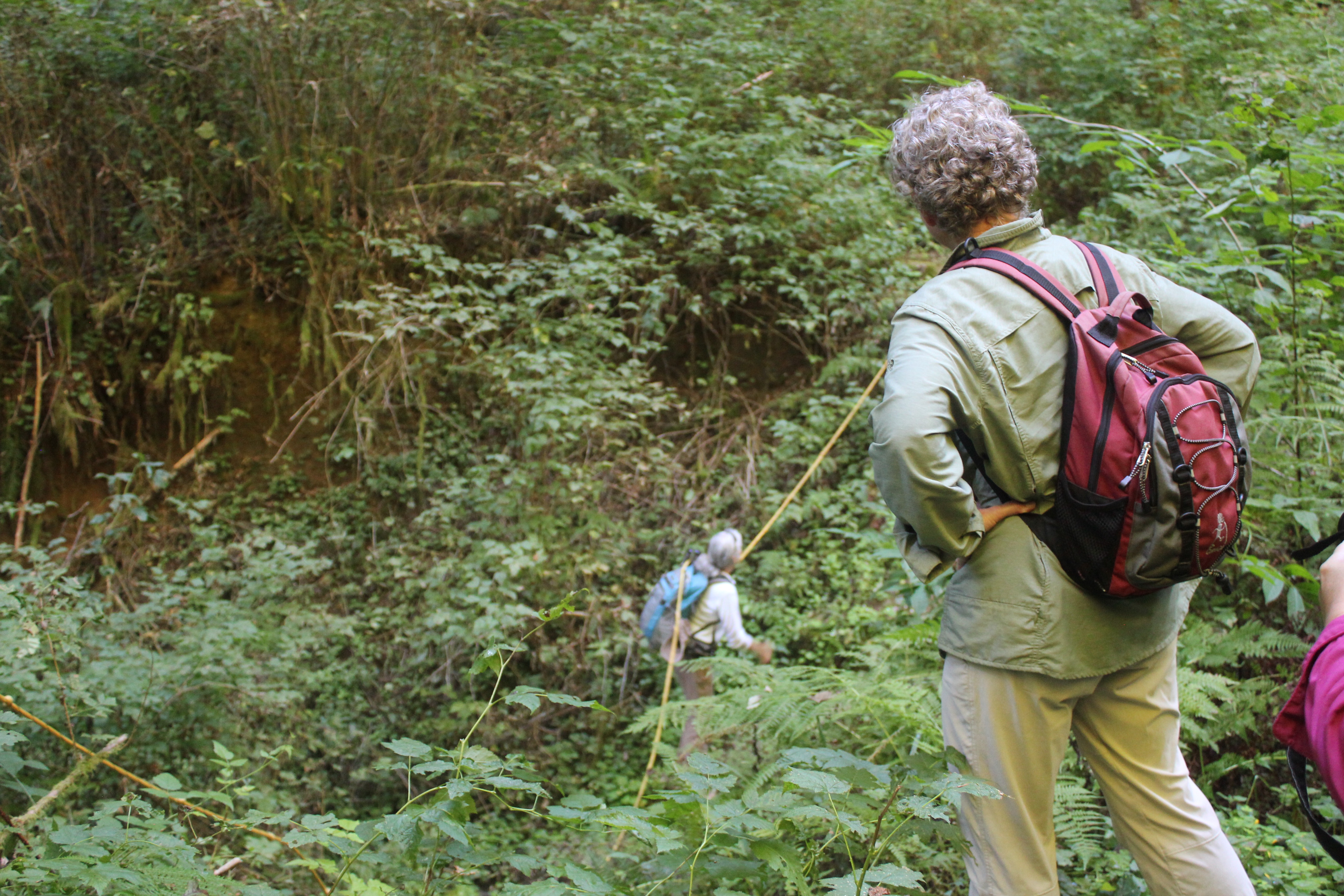 Our 8-mile hike started up a reclaimed forest road, past cedar trees used by mountain lions for scratching, across the deep ravine where a rope was needed (shown), and finally to a deceptively steep forest road.
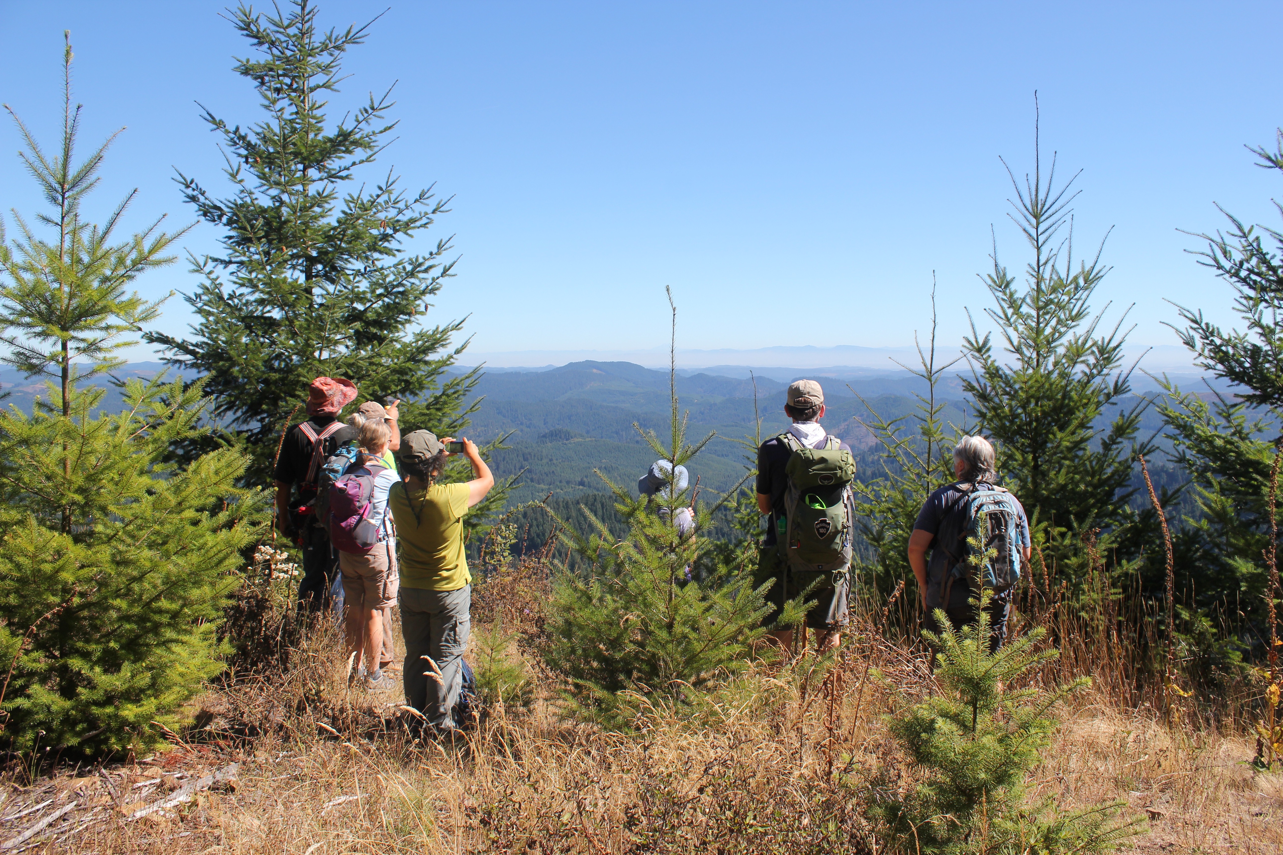 After a good heart-pounding climb, we arrived at the “Secret Spot,†the highest location within the Coast Range in Lane County. We had climbed roughly 1,600 feet from where we started but the view made up for it. Looking east we could see 130+ miles in the distance: in the north, Mt Hood, followed by Mt, Jefferson, Three-Fingered Jack, North, Middle and South Sister, Mt. Bachelor, and finally 125 miles further south, Diamond Peak.
 We rested, enjoyed some lunch, and then traversed back down the forest road to several turnoffs, and a forest trail that deposited us back at Big Bear. That evening we shared a potluck with neighbors; everyone’s gardens were abundant and we and enjoyed the bounty of harvest-time meals. Later that evening we enjoyed guitar folk music by the fire and enjoyed freshly picked grapes (shown below). In the morning we hung out, explored the local creek, enjoyed the garden, and planned a route for a 42-mile, 4-day backpacking trip to the coast for next spring.