Trip Report:
Volunteer Leader: Mark Hougardy | Organization: Eugene-based Hiking Club | Dates: December 2017 | Participants: 19 | Type: Urban Walking Tour
Over the past months in Eugene, Oregon, a number of building-sized murals have started appearing – some almost overnight. I needed to check out this gigantic expression of creativity, so I offered an invitation for an informal walk. Surprisingly, nineteen people joined me! The murals are part of the 20×21 project, an initiative to create 20 or more world-class outdoor murals in Eugene between now and the premier track and field 2021 IAAF World Championships. As a runner myself, I am really excited about this event. After the walk, some of us enjoyed a tasty lunch of pizza and salad (the vegan pizza there rocks; an image is included below). Here are a few photos:
I’m an outdoor guide because traveling and nature experiences can be powerful teachers. Here is one such story about how an encounter with a whale helped others (and myself) to grow.
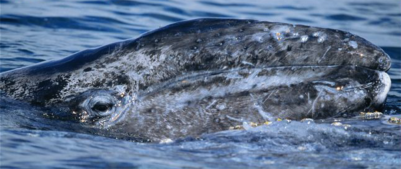
Two dozen people slammed themselves onto the starboard railing of our small whale-watching vessel. It listed uncomfortably sideways as people gawked. Just feet away, a baby gray whale –the length of a long kayak– floated in the rough surf. Its large black eye seemed to study each of us. Everyone was absorbed in the experience. They had forgotten their discomfort in the previous hour and a half. Up until then, it had been a bad day to be on the water: we had not seen a whale – not one! Our ship sickeningly rolled side to side in the deep troughs, the smell of diesel and vomit permeated our nostrils, cold January weather nipped our skin, the sky was oppressively overcast and the wind-chapped our lips. Worst of all was seasickness. I heard participants simultaneously cursing my name as they barfed over the boat’s edge. Some made multiple trips to the side. As they staggered back, a sick yet relieved look crossed their faces. I received several vexing glances. The words were blazed in their eyes, “Why did you make me come out here?”
It was a hard day of whale-watching. My camera had broken too, then again maybe it was for the best. This was the first whale-watching tour that I had organized for a group and it was going horribly. I secretly wanted this trip to be over, to slink home and erase it from my memory. I wanted the trip participants to forget about it, too.
When the young whale appeared the trip was born anew. A marine biologist shared her commentary: the mother was likely on the seabed feeding and would be returning shortly. The juvenile was not lost, just hanging out at the surface.
Amazingly the whale stayed parallel with our ship for about twenty minutes. Then several hundred feet away from a large mass the size of a city bus rose to the surface. She dramatically announced herself by ejecting a plume of air in a geyser-like spray. This was the mother! The smaller whale joined her and they swam off together.
The people were seasick and green in appearance and happy to return to port. I had organized the outing as a way for overscheduled tech workers to connect with their families in the outdoors, but had I inadvertently turned more people off that helped? This was the first of several trips where unexpected situations and hardships caused me to question my outings and slowly I became disillusioned.
I stopped leading nature adventures.
Fast forward five years.
I was at an outdoor market selling youth-in-nature backpacks. A man approached and we talked for a minute, then he said, “Hey, you’re that guy who led the whale-watching trip.” He briskly shook my hand and said, “Thanks.” I wondered if we were talking about the same excursion. He told me about that day, I listened with interest and then in dismay. He and his mother-in-law despised one another, and for spite, they created ever-increasing hardships for each other, often to the detriment of family members. One day, he saw my whale-watching trip advertised and suggested a pleasant outing for the entire family. But his coyness was masked with a desire that his mother-in-law have a miserable experience. In fact, she hated that whale-watching trip and wanted nothing to do with him again. To his glee, she stopped visiting altogether! Eventually, her lengthy absence spoke to his better nature and he felt guilty for his childish behavior.
Almost a year later she returned for a holiday visit. The conversation at the dinner table was palpable; everyone in the room knew the two were enemies. As the serving plates moved about she looked at him and said, “Remember that whale-watching trip?” He suspected a trap but replied, “Yes.”
She looked directly at him and with a heartfelt voice said, “Thank You.” The man’s mind was blown.
She shared her story:
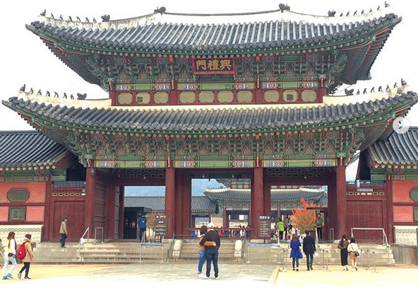
The mother-in-law suspected the man invited her along so she would get sick on the boat, but she went anyway. It was a most unpleasant time. But, when she viewed the whale up close and looked into the creature’s eye, she saw there was something there, and something awakened in her. She returned home to southern California and was anxious to the point where sleep was difficult. She spent more time outside and took long walks. She started to walk to the store. Her walks became hikes and she asked her friends to join her, but they were “too busy”, so she went by herself. Later she joined a local hiking club. On these outings, she saw hills and valleys near her house that she had never seen despite having lived in the area for decades. On one hike in the Mojave Desert, she saw a magnificent vista and it inspired her to make a big decision. She decided to visit a location she had always dreamed of since she was a child: The Gyeongbokgung Palace in South Korea. Then she announced to the family around the table, “I’m leaving for Seoul in three weeks.”
The iconic Gyeongbokgung Palace, Seoul, South Korea. Image copyright Korea Tourism Organization.
The man was shocked and ashamed. After dinner, the two of them had a heart-to-heart talk. The trickery and malice evaporated and they started to heal their relationship. Several weeks later the mother-in-law traveled to Korea and had a wonderful trip. In the months that followed, she visited the family more often and the two of them started to go on short walks, then longer walks. They both enjoyed being outside, even having deep conversations. A year later, they had become friends and hiking buddies. The entire family was happier and everyone was even talking about an overseas trip.
The man finished telling me his tale. Before disappearing into the crowd he said, “Thanks again for the great trip!”
His story was an elixir for me, it helped to renew and strengthen my own passion for connecting people with the outdoors. I started to organize and lead trips once again. Fifteen years later I’m still going strong.
I guide because travel and being in the outdoors teach things that we can only learn by experience. Guiding is at that nexus, the point between being in the now, learning, and living; and it is best shared with others who seek it.
Trip Report: Volunteer Leader: Mark Hougardy | Organization: Eugene-based Hiking Club | Dates: September 10, 2017, | Participants: 7 | Type: Day hike and wayfinding
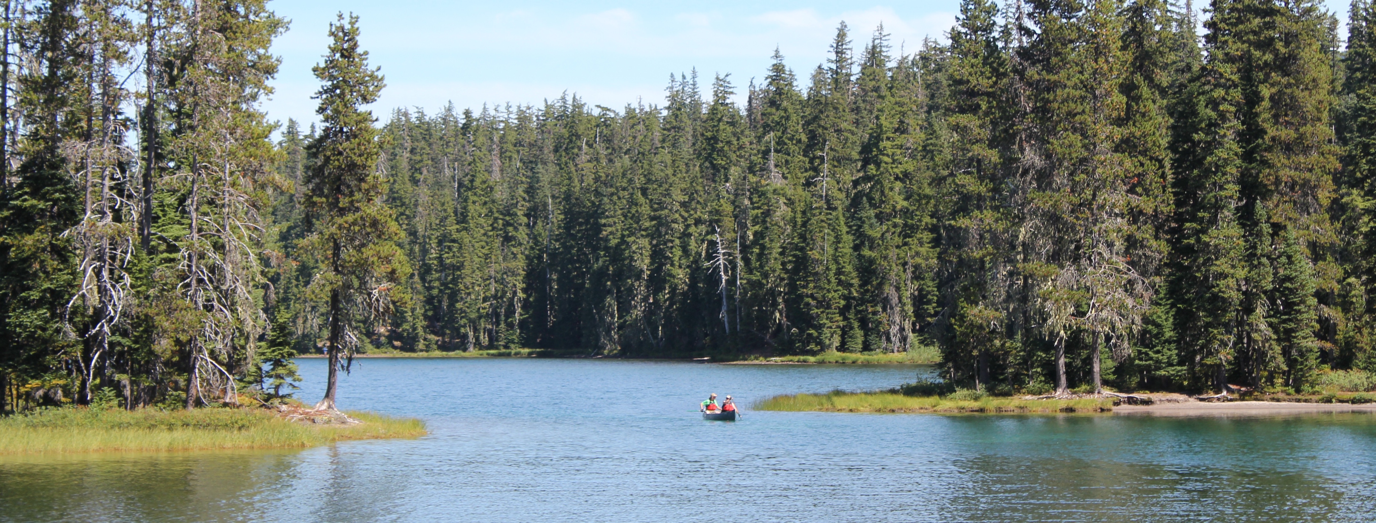
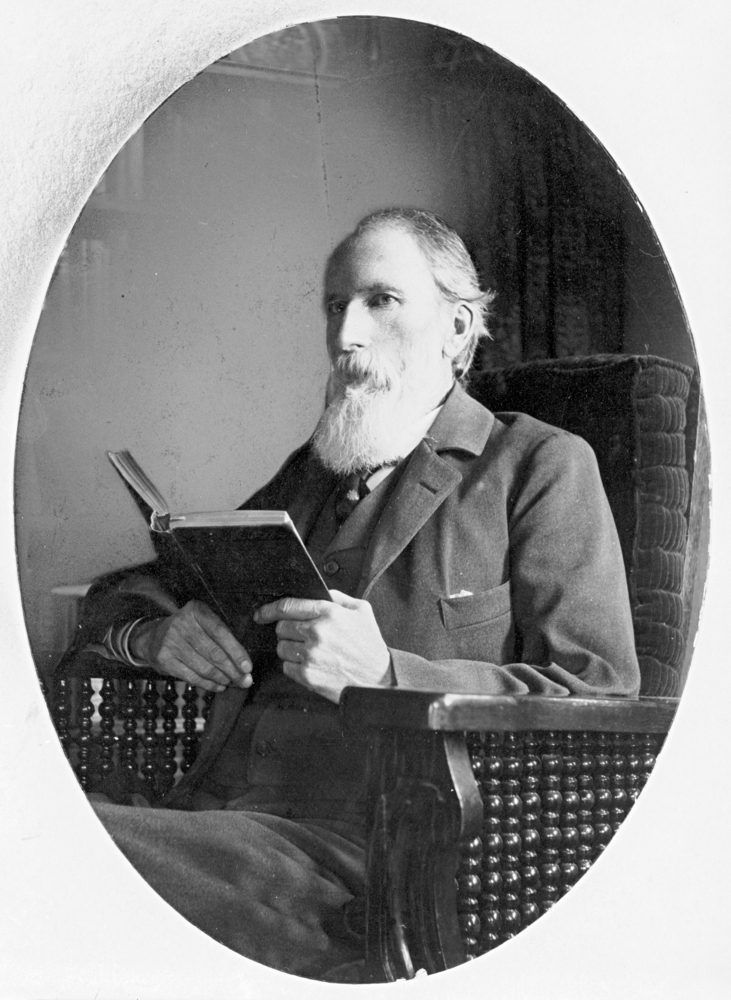
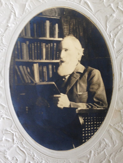
Along the forested backbone of Oregon’s Cascade Range is a large tranquil lake that invites “Where’s Waldo?” jokes. But, laughter aside, Waldo Lake is quiet. For those exploring the hushed shoreline, they might wander upon an old mountain hemlock blazed with the 130-year-old text, “Camp Edith, Waldo Lake.” At first, the blaze appears as an act of modern vandalism, but looking closer at the aged wood a modest story slowly reveals itself. The story is about a child who grew up to become the astute and reserved white-bearded grandfather of Oregon’s public lands. It was his passion that laid the groundwork for six national forests, over a dozen wilderness areas, and even support for Crater Lake National Park. Yet, most who visit these places today, don’t know this man’s name, Judge John Breckenridge Waldo. The few who know his name compare him to Emerson or Thoreau; some even call him “Oregon’s John Muir.”
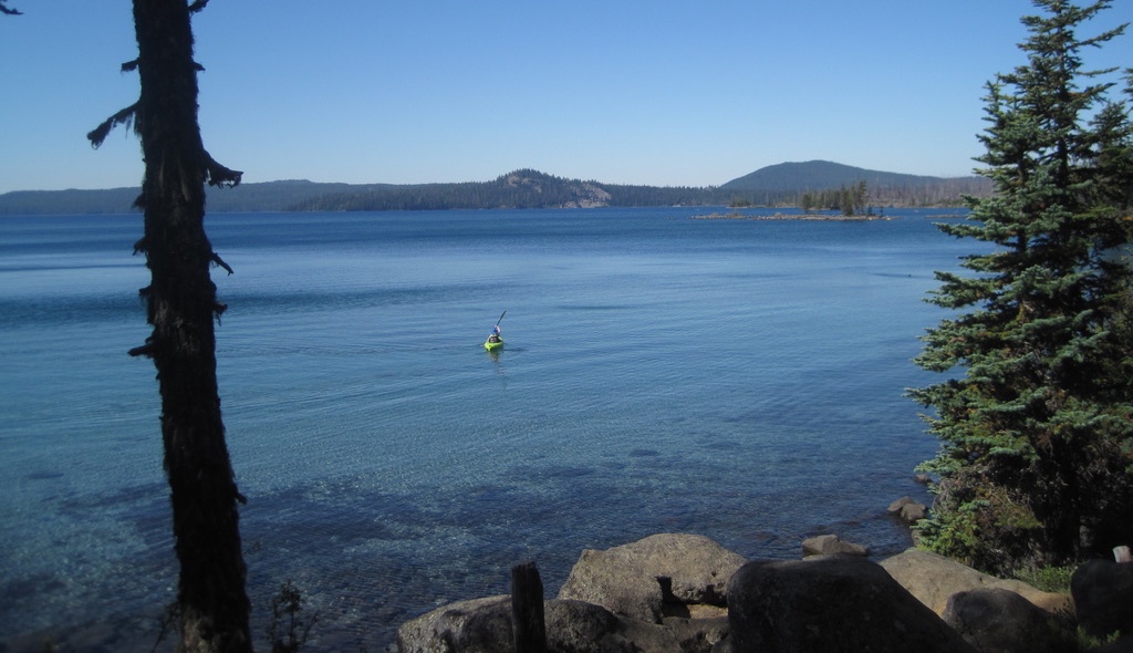
The beautiful Waldo Lake in Oregon’s Cascade Range. Waldo Lake is 10 square miles in area. The lake is rare in that it is a gas-free zone, only wind and human-powered boats are allowed.
My curiosity about John B. Waldo was piqued when I learned that his documents could be found nearby at the University of Oregon Special Collections archive. A visit to the archives was arranged through a local hiking club and several others joined me. A library staff member delivered several old boxes to our table.
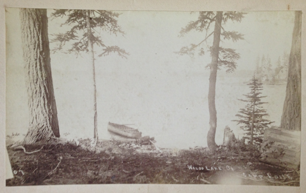
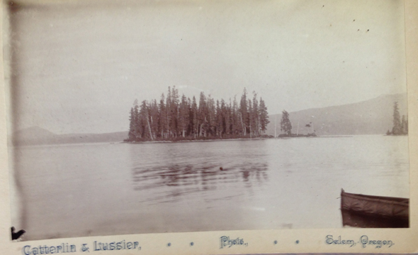
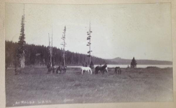
As we carefully reviewed this man’s life, a grainy black-and-white photograph caught my gaze. The photo was etched with the text, “Camp Edith, Waldo Lake.” The picture was dated 1890 and revealed a couple of trees and a canoe. At first, I was stunned by the fortitude and strength involved in hauling early camera equipment and a canoe more than 70 miles or so into the mountains.
Camp Edith, Waldo Lake, Oregon (circa 1890). I have hiked all over Waldo Lake and never encountered Camp Edith. Waldo’s campsite was not listed on modern maps. Where was it?
Then I was curious because none of my fellow hikers had ever heard of this place. I looked at modern maps, but there was no reference to Camp Edith. I looked at maps from the late 1800s and early 1900s, but still found nothing. The more I researched, the deeper the mystery became. This “lost” campsite of Waldo’s was a loose thread in a story, and I just had to pull at it.
John B. Waldo was born in 1844 to parents who had arrived just a year earlier on a wagon train and were new arrivals to the Willamette Valley. Waldo, as a child, had asthma which worsened in the summer as the valley filled with heat and smoke. Seeking refuge, Waldo and his brother made forays into the nearby Cascade Mountains for clean air. Waldo returned often.
As a young man, he studied law, became an attorney, and was eventually elected to the Oregon Supreme Court, even serving as a representative in the state legislature. He loved law and policy but always returned to the mountains, often for months at a time, to write about nature.
Judge John Breckenridge Waldo
From 1877 to 1907, Waldo extensively explored and chronicled —in his words— the “untrammeled nature” of Oregon’s Cascades. He believed that modern life had “narrowing tendencies” on a person and that wilderness allowed difficulties to “be perceived and corrected, and the spirit enlarged and strengthened.”
He had seen the effects of over logging back east and overgrazing in the Cascades by sheep. Waldo imagined a protected place in the mountains where people could escape the toils of life. An individual’s trip would be assisted by an interconnected trail system dotted with lodges. These lodges would be roughly a day’s walk apart, where hikers and travelers could stay, enjoy a meal, and rest. Upon returning from his expeditions, he quietly and diligently advanced such a vision: a 40-mile-wide protected band along Oregon’s mountainous crest stretching 300 miles from the Columbia Gorge to the California border. Waldo spent decades and countless hours increasing public awareness through letter writing, newspaper posts, and using his professional resources to advocate for this vision.
Waldo died in 1907 at the age of 63; he had become ill while attempting to summit Mount Jefferson. His colleagues returned Waldo to his family farm outside of Salem, where he passed. After his death, his writings became missing, but Waldo had started something in the minds of others. In the following years, national forests and wilderness areas began to form a patchwork along Oregon’s crest. Outdoor enthusiasts created clubs like the Mazamas, the Chemeketans, and the Obsidians, all dedicated to experiencing the outdoors. Three of the west’s greatest national park lodges were constructed in Oregon: the Chateau at the Oregon Caves, Crater Lake Lodge, and the crowning gem Timberline Lodge on Mount Hood. Rangers opened campgrounds, trail maintenance volunteers began creating and maintaining hundreds of recreation trails, skiing enthusiasts opened ski resorts, and rafters opened rafting companies. Friends of the Pacific Crest Trail (PCT) worked to span Oregon with this narrow ribbon of trail that crosses the U.S. from Mexico to Canada. In the past few years, via a citizens’ initiative, Oregon voters secured funding so all fifth or sixth-grade students can move from their school classrooms into the outdoors to learn and be immersed in nature.
For almost 80 years, the location of Waldo’s writings and photos was unknown and thought to be lost. In the 1980s, these items were located in an attic and delivered to a conservation organization in Eugene. Eventually, his papers made their way to the University of Oregon archives and can be viewed today by appointment. It was here where I first saw the old grainy photo inscribed, “Camp Edith, Waldo Lake.” Supposedly this was one of his favorite locations. Yet, where was this place?
During the past year, I have been reading, researching, and trying to figure out where Camp Edith might be. I poured over maps, performed internet searches, and reviewed old hiking books but found nothing. I checked with living knowledge keepers: the seasoned hikers, campers, and old-timers in central Oregon. Most only knew about Waldo because of the lake that shares his name. Of the few who knew about Waldo as a preservationist, only a handful had heard about Camp Edith.
A man said he knew of the camp. He suggested that I look at Waldo’s obituary for guidance. One portion stood out. It read, “To him, the mountains with their purpling canyons and glittering snow peaks were a book to which there was no end. The beauty of the hills was a sermon.” Inspiring words, but was I any closer to finding Camp Edith?
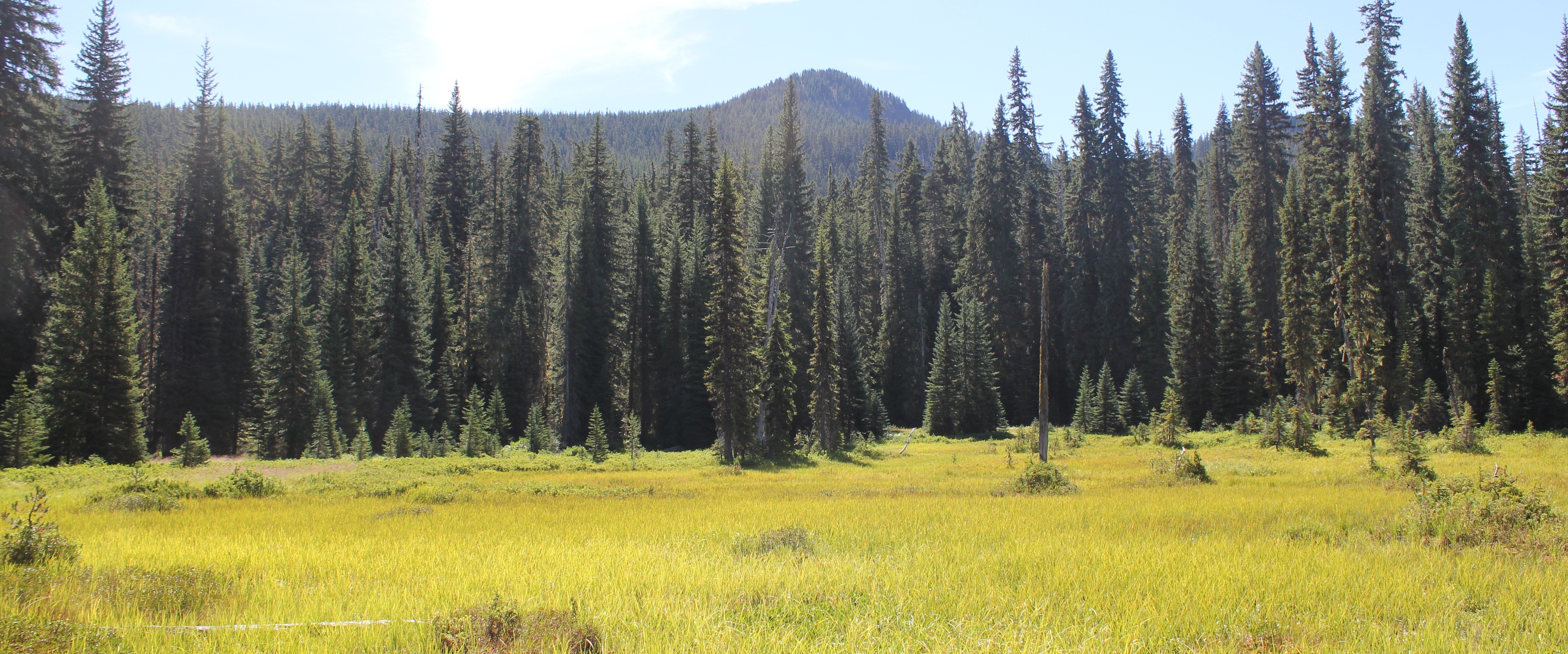
To Waldo, “the mountains with their purpling canyons and glittering snow peaks were a book to which there was no end.” A photo of a meadow and Mount Ray, Waldo Lake area.
Another person, a retired employee of the Forest Service, revealed she knew of the camp’s location. She added, “It’s easy to forget where a single tree is in the forest, but [she] could point me in the right direction if I wished.” Several weeks later, a PDF copy of Waldo’s transcribed 500-page diary arrived in my inbox from someone I never met along with the text, “A former colleague thought you might appreciate this.”
One individual, with ties to the Waldo documents, said he knew where the campsite was located, but, “It’s yours to find.”
Finally, I met an aged man who loved long-distance hiking and somehow knew that I had been looking for Camp Edith. He claimed to have walked across the U.S. a total of four times in his life and was eagerly looking forward to at least another two trips. He wore a Grateful Dead t-shirt and on his pack a bright yellow button of the Gadsden flag with a rattlesnake and the words, “Don’t Tread On Me.” The man said he had “hiked all over Oregon including Waldo Lake” and had seen the Camp Edith tree and knew the location. He had enjoyed eating a sandwich there. I leaned in, hoping for a quick answer to the location, but he uttered these enigmatic words, “When you find the tree, man, you’ll be there.” I left feeling none the wiser, or did I?
Waldo Lake, Oregon
That winter, when skies in the Pacific Northwest are overcast and darkness comes quickly in the afternoon hours, I wrapped myself in a warm quilt. I jumped into reading Waldo’s 500-page diary. It was here that I learned that during Waldo’s treks, he traveled for months to nourish his insatiable wanderlust and love of the mountains. This included trekking as far south as California’s Mount Shasta.
But like many of us who desire to travel, when we do so, we become homesick for loved ones, and Waldo was no exception. In 1889, or thereabouts, to lessen his loneliness he christened a favorite camping site in honor of his daughter, Edith. Shortly after, a colleague blazed a heart-shape and Edith’s name into a tree trunk.
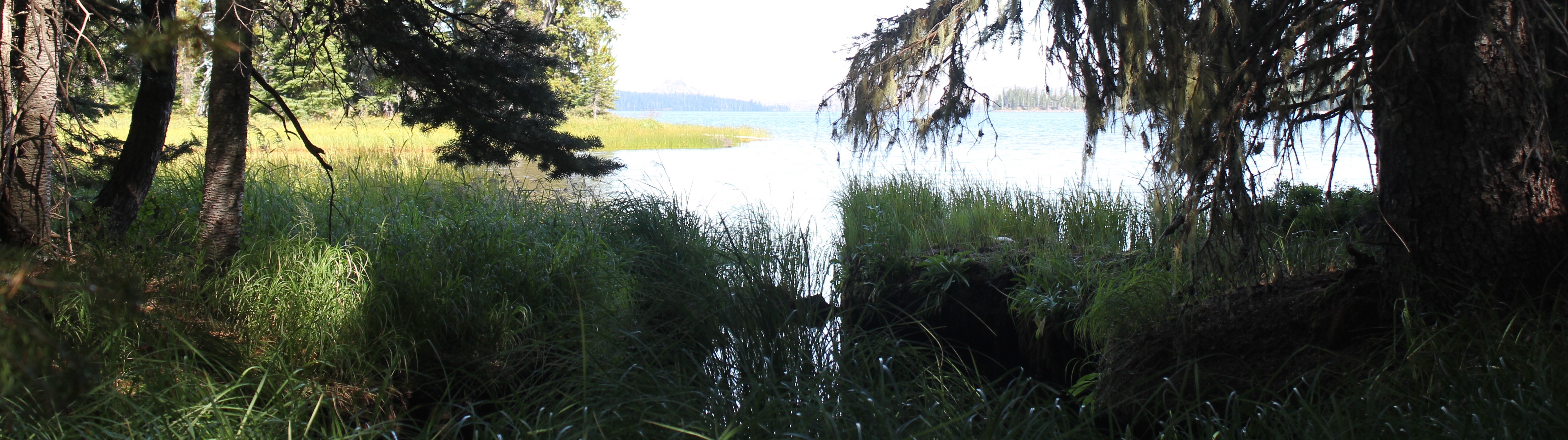
Part of the marshy shore of Waldo Lake.
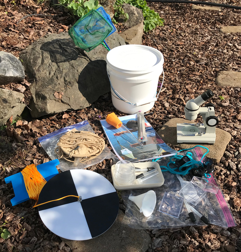
Secchi Disk: The black and white plate-looking object in the lower left of the image. On a separate visit to the lake, 60 feet was the maximum amount of line attached to my Secchi disk and I could still see the disk in the water. The disk is a simple device used to measure water transparency or turbidity. Also shown is my freshwater sampling kit.
As I waited for the snow in the mountains to melt and for the highway to Waldo Lake to reopen, I casually picked up the old photo of Camp Edith that I had looked at a hundred times before and saw something small. I grabbed a magnifying glass. At that moment, I knew the basic location of the camp. I had enjoyed my journey up to this point, but now, others needed to share in the experience. Therefore, I enlisted members of the same hiking group I had met at the archives the year before.
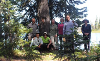
Several months later, we arrived at the lake. I provisioned them with three items: a copy of the Camp Edith photo from 1890, a few telling diary entries from Waldo’s writings, and pointed them in a direction. Everyone was eager, if a bit perplexed, as we walked into the vast forest to find a single tree.
Waldo Lake is always an inspiring place to visit. It is one of the largest natural lakes in Oregon, roughly 5 miles in length and 2 miles in width. The waters are clear and turquoise and the deeper areas are bespeckled with shades of rich blue. Light can easily penetrate 60 feet deep and possibly further.
Progress was slow as we carefully crossed marshy fields, scrambled over downed logs, and occasionally got our feet muddy as they identified clues in the photo. The day was getting late and several questioned if the tree even existed. I was also beginning to wonder, as this was taking longer than expected, but then a joyous shout.
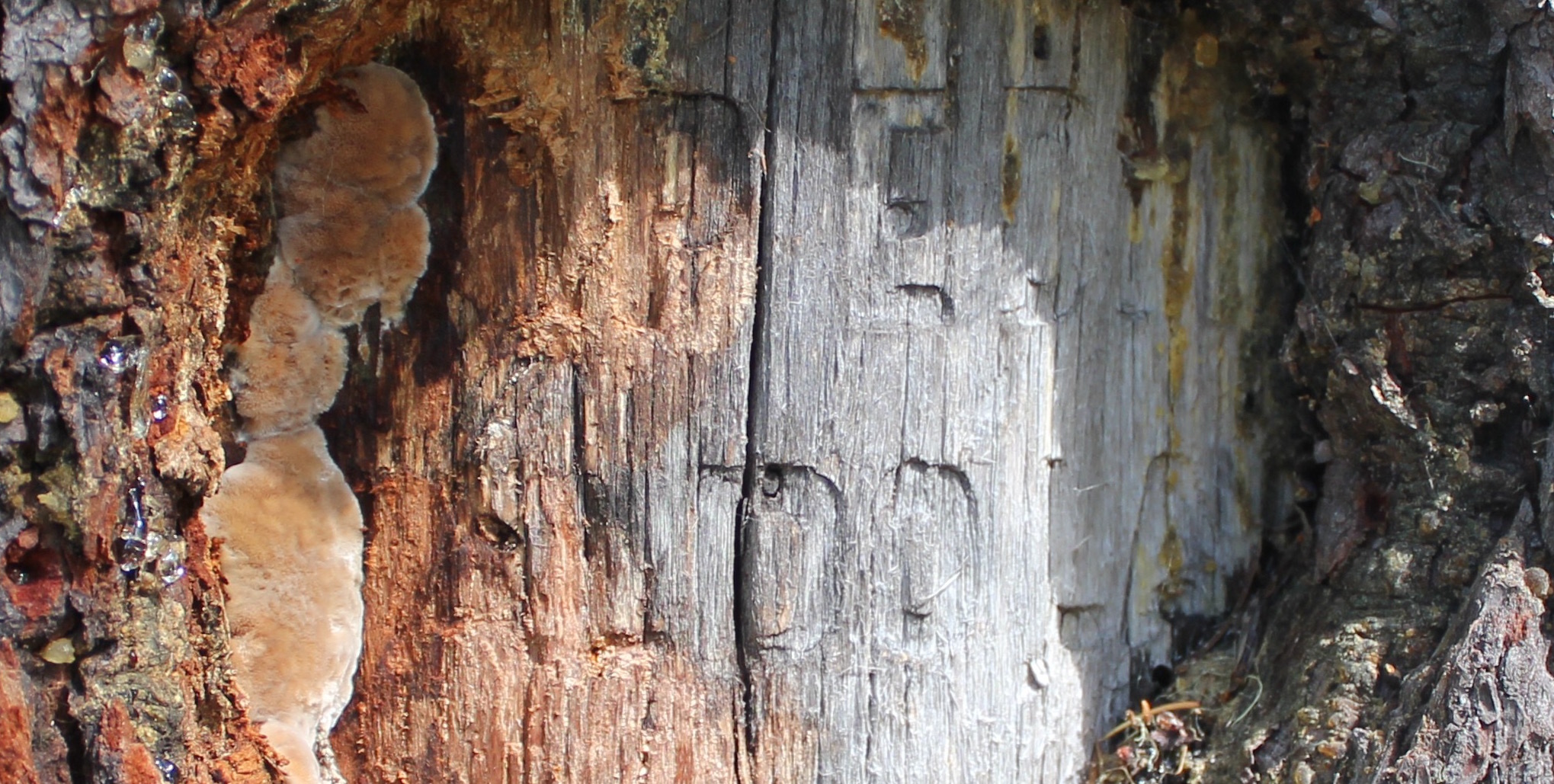
Arriving at the tree, we saw thirteen decades of bark growth had covered the blaze, but the inscription was still legible: “Camp Edith, Waldo Lake.”
After a year of reading Waldo’s papers, speaking with others, and carefully studying an old photo from 1890, my fellow explorers and I stood at Waldo’s lost campsite. Well, “lost” is a relative term. While we celebrated our discovery, we were not the first to locate the tree. People had likely visited here many centuries before Waldo’s time, and in more recent years pitched tents, or stopped for lunch along a lake’s edge, or even tried to solve the mystery of Camp Edith’s location for themselves.
A close-up of the Camp Edith tree, part of the “Camp Edith, Waldo Lake” inscription is still visible.
Standing there, I remembered blissfully walking past this location several years earlier during a day hike, yet never turning to see the blaze on the tree. I shook my head at the wondrous absurdity of my journey, a year of research only to discover a place in the outdoors where I had walked before.
Sharing that moment with others, standing on the shore of a picturesque lake in the middle of the woods, was a sense of nourishment, renewal, and connection. The tree’s inscription shares a nearly forgotten story, but to me, this is not a monument. Waldo’s monument isn’t this inscription, or a lake with his name, or even dusty photos in an archive. Waldo’s monument —his legacy— is about generations of people being outside, connecting with nature, and enjoying Oregon’s beautiful mountains.
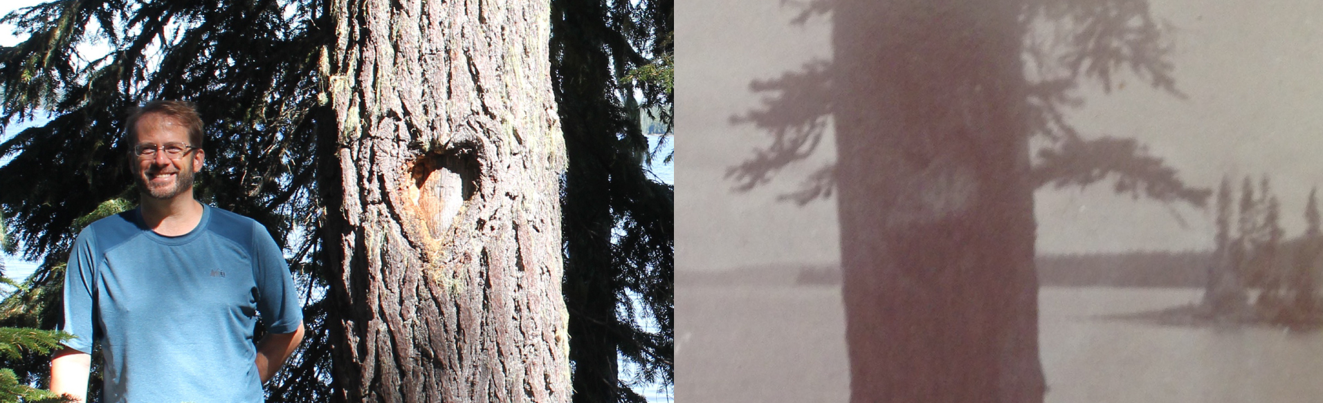
Standing in front of the Camp Edith tree.
“The lake stretches away up to the North; crags and peaks tower above us. It is a splendid scene – this source of rivers and cities, hid away, like pure trains of thought from vulgar observation – in the deep bosom of the wilderness buried. Camp Edith sends you greeting, “greeting to Edith from ‘Papa’s Lake.’” -An excerpt from one of Waldo’s 1890 letters
“Children born and reared here might be expected to have something of the wild flavor of nature in their composition.” -Some of the last known words recorded in Waldo’s wilderness diary (between Aug 14- 17, 1907 just before his death)
A side-by-side comparison of the heart-shaped blaze seen in 2017 and 1890. You can still see the original heart outline in the bark of the newer photo.
Trip Report:
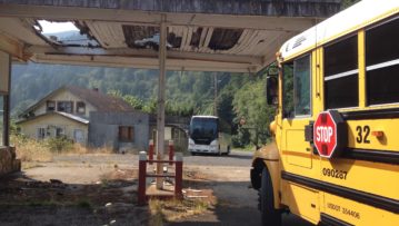
Leader: Mark Hougardy | Company: Road Scholar | Dates: Three trips, July-August, 2017 | Participants: 15-25 per group | Type: 6-days of field outings and motorcoach travel in western Oregon
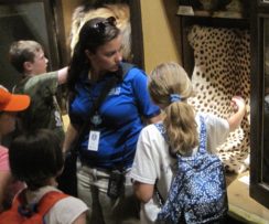
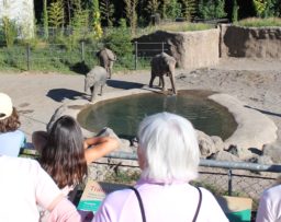
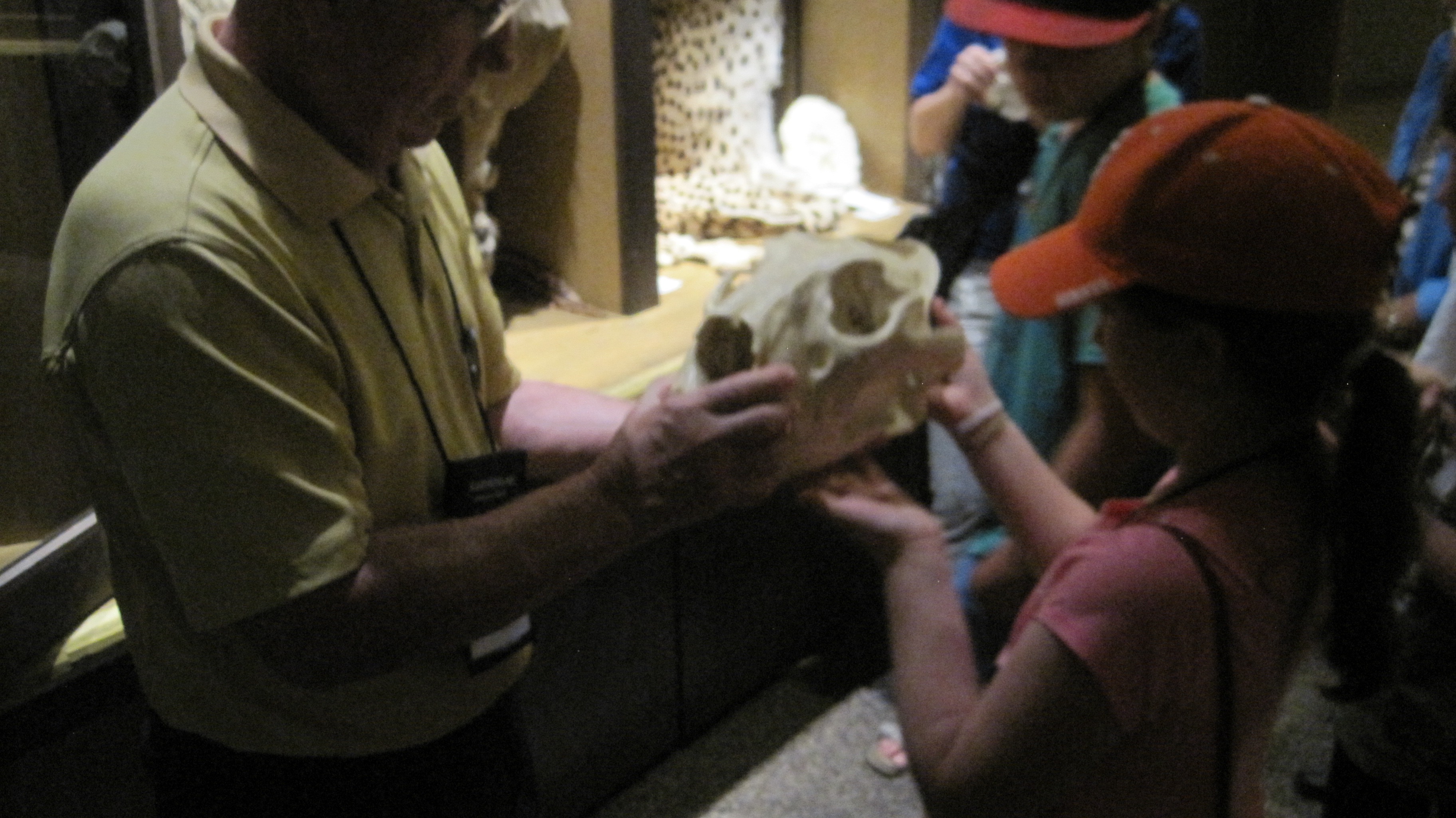
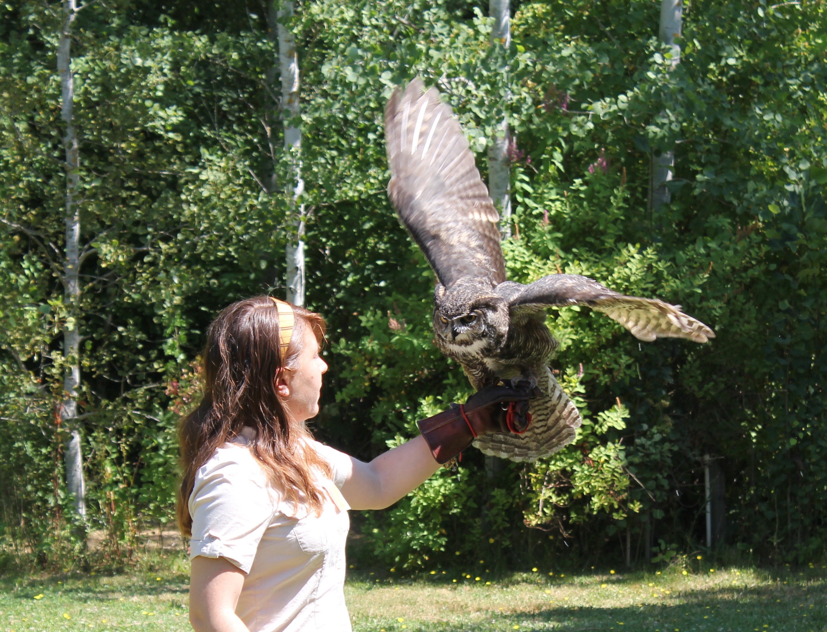
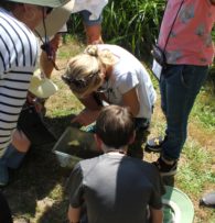
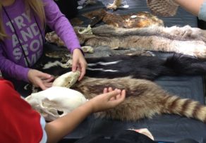
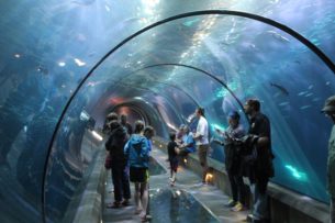
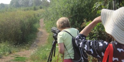
I enjoyed leading this Road Scholar trip for grandparents and grandchildren. It was a fun and educational opportunity for different generations to share time together exploring the world of animals. For my programs, I wanted to create a mentoring environment where, at the end of the program, everyone who is young at heart would think of themselves as beginning zoologists. A zoologist is a curious person (a scientist) who loves to learn about animals and everything they can teach us.
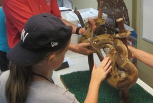
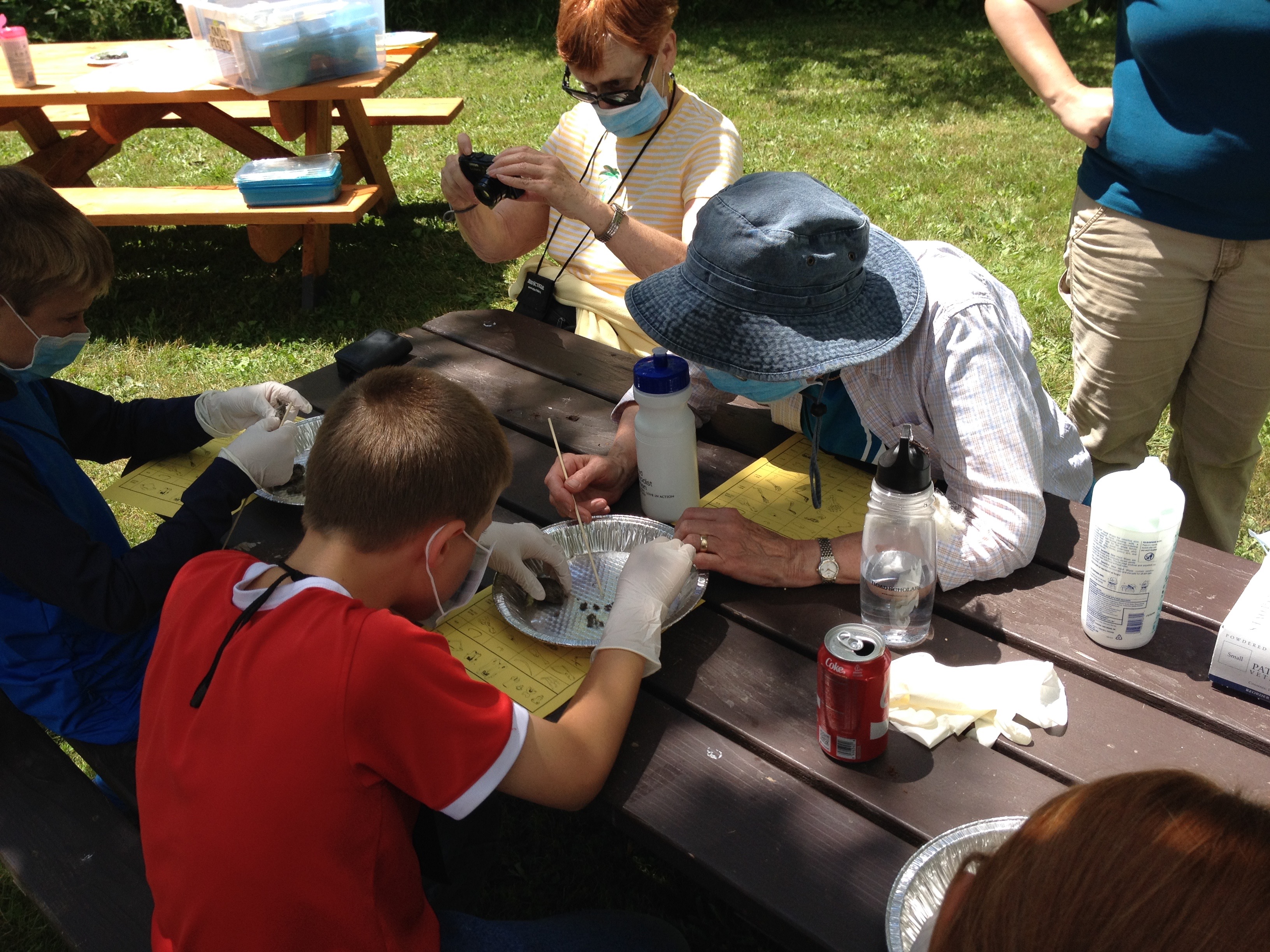
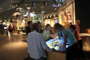
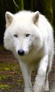
An enrichment activity I created for when the group had to be indoors. A key skill in tracking is understanding how animals move. We did this by measuring the stride and placement of tracks by various animals. This activity reinforced the story of OR-7 “Journey” Oregon’s most famous wolf who has traversed 4,000 miles during his lifetime (so far).
Trip Report:
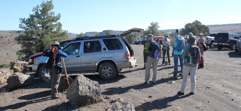
Volunteer Leader: Mark Hougardy | Group: Eugene-based Hiking Club collaborating with the Oregon Natural Desert Association (ONDA) | Dates: May 22, 2017 | Participants: 6 | Type: Weekend Camping & Restoration Work
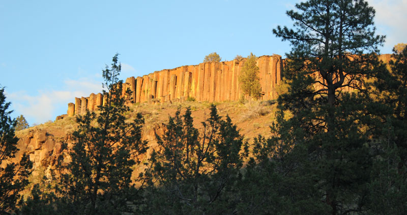
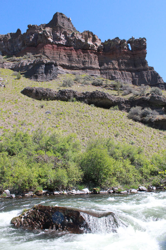
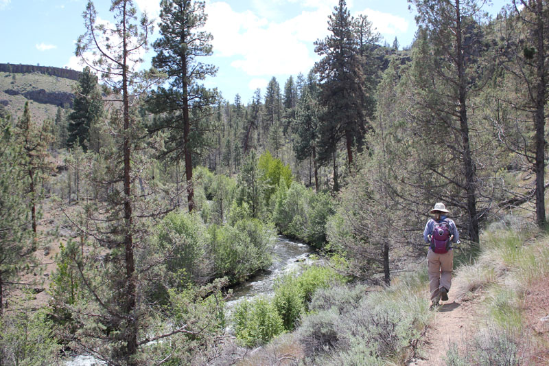
The Whychus-Deschutes proposed Wilderness is a rugged and beautiful landscape in central Oregon. Driving here requires a vehicle with high clearance and some sturdy hiking shoes for the remaining distance. It is a place of weathered cliffs, cold streams, and rocky canyons. If you have observant eyes you might even see bald eagles flying overhead. A prominent landmark is Alder Springs. The mainspring spontaneously gushs from the dry ground at an impressive 60 gallons per second. These cool waters flow a short distance into the picturesque Whychus Creek and a few miles further it joins the turbulent water of the Middle Deschutes River. These unique waterways provide spawning habitat for salmon, steelhead, and are central to all life in the area. This wilderness is prominent in fueling the region’s robust outdoor recreation opportunities, tourism industry, and a high quality of life. The Whychus-Deschutes landscape is an asset, yet it lacks permanent protection.
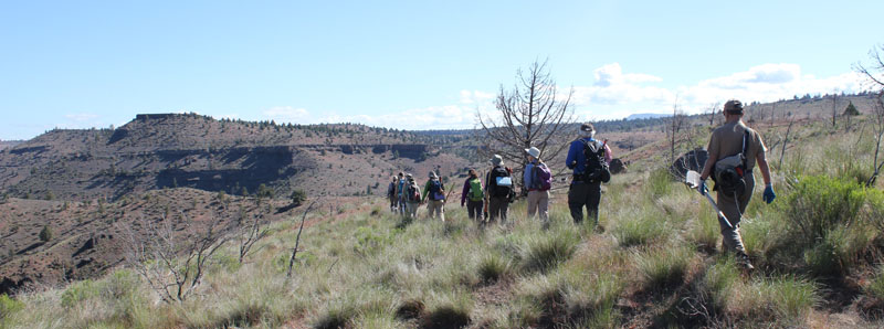
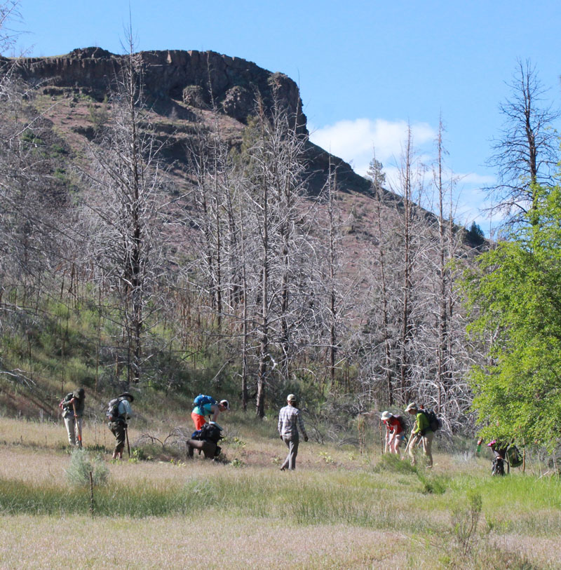
The first evening allowed for some hiking and enjoying the local sights. The ridge above the campground offered wonderful views of basalt columns. The columns were between 80 and 100 feet in height.
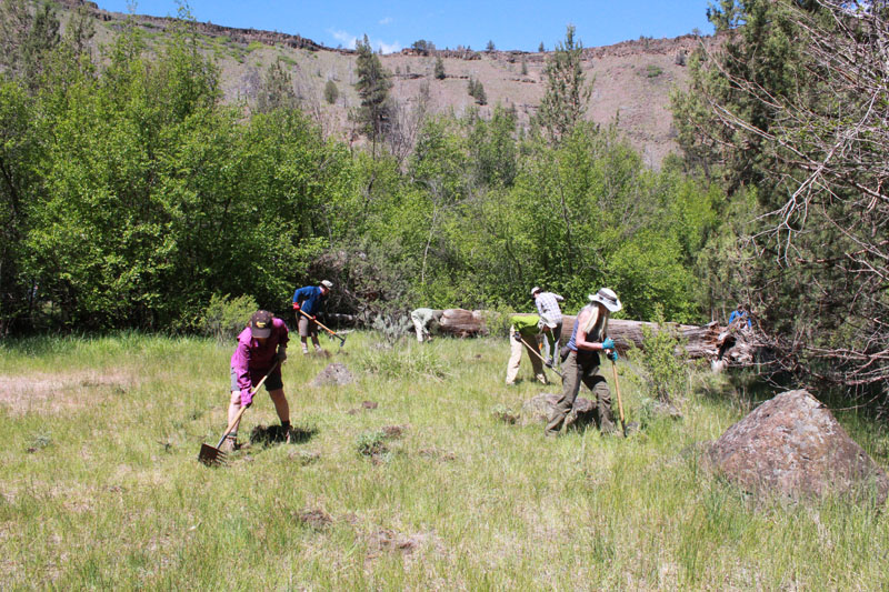
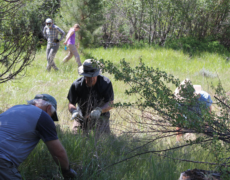
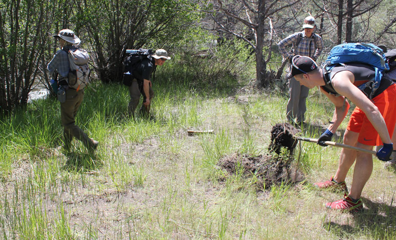
I wanted to learn more about protecting this land so I led a group of fellow eager hikers. We joined several other volunteers for an extended weekend of restoration work with the Oregon Natural Desert Association (ONDA). During the summer months, this sensitive area can be hammered by an influx of visitors who are seeking their interpretation of this place. We were there to learn about the natural history, rebuild trails, fix up campsites, and remove some invasive plants that were taking resources from native species.
First, a shout-out to ONDA. Learn more about ONDA’s great work and how you can help at onda.org
Here are some photos of our restoration weekend:
The next morning, we drove to the Alder Springs Trailhead and gathered our gear.
This is a stark and beautiful country. Our route was about three miles one way. We worked the entire distance down the trail.
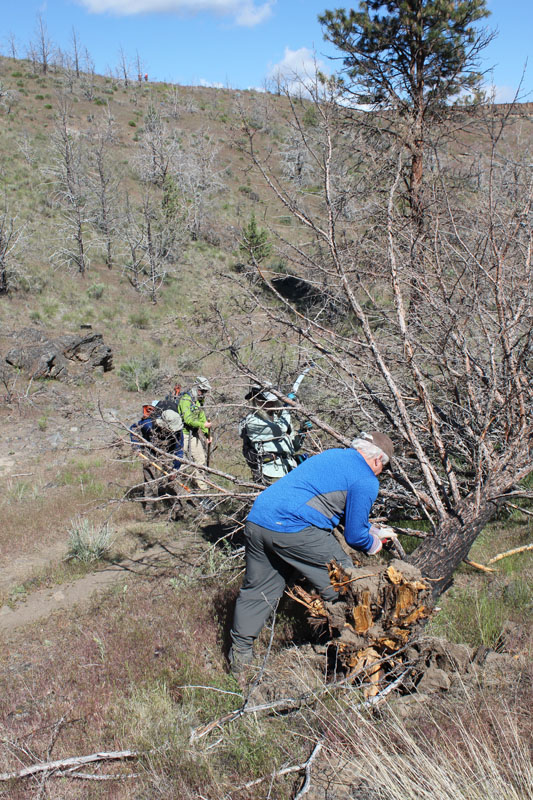
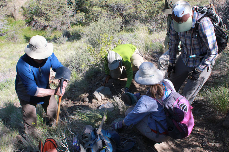
Volunteers jumped to it keeping the trail open.
This water bar (a small dike that prevents erosion on trails) had filled in and was no longer functioning. Our team rebuilt this and a good many others that day. The green in the background is courtesy of Alder Springs which flows at the base of the canyon.
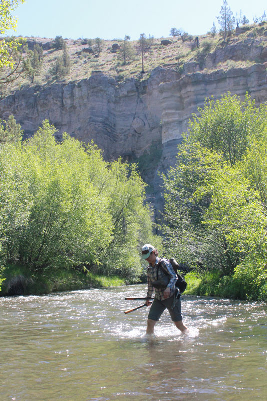
Our host, Gena from ONDA, is crossing Whychus Creek.
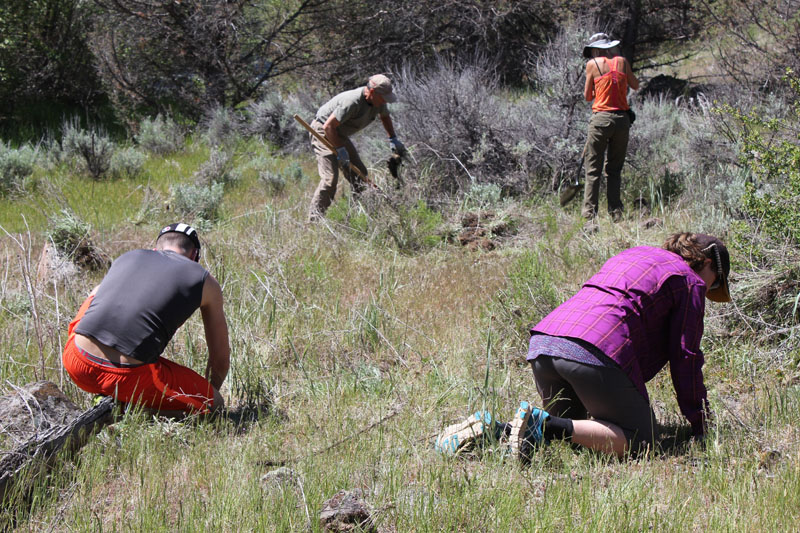
Our group is removing an abundance of Knapweed from a meadow. Knapweed can quickly take over an area and choke out native vegetation.
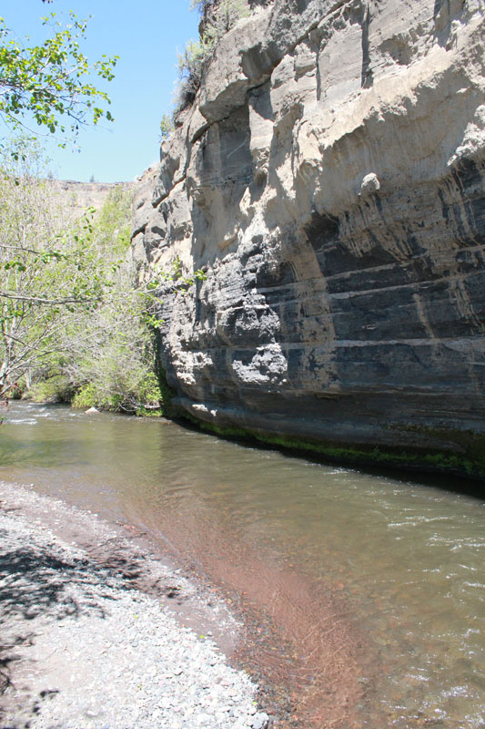
The creek skirted along the base of this amazing painted cliff. The horizontal bands displayed a multitude of geologic layers. The cliff’s face was streaked with gray which oozed out during recent rains. Several of us enjoyed lunch at this picturesque location.
Our work group is removing a large outcrop of Mullein. Mullein adapts easily to natural meadows and can outpace native plants.
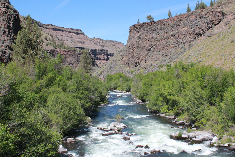
An amazing view looking down Whychus Creek.
We enjoyed a well-earned break at the confluence of Whychus Creek as it pours into the Deschutes River. This view is several hundred feet downstream from the confluence. The scenery here is spectacular.
The next day we were at it again. We easily spent two hours pulling Knapweed in just this little meadow.
More Knapweed! One plant was so tough it snapped a hand trowel.
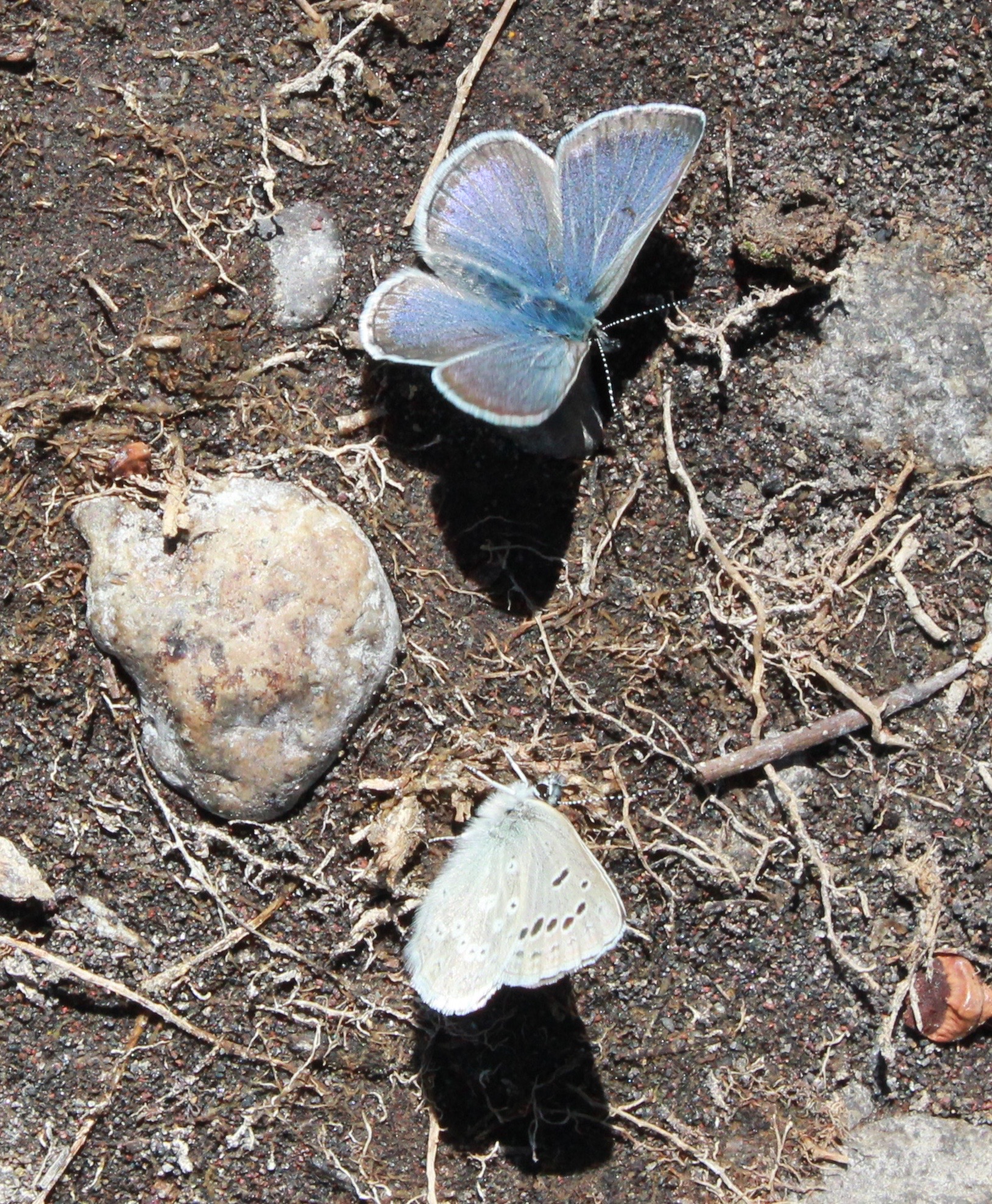
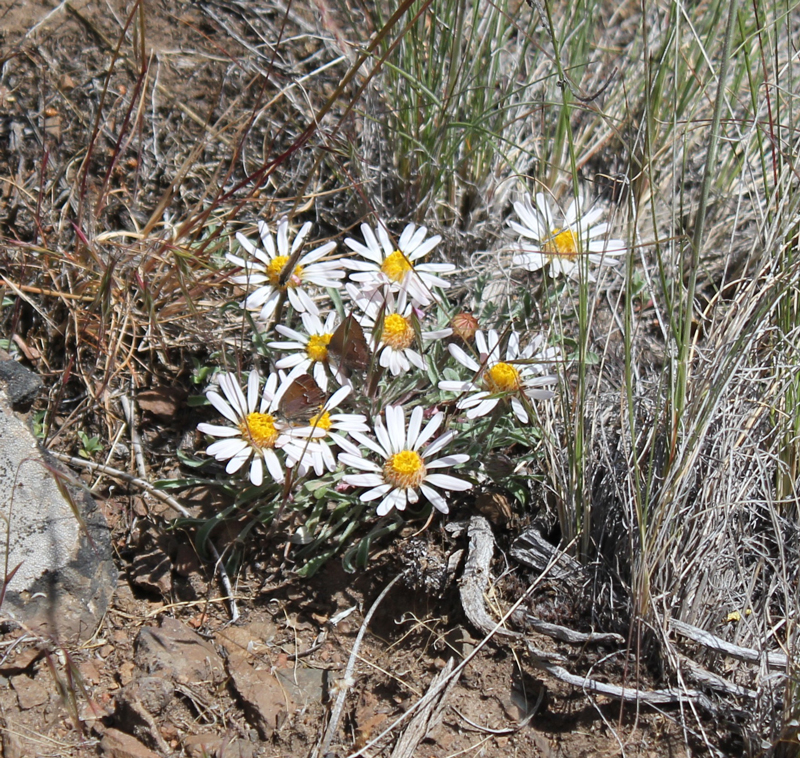
Amazing colors on these butterflies! Animals we saw on this trip included two bald eagles, turkey vultures, several meadowlarks, a robin, one gemstone-colored Lazuli Bunting, scores of butterflies, and two snakes. Sadly, we saw four deceased deer, victims of an aggressively cold winter.
Our group removed an illegal fire ring fifteen feet from the creek. We restored this sensitive habitat as best we could.
Such simple, yet complex, beauty can be observed here. Note the small butterflies.
The last of our group returns down a dusty path after a long and rewarding weekend.
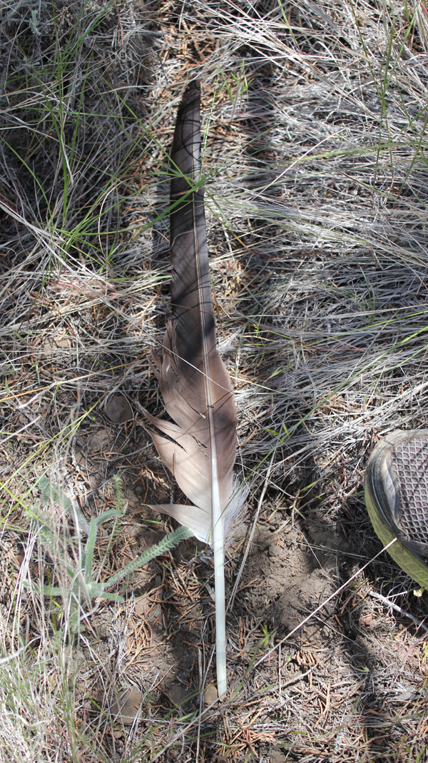
A true delight was spotted next to the trail. This is believed to be a primary feather of a Bald Eagle (possibly from a sub-adult). The top edge of a trail shoe is included for scale. This feather was discovered near the final hour of our restoration work – helping to protect public land. Seeing it was a welcome gift.
Volunteer Organizer: Mark Hougardy | Location: Eugene-based Hiking Group Lodge | Date: April 2017 | Duration: 1 day | Participants: 80+ | Type: Outreach Event
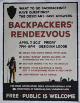
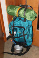
The Backpackers’ Rendezvous helps hikers, backpackers, and anyone curious about the trail to network, learn, and do more with less. I’m happy to have organized the event and contributed to Eugene’s backpacking community.
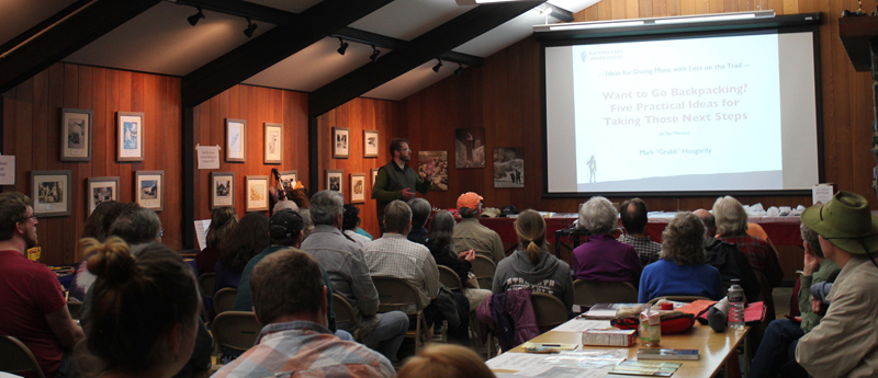
An evening of rain, wind gusts, and downed trees could not deter seventy hearty folks of all ages and skill levels from attending the second Backpackers’ Rendezvous held at a local lodge in Eugene, Oregon.
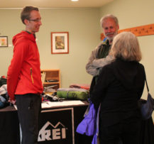
The first hour includes presentations from PCT and AT thru-hiker Chris “Scrub” Burke with tips on approaching a large hike, REI’s Mark “Jar-Jar” Lemaire on researching lightweight gear options, and Mark “Grub” Hougardy on five tips for starting a section hike on Oregon’s PCT.
Presenters from Left to Right: Mark “Grub” Hougardy rendezvous organizer, Mark “Jar-Jar” Lemaire of REI, and Chris “Scrub” Burke a PCT/AT thru-hiker.
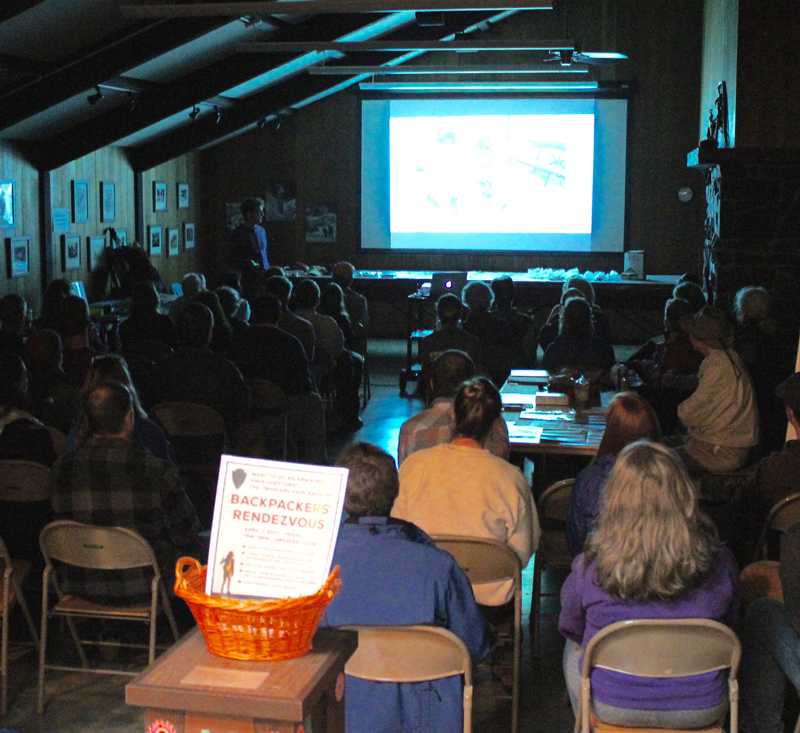
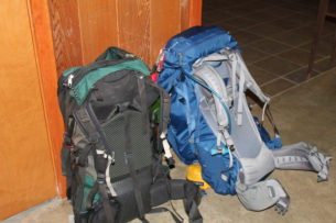
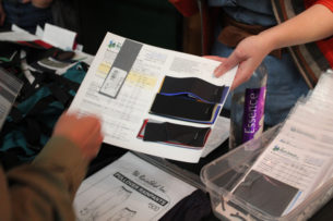
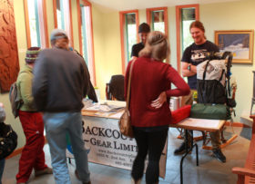
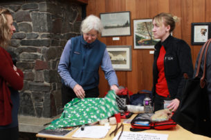
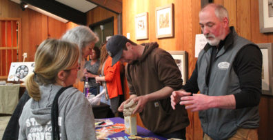
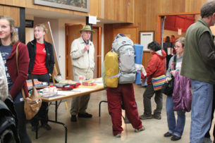
The second hour included knowledge tables, pack shakedowns, and interactions with local outdoor retailers and thought leaders, including lightweight ideas for the big three with REI-Eugene, staying warm and dry with Backcountry Gear; resources for making your gear with the Rain Shed, staying safe outdoors with a hiking club’s safety committee, hiking Oregon’s coast with the National Coast Trail Association, and dry food options with Capella Market.
One of the best quotes during the event came from a woman in her thirties, “I want to go backpacking and don’t know where to start. I came here to find out more.” Thank you to everyone who helped enrich and strengthen the backpacking community in Eugene.
Chris “Scrub” Burke, PCT & AT thru-hiker shares his lightweight tips.
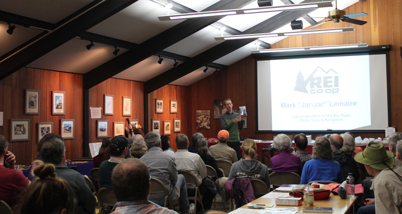
Mark “Jar-Jar” Lemaire of REI on “Lightweight Ideas for the Big Three, Starter Trips, & Navigation.”
Mark “Grub” Hougardy on “Want to Go Backpacking? Five Practical Ideas for Taking Those Next Steps”
Trip Report:
Volunteer Leader: Mark Hougardy | Group: Eugene-based Hiking Club | Dates: November 7, 2016 | Participants: 6 | Type: University of Oregon Archives Visit
On this sunny day in November, our small group spent several hours with the original writings, journals, and photographs of a true champion of nature – John B. Waldo.
Waldo was an ardent conservationist, he’s been referred to as the west’s David Thoreau and even Oregon’s John Muir. Waldo was known for venturing into the Cascades, often spending months at a time, and recording his findings of this dynamic and vibrant landscape.
Over the course of his life, Waldo worked as an explorer, legislator, and chief justice on the Oregon Supreme Court, all the time helping to preserve land in the Cascades. He envisioned a protected band of land along the crest of the Oregon Cascade Range that ran the entire length of Oregon. This goal became his personal mission.
On September 28, 1893, the Cascade Range Forest Reserve became a reality and 5 million acres were protected.
Today, we can experience his legacy in the protected lands and open spaces of the Cascades from Mount Hood south to the border with California, that include: Crater Lake National Park, Mt. Hood, Willamette, Umpqua, Rogue River national forests, and other public lands. And in the middle of this grand monument are the deep and pristine waters of Waldo Lake, named in his honor.
Curiously, little is written about Waldo. The judge was a philosophical and reflective person who did not directly seek publicity. But possibly this muted message is part of his larger voice – appreciating the beauty of Oregon is best experienced by hiking on the trails, exploring in the mountains, traveling in the wilderness, and experiencing the (as he wrote) “untrammeled nature and the free air.†Discover Waldo’s story for yourself. The University of Oregon archive is free to use – Knight Library, Paulson Reading Room.
Reference: John B. Waldo and William G. Steel: Forest Reserve Advocates for the Cascade Range of Oregon, Gerald W. Williams
Umpqua and Willamette National Forests
http://www.foresthistory.org/Publications/Books/Origins_National_Forests/sec21.htm
Here are just a few of the photos from his collection:
Trip Report:
Volunteer Leader: Mark Hougardy | Group: Eugene-based Hiking Club | Dates: September 10-11, 2016 |Participants: 10 | Hiking 8 miles | Type: Day Hike & Tent Camping
Visiting Big Bear Camp is like inhaling a fresh breath of forest air: it’s invigorating.
That’s me with the apple. The lodge’s owners Hal and Tonia quickly welcomed us as we arrived at their retreat/garden/camp in the woods. Hal offered us delicious Honey Crisp apples directly off the tree to enjoy on our hike. [Photo by Darko]
Our 8-mile hike started up a reclaimed forest road, past cedar trees used by mountain lions for scratching, across the deep ravine where a rope was needed (shown), and finally to a deceptively steep forest road.
After a good heart-pounding climb, we arrived at the “Secret Spot,†the highest location within the Coast Range in Lane County. We had climbed roughly 1,600 feet from where we started but the view made up for it. Looking east we could see 130+ miles in the distance: in the north, Mt Hood, followed by Mt, Jefferson, Three-Fingered Jack, North, Middle and South Sister, Mt. Bachelor, and finally 125 miles further south, Diamond Peak.
We rested, enjoyed some lunch, and then traversed back down the forest road to several turnoffs, and a forest trail that deposited us back at Big Bear. That evening we shared a potluck with neighbors; everyone’s gardens were abundant and we and enjoyed the bounty of harvest-time meals. Later that evening we enjoyed guitar folk music by the fire and enjoyed freshly picked grapes (shown below). In the morning we hung out, explored the local creek, enjoyed the garden, and planned a route for a 42-mile, 4-day backpacking trip to the coast for next spring.
Trip Report:
Volunteer Leader: Mark Hougardy | Date: June 12, 2016 | Duration: 3 Days
Participants: 10 | Group: Eugene-based Hiking Club | Hiking 5 miles (1,000-foot elevation loss/gain) | Type: Day Hike and Camping
On this trip, Mother Nature reminded our group of nine that she is always in control, and she reminded two members of our group to remember the tent!
Our original itinerary had to be re-worked because of a late July storm, but the unusually cold weather added an extra element of adventure and excitement.
Everyone arrived in great spirits on Saturday, though we knew that rain was on the horizon. Unfortunately, two members of the group had – in their enthusiasm – unexpectedly left their tent at home. Undeterred by the unfortunate error they purchased a tent at the campground store – for a good deal of course! The skies that afternoon were clear and we made good use of the sun by hiking to Garfield Peak.
On the way, we encountered several snowfields, one of which was very steep, but the stunning views from the top were well worth the extra effort in getting there. In the distance, Mount Scott was enticingly clear of snow, though we later learned it was impossible to reach because several miles of the eastern rim highway was closed for repairs. Returning down the mountainside we visited the small loop trail of Godfrey Glen where we collected trash that uncaring visitors had left. We collected enough garbage to fill a large bag! That evening we sat around the campfire and commented on the number of stars that were visible, where was the rain? All was calm until 2 am when the rain arrived and temperatures lowered to just above freezing. Our two members in their “good deal†tent had a cold and wet night.
Sunday morning I looked out my tent and was excited to see full-bodied snowflakes quietly falling but they only lasted for a minute. Several early risers made a trip to the rim where 3-4 inches of snow had fallen the night before. All of us were off to a slow start that morning. The “good deal†tent had not fared well in the rain and when the drops were shaken off the outer cover a support bar snapped making the tent almost useless. For the entire day temperatures never ventured past the mid-thirties and at times the drippy rain became unrelenting torrents.
We explored the Visitor’s Center, the Sinnott Memorial Overlook (featuring an indoor exhibit room) and the gift shop to escape the fog, wind, rain, and occasional snow flurries. The fog was so thick we could not see the lake or a few hundred feet in front of us. In the afternoon we moved below the cloud line to hike the picturesque Annie Creek trail. Although a short hike, it was very picturesque. Laurie and Brad had reservations at the Crater Lake Lodge for dinner, they generously increased their table size to include all of us so we could get out of the rain and have some warm food. About 8 pm that evening the sky cleared and at first, the temperatures seemed warm. The group campfire that evening had just half of the group, the remainder had gone to bed early. The two members in the “good deal†tent had another cold and memorable night. In the middle of the night I awoke and was stunned by the visibility of the night sky – there were thousands of stars! My tent thermometer showed that temperatures had dropped into the upper twenties.
On Monday the sun returned and the group broke camp, but before we did we waited anxiously for two members to return their “good deal†tent. The two walked stoically into the store and presented their tale of woe to a staff person when the person said “no refunds†the disheveled and muddy remains of the tent was plopped like a large wet sponge onto the counter for all to see. The act proved its point about the product’s poor quality. Their money was returned. Victorious that two of our members had saved their money (and dignity) we traveled to the rim where we hiked for several hours sightseeing and enjoying the views of Wizard Island. We tried to visit Watchman Peak but the trail was still heavy with snow and the area was closed. Although the sun was shining the temperatures remained in the mid-50s and the wind had a nippy bite, the group tabled Cleetwood Cove for another time, jumping in Crater Lake would be for another trip.
Trip Report:
Volunteer Leader: Mark Hougardy | Date: June 12, 2016| Duration: 1 Day| Participants: 10 | Group: Eugene-based Hiking Club; As this was the first visit to a very remote location, for safety, I enlisted the help of Oregon Wild to introduce us to the area. | Hiking 5 miles (1,000-foot elevation loss/gain)
Type: Day Hike
The proposed Devil’s Staircase Wilderness is one of the most remote and inaccessible regions of rainforest left in the Coast Range. This impenetrable area has limited hiking trails or roads and is visited by only a few hundred people a year. Yet it remains unprotected despite the efforts of conservation groups and Oregon’s congressional delegation. To find out more about this compelling landscape, eleven hikers joined Chandra LeGue, the Western Oregon Field Coordinator at Oregon Wild, for a day of hiking to the Dark Grove. The Dark Grove has never been logged and is home to ancient trees that are 400-500 years old.
Our caravan of cars departed Eugene and meandered on back roads through the coast range. At one point, the green surroundings were cleaved from our sight as we drove through a wasteland of cut and darkened stumps: one member in the car likened the lifeless land to the desolated area at Mount St. Helens just after its eruption. This sight was a stark contrast to the lush biomass that we would encounter later that day.
About 15 miles northeast of Reedsport, we pulled off the pavement and slowly traveled up a single laned, overgrown backroad. Salmonberries grew in abundance here and scratched the sides of the car.
We parked at a junction and walked down an old logging road that was being reclaimed by the forest. Then we disappeared into the bushes, venturing down an elk trail. Posted on a tree was a sign that told us this was not the path to the Devil’s Staircase waterfall and unless you’re prepared to stay the night, and have Search and Rescue to look for you, to turn back. Fortunately, we had a guide for our inaugural visit.
The so-called “trail†was on loose soil and maintained a direct angle downward at 45-50 degrees. For the next hour and a half, we carefully descended 1,000 feet. Roots frequently caught our feet as we clamored over fallen logs and beneath large trees that had crashed across ravines and splintered. Ferns grew in abundance and they and helped us balance ourselves with their solid fronds. We quickly learned that ferns were our friends.
The weather that day was pleasant and sunny, though had our schedule been a day or two off, our visit might have been plagued with slippery trails.
Finally, the trail leveled out and we enjoyed lunch in an amphitheater-like area of fallen logs surrounded by a carpet of greenery. We saw a shadow over the canopy as a turkey vulture circled far overhead, no doubt curious to see if the humans had lost their way.
A forest of Salmonberries obstructed our path, so we made a trail straight up a ridge, then down into a forest of sword ferns. The ferns stood at five to six feet in height, so they engulfed us all and many of the shorter members traveled with their arms raised straight overhead. These tranquil glens often hid downed logs and it was easy to twist ankles or slam shins.
A fallen giant became our catwalk above the salmonberries, foxgloves, and ferns. We crossed a creek, but could barely see the water because of the thick undergrowth. Scampering down the side of the massive tree, we squatted and crawled through a small jungle, then emerged at the root base of the fallen giant – it was 25 feet tall!
In front of us was the Dark Grove, a cathedral of 8-foot wide Douglas Fir trees. The trees were dark in appearance, the result of fire about 150 years earlier. Touching the bark a charcoal residue was imprinted on fingers. The tree model is Becky Lipton.
Crossing back across the fallen giant, we stood at the base of one of the largest trees we saw that day. Eight people stood at its base, arms outstretched and hands grasped. They counted one, two, three… their calls became muffled as they rounded the opposite side…the voices returned and the loop stopped – at seven and a half people! This immense tree was somewhere between 35 to 40 feet in circumference! Several hikers mentioned they felt like kids in a giant outdoor playground.
We continued through the ferns and back again along the ridge (which was unmarked on the Forest Service map). We lost the trail several times but finally found what we were looking for: a small rocky outcrop along Wasson Creek where the channeled water made a small waterfall for us to enjoy. We rested for half an hour in the sun.
The rest of the afternoon was spent returning via the same trail that we had descended earlier, which was a workout! At about 4 pm, we returned to our cars and started our two-hour drive back to Eugene.
This hike was a rugged and demanding off-trail experience, and all of us got scratched and dirty, some of us stung by insects, and one person had a fall (fortunately the ground was padded by an abundance of moss and there was no injury)! I understand why people get lost in this wilderness; even with directions, I could never have found this remote location. The sheer scale of the forest is very disorienting, but experiencing this place at ground level provides clarity as to why it needs to be protected.
Volunteer Organizer: Mark Hougardy | Location: Eugene-based Hiking Group Lodge | Date: April 30, 2016 | Duration: 1 day | Participants: 25 | Type: Outreach Event
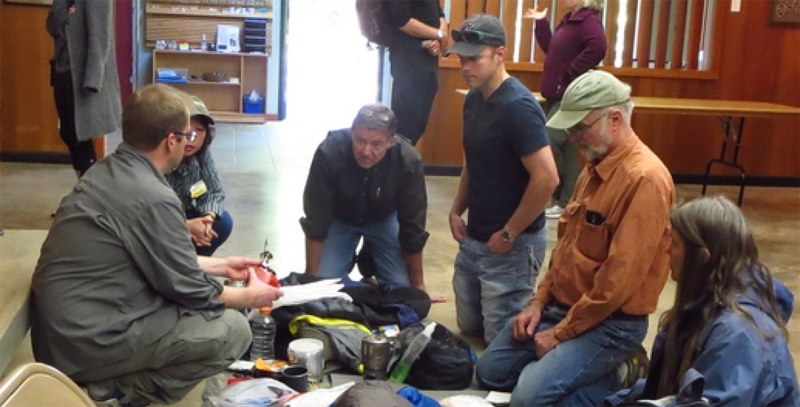
Backpackers of all experience levels spread out their gear to share ideas and swap stories about backpacking. Of particular interest was the lightweight and ultra-light items and how they could help people do more with less. Twenty-five people attended to learn from other backpackers about what stove, sleeping bag or tent might best help them on the trail.
Trip Report
Volunteer Leader: Mark Hougardy | Group: Eugene-based Hiking Club: joined by BRING Recycling| Date: April 9, 2016 | Participants: 8 | Type: Day Hike
Visiting the local landfill is not high on a person’s bucket list, but ask this question, “Where is away?†When you throw something in the trash where does it go? What happens to it? What will happen to it?
Roughly 5-miles from Eugene is the County landfill. Visiting such a place is very useful for gaining perspective about our personal and societal use of resources. This was short, but a very educational trip. A handful of curious folks made the trip to learn about the facility’s methane recovery operations, how the landfill cells are designed, how space is maximized via compaction, leachate management (trash juice), wetlands mitigation, and impacts on the Middle Fork’s water quality – a potential secondary source of water for 250,000 people.
The footprint for this site is 540-acres, and the hills will eventually reach a height of 600-feet. The expected “lifespan†for this site is another 100-years; which means we will be putting trash into the ground for another 100-years at this site. That is a lot of trash.
Trip Report
Volunteer Leader: Mark Hougardy | Group: Eugene-based Hiking Club: joined by BRING Recycling | Date: October 27, 2015 | Participants: 8 | Type: Day Hike
Our trip to the landfill was cut short because of gunfire in the vicinity. We left the area immediately. Apparently, a state-licensed trapper was on top of the 250-foot trash hill shooting birds considered to be a nuisance. The BRING representative, who was guiding our trip, was not happy because there was a breakdown in communications. Our trip had apparently uncovered a major hole in the landfill’s processes concerning visitors, signage, and contractors with firearms using the site. This has been resolved and I will be re-scheduling another visit to see everything that we missed.
Trip Report
Volunteer Leader: Mark Hougardy | Group: Eugene-based Hiking Club | Date: March 13, 2015 | Participants: 15 | Hiking: 2 Miles | Type: Day Hike
We have all turned on the kitchen tap and filled up a bottle in preparation for a hike, but have you ever wondered what was in your bottle? Think about it – we all live downstream from somebody.
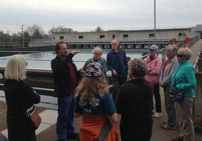
How does river water become the tap water we drink and how is wastewater made safe for wildlife and others downstream? To learn more, I organized a trip with a local hiking club to visit the local water intake and the wastewater facilities.
Our first visit was to the Hayden Bridge Water Filtration Plant, located adjacent to the McKenzie River, in Springfield. The facility is no small operation; it serves the needs of 200,000 people on a daily basis by removing water directly from the river, treating it, and finally delivering it to our taps.
Here are some observations from the visit:
The facility is very high-tech and water quality is measured at all stages of the process both by computer and by a human with hourly lab checks.
Security is paramount; the plant is gated with a security fence/gate, cameras are everywhere.
Our local water system has about two days of water reserves if there is a calamity.
On the day we visited the facility had processed and was sending out 16 million gallons (24 Olympic sized swimming pools) of water to the surrounding community.
Next, we traveled to the Eugene/Springfield Water Pollution Control Facility in Eugene. This is where all of the waste materials that go down the drain/flushed from our households and businesses in the greater Eugene metropolitan area (a quarter of a million people) are processed. The plant is located adjacent to the Willamette River. Our hour and a half visit was very informative:
More than 99% of what arrives at the facility is water; less than 1% are solid materials that need to be either removed or turned into bio-solids.
Most of the odoriferous gases are collected and used to power a generator that supplies 50-60% of the energy needs of the facility.
Waste materials can take up to 10 hours, once they leave your home until it reaches the wastewater facility; then wastewater can take another 10 hours to be processed. In short, waste materials take less than 24 hours until that water is returned to the river.
The amount of water being cleaned and being returned to the Willamette River that day was about 15 million gallons (roughly 23 Olympic swimming pools).
During the summer, the plant can process up to 70 million gallons per day (106 Olympic swimming pools) of wastewater!
I was fascinated to learn that on the Willamette River in Oregon there are about 25 wastewater treatment stations, and that does not include communities on the tributaries that flow into the Willamette! Just think about that…for every wastewater plant, there is likely a water intake facility that supplies drinking water for the next community downstream. If you live downstream you really want to know that the people upstream are taking care of your water – the water you drink, use for bathing, and for recreation.
If you’re curious about the water that goes into your water bottle start asking questions. Most water intake and wastewater plants are happy to host tours for small groups. Let them know you are interested in visiting.
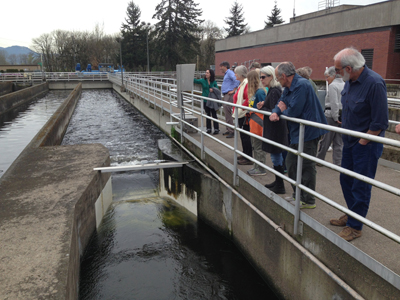
Water Filtration Plant: Behind us is a 2-million gallon settling basin. This is used to settle any particulate matter in the water. This water was recently pulled from the McKenzie River.
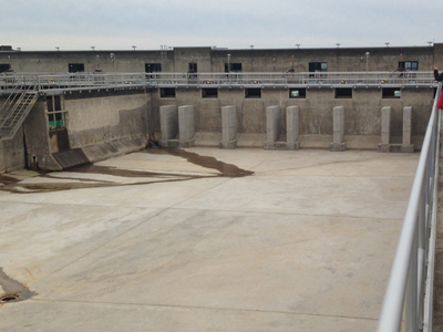
Water Filtration Plant: A view an empty 2-million gallon setting basin.
Water Pollution Control Facility: It looks like a really bad root-beer float, it is actually air being passed through the wastewater, this allows bacteria to better digest the waste.
Water Pollution Control Facility: Treated water that is almost ready to be returned to the Willamette River.
What about when the water is returned to the Willamette River? Find out more, read my post, Rafting the Upper Willamette River with the McKenzie River Trust; the majority of the photos were taken only a few miles downstream from Eugene’s wastewater treatment facility.


 Volunteer Organizer: Mark Hougardy | Location: Eugene-based Hiking Group Lodge | Date: April 2017 | Duration: 1 day | Participants: 80+ | Type: Outreach Event
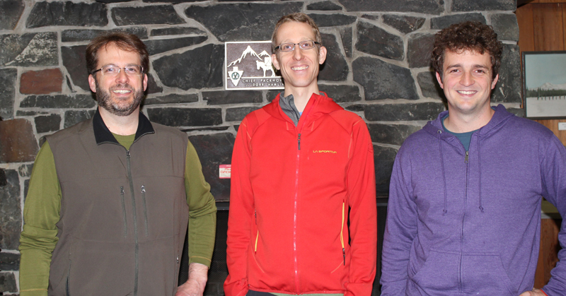


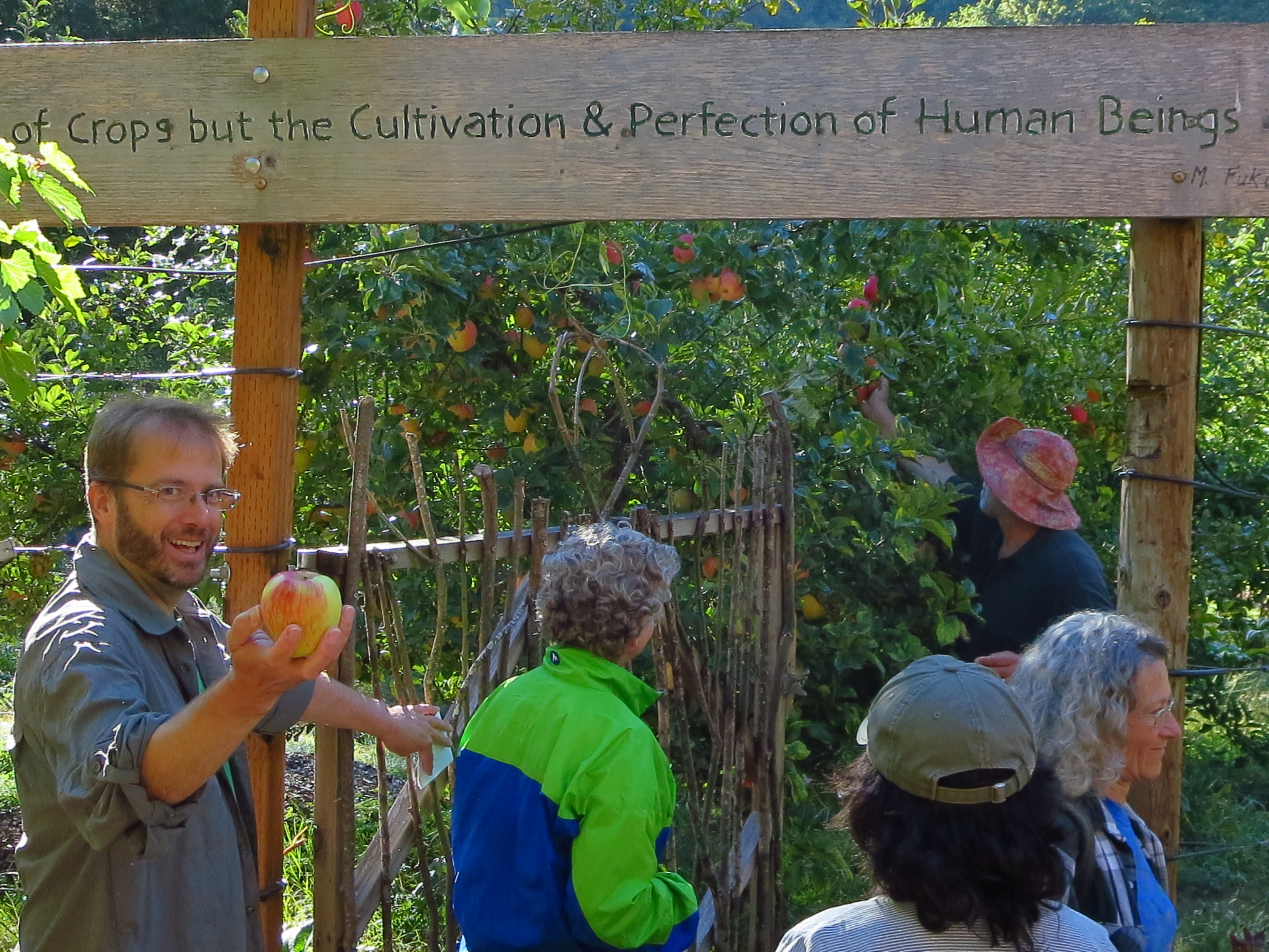 That’s me with the apple. The lodge’s owners Hal and Tonia quickly welcomed us as we arrived at their retreat/garden/camp in the woods. Hal offered us delicious Honey Crisp apples directly off the tree to enjoy on our hike. [Photo by Darko]
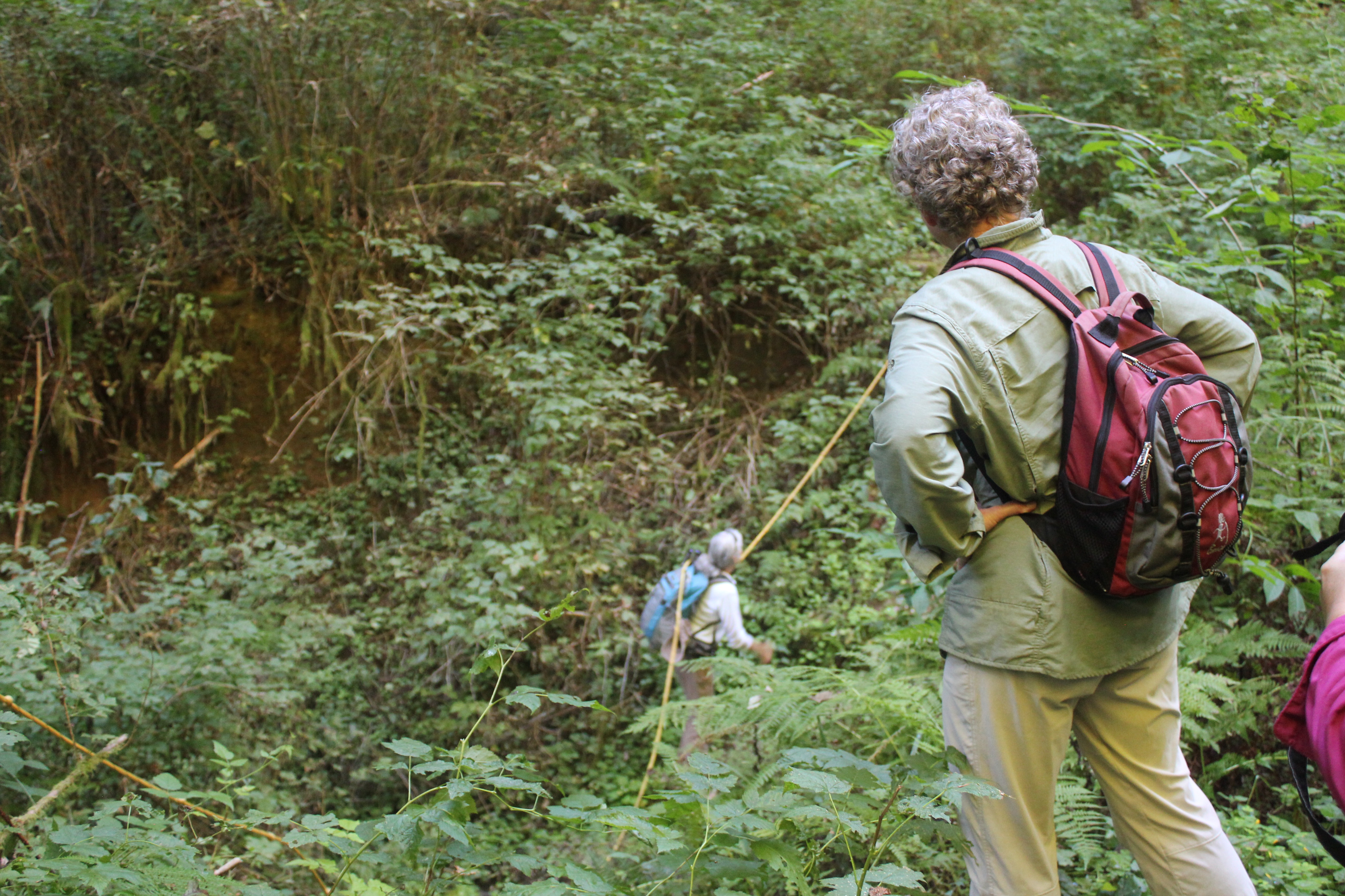 Our 8-mile hike started up a reclaimed forest road, past cedar trees used by mountain lions for scratching, across the deep ravine where a rope was needed (shown), and finally to a deceptively steep forest road.
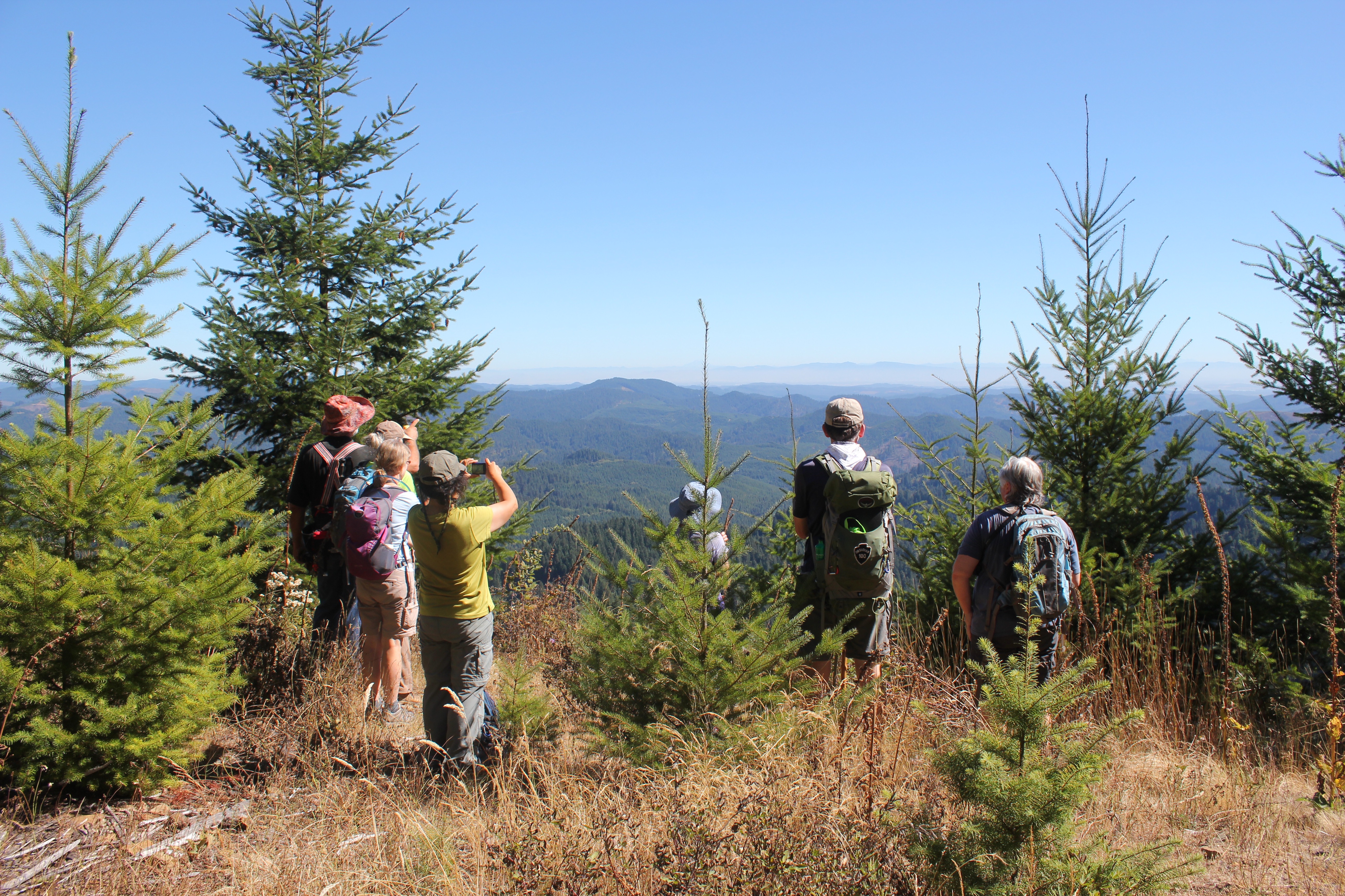 After a good heart-pounding climb, we arrived at the “Secret Spot,†the highest location within the Coast Range in Lane County. We had climbed roughly 1,600 feet from where we started but the view made up for it. Looking east we could see 130+ miles in the distance: in the north, Mt Hood, followed by Mt, Jefferson, Three-Fingered Jack, North, Middle and South Sister, Mt. Bachelor, and finally 125 miles further south, Diamond Peak.
 We rested, enjoyed some lunch, and then traversed back down the forest road to several turnoffs, and a forest trail that deposited us back at Big Bear. That evening we shared a potluck with neighbors; everyone’s gardens were abundant and we and enjoyed the bounty of harvest-time meals. Later that evening we enjoyed guitar folk music by the fire and enjoyed freshly picked grapes (shown below). In the morning we hung out, explored the local creek, enjoyed the garden, and planned a route for a 42-mile, 4-day backpacking trip to the coast for next spring.
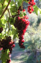
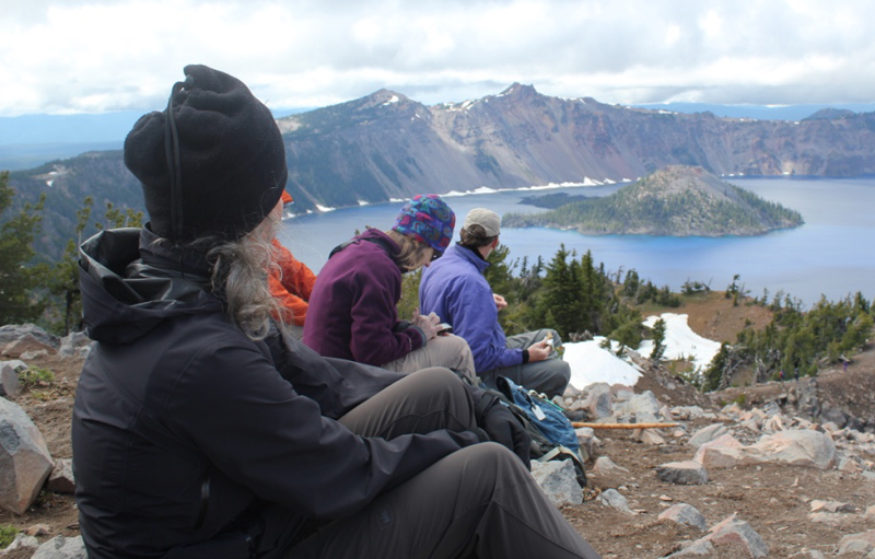
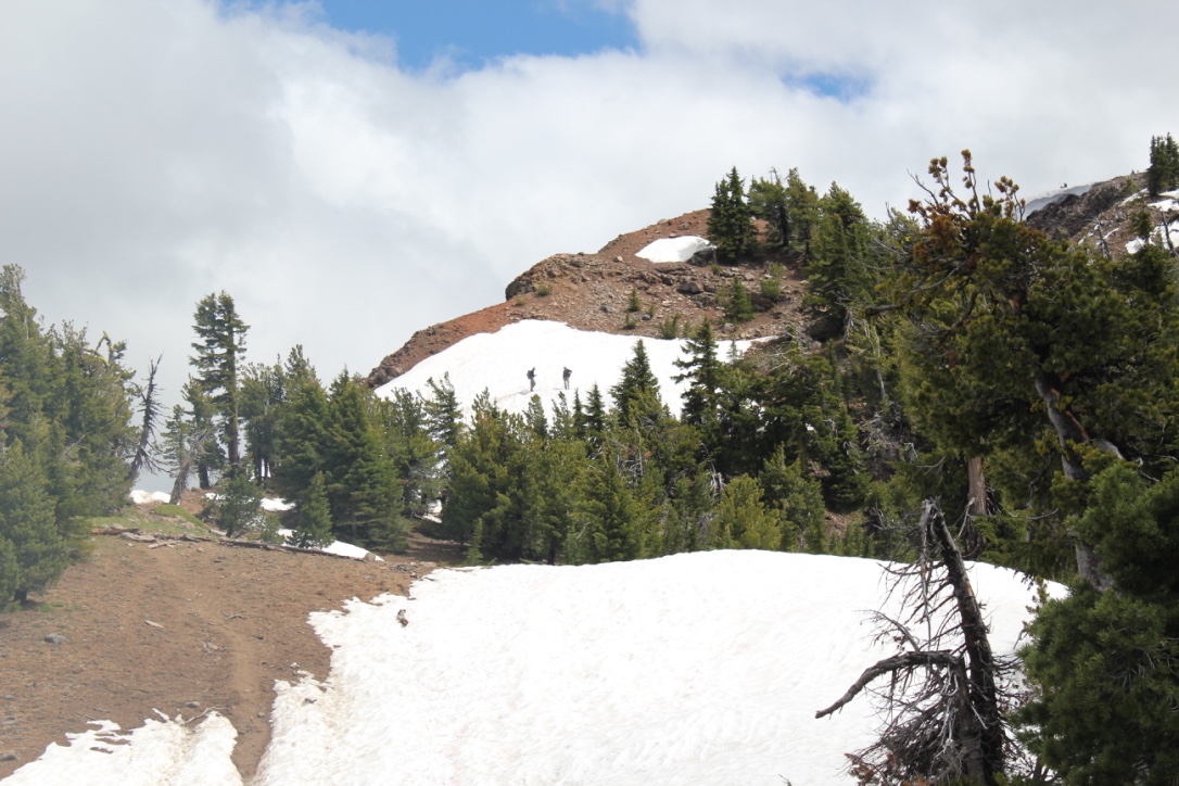 On the way, we encountered several snowfields, one of which was very steep, but the stunning views from the top were well worth the extra effort in getting there. In the distance, Mount Scott was enticingly clear of snow, though we later learned it was impossible to reach because several miles of the eastern rim highway was closed for repairs. Returning down the mountainside we visited the small loop trail of Godfrey Glen where we collected trash that uncaring visitors had left. We collected enough garbage to fill a large bag! That evening we sat around the campfire and commented on the number of stars that were visible, where was the rain? All was calm until 2 am when the rain arrived and temperatures lowered to just above freezing. Our two members in their “good deal†tent had a cold and wet night.
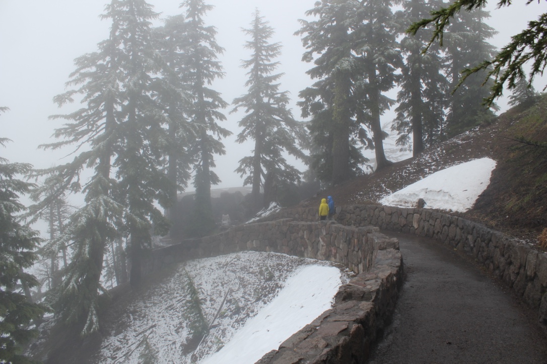 We explored the Visitor’s Center, the Sinnott Memorial Overlook (featuring an indoor exhibit room) and the gift shop to escape the fog, wind, rain, and occasional snow flurries. The fog was so thick we could not see the lake or a few hundred feet in front of us. In the afternoon we moved below the cloud line to hike the picturesque Annie Creek trail. Although a short hike, it was very picturesque. Laurie and Brad had reservations at the Crater Lake Lodge for dinner, they generously increased their table size to include all of us so we could get out of the rain and have some warm food. About 8 pm that evening the sky cleared and at first, the temperatures seemed warm. The group campfire that evening had just half of the group, the remainder had gone to bed early. The two members in the “good deal†tent had another cold and memorable night. In the middle of the night I awoke and was stunned by the visibility of the night sky – there were thousands of stars! My tent thermometer showed that temperatures had dropped into the upper twenties.
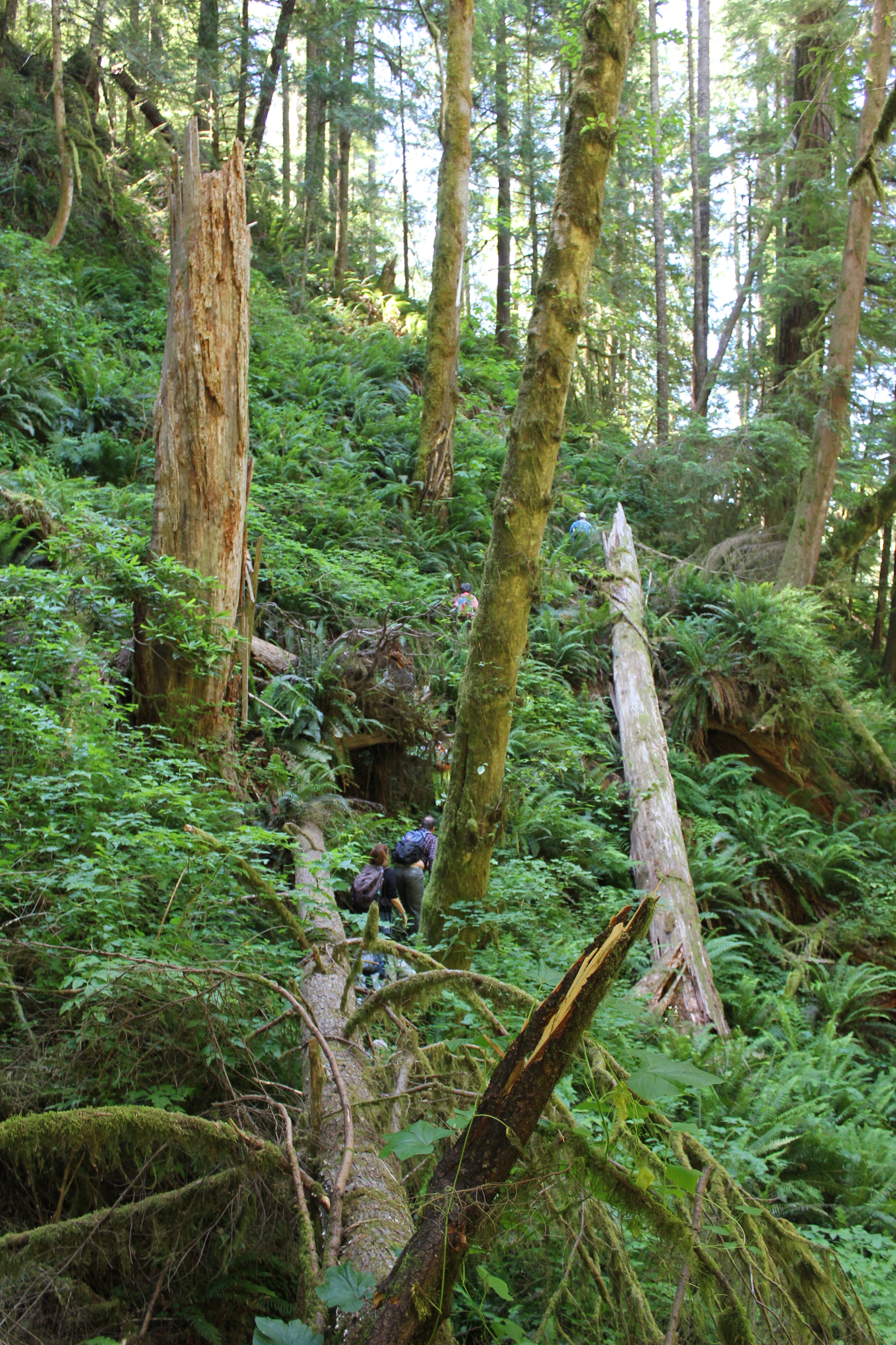 We parked at a junction and walked down an old logging road that was being reclaimed by the forest. Then we disappeared into the bushes, venturing down an elk trail. Posted on a tree was a sign that told us this was not the path to the Devil’s Staircase waterfall and unless you’re prepared to stay the night, and have Search and Rescue to look for you, to turn back. Fortunately, we had a guide for our inaugural visit.
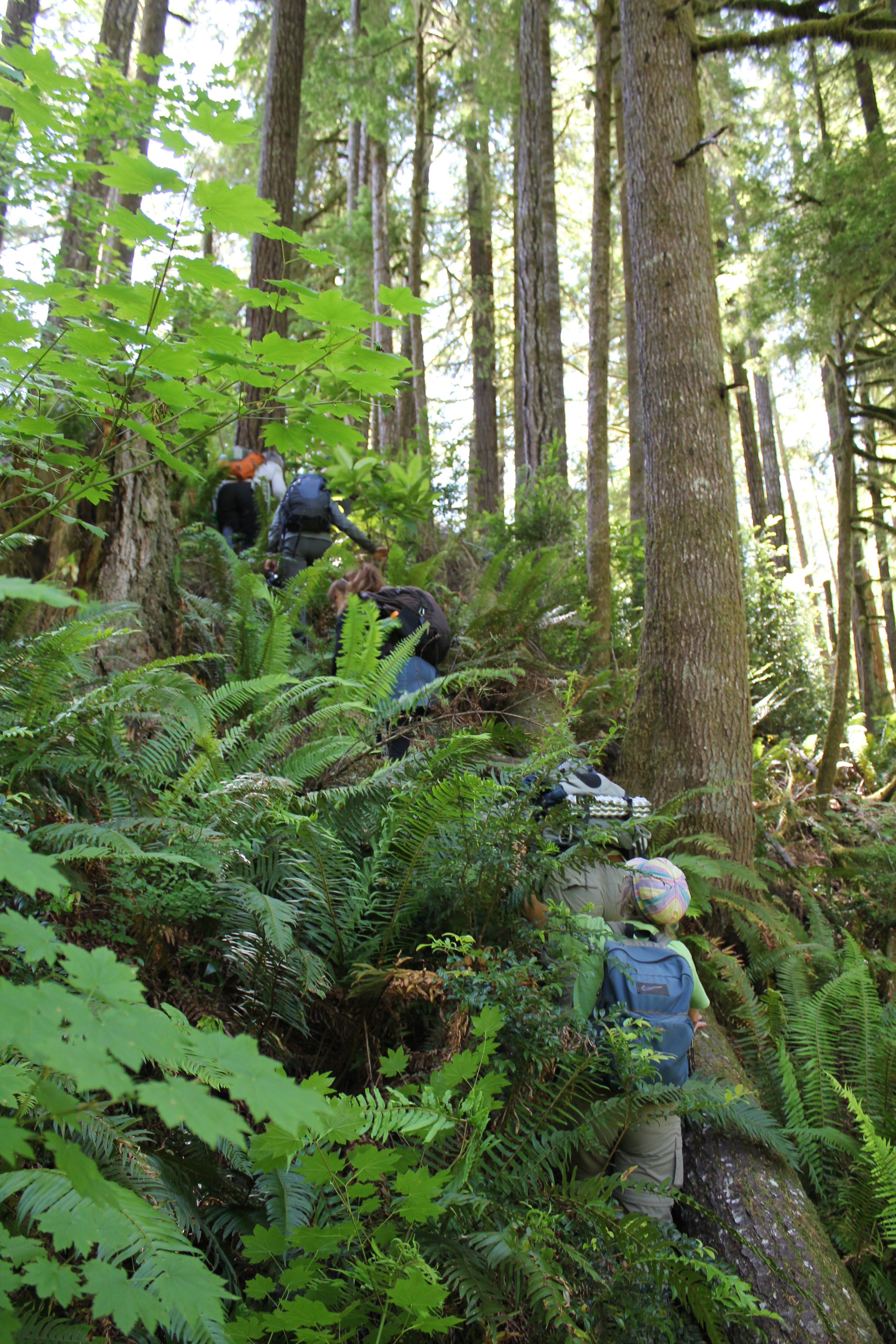 A forest of Salmonberries obstructed our path, so we made a trail straight up a ridge, then down into a forest of sword ferns. The ferns stood at five to six feet in height, so they engulfed us all and many of the shorter members traveled with their arms raised straight overhead. These tranquil glens often hid downed logs and it was easy to twist ankles or slam shins.
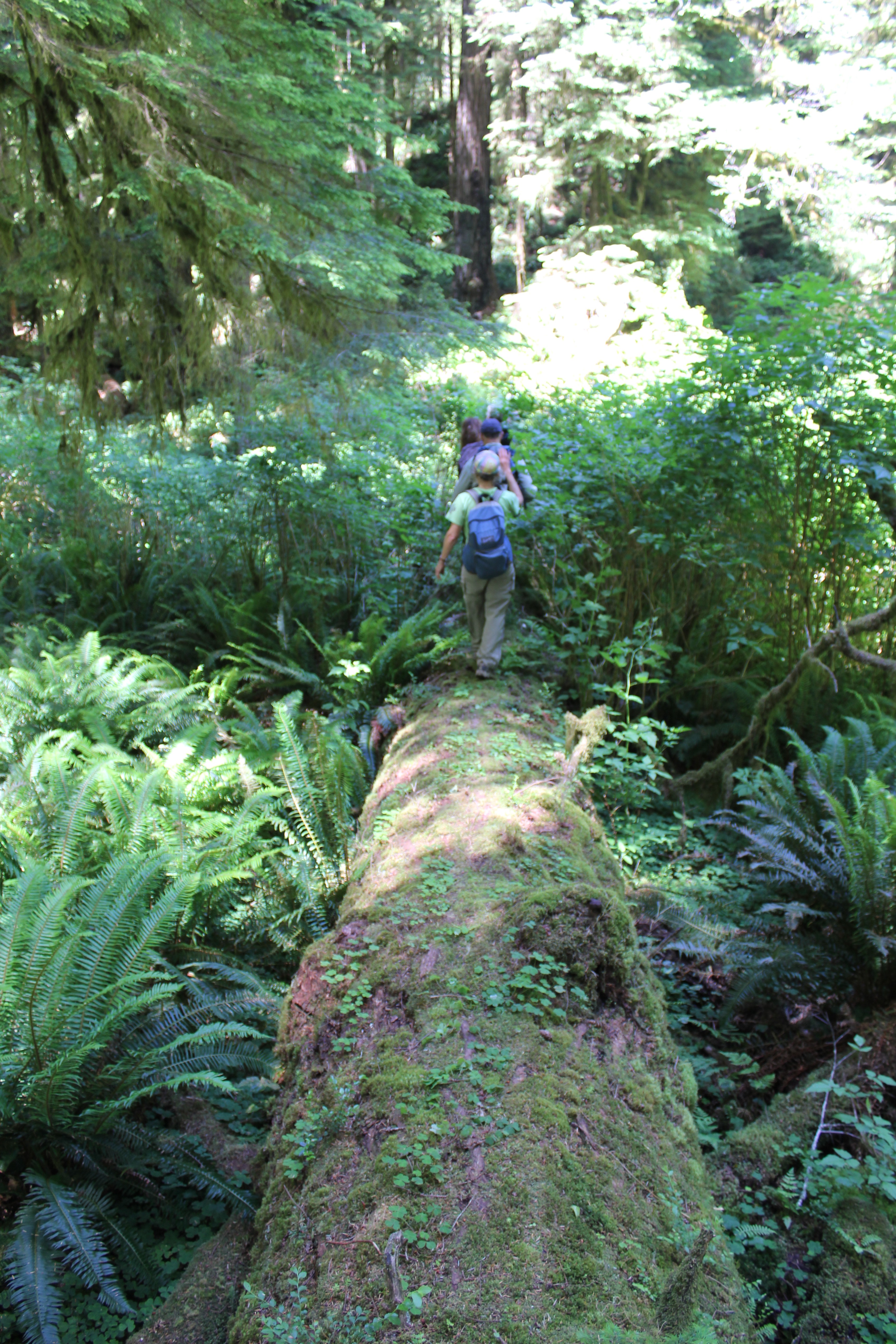 A fallen giant became our catwalk above the salmonberries, foxgloves, and ferns. We crossed a creek, but could barely see the water because of the thick undergrowth. Scampering down the side of the massive tree, we squatted and crawled through a small jungle, then emerged at the root base of the fallen giant – it was 25 feet tall!
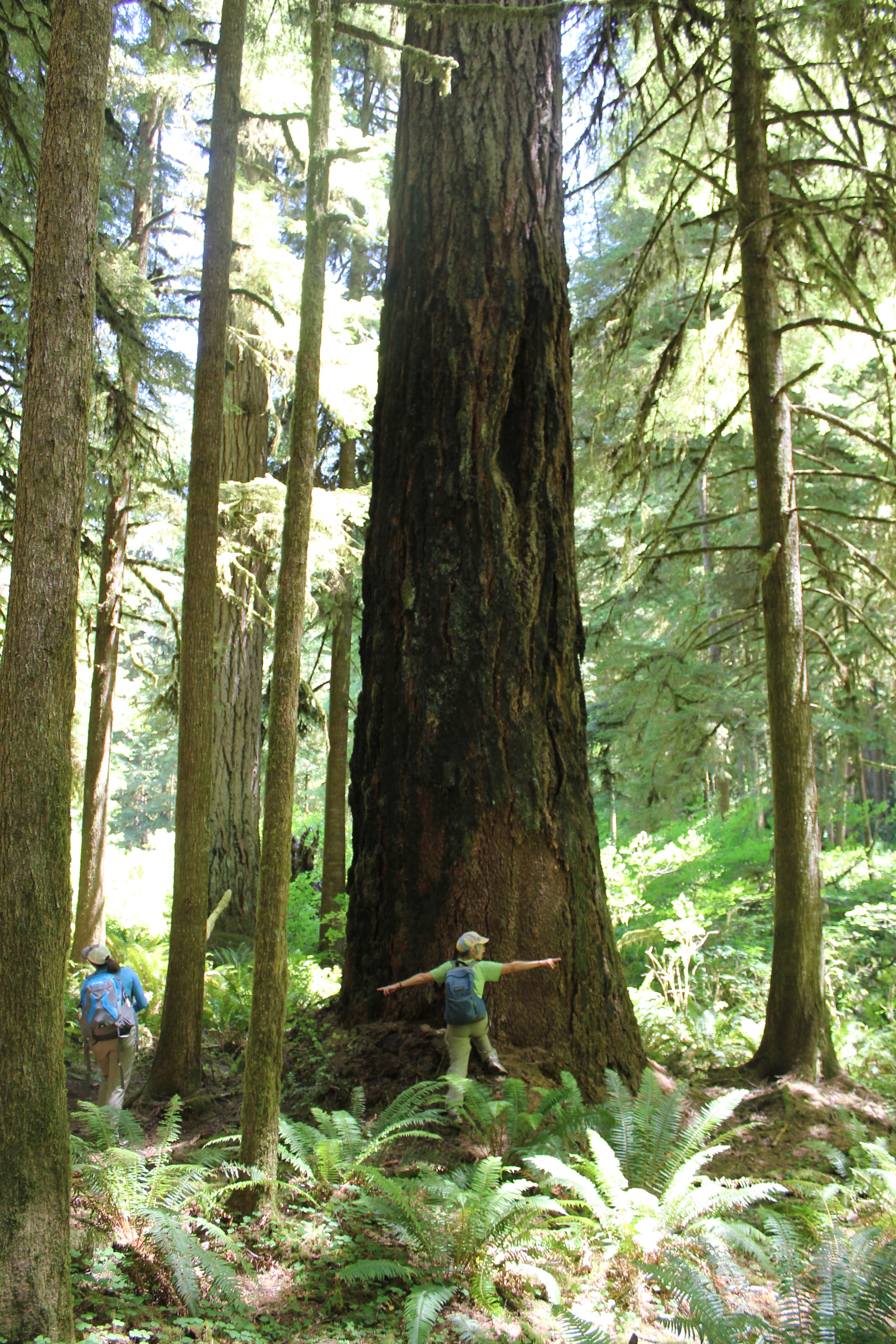 In front of us was the Dark Grove, a cathedral of 8-foot wide Douglas Fir trees. The trees were dark in appearance, the result of fire about 150 years earlier. Touching the bark a charcoal residue was imprinted on fingers. The tree model is Becky Lipton.
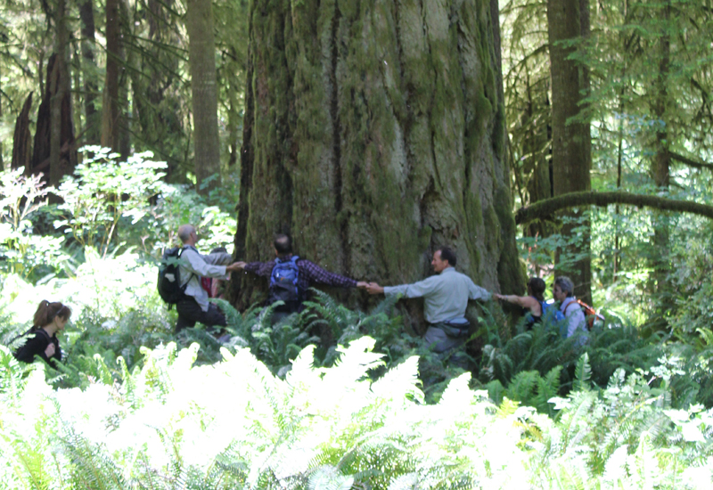 Crossing back across the fallen giant, we stood at the base of one of the largest trees we saw that day. Eight people stood at its base, arms outstretched and hands grasped. They counted one, two, three… their calls became muffled as they rounded the opposite side…the voices returned and the loop stopped – at seven and a half people! This immense tree was somewhere between 35 to 40 feet in circumference! Several hikers mentioned they felt like kids in a giant outdoor playground.