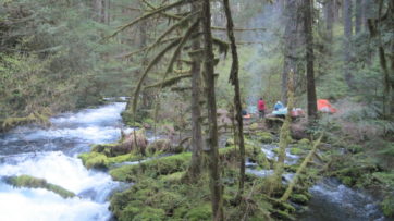
This was possibly the last warm-ish weekend in the Cascades this year, and our group was able to enjoy 3-days of hiking and camping at beautiful Waldo Lake, Oregon.
Trip Report: Group Leader: Mark Hougardy | Organization: Eugene-based Hiking Club | Date: September 2019 | Duration: 3 days | Participants: 11 | Type: hiking, car camping
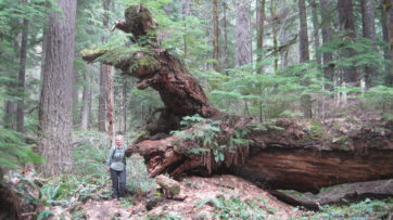
A remote area of the lakeWaldo’s Camp Edith sign continues to show its age…not bad though for 130 years of weathering. The camp remains a secret, known only to those who find it, including my group who spent part of an afternoon using a photo from the 1890s to re-discover the location.It was a mycological paradise in the woods – lots and lots of mushrooms to see!
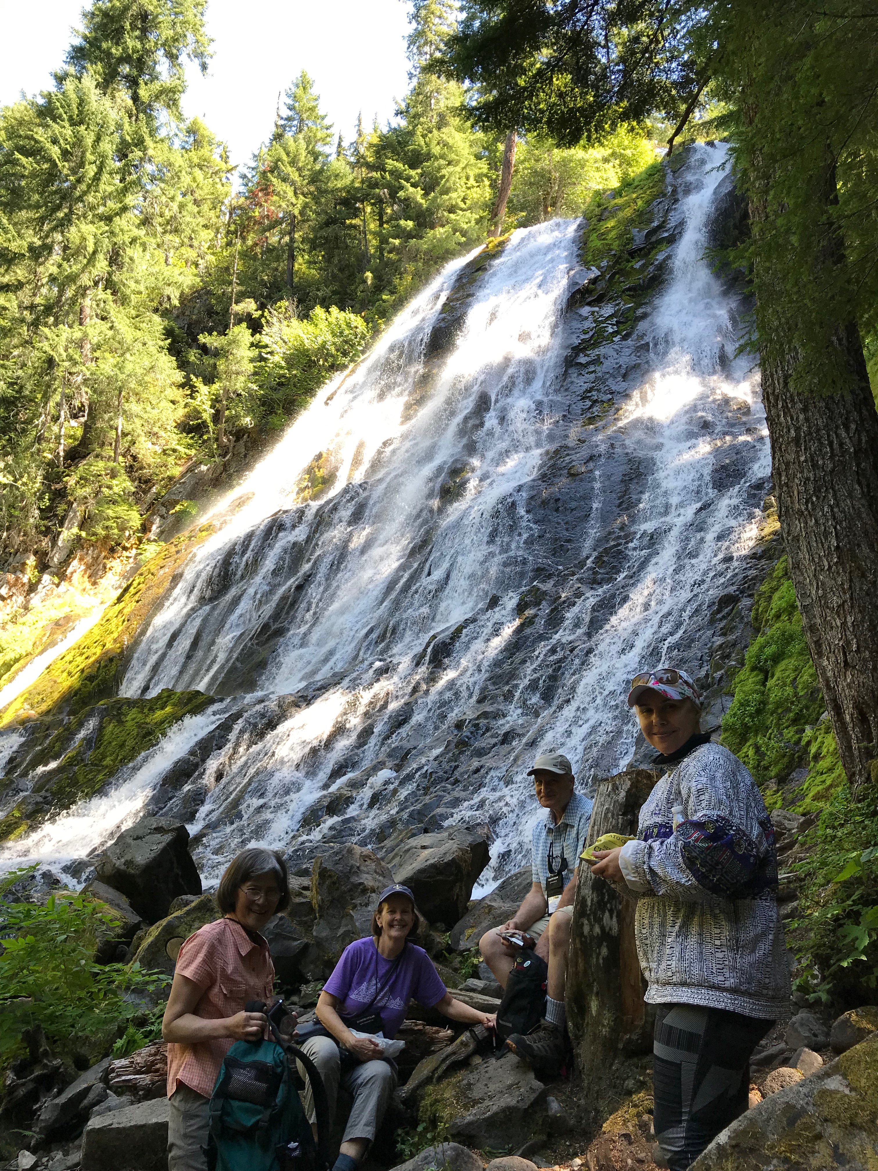
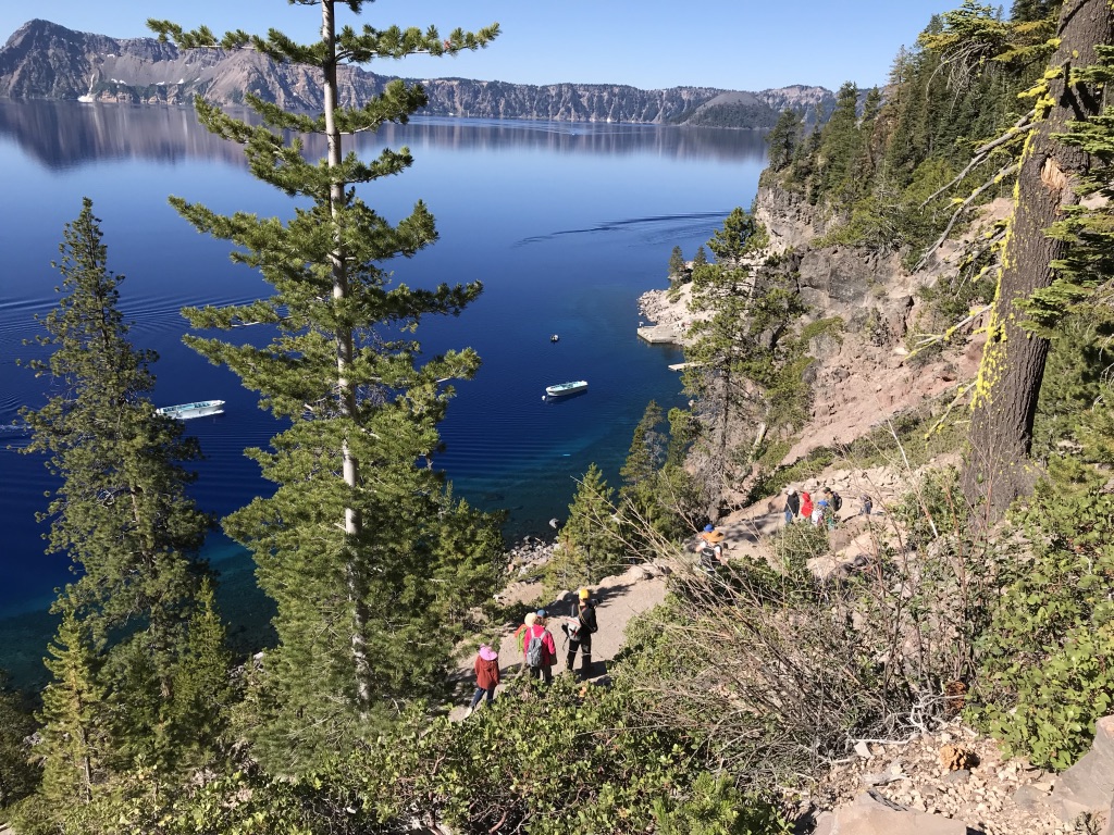
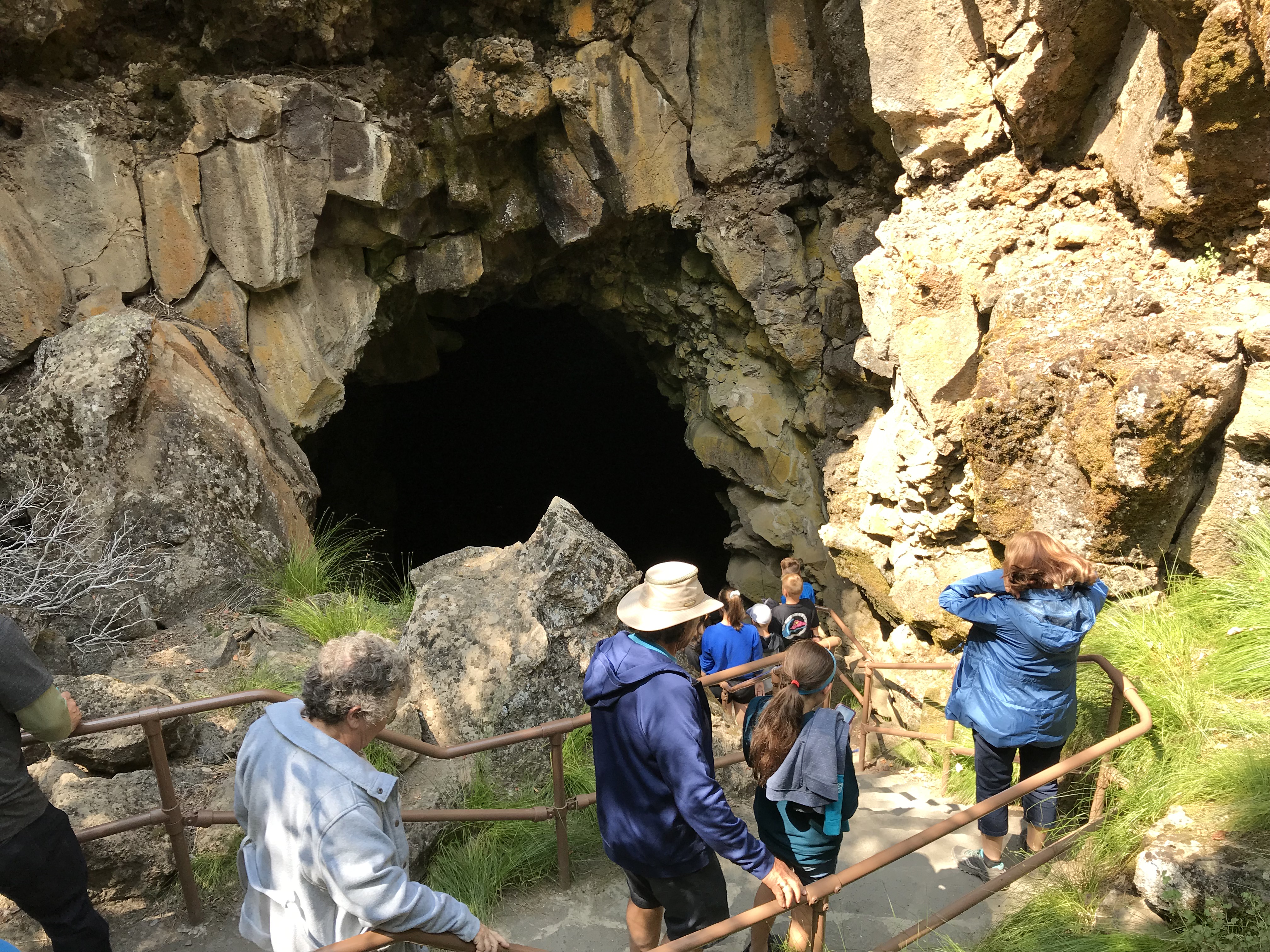
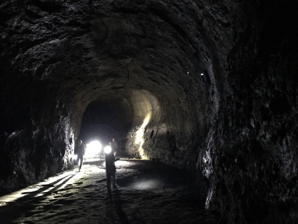
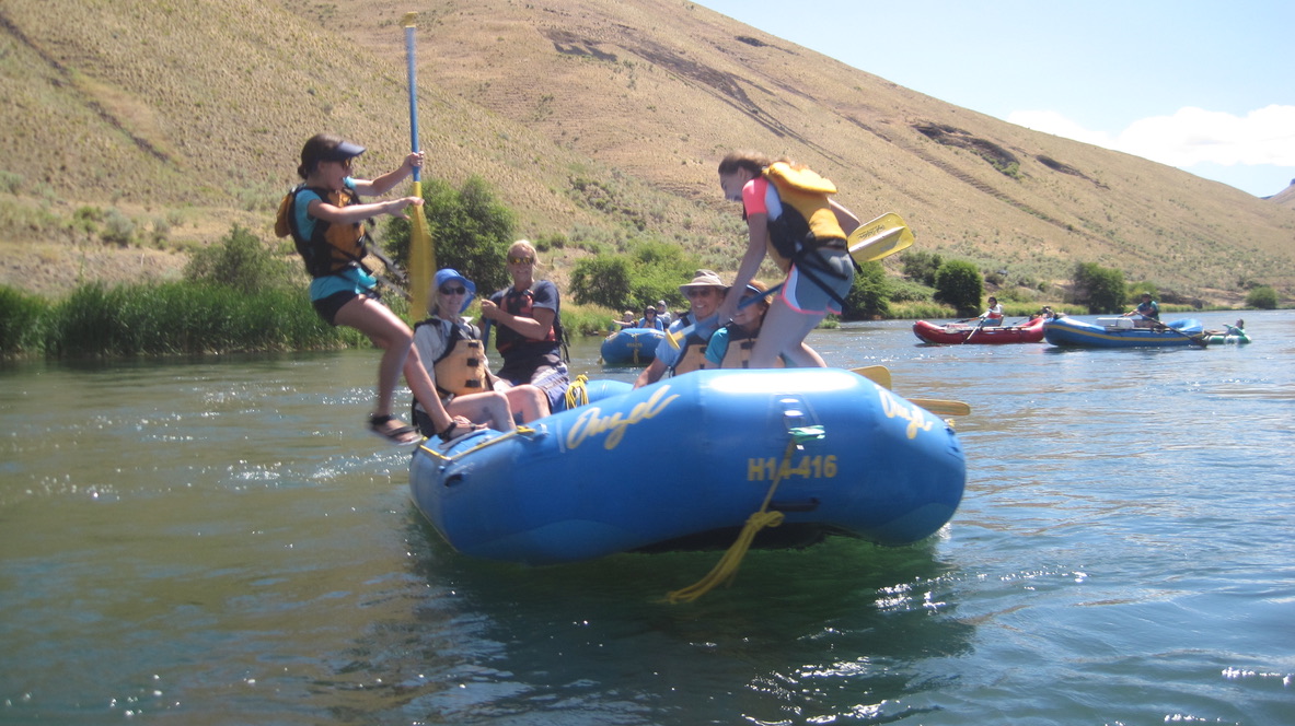
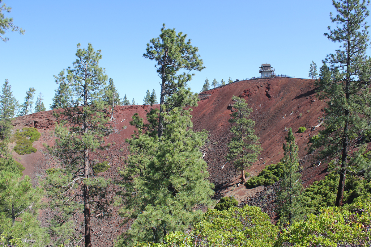
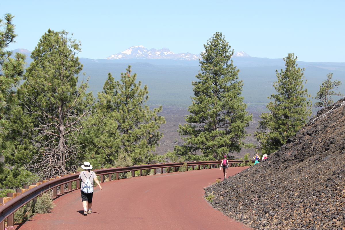
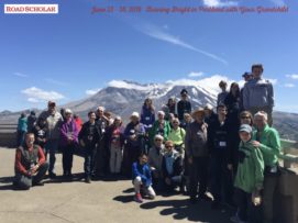
Helping people experience and learn about the rich natural history of central Oregon is always a treat. My energetic group of 14 adults hiked, rafted, and explored the amazing volcanic landscape.
Trip Report:
Group Leader: Mark Hougardy | Organization: Road Scholar | Date: August 2019 | Duration: 8 days | Participants: 14 | Type: hiking, rafting, tour
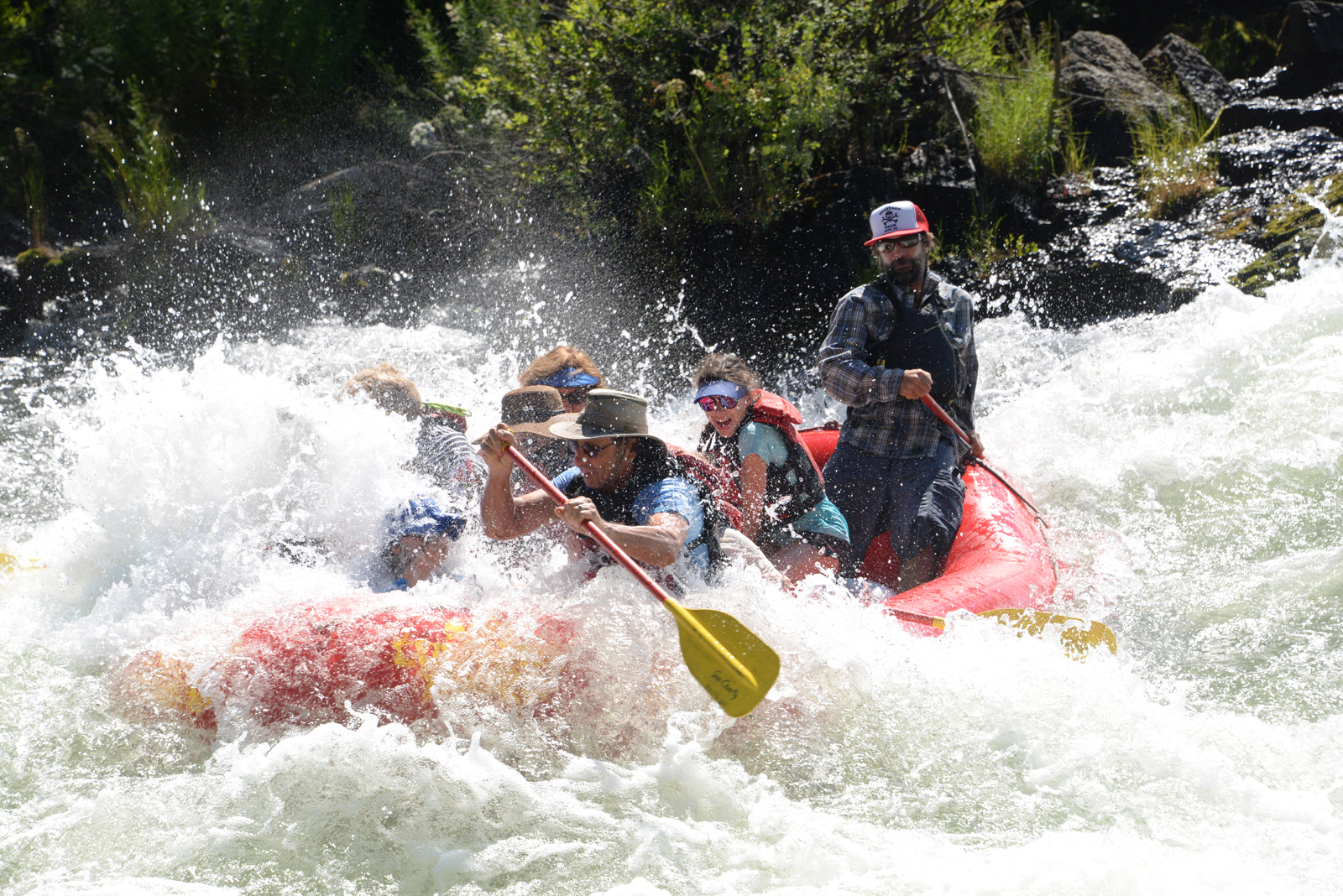
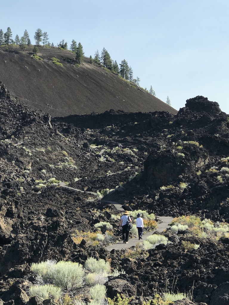
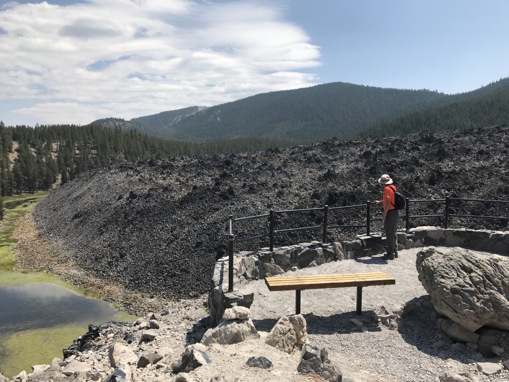
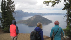
A Double Rainbow Over Crater Lake!Rafting on the Deschutes River A Day Hike in Smith Rock State Park, OregonA day hike across a magnificent lava field.Entering the Massive Lava Tube Cave Crater Lake National Park – The Watchman – Overlooking Wizard IslandHiking in the lush CascadesEnjoying the 100-feet cascade of Diamond Creek Falls, Willamette Pass, Oregon.We just finished up a rafting trip on the Santiam River.Enjoying an evening walk to explore Eugene’s colorful murals and micro-art.
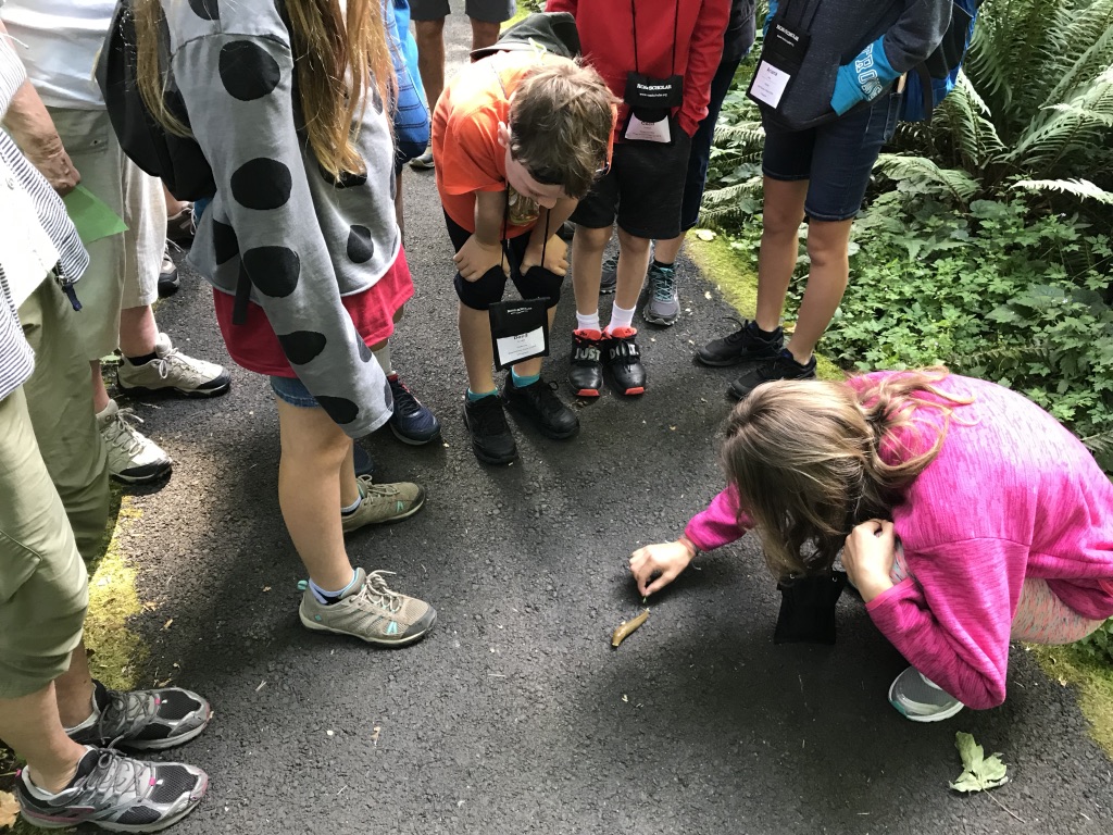
I enjoyed leading an 8-day outdoor spirited program in central Oregon for a group of 16. This was an inter-generational trip for grandparents and grandchildren. The tour was an exciting exploration of the natural and cultural history of the area. I’m so happy to have helped develop this interpretive program and I loved introducing others to this amazing landscape.
Trip Report: Group Leader: Mark Hougardy | Organization: Road Scholar | Date: July 2019 | Duration: 8 days | Participants: 16 | Type: hiking, rafting, tour
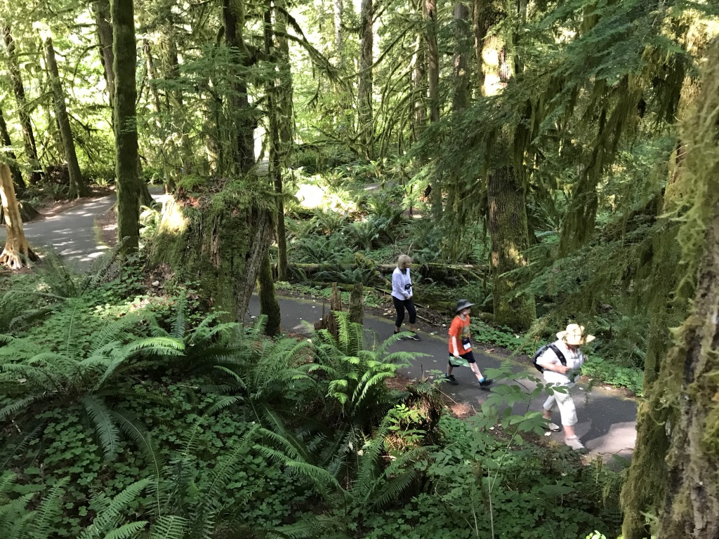
Rescuing a Banana Slug off the trail. The visit was also an introduction to the dynamic and rich Cascade Forest ecology.
Walking through a bountiful Pacific Northwest forest.
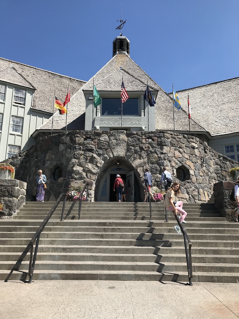
Timberline Lodge, Mount Hood. Also enjoyed a stellar lunch at the Lodge.
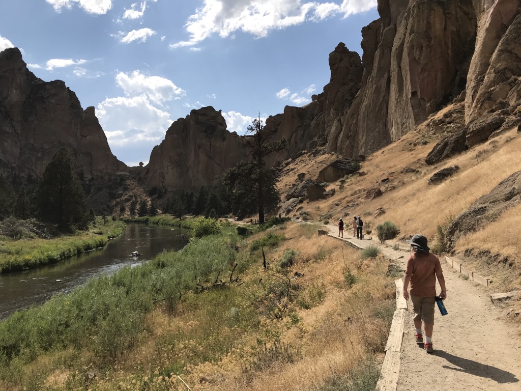
Hiking in Smith Rock State Park and learning more about its geology.
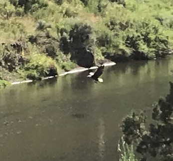
An eagle catches lunch from the river!
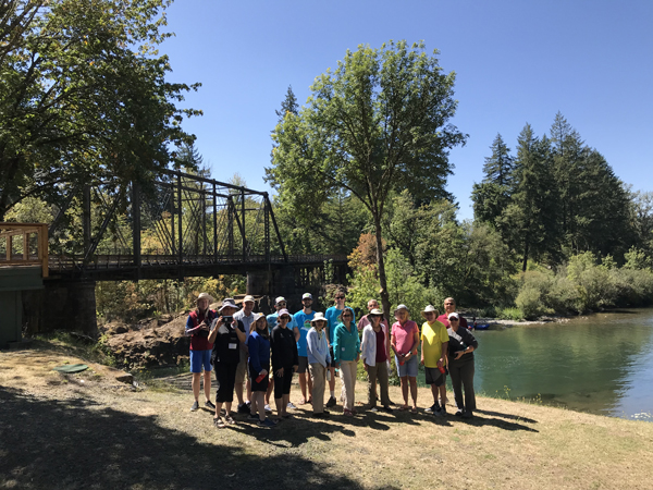
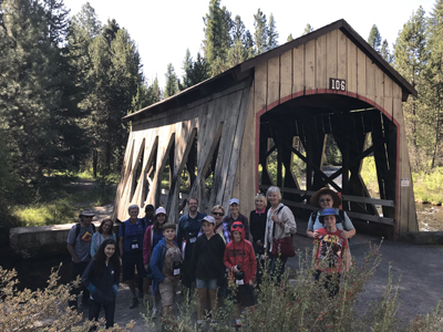
A group photo at a beautiful bridge in Bend, Oregon. The bridge was used in the movie, “Homeward Bound.”
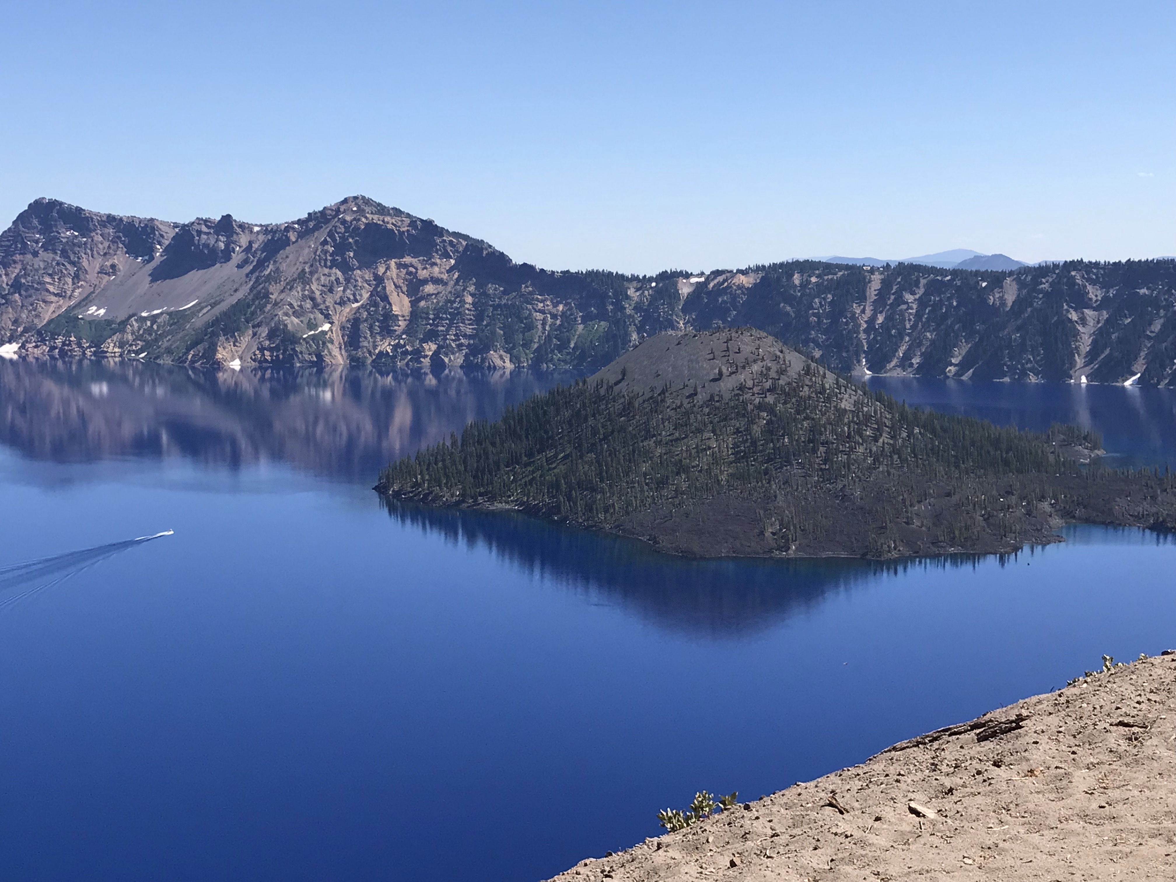
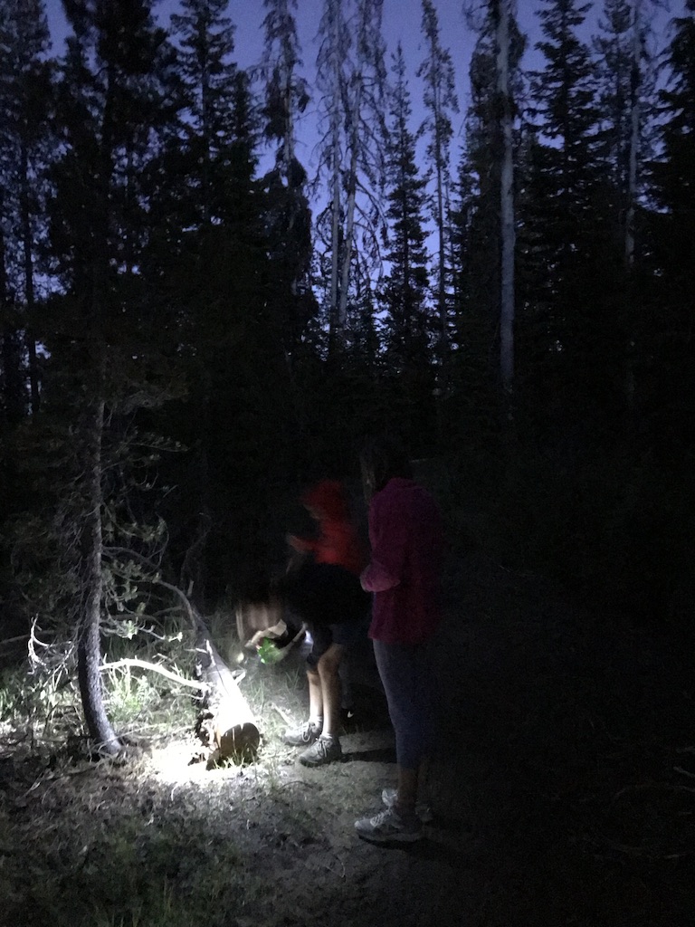
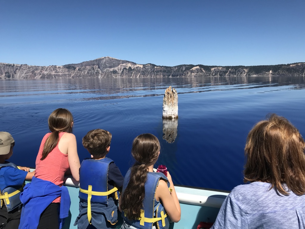
A first view of Crater Lake.Some of the younger members of the group found a cool-looking bug on the trail during a night hike.A real treat! Because of an interpretive talk I gave the younger members of our group knew about the Old Man of the Lake and were able to point it out to the captain.Hiking at Crater LakeRafting the Big Eddy Rapids on the Deschutes River. I’m on the other side of the raft taking the full river experience in the face.A grandparent and grandchild enjoying walking across the lava at Lava Lands.Overlooking the Big Obsidian Flow – one square mile of black Obsidian!Entering the Lava River Cave (lava tube)Walking with the group at Lava River CavePlaying on the lower Deschutes River – one of the trip participants is about to get really wet.
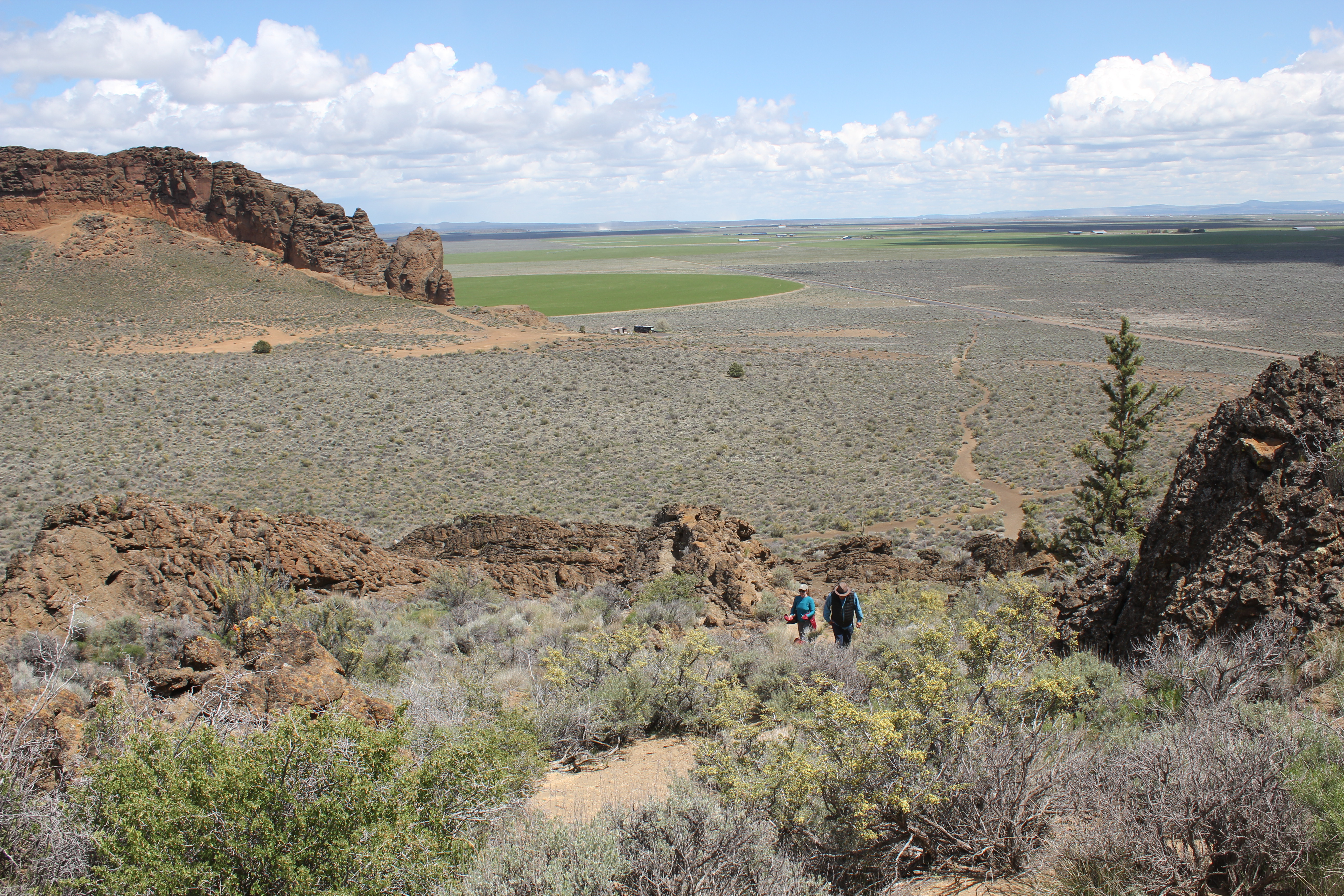
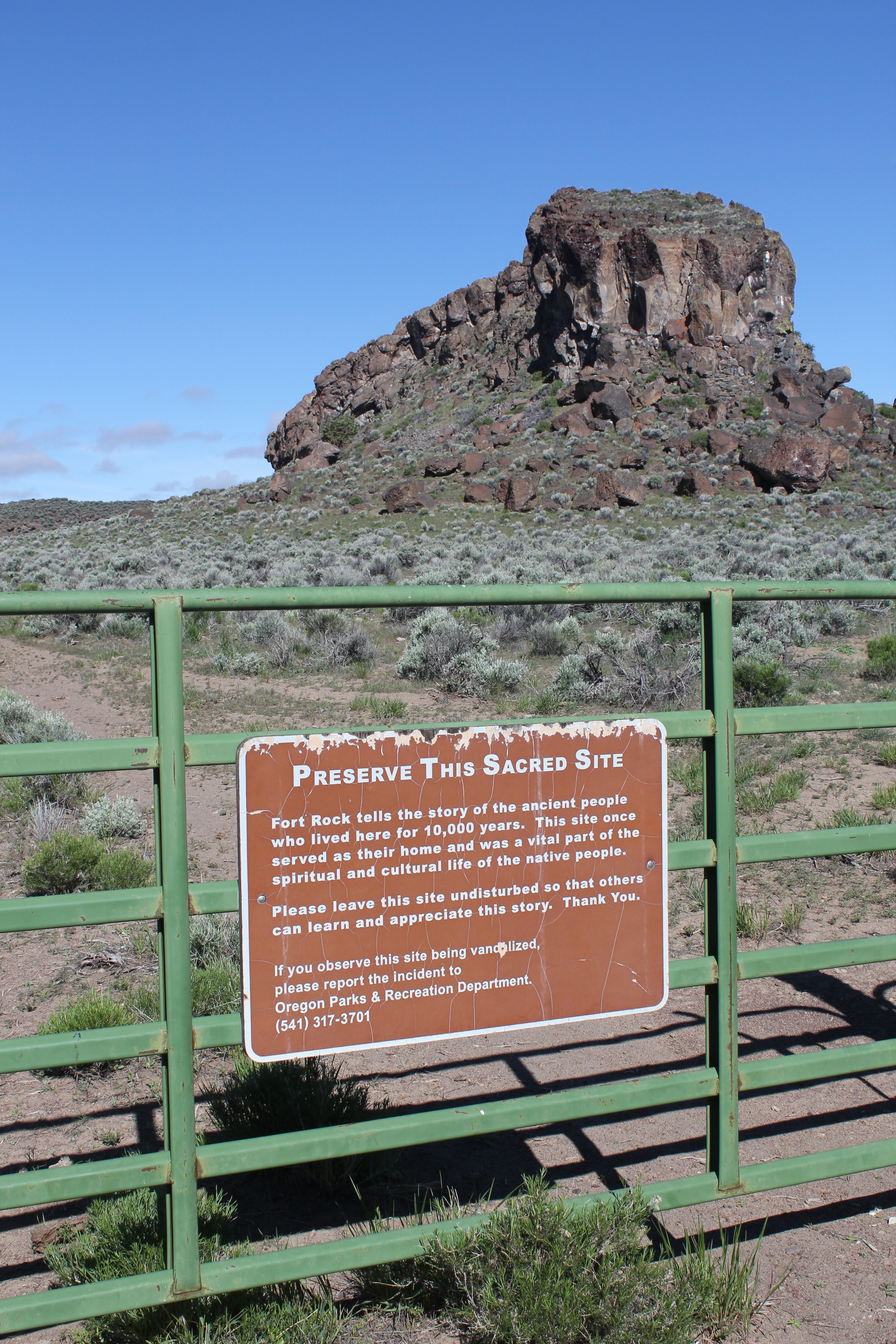
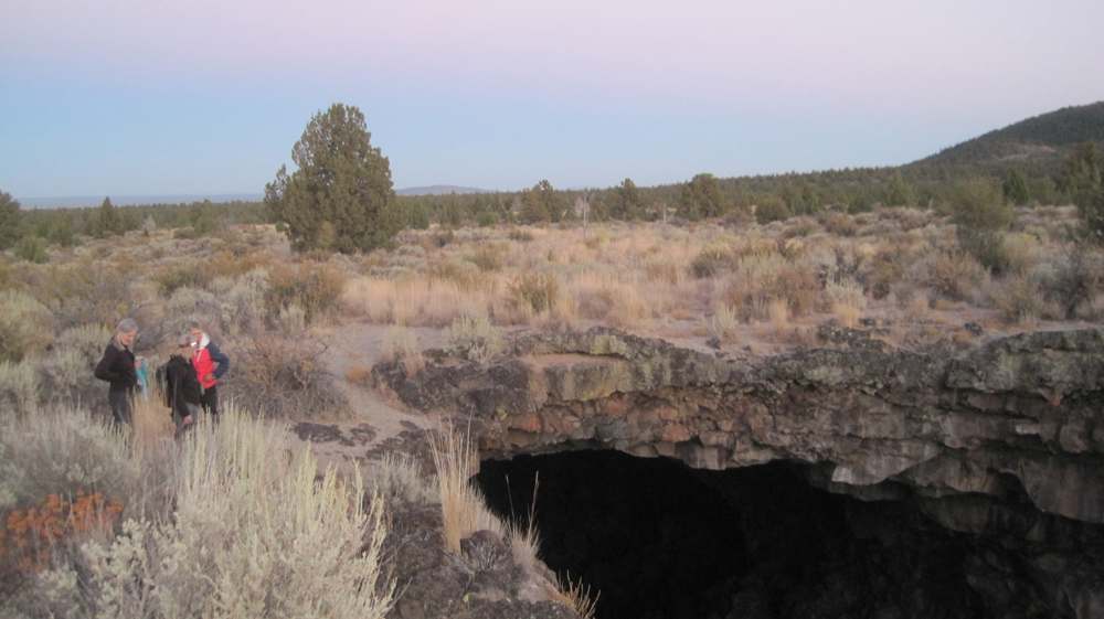
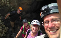
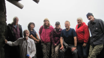
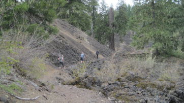
This was a 3-day experience into Central Oregon’s Outback to learn more about early human habitation and the area’s geology. Our route included the archaeological site of Fort Rock Cave, the 2-mile long volcanic fissure known as Crack in the Ground, and plans to visit the Fossil Lake area.
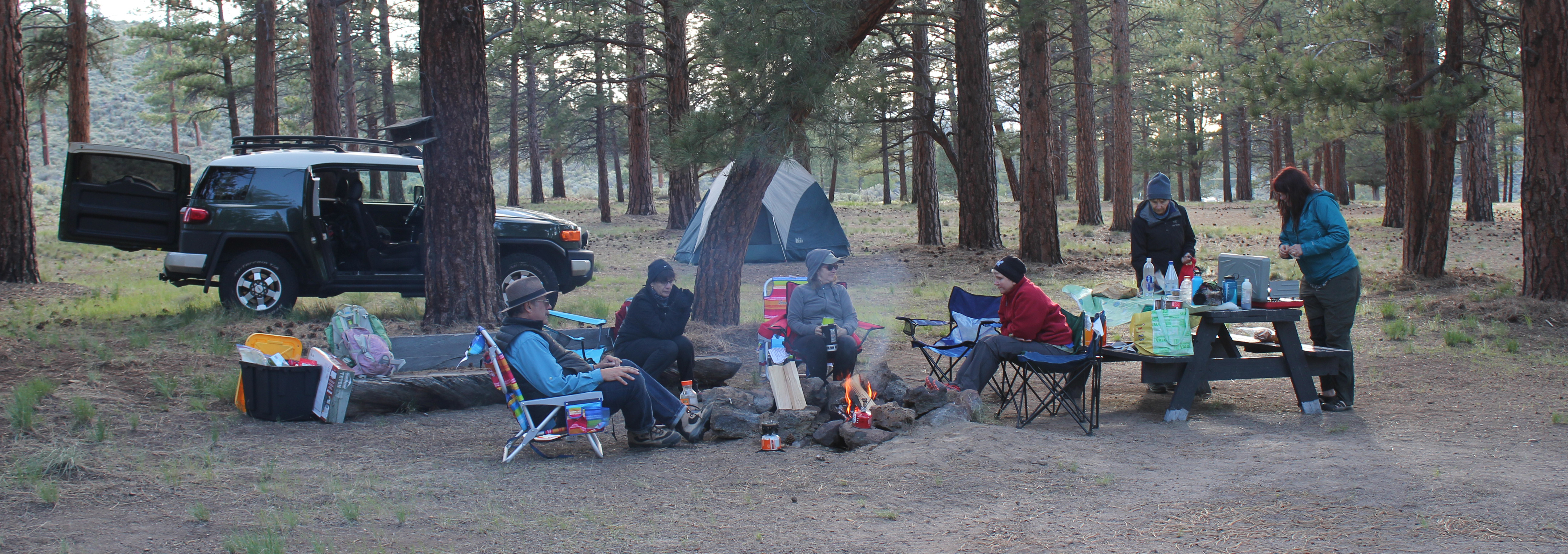
Trip Report: Volunteer Leader: Mark Hougardy | Organization: Eugene-based Hiking Club | Date: May 2019 | Duration: 3 days | Participants: 8 | Type: hiking & camping
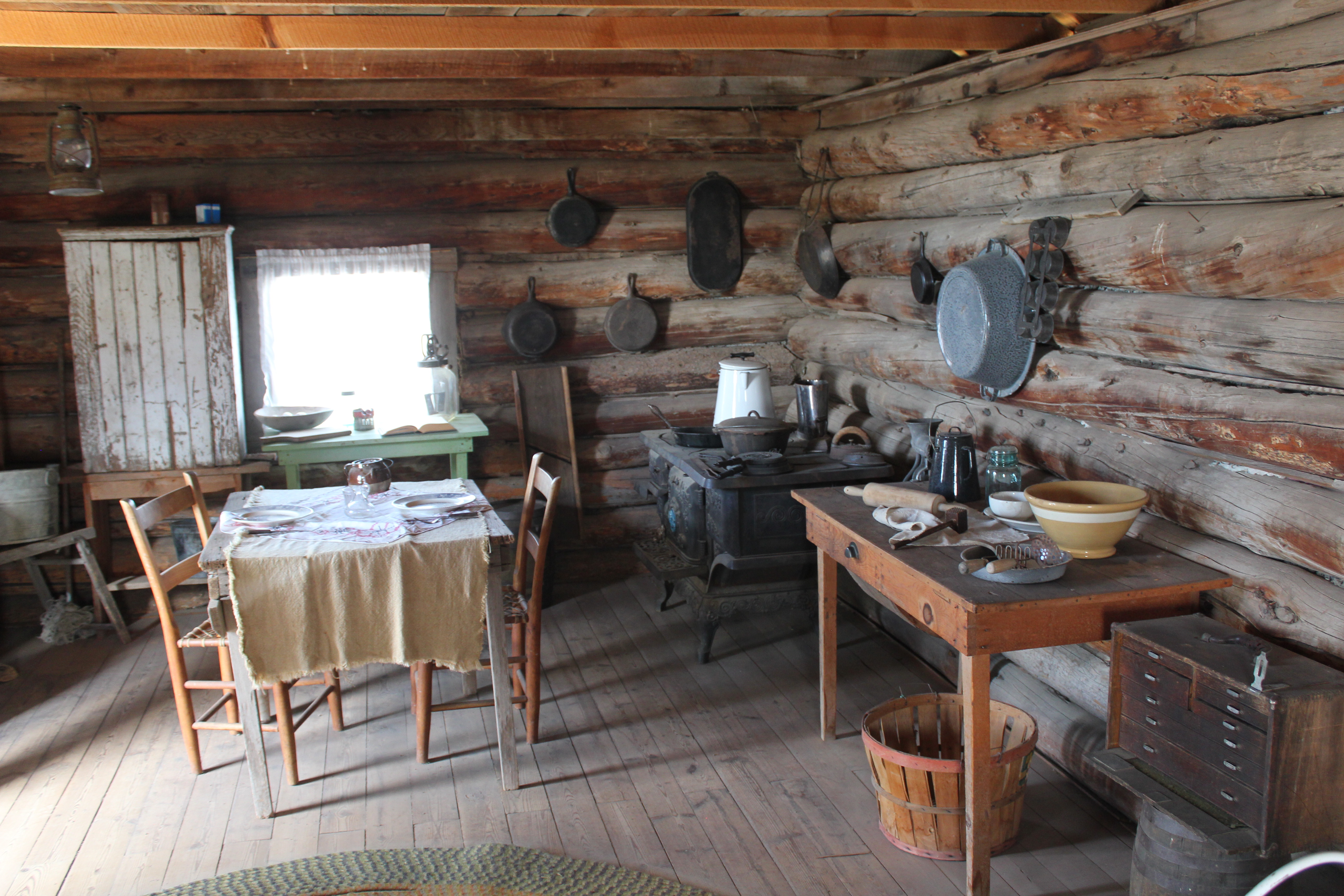
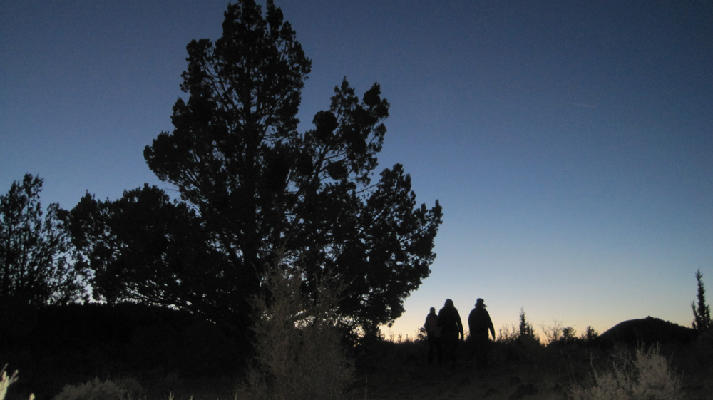
On our first day, one member discovered she didn’t have the right key to the car carrier which held her sleeping bag. Our caravan stopped at a hardware store in Oakridge where the employee emerged with the largest pair of bolt cutters ever seen. He quickly removed the troublesome lock. For lunch, we stopped at Salt Creek Fall for a break and later at an info kiosk on Hwy 31 before continuing to Fort Rock. At Fort Rock, we hiked to “the notch” along the western tuff ring where the wind was really strong. We made our own trail back down the rough side to more level ground. Afterward, we visited the Homestead Museum to learn more about homesteading was like in earlier years. At a nearby private campground, we set up our tents and enjoyed a fire for an hour or so when we noticed a mist in the distance. Within a minute or two it started to rain. We called it an early evening.
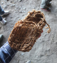
On the second day, in the early morning, the sunrise was beautiful and a coyote was heard yelping in the distance. One participant had green shower shoes and after a miscommunication about where they were to be delivered, gave everyone a good laugh. At 9 am we drove to Fort Rock for our interpretive tour of the Fork Rock Cave where 10,000-year-old shoes had previously been found. The Oregon State Park Ranger had driven from La Pine and was delayed a few minutes because of traffic. Our group and two others joined him in a state park van and we drove ten minutes close to the site. Then we walked about half a mile to the cave. He shared 3 prevailing theories about how humans arrived in the Americas and included a traditional story about how Fort Rock had been formed. We were asked that the story remains in the cave. As we walked back to the van one participant was keenly interested in the bleached bones of a dead cow. Back at Fort Rock we ate lunch and watch some of the birds on the cliff face.
A reproduction of a 10,000 year-old sagebrush sandal
We then drove half an hour to Christmas Valley then to Crack in the Ground. We hiked several sections that we could scamper through and also hiked along the top of the fissure. Several participants disturbed a prairie falcon who was not happy to see them. The falcon made a lot of noise, and as they moved away it acted as though it wanted to nose dive them. Storm clouds were approaching; we left about 3 pm and drove to an isolated ranch. The directions were a bit off and we took several wrong turns before arriving. We were greeted by two rambunctious dogs, a golden colored and bear-sized dog and a smaller ten-month-old border collie. As we were unloading our cars the collie jumped in the back of the trip leader’s car when a door was open and pee’d on the back seat. Just as we completed setting up our tents a 20-30 mile-an-hour wind blew past and dark clouds rolled in. The rain started at about 6:30 pm and everyone quickly disappeared into their tents to eat. We didn’t see anyone again until the next morning. The rain poured throughout the night.
The morning of the last day we were happy to hear that everyone pretty much stayed dry during the rain. We decided that traveling on muddy back roads might be problematic so we canceled the last portion of our trip to Fossil Lake. Just as we packed the last of our gear the two dogs reappeared but now they covered in mud – quickly we departed. We stopped in Fort Rock at a convenience store for gasoline and a break, then another break at Fort Rock, then again Salt Creek Falls before returning home.
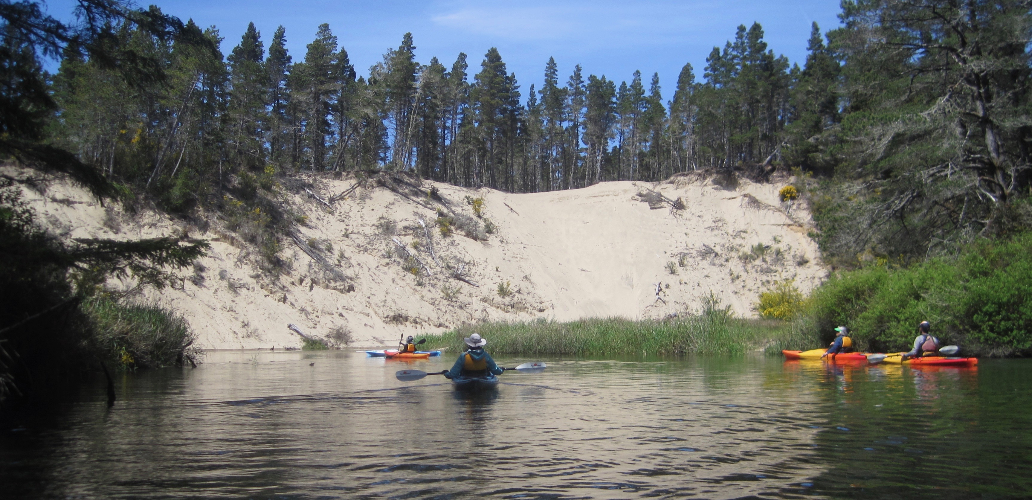
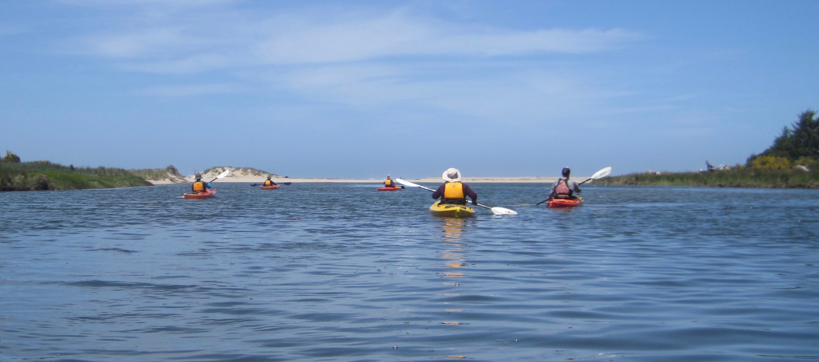
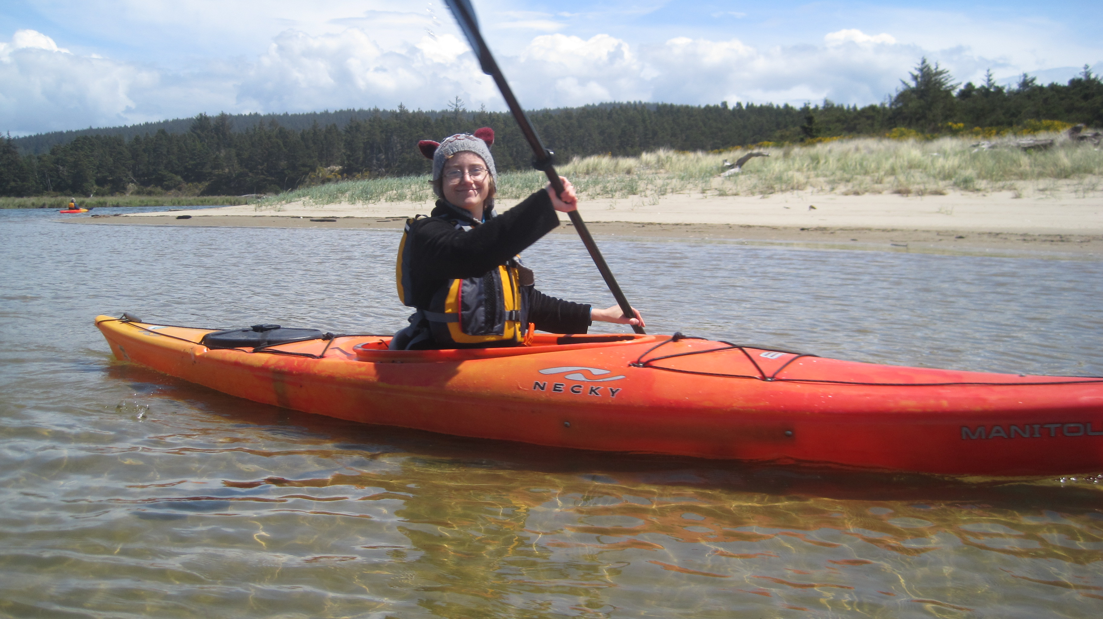
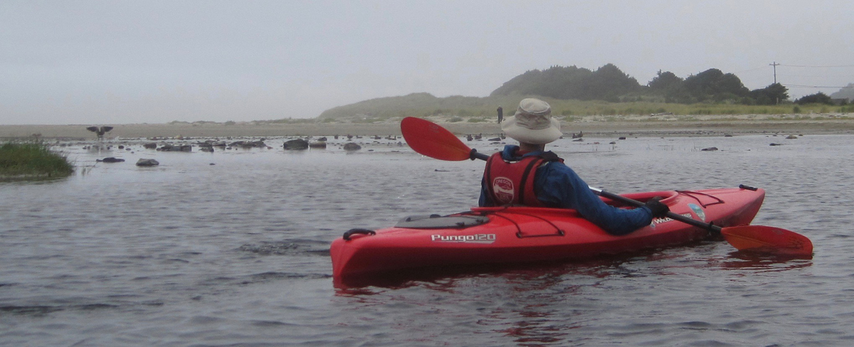
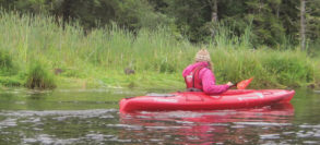
Trip Report: Volunteer Leader: Mark Hougardy | Organization: Eugene-based Hiking Club | Date: May 2019 | Duration: 1 day | Participants: 7 | Type: kayaking
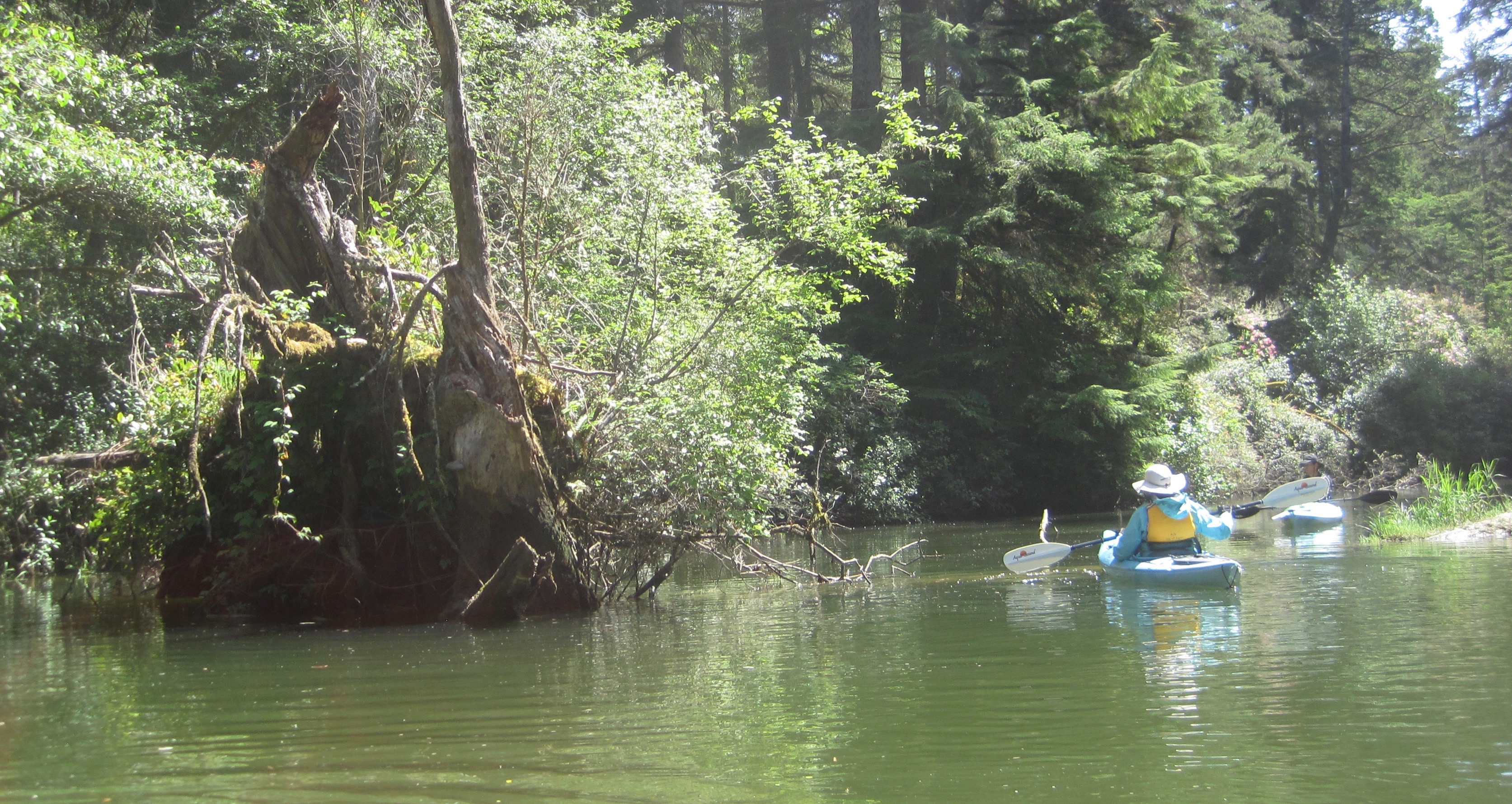
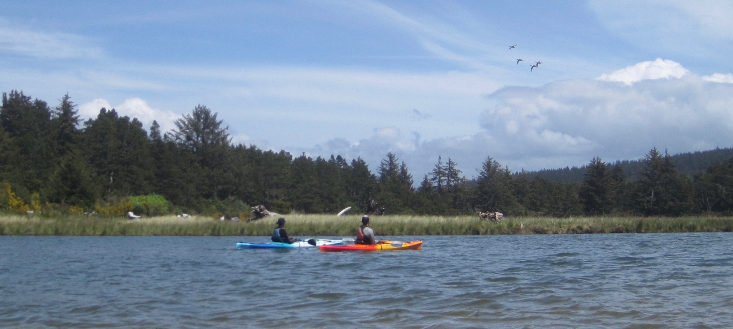
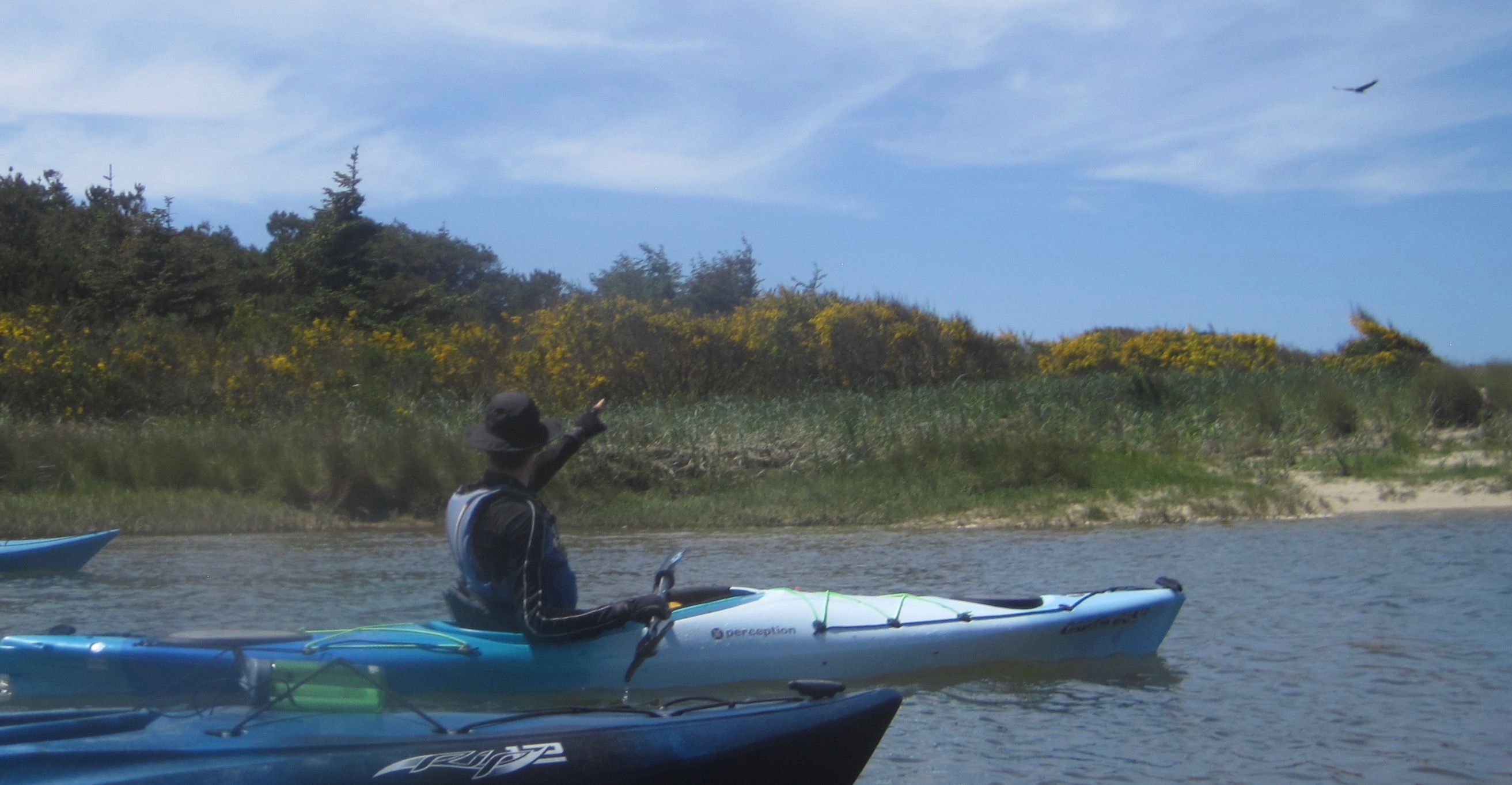
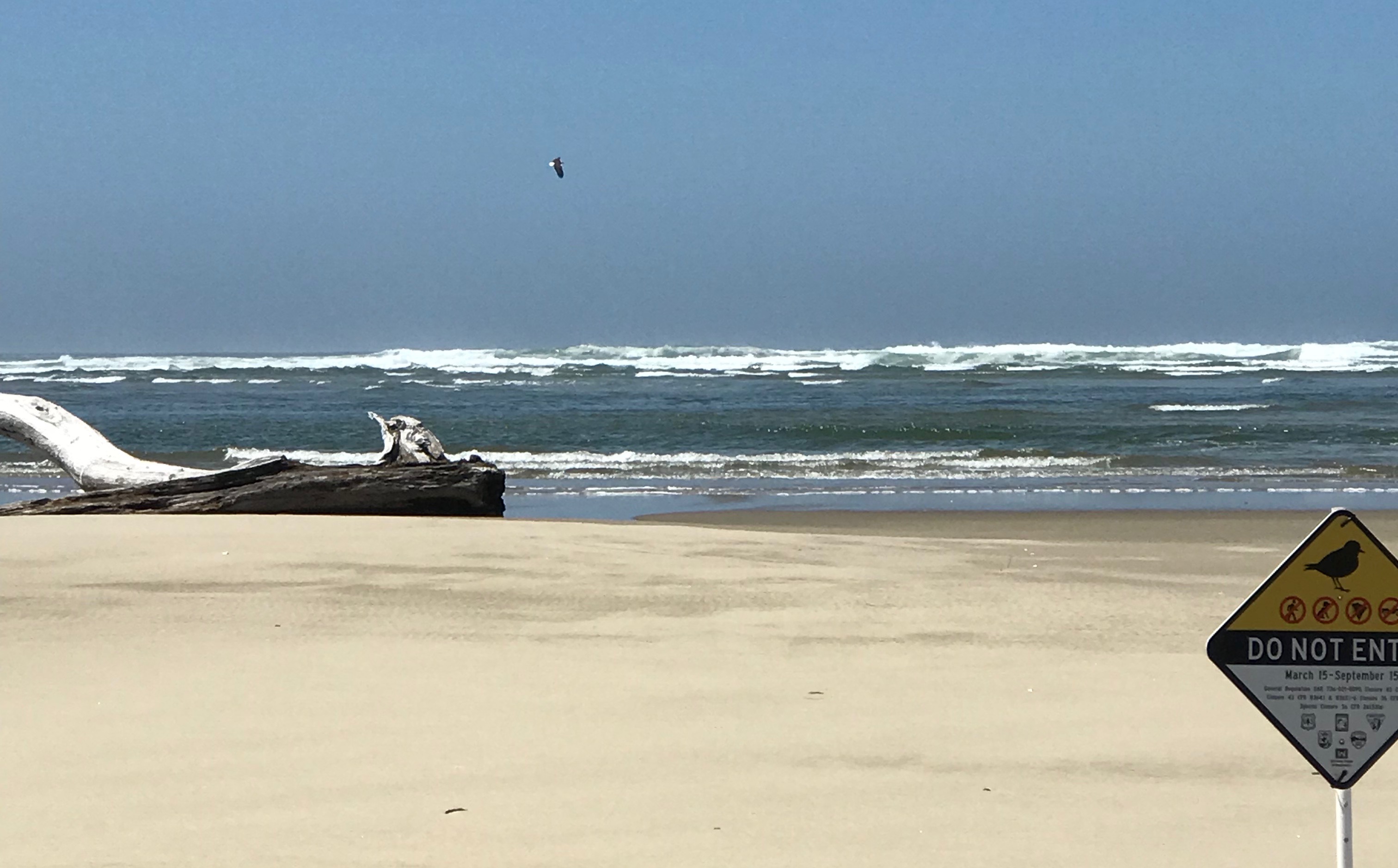
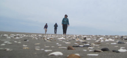
Kayaking Oregon’s Siltcoos River during the springtime is a treat, provided you can time it right. A day earlier dark clouds, lighting, and sheets of rain pelted the area. But, today, the temperature was warm and the sky was clear, allowing us to witness the Siltcoos in all its splendor. We were fortunate and very thankful. The Siltcoos is an interesting interplay of a riparian area within the Oregon Dunes National Recreation Area. The dunes are one of the largest expanses of temperate coastal sand dunes in the world. When geologic forces created the dunes, the sand-choked off several coastal rivers and created about 30 lakes. Some of the rivers have found a way back to sea, the Siltcoos River is one of these rivers. Today, it is a slow-moving three-mile long waterway that holds the distinction of being a canoe trail. We were unable to visit the lower water dam because of a large fallen tree. A special thank you to the River House Outdoor Center of Eugene for the use of their kayaks and local guides. From the water, our group saw at least 18 animal species: bald eagle, osprey, a grey fox, swallows, killdeer, newt, bumble bee, heron, fish, stellar’s jay, crow, seals, egrets, mergansers, butterflies, dragonflies, spiders, and egrets. We also saw a dog at the bow of a kayak, and (not paying attention to posted signs) a human and dog in a protected area.
An 80-foot wall of sand along a bend in the river.Upriver there were a number of fallen and downed trees we gave them a wide berth.The dunes gave way to open spaces and a green marsh. Several ducks were flying overhead.A large bird turned in our direction. As it approached we saw a white head and white tail feathers – it was a bald eagle! A magnificent sight, and seeing it was worth all the money in the world at that moment.The river widened as we approached the mouth of the Siltcoos River.At the mouth of the Siltcoos River. The Pacific Ocean had 4-6 foot swells that day. A bald eagle was observed looking for a mid-afternoon snack in the surf. Note the white tail feathers. The area before us (all the shoreline in the area) was closed to protect habitat for the Snowy Plover, a threatened species. Photo credit: Anna Hougardy.A happy trip participant
Trip Report -Volunteer Leader: Mark Hougardy; Group: Eugene-based Hiking Club; Dates: April 2019; Participants: 16; Type: Urban & Trail Walking
Imagine attending a grand celebration… Every year, 100 people gather to laugh, tell stories, eat good food, and celebrate. Near the conclusion of the festival, everyone erupts into a joyous song, this music is extra special because for it to be harmonious each person is responsible for contributing just one note at the right time. The song rises and flows with many voices as old and young share. The following year there is another celebration but now a people few are missing. The next year, there are others who don’t attend and the melody starts to fray. For decades this unraveling of the song continues as fewer people are around to sing. Afer one hundred years only two people remain. They sing with passion, but how do they celebrate the larger song with so many notes missing? …How would you?
In the early 1800s, the Kalapuya people numbered around 15,000 and were the largest Native American group in what is now known as the Willamette Valley of western Oregon. Diseases introduced to the area decimated the population and by 1850 about 1,000 people remained. In 1900, the Kalapuya numbered about 300 (2% of the original population) and by the 1950s the last generation of speakers had passed. A 1977 University of Oregon anthropological paper declared, “the Kalapuya population is now presumed extinct.”
This was the setting for Esther Stutzman, a woman of Kalapuya heritage who wanted to revive the language. Over the years she made incremental steps to build awareness about the Kalapuya and awaken the language, but even into the early 1990’s, she was told by academics to not even bother as the language was dead. One reason for this difficulty was the geographic connection to Kalapuya place names no longer existed; pioneers had given all the landmarks names. Esther eventually partnered with the Citizen Planning Committee of East Alton Baker Park. Together, they convinced Willamalane Parks and Recreation and the City of Eugene to re-associate place names with Kalapuya words and phrases. The 237-acre park was re-named the Whilamut Natural Area of Alton Baker Park, and a year later, they placed cultural art installations known as the Kalapuya Talking Stones.
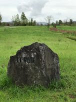
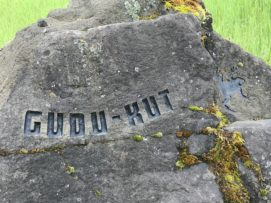
The Talking Stones are etched boulders that carry a Kalapuya word from one of the several dialects that describe the location where the stones reside. Today, fifteen stones quietly speak with those who will listen from along riverside trails in the Whilamut Natural Area in Eugene and the Eastgate Woodlands of Springfield, Oregon.
Talking Stone GUDU-KUT (frog)
The stones are etched with a simple font that approximates being written by a human finger as though an elder has just shared an idea by drawing a concept in the earth.
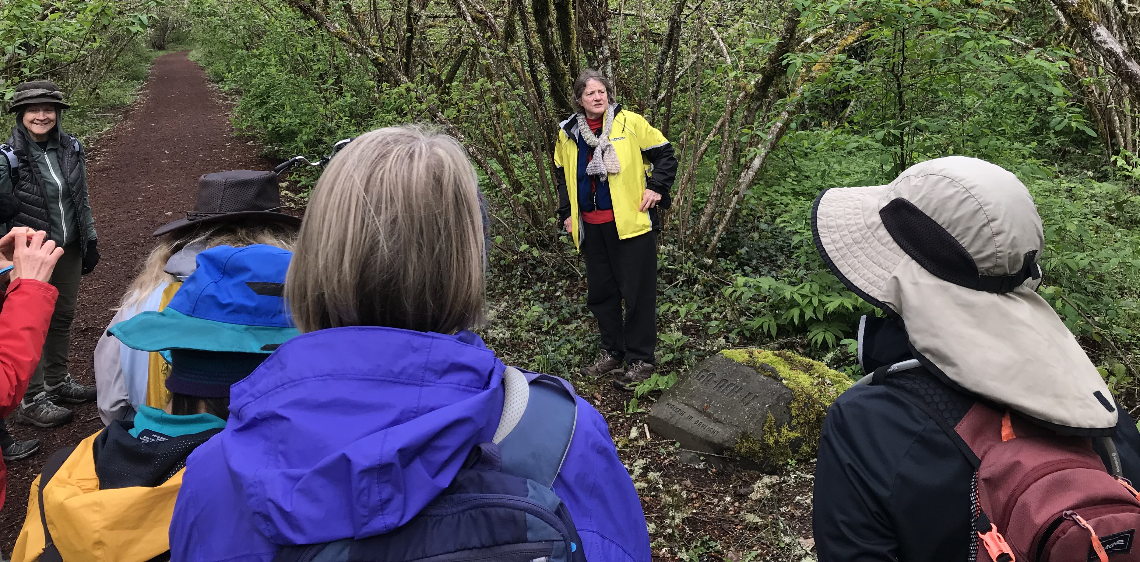
Placing the stones required years of work, public education, and patience from Esther and often-unsung heroes on the Citizen Planning Committee (CPC), including Charlotte Behm, Vicky Mello, David Sonnichsen, and others. The group has spent more than twenty years (as volunteers) diligently working to place and maintain the sacred Talking Stones and to educate the public about their important role in our community. The Talking Stones is a watershed project on blending native place names within metropolitan areas for the education about the people who once lived -and continue to live- in the area.
Charlotte Behm shares stories about the creation, installation, and public interactions with the Talking Stones.
To better understand the Talking Stones’ stories Charlotte Behm joined us on our 2.5-hour walk. She shared her experiences and history about the stones and some of the challenges that remain. We were happy to listen and better understand the geographic connection to Kalapuya place names. Thank you, Esther and Charlotte, and the many others for helping to share a larger story with your voices.
An additional thank you to Charlotte Behm for her help with this article.
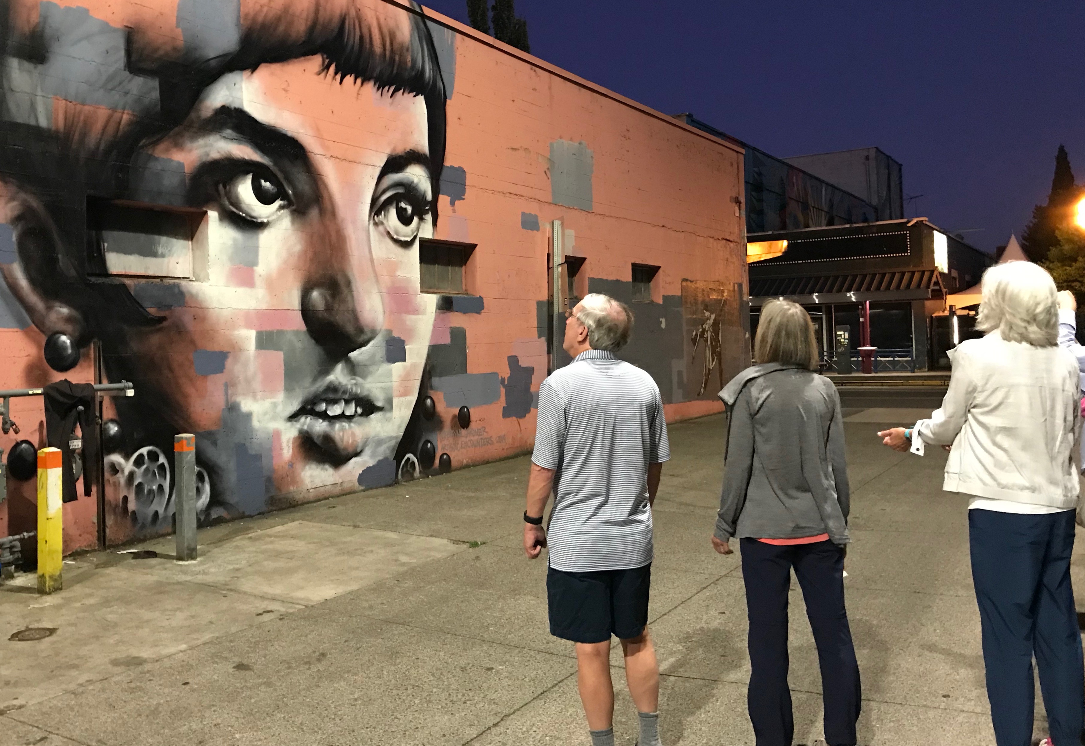
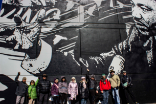
Group Photo in front of the Martin Luther King Jr. Mural, Eugene, Oregon, Photo by Eduardo Tapia.
I’m happy to have introduced a great group of 11 to some of Eugene (OR), beautiful murals. Eugene has scores of outdoor images and they are best enjoyed while walking. Most are part of the 20x21EUG Mural Project, an initiative by the city to create 20 or more world-class outdoor murals between now and the 2021 IAAF World (track) Championships. Our walk of the downtown area visited building-sized masterpieces and a number of hidden micro-art images. We walked just over 2 miles and a great lunch afterward.
Trip Report – Volunteer Leader: Mark Hougardy | Eugene-based Hiking Club | Dates: March 3, 2019 | Participants: 11 | Type: Urban Walking
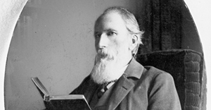
Judge John B. Waldo is often associated with John Muir and Henry David Thoreau. While his impact was substantial he is not as well known as other conservationists of the day. In the late 1800’s he proposed a green space straddling the crest of Oregon. For decades he traveled extensively documenting the area’s unique topography and natural beauty. He worked hard to pass legislation preventing special interests from monopolizing the area’s resources. Today, numerous national forests, a national park, and wilderness areas between the border with California clear to the Columbia Gorge exist because of his vision. Our visit to the UO Archives was an introduction to his original writings and photographs. We even saw some founding documents for Crater Lake National Park.
Trip Report – Volunteer Leader: Mark Hougardy | Group: Eugene-based Hiking Club; |Â Dates: February 16, 2019 | Participants: 6 | Type: University of Oregon Archives
This was an exploration of two dramatic volcanic landscapes timed with the Autumnal Equinox.
Trip Report:
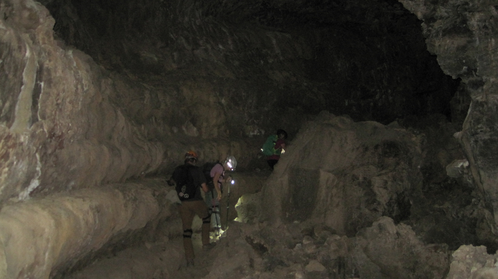
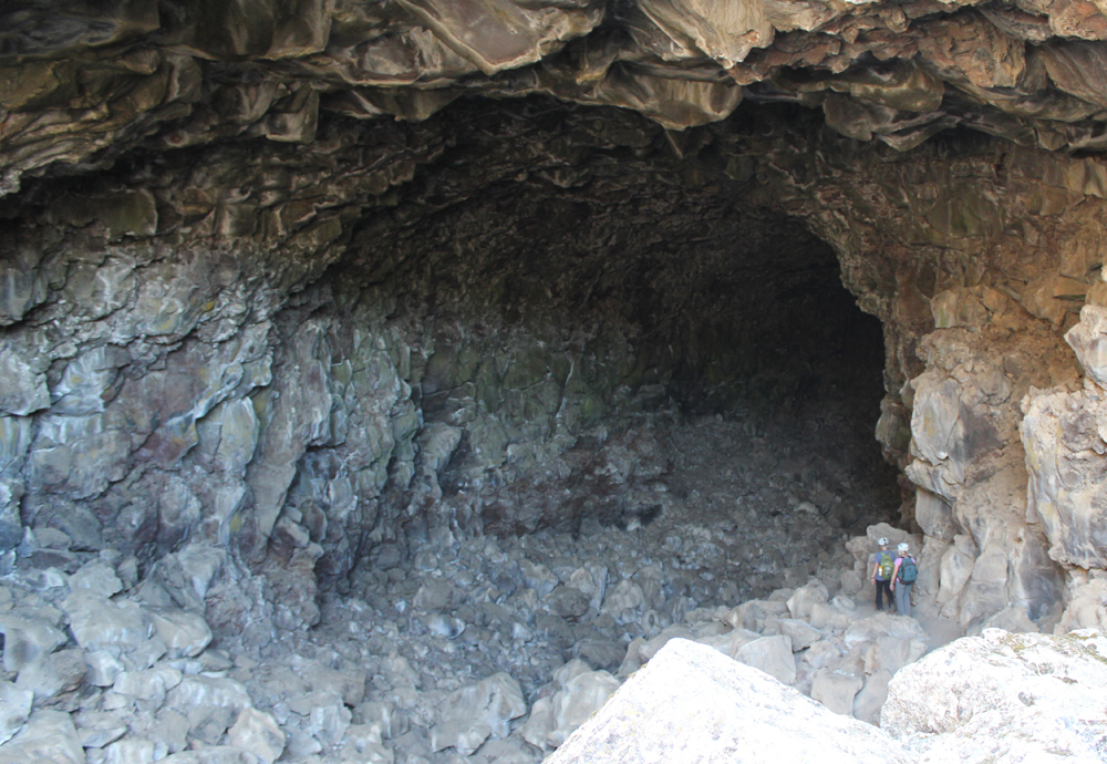
Volunteer Leader: Mark Hougardy | Organization: Eugene-based Hiking Club | Date: September 2018 | Duration: 4 days | Participants: 5 | Type: car camping, hiking, and caving
Upon arriving at the forbidding Lava Lands National Monument we made camp and then explored several accessible lava tube caves around the visitor center. We also climbed the conical shaped 5,302-foot tall Schonchin Butte where we enjoyed views 100 miles east to the Warner Mountains, near Nevada, and 50 miles west to Mount Shasta. In the evening, we walked along a dusty trail into the Schonchin Wilderness Area and encountered an entrance to a lava tube that was at least 4 stories tall.
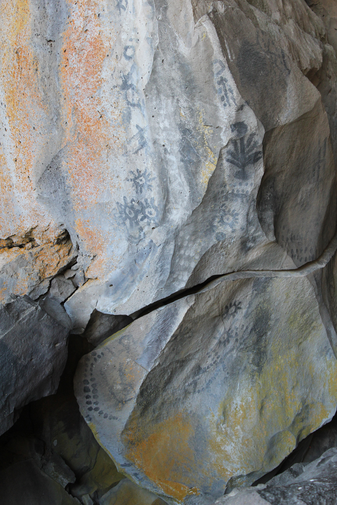
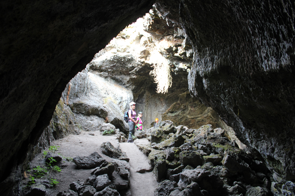
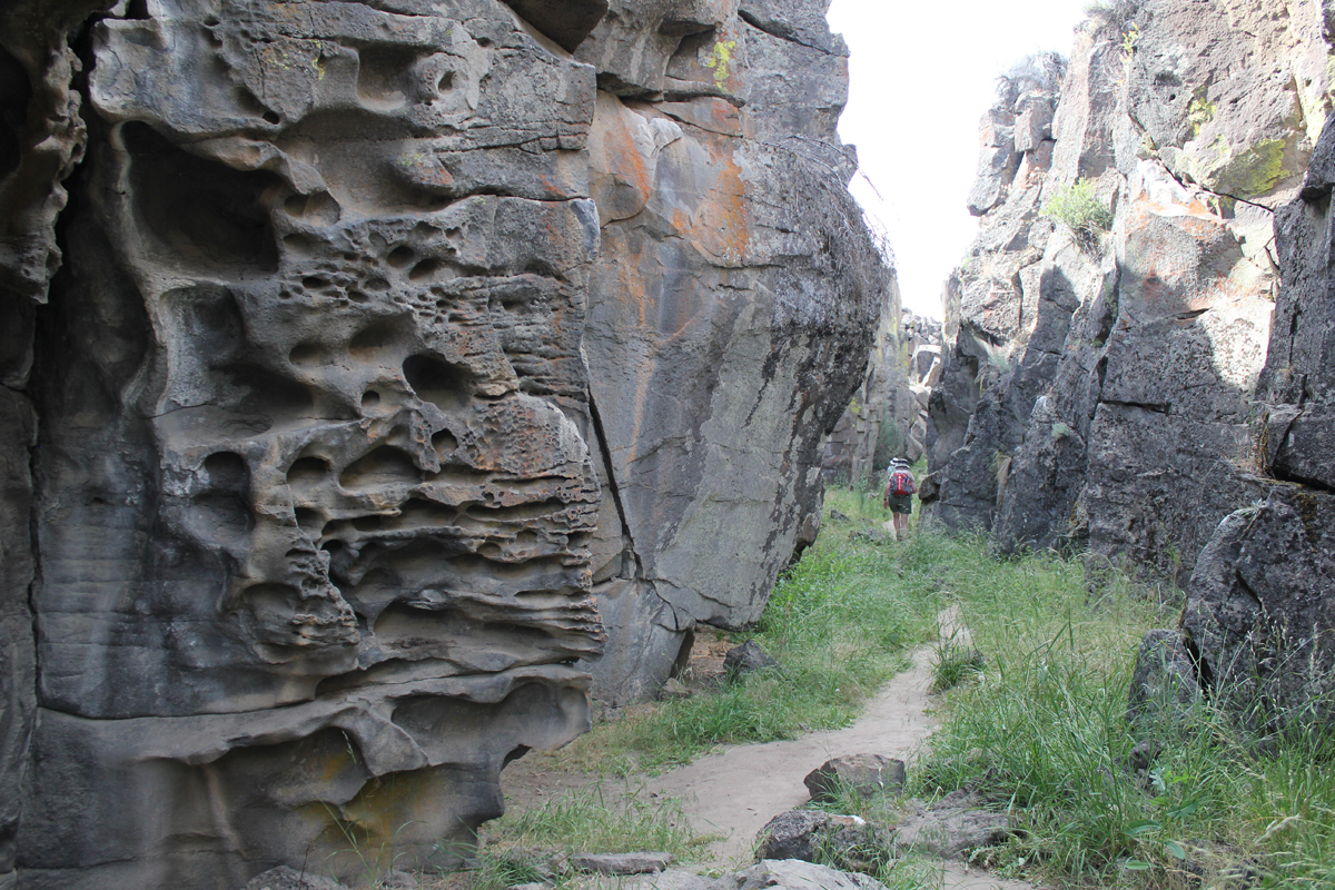
The next morning we hiked from the campground to Skull Cave where a small ice pond can be viewed year round. We also hiked to several pictograph caves and enjoyed our lunch on the trail. As the afternoon warmed we spent our time underground where we explored three caves and partially a fourth. Back at camp, we were surprised to discover that several hundred bugs had descended upon the hood of one of the cars, possibly attracted by the metallic-blue color. They had apparently been engaged in a frenzied mating and exhausting themselves to death. Bugs that fell onto the ground were snapped up by an eager lizard. As the sun set, we hiked into the nearby wilderness and enjoyed a pastel sky.
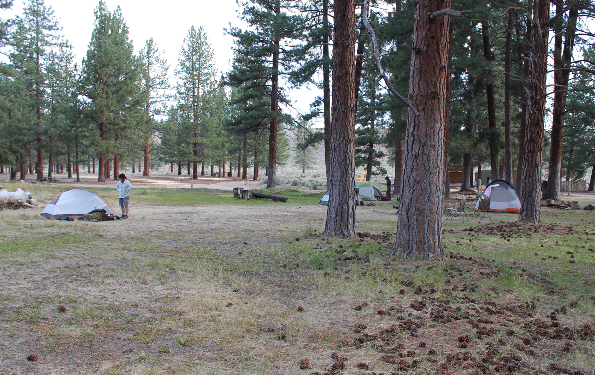
On the third day, we packed up and drove through the northern section of the monument. Our last stop was to Petroglyph Point where a monolithic wall includes petroglyphs, raptor nests, and evidence of former wave action. Tule Lake was a gigantic, yet shallow inland lake that existed for millennia. The lake was drained in the early 1900s and the exposed land turned into farmland. The existing lake is far to the west and is one-sixth its original size. Future explorations to Lava Beds will include additional sites of the Modoc War and seeing the remnants of an imprisonment camp where Americans of Japanese ancestry were forced to live during WWII. In the afternoon we drove to Crater Lake and made camp. The Mazama Campground was closing for the season and this was its last weekend. Upon our arrival, the sky darkened and it rained for several minutes. After making camp we hiked to the Great Spring and down the picturesque Annie Creek trail loop. In the late afternoon, we made good use of the camp showers then drove the rim to enjoy the views from Discovery Point. At dinnertime, we made our way to the historic Crater Lake Lodge where we raised a glass to celebrate the Autumnal Equinox then enjoyed a meal. Back at the campground, a nearly full moon encouraged multiple parties at neighboring campsites and sleeping was difficult.
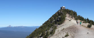
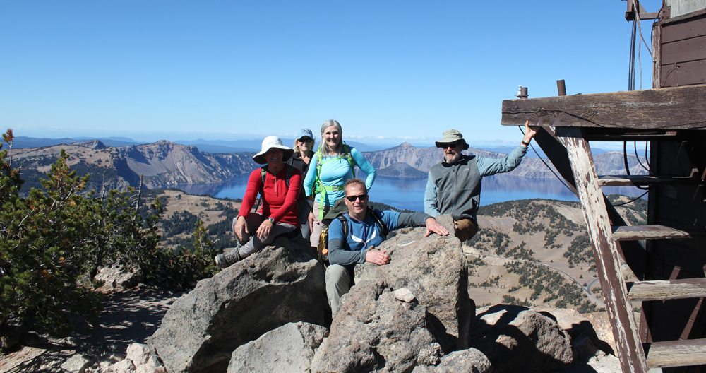
On day four we woke to a frosty 28 degrees Fahrenheit. We warmed up though at the local Annie Creek Restaurant with some hot coffee and breakfast. As we drove along the east rim to the Mount Scott trailhead the sky was blue and clear. We hiked for about an hour to this highest point in the park, which stands just less than 9,000 feet. The view of the once massive volcano Mount Mazama, now known as Crater Lake, was superb! We could see about 100 miles in each direction; to the north the Three Sisters, and to the south Mount Shasta. As noon approached we hiked back down the mountain and ended our trip with a late lunch. There was a definite chill in the air, fall had arrived.
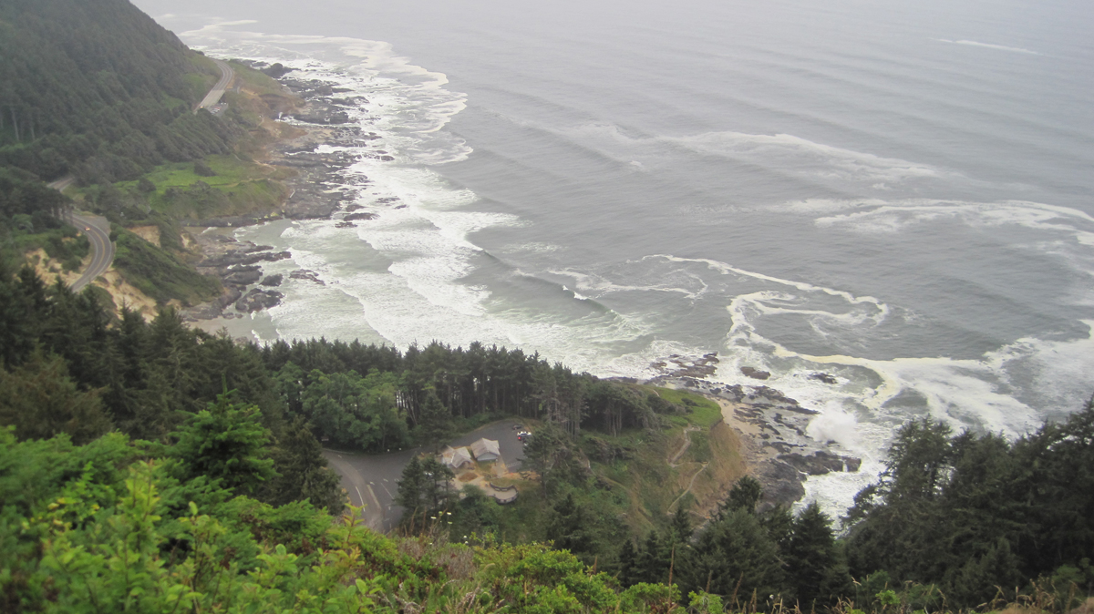
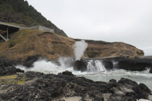
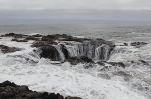
The Cape Perpetua Scenic Area on Oregon’s coast is stunning.
Trip Report:
Volunteer Leader: Mark Hougardy | Organization: Eugene-based Hiking Club | Date: August 2018 | Duration: 2 days | Participants: 8 | Type: car camping, hiking, and kayaking
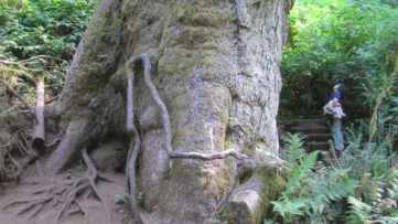
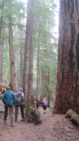
Our group was fortunate as the weather was surprisingly mild and there was little wind. We spent much of the morning exploring tide pools and beachcombing during low tide. The Cape’s forest offered us the chance to stand at the base of the 200-foot tall and 500-year old Sitka Spruce. These amazing trees grow in a four-mile-wide zone along the coast from northern California to Kodiak Island in Alaska. Around lunchtime, we pitched our tents at a nearby campground and had a quick bite to eat. Our two tiny campsites proved challenging with our collection of tents. In the late afternoon, during high tide, we appreciated the coast’s craggy beauty. A favorite is Spouting Horn, where wave action forces water into a small sea cave and through a hole at the top creating a sizeable plume. Thor’s Well, a large sinkhole on the shoreline, water cascades into what appears to be an unearthly entrance to the underworld. In the evening, some of us climbed the 700-foot cape and enjoyed awe-inspiring views of the rocky shoreline below. Standing inside the historic Civilian Conservation Corps shelter, we witnessed a brief sunset. That day we saw a whale, gulls, cormorants, sea lions, a myriad of tide pool creatures, turkey vultures, and ravens.
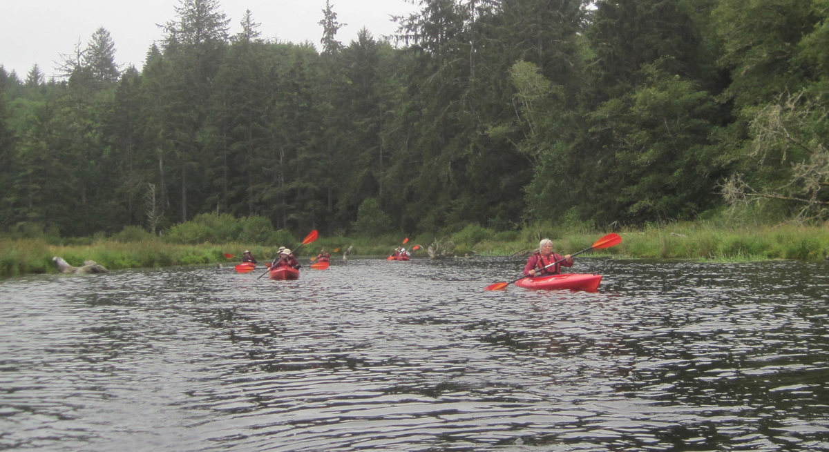
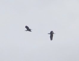
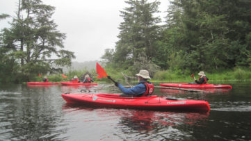
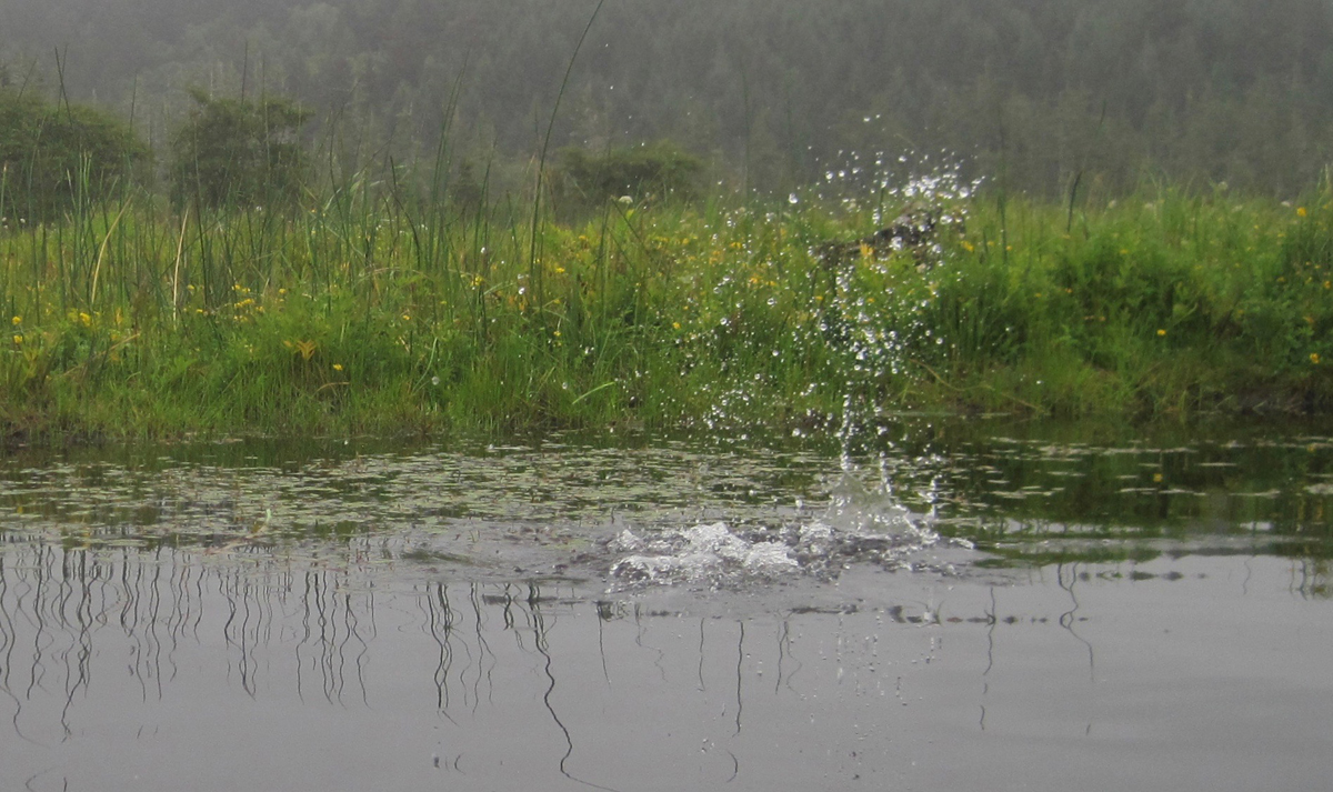
We woke with the sun and drove to Brian Booth State Park where we participated in a kayaking trip along Beaver Creek. This interpretive tour is offered as a service by Oregon State Parks. Beaver Creek is a freshwater estuary and is prime habitat for Coho salmon, cutthroat trout, winter steelhead, and waterfowl. We finished our three-mile paddle about noon and had a great time. We had seen ducks, nutria (invasive), a family of river otters, kingfishers, a young bald eagle, swallow, cranes, blue herons, a green heron, Canada geese, merganser, and a red-tailed hawk. As we pulled our kayaks from the water there was a nearby splash, a river otter had been playfully observing at us. Across the creek, a bald eagle surveyed our group. That afternoon we drove south to Yachats and enjoyed a tasty lunch before heading home.
I snapped this picture half a second too late! A chain of bubbles was rapidly passing my kayak on Beaver Creek. They were followed by a furry head popping out of the water. The river otter, upon seeing me, immediately dove. Here is the splash it made as it disappeared.
Our 4-day trip to learn more about central Oregon’s historic past started with a call from the interpretive ranger at Fort Rock. The 100-degree heatwave hitting the region was the cause for canceling our visit to the Fort Rock Cave for safety concerns and the threat of extreme fire danger. The cave is a significant archaeological site where shoes dating back 10,000 years were discovered and public entry is limited to just a handful of people each year. Sadly, but understandably, we were not able to visit the cave and I had to amend our trip to Oregon’s high desert on the fly. Fortunately, everything worked out. [Here is a link to a later visit to Fort Rock Cave.]
Trip Report:
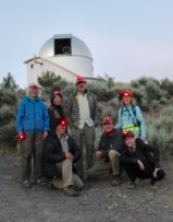
Volunteer Leader: Mark Hougardy | Organization: Eugene-based Hiking Club | Date: July 2018 | Duration: 4 days | Participants: 7 | Type: A 4-day exploration of central Oregon’s rich cultural heritage, dynamic geology, and the majestic night sky. Car camping, hiking, and lots of open space.
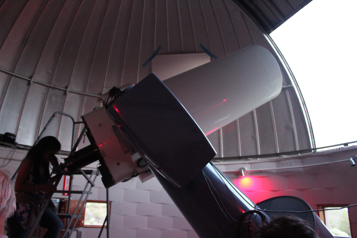
Group photo at the Pine Mountain Observatory. The red lights are easier on the eyes when working around astronomical equipment.
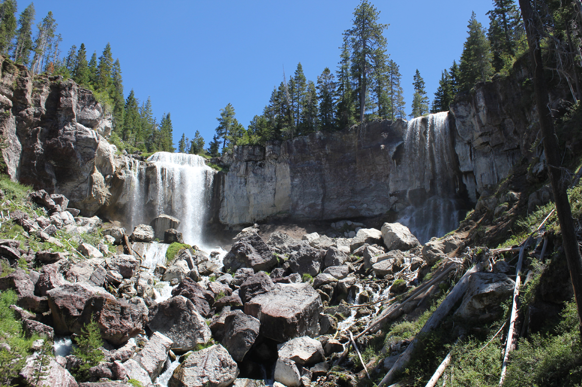
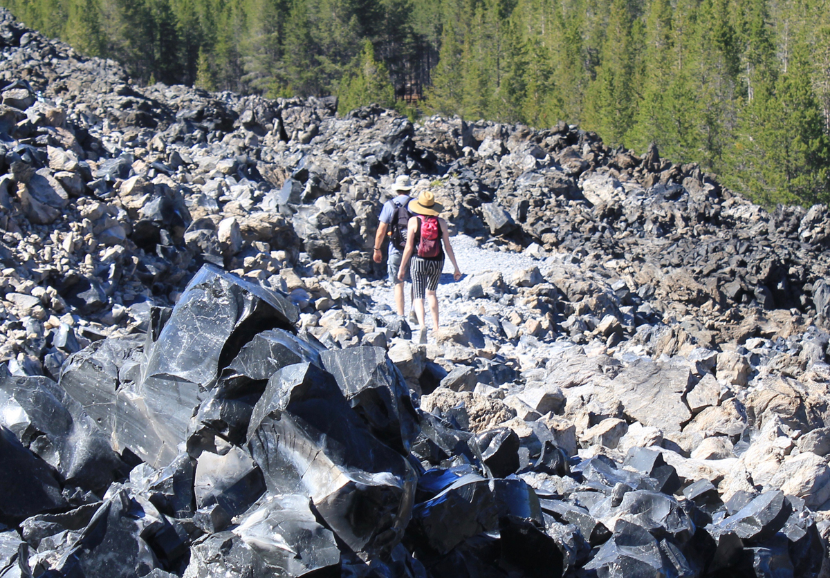
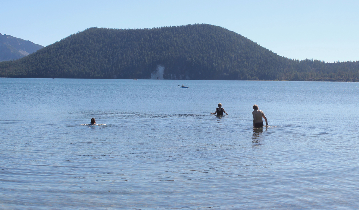
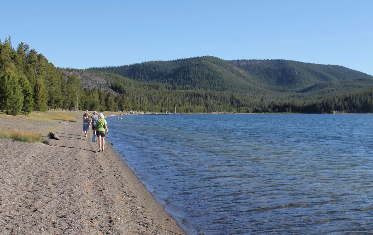
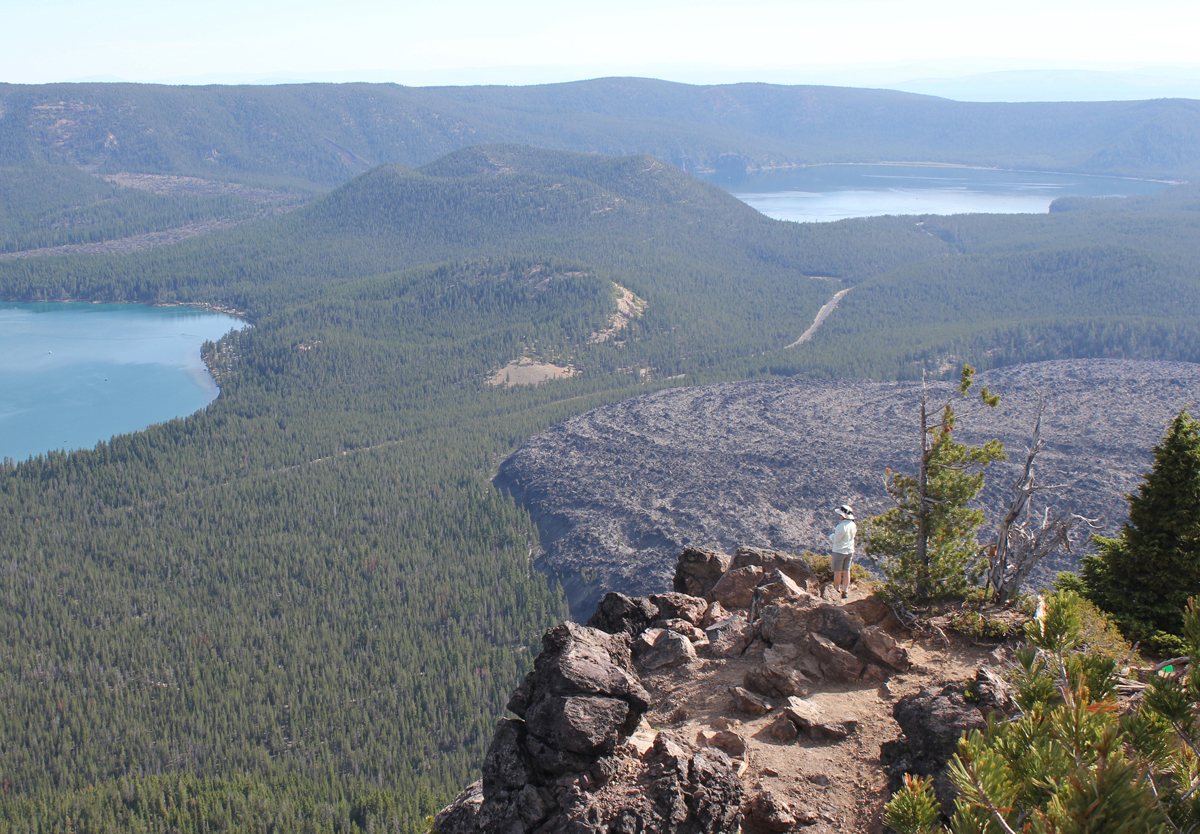
On our first day, we arrived at the massive caldera located in the heart of the Newberry National Volcanic Monument. We visited the double 80-foot Paulina Falls and ate lunch overlooking the stream. We located two adjoining campsites on the picturesque East Lake, and just in time as the park was busy. In the afternoon we hiked the impressive Obsidian Flow trail, a massive flow of volcanic glass and pumice 17 stories tall. Returning to camp we enjoyed a swim in the cool and clear waters of East Lake. Afterward, we hiked on the beach to the local resort and were reminded of the subtle, yet abrasive qualities of volcanic glass on the feet. At the lodge, we enjoyed a delicious meal and had some good laughs with the staff. The radio in the background was playing a tribute to Tom Petty. We walked about a mile back to camp. That night we listened to acapella hymnals from a Mennonite group camping nearby.
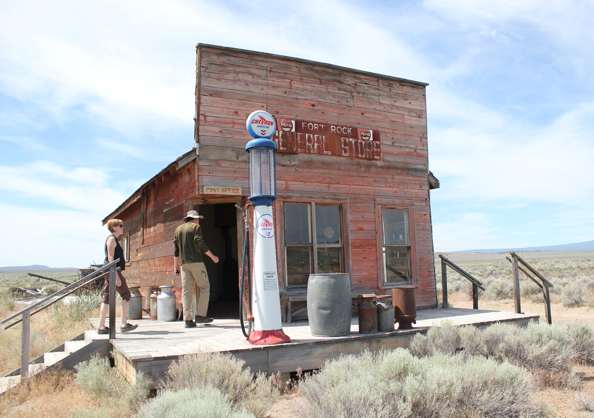
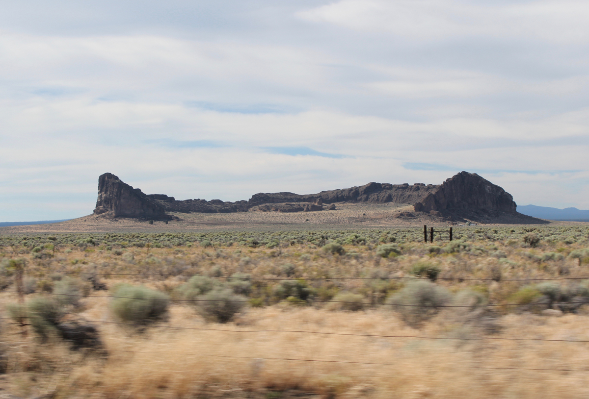
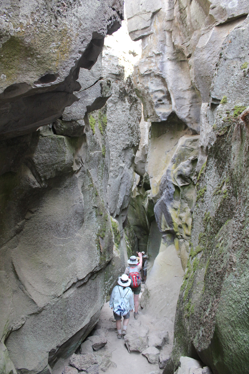
On day two we drove to the top of Paulina Peak. The peak is 7,984 feet and sits in the middle of Oregon. The views are impressive; to the north, we could see the massive stratovolcano, Mount Hood, then down the spine of the Cascades to the steep-sided Mount McLoughlin close to the California border – a distance of about 300 miles! To our south was our next stop, the iconic shaped Fort Rock, a volcanic landmark named for the tall fort-like walls. We left Paulina Peak and drove for about an hour. Our first stop was the Fort Rock Homestead Museum, an open-air collection of historic structures. This is where I learned about a shortcut of a backroad to Derrick Cave, a remote lava tube that we had hoped to visit. Apparently, the private landowner had closed the shortcut because visitors were not closing a gate and his cows were escaping. The alternate route would have involved about a 50-mile detour on forest and back roads. This was tabled until another visit. Our next stop was the massive Fort Rock a horseshoe-shaped tuff ring that rises 300 feet over the surrounding flat landscape. We hiked for about an hour in the heat then drove to the town of Christmas Valley for ice. We continue on a short distance to Crack in the Ground, a 2-mile-long tension fracture where we could hike and scramble over boulders about 30 feet underground. The temperature at the surface was 95 degrees, in the fissure it was a comfortable 70 degrees with some pockets of air in the lowest sections that were very chilling. Late that afternoon we stayed at the Rockhorse Ranch where we pitched our tents and gleefully enjoyed their shower! A celebrity at the ranch’s store was a black cat named, “Scratchy.”
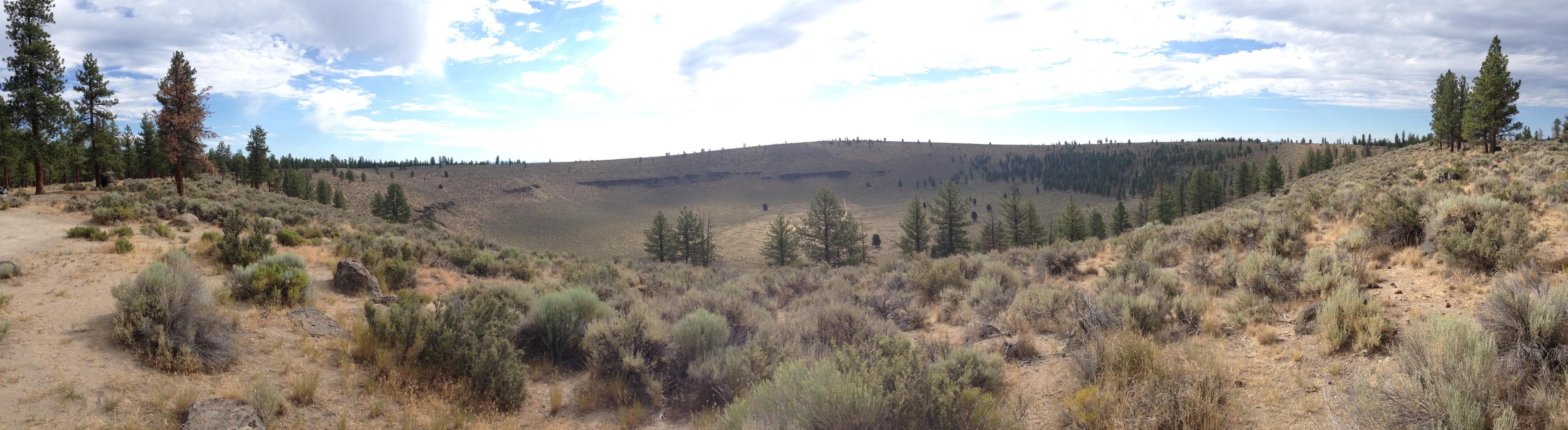
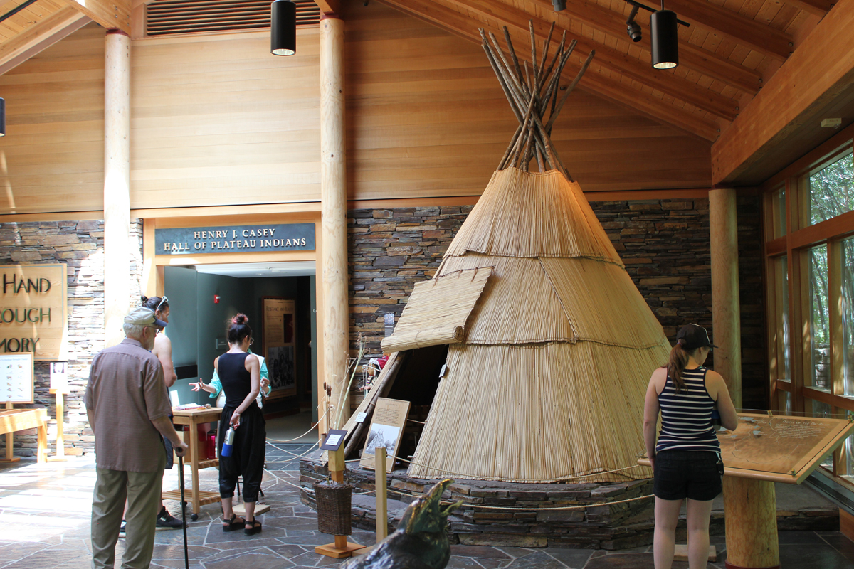
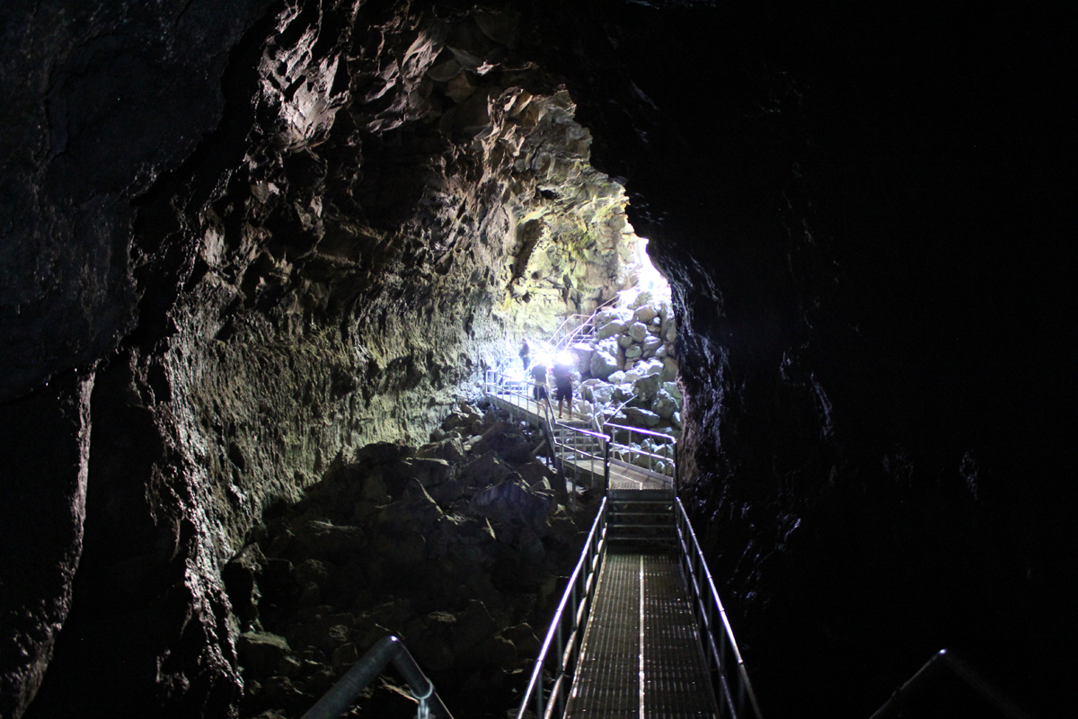
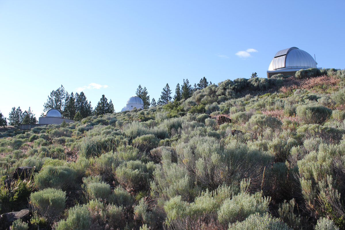
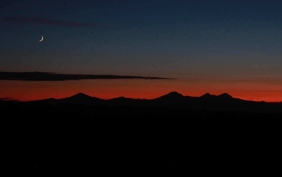
On day three we drove a short distance to Hole in the Ground, a crater that is a mile wide and 500 feet deep. Once thought to be a meteor impact the formation was actually caused by magma contacting groundwater. The resulting flash (there were many over the millennia) formed the massive hole we see today. The steep hike down the side was dusty and the walk up the forest service road was blazing hot. Near the end of our hike, three cars zipped up the road in a cloud of thick dust. The vehicles looked as though they were from the set of a Mad Max movie. The last car to pass was missing the driver-side door; the driver was wearing thick goggles. The rag-tag group waved as they passed. These were participants in the Gambler 500, a navigational adventure for cars whose value is no more than $500. Later that day we visited the High Desert Museum for a closer look at the cultural and natural history of the region, and we explored by flashlight the 1-mile-long Lava River Cave, the longest continuous lava tube in Oregon. The cave was a welcome 42 degrees! As the sun lowered in the sky we made our way about 30 miles east of Bend to the Pine Mountain Observatory, an astronomical observatory operated by the University of Oregon. The center sits near the top of Pine Mountain at an elevation of 6,509 feet. We made camp, ate dinner, watched the sunset, and enjoyed the various telescopes of the facility. There were close-up views of Jupiter, Saturn, Venus, Mars, nebulae, globular clusters, and various astronomy talks from UO instructors. Most impressive was a view of Jupiter and several moons through the 24-inch scope.
The final morning we woke up hearing a chorus of cows in the distance. We made our way off the mountain appreciating the drastic change in terrain from pines to the open high desert. We took a shortcut around Bend and stopped at the Lava Lands Visitor Center where we explored the 500-foot tall Lava Butte that has commanding views of central Oregon’s volcanic story before returning home.
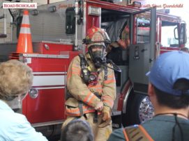
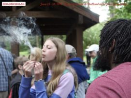
I’m happy to have been the leader on another great Road Scholar trip. This program introduced grandparents and grandkids to how fire helps forge every aspect of our life (homes/communities, food preparation, entertainment, arts, places we play, and our survival).
Trip Report:
Leader: Mark Hougardy | Organization: Road Scholar | Date: June 2018 | Duration: 6 days | Participants: 28 | Type: Field Trips & Motorcoach
“Erupting volcanoes. Blacksmithing. Outdoor cooking. Glassblowing. A fire has countless uses, and incarnations, and has been paramount to our way of life since the beginning of our time. You and your grandchild will spark your desire to safely learn more about fire through interactive experiences with professional firefighters, survivalists, welders, and fire dancers. Discover how fire can create a delicate piece of artwork, as well as destroy entire forests and cities. Learn how to survive in the remote wilderness, and discover the inner workings of a city’s fire engine. Together with your grandchild, finally have the chance to play with fire as you discover why nothing can hold a candle to this learning adventure.”
This hiking trip was to the site of the “exploding whale,” one of Oregon’s most prominent stories of local lore.
Trip Report:
Volunteer Leader: Mark Hougardy | Organization: Eugene-based Hiking Club | Date: June 2018 | Duration: 1 day | Participants: 6 | Type: Day Hike
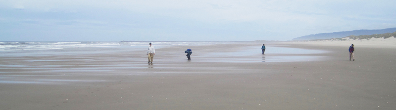
In 1970, near Florence, a 16,000-pound whale carcass the length of a bus washed ashore. After 3-days in the sun, it became so foul smelling that locals wanted it gone. An idea was hatched to dynamite the odorous mass into tiny bits. A local TV report of the incident is classic web viewing. In the clip, a massive boom launches putrid blubber into the sky. As the blast ends, behind the camera, a series of cheers and laughs ring out. One woman’s voice is heard, “All right, Fred, you can take your hand’s our of out of your ears now … here come pieces of … my G-” No one was injured, but viewers were covered in goo and a car was nearly totaled. Our group located the approximate location of the detonation. The day included a pleasant 5-mile beach walk where we viewed a number of shells. We also observed a memorial to 41 sperm whales who mysteriously stranded themselves in the area in 1979. One whale spout was observed just offshore.
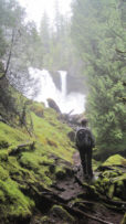
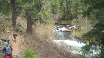
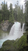
The season’s first warm weather brought significant snowmelt into the McKenzie River watershed and over the majestic Sahalie Falls and Koosah Falls.
Trip Report:
Volunteer Leader: Mark Hougardy | Organization: Eugene-based Hiking Club | Dates: May 2018 | Participants: 5 | Type: Hiking and Car Camping
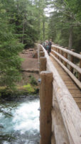
Our plan to hike to Tamolitch Falls (Blue Pool) was cut short when a sign stated a mile of trail was closed because water had flooded the path in places to a depth of 3 feet. Even with the closure, there was plenty to appreciate further upstream at Clear Lake with its crystalline waters and turquoise colored Great Spring. Animals that were seen along the trail also appeared to appreciate the warmer weather as fish jumped in the lake, several species of birds flew overhead, and a garter snake warmed itself on the rocks. In shaded areas winter still managed to hold its grip as large patches of snow remained. Springs spontaneously appeared on the trail sometimes forming small ponds, and at one point, all of us were mesmerized by a plate-sized vortex that had formed in such a pool. After a solid day of hiking, we visited Belknap Hot Springs for a relaxing soak. Because we timed our visit before the Memorial Day crowds the U.S. Forest Service campground was basically empty. Our campsite was green with moss and located next to a white rushing stream that looked like it was born from a Tolkien novel. The next day we enjoyed the comfort of a morning campfire, broke camp, and explored several more miles of trail before heading home.


 Our plan to hike to Tamolitch Falls (Blue Pool) was cut short when a sign stated a mile of trail was closed because water had flooded the path in places to a depth of 3 feet. Even with the closure, there was plenty to appreciate further upstream at Clear Lake with its crystalline waters and turquoise colored Great Spring. Animals that were seen along the trail also appeared to appreciate the warmer weather as fish jumped in the lake, several species of birds flew overhead, and a garter snake warmed itself on the rocks. In shaded areas winter still managed to hold its grip as large patches of snow remained. Springs spontaneously appeared on the trail sometimes forming small ponds, and at one point, all of us were mesmerized by a plate-sized vortex that had formed in such a pool. After a solid day of hiking, we visited Belknap Hot Springs for a relaxing soak. Because we timed our visit before the Memorial Day crowds the U.S. Forest Service campground was basically empty. Our campsite was green with moss and located next to a white rushing stream that looked like it was born from a Tolkien novel. The next day we enjoyed the comfort of a morning campfire, broke camp, and explored several more miles of trail before heading home.
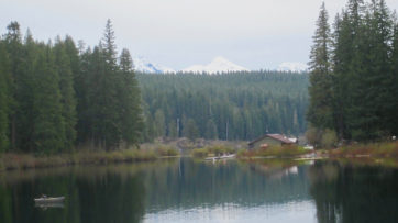
 Â Â