Trip Report:
Group Leader: Mark Hougardy | Organization: Eugene-based hiking group | Date: in September 2023 | Duration: 1 day | Walking Distance: 2.5 miles | Participants: 6 | Elevation Gain/Loss: 55 feet
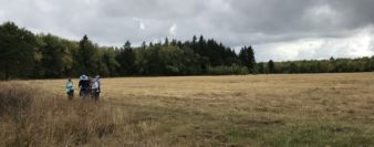
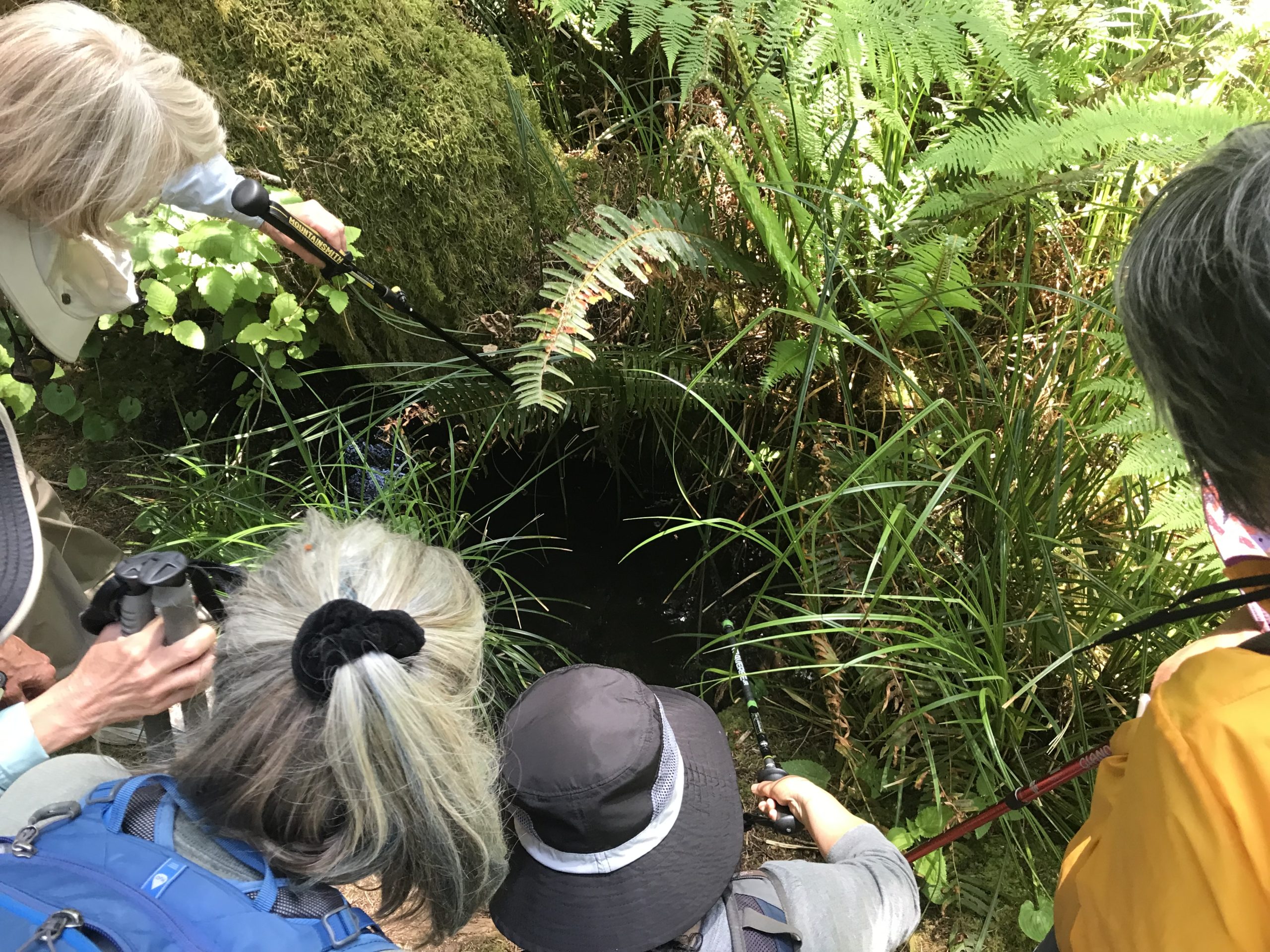
Our group followed a mowed pathway around the perimeter (from 18th Avenue in west Eugene) to the south end of the preserve. The area was quiet and there were pleasant views of the nearby hills. The trip leader took a spill on the trail. Walking to the east we attempted to cross a little creek but poison oak had turned seasonally red revealing its abundance. We decided it best not to risk it and returned to our original route back to the cars. Willow Creek’s native grasslands, ash woodlands, and perennial streams provide the best remaining example of native wet prairie habitats in the southern Willamette Valley. The property is managed by the Nature Conservancy where more than 200 native plants, 100 birds, and 25 butterfly species have been recorded on the preserve. This biome once occupied much of the Willamette Valley, but today has been reduced to only a few remnant patches.
Trip Report:
Group Leader: Mark Hougardy | Organization: Eugene-based hiking group | Date: in September 2023 | Duration: 1 day | Walking Distance: 4.5 miles | Participants: 5 | Elevation Gain/Loss: 300 feet
Arriving at the Finley National Wildlife Refuge we discovered the Woodpecker Loop Trail was closed for repairs. Instead of beginning our hike on that path, we parked at the Visitor Center and then proceeded to the second part of our planned hike, the Mill Hill Loop. We saw a vulture on the trail. There were numerous flying ants emerging from the ground in several areas. Upon returning to the Visitor Center area, it was learned the nearby and rarely opened Fiechter House was open and staffed with interpreters. The house was built in the 1850s and is considered to be the oldest house in Benton County. After our visit to the Fiechter House, we stopped by the Campbell Boardwalk for a side trip to the Cabell Marsh. We made good use of the opportunity to eat plums and blackberries in the parking area before heading home.
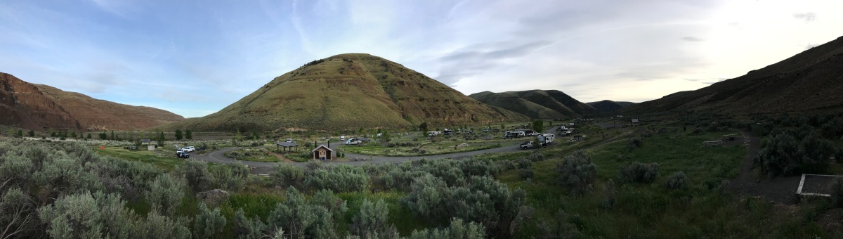
Trip Report: Group Leader: Mark Hougardy | Organization: Eugene-based hiking group | Date: in June 2023 | Duration: 3 days | Walking Distance: 17 miles | Participants: 8 | Elevation Gain/Loss: 1,000 feet | Type: Urban Walking
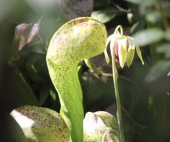
Pitcher Plant – Darlingtonia californica
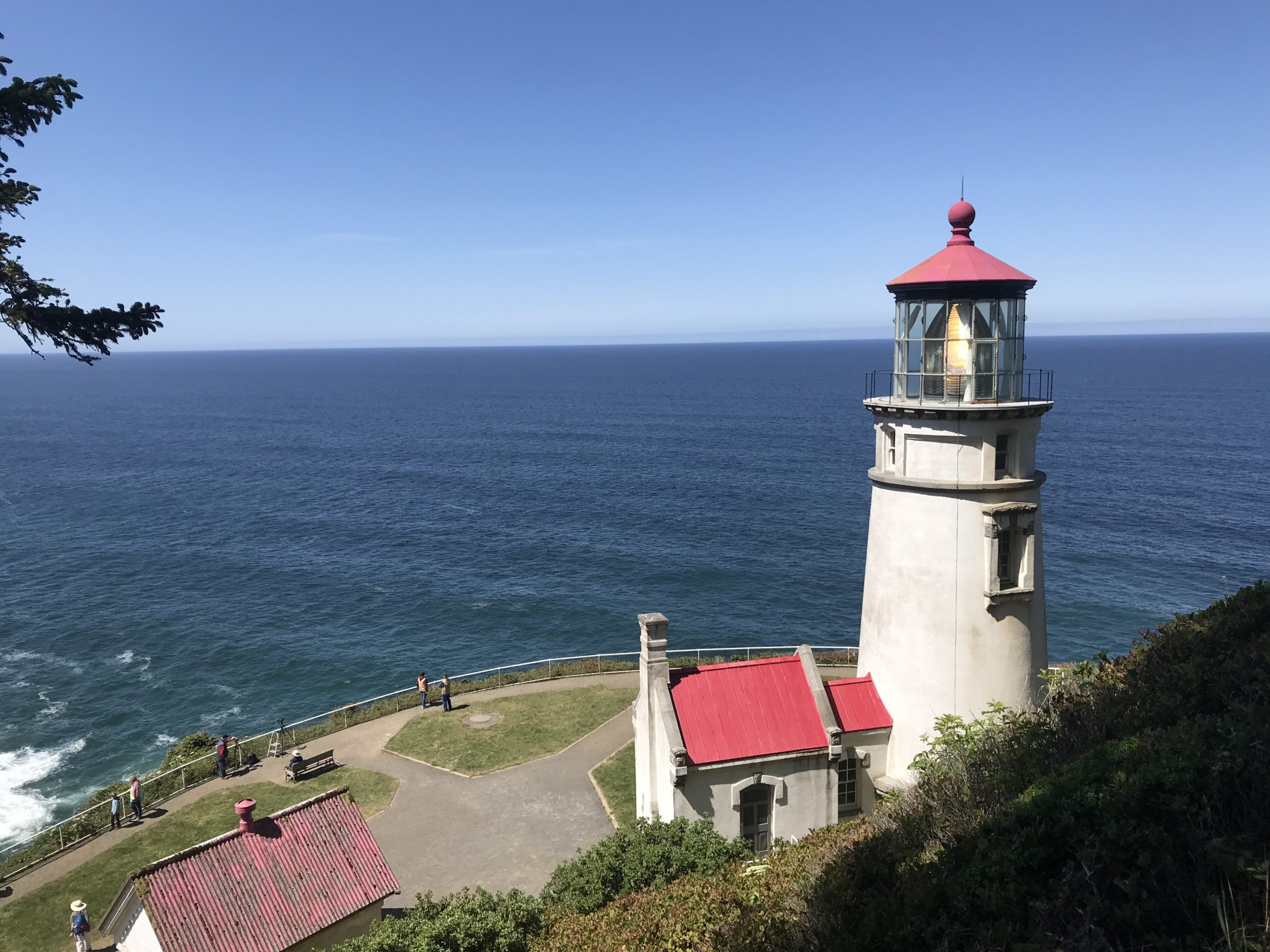
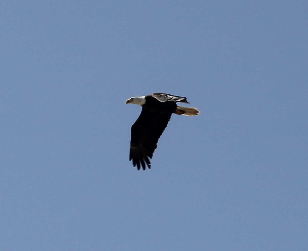
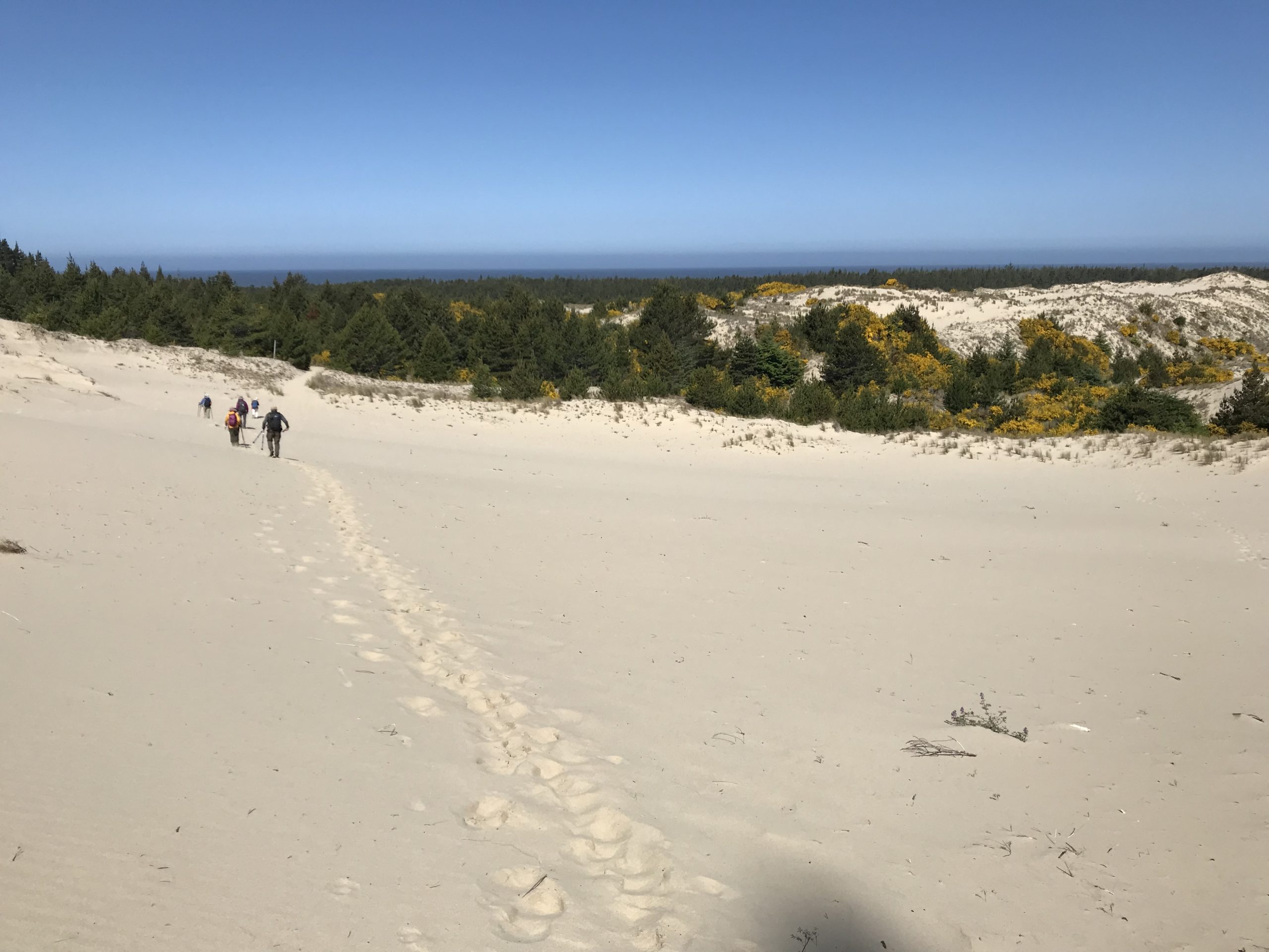
On our first day, after getting settled at the Sutton Group Campground, we drove about 5 minutes to the Darlingtonia State Natural Site. This small botanical park is home, to a carnivorous pitcher plant Darlingtonia californica. The Sutton campground was strangely quiet for the time of year, and the host was out of campfire wood to sell. We recovered some wood from vacant campsites for that evening’s fire. The next morning, we drove about twenty minutes north to Carl G Washburne Memorial State Park. We hiked down the coast while exploring the cliff face and rocks, then up the Hobbit Trail and onto the Heceta Head Lighthouse. The day was surprisingly sunny with little wind. On our return hike, the wind began to pick up. We crossed the coast highway and down to the China Creek Loop, which, unfortunately, was still closed from the year before due to a collapsed footbridge. Continuing our hike, we explored a nearby old homestead. We saw many beautiful rhododendron blooms. In the park, we walked to the far end of the beach trail that took us under the highway and out to the mouth of China Creek. We walked a short distance back to our cars. The Washburne ranger was generous enough to sell us some wood. That evening, we enjoyed dinner around our campfire. On the last morning, we departed camp for the Tahkenitch Campground day-use area. We hiked out to the beach, saw some storm damage, and also a bald eagle. We crossed inland over the dunes to Threemile Lake, where we had lunch. We had a pleasant hike through the woods and back to our cars.
In search of a Rough-skinned NewtThe Heceta Head LighthouseA Bald Eagle Seen Flying Over the BeachCrossing the dunes at Tahkenitch
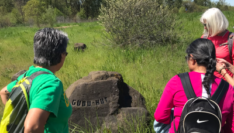
Trip Report:
Group Leader: Mark Hougardy | Organization: Eugene-based hiking group | Date: in April 2023 | Duration: 1 day | Walking Distance: 4.5 miles | Participants: 8 | Elevation Gain/Loss: <100 feet | Type: Urban Walking
Walkers, runners, bikers, birders, and anyone who enjoys exploring the many trails and paths of the Whilamut Natural Area in Eugene, Oregon (and nearby Springfield) can learn from these quiet stones of place. The stones help to connect people with traditional names on the land and remind people that the Kalapuya people are still here. Our 2.5-hour walk was sunny and the temperatures were perfect for a springtime walk. Shown is the Gudu-kut stone; Gudu-kut is the Kalapuyan name for frog.
Trip Report:
Group Leader: Mark Hougardy | Organization: Eugene-based hiking group | Date: in April 2023 | Duration: 1 day | Walking Distance: 3 miles | Participants: 12 | Elevation Gain/Loss: 50 feet | Type: Urban Walking
Corvallis, Oregon, has a picturesque downtown area that is easily walkable. Hidden in plain sight, and in the alleyways are some colorful murals and art pieces just waiting to be discovered.
Trip Report:
Group Leader: Mark Hougardy | Organization: Eugene-based hiking group | Date: in April 2023 | Duration: 1 day | Walking Distance: 3 miles | Participants: 12 | Elevation Gain/Loss: 50 feet | Type: Urban Walking
A little rain did not deter our group from seeing large murals and micro art pieces in downtown Eugene. A special treat was seeing the new colorful mural at the Farmers Market (shown).
Trip Report:
Group Leader: Mark Hougardy | Organization: Eugene-based hiking group | Date: in April 2023 | Duration: 1 day | Hiking Distance: 3 miles | Participants: 10 | Type: Walking
The weather was a little cool and cloudy, but that did not deter our group of lifelong learners. Our walking group enjoyed exploring local museums, seeing colorful murals, and eating some great local food. Shown in the Opal Whitely mural in Cottage Grove. A special thanks to the Cottage Grove Museum.
Trip Report: Group Leader: Mark Hougardy | Organization: Eugene-based hiking group | Date: late-June 2022 | Duration: 3 days | Hiking Distance: 9 miles | Participants: 5 | Type: Hiking & Tent Camping
This trip was to visit the southeast side of Mount St. Helens, in Washington State.
Day 1: The group arrived and we had time to explore the quiet tent-only campground and some local trails near Cougar, Washington. We had dinner, talked around the campfire, and some stayed out close to 10 pm as the mid-summer sun stayed long into the evening sky.
Having lunch at Lava Canyon.
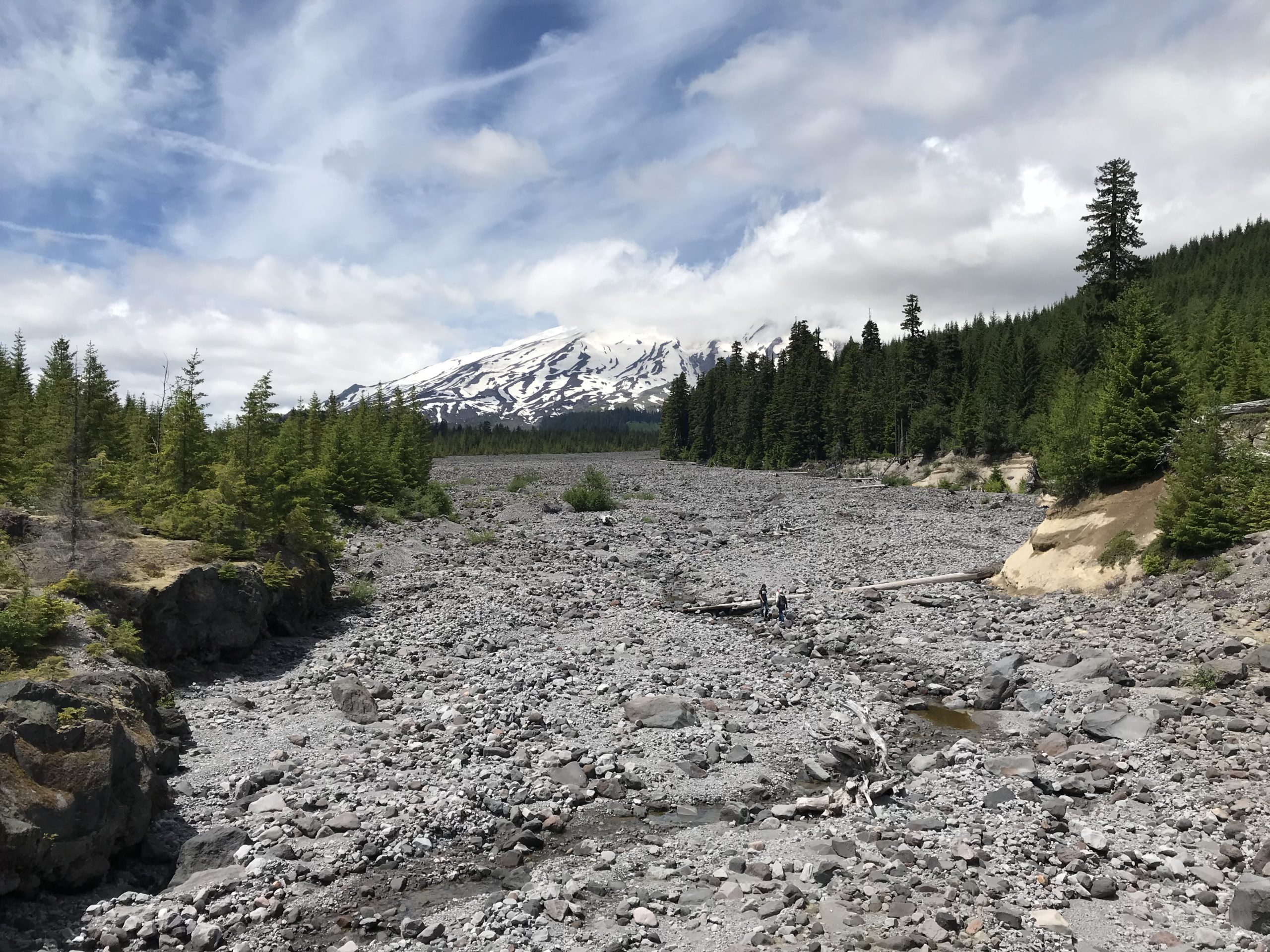
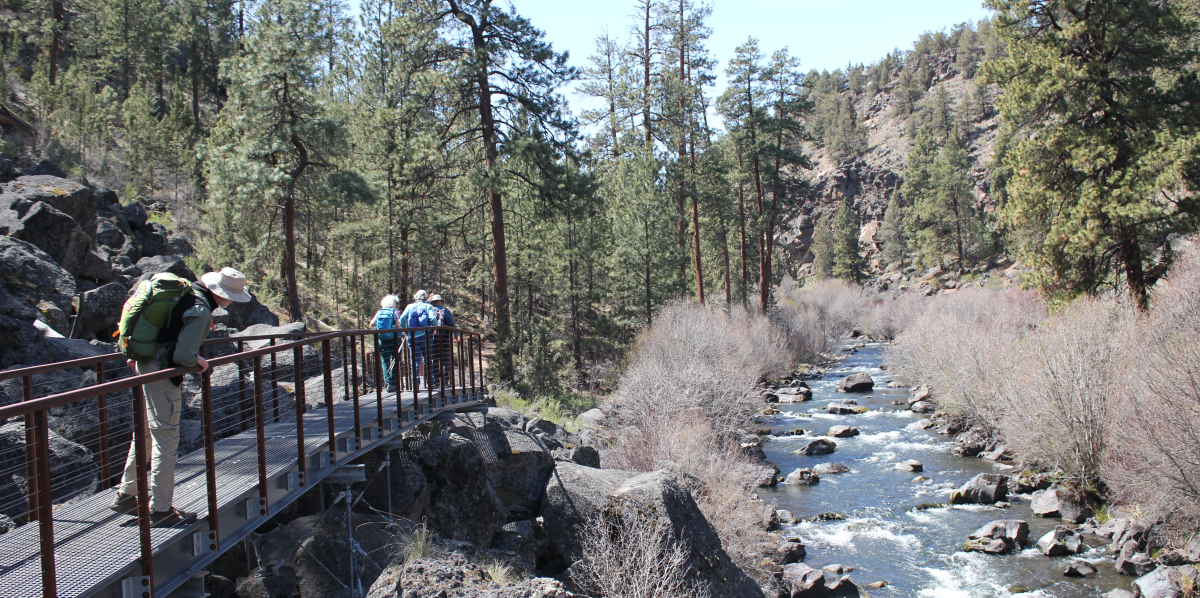
The morning of Day 2 began with birds blasting the campground with calls at about 4:30 am! The group had a relaxed morning, though several commented they had not slept well that night. Possibly this was related to being tired, or we were talking, but while driving to the hiking area we missed a turn-off and went the expected distance down a road to realize we needed to backtrack. This delay caused us to start about an hour and a half late. Driving back, we learned there was a significant absence of Forest Service signage in the area related to general features like river crossings, sights, overlooks, etc. We finally made our destination of Lava Canyon and hiked around the upper trail area. Prior to the trip, we knew the suspension bridge was out of commission, though we had hoped to hike downstream to the Ship Rock area, sadly this trail was also closed. Hiking back, we crossed over the main footbridge and ate lunch overlooking the beautiful glacial-blue Muddy River. Leaving, we made a stop at the bridge overlooking the 1980 lahar flow with Mount St. Helens looming in the background.
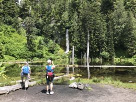
Viewing the waterfall at June Lake.
We drove to the June Lake parking area and began our hike to June Lake. The plan had been to continue to Chocolate Falls for a 5-mile loop, but about 2 miles into the trip the leader made the call to stop the hike soon after June Lake. This was an unhappy call to make but hopefully avoided an injury. Driving back to camp, we located where the earlier signage mistake had been made – a sign had been misinterpreted. We also visited the Ape Cave turnoff to better know where to go the following morning and we discovered the sign along the road identifying the turn for Ape Cave was completely missing! Finding the turn, we stopped for 20 minutes at the Trail of Two Forests Interpretive Site where a 2,000-year-old lava flow from Mount St. Helens ran through the forest, around trees, solidifying around the trunks and leaving tree wells. The group ended our day back at the campground and had an early evening.
Looking up the lahar, Mount St. Helens is in distance. For scale, note the people walking in the lahar.
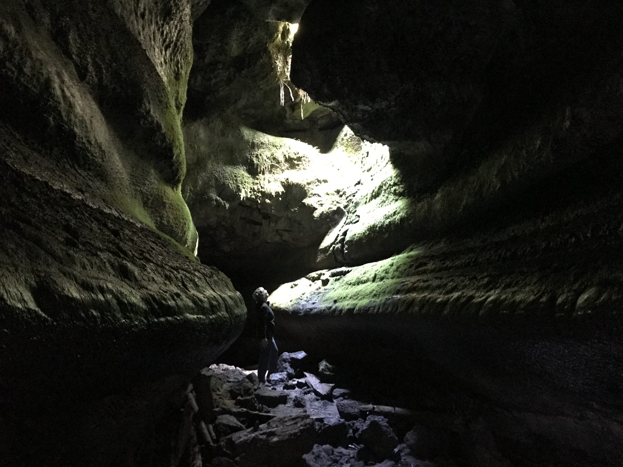
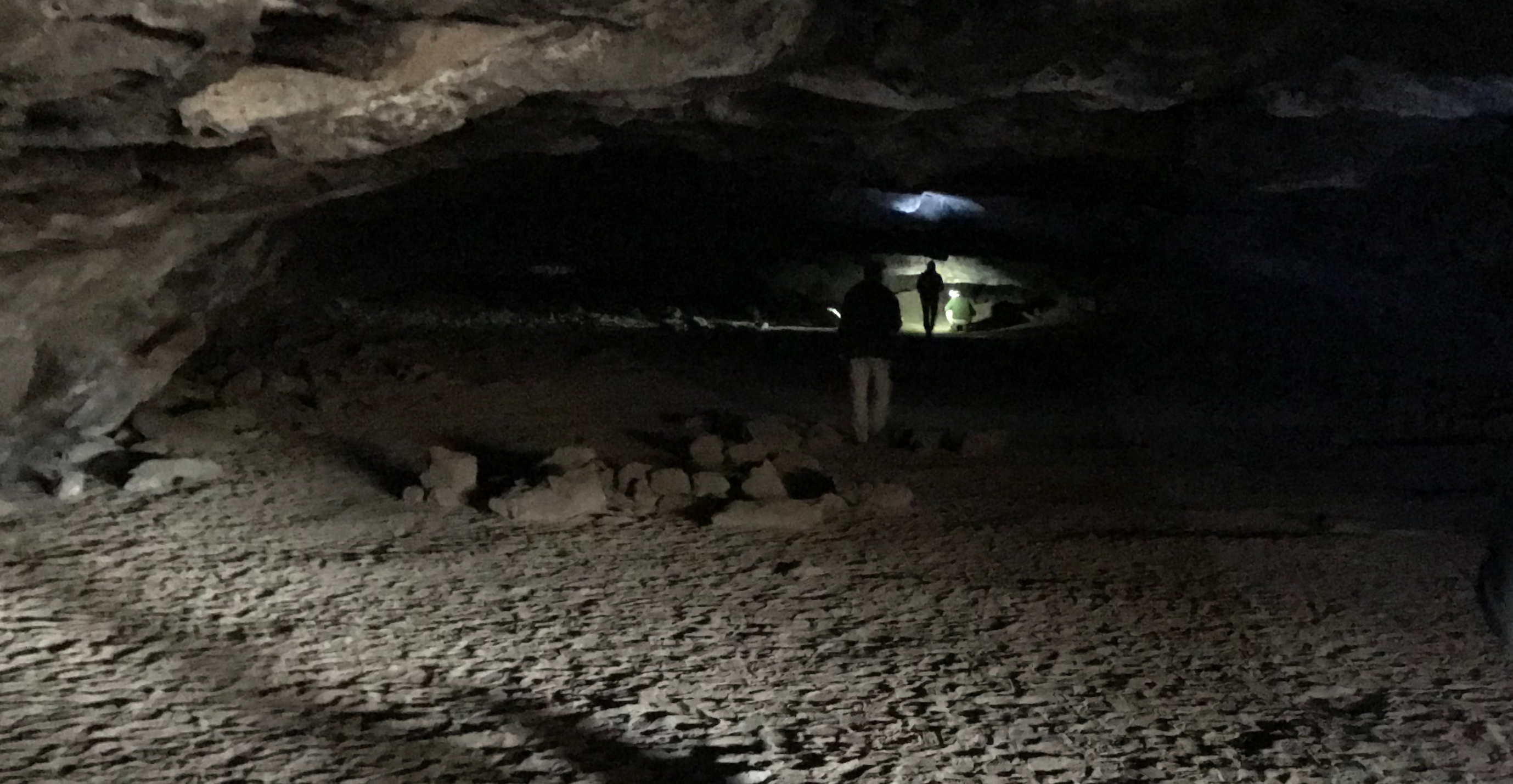
On the final day, we departed camp at 8:45 am and visited Ape Cave for our 9-9:30 am time slot to arrive. We parked in a lower lot as the official signage in the area was poor and did not direct us to the upper lot. Finally, we began our adventure up the difficult 1.5-mile upper cave route. Progress was slow as there was a significant amount of bouldering across rock falls, several tight places, and a harder-than-it-sounds narrow 8-foot wall that had to be scaled. There were a few scraped knees, but the group arrived at the end of the lava tube; our completion time was 2 hours and 15 minutes. We walked 1.5 miles back to the visitor center through the forest for farewells and then drove back to Eugene. We had hoped to get ahead of any surge related to the Fourth of July weekend holiday traffic but still managed to hit bumper-to-bumper traffic through Portland, making drive time from Ape Cave to Eugene 4 hours.
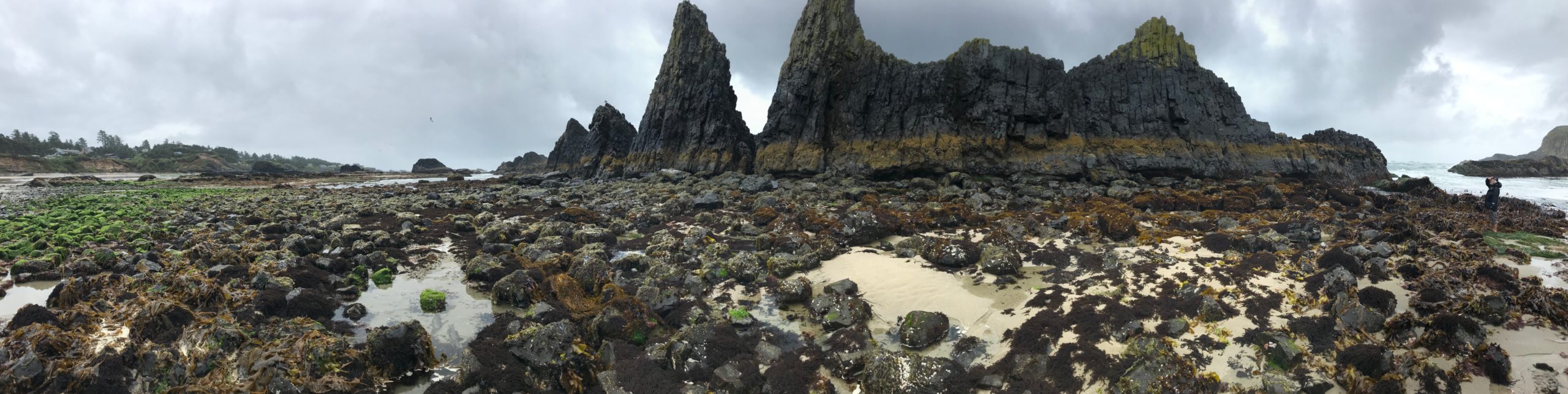
Trip Report: Group Leader: Mark Hougardy | Organization: Eugene-based hiking group | Date: mid-June 2022 | Duration: 3 days | Hiking Distance: 7 miles | Participants: 8 | Type: Hiking & Tent Camping
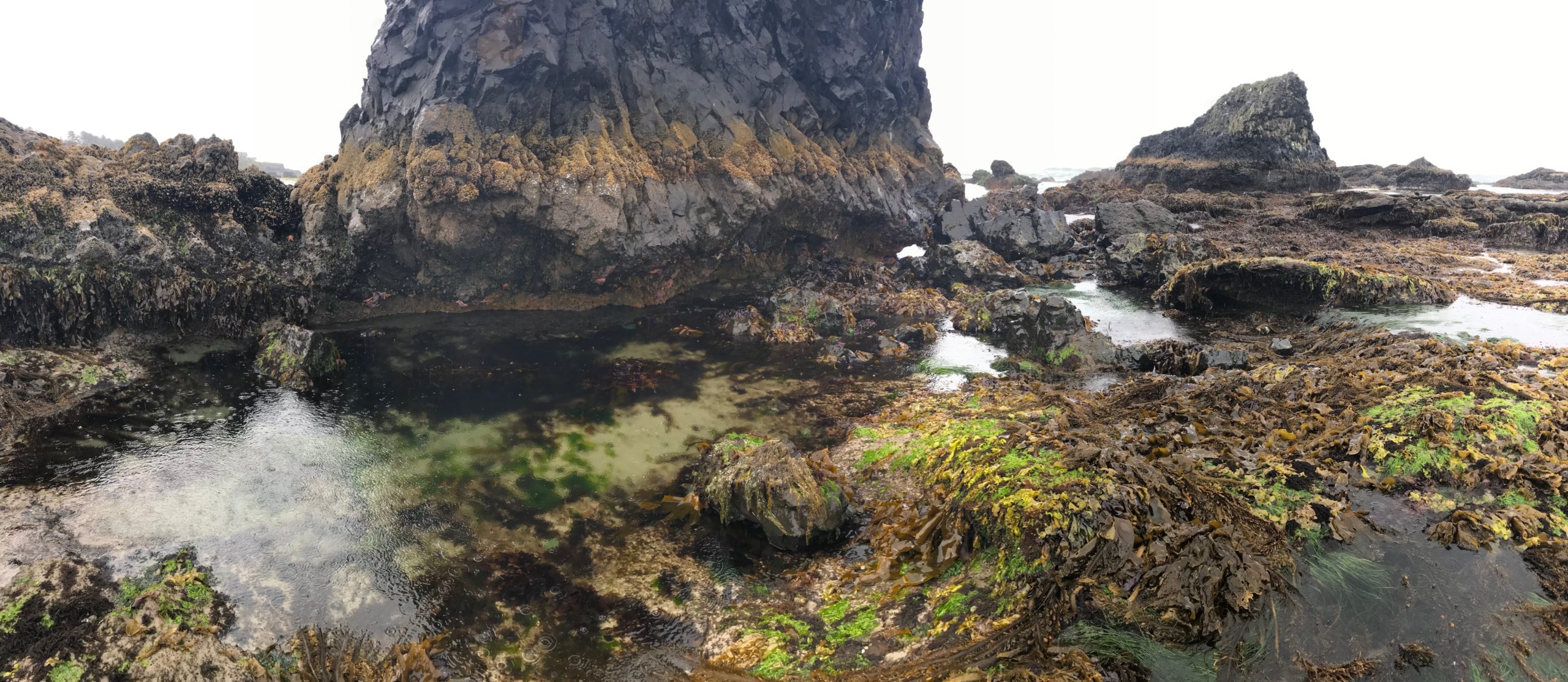
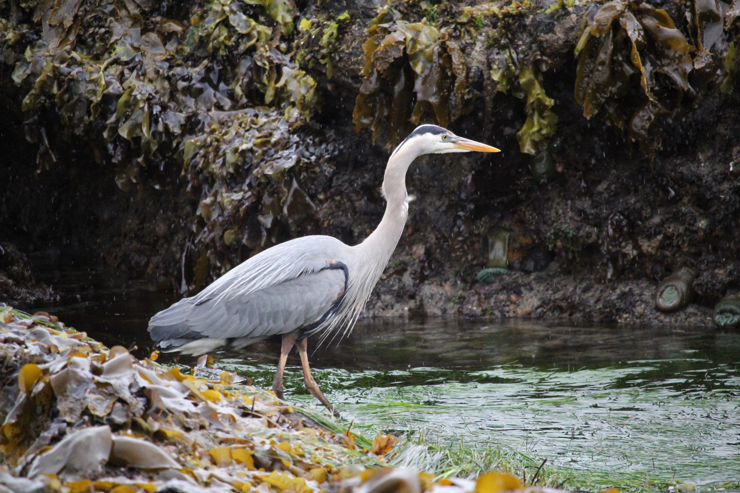
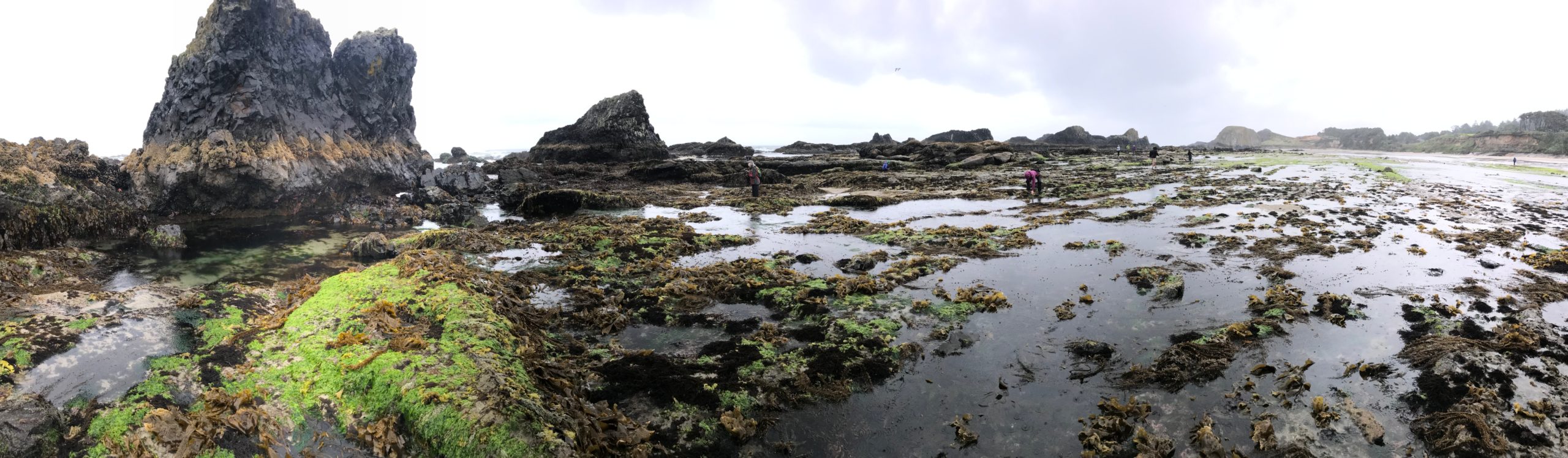
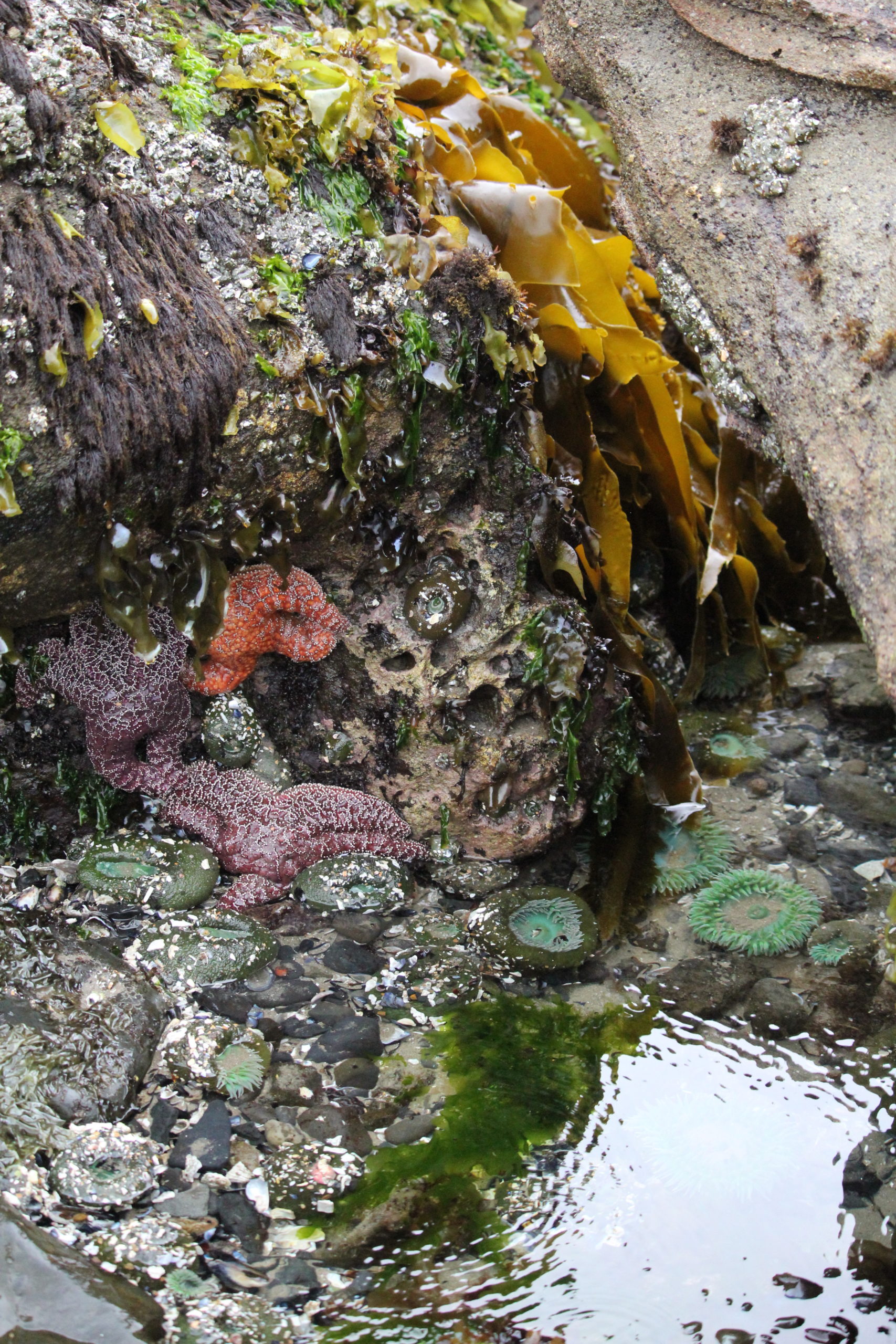
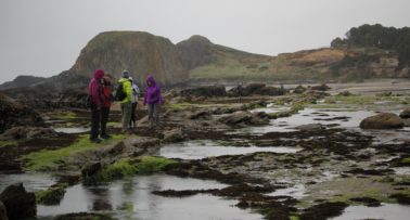
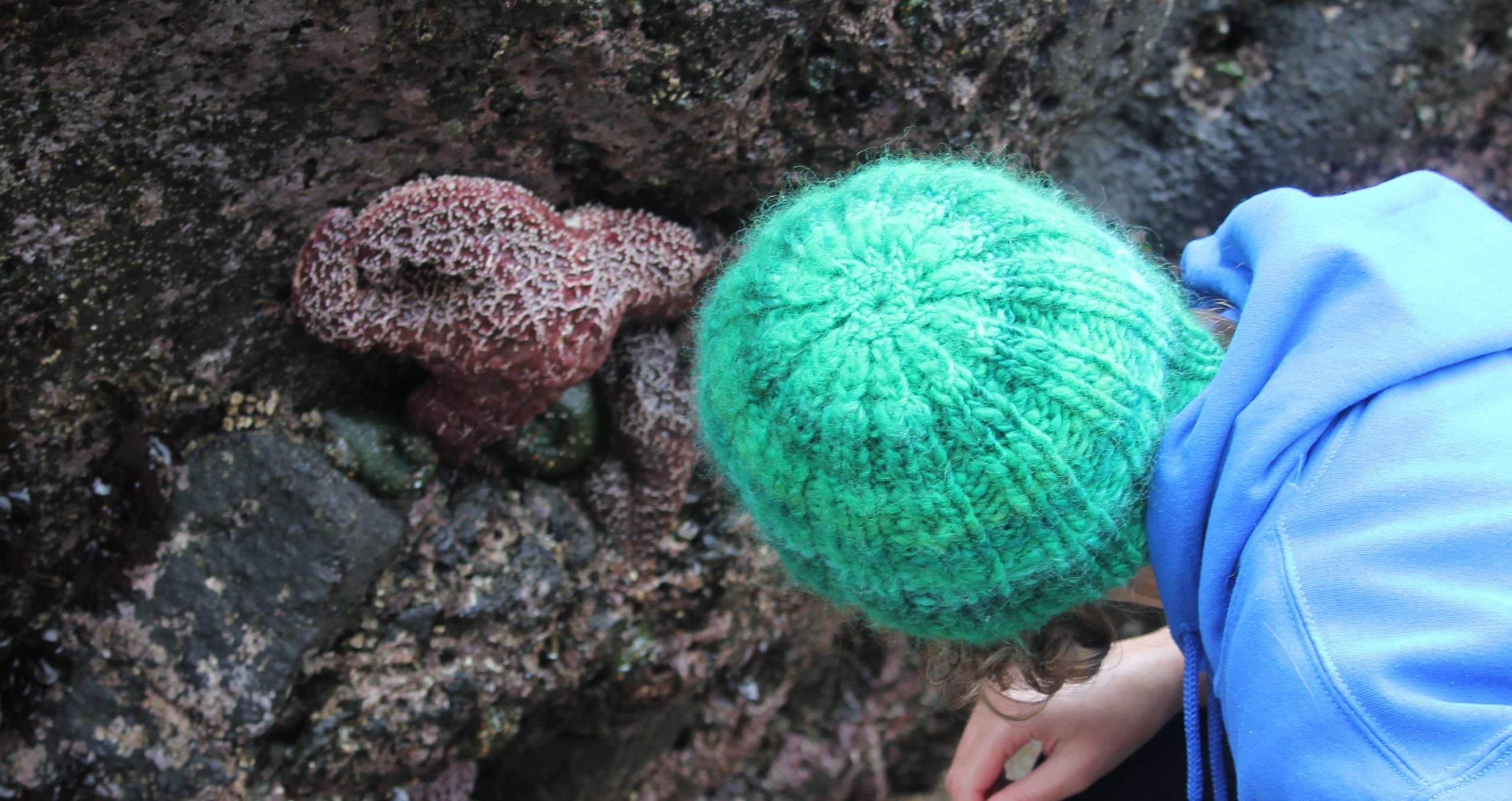
The low tide zone is always covered, except for a few times a year during the lowest tides. It was during one such minus low tide that 8 of us ventured to an area along Oregon’s central coast to explore tide pools during an impressive -2.4 feet (-73 cm) low tide!
Day 1: Our group arrived on their schedule at one of the nearby Oregon State Park group camps. That afternoon and evening were open for beach walking, exploring on your own, or watching the sunset. In the evening, everyone enjoyed a campfire and discussed plans for the next day. It was interesting that one topic of conversation that arose was the book, “Braiding Sweetgrass.” Of the 8 participants, more than half had read the book, one was in the process of reading, and the others were interested. At 10 pm a gentle rain started and continued through to the morning.
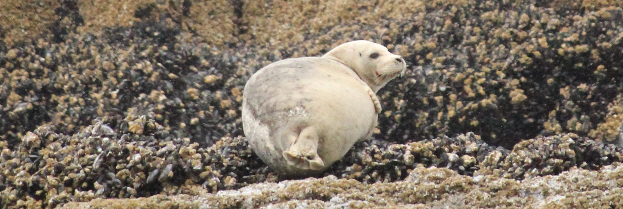
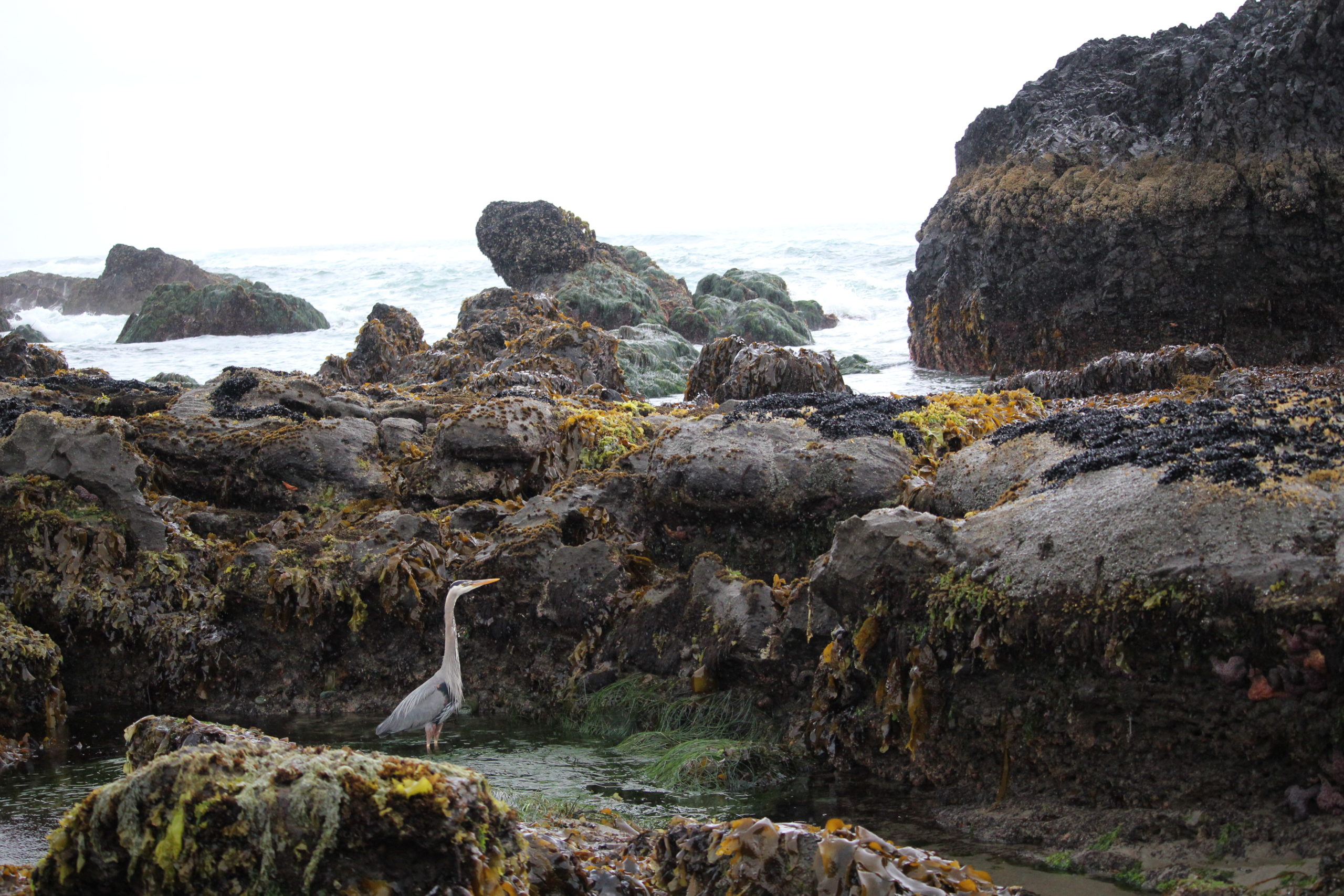
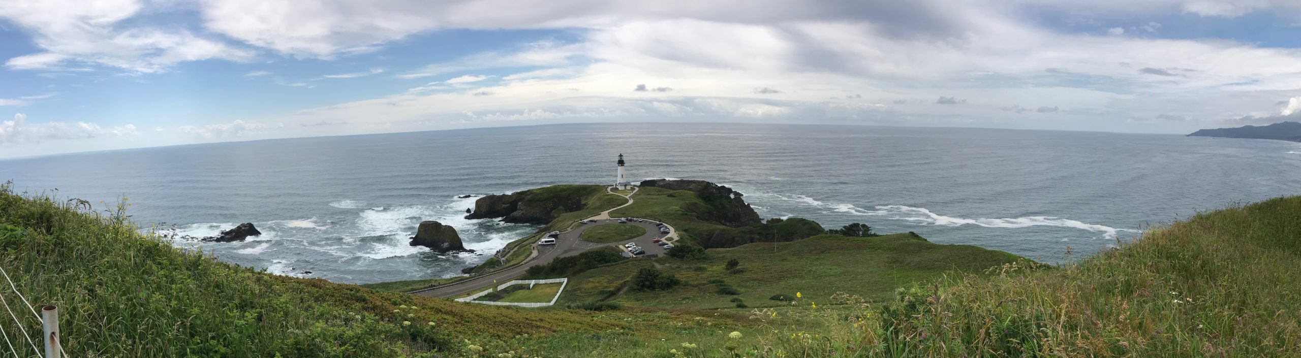
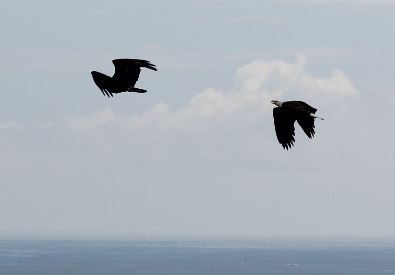
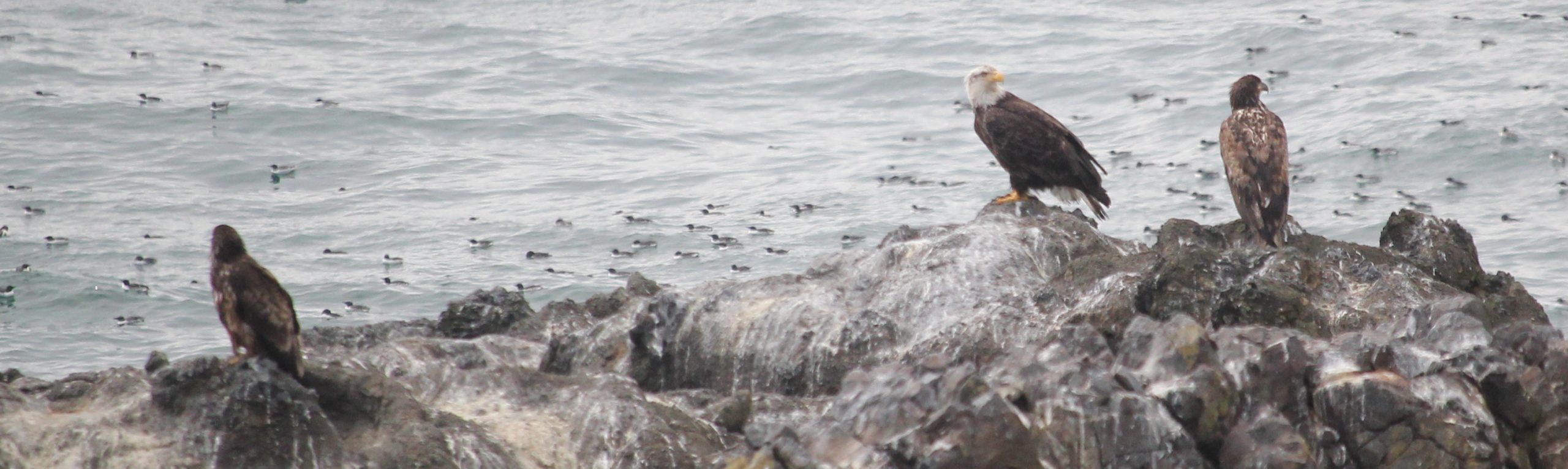
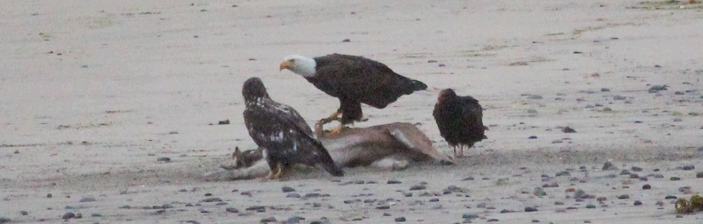
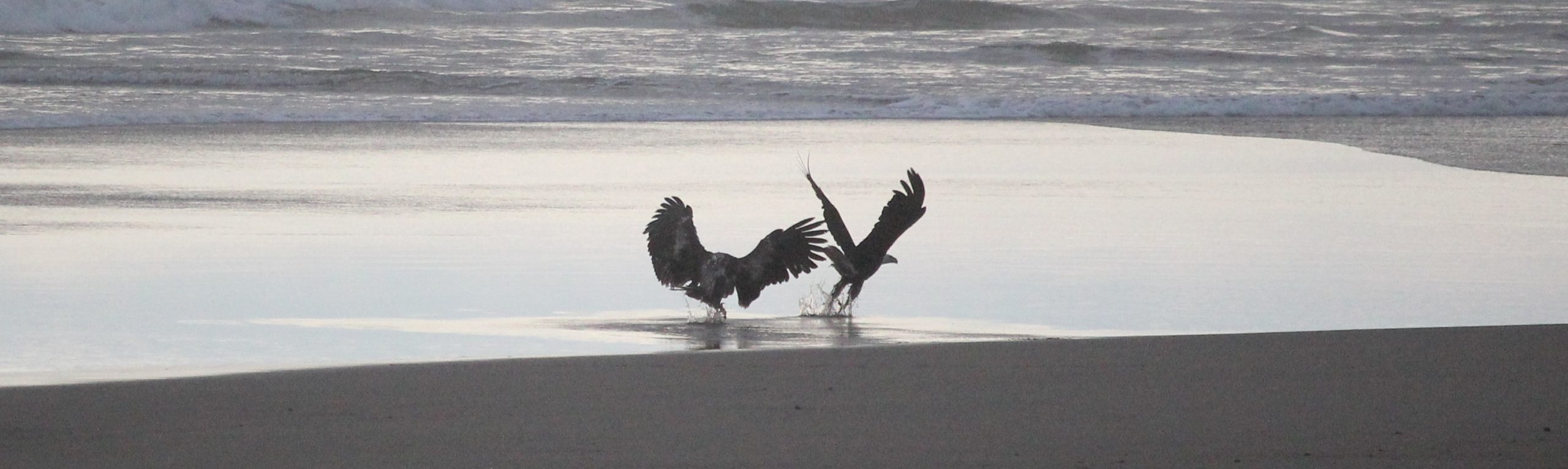
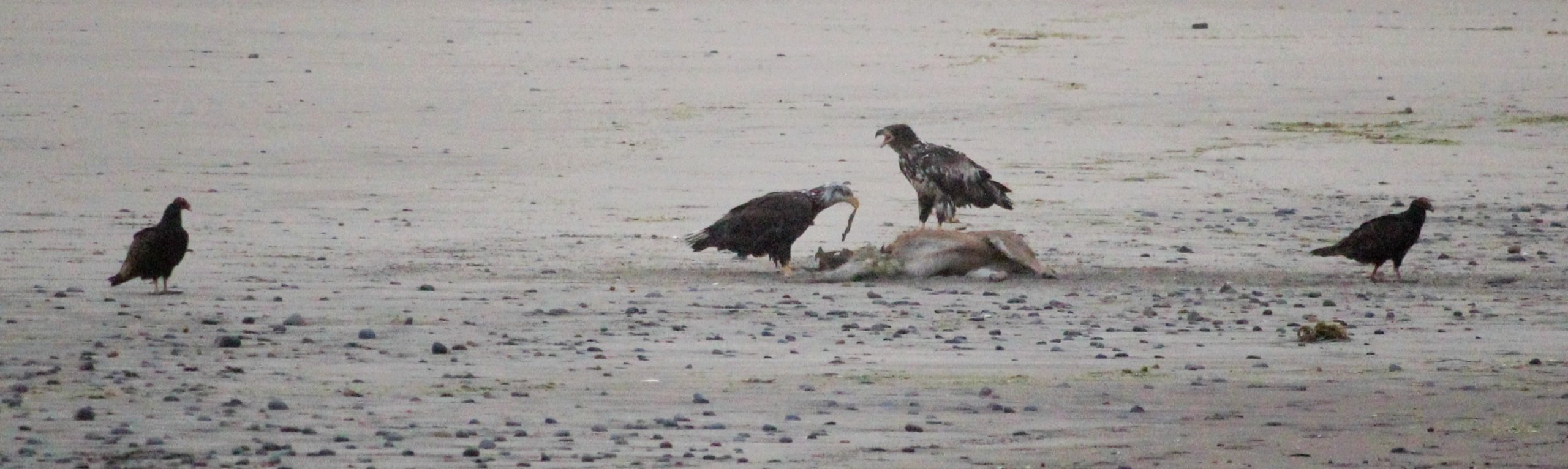
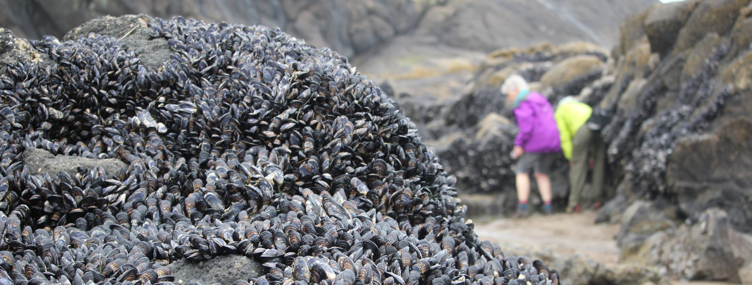
Day 2: At 7 am, we carpooled to an unnamed parking area expecting a filling parking lot, but to the trip leader’s surprise were only 3 cars. The rain, cool temperatures, and overcast skies likely contributed to the low turnout. We arrived about 2 hours before low tide to follow the tide out. This particular tide pool area is special because we can walk on sand and open rocky surfaces to visit ‘islands’ of marine life. After 2.5 hours, and a returning tide, we started back and met several rangers who helped to provide some more context to the area. One ranger said the rain had chased most away that morning. We saw numerous anemones, various seaweeds, chitons, crabs, limpets, mussels, and some small fish believed to be skulpins. Also observed were a pacific harbor seal, seagulls, and great blue heron. Later that morning, we drove to a coffee shop in Nye Beach to warm up. Then half of the group ventured back to the campground, and the other half visited the Hatfield Marine Science Center. That afternoon, we met up at the Yaquina Head Outstanding Natural Area and saw at least 4 bald eagles in addition to the common murres, surf scoters, and pigeon guillemots. One participant said that in 30 years of visiting Yaquina Head she had not seen that many eagles there as that day. That evening we enjoyed dinner around a campfire. Several of the group visited the beach at sunset to see up to 8 large birds visiting what appeared to be the body of a deer on the beach (the deer had not been there 24 hours earlier). The deer had been possibly struck by a vehicle on the nearby highway and made it to the beach before dying. Near the body were 8 birds; 3 were vultures, 2 were adult bald eagles, and 3 were juvenile bald eagles. The interactions between the birds were raucous at times. Just at sunset, the eagles departed and the vultures returned. That evening the rain returned.
Day 3: We awoke to a wet campsite and decided to meet in Depoe Bay at 9 am. Some broke camp early to grab some breakfast in town. In Depot Bay the group met up again, and we looked briefly for whales, but saw no signs, then drove north to Fogarty Creek to enjoy a -1.5 foot low tide. After an hour and a half, everyone departed for home.
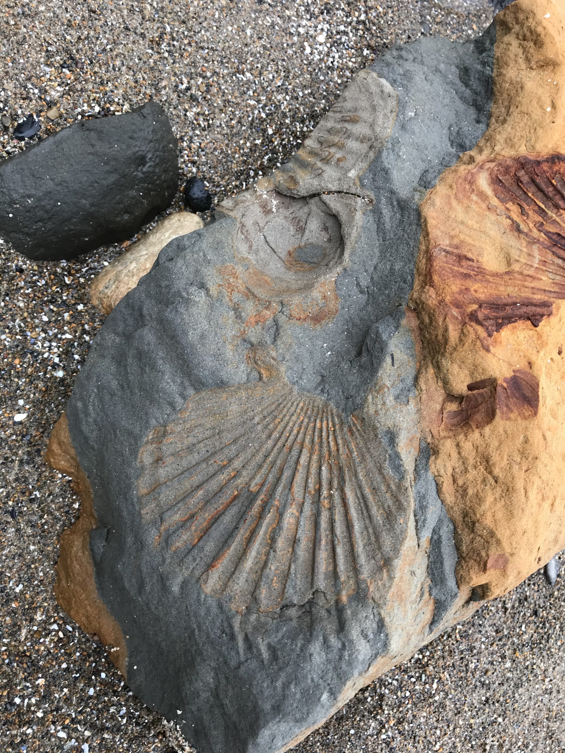
Pacific Harbor SealA visitor to the tide pools during a minus low tide.Great Blue HeronWet and overcast during our visit.Yaquina Head Outstanding Natural Area. What was most amazing today is the lack of wind.Eagles!An adult bald eagle and what appear to be two juvenile eagles at the ocean’s edge.An adult bald eagle and juvenile (at left) stand over what appears to be a deer carcass on the beach. A turkey vulture is at the right.The two juvenile eagles are much larger that the turkey vultures who are keeping their distance.Found some fossils while tide pooling!Mussel coloniesUp close with a starfish
Trip Report: Group Leader: Mark Hougardy | Organization: Eugene-based hiking group | Date: late April / early May 2022 | Duration: 4 days | Hiking Distance: 17-20 miles | Participants: 9 | Type: Hiking & Tent Camping
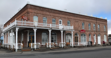
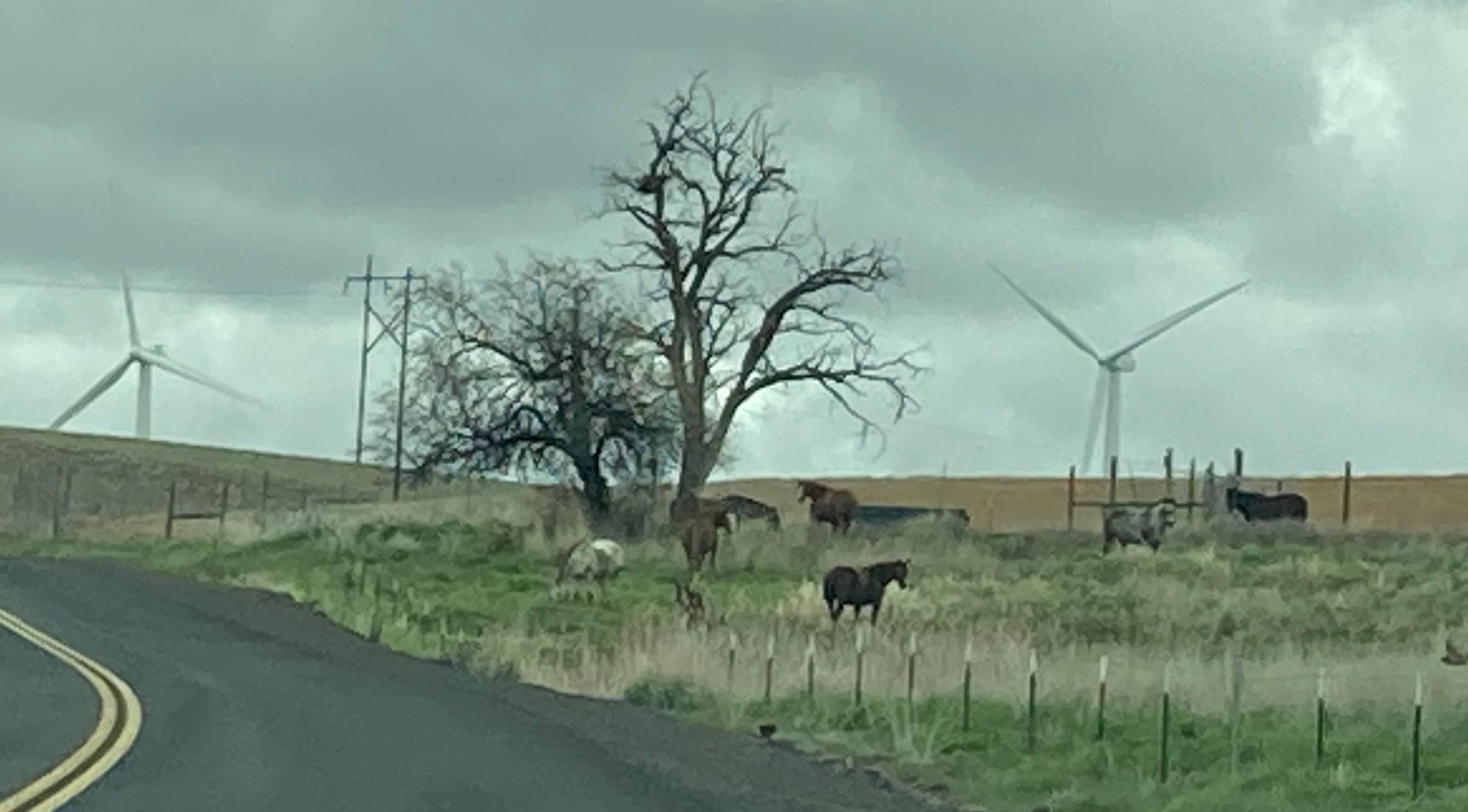
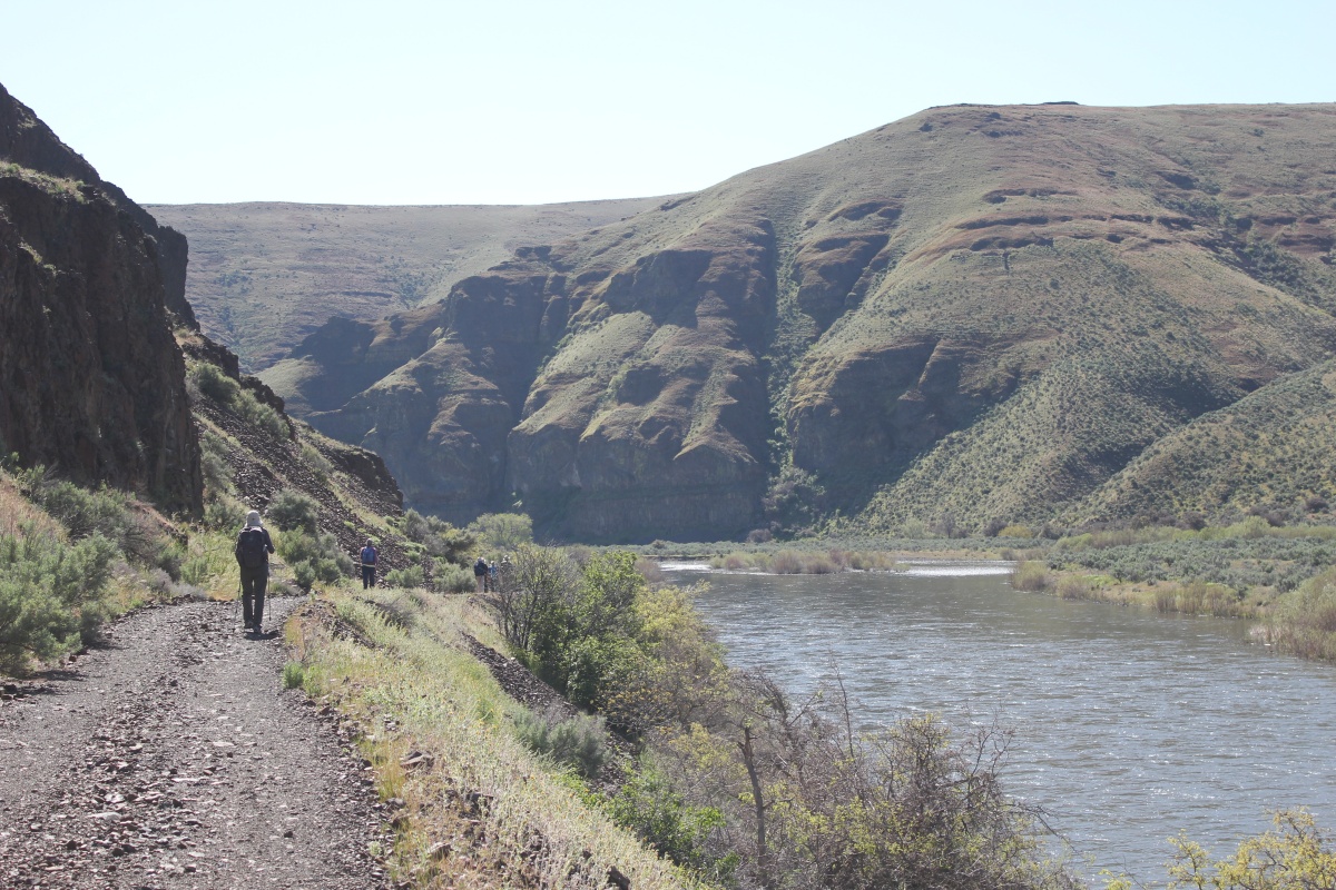
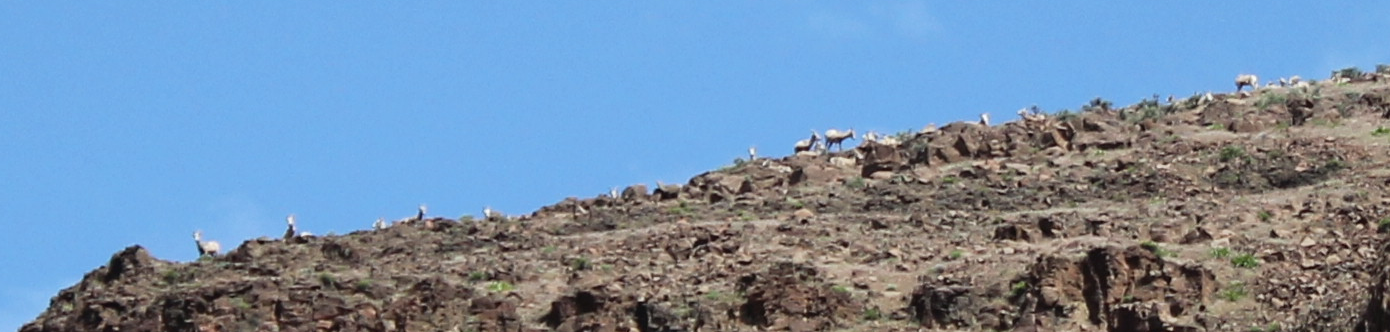
Just getting to our assembly area was an adventure with snow and cold temperatures crossing the Cascades. Arriving at Oregon’s Tumalo State Park the temperatures were mild if a bit cool. The group hiked 6-miles along the picturesque Deschutes River and then enjoyed an evening around the campfire. On the morning of day 2, we made a stop at the Ogden Wayside to see and walk the impressive 500-foot canyon made by the Crooked River. The weather included dramatic downpours mixed by sun and calm. We drove to the historic town of Shaniko and were welcomed inside the historic Shaniko Hotel (1900) which is undergoing renovations for opening later in the year. The town is a page out of the late 1800s and early 1900s and the hotel has a number of ghost stories. Continuing to Cottonwood Canyon State Park we drove past a number of wind turbines, cows, and open rangeland. Arriving at the park we made camp and enjoyed a 4-mile hike. It was windy that afternoon and well into the night. On day 3, we hiked 7-miles in the morning along the John Day on the Pinnacles Trail. We had to turn around due to a trail closure because Golden Eagles were nesting. Bighorn sheep peered down at us from high above the basalt cliffs. After returning to camp and enjoying some lunch several of the party hiked another 4 miles, with some making an additional 7. We enjoyed a quiet and windless evening around a warm campfire. We went to bed as the stars were coming out. Later that night the stars were amazing, though rain clouds were rolling in. The morning of day 4 was an early departure for the group with some opting to enjoy a warm breakfast in Condon.
We observed merganser, deer, mallard ducks, turkey vultures, Canadian geese, California bighorn sheep, swallow, crows, hawks, an unidentified lizard, and several snakes along the trail. There were tracks and signs of bobcats, coyotes, more bighorn sheep, and possibly pronghorn. We heard soft hoots with a stuttering rhythm: hoo-h’HOO-hoo-hoo from a Great Horned Owl, and the chucks of what was believed to be Chukar partridges.
Driving over the pass to the Bend area that morning, we encountered snow with temperatures in the 30s. Arriving at Tumalo State Park in the afternoon the temperatures were mild today and provided the setting for a great hike along the Deschutes River. We stayed for an evening in the park before venturing further inland.
The often-overlooked urban caves in Redmond provided a respite from the rain.
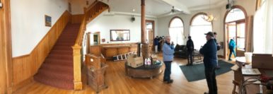
The Shaniko Hotel is being refurbished. Our group was fortunate to be invited inside to see the renovations and hear some ghost stories.
The lobby of the Shaniko Hotel (dated 1900) is undergoing a facelift.
Horses and wind turbines
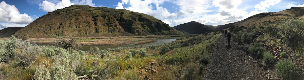
Arriving at Cottonwood Canyon State Park we enjoyed several hikes along the John Day River.
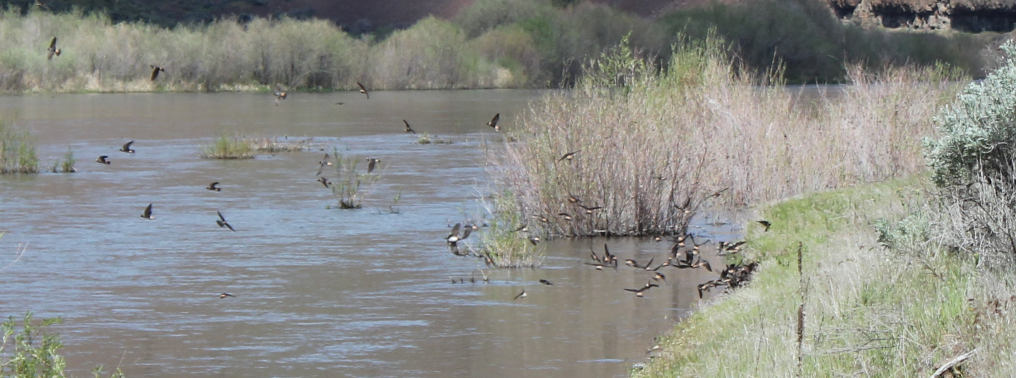
Swallows gather mud for their nests along the edge of the John Day River. They flew across the river to a cliff and disappeared among the complex shadows and crevices of the massive rock wall.
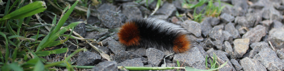
Occasionally called a white woolly bear caterpillar or “white woolly,” the hickory tussock moth caterpillar is white with a black line going down its back. According to legend, the wider the rusty brown sections, the milder the coming winter will be; the more black there is, the more severe the winter.
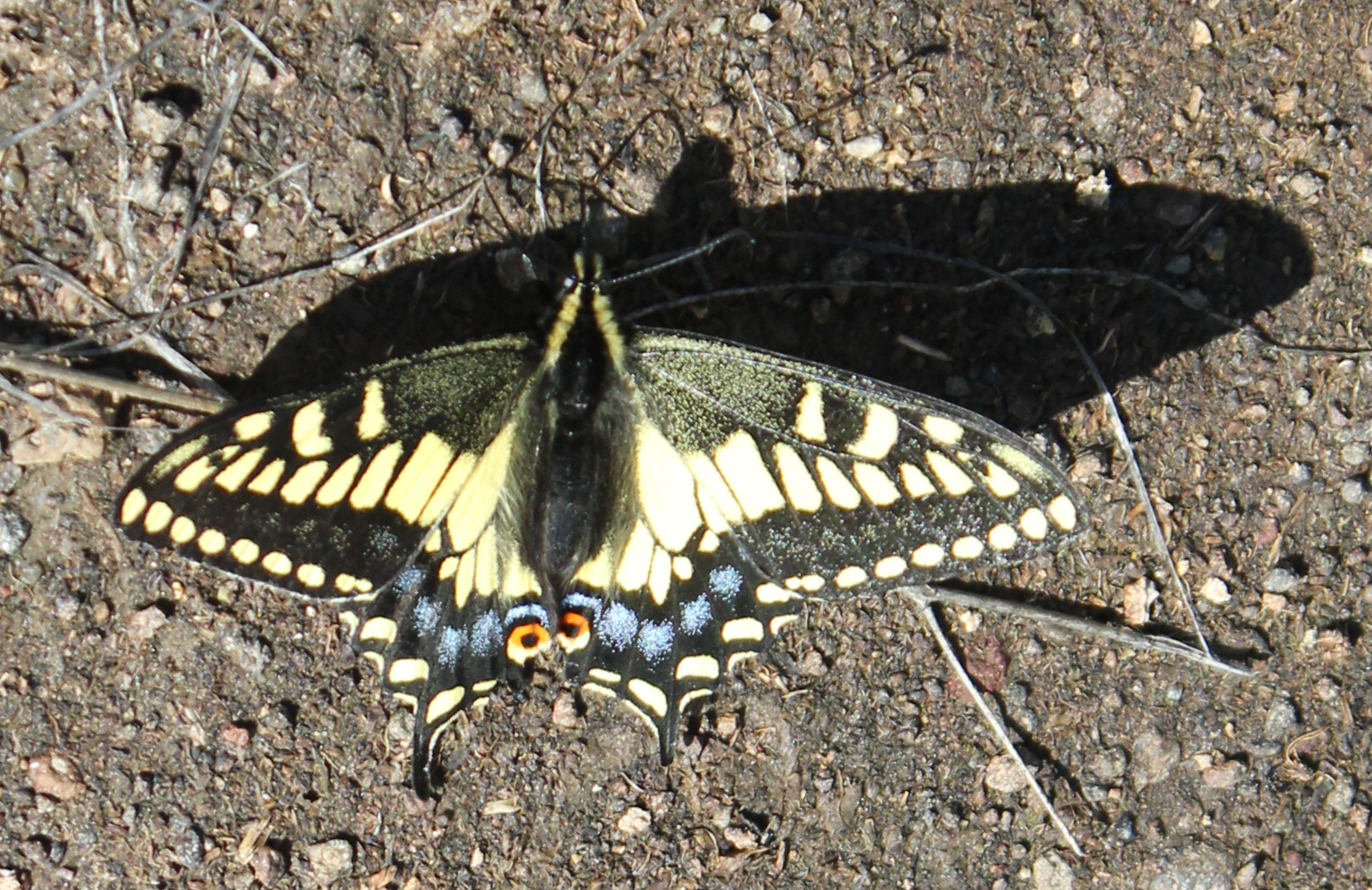
Swallowtail butterfly
The beautiful John Day River amid a stunning landscape.
A herd of California bighorn sheep gazes down upon human hikers.
A quiet (and windless) evening in Cottonwood Campground. The quiet and comfortable evening led to a night of blustery weather with temperatures in the 40s (F), strong winds, and pelting rain.
Group Leader: Mark Hougardy | Organization: Eugene-based hiking club | Date: March 2022 | Walking Distance: 2 miles | Participants: 10
The weather was a bit wet and windy, but it did not lessen our enjoyment of the University of Oregon’s iconography. Our walk focused on the historic head sculptures at the Knight Library representing historic figures from the disciplines taught in academia, the science gargoyles of the Lokey Science Complex, and the printer’s marks (colophons) at Allen Hall. Shown is the humorous Einstein gargoyle.
Trip Report:
Group Leader: Mark Hougardy | Organization: Eugene-based hiking club | Date: March 2022 | Walking Distance: 3 miles | Participants: 10
Downtown Eugene has some colorful building-sized murals along with multiple micro-art pieces. It’s been about 9-months since a previous walk downtown, it was good to see several old favorites, and a few new pieces too.
Shown are two recent additions: “We Rise” by Rachel Wolfe Goldsmith & a colorful Tyrannosaurus mural by Bayne.
Trip Report:
Group Leader: Mark Hougardy | Organization: Eugene-based hiking club | Date: February 2022 | Walking Distance: 6.5 miles | Participants: 10
Our walk through the Masonic cemetery and across the UO campus recognized the 200th birthday of Thomas Condon, a fossil-hunting minister who was Oregon’s first state geologist, the University of Oregon’s first science professor, and the first to recognize the paleontological importance of the John Day region: an area with a fossil record that spans over 40 million years.
Group Leader: Mark Hougardy | Organization: Eugene-based hiking club | Date: February 2022 | Walking Distance: 5 miles | Participants: 11
Scattered throughout the Whilamut Natural Area in Eugene, Oregon (and nearby Springfield) are 15 boulders etched with words from the Kalapuya language. These are the Kalapuya Talking Stones, and they help educate and remind visitors that the Kalapuya people, the original inhabitants of the area, are still here. The writing on the stones reflects natural items in the traditional landscape. We enjoyed visiting all 15 stones on our walk.
On Saturday, February 26th, attend the Kalapuya Storytelling & Drumming event (Downtown & Online) at the Eugene Public Library.
https://www.eugene-or.gov/Calendar.aspx?EID=25128&month=2&year=2022&day=5&calType=0

 Trip Report:
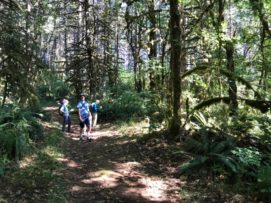 Trip Report:
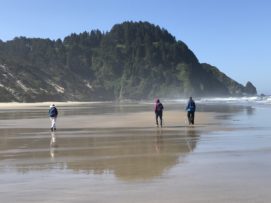
 Trip Report:
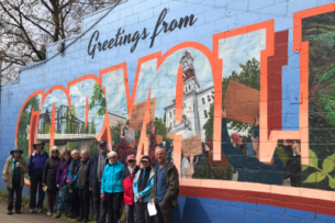 Trip Report:
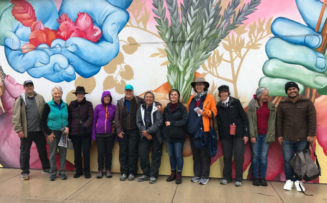 Trip Report:
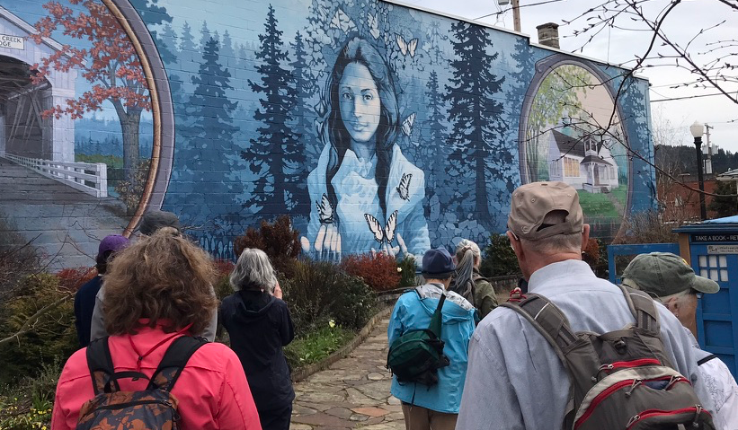 Trip Report:
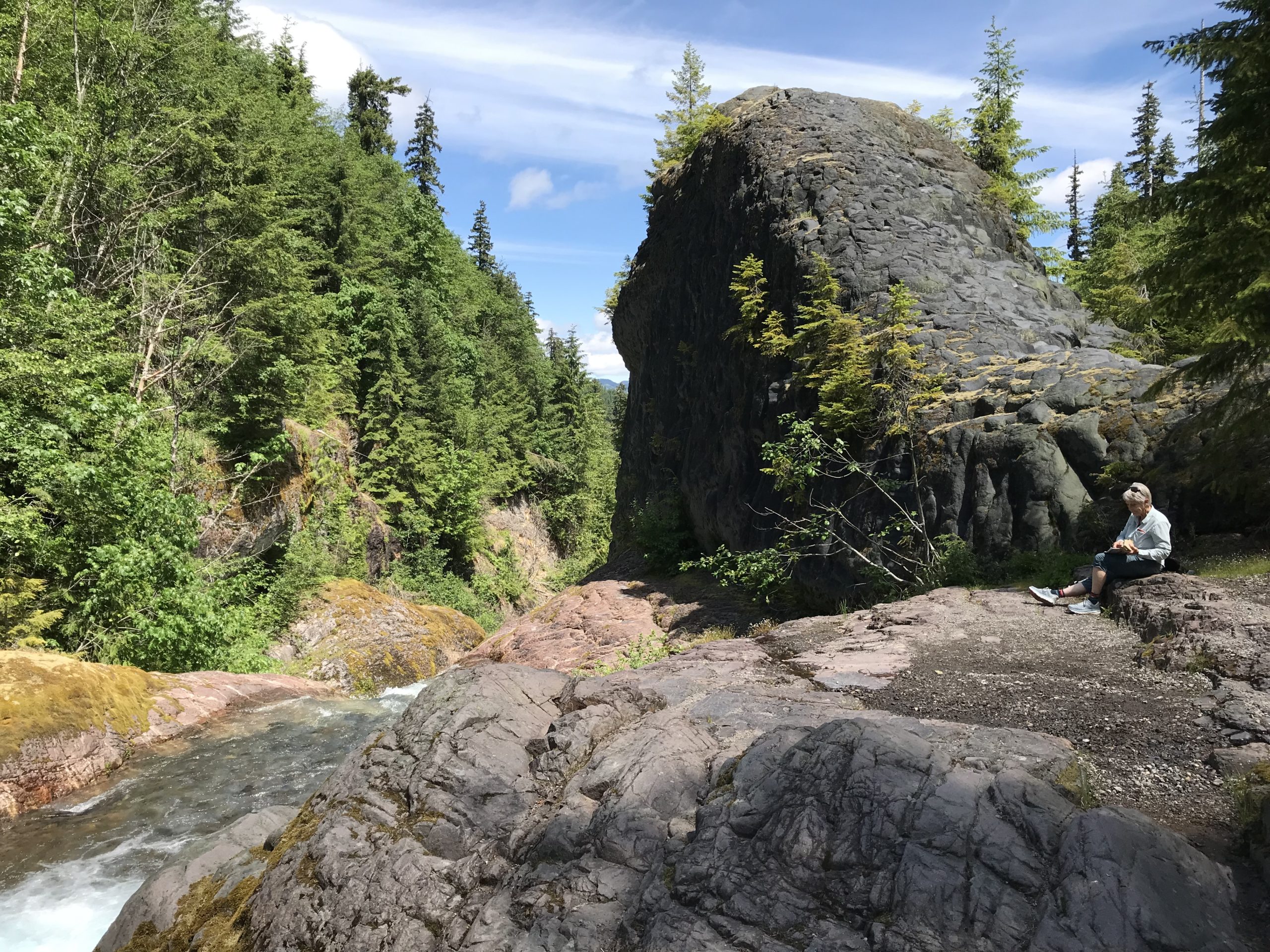
 Group Leader: Mark Hougardy | Organization: Eugene-based hiking club | Date: March 2022 | Walking Distance: 2 miles | Participants: 10
 Trip Report: